|
 |
 |
 |
 |
|
|
|
|
|
|
Sunday, June 10 2 miles El Morro
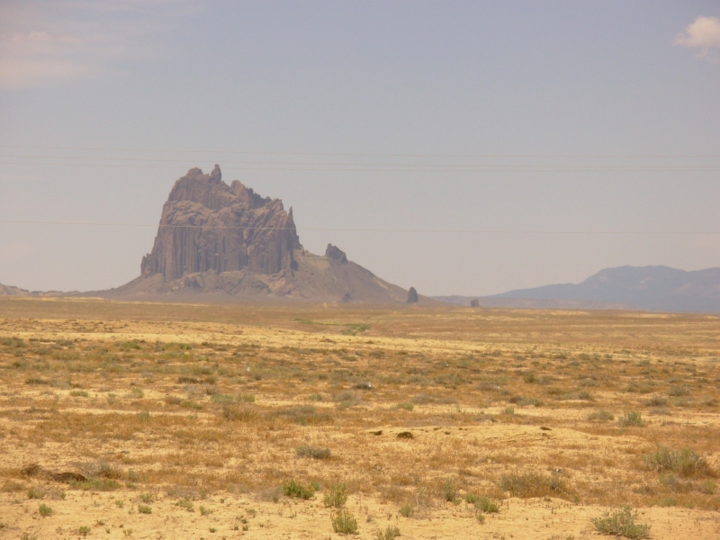
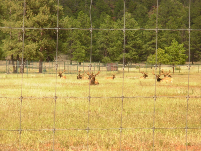
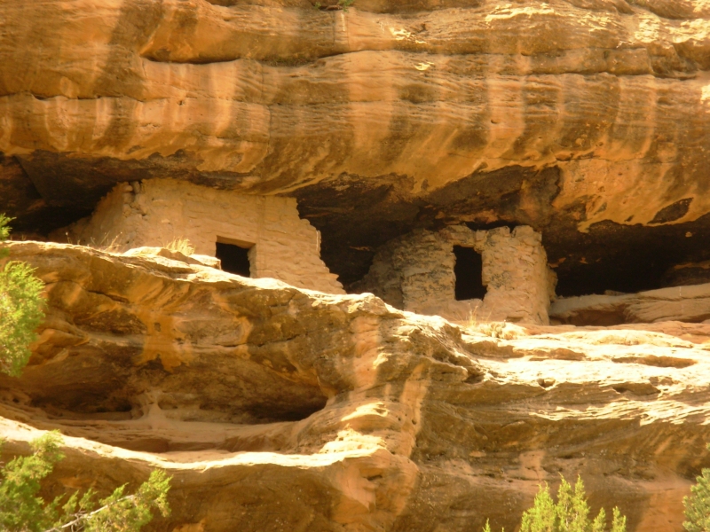
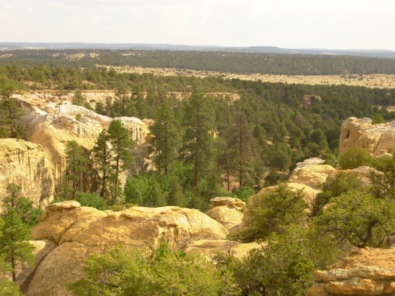
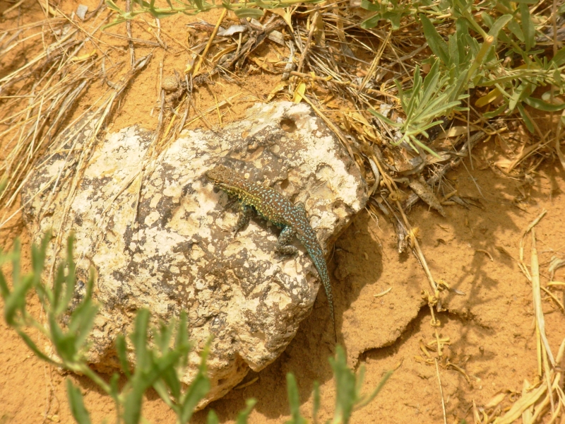
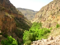
We spent the morning doing laundry and the afternoon driving through the northwestern corner of New Mexico. That part of the state, through the Navajo Reservation, is very dry and barren. Theres no grass, no trees, no bushes, just a few big rock formations like Shiprock provide a touch of beauty. We ended up doing a roundabout route through the Cibola National Forest thanks to a road detour and an inaccurate map. We ended up on the wrong road, but one that went where we wanted, it was just much rougher than we expected. We kept thinking it would dead-end at someones gate, but we kept following the road since it headed south. The forest was lovely, with large pine trees and open meadows. We ran into an elk ranch with a dozen stags penned up by the road. It was sad to see them penned up like cattle, with the same fate in store no doubt. A while later, we passed through red sandstone cliffs surrounding a new housing development and were treated with an unexpected Anasazi ruin in an alcove next to the road.
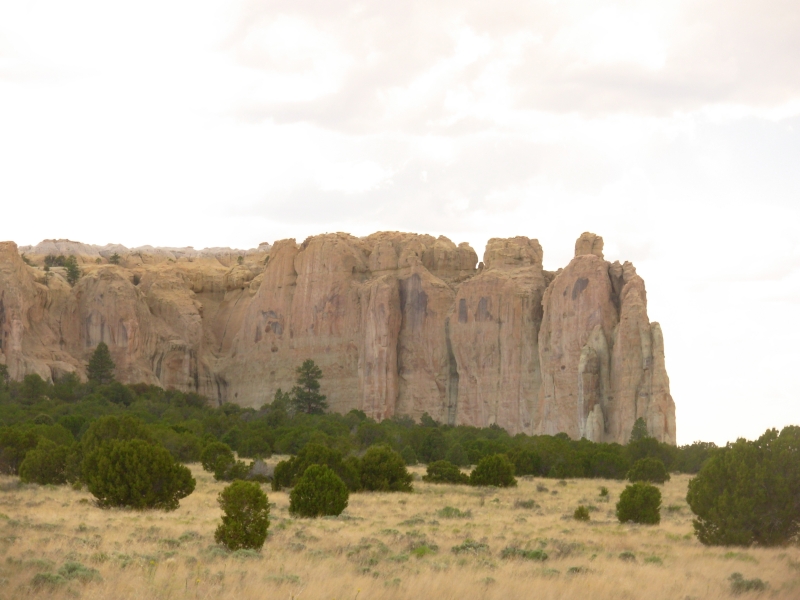
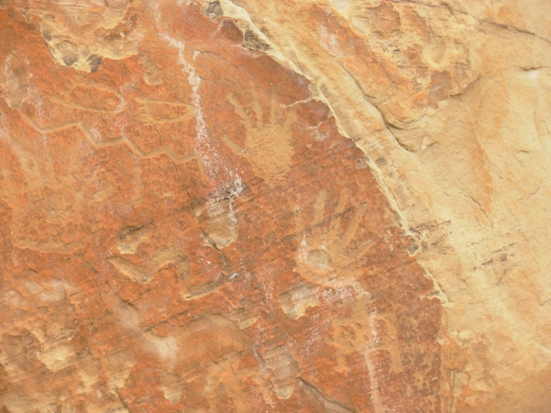
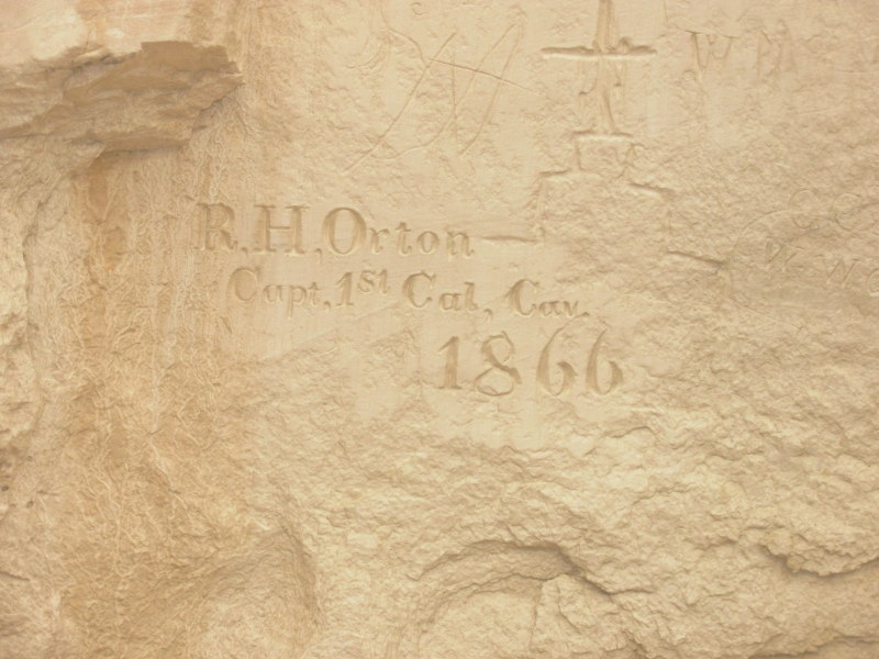
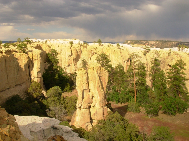
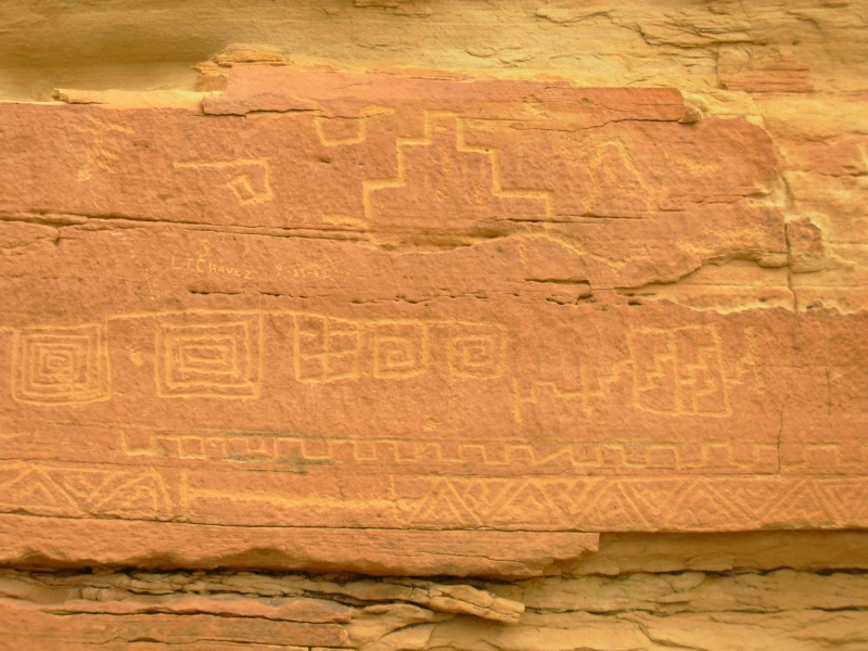
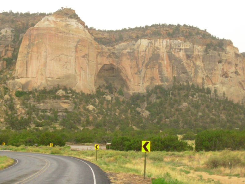
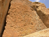
We didnt reach El Morro National Monument until 5:00. Fortunately, it stays open until 7:00. El Morro is a large sandstone bluff that was a major landmark for centuries, if not millennia. There is a large pool at its base--the result of runoff from above, not a spring-- that provided necessary water to the Anasazi living in the village above and to generations of travelers crossing the grasslands below. The cliffs became a trail register of sorts, starting with Anasazi petroglyphs that probably fostered the idea, followed by Spanish soldiers and governors from the 17th and 18th centuries, to pioneers and soldiers and freighters in the 19th century. It was intriguing to read the words of a Spanish priest, killed 400 years ago by the Zuni, or the Governor who passed by in 1609. It was definitely an interesting monument with a lot of history I didnt know very well. I had forgotten that the Spanish were kicked out of New Mexico for over a decade after a successful revolt by the Pueblo people.
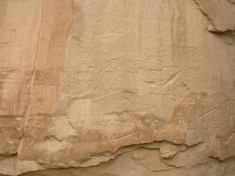
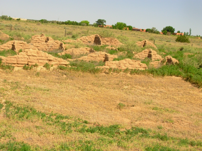
We then climbed to the top of the mesa to see the ruin there. Only a small corner is exposed, but the original village had about 850 rooms and housed perhaps 1100 people. Thats a big village. The architecture is similar to Chaco, though they had both round and square kivas, so there was some Kayenta influence as well. It was built around 1300-1400, so after Chacos abandonment. It was good to see the beautiful masonry of the Anasazi again. The Fremont just werent good masons, aside from their granaries.
El Morro has a small nine space campground that still had a few empty spots when we finished visiting the mesa. The rest were taken soon after we arrived. It was very quiet and we enjoyed a purple sunset from our picnic table. Its piñon juniper country around 7000, so its nice and cool. Nice place.
June 11 3 miles - Cebolla Wandering
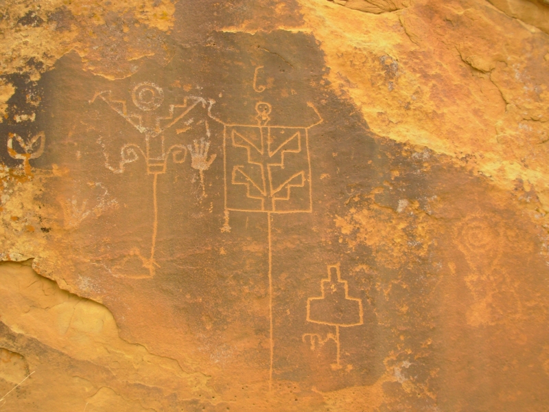
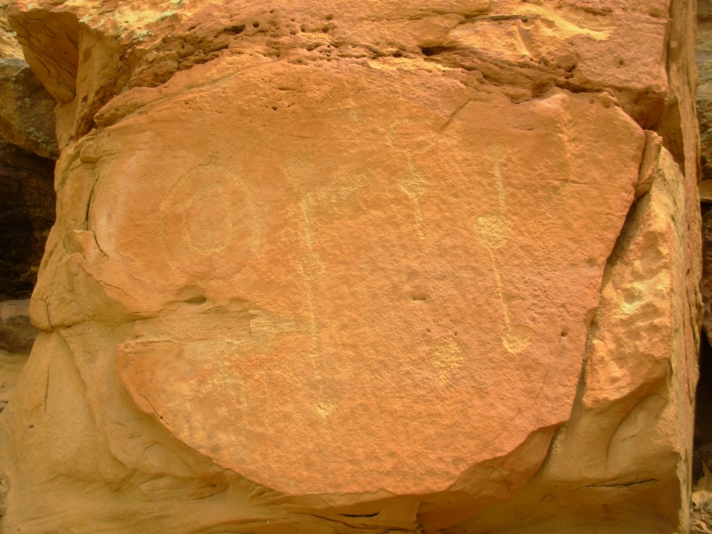
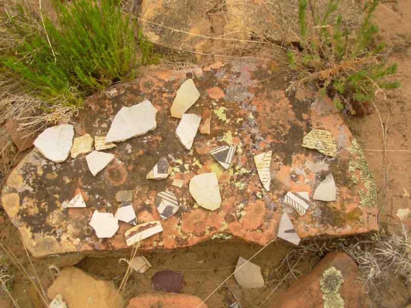
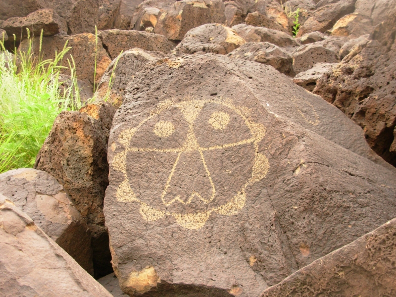
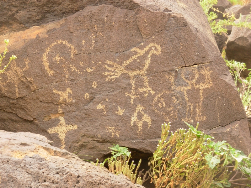
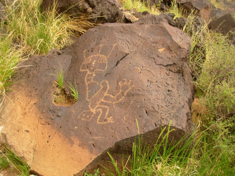
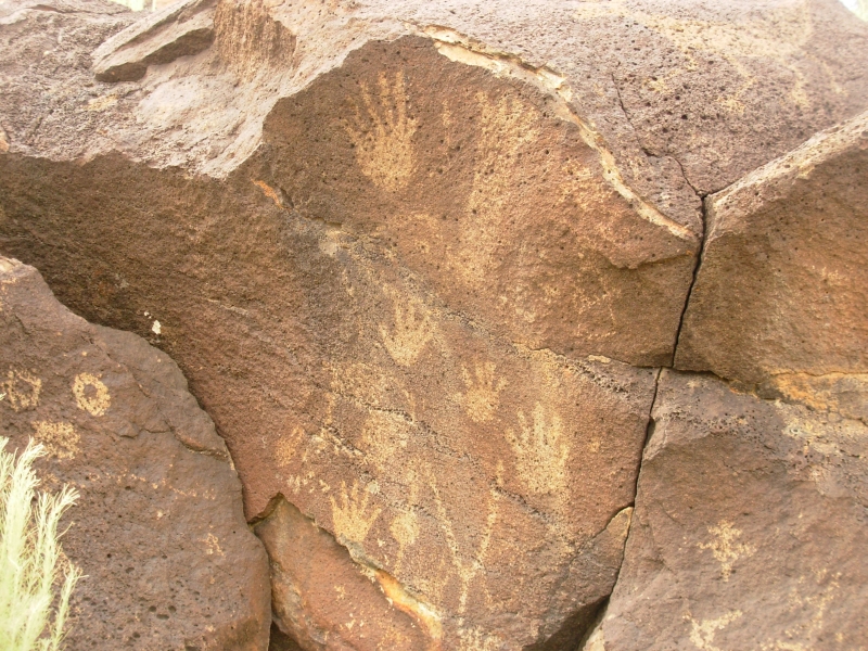
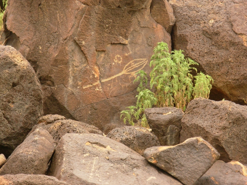
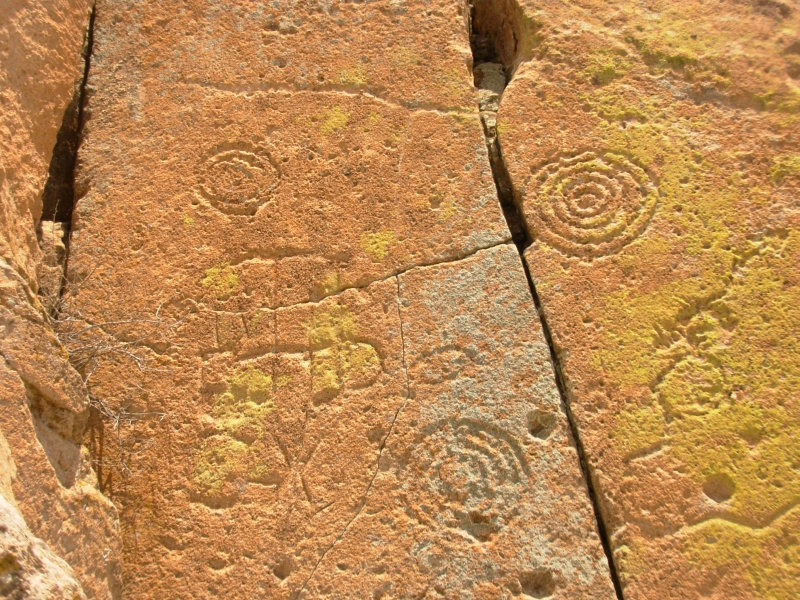
Yesterday Jim picked up yet another rock art book that had several sites we didnt know about. (We're collecting quite a library on Indian rock art sites and the archaeology of the southwest.) Two sites were on the eastern side of the Malpais, not far away, so we decided to look for them. On the way we stopped at the BLM office on NM 117 and asked about the nearest rock art site, in the Sandstone Bluffs across the highway from the BLM office. Thats Forest Service land. I dont know anything about it. But when we asked about North Pasture, the ranger got out a book of photos and showed us how to get to a site near Lobo Canyon in the Cebolla Wilderness. That one wasnt in our book, but we found it, using her directions and some cairns we found when we headed toward the cliff. The pictures looked Zuni, with cloud or pueblo images that looked like pottery or blanket designs. The other site, a couple of miles away, had similar designs. We also found a place with lots of pottery shards at the base of the second cliff. The pictures were very different from the Fremont art weve been seeing lately.
At the second site we got caught by a massive thunderstorm when we were still a half mile from the car. We got soaked. We were mostly concerned because the road can get impassible in rain because it has so much clay. The car was two miles from pavement so we got out barely in time. There was also a deep ravine we had to cross, and we really wanted to get out before it filled up with floodwaters. We felt a few drops of rain yesterday and a few more this morning, but we hoped the black clouds to the south would not come our way. They did.
We waited until the rain stopped, (about ½ hour), then set out to look for the Sandstone Bluffs petroglyphs. The guidebook gave two ways to find it ours didnt work. The problem was that there were no distances given. We walked in at least a mile. We found an old homestead, as directed, but it was a long way from where we expected to find it. There were sandstone cliffs all over, but we saw no petroglyphs. We did find two hidden arches and a nice piece of pottery, but that was all. Still, it was an interesting day.
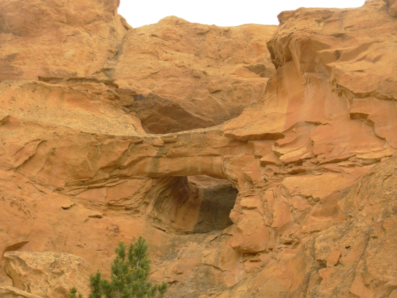
It was odd to be back in our old stomping grounds. The sites we visited were very close to the CDT route through the Cebolla Wilderness. In fact, we walked right past one set of petroglyphs last year and didnt even know it. The grass is greener this year; it has been a wet spring. The feel of the land was so familiar. Yesterday when we drove through the Cibola Forest I had the same feeling. It looked like so many areas we had walked through in New Mexico and Montana with green meadows, cows and dark forest around the open land. La Ventana, a beautiful large arch, was hidden last year in thunderclouds and rain as it was this year.
June 12 5 miles in Petroglyph NM, New Mexico
Our day started out very badly: we finally managed to reach Animal Control in Moab and were told that the dog was put to sleep after all. His back leg was shattered and surgery would have been expensive so they killed it. When I started to cry, the man on the phone asked, Did you want it? I said, Yes. I wish Id known, he answered. This said to me that the leg was fixable, just not worth the effort for a stray. We had told Janette on Saturday that if they couldnt find anyone to take the dog, we would. But I guess that wasnt good enough. Jim and I were both upset. If wed waited for the vet to return on Saturday, this might not have happened.
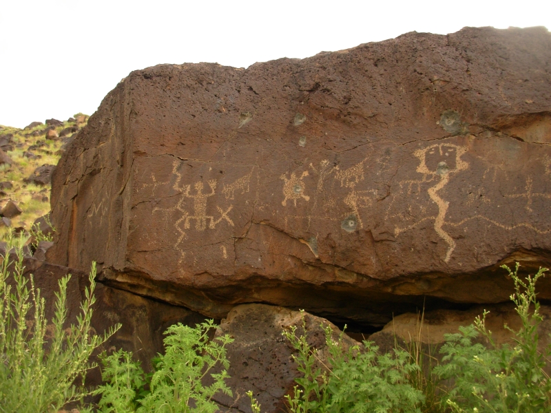
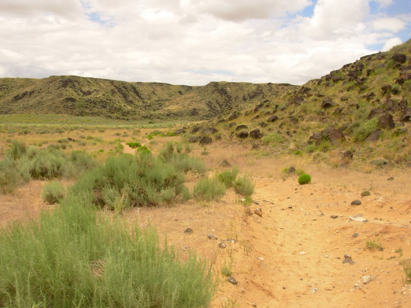
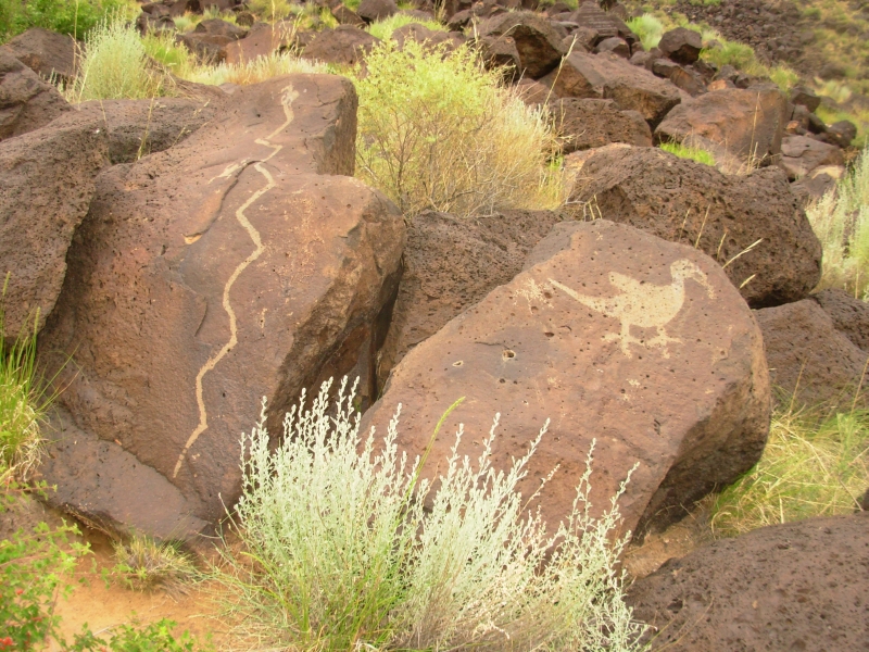
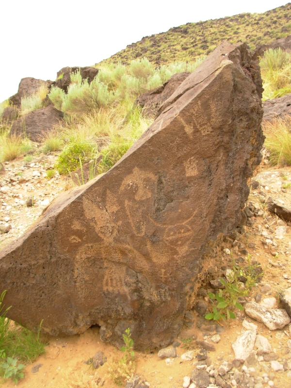
We got a late start, but didnt have far to drive since our motel was only five miles from our goal, Petroglyph National Monument. Petroglyph is a spread out park in Albuquerque, with four separate tourist areas. One has volcanoes, and three have short hiking trails through areas with lots of petroglyphs.
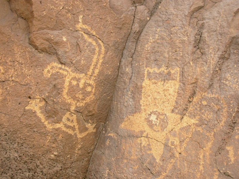
They are all along the same volcanic escarpment but surrounded by housing developments. There are supposed to be 20,000 images in the area. We didnt see that many, but we did see a lot. The Park is a mixture. Boca Negra Canyon is the easiest (and most popular) for tourists. There are short trails with signs telling you what to look for and where and what they mean. You cant miss the petroglyphs.
The two other canyons, Rinconada and Piedras Marcadas, have longer trails (2 ½ miles RT on one and 1 ½ on the other) with a few places that have signs, but the vast majority of the panels are up to you to find. Piedras Marcadas had the best panels and the most frequent. There were lots of star images, macaws, and masks. I enjoyed the stars with faces, hands and feet. There were Kokopellis, including twin Kokopellis next to twin masks. (There are Twin Gods in the local pantheon.) There was little obvious vandalism, though there was some. Many of the images were hard to see because the rock is hard basalt rather that the soft sandstone or limestone so common in Utah. Also, Petroglyph NM is a bit more modern than many of the sites weve visited and the more recent artists tended not to carve as deeply as some of the earlier ones. It makes a difference. Still it was a fun day. The rain held off until we were finished, then it sprinkled for all of two minutes.
Jim was worried about the car. It had started to pull right and sway. We found a mechanic who said here was a bulge in one of the tires and it needed to be replaced. We found a tire store and replaced both front tires which were very worn and dried out. The rubber was starting to separate. It was definitely time for new ones. We were lucky; the shop was able to change them right away. Given some of the backcountry areas we've been driving through, we were especially lucky not to get another flat out in the middle of nowhere.
One fun moment: as I was taking pictures of petroglyphs, I heard a sharp yip. I looked up to see a small sand colored fox in the rocks above me. It barked a few times, then vanished. We must have been near its den.
June 13 3 ½ miles in Bandelier National Monument
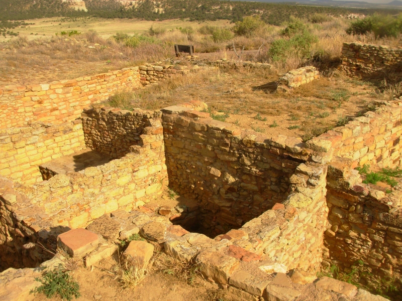
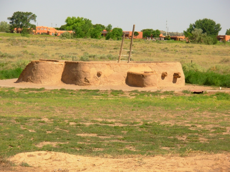
We stayed last night in Bernalillo, a few miles north of Albuquerque. Since we were on the spot, we started out the day with a tour of Coronado State Monument. Its the site of an old Pueblo with one unique feature: when they excavated the ruin in the 1930s, the archaeologists found a kiva with painted walls. We ran into this in Canyon of the Ancients, but the paintings at Coronado were different. There were 300 paintings on the walls, in thin layers. A picture would be covered with a thin layer of adobe and a new painting drawn on it. The archaeologists very carefully separated the paintings. Some are in the museum here, the rest in storage at a museum in Santa Fe. They were good paintings mostly with a water theme. There was a man pissing, fish, a kachina holding a water jar, etc. They had a reproduction inside a reconstructed kiva, but the originals were in a room in the museum very faded and fragile, but visible. That was very cool.

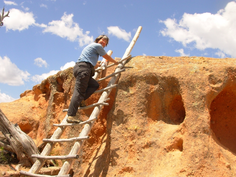
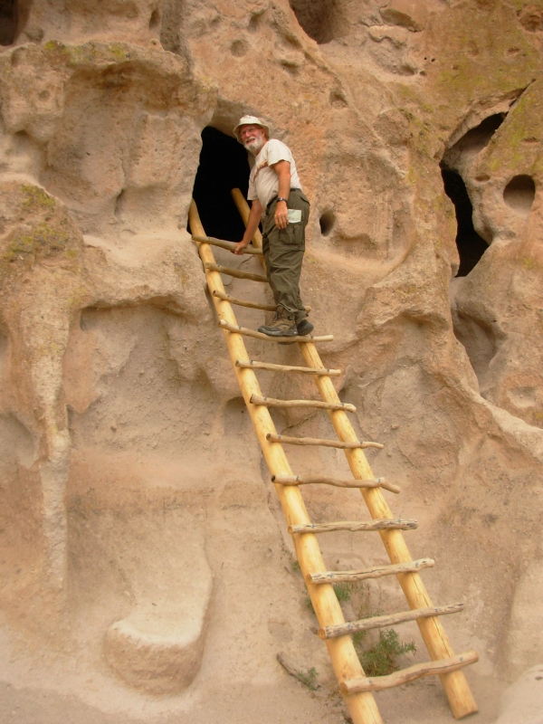
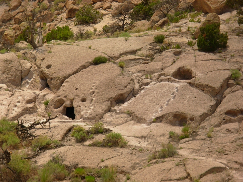
From Bernalillo we headed to Bandelier National Monument, northwest of Santa Fe. We stopped at Tsankawi, an outlying section of the park, and walked 1½ miles to an unexcavated ruin atop a mesa. Unexcavated ruins tend to be rather disappointing just a pile of rocks in the brush. The walls were mostly buried, but there were pottery shards and caves that had been enlarged and lived in. There were lots of very faint petroglyphs in the volcanic tuff. The hike was fun, up three ladders, along the edge of the mesa, up narrow pathways worn into the soft rock by generations of feet. Tuff is volcanic ash compressed into rock. It looks like white pumice. Steps were easily carved in it and the foot channels are sometimes 6 inches wide and 2 feet deep.
The views were beautiful with green mountains all around. The Sandias above Albuquerque were more beautiful than I remembered. Had we completed the GET, we would have hiked those mountains in May. There were nice views from Bernalillo of the mountains this morning as well. The cliffs around Bandelier are red and white with lots of holes, like Swiss cheese. The park elevation varies from 5300 to 10,000, so it is cool and green with a mixture of vegetation.

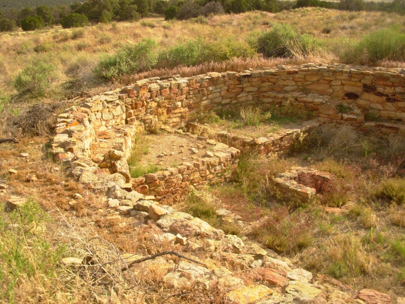
We easily got a campsite in Bandelier NM at the large campground in the pines, then headed to the Visitors Center to watch the orientation film and to get a backcountry permit for tomorrow. Bandelier was inhabited between 1100-1500 a fairly long period. (Actually people lived here before then, but the Anasazi were the ones who built the multi-story ruins that we see today.)
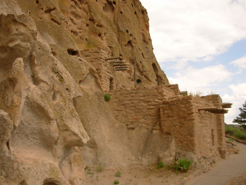
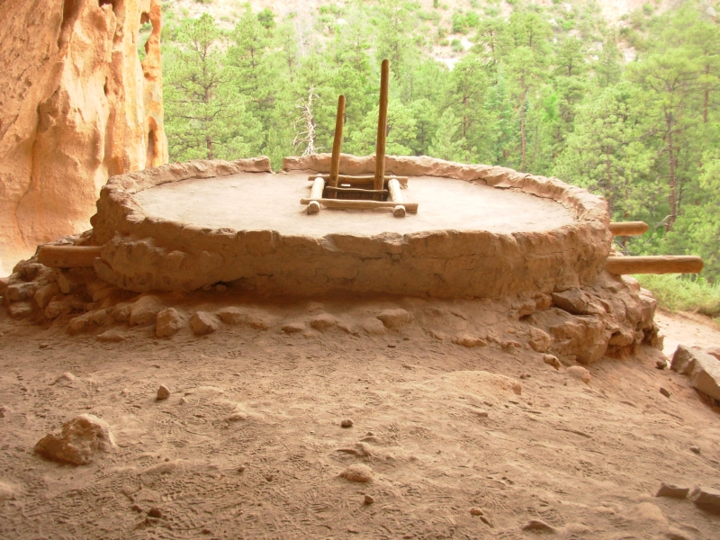
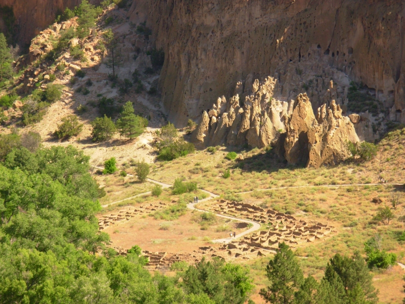
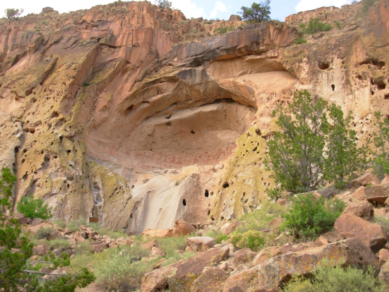
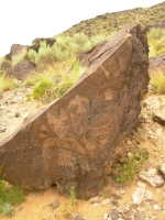
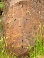
We took the short Main Loop Trail through Frijoles Canyon to the Tyuonyi Ruin (about 400 rooms) and the cavates in the cliffs beyond. Its a pretty canyon with a perennial stream and large pine trees. The people who lived here used caves in the walls to live in which they enlarged and modified. Then they built more rooms in front of the caves, using the cliffs as a brace for the multi-story buildings. It was a large complex, between the big ruin in the meadow and the many rooms in and along the cliff walls. There were more hard-to-see petroglyphs on the cliff side. Most of the images here are anthropomorphs, though there were also snakes, a shield with a star, a mountain lion and others.
The trail continued to a large alcove/cave 150 up the cliff that had more rooms and a kiva. Access was via four long wooden ladders. I didnt mind going up but I hated descending. It did help that the ladders were bolted into the wall.
Tomorrow we will begin a strenuous backpacking trip to a Painted Cave the things we do in pursuit of rock art!
June 14 14 miles in Bandelier NM
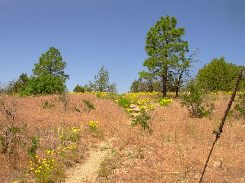
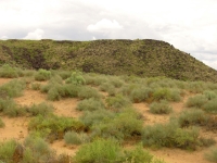
The description we read of this hike was very strenuous they werent exaggerating. The trail went up and down very steeply, in and out of several rocky ravines. Sometimes we only went up or down 100-200, sometimes 500. There were stone steps and many switchbacks, but it still felt like a killer day. Part of that was the heat and sun. There are pine trees in the canyons, but most of the time we were out in the open in a pygmy forest -- piñon and juniper grasslands with lots of prickly pear.
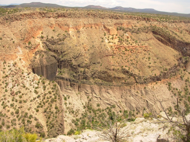
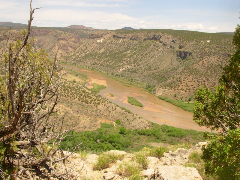
Parts of the area were burned in a huge fire in 1996. It wasnt total devastation, just hit or miss burned areas. There were lots of flowers in those areas. Some canyons were very steep with smooth cliff walls. Alamo Canyon was really harsh. We got a good view of the Rio Grande, which borders the park. We only saw two people today: a biologist out listening to the wilderness with special equipment, and a fire fighter, heading toward the park headquarters with an axe in hand to cut some blowdowns.
We started by climbing the steep Frijoles Trail to unexcavated Frijoles Ruin. We headed west for a bit, toward the peaks, then dipped in and out of Lummis and Alamo Canyons, then headed south near the rim of Alamo Canyon on a trail that gets very little use. We frequently lost the tread in the grass and rocks. It was hard to get lost though with a 500 canyon to one side. As we descended to Hondo Canyon the footing got very rough, with loose volcanic rock underfoot, but once we reached Capulin Canyon the walking got easier. By that time I was seriously dehydrated headache, nausea and no energy. Capulin had water a bit swampy in smell and taste, but cool and wet. Jim filtered a couple of quarts.
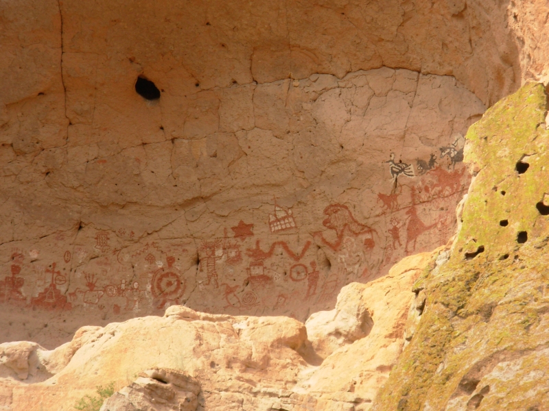
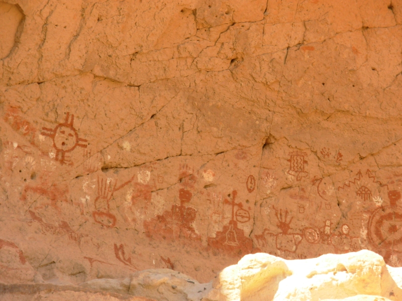
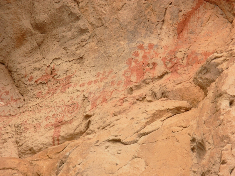
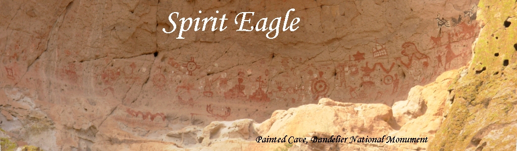
Then we headed upstream to our goal, the Painted Cave. Th cave is a large alcove about 50 up with dozens of pictographs. Most arent very old there were churches, a horse, a dragon, a Gila monster, wolves and several Kachinas. The Zuni sun symbol appeared along with clouds, a shield man and some shields. Although we couldnt climb up, we got a good view of the pictures from below. It was worth the long walk. We were told that local tribes still visit the site and probably add to the images.
We found a campsite a mile or so upstream. Bandelier has a permit system in which you pick a zone to camp in, but then find your own campsite. Some areas are off limits, like the area around the cave and some of the narrow canyons. We had a pretty good idea of when wed be ready to stop. Fortunately the stream isnt far. There are lots of birds because of the water and the big trees. It was very peaceful listening to the song.
June 15 10 miles in Bandelier

Our return hike was easier than yesterdays since it was shorter and mostly early in the day. We saw only one person on the trail a hiker who passed our campsite while we were still abed.
I enjoyed the wildflowers in many of the burned areas. I was sorry to miss the famous stone lions. They werent on our map and were just a little way off our route. We did see Yapashi Ruins, a large unexcavated village in a huge cholla patch. There were a lot of pottery shards and a couple of manos and a metate visible around the edges.
We returned to the Visitors Center around 1:30, got some ice cream and another rock art book, then we decided to go to the nearest town, White Rock, for ice and a few groceries. We made a loop via Los Alamos, which was much larger than I expected. There are security gates at both sides of town, but they waved us through. Strange place. Then we returned to the campground where we spread our gear out to air.
June 16 3 miles in Bandelier, motel in Pagosa Springs


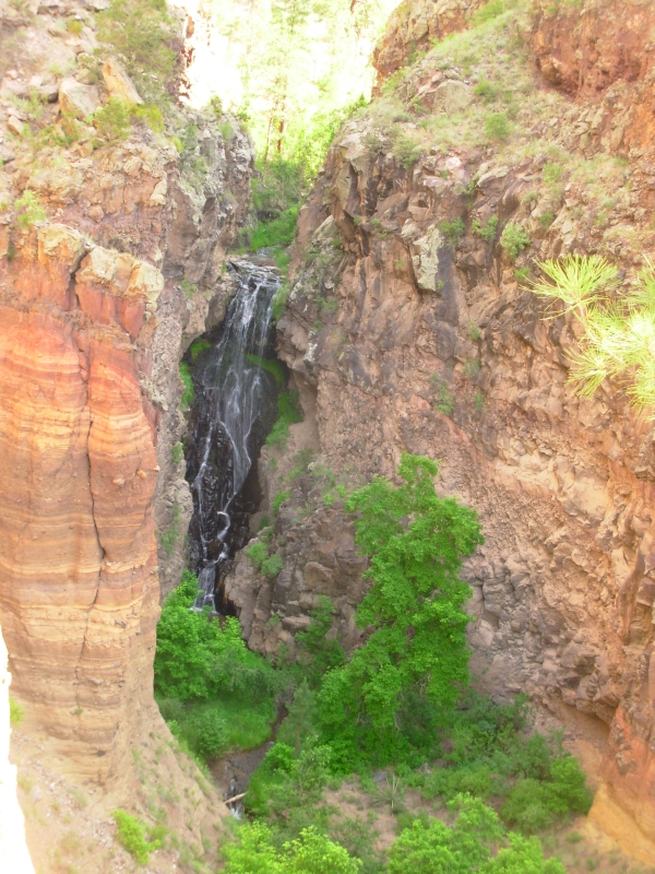
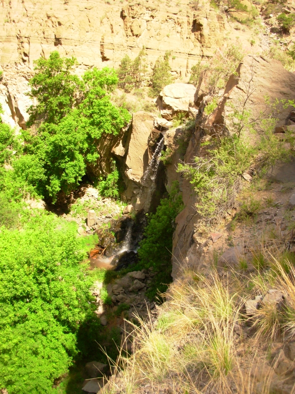
Today was a transition day. We did a short hike to two waterfalls in Bandelier this morning. One was 80 tall and the other was 40'. They were beautiful, but we were there at the wrong time of day to take good photos. It was a nice walk along Frijoles Creek, though very warm. Threatening thunderclouds accompanied us all day, but we never did get any significant rain. The clouds were beautiful.
We headed north to Abiquiu Reservoir, then west on Highway 64. There was a half-mile section of the CDT we missed last year. We had been following pink ribbons (prospective new trail) and they seemed to dead-end at the highway. We turned west and walked two miles uphill. We realized our mistake and turned around, walking back the way we had come. After a mile or so, we got a ride down the hill, but were dropped off about ½ mile east of where we had reached the road. We wanted a continuous hike, but at the time that short gap didnt matter enough to turn back, especially since we were so mad about the wrong turn and the three miles we had done unnecessarily.
But since we were in the neighborhood today, we decided to connect our steps in that section. We actually found the location of the trail on the other side of the highway, but lost the ribbons marking the proposed route after about 1/3 mile. We bushwhacked the short distance to the trail, connecting our steps with the CDT. It was a small nit, but one that nagged. We still have the section to complete where we had to leave the trail because of the fire last year but thats coming. Then we will have really finished our CDT hike of 2006.
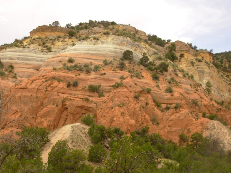
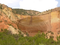
We headed north again past Ghost Ranch. The land in that area is gorgeous yellow Entrada and pink and white Chinle Formation sandstone. It was early afternoon, so we decided not to camp at Ghost Ranch. Besides, we saw a sign saying Wedding at the gate, so we probably wouldnt be welcome there. There was a big film crew parked at the museum with many trailers, caterers and security personnel. I dont know if that had any connection to the wedding. This is a very picturesque spot, so I imagine a lot of movies have been made here.
We stopped at Echo Amphitheater, a large alcove in the colorful sandstone cliffs. A group of kids were yelling, testing the echo, and having a grand time. We didnt linger.

We wandered through Chama, learned that the motel we like was full, so we continued on to Pagosa Springs, 60 miles up the road. We desperately wanted a shower after our hot stay at Bandelier, so a motel was desired, especially given the black clouds all around. We also wanted internet access so ended up at a more expensive motel than last time, but it is nice and the water is hot, so its worth the money.
It was fun wandering near the CDT again and getting a chance to see the land nearby. Southern Colorado is very green, very beautiful. There is still snow in the South San Juans. We looked for thruhikers, but didnt see any. We really hoped to find our friend Sly there, but he didnt answer his cell phone. He had been staying in Pagosa Springs, but intended to flip north and hike south from Glacier We must have missed him.
Home | Links| Trail Journals |
The Thruhiking Papers | Bun-bun
Created: 10 November 2007
Revised: 30 Sept 2016Copyright © 2007-2017 Spirit Eagle