|
 |
 |
 |
 |
|
|
|
|
|
|
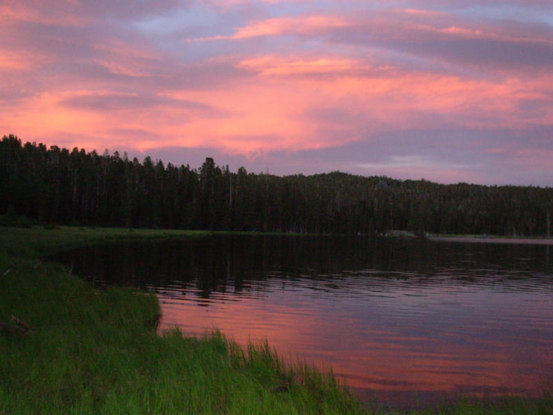
June 23 1 mile camp at Fiddler Lake in Shoshone National Forest
We had a slow start out of Rawlins since we wanted to check out a couple of places we stopped at last year. The bookstore has just gone out of business (they were packing up the store when we stopped by) and the internet café has moved across town. As we drove up the highway north of town, we spotted a hiker resting in the meager shade of a signpost. We stopped and asked if he was hiking the CDT and if he wanted a ride. Yes to both. Although there is a new route north of Rawlins that takes hikers off of the highway, it hasnt been marked yet. Fifteen miles of busy highway can be nerve wracking. The highway walk was a dangerous stretch of trail. Im really glad the BLM has gotten agreements with local landowners so they can finally move the trail off the road. Maybe by the time the hikers reach here in August the trail will be marked and information on the new route will be available. I hope so. We drove Bob to the Post Office and then to a motel and finally left town, for the second time, at 11:30.
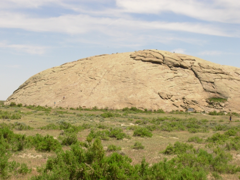
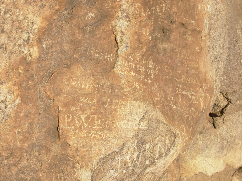
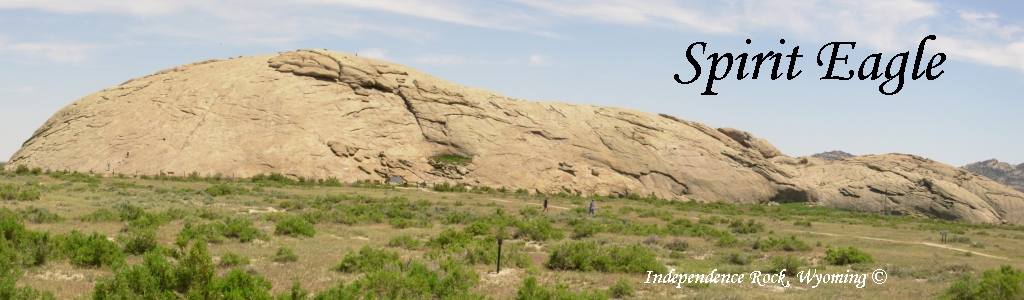
I had a couple of detours I wanted to try, since we werent in a hurry. First we stopped for a long visit to Independence Rock, a landmark on the pioneer trails. Thousands of people carved their names on the huge rock on their way west. Many are faded and there are way too many modern ones, but it was fun to see names from the 1850s to 1920. The handwriting back then was beautiful. I cant imagine writing that well on paper, much less on stone. There are supposed to be a couple of signatures from the 1840s but we didnt see them. The rock is huge 120 high and a mile around the base. We climbed to the top and then walked around the bottom, looking for carved signatures. They were scattered all over.

Then we went to Willies Handcart Monument on Rock Creek. The CDT passes quite near there, but we didnt make the four mile detour when we hiked the trail. There isnt much at the site, just a campground and a memorial stone, but every year thousands of Mormons make a pilgrimage to the spot where a group of Mormon pioneers were caught by winter storms in 1856. Many perished of cold and hunger. Some reenact the handcart experience by walking 30 miles to Willies site pushing a handcart. There are Hosts there to answer questions. A group that arrived shortly before us included a woman whose grandfather had been one of the survivors. He nearly froze to death there. She was very moved by the site. For us, it wasnt really worth the detour, but for them it is a sacred site. I saw a PBS program a couple of years ago about the event, so I had half a clue about what happened, but there is very little in the way of information for casual visitors about what happened there no signs or brochures. I think all of the Mormons who visit have been taught the story in church or school and few others will make the detour off the highway even though it isn't very far and the road is graded. We passed another site on the highway that may be more tourist friendly. It was the site where the other stranded group of Mormon pioneers, Martin Company, was snowbound at the same time. I think there was a museum there.
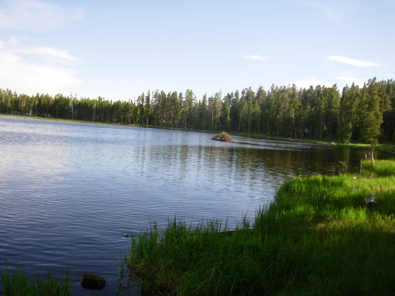
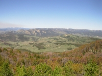
Afterwards we headed up the road to Sinks Canyon. Its a National Forest area on the edge of the Wind River Range. There are lakes and the Little Popo Agie River, so its very popular with RVs, ATVs and fishermen. We drove in 14 miles to Fiddler Lake where we found a nice campsite looking out over the water. Were at 9000, so it is cool and seems generally quiet. The campsites are spread out so we should have a peaceful night. We sat by the water and watched a beaver swim slowly to its lodge. There was a beautiful sunset. All in all, it was a very nice campsite.
Sunday, June 24 1 mile at Sinks Canyon, Motel in Dubois
It turned out that the road we were following was closed five miles beyond our campsite. Seems the state of Wyoming plans to pave it, so they closed it to through traffic. I wish we had known about that 20 miles back. On the other hand, it was a nice campsite. The sign we saw said the road was open on weekends, but it lied. So we turned around and drove the rough road back to the highway. It was still a pretty drive to Lander past Red Canyon.
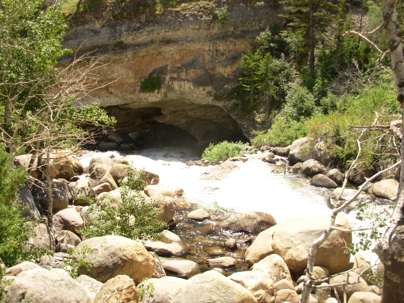
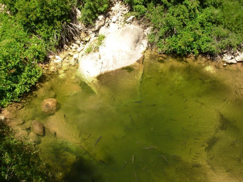
We had a second breakfast in town (really bad, but filling) and then went out to Sinks Canyon. The Popo Agie River dives into a large cave, then resurfaces as a large spring ¼ mile downstream. There were huge trout in the Rise, the spring downstream. The amazing thing is that supposedly the water takes two hours to travel from the Sink to the Rise. (They poured dye in the water and timed it.) It was an interesting detour.
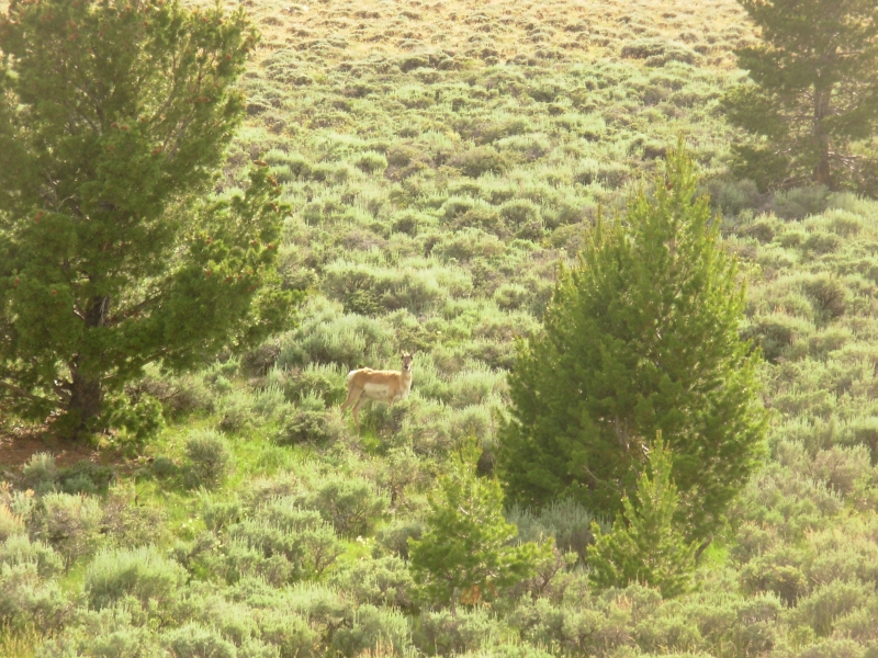
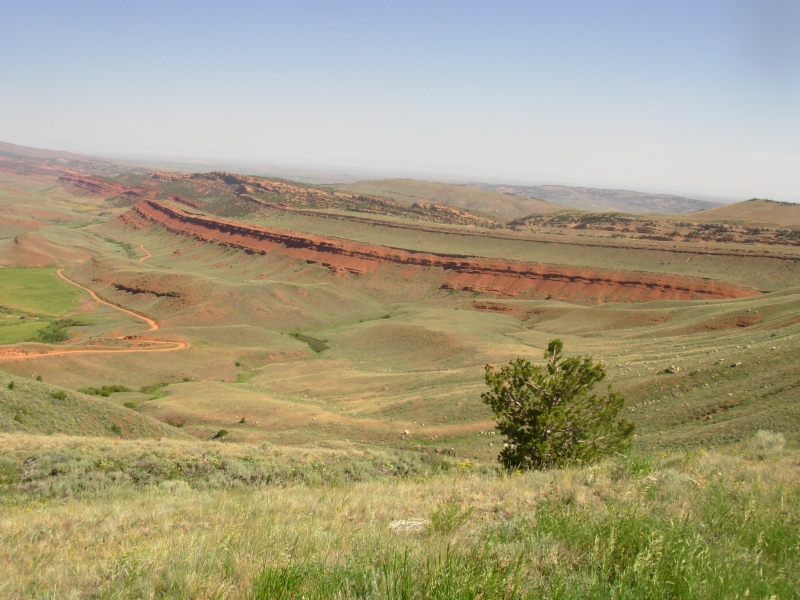
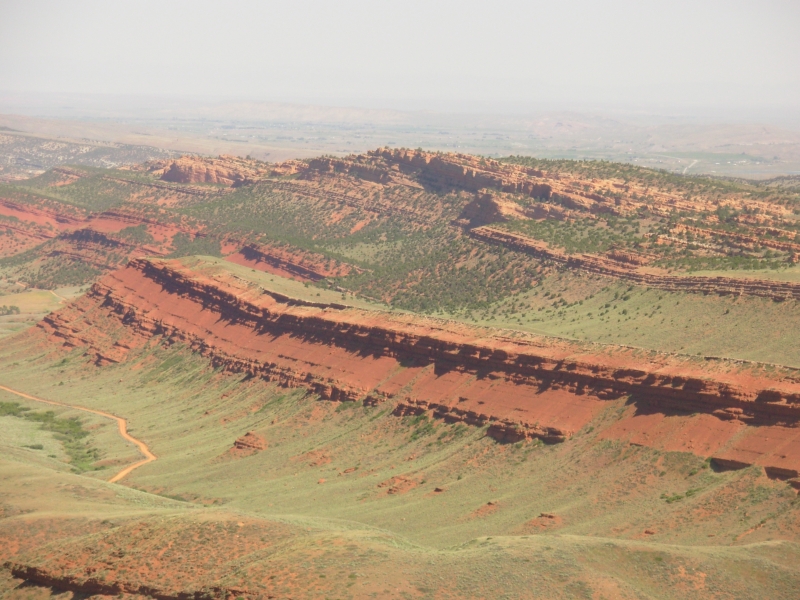
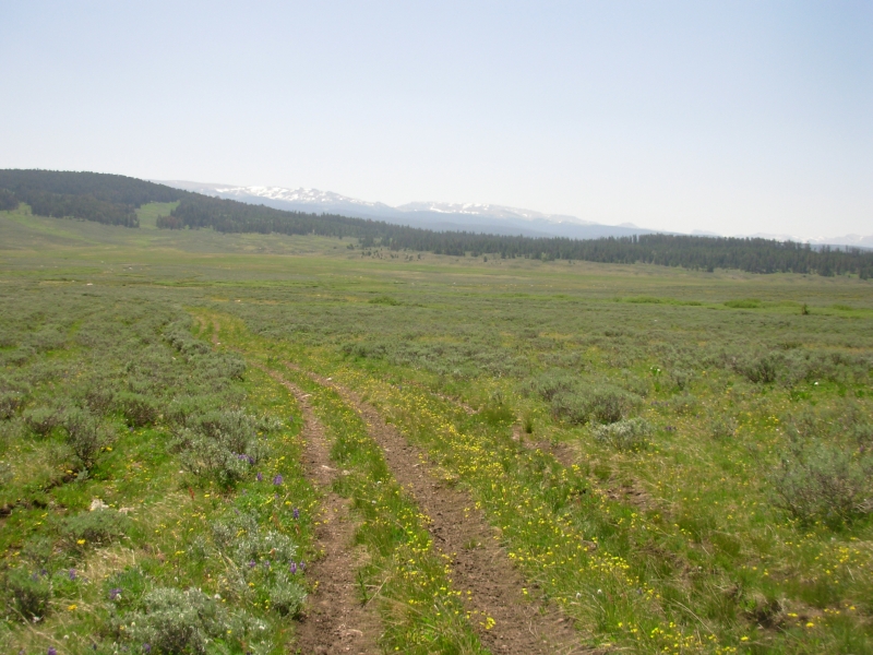
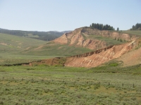
The drive to Dubois through the Wind River Indian Reservation is pretty too. There are colorful red and white sandstone formations on one side, rolling tree-covered mountains on the other. Its horse and cow country, though we saw a couple of antelope as well. Yesterday I spotted 57 antelope, two deer, and two small herds of horses. Happiness is lots of wildlife.
June 25 14 miles in the Gros Ventre on the CDT
Yesterday we returned to Dubois to hike the section of the CDT that was closed by the Purdy Fire last August. Today was a beautiful cool sunny day. The motel owner gave us a ride up to Union Pass where we left the trail last year. Supposedly the fire burned on both sides of the Divide, but didnt damage the trail. Well see.
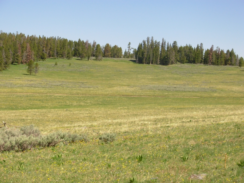
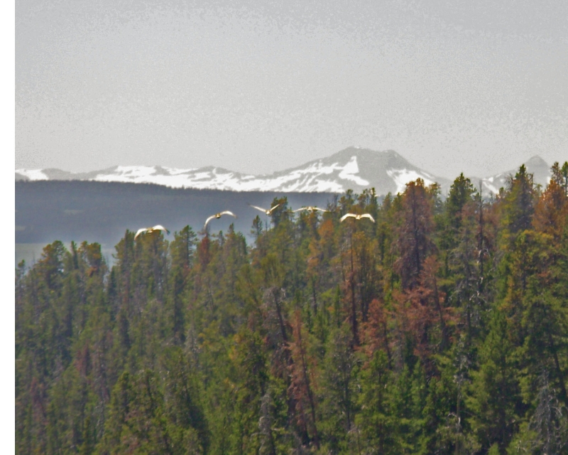
Union Pass is a beautiful area with big green flower-filled meadows and scattered groves of trees. We followed faint trail through the forest to lovely (but buggy) Lake of the Woods, then jeep track around the lake and northward, then an obscure turn on old jeep track led us across a wide meadow and up to the Divide. There are CDT trail markers, but they arent consistent. In the first two hours we spotted two groups of antelope and five elk. It feels great to be hiking, though the 9000 elevation is affecting our breathing. We can see snow-covered peaks to the south and west. The Tetons are very white. Theres smoke from a fire to the south so the views arent clear, but theyre there. Flowers are abundant: blue lupine, larkspur and forget-me-nots, white phlox and bistort, yellow cinquefoil, and red paintbrush.
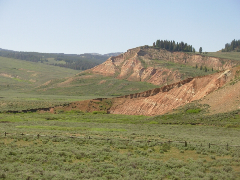
At the Divide, the guidebook route and the marked CDT diverged. Jim Wolfs guidebook follows a jeep track along the Divide. The official CDT heads west on jeep tracks, winding down and around and back up again. We decided to check out the new official trail. The blazing was erratic with some junctions totally unmarked. Eventually we took off on footpath, leaving the old logging road we had been following, and soon the trail vanished completely. There wasnt much treadway and in the willows even that vanished entirely. Without blazes we had little chance of staying on course since we had no idea where the trail was supposed to go. Since we knew the alternate route was on the ridge to the east of us, we just bushwhacked uphill until we found the jeep road again. It soon descended to Leeds Creek, which we crossed, then we followed a faint horse trail for a few miles upstream. We set up camp at the head of the valley, when we found real trail again. There are some burned sections along the creek, but so far it hasnt been bad.
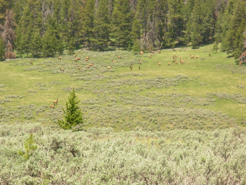
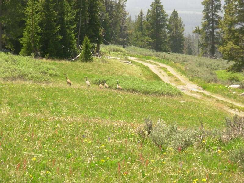
Most of the forest is green, though the pine borer has done some damage here too. It was a great afternoon for wildlife. We saw a herd of at least 35 elk, then five more, then six, then a herd of 50 or more, then a deer, then a young (two year old) black bear. He ran, but well still hang our food tonight. It was really fun seeing so much wildlife today elk, deer, antelope and bear. Thats the CDT I know and love! We also saw five sandhill cranes and two hawks. The cranes took us a minute to figure out as they were standing head down when we saw them; only the rumps sticking up above the sage were visible.
June 26 17 miles to Beauty Creek
Fresh bear tracks came within sight of our tent, then turned around. They were small, so may have been yesterdays young bear. The smoke is thick enough to smell as there is no wind to clear the air. We got a few nice views though before the air thickened.
We got a bad start this morning. We couldnt find the trail. There were jeep tracks and horse trail, but nothing that went up along the Divide. We wasted 45 minutes going in circles, trying out various options. Finally we noticed orange snowmobile markers crossing the meadow and heading up to the ridge. Sure enough, that was our trail. We followed orange diamonds for the next seven miles.
The CDT follows an old jeep road, but it has been closed to vehicles for years. The meadows have reclaimed it so the ruts are very hard to follow except in the trees. Fortunately, someone came out after the fire and put up new orange markers so the way wasnt difficult to follow even though there was often no pathway. We only saw three CDT markers in seven miles two at each end of a detour off the road, into the woods, through a burn, and back to the road and again at Sheridan Pass, where we left the Divide to bushwhack down Squaw Creek. The official trail went straight, but as badly as its marked, Im not willing to risk getting lost in the maze of jeep roads east of the pass. Jim Wolfs route is obscure, but at least we have a map showing where we are supposed to go and detailed trail descriptions.

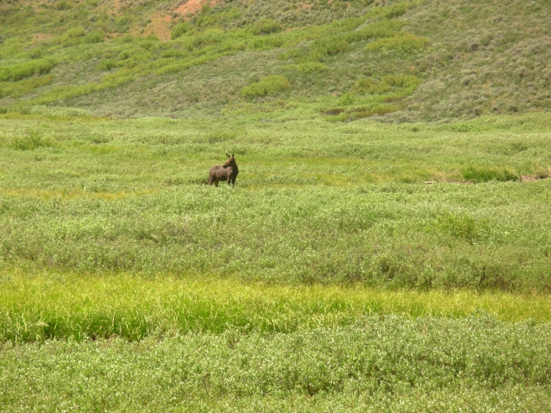
We only saw two elk this morning, a female moose and a deer this afternoon. We did see two more sets of bear tracks though. The days cant all be like yesterday.
We picked up good pack trail just below the pass which we followed for about three miles, crossing the stream three times. The trail split up in a wide willow covered meadow and we lost it for a while. We followed a game trail along the side of the valley, then found pack trail again which headed uphill, away from Squaw Creek. A map check said it was the Sheridan Creek Trail which meets a jeep track that parallels Squaw Creek for about three miles. We took it, rather than bushwhack down the creek. The road wound a lot, making us wonder if we were on the right path, but eventually we descended to Squaw Creek again near its junction with Fish Creek.
It was one of those classic CDT moments. Should we keep looking for the vanished trail or take a good path thats longer, but will eventually get us to our destination? Or yesterdays question: should we follow the known route which weve done before, or check out the new marked route, with the understanding that the markings could and probably would end at any time? Yesterday we took the chance. Today we didnt. We followed a jeep road up the valley of Fish Creek to its junction with Beauty Creek. We washed up and then set up in a horse camp up the hill. It should be quiet. None of the jeep tracks we followed today showed signs of use. Fish Creek is probably open, but it doesnt seem to get a lot of traffic.
June 27- 10 Miles in the Gros Ventre Motel in Dubois
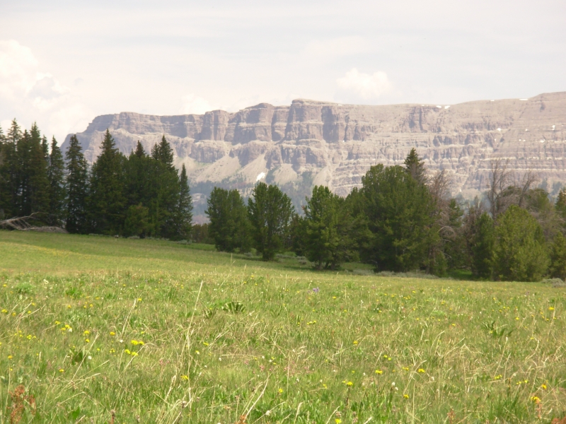
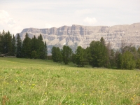
We knew todays route consisted of faint trail and some bushwhacking, but it was actually better than we expected. We picked up pack trail up Beauty Park, marked by yellow diamonds. A mile later we lost the trail in a meadow. (It probably went right while we went straight). We bushwhacked north about 10 minutes and managed to pick up the old logging road we were supposed to be following. Nice! At the head of Beauty Park we turned right on pack trail with orange diamonds for ¼ mile, then began a planned bushwhack up a tree-covered ridge parallel to Larkspur Creek. There were game trails and intermittent meadows, so the walking wasnt too bad. Then we unexpectedly ran into good pack trail that took us the rest of the way up and over the ridge. It was mostly in beautiful open green meadow, filled with flowers. We ate lunch at the head of Squaw Basin, a rolling green meadow with dramatic cliffs to the north and east. Flowers are abundant, as are the mosquitoes. We saw one deer and one elk this morning and tracks from a mama bear and cub.
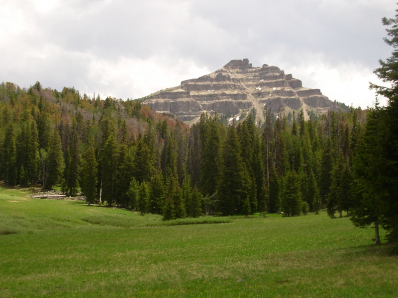
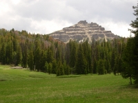
The pack trail ended at a campsite at the head of the meadow. There we picked up jeep tracks heading north. After about half a mile we turned onto a better jeep road that took us all the way to Togwotteee Pass. It wound through meadows and woods but had nice views of Breccia Cliffs, Sublette Peak, etc. Its beautiful country.
Getting a ride back to town was very slow. Thanks to road construction, the cars came in clumps so there was ten minutes of no cars, then five or six vehicles in a row, then ten minutes of no cars. Frustrating. It took a little over an hour to get a ride with a journalist from Idaho.
Home | Links| Trail Journals |
The Thruhiking Papers | Bun-bun
Created: 10 November 2007
Revised: 30 Sept 2016Copyright © 2007-2017 Spirit Eagle