|
|
|
 |
 |
 |
 |
|
|
|
|
|
|
|
|
The Pacific Crest Trail
Idyllwild to Wrightwood
Tuesday, May 2: Fuller Ridge Trailhead — 12 + 4 miles (192.2)
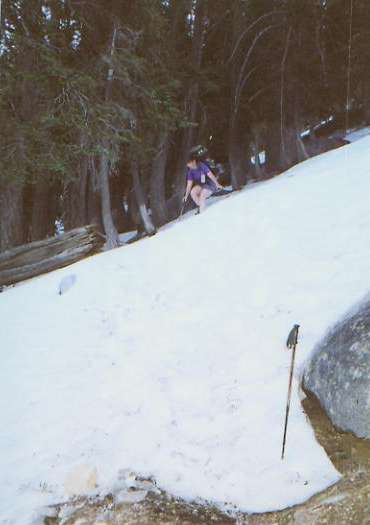
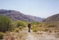
We managed to break out of Idyllwild, though it wasn’t easy. Many of the hikers are staying over to rest sore knees, blisters, etc. I think that dread of the long climb out of town may have played a part too. They’ll undoubtedly catch up, sooner or later. The climb was long and slow, but at least without the hordes of hikers we saw on Sunday. We spoke with only two dayhikers on the Devil’s Slide Trail, then one German overnight backpacker and Chris Ramias, a PCT section hiker from Phoenix. We stopped for a late lunch/early dinner at the last water source for 22 miles. It was pure snowmelt – cold! It has been a slow day, between climbs, heavy packs and snow. Most of the snow is shallow, but it is still slippery. Jim’s knees don’t like the slipping and sliding (mine don’t either, but they’re not complaining as much.) We’re still high in the San Jacintos, with lots of huge pines and firs. Lots of snow up here, but soon we’ll begin a long 25 mile descent and the snow should begin to vanish. I’m glad to be out on the trail again, despite the difficulty.
Later: we hiked late, trying to descend past snowline. It was slow going, with a few scary spots and a few twisted knees and ankles. Fortunately, we could follow footprints, so navigation wasn’t a problem. They even went in the right direction, most of the time. There was enough clear trail that we could tell where it was, but enough snow to be a real trial. According to the altimeter, we climbed about 10,000’ today, up and down and up and down. And we do this for fun? We ended up camped at a car camping campground. There’s no water or amenities, but there are nice flat spots in the trees.
Wednesday, May 3: San Gorgonio Pass - the Middleton’s cabin -- 21 miles (213)

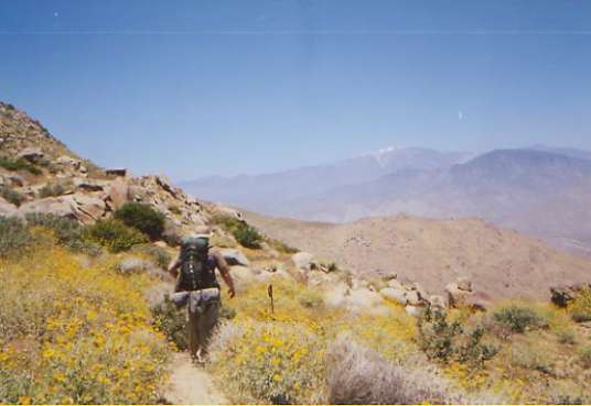
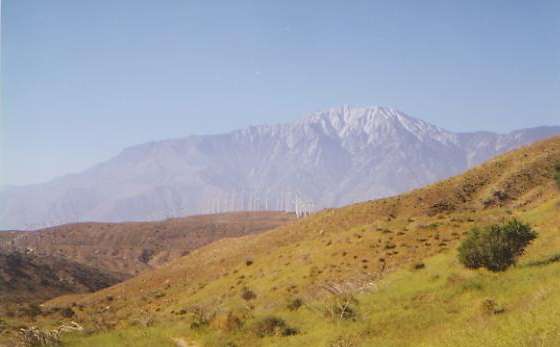
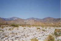
The descent to San Gorgonio Pass was interminable. The drop is about 7000’, but the trail twists and turns for endless miles as it makes the gradual descent. The first few miles in the trees were nice and cool, but the lower we dropped, the warmer it got. At the bottom we were only 12 miles from Palm Springs, where the temperature was 105° on Monday. The desert is in full bloom, with lots of variety in the bushes and flowers. We had nice views of steep-walled San Jacinto Peak behind us and snowy San Gorgonio Peak ahead, as well as a few peaks further west poking up above the smog. Yesterday the haze was so bad we could barely make out San Gorgonio, just across the pass. Today we could see I-10 below us and the weird shape of the windmills at the wind farm beyond. A couple of hummingbirds stopped by to check us out. We saw lots of lizards and snakes. One gray snake had lengthwise orange stripes. One big lizard had a brown back and greenish legs. Both were new to us.
At the bottom of the descent of Fuller Ridge there is a water fountain (at last), but then the trail weaves about six miles across the flat hot windy valley before we begin climbing on the other side. Ouch! There is a big boulder next to the water fountain, which creates a tiny patch of shade. We sat in that shade for about two hours, drinking and drinking and drinking. I drank so much water I felt sick, but I was totally dry after the interminable descent through the desert.

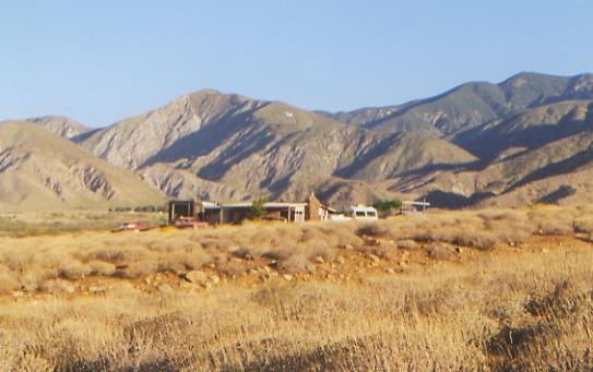
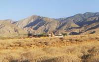
We had heard that there were a couple of trail angels, Don and Helen Middleton, living near San Gorgonio Pass. Tacked on a post along the trail beyond the freeway there was a photo of their home and the cabin/trailers they let hikers use (affectionately known as the Pink Motel). We stopped in at their house to say hello and were given some very cold ice tea. When Helen heard that Jim had hurt his foot on the descent, she insisted he use a foot bath and salve to try to heal it. (NB: Jim thought it was a stone bruise. Eventually we found out he had broken a toe.) We had a nice visit, then went on to the cabin about ½ mile away. It is set on a hill in the middle of an unfinished housing development. The place is surrounded by a small junkyard. There is a cabin with a living room, another with a kitchen and a couple of trailers. There are sofas to sleep on, lots of food to eat, a hiker box, magazines and bottled water. The cabin is unfinished — not much to look at, but a comfortable corner out of the incessant wind, and a very kind gesture from two non-hikers.
The trail across the valley was hot (90ish), sandy, windy and long. The gallon of water we were carrying from the water fountain at Snow Creek was very heavy. We were more than ready to stop. We both hurt more than expected. But then, that was a very long trail down the ridge. I think we weren’t really prepared for the force of the wind across the pass either. It was hard walking against the wind. Of course, that’s why they built a wind farm there – we should have expected it.
Thursday, May 4: Mission Creek — 15 miles (228.4)

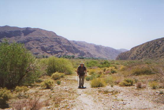
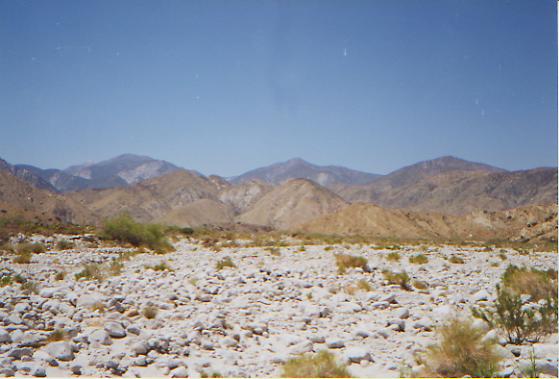
It was an interesting walk this morning, up past a wind farm with huge white windmills, along and above a couple of dry canyons, then down to Whitewater Canyon -- a wide rocky valley with a good sized stream. We had lunch next to the river, after a lovely bath in the cold water. I was getting worried as there seemed to be no water in the canyon. For a mile and a half we walked along dry rocky washes, seeking water. The canyon is about half a mile wide, and the water was running on the far side, not near the trail. The canyon is nearly treeless, just a broad white rocky plain, very hot and dry. Only a few willow bushes and desert broom give meager shade. My hope for cool cottonwood trees was dashed again. It was hot, at least in the 90’s. But at least I was able to cool off in the water. What made the morning interesting was the incredible variety of flowers. There were 40 or 50 different kinds. Around every corner I found new ones, including pink and purple poppies, which I’ve never seen before. It was fun. We also saw a couple of tiny desert turtles, only about two or three inches long.
We had a short day, hiking until about 5:00. We were slow with the heat and sore feet. Some days we really seem to fight the trail, and it does slow us down. The country this afternoon was very dry and barren, burned a few years ago in a fire. We climbed up to a ridge, which we followed for about a mile, enjoying views (of a sort) in all directions. We could barely make out Palm Springs to the east. The smog is a disappointment. I hadn’t realized it reached out to the trail, but there is a grey haze over everything. We kept getting glimpses of San Jacinto, like a white ghost above the desert, obscured by the haze. Eventually we descended to Mission Creek, which we will follow all day tomorrow. We found a lovely campsite in the shade of a tree, within sound of the water. We haven’t seen anyone all day. It is very peaceful -- a few birds, a few bees, the song of the water in the creek. Very nice! We decided to try to slow down through here since once again we’re due to reach town (Big Bear City) on the weekend. If we had really pushed, we might have made it there on Saturday, in time to catch the brief hour that the post office is open, but it didn’t seem worth the effort. Taking our time and doing a few short days seems both smarter and more enjoyable. We have books, which we have already traded. Next up, Louis L’Amour. With the long midday breaks, a book is a necessity for me. I can’t just sit for two hours with nothing to do. I don’t have that much to write about, and huddled under a bush, there isn’t much to see.
Friday, May 5: Heart Bar Creek 15.3 +2 (243.7)
We had a nice night tucked under our tree, listening to the frogs. All morning we climbed up along Mission Creek, crossing it more than 20 times. Some of the crossings were pretty obscure, buried in deadfall and flood debris. The stream itself is only a couple of feet wide, no wet foot crossings here. Often only the footprints of previous hikers showed us which way to go. We lost the trail several times, even with that help, but since we knew we were supposed to keep going upstream, eventually we always found it again. The terrain was mostly desert, with lots of prickly pear and agave and various flowering bushes. There weren’t as many flowers as yesterday, mostly the usual brittlebush, lupine and paintbrush, as it’s so dry. The creek itself was dry for about three miles. It just vanished in the sand. We had lunch at a nice campsite at 6100’ near a tiny trickle of water. A horseman left behind a lot of garbage: clothes, rope, feedbags, horsefeed, etc. Too bad, as it would be a nice site otherwise. We saw one big orange rattlesnake hiding in a yucca. He didn’t rattle though. It was too hot, I think. The climb was a nice one, mostly gentle. The first hour was in the cool shadow of the canyon walls. About 10:00 some cirrus moved in, cooling things off considerably. We’re heading up into the trees again and should be fairly cool for the next day or so. That will be welcome.
Later: Of course, as I sit here shivering, waiting for dinner to boil, the cool is a bit less welcome. This afternoon, we continued the climb up above 8000’. We’re up in the pines and manzanita. Looking back, we could see snow on the ridge behind us. We set up for the night on a ridge above Heart Bar Creek. It was a long, long way down to water, following a dry creek. The guidebook said there was supposed to be water about ½ mile down, but I saw nothing. Finally, after more than a mile, I gave up and turned around. It was so frustrating, following the dry creekbed as I dropped and dropped on the steep trail. Then I spotted a cairn beside the trail. Looking beyond the cairn, I saw a hint of green below. Sure enough, it was a small spring — very small. I was following a set of footprints, but I don’t think he found the spring. Poor man. The next water is 14 miles ahead, so if I hadn’t found the spring, we would have had to turn back a couple of miles to Mission Creek Camp, which had a small trickle. Then came the hard part, lugging the water back up. I was very happy to see Jim, who had gotten worried when I didn’t reappear and came down to meet me.
Saturday, May 6: Nelson Ridge — 19.8 miles (263.5)
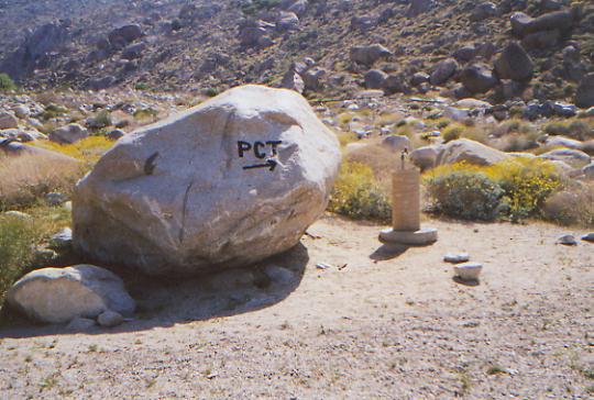
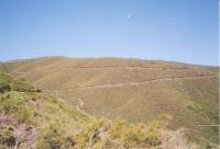
We’ve been making good time, wandering along the ridges above Highway 38. There have been some nice views of San Gorgonio and Ten Thousand Foot Ridge, back toward San Jacinto, west toward some unknown snowy peaks, east into the haze that is Palm Springs, and north to tomorrow’s hike. As the crow flies, this morning we’ve come about a mile. On foot it was eleven. The PCT does some odd things. It can be hard to be enthusiastic about the trail sometimes. It does wind! On the Appalachian Trail, 300 miles put you past the Smokies, the Stecoahs and into the North Carolina Balds. On the Continental Divide Trail, 300 miles gets you though Glacier, the Bob Marshall and Scapegoat Wildernesses. Northbound, it gets you through the Gila Wilderness. All are beautiful, worthwhile goals, totally aside from the long trails. Here we’ve had some nice views and lots of flowers, but mostly just lots of easy trail winding though the desert or through the trees. There have been few highlights. Our biggest challenges were the Scissors Crossing traverse and Fuller Ridge’s snow. Neither was that challenging. We don’t even climb any peaks on the PCT. The trail was 3.5 miles from San Jacinto Peak, not worth the extra time and effort, especially given the smog. Here the challenge is to keep going, despite the lack of obvious reward or challenge. I know it will get better. The Sierras await, and the Mojave. Those will be real challenges, I hope. In the meantime, I have to remember to savor the moment. It is still better to be out here hiking than sitting in an office staring at a computer screen. There may not be a great sense of accomplishment, but there is a happiness in just spending time in this strange and beautiful world.
It was an easy day, all in all. We stopped for an hour at the spring at Arrestre Trail Camp to rest and camel up, then carried water for another 5 ½ miles to a windy ridge overlooking the desert. A front seems to be moving through, brining high winds, cirrus clouds and cooler temperatures. Nice. We’ve been walking through sage and pinion pines. It felt like New Mexico.
We met a dayhiker at lunch and a large group from a camp or school, and saw bike, motorbike and horse tracks. It’s a busy trail on a Saturday. We haven’t seen any other thruhikers for three days, though we see signs of their passage. There is a large group just ahead. We’ll probably meet them in town tomorrow. We considered pushing on to Big Bear tonight, but 24 miles is a big day when your feet hurt as much as ours do. I’m not all that excited about going to town. Yes, a shower would be nice, but I’m not starving for any particular food and we’ll be camping, not staying in a motel this time. The local fire station lets PCT hikers camp in their back yard. Besides, passing Big Bear means dropping in elevation again, and I’ve enjoyed being up in the pines.
Sunday, May 7: Big Bear City — 4 miles (267)
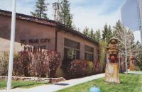
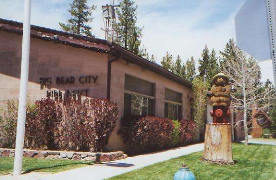
We had a restless night, listening to the wind rattle our tent, so we were up with the sun, heading into Big Bear. The fire station is very welcoming to hikers, allowing them to use the showers and bathrooms and camp on a nice green lawn in the courtyard. We hitched into town early, ate breakfast, took a shower, did laundry, visited with the other hikers a while, took a local bus three miles to a grocery store, then came back to the fire station to relax a bit. It’s cool and breezy. It feels really nice to just sit in the sun and rest.
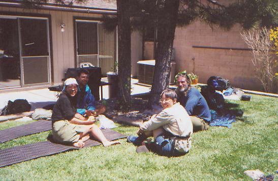
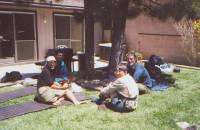
Since the fire station is right in the center of town, and free, there are a lot of PCT hikers here. It’s a bit hard to keep the other hikers straight at this point. We had only met one of them before — Emily — and she left soon after we arrived. Most seem to be former AT hikers. One, Doug, hiked the PCT before. I can’t imagine why he would want to come back, knowing what the trail is like! Some are only out for a short while, not thruhiking. A group, known collectively as the Menacing Vegetables (Ben, Ezra, Kate, Jonny, and Maria) is out for six months. They got their name from a line in the guidebook, which said to “watch out for the menacing vegetation.” They thought that was funny; so do I. They’re taking their time, not really planning or expecting to go all the way. They’ll keep going as long as its fun, I think. They do seem to be enjoying themselves though. Kate is off to join her boyfriend in Europe soon. Brad will head off to the Peace Corps in September. John Meyer has limited funds, so doesn’t plan to go all the way. He has hiked a lot of the PCT before, but says he prefers hiking in Europe to hiking in the wilderness. But then, he’s a talker, with very decided opinions. I’ve had to bite my tongue a time or two. He picked up a stray German shepherd dog along the trail. He said she had been abused, so he didn’t want to let the Humane Society try to find her former owners. Doug and Christa are also hiking with a dog, a chow/lab mix that is very unfriendly, growling and snapping. Drew plans to thruhike, I think. He is just out of the Marines, which he had to leave because he is allergic to just about everything. It doesn’t seem to slow him down any, but the military wouldn’t risk it. Sundance is a wildlife biologist, more or less hiking with Brad for the time being, but maintaining her independence. It’s pretty noisy and crowded here.
We still feel a bit outside the hiker community. Partly it’s the effect of last year’s solitude. Partly it’s because we don’t know whether any of them will last past the Sierras, or whether we will pass them or they will pass us and we won’t ever see them again. Some may become friends. Most will remain strangers. We’re tied by the common bond of the trail, but without time to get to know each other, it isn’t enough. We are all part of the early group. The majority of PCT hikers leave later than we did, but we wanted to be able to take our time, without being part of a pack, and with a fairly good chance at finding water in the springs. A week or two later, and the springs begin to dry up. We didn’t want to risk that. The tradeoff is that we’ll find more snow in the Sierras, but we decided it was worth the risk, especially since this is a low snow year. We also knew that a huge group was leaving Campo a week after we did, part of the PCT-L Kick-Off party (ADZPCTKO). We didn’t want to be competing for campsites and water with a large group. They’ll start catching up in the next few weeks, but will be spread out by the time they do, we hope.
Monday, May 8: Delamar Mountain -- @ 16 miles + .6 (283.5)
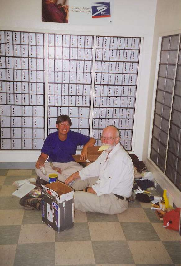
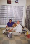
We didn’t get much sleep last night. Too much noise from hikers talking, a punk band playing nearby, traffic on the road, plus too much light, twitchy feet and too much sugar and caffeine. We slept only a couple of hours, then went to breakfast with some other hikers, walked over to the post office to check for mail, then finally headed back to the trail. A very nice Hispanic family from Los Angeles picked us up and took us out to the trailhead. They were quite intrigued by what we are doing.
The morning hike was nice, first in sage and pinion around Gold Mountain, then up into the firs and pines again. A rattlesnake scared me by rattling as I passed.
The other hikers are spread out all over the place. There are several alternate ways into Big Bear, and we used all of them. In the case of John and Drew, they walked right past the road into town, and kept going another 3 or 4 miles to a side trail. The Menacing Vegetables planned to get a ride so they could climb Mt. San Gorgonio. It isn’t near the trail, but it is a big snowy mountain that is probably fun to climb. If the trail won’t oblige with worthwhile short-term goals, some people make up their own. Going from town to town just isn’t the same as saying, “I climbed to the highest point, hurray!” Some of the hikers were planning to slackpack a few miles, then head back to town. We may not see most of them again, at least until the next town, when we’ll accordion up again. Marc from New Hampshire showed up this morning. He left Idyllwild a day behind us. He told us that British Mark was off the trail (temporarily as it turned out. He was having trouble with the heat and a too heavy pack, so decided to lighten his load.) Guy had severe knee problems, exacerbated by the long descent off Fuller Ridge, and decided to stop hiking. Guy was more of a bicyclist than a hiker in any case, out on the PCT only because his fiancee wanted to do the trail before they get married. (As it turned out, he went to Phoenix to pick up Kerstan’s truck and acted as trail support for her all the way to Canada.) The two boys with the dogs left the trail in Idyllwild, and Peter Haskell got off at Anza. I was sorry to hear that.
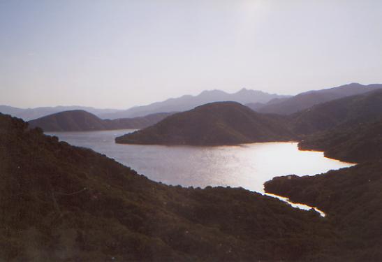
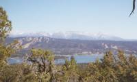
We had a pleasant stroll through the woods on a cool and sunny afternoon. We had occasional views of Big Bear Lake with the snow-covered San Gorgonio Wilderness behind it and views on the other side of the ridge of open pit mines. We met a couple of mountain bikers and a day hiker. Most of the time I was in the groove, just flowing with the trail, thinking odd thoughts and heading off on wild mental tangents. We had gotten enough water at lunch to carry us overnight since I didn’t really want to have to push to make the next spring at Little Bear Campsite. With our late start, that would have made a long day. Jim’s foot is still very painful, and mine were certainly ready to stop when we did.
Tuesday, May 9: Deep Creek -- @ 21.5 miles (305)
The morning hike was easy gentle up and down in forest and rocks, often near creeks. It has been pretty, though the very narrow soft trail is not great. We’re making good time, despite frequent long breaks. Just taking it easy. We are entering a burned zone from a fire last year. So far, it is intermittent, though the smell permeates everything. We had lunch beside Holcomb Creek. I had been longing for a bath, so we stopped by the creek, where I took off my clothes and waded in. The water was very cold, so I just splashed a bit before retiring to shore. There are flowers in the burned areas, especially a pretty tiny purple one with a white center. Not much fire weed though. A couple of ducks joined us at lunch.
This afternoon we climbed up and over a ridge to Deep Creek, a steep narrow canyon with a lot of water in it. We hiked far above the water for several miles until we found a semi-flat side ridge where we could stop for the day. That’s one of the problems with trail that contours along a ridge: no campsites. It was a long way down to the water, and few if any spots down there as the canyon is so narrow, and it’s just as far up to the top of the ridge. The trail is only a foot or two wide, cut into the cliff. Erosion is the other problem with sidehill. There have been a lot of slides, making the trail a bit difficult in spots. In others, horses have knocked off the edges of the trail, making the treadway very narrow. Anyhow, the burn remained intermittent. The far side of the creek is mostly burned, our side not as much, though that was a part of our difficulty in finding a place to set up for the night. We didn’t want to lay the sleeping bags down in ash. That can be very hard to clean off. My pants have black marks all over them from burned bushes and rocks. There were lots of flowers again, especially the purple ones: lupine, chia, and phacelia, among many others. We scared off a baby rattlesnake, only a foot long, and another striped snake later.
It was pretty looking down at the creek, though lack of access meant we each had to carry a gallon of water for the last five miles. As it turned out, it is possible to get down to the river from our campsite, though the way is a bit steep. I went down to wash up, and Jim ended up coming after me since I was gone so long. It’s about five miles from our campsite to the next place where the trail goes near the creek at a hot spring. I would have liked to go that far — a hot bath sounds wonderful — but not if it means a 25 mile day. My feet aren’t ready for that. It is very peaceful here. We have seen no people all day. There is just the sound of birds and the water tumbling below us. The sun will sink below the cliff soon, though it won’t be dark for a while. We were too tired to keep going, especially with flat spots so few and far between.
Wednesday, May 10: Silverwood Lake — 21.1 (327.4)
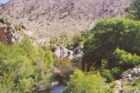
It was an odd morning, both good and bad. We woke early, but took our time getting started and arrived at the hot spring around 9:00. We stopped for a swim in the pools, which we shared with Brad, Emily and Sundance. The hot pool was nice and warm, the cold wonderfully refreshing, and the water was deep enough to really swim. We didn’t stay in very long, just long enough to get a taste of the peace and beauty. It was really nice, a lovely oasis in the burned canyon.
As we were putting on our shoes, a BLM ranger came along, prepared to cite us for camping illegally and being in a closed area. He said that the trail was closed because of the fires last year. We explained that we hadn’t camped there and that we had seen no indications that the trail was closed, and in fact, had been told via the PCTA website that the trail was open. He all but called us liars, and tried several times to trip us up. He wouldn’t believe that we were thruhikers, and that we had come in from the south instead of the local (closed) trail. It wasn’t until Jim began to doctor the huge blister on his foot, utterly nonchalant, that he started to buy our story. I guess he figured that anyone who could continue to walk with that mess might actually be a long distance hiker. Finally he sent us on our way, though even that got confusing when he said we couldn’t go back on the trail the way we had come, or forward on the trail that was closed. Eventually he said to just go ahead on the PCT and watch out for trail crews. We met none and saw little sign that they had been there recently. When we left, the others were still in the pools and hadn’t met the ranger. I worried that he would cite them for camping there, if not for the closed trail issue. The whole episode was really upsetting. The ranger was one of the stiff and rigid kind -- occasionally friendly, but mostly a jerk. He said he was actually out looking for some naked guy who has been harassing women hikers in the area. We just got in the way. It is odd, because the trail, while it has some washouts, is still passable. Maybe not for horses, but certainly it was okay for hikers. We saw no signs telling us that the trail was closed until we reached the trailhead several miles north of the hot springs.
We followed trail above the creek to an enormous dam (as Jim called it, “a California project” — totally excessive) where the trail got very obscure. We crossed the dam, then headed off on an old road to the creek beside it, but there were no markings to be seen. Most of the time the PCT is really easy to follow, so this was odd. We saw an odd lizard that looked more like a snake, with a long body, viper head, and tiny legs. Someone later told me that it was a skink.
The trail wound through the chaparral for several miles, in and out of small gullies. Descending one, we spotted a sheriff looking at a shot-up van. From the tracks, it hadn’t been there long, probably only overnight. The driver had driven it though brush barricades onto the hidden trail, then someone spent a long while shooting holes in it. Combined with the earlier story of the pervert harassing hikers, this made me nervous. We followed a dirt road out to the highway, where we knew there was a small store. We called PCTA to ask about the status of Deep Creek. Joe said that as far as he knew, the trail was open. That was what the recorded trail report said too. We suggested he let the BLM know that, so they would leave the PCT hikers alone. We had a long chat with Larry, the owner of the store, as we ate ice cream and drank cokes. He seemed glad of the company. Finally, about 5:30 we headed up the paved road to the State Park at Silverwood Lake where we searched for a hidden campsite where we wouldn’t be near any roads or boats, and would be out of sight and sound, we hope, of troublesome intruders. I didn’t want to camp near the shot up van. It was obviously an area where the locals dump their trash and shoot up the remains. (Ever see a Swiss cheese dryer? We did.) We’re sore and tired, but with a nice sugar buzz.
Thursday, May 11: Swarthout Canyon — 22.6 + 1 (350.0)

It was quite cool all morning, with a cold breeze blowing. Yesterday the winds were really fierce, knocking us back and forth. Today’s were gentler, but colder. We wound around Silverwood Lake, a big recreational area, and up into the hills beyond. The vegetation is all chaparral, with tall bushes and a few shade trees. There is a lot of poison oak, and even some poison ivy. There are a few flowers, but not an abundance, mostly lupine, paintbrush and prickly pear, as well as a pretty yellow flowering bush, probably Fremontia. Jim’s feet are still a problem, blisters on both and the ever-present stone bruise (actually a broken bone, though we didn’t figure that out for another 1200 miles.) He keeps going, but some days, every step hurts. We set up camp last night on top of some ant hills. They kept us awake, crawling all over us. Heading toward Cajon Pass, where the trail crosses Interstate15, we could see trucks ten miles away. There was a pretty little canyon with a creek leading up to the freeway. It would be a nice place to camp, except that it is so close to the interchange.
For hikers, the highlight of Cajon Pass is the MacDonalds and mini-mart at the highway interchange. I felt utterly alienated at MacDonalds, watching all the travelers come and go. Culture shock. I felt invisible. I think if people saw the packs, they just assumed we were homeless, or something. Weird. We ate too much, then happily went up into the hills looking for a campsite. I goofed and put the next guidebook section in the Wrightwood box, so we don’t have a trail description for the next 25 miles. Oops. While the trail is generally well marked, in ‘civilized’ areas blazes can be scarce, but we managed all right, despite the freeway and a couple of railroad tunnels and tracks. Once past “civilization,” the trail wound around the hills on narrow sidehill. The country was interesting, with big boulders and sandstone bluffs. It was a late hiking day. The noise of the freeway followed us for miles. By the time we crossed the ridge to get away from the noise, we had run out of flat spots. We ended up camped in a dry wash at the bottom of the ridge. Tomorrow we climb.
Friday, May 12: Guffy Campground — 16.8 miles (366.8)
We had a good day climbing up into the San Gabriels. It was a long way up, but very gentle. Around noon, we met our friend Dave Fleishman, who now lives in LA and came up to spend the weekend with us. It was really good to see him again. We also ran into Doug and Christa, slackpacking in the other direction. They had hitched into town from Cajon Pass in order to get their maildrop before the weekend, then decided to walk back to Cajon sans pack. We are back up at 8000’, camped at a small primitive campground with a view of snowy mountains in one direction and burned forest in the other. It is cold and windy. Dave kept saying he didn’t remember this place when he hiked the PCT, but then, he hiked in a high snow year, and the campground was totally buried when he went through. I’m glad this is a low snow year. I can handle small stretches, but continuous snow gets very wearing.
A couple of motorcycles came up the trail while we were eating lunch and almost ran us over. They are forbidden on the PCT, but we see a lot of tire tracks. We refused to move out of their way and waved them back to the dirt road a mile or so back from which they came. I was irritated. I was also badly frightened since they came very close to running into Jim as they came around the corner. Actually, they should have thanked us, as there were some really bad blowdowns on the trail that would have been impossible for them to pass not far from where we met them.
Saturday, May 13: Wrightwood — 5 miles (371.8)
Easy ups and downs took us out to the Crest Highway. There was more snow than expected on the trail--hard, icy drifts. We ran into several runners along the way. Once at the highway, things got more difficult. There was little traffic, and most was going the other way. Finally, a man came over to his parked car with his dogs. I went over to him and said, “Can you please take one or all of us into Wrightwood? We’ve been trying for hours, and no one will stop.” He agreed to take only one of us, so Dave got a lift to his car in town and came back to pick us up. There is a side trail that goes into town, but it seemed like it would be easier to get a ride than to walk an extra four miles each way, especially given the climb back out with full packs. Apparently, I was wrong. When Dave came through on his PCT thruhike, the road wasn’t even open.
We stopped at the post office and discovered that it isn’t open on Saturday, so we’re stuck in town until Monday. Oh well, we had planned to take a day off, this will just add a bit to that. Dave suggested we slackpack the next section, over Mt. Baden-Powell, with his help. The trail crosses the highway several times, and he could drop us off so we would walk back to town, without our packs, then go back to where we left the trail the next day. However, given how difficult it was getting a ride today, we may pass on that. Anyhow, we ate lunch, quickly skimmed our e-mail (half hour limit at the library), got a room for half price, did laundry, went to the grocery and talked a lot. It was a nice day--not very productive, but fun.
Home | Links| Trail Journals |
The Thruhiking Papers | Bun-bunSouthern California | Central California
Northern California | Oregon | Washington
Created: Fri, 16 Jan 2004
Revised: 30 Sept 2016Copyright © 2004-2017 Spirit Eagle