|
 |
 |
 |
 |
|
|
|
|
|
|
Saturday, August 30 Bighorn National Forest CG near Medicine Wheel
It was an interesting, though not entirely successful day. We had heard about a place called Petroglyph Canyon in northern Wyoming near the Montana border. I got Mapquest directions, but they only got us to the canyon, not to the actual petroglyphs. We backtracked to Crowley, the nearest town, and asked about the petroglyphs at the grocery. Both of the people at the store had been there, but 30 or 40 years ago, so their directions were impossibly vague. We gave up. It turned out that we were very close, but not quite in the right spot. We were looking on the wrong side of the canyon where the walls were soft sand. We knew that wasnt right.
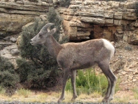
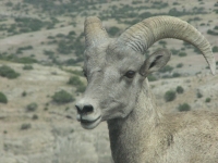
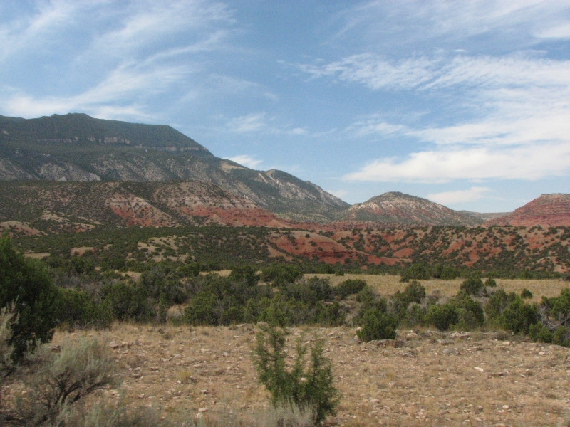
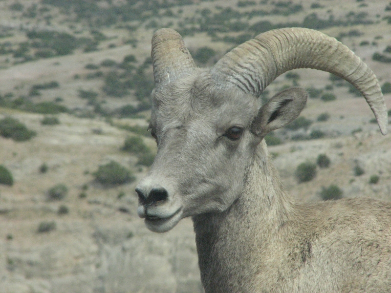
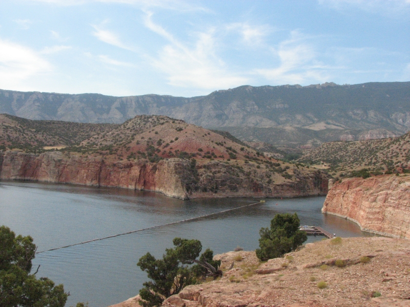
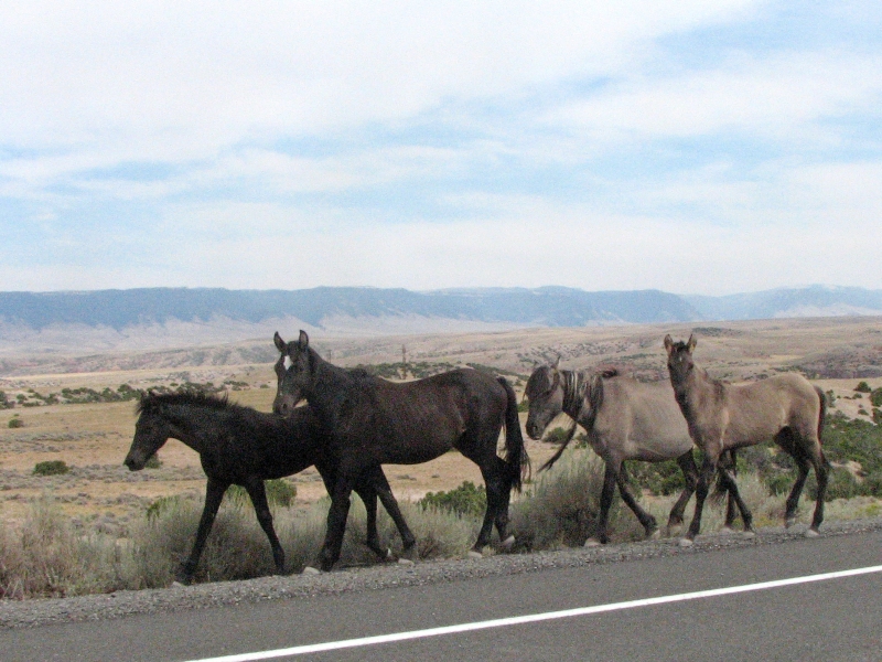
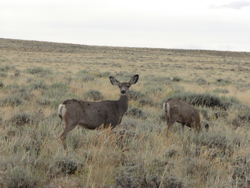
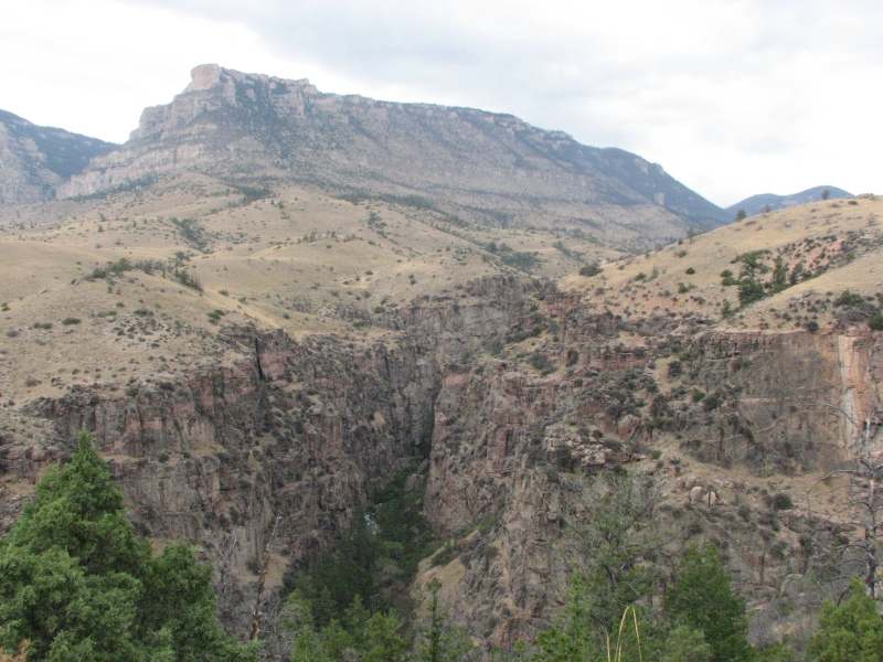
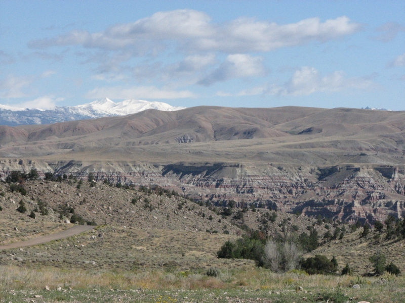
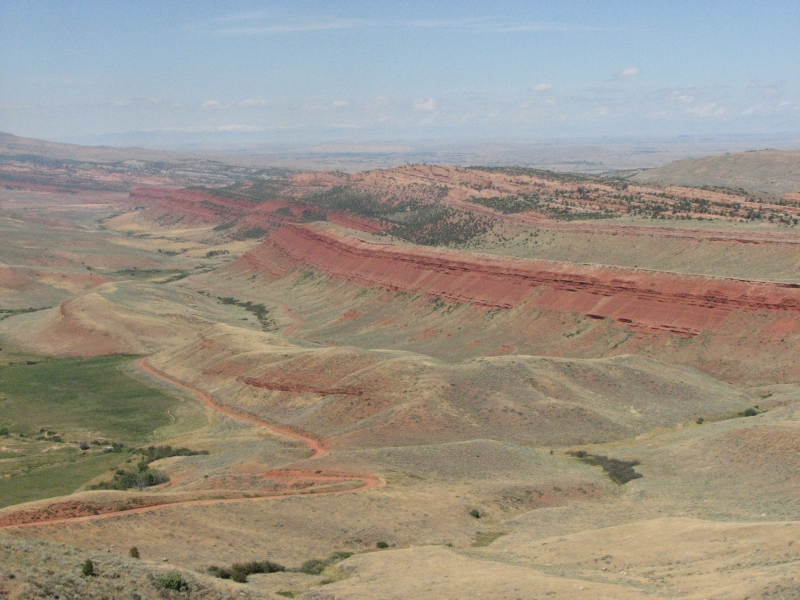
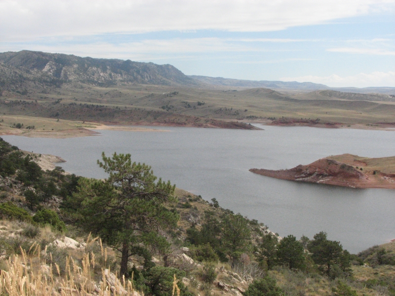
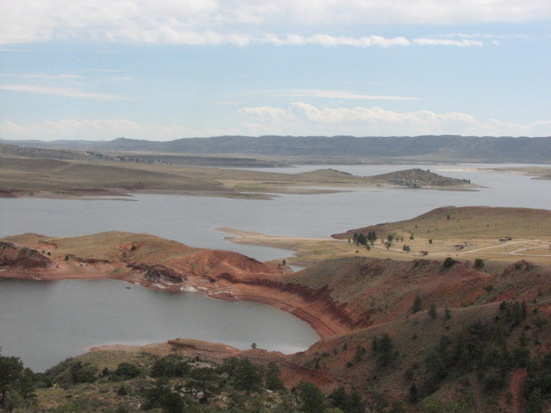
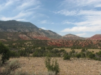
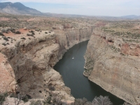
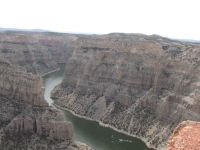
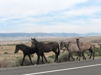
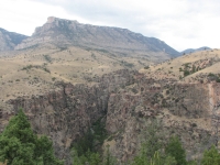
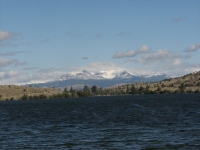
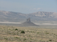
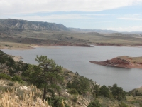
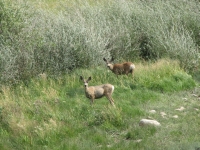
We continued the drive to Bighorn Canyon National Recreation Area where we had a long chat with a ranger at the Visitors Center. He knew about the petroglyphs and showed us on a map where they were, but we decided not to backtrack the 30 or 40 miles to look for them. Instead we headed up Bighorn Canon. Its a beautiful area, very reminiscent of Utah with multi-colored layers of red, orange and yellow rock and a deep eroded river canyon. We saw several bighorn sheep (reintroduced in the 1970s) and a family of eight wild horses from the Pryor Range herd, plus a mule deer. The red canyons are surrounded by blue mountains. Its very dry country. The grass is sparse and brown this time of year not much nutrition for the horses. The park road climbs from sagebrush to pinion juniper but the mountains above are ponderosa pine and fir country. It makes for a lot of biological diversity. I enjoyed seeing the rich colors. It reminded me of Dinosaur NM in some ways. The river was very busy with lots of boats and fishermen.
From Bighorn Lake we climbed and climbed into the mountains, going from 4500 to 10,000. We had intended to visit Medicine Wheel National Historic Site, but decided that finding a campsite had priority. There are three campgrounds in the vicinity: one at 6000, the other two up high. Since it was 92 degrees in the basin, we chose to climb to the high country. The first campground was full, but the second had one small vacant site. Its not a great one, but it has a nice view of grassy meadows, cows and the nearby high ridges. It was 5:00 by the time we settled in, so we decided to wait until tomorrow to hike to Medicine Wheel. Its a 1½ mile hike each way, better done in the morning, I think.

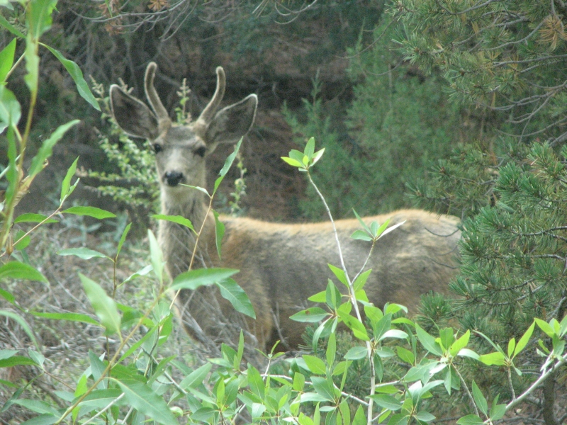
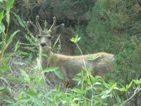
After dinner I looked out on the meadows with binoculars and saw an animal I thought might be a blond bear. I couldnt tell since it was so far away and I was feeling restless anyway, so I decided to walk down to the meadow to get a closer view. I walked about a mile down the hill, across a couple of streams and up to a small hill where I could finally see the animal clearly. It was, of course, another cow just not black like all its cousins in the meadows. On the way back I saw a big mule deer buck in one of the draws. Jim got worried about me, since darkness was falling, and came out to the meadow to look for me. We made it back to the truck with ten minutes to spare before it got fully dark. He wasnt really happy with me, but I had had a fun walk, even though my bear was just a cow.
Sunday, August 31: Medicine Wheel NHS to Castle Garden to Riverton

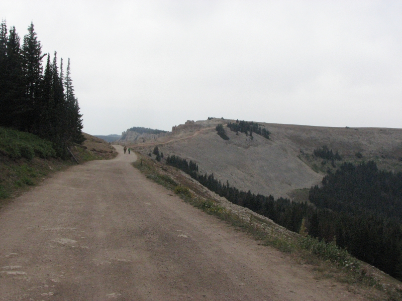
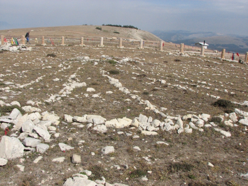
We slept in a bit then headed a few miles up the road to Medicine Wheel NHS. It was gray and cloudy and sprinkled a few drops as we reached the parking lot, but there were also a few rays of sunshine, so we put on rain jackets and set off. The ranger at the entrance told us the forecast was for showers today, snow in the high country tonight. Im glad we got here when we did. I wouldnt want to drive that twisty road up after a snowfall.
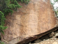
We followed a closed dirt road toward the ridge with the Medicine Wheel. Evidently if youre handicapped, the ranger will drive you up, but the rest of us walk 1½ miles around the mountain and up to the site. I suppose the idea is to minimize the opportunity for vandalism, and perhaps to allow people to get into a respectful frame of mind as they approach what is a still a religious site for many Native Americans. Its an easy climb, though I felt the altitude a bit. We noticed that the sky above the Wheel was blue and as we got closer the clouds parted and the sun came out. After we returned to the truck, the clouds returned. The Medicine Wheel is a rock wheel that is 80 in diameter, 245 in circumference, built by Indians between 1200 and 1700 AD, probably for prayers or other rituals. It has 28 spokes radiating from a central cairn to an outer circle. Theyve fenced off the actual circle and people put prayer offerings (usually cloth or medicine bundles, sometimes feathers or bones or an eagle claw) either on the fence or inside the circle. We walked around the circle three times. It was smaller than I expected, but I felt, very strongly, the power of the place. As Jim said, the Wheel wasnt built on the highest point of the ridge or the most obvious one, so there must have been an inherent spiritual power at the location that was chosen that isnt obvious, but is still there.
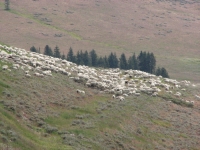
We decided to drive east over the mountains rather than descend on the steep twisting road we had driven yesterday. A large herd of sheep was grazing by the highway, with no obvious shepherd but a big guard dog. Cows wandered along the highway. Open range is one of the hazards of this country. Drivers have to stay alert.
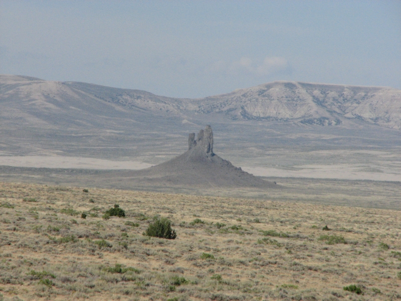
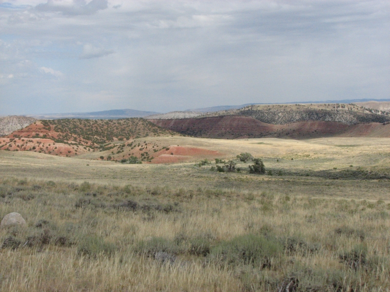
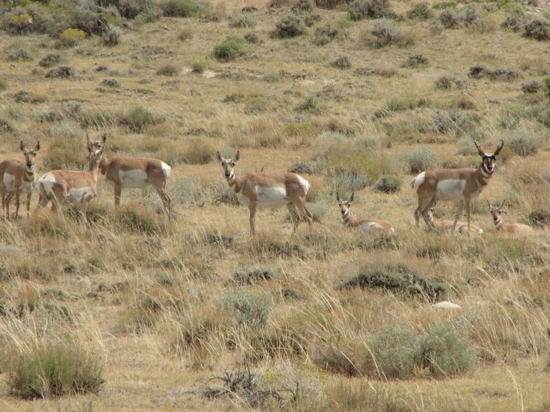
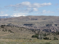
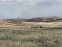
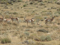
We decided to head south to a petroglyph site known as Castle Gardens. We tried to visit it in May but the road was so muddy then we had to turn around. Were hoping for better luck this time, though the forecast isnt encouraging. The drive passed through a wide variety of landscapes, from the high meadows and forests where we started to dry desert and gray sandy hills. The area around Shell Creek was beautiful with dramatic multi-colored cliffs in a narrow steep walled canyon. Wind River Canyon was also especially scenic. We passed though a lot of ranch and farm country with horses, sheep and cows, plus corn and hay growing in irrigated green fields. From tall mountains to flat desert basin. There were antelope beside the road in the hay fields and out in the desert. We also saw a couple of groups of mule deer out in the desert.
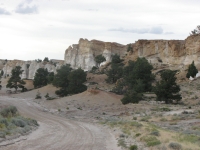
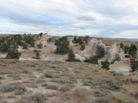
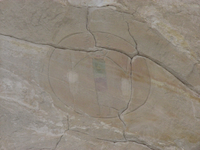
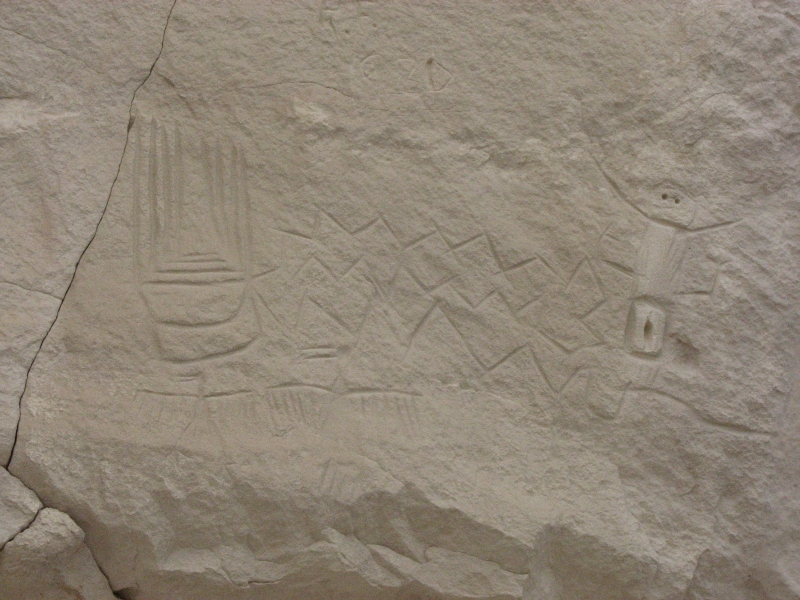
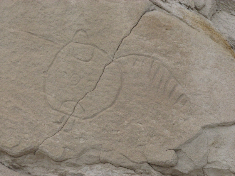
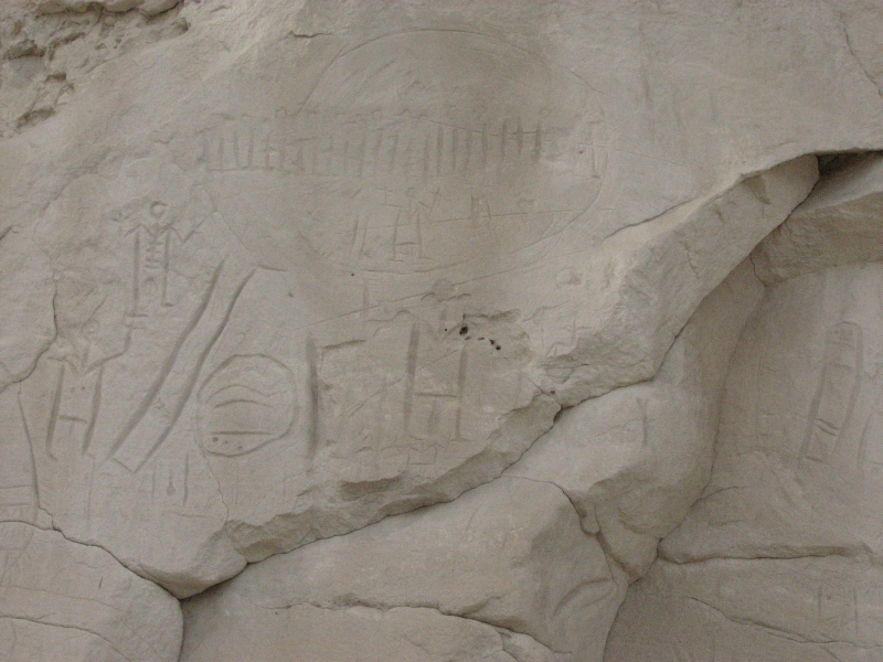
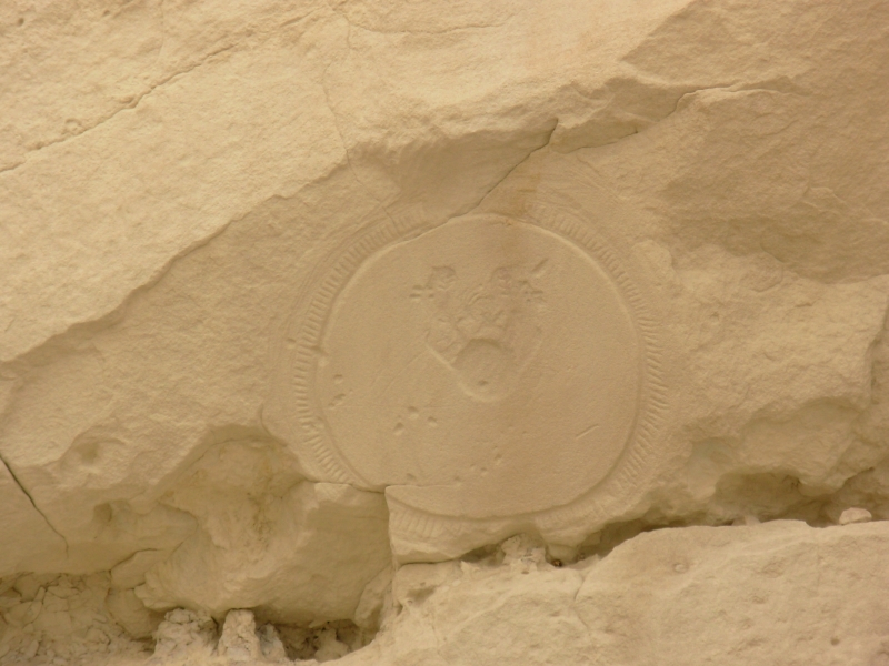
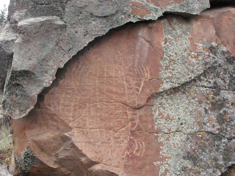
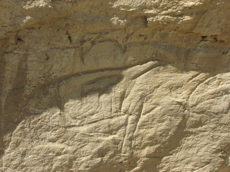
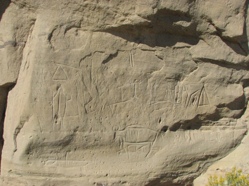
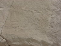
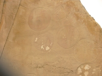
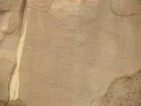
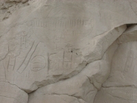
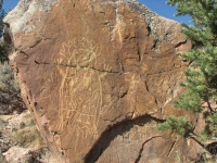
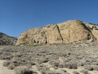
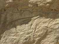
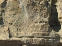
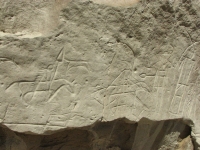
The road to Castle Garden was dry and firm except for a few sandy patches. Its about 20 miles of graded dirt road to get to the historic site. The petroglyph site is an interesting place with a cul de sac of colored sandstone formations. On the south side of the rock face were numerous petroglyphs in the Plains Style, mostly people and shields. I think theyre relatively modern, carved in the past 200 years or so. There were a couple of images that looked like atlatls, so were possibly much older. The problem with Castle Garden is that it has been badly vandalized. There are hundreds of names and modern carvings in the soft rock. Some were superimposed over the older images. I HATE vandals! Some of the signatures dated back to 1888, but most were contemporary. The best images had been fenced off to protect them, fortunately. It was worth the long drive to see the petroglyphs, despite the destruction of so much of the site. If not for the forecast, wed have camped there and taken more time, but as it was we spent about two hours wandering through the rocks.
Then we were faced with the question of where we were going to spend the night. We decided to head south as its shorter to a paved road, according to the map anyhow. Its farther to Riverton, that way, but we were happy to avoid some of the sandy road. I enjoyed driving through the desert that was so similar to the CDT route through the Great Basin: dry grasslands with wet draws that are so much greener than the sage and brown hills all around. As the sun was setting we saw several antelope and deer. We watched in disbelief as one big antelope buck crawled under the wire fence. Ive seen them jump fences, but never crawl under. The space wasnt very high, so it was an amazing sight.
We planned to camp at an RV park in Riverton where we could get a shower, but they wouldnt let us stay there. RVs only, we were told, no tents, and no camping in the back of a truck. Evidently tenters are low-lifes to the folks in Riverton. I was shocked. Weve never run into that before, though we have run into places that dont allow tents for other reasons. They just didnt consider us tent people, so we werent affected. Since the only other campground was a small one 12 miles north of town, and we were tired and hungry, we got a very expensive motel in Riverton. Thanks to the gas and oil boom in Wyoming, motels are expensive these days. Still, I did enjoy the shower.
Monday, September 1: Whiskey Basin


It rained last night and this morning. We may have been lucky to end up in a motel after all, since we stayed warm and dry, plus they had waffles and juice, so we got breakfast too. We werent feeling very motivated to hit the road thanks to the gloomy day, so we took our time leaving town. We decided to head northwest a bit to Dubois, a CDT trail town that we know well. Near Dubois there are some very interesting petroglyphs we wanted to check out. It was raining so we stopped in Dubois to eat lunch and visit the tiny bookstore before heading out to look for rock art.
Evidently the Wind River area has petroglyphs all over, but they arent advertised much. They arent on the tourist maps the way Castle Gardens and Medicine Lodge are, though they arent a secret either. Legend Rock was not on the state map, but it is in the tourist brochures and it is somewhat protected by the fact that you need a key to get in to the site. The petroglyphs we saw today have no protection, but they havent been vandalized much; only one rock had graffiti.
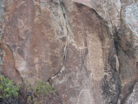
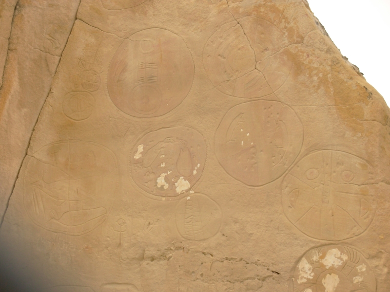
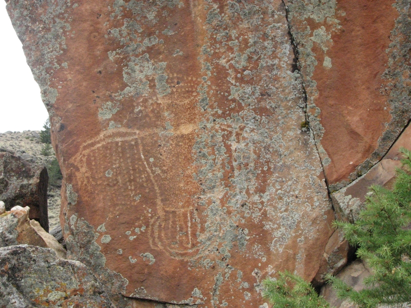
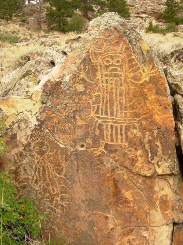
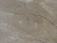
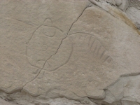
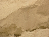
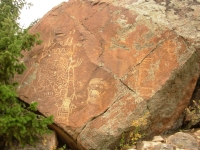
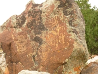
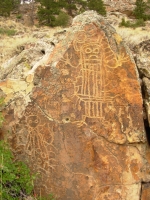
The Wind River petroglyphs are of a very distinctive style, known as the Dinwoody style, that is similar to the ones we saw at Legend Rock. They include a lot of bird images and bird/human hybrids. Their spiritual life must have been quite different from what weve seen elsewhere. The images are interesting and usually fairly large, so quite visible. That was good for us, since we ended up walking about a mile, looking for images scattered on big boulders. We found dozens of images in the 3 ½ hours we spent looking for them. We had a lot of fun.
It was cold about 45 degrees. There was a lot of fresh snow on the mountains above us. It was beautiful when the clouds lifted enough to see them. It cleared for a while then began spitting rain at us, so we wound up our wandering. We drove around checking out possible campsites. The rain came and went, but the wind was cold, fierce and steady. We found a campsite next to a lake in Whiskey Basin Wildlife Area. There is a trail nearby that looks interesting, but we decided it was too cold and wet to backpack there right now.
It appeared there was some sort of problem up there: we watched an ambulance head up the road to the trail, then leave, slowly, a few hours later. Weve run into several Search and Rescue efforts lately: first up in Glacier, then Bighorn Canyon and now in the Fitzgerald Wilderness. Well probably never know the outcome of any of the searches, but this one didnt look too good.
Tuesday, September 2: Green River, Wyoming
It was a beautiful cold sunny day. The air was crystal clear. Ive been enjoying the stars lately because of the clear night skies. Now that its dark at 8:00 again, we can see the Milky Way and all the constellations clearly. Beautiful. While we were in Alaska we didnt see stars for weeks. I missed them.
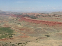
Today I enjoyed the views of snowy white mountains and the red and gray or red and tan badlands along the Wind River valley. We decided to continue south to the one major Wyoming petroglyph site we havent seen yet. We tried in May, but the road was covered with 10 inches of snow at the time, so we kept moving. Today the road may be wet, but not snowy, I hope. On the way we stopped in Lander to get another slow tire leak fixed. Turns out we had a nail in the tire which weve probably been carrying since Alaska. We kept just adding air every day or two. Jim finally got tired of that so we found a tire shop to fix it.
The route south is a pretty one. Red Rock Canyon is gorgeous, much like the red ridges east of Dubois. We crossed the CDT near South Pass. Rabbitbush is blooming right now, providing a shot of yellow color to the brown grassy hills. The Winds were dusted with fresh snow. We saw several hawks and antelopes out in the sage desert.
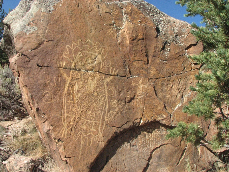
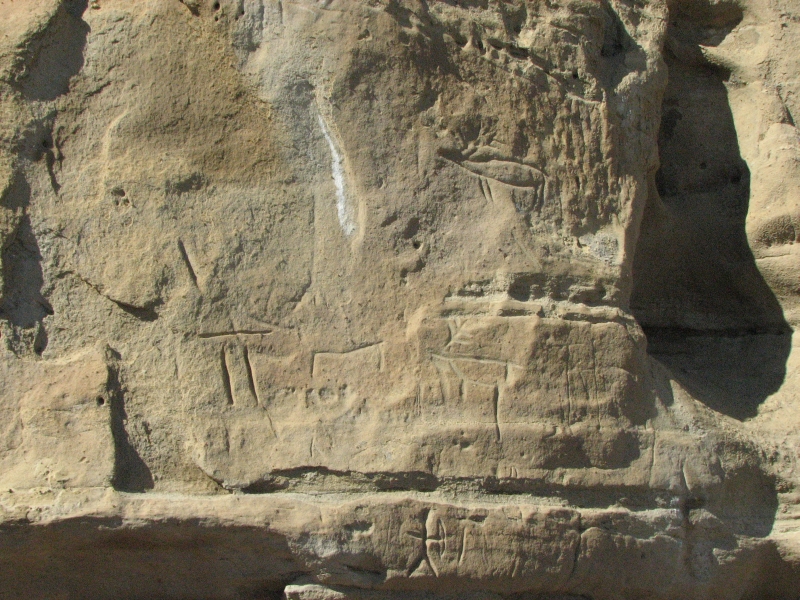
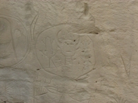
The road out to the White Mountain petroglyph site was really rough. It actually looked new, but it leads out to a gas or oil field, so gets a lot of use and is really rutted. The rock art site consists of a largely sandstone bluff with mostly fairly modern carvings. There were horses and stick men with bows and arrows. One horse or deer image had a baby animal inside it. There were several deer or elk and teepee images. There was a lot of graffiti, though not as much as at Castle Garden. Im not sure it was really worth the drive out, but it was a different style of Wyoming rock art, so at least somewhat interesting, though not as much fun as yesterdays treasure hunt among the boulders.
We ended up in an RV park in Green River. We tried Rock Springs but the KOA was crammed full and the motels were expensive ($75 for a Motel 6?) so we kept going. The gas boom strikes again. The campground in Green River was mostly construction and gas workers who live there full time. We got the last free space, then ended up moving to a storage space when a big RV showed up. It was a noisy campground since it backed onto the freeway, but I slept well. It had a shower and electricity so Jim could continue to work on the Gathering presentation. That slideshow has actually cost us a lot of money when you consider the number of times weve stayed at expensive RV parks instead of more primitive campgrounds that dont have electricity. Since Id much rather stay in the more primitive places, except for an occasional shower, it has been a bone of contention at times. Eventually I came to accept that doing the slideshow is important to Jim, so Ill live with the hated RV parks, especially since some really arent that bad. I just dislike the big paved parking lots; you might as well park at WalMart.

Wednesday, September 3: Casper

Driving on I-80 across Wyoming is not an inspiring spectacle. Flat, brown, sere only the scattered pronghorns provide interest. We turned off the freeway just past Rawlins, following the Scenic Backway north from Sinclair to Alcova. We passed a couple of large blue reservoirs surrounded by red cliffs, followed the North Fork of the Platte River for a distance, then wound through steep narrow canyons in the Seminoe Mountains filled with lush vegetation (lodgepole pines and cottonwood trees) and big boulder outcrops. It was a pretty drive and the roadpartly paved and partly graded dirtwas better than we expected. We saw 50 or more pronghorns, lots of prairie dogs and four mule deer, including one nice big buck.
It was storming to the northlightning lit the black skybut we stayed mostly dry. Still, Jim decided it would be a good night for a motel so we found a place in Casper and settled in early. Im not crazy about cheap motels with their super-soft beds, but they had WIFI and we were overdue for checking email, plus Jim wanted to look on the web for more rock art sites.
Home | Links| Trail Journals |
The Thruhiking Papers | Bun-bun
Created: 1 Jan 2009
Revised: 30 Sept 2016Copyright 2009-2017 Spirit Eagle