|
 |
 |
 |
 |
|
|
|
|
|
|
Thursday, September 4: Wind Cave National Park Campground (4 ½ miles)
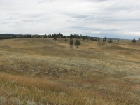

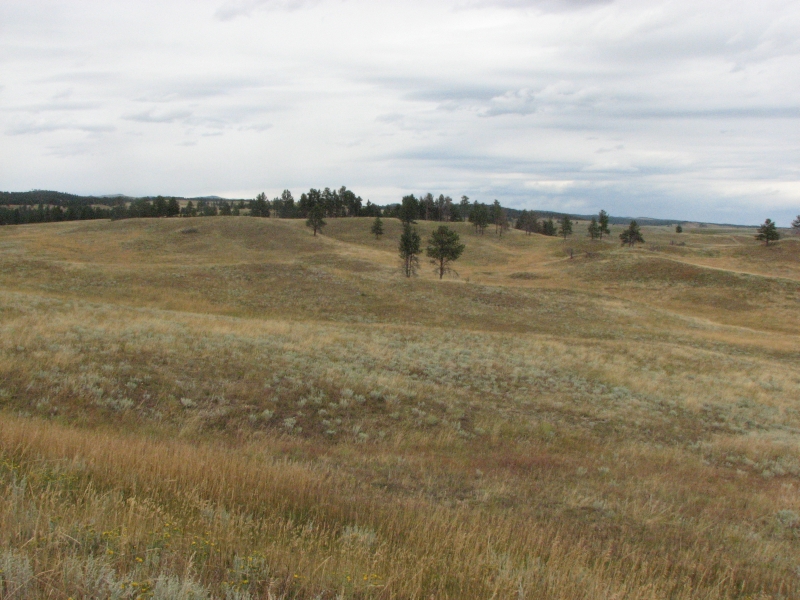
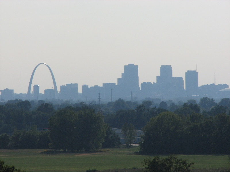
We decided to head north so we could drive through the Black Hills region again. We both enjoyed the beauty and abundant wildlife when we were in South Dakota last September. We drove through grasslands to pine-covered hills. I was amazed at how many pronghorns we spotted in eastern Wyoming. There were groups of 4-20 all over the place. We saw a couple of hundred at least. Those white markings really stand out against the yellow grass. There was one mule deer grazing in front of a motel in the town of Hot Springs. Hot Springs was a pretty town, with many buildings constructed out of red sandstone blocks. It looked like a nice tourist town, worth a visit. Maybe next time?

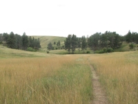
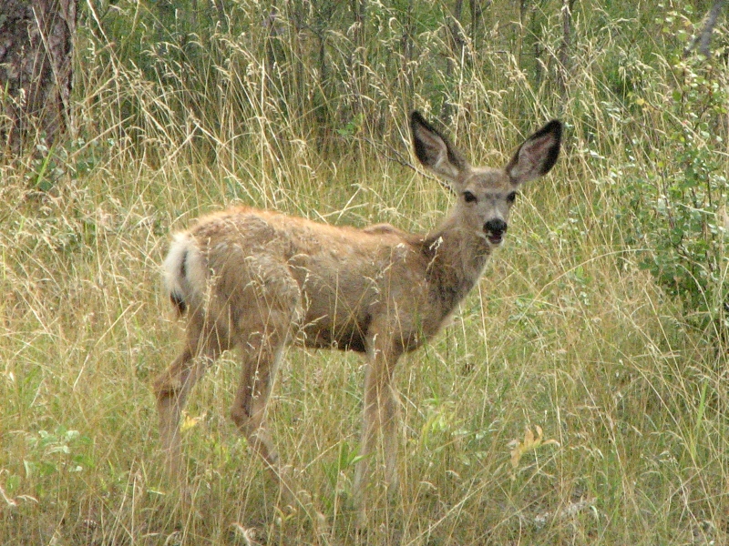
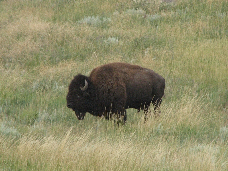
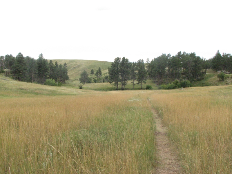
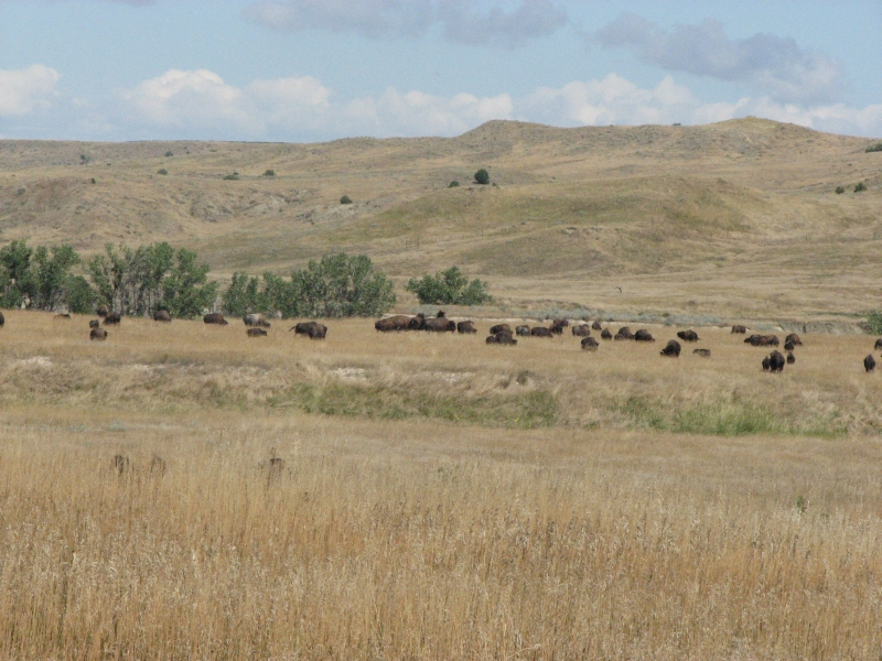
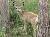
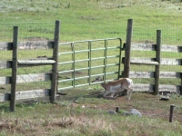
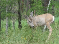
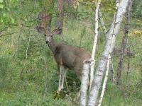
We stopped mid-afternoon at Wind Cave National Park. We visited the cave last year, so today we decided to go for a short hike across the prairie. There is a lot of wildlife here; we saw several bison, pronghorns and mule deer in just a few miles as we drove in to the park. At the campground we spotted two young deer--still covered in spots--that were grazing across the creek from our campsite. Mama wasnt far away, though she stayed out of sight most of the time.
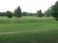
The hike was very nice: a 4 ½ mile loop using the first two miles of the Centennial Trail, a 111 mile linear trail from Wind Cave to Bear Butte. The first couple miles of our hike was out on the prairie, past a dozing bison and a couple of elk.
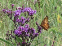
Then we dropped down into a canyon and followed creeks back to the car. The canyons had tall grasses and pines and rugged limestone cliffs with caves. It was pretty country. The only drawback was lots of poison ivy in the grass that we couldnt avoid. There was something else that I was very allergic to in the vicinity, but I have no idea what it was. I was sure sneezing though. I dont usually have a problem with sage, goldenrod or asters, which were the most abundant flowers. There was a wild mint that was very fragrant, but I wasnt sneezing when we crossed it up on the prairie. Oh well. I just hope we didnt get any poison ivy oils on our shoes or pants. Jim is very sensitive to it and I am somewhat allergic. Well see.
It spit on us a little while we were hiking, began to rain a bit more seriously after we got in the car, then turned into a real downpour shortly after we reached the campground. I tossed a Liptons dinner and some chicken on the stove and we ate in the back of the truck, only a little damp around the edges.
Friday, September 5: Custer State Park
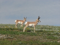
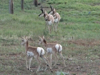
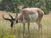
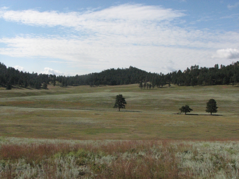
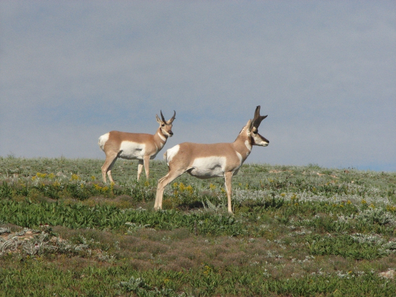
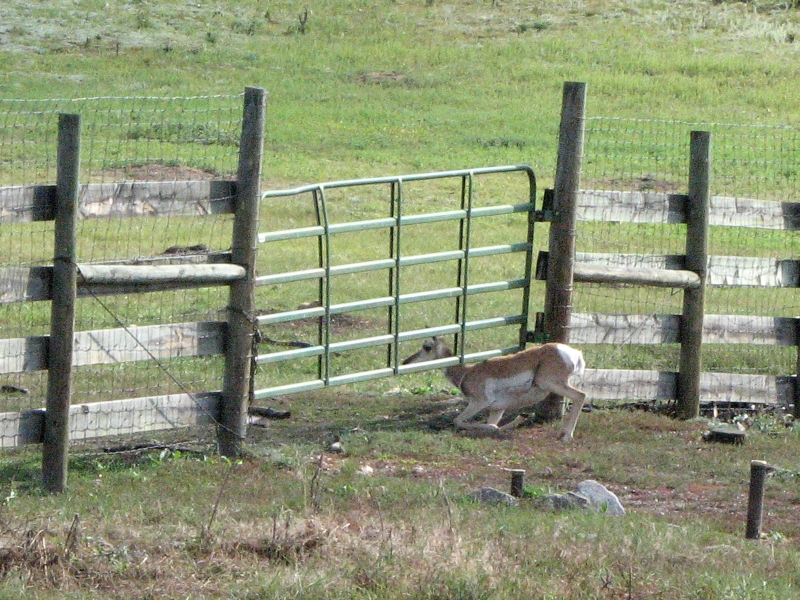
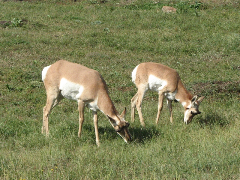
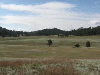
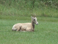
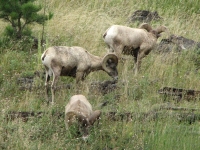
It was a beautiful morning of wildlife watching in Wind Cave NP and Custer State Park. Rolling grassy hills with scattered pines, oaks and cottonwoods are home to herds of bison, pronghorn, elk, deer and bighorn sheep. We saw a lot of deermostly whitetailand pronghorns. Again we watched an antelope crawl under a gate, leaving her two young fawns behind. They were quite agitated, so they ran back and forth in front of the gate, emitting small peeps, until they got the nerve to go under the gate too.

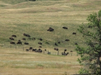
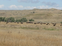
Later we watched a buck scratching at a fence trying to see if he could get under it. The herds of bison were less obvious, resting in the shade of the trees or out on hilltops far away from the road. Then we watched a herd of bison cross the road, holding up traffic for about ten minutes.
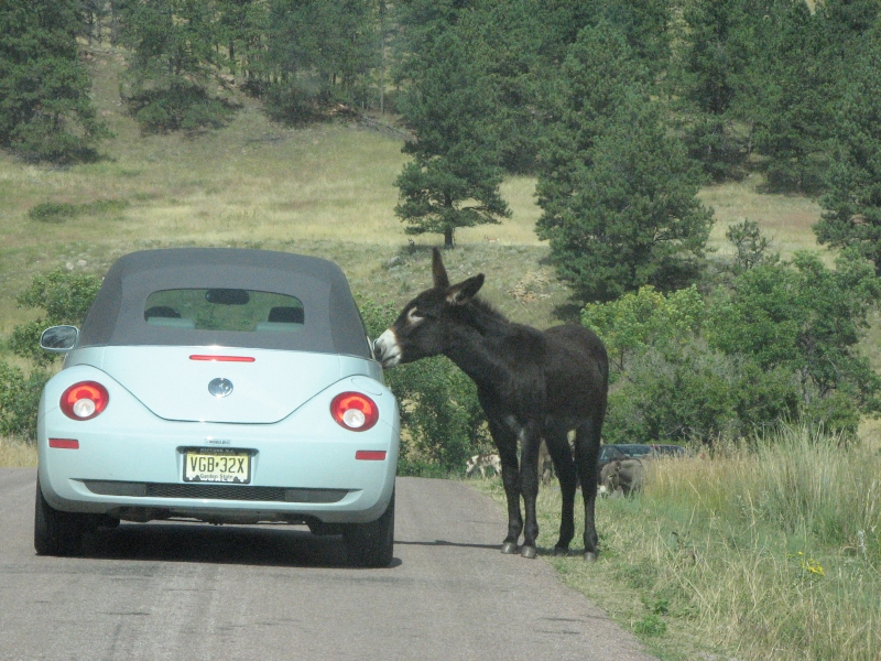
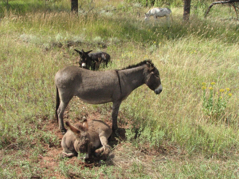
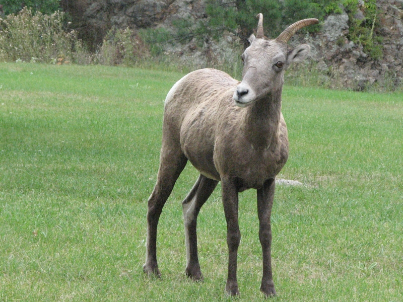
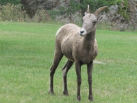
A herd of feral donkeys was worse: they stood in the middle of the road, licking the stopped cars. They were cute little Eeyores, some gray, some brown, some spotted. We saw two napping bighorns on the lawn behind the lodge at Custer. Around noon it began to rain. We saw four more bighorns, two with broken horns, a mile or so later.

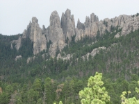
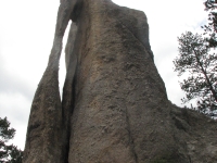
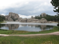
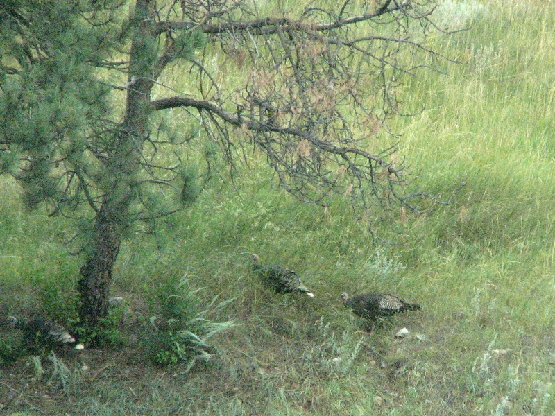
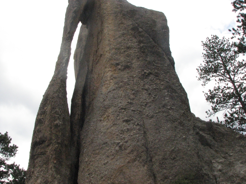
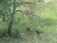
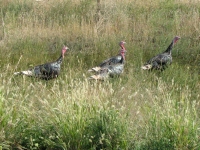
We drove up the Needles Highway, past the granite formations called the Needles, Cathedral Spires and the Needles Eye. It was a pretty drive, though slow on the narrow twisty road. We spotted some more deer (at least 25 today) and a family of turkeys before we reached the main highway. Then we looped back through the town of Custer, with stops at the used bookstore, grocery and post office, then reentered Custer State Park. A herd of bighorns, including several males with curled horns, greeted us.


We decided to stay at one of the park campgrounds. There was one open site with electricity and a couple of tent sites; the rest were reserved for the weekend. While I was cooking dinner, a camper pulled up and the driver said, This is our campsite. We paid for it this morning. Since we had also paid for it, we suggested he find the campground host and find out what happened. It took a while, but it turned out that the temporary replacement for the campground host had screwed up and sold the site twice. Not only that, but she had pocketed at least part of the money, since our receipt was for a tent site ($18) but we had paid cash for an electric site ($22). We told them we were willing to move, if he could find a spot for us to park. We ended up in one of the cabins with power, light, and best of all, heat. The odd thing is that this happened a few days ago in Green River: we paid for a site and were asked to move because a big RV needed a pull-through site and we had the last one. With our pick-up truck, were pretty flexible. All we need is a flat place to park. Getting a cabin instead was a nice and unexpected bonus.

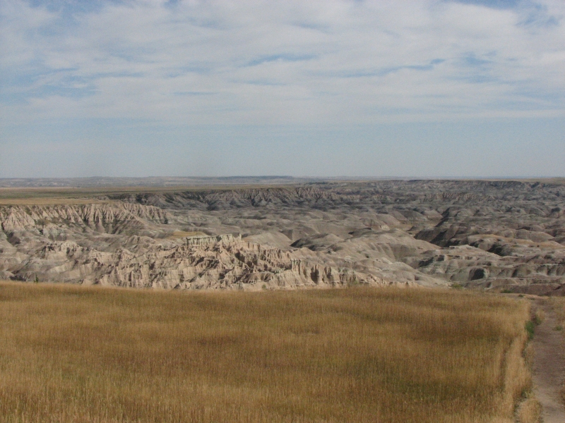
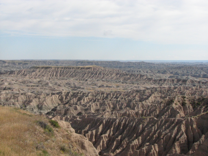
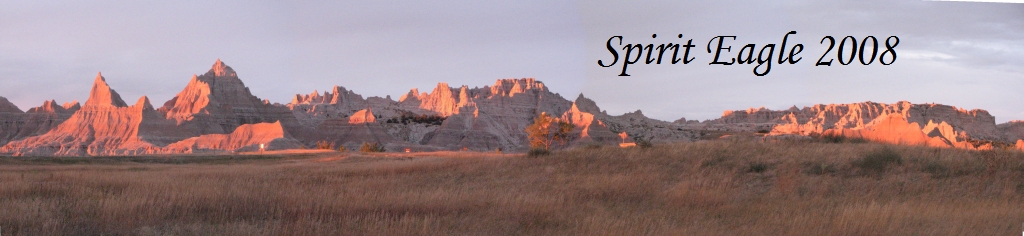
Saturday, September 6: Badlands National Park
It rained most of the night, so we were happy to be snug and warm in our little cabin. The sun was bright when we woke up, but there were dark clouds around the edges. We decided to drive back roads to Badlands National Park, a slower route than the freeway, but a lot more scenic. Were in no hurry.
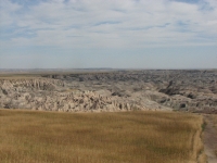

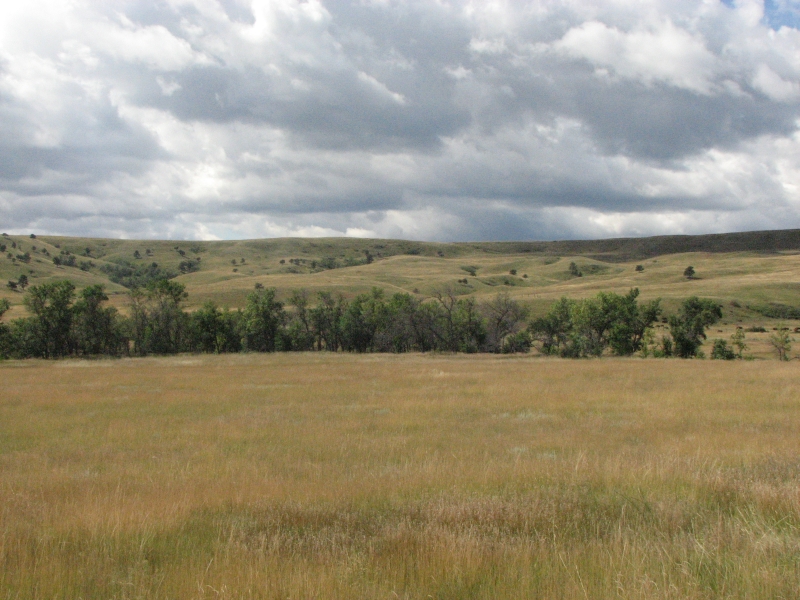
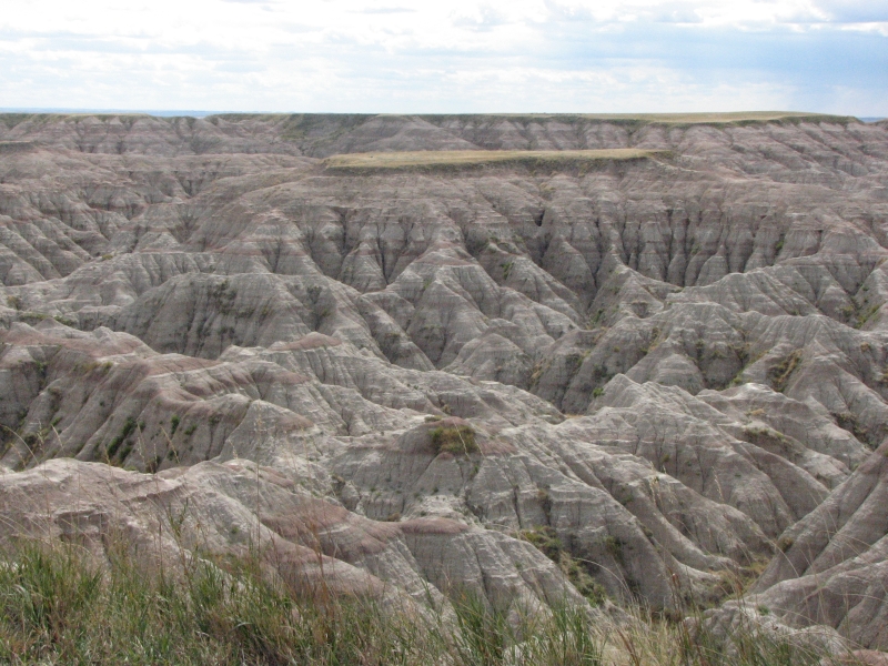
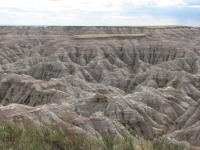
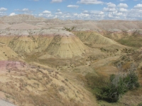
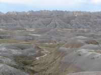
As we headed east, the hills were smaller, though still rolling grasslands. We saw six deer, including two more spotted fawns, plus numerous antelope and a flock of turkeys. Soon after we entered the Pine Ridge Indian Reservation we began seeing the eroded land formations known as the Badlands. There is a lot of overlap between the Reservation and the Park. It was interesting to watch the transition from the lush wooded Black Hills to irrigated hay and corn fields and ranches with horses and cows to the very dry desert-like Badlands. Sometimes the ranches and badlands were mixed: the plateau was covered with grass, but erosion had eaten the edge of the plateau. Sage Creek Road looked very like southern Wyoming with its green hills and greener water courses. We passed through a large herd of bison.
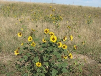
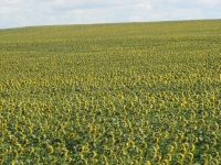
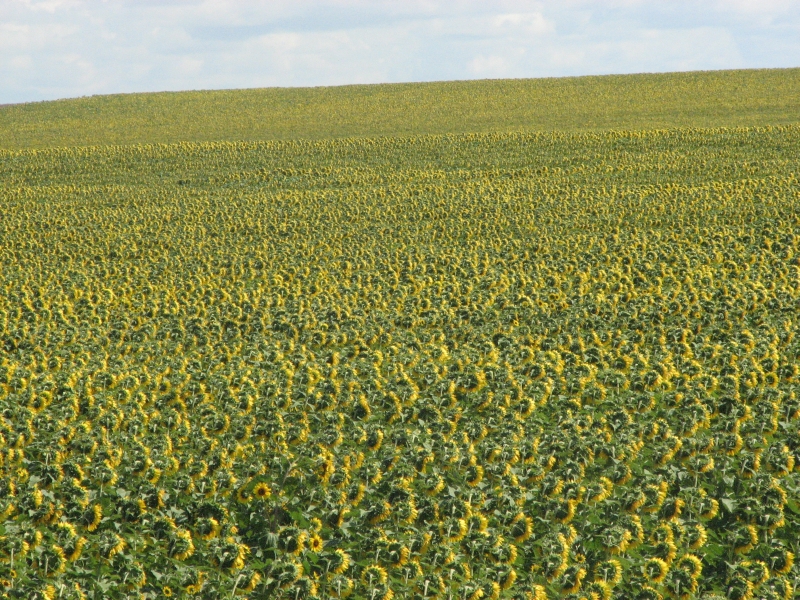
The badlands were far in the distance, just sharp jagged needles on the eastern horizon. There were many small wild sunflowers along the road and one field of large cultivated flowers. Its pretty country.
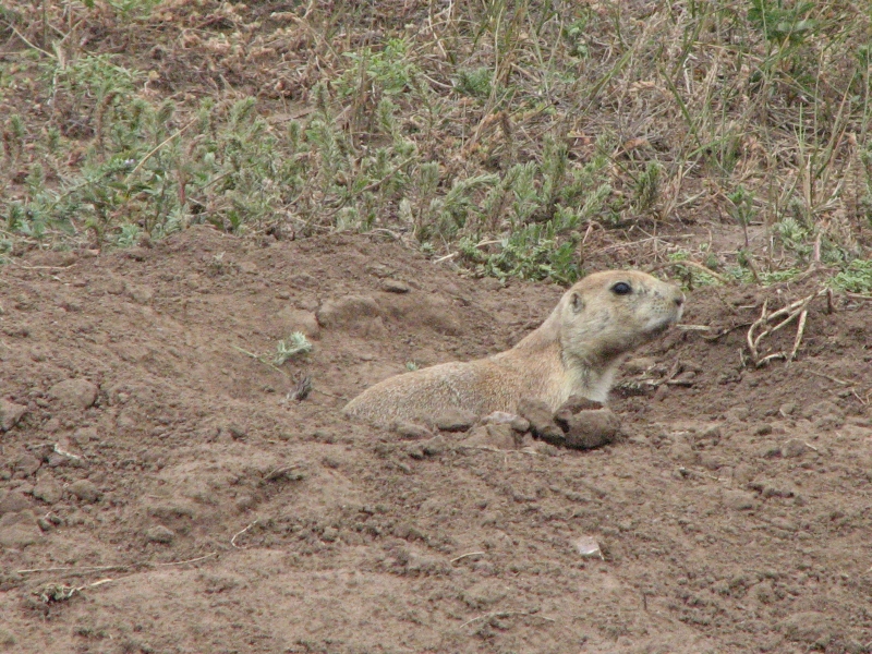
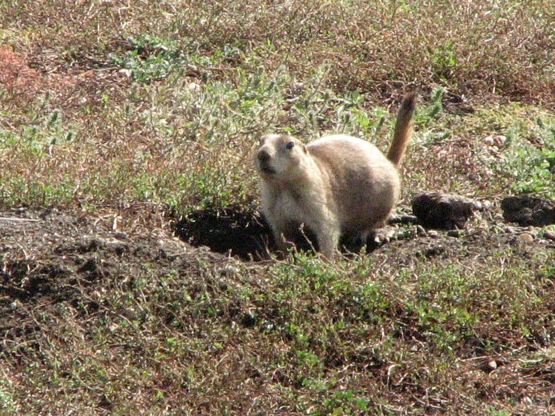
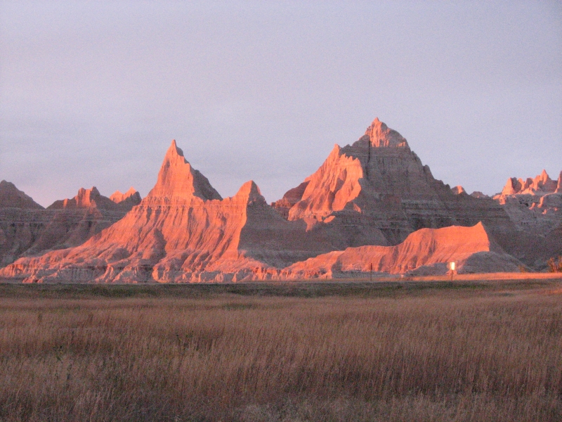
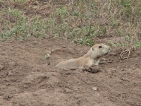
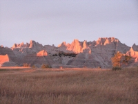
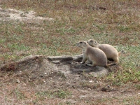
We drove to the tourist community of Wall to get gas, lunch at Subway and some maps at the Tourist Information Center ten miles west, then turned around and headed back to Badlands National Park. We camped there last year and enjoyed the view of the sunset and evening light on the pink and tan striped ridges, so we decided to see if it was as memorable a second time around. We stopped at all the overlooks on the way into the park and enjoyed the dramatic scenery. No bighorns this time, but there were a few pronghorns and lots of prairie dogs.
The campground is only about ¼ full tonight, but there is a storm threatening so people may have chosen to keep moving. The number of tourists in the park was a bit surprising, but then, September is a good time to travel and many were European or Asian evidently. I heard Italian, German and Chinese at the overlooks.
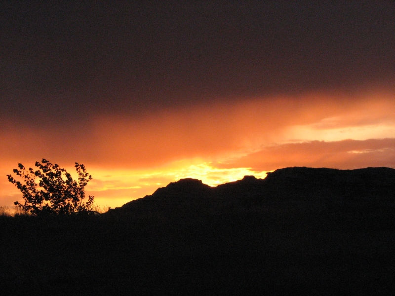
I enjoyed the view of the cliffs in the afternoon light. We were lucky: once again there was a beautiful sunset. The alpenglow on the badlands was really spectacular.

Sunday, September 7: Grand Island
A rainy gray day. We got a couple of showers yesterday after dinner, but the rain today was a serious drizzle. So much for my hope of hiking in the Badlands this morning. Since we followed I-90 last year, we decided to find an alternate route east. At Murdo we dropped south through the Rosebud Indian Reservation to Nebraska. Not much difference in scenerystill grassy hills with cows, horses, llamas and pronghornsbut it was nice to get off the interstate for a while. We followed a scenic byway through the sand hills past a couple of wildlife sanctuaries (lots of small ponds) and through a lot of flat farmland. We saw a dozen or so coal trains (full going east and empty heading west) and ended up in a motel in Grand Island. It was a nice drive on the back roads and surprisingly quick (60-65 mph) since the countryside is flat. There were lots of flowers but little wildlife except ducks and hawks.
Monday, September 8: Marysville

Today was sort of a weird day. We never really woke up, and never had any energy. It was gray, cold and wet -- generally dreary. We stayed on back roads in Nebraska and Kansas, driving past farms, fields and cows. Pretty, but very repetitive. After only a few hours we had had enough. We pulled up at a motel, got a room, then whiled away the afternoon at a Laundromat. We walked a mile each way to dinner to get our blood moving a little, then spent the evening on the Internet and watching MASH reruns.
Tuesday, September 9: Thousand Hills State Park, MO
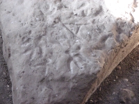
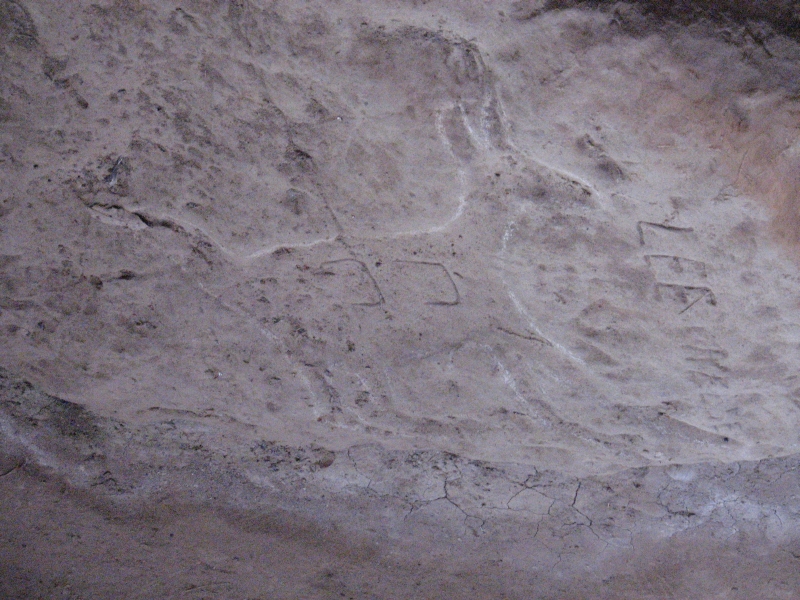
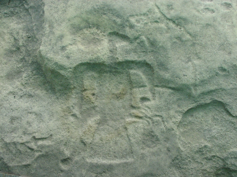
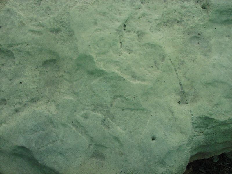
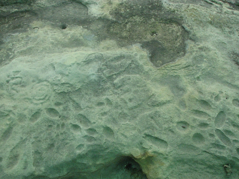
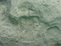
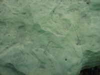
We continued east today on Highway 36, the old Oregon/California/Pony Express trail. Today we had sunshine and blue skies, much more cheerful than yesterday. We enjoyed a lunch buffet at Pizza Hut, then headed up a real back road to Kirkville, home to Thousand Hills State Park, our destination. It has a petroglyph site we wanted to visit, as well as a campground and some hiking trails. The petroglyph site was a bit disappointing, though weve learned not to expect too much at the really developed sites. It had a covered pavilion over the rocks with carved images. Even so, the rocks were covered with dust, bird droppings and graffiti. There were a lot of images, but they were hard to discern, especially from a distance. We could make out birds, human and animal figures, spirals, etc. but they were really faint, even though some had been chalked. We took photos anyway, hoping wed be able to see them better under magnification, but I wont hold my breath.


Afterwards we went for a walk on the loop road along the lake. We spotted a whitetail doe in the woods and a flock of 30-40 black vultures soaring overhead. We watched them for a while. There were people in cabins by the lake and others who were out on the water fishing or canoeing who may live nearby. We had the campground to ourselves, surprisingly. It was a nice campground.
Jim: Chalking petroglyphs to make them more visible used to be common practice,even for archeologists. But it's not usually done anymore because it ends up damaging or destroying the petroglyphs. I was surprised to see it done here.
Wednesday, September 10: Cahokia Mounds, Washington State Park CG
We decided to take advantage of the good weather to visit Cahokia Mounds today instead of tomorrow, when rain is forecast. It made a slight change of plans and a somewhat different route, but it didnt add much mileage. Cahokia Mounds is the reason for our trek through Missouri. We heard about it last year when we visited Hopewell Mounds, but, at the time, we didnt want to take the time to drive that far south. This year we planned from the beginning to come to St. Louis, despite the extra distance.

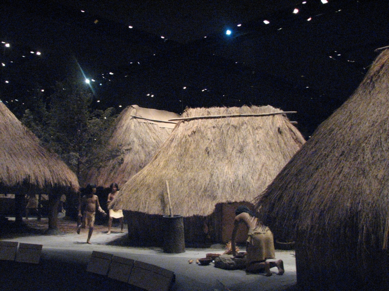
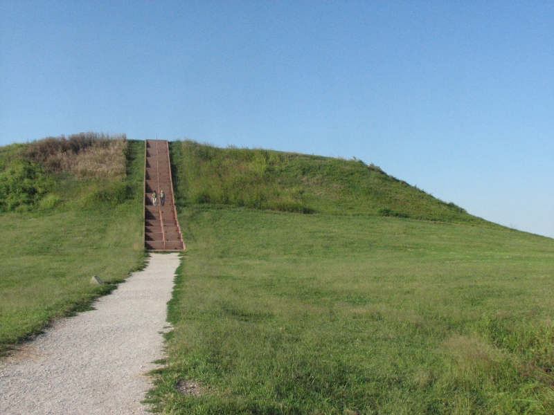
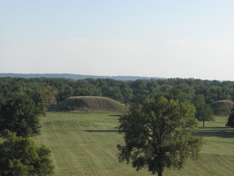
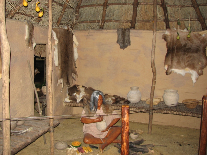
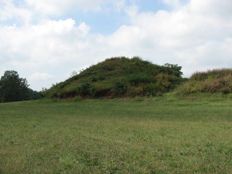
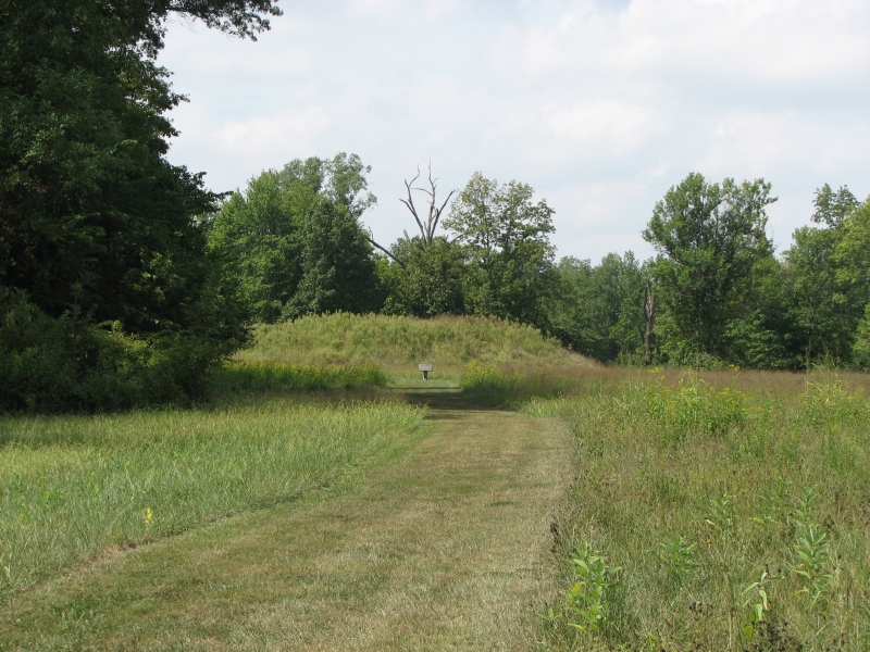
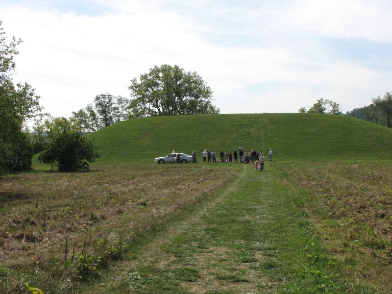
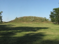
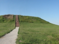
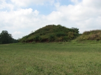
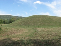
Cahokia is the location of the largest prehistoric Indian site north of Mexico. It was once home to 10-20,000 people in a complex hierarchical civilization that had influence over hundreds of miles. The town covered six square miles and included 120 mounds. Currently 70 mounds remain, 60 of which are protected within the historic site. The mounds were mostly built as platforms for important buildings - either residences of the chieftains or religious sites. Earlier cultures built mounds as burial sites, but the later Mississipian people didn't do that as much. There is a good museum and long trails around the remaining mounds. We didnt have time to do the full 6-10 mile walk, but we did wander around Twin Mounds and enormous Monks Mound. That one is 100 high and 400 along the base, built one basketful of dirt at a time.
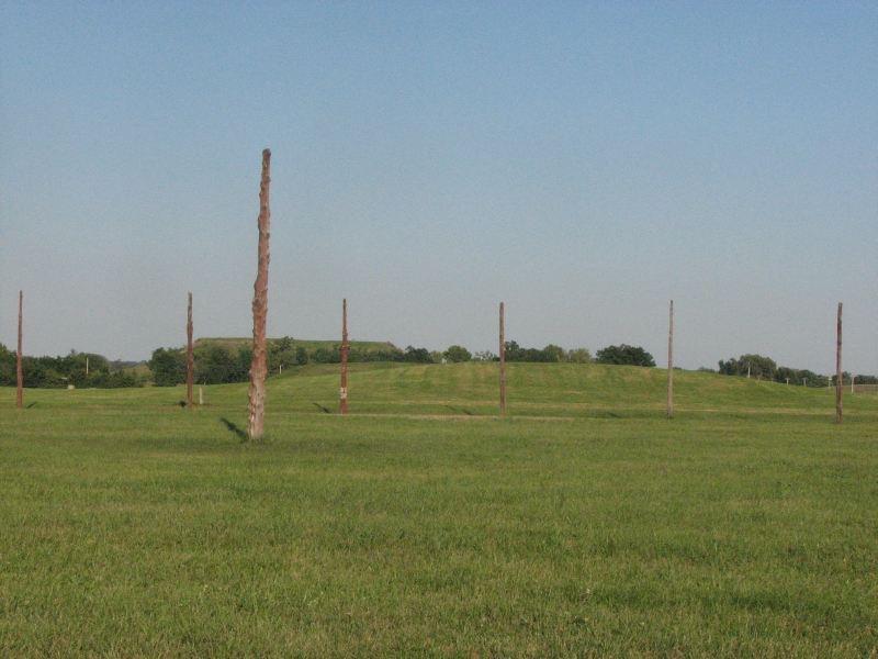
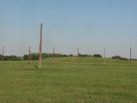
The Mississippian Culture at Cahokia flourished at the same time as the Anasazi and Fremont cultures, which is part of the fascination for me. What caused the rise of these civilizations and their subsequent fall? We also visited the Woodhenge, probably an astronomical observatory made of wooden poles. It was a large circle that marked the solar and lunar cycles.
There are a lot of unanswered questions about Cahokia and the Mississipean culture, like all the other long vanished North American civilizations. Since the people merged with more nomadic tribes after the cities fell apart and left no written record, information on how they lived is sparse and largely based on educated guesswork.
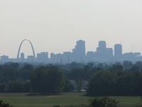
Dealing with urban traffic around St. Louis was really strange after so many months traveling quiet back roads. Jim stayed calm, but I got a bit freaked at all the busy roads and crazy drivers. How am I going to adjust to Washington, DCs insanity?
We headed south to another state park that is supposed to have rock art. Well visit the petroglyphs tomorrow. We drove a long way today and barely made it to Washington State Park before dark.
We did see some wildlife: seven deer at Cahokia Mounds, some turkeys and lots of white egrets, plus we got to listen to the very noisy peepers at the campground. This park actually has some people camped in the large campground. It has a shower, which was very welcome.
Thursday, September 11: Evansville, Indiana
Happy Birthday Jim!
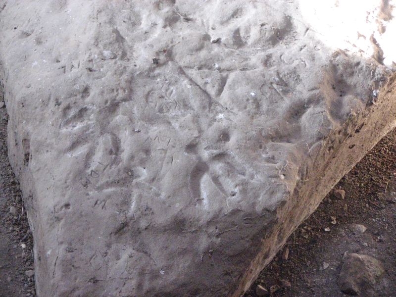
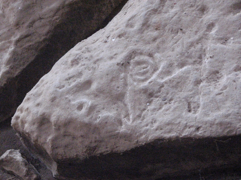
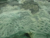
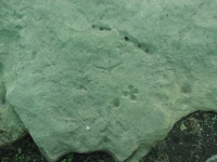
It was a gray humid day, but very warm. There were a few sprinkles in the night, but no sustained rain. We visited the petroglyphs after breakfast. Washington State Park has the largest concentration of carvings in Missouri, but they are very hard to discern. The images were carved on top of the rock outcrops (rather than on the sides or in overhangs) and hundreds of years of weather and other wear has worn down the petroglyphs so its hard to tell which lines are carved and which are natural. There were arrows, thunderbirds, squares (houses?), round fertility symbols, turkey tracks and footprints. Supposedly there are over 300 images at one of the two sites open to the public. The images at the second site were even harder to see. There are supposed to be two other areas in the park that have rock art, but we couldnt find anyone to tell us how to locate them.
We continued following back roads through Missouri and Illinois into Indiana. It wasnt like following back ways out west. Town followed town, each with strip malls and traffic. There were farms and lakes, rolling hills covered with dense forest, but we probably would have done better to follow the freeways. After all the truck traffic on I-70 yesterday, the back roads sounded more peaceful. Were heading to another mound site near Evansville, Indiana. In the meantime, were immersed in the rural Midwest scenery on the edge of the Ozarks.
In honor of Jims birthday, we got a motel room in Evansville and celebrated with ribs at Outback. A huge thunderstorm reinforced the decision to stay in the city.
Friday, September 12: Motel near Louisville
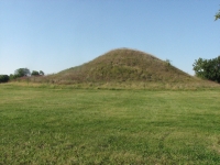
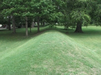
After breakfast at Dennys, we headed to Angel Mounds, just outside Evansville. Its one of the best preserved of the Mississippian mound sites. There are ten mounds built as ceremonial platforms and one burial mound that is much older. Most of the mounds were quite low, but the biggest was 43 tall and 400 x 200 at its base. The town once held 200 houses and other buildings, with a population of around 1000 people during the period 1200-1420. There are similarities to and differences from the other mound sites we have visited in the past two years. Of course, each museum tells somewhat different stories, which is why we continue to visit them. Were still learning.
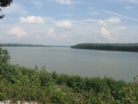
We headed east along the Ohio River on a scenic route that gave us views of the wide river and then wound slowly into the hills. We crossed into Kentucky after 6:00, picked up a state map at a rest area and discovered there are no campgrounds on our route for a long long way. We had a motel discount coupon, but it was invalid because the Ryder Cup golf tournament is forthcoming in nearby Louisville. (Thats what we were told, but we found out later the tournament isnt this week, its next!) We took the room anyway and enjoyed a respite from the heat and humidity.
Saturday, September 13: Deer Creek State Park, Ohio (4 miles)
I realized last night that all the sitting, driving long miles from state to state, was starting to get to me. I was feeling claustrophobic, depressed and more than a little testy. So when we reached Ohio, we asked at the information center for literature on state parks. We both needed and wanted a hike of some sort that was a bit more demanding than just wandering around a few mounds or inside a museum. Deer Creek was the closest state park, so we found a campsite in the large campground and headed out for a walk from the campground to the Lodge. It was 90 degrees and very humid with some clouds threatening (promising?) rain. I was actually hoping wed get wet. It was a nice walk in the wood with occasional views of the lake. Our only wildlife was one deer and some birds, but I enjoyed all the wildflowers and just the feeling of moving my body again. Deer Creek is a busy campground on a Saturday lots of families out enjoying he warm weather.
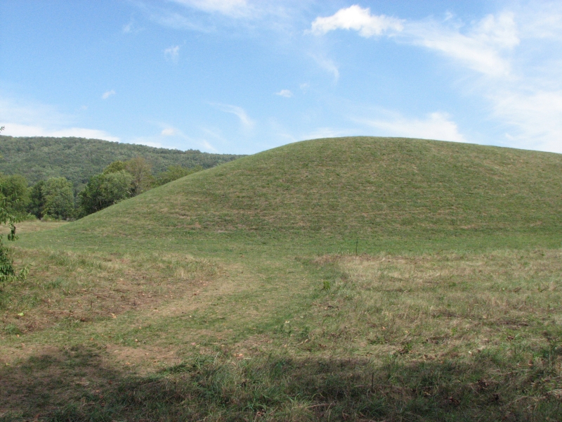
Sunday, September 14: Serpent Mound, Newark Earthworks, Cambridge, Ohio

Wandering in circles through central Ohio proved to be a rather frustrating experience. We started out tired, thanks to loud neighbors who stayed up until at least 3:00 a.m. Leaving the park we ran into both a bike and running race that held up traffic for a while and slowed us down even longer. We headed to Chilicothe, which has several mound sites. We visited Hopewell Culture NHP last year, but there are others in the vicinity we wanted to see. Unfortunately, our state map wasnt very helpful: we couldnt find either Story Mound or Tarlton Cross Mound, though both are shown on the map. Not finding the two sites was really frustrating. We did locate Serpent Mound, which is a 2000 year old Hopewell Culture burial mound. A group was having a church service at the base of the mound, which seemed a bit odd to me. Having a Christian church service at a Native American religious site seems rather disrespectful to me but it may not have been intended that way. They were having a picnic afterwards, which may have been the point. The mound was about 30 high and 100 or so along the base with an earthwork wall surrounding the area that used to be 10 high (before time and farmers demolished it). They found a lot of interesting artifacts when they excavated the area. The Hopewell had a huge trading circle, from the Rockies to the Atlantic to the Gulf of Mexico. We drove through a lot of farm country, now turning yellow at the end of summer, and some nice old towns. Lancaster had a lot of lovely old brick and stone buildings.
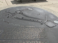
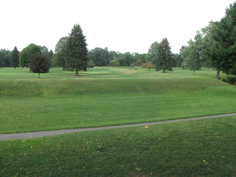
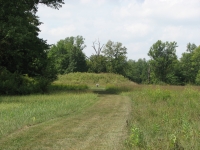
Our next destination was Newark, which has a major earthworks site from the Mississippian era. The main site once covered four square miles, and was the largest geometric earthworks in the world. It may have been an ancient lunar observatory. The geometry of the site is interesting in the way the sites lined up with each other, with the moon, with other sites nearby, and in the size and area of each of the geometrical forms. There were two circles, an octagon and a square, with walled roads between them. Most of the original mounds and earthworks were destroyed as the town of Newark developed and grew. The Great Circle remained intact because they held the country fair and other outdoor events within its walls.
The Octagon was used as an army camp, then around 1906 was leased to a golf course that still maintains the earthworks as hazards. Since it is still in use as a golf course, visitors can only see part of the octagon from the edge of the course. The Circle was easy to visit, since it is still intact, including the central mound, right in the middle of town in a park/picnic area. There was a Visitors Center nearby that had a DVD that explained the history and meaning of the sites. Afterwards we drove to nearby Granville to see an effigy mound called Alligator Mound in the middle of an upscale housing development. I couldnt see the animals shape in the hill, but early explorers were sure it was an animal. That was also somewhat true for the birds and bears at Effigy Mounds in Iowa. From the air they are more obvious than from the ground.
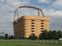
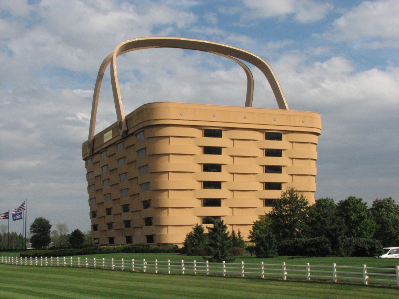
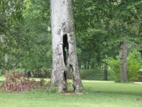
It was really windy today. We are catching the edge of Hurricane Ike, I think. Louisville and St. Louis had really bad flooding and electricity has been off and on all day. The road in Granville was completely blocked by a downed tree, just beyond our turn. We were lucky that we missed it. Other interesting sights included a building shaped like a giant picnic basket and an old tree that was completely hollow, with huge holes through the trunk, but it was still alive. We ended up at a motel in Cambridge. We hadnt planned on it, but the wind was so strong I really didnt want to be camped in the trees.
Home | Links| Trail Journals |
The Thruhiking Papers | Bun-bun
Created: 1 Jan 2009
Revised: 30 Sept 2016Copyright 2009-2017 Spirit Eagle