|
 |
 |
 |
 |
|
|
|
|
|
|
Thursday, August 21: West Yellowstone
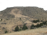
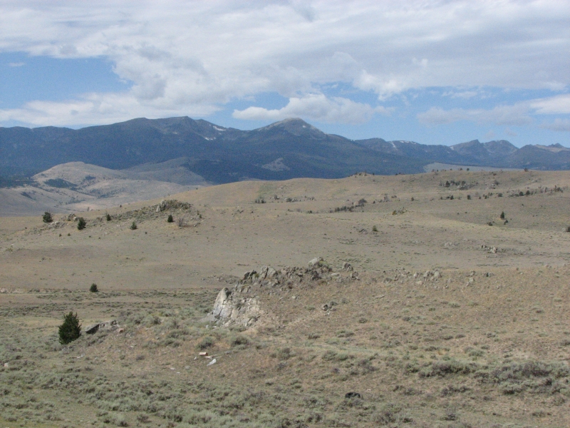
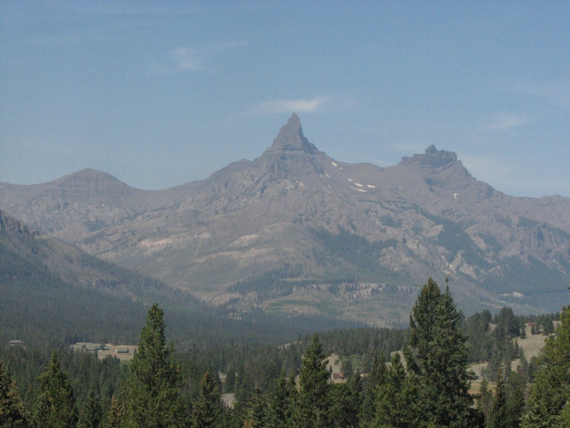
The day started well with a rainbow over the mountains to the south. We drove into town and had a huge breakfast at IHOP. It rained while we were eating, stopped when we left and then began raining again a few miles south of town. As we drove along Canyon Ferry Lake we couldnt even see the water, it was raining so hard. It didnt last long, though it sprinkled a few more times as we drove south. We made a short stop at Madison Buffalo Jump State Park. It was the same scenario as at Head Smashed In, but the site was less developed. A series of signs at the lookout explained how the jump functioned, but there was no museum or developed trail system. Madison was a much taller and narrower cliff than the one in Alberta, probably quite effective, though creating the brushy lanes to channel the bison may have been more difficult.
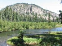
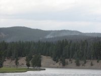
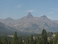
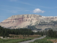
We drove south through Ennis to the town of West Yellowstone. Its pretty country with yellow hills, some interesting rocky cliffs, big rivers, and hay, corn and sunflower fields. We spotted numerous hawks, including a falcon that dove in front of us and a couple perched on telephone poles and an irrigation sprinkler. Near Ennis, we began seeing antelope in the irrigated fields and later a herd of either deer or antelope that were too far to see clearly.
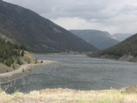
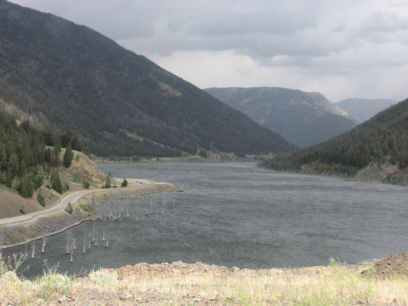
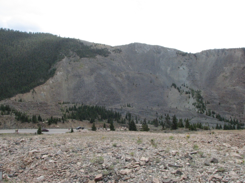
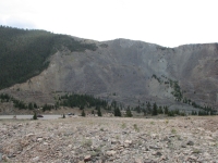
We detoured to Madison Canyon Earthquake Center aka Quake Lake. In 1959 a 7.5 magnitude earthquake struck nearby, displacing the land up to 21 feet, causing a huge rock slide, 100 mph winds and flooding. Some 28 people were killed, houses were destroyed or washed away and the roads were completely demolished. We watched a film and looked at the exhibits in the Visitors Center. The rockslide is still glaringly obvious, even 60 years later. It was an interesting, though tragic, site. Last year we ran into a similar place in Rocky Mountain National Park where a dam breach in the mountains killed some campers downstream. It wasnt nearly as destructive though. As the film noted, it is a reminder of how suddenly everything can change. One minute asleep in your tent, the next buried in a rockslide. Scary. The canyon was a real wind tunnel today. The winds were strong enough to push me sideways as I staggered to the truck. Evidently its a fairly common occurrence since there were windbreaks next to the bathrooms and the picnic table.
We headed to Raynolds and Targhee Passes, where the official CDT crosses the highway. We havent done that route yet, since water is a real problem on it, so we wanted to see what the land is like. At Raynolds Pass there were CDT markers on one side of the road, but none on the other, which was an old forest road into the hills. At Targhee Pass, a wooden CDT marker was nailed to a stop sign at a Forest Road, and 100 yards down the road on the south side, we saw clearly marked trail into the woods. Nice.
Then we continued to the town of West Yellowstone. I have wanted to hike the southwest corner of Yellowstone along the Bechler River since I first heard about it a few years ago. It is an area that is very wet early in the summer, so late August or September are the best months to hike there. We couldnt make a backcountry reservation at the Visitors Center, but we were able to talk to the rangers there about conditions on the trail. I revised my original plan a bit, shortening the trip to three days, and Jim agreed to try it. Ive heard good things about the Bechler and weve really enjoyed our past hikes in Yellowstone, so Im looking forward to backpacking there again.
We had planned to camp, but the strong winds persisted and I knew we werent going to be grilling burgers tonight, so we found a motel in town. Even heating soup would have been difficult in the blustery winds. Since well be backpacking tomorrow, tonight well sleep warm, clean and well fed.
Friday, August 22: Bechler Campground (4 miles)
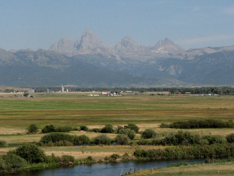
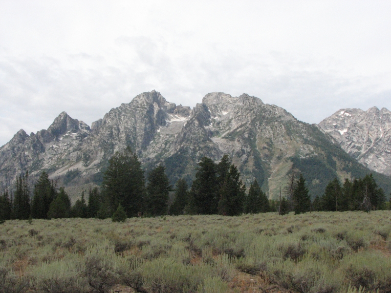
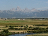
It was a beautiful day, cool and sunny with no serious winds. We ate breakfast at a pancake house, then headed west to Idaho. Our hike will begin at a trailhead about 80 miles south of West Yellowstone. We drove through the tiny resort of Macks Inn to Ashton, with hazy views of the Tetons to the south, then headed west on a dirt road toward Cave Falls.
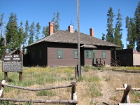
There is a NPS ranger station in the Bechler Region that issues backcountry permits. We didnt get there until noon, thanks to a late start and the long drive. As it turned out, we were too late: the backcountry campsites we wanted were all full tonight.

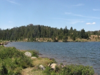
So we went on to Plan B: camp at a nearby car campground tonight and begin our backcountry trip tomorrow. That worked. We were able to get our choice of campsites by waiting a day. There is a National Forest campground three miles from the ranger station which has 23 spaces. Only three were occupied when we arrived, so we found a nice flat spot near the river.
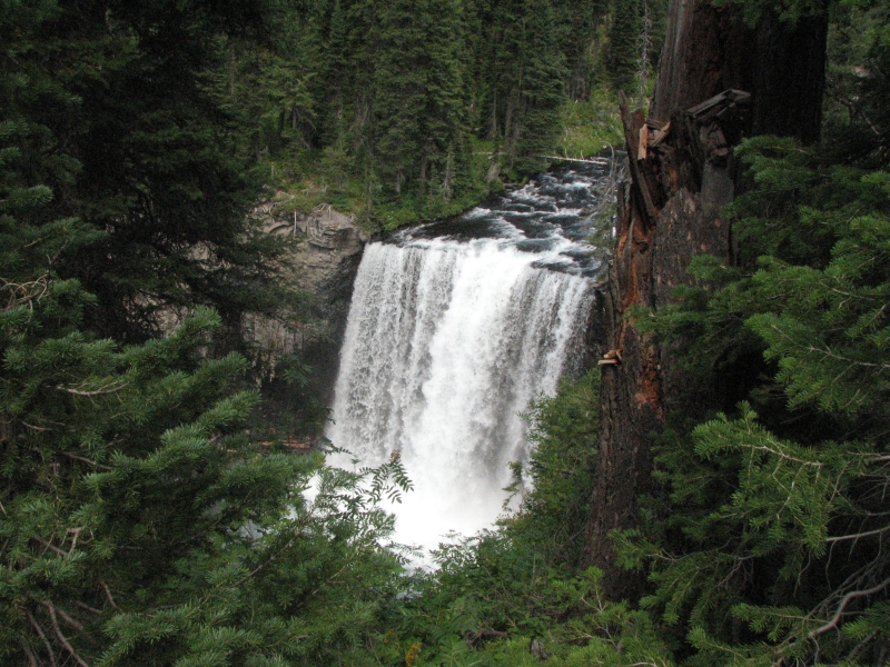
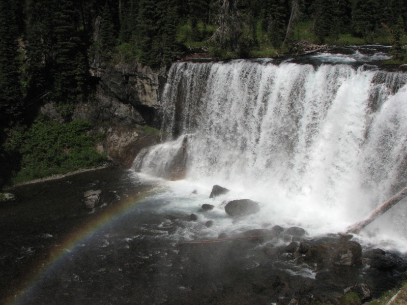
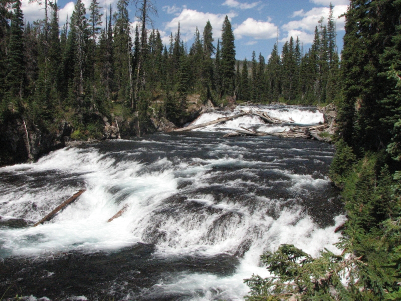
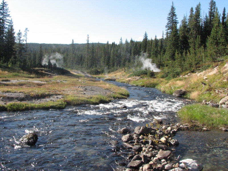
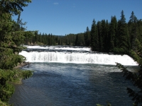
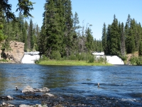
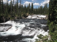
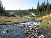
After lunch, we drove a mile or two to beautiful Cave Falls where we picked up a good hiking trail along Falls and Bechler Rivers. We passed Bechler Falls, which arent as big as Cave Falls but still pretty. Neither is very tall, but the river is so broad they are quite impressive because of the sheer volume of water. It was a beautiful day for a hike. The rivers sparkled, the grassy meadows were golden, and the huckleberries were fat and ripe. We decided to just do a short out and back hike, saving Jims knees and feet for the main event tomorrow.
Saturday, August 23: Yellowstone (8 ½ miles to Dunanda Falls Campsite)

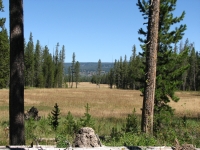
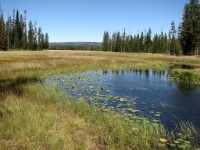
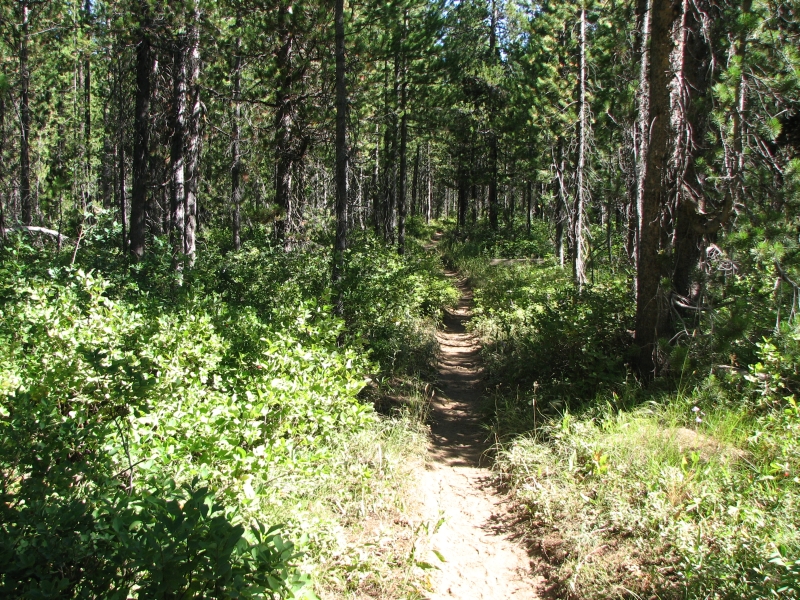
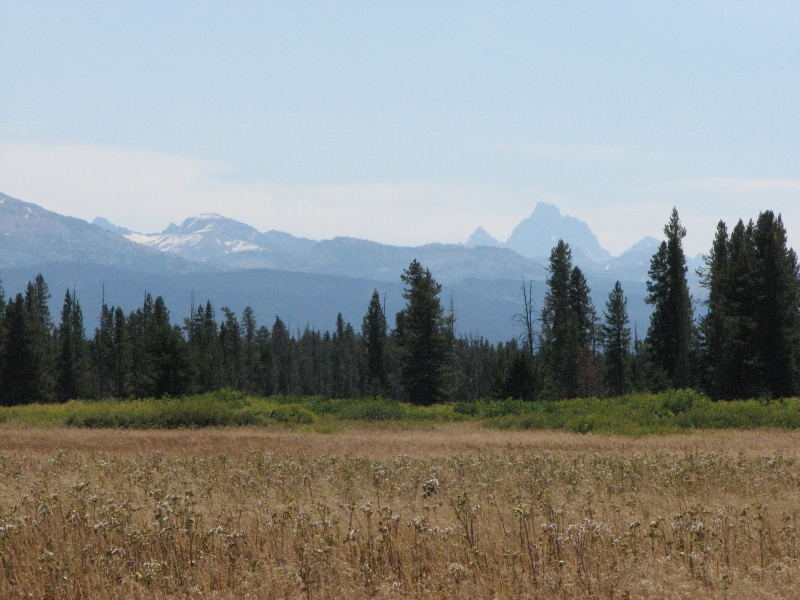
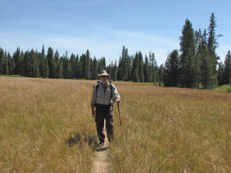
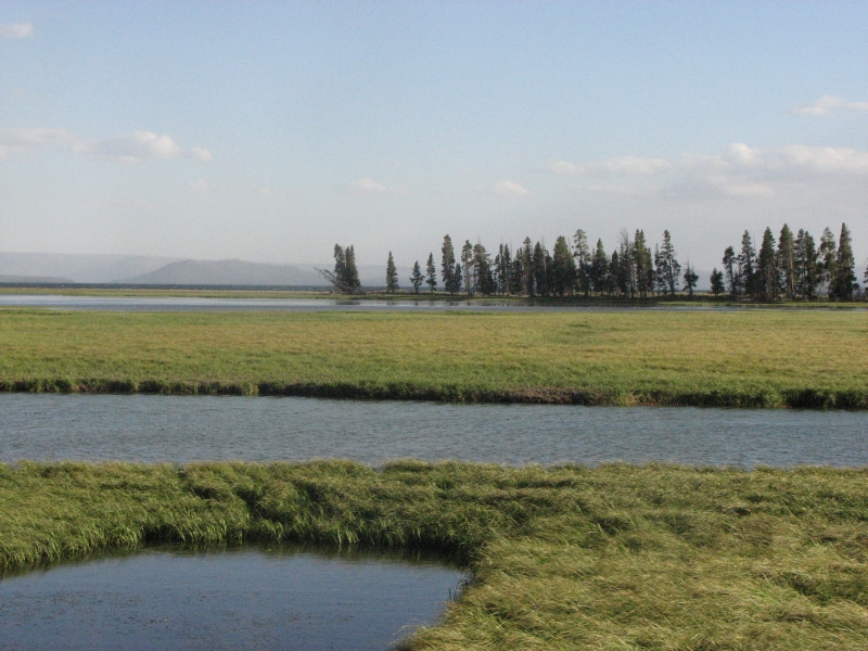
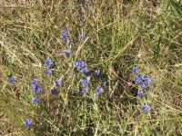
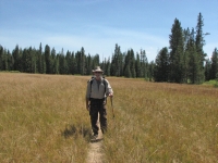
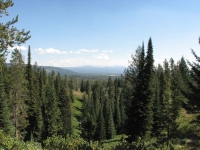
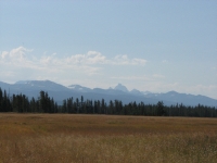
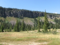
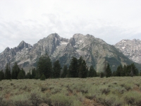
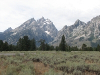
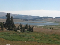
Since today was to be a short day, we enjoyed a leisurely morning, sleeping late, reading for a while over a second cup of coffee, and taking our time packing up and leaving the campground. We were on the trail by 10:30, hiking through open lodgepole forest for the first couple of miles. Then we began seeing big grassy meadows, some lily-ponds and deep sloughs. Crossing some of the big meadows we had views of the Tetons to the south and a green ridge (our destination) to the north. The country reminded me of Huston Meadows on the CDT, with one big meadow leading to the next. Summer is nearly over here. Although it was warm today (mid-70s) the grasses were yellow and brown and many of the plants are turning red and gold. Goldenrod is in full bloom, always a sign of the end of summer. We also ran into a lot of blue gentians as well as several other late blooming flowers. There were ferns toward the end of the day--some still a lush green, some autumn gold. Our only wildlife was a small snake on the trail and a chipmunk that ran between my legs and over one foot.
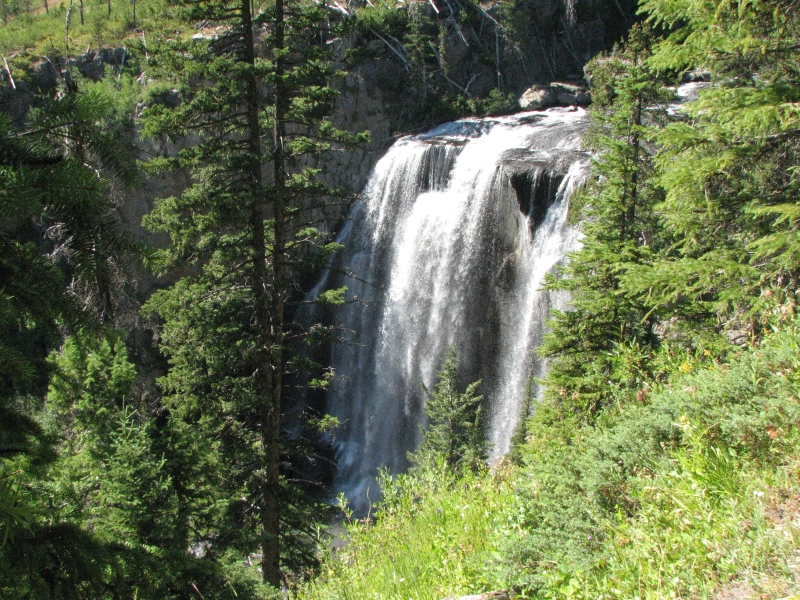
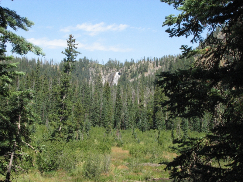
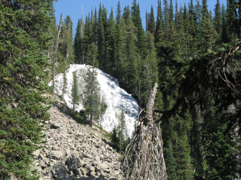
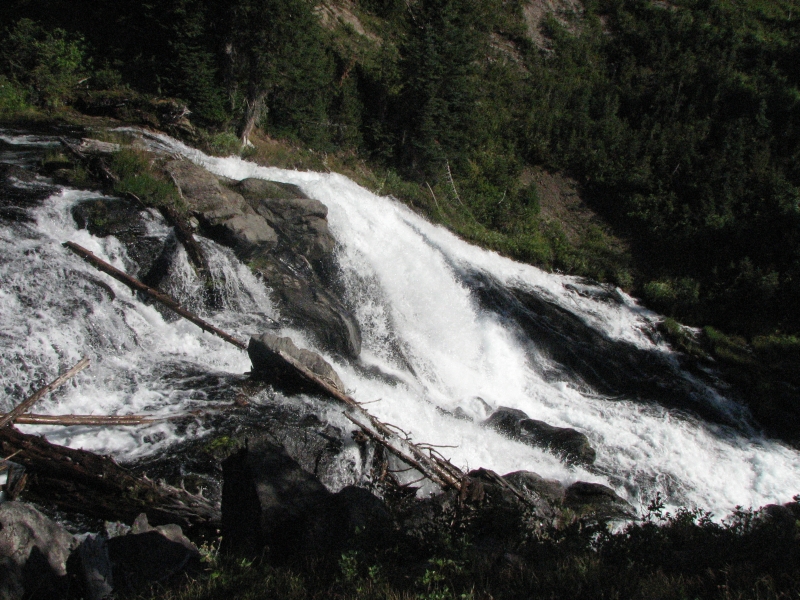
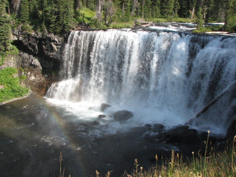
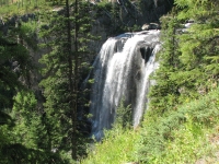
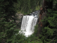
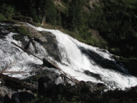
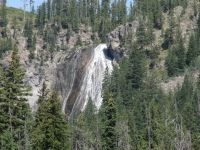
Our reserved campsite is along a small stream about ¼ mile before two big beautiful waterfalls. We set up the tent and hung our food before climbing up the ridge. Most of our hike today was flat until the last mile or so up to the falls. Silver Scarf Falls is beautiful with multiple tiers. It was a really tall waterfall, but impossible to photograph well, especially from the trail. We bushwhacked to a place where we could see a section of the falls, but we couldnt see any spot where we could photograph the whole thing. There were too many trees in the way. Dunanda Falls was a little farther up the trail, about ¼ mile off on a side trail and it was a single 100 drop big and beautiful. There was a nice overlook so we could look at it from up high, but there was no way to get to the bottom of the falls for a better photo.
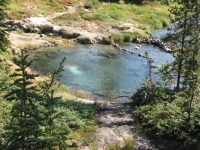
Back at the campsite, we decided to take a bath. There are several hot springs into the creek and we found a spot where hot, warm and cool streams met. I scalded my back a little with the hot water, but it felt good. When we climbed back up to the campsite, we ran into a couple of guys who had hiked from their camp four miles away just to visit the hot pools. Well, also to see the waterfalls, I think. I was glad they came after we got dressed and not while we were sitting in the stream.
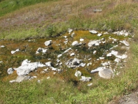
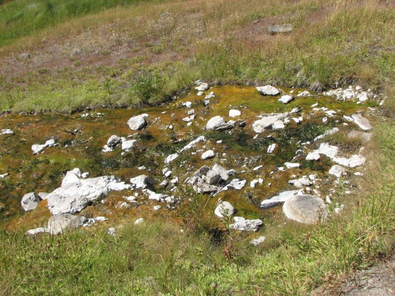
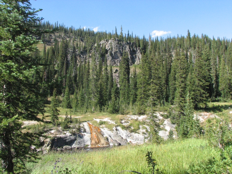
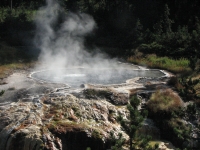
There are several hot springs in the area. You can tell how hot they are by the color of the algae. Green is a little warm, yellow hot and orange hotter still, I think. None of the ones we saw were very big, most just had a trickle of water. Unlike some of the thermal areas in Yellowstone, we smelled little or no sulphur, so there was a lot of vegetation around the hot and warm springs. We had stopped earlier to get water from a side stream and were surprised at how warm the water was, though the water looked, smelled, and tasted normal.
We had four knee-deep stream crossings today and a couple of log bridged ones. I dont like log bridges, so unless it has been flattened and scored, I wont usually cross on one. Id rather wade. The water felt cool on a hot day, but not cold.
This area is fairly busy. We saw a couple of backpackers this morning, a ranger with an axe, a large group of hikers (15 or so) with llamas at noon, and another day hiker who passed us when we were setting up camp. Since the campsite is 200 yards from the trail, Im not sure what he was doing, maybe looking for the hot springs, maybe looking for the privy. There is one, surprisingly. No walls, but a green throne. Theres a good bear pole too. Bugs were awful this morning, but we climbed a little and seem to have lost them. Halleluiah! The sleeping area is really too close to the cooking area, but that is fairly common in Yellowstone. They must have few habituated bears.
Sunday, August 24: Allbright Falls Campsite (14 ½ miles)

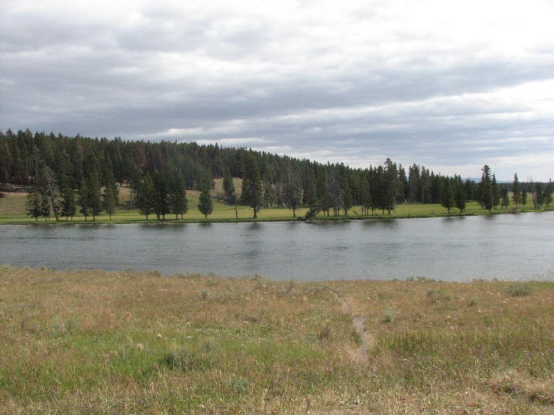
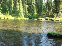
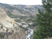
Another beautiful warm sunny day, with a light scattering of clouds from time to time, but mostly sunshine. We backtracked 1.6 miles through a burnt area, then picked up a cut-off trail through Bechler Meadows to the Bechler River Trail. That trail follows the river though a fairly narrow canyon with numerous waterfalls and cascades. We crossed the river three times, with water that was mid-thigh to hip deep. It wasnt very fast, just high.
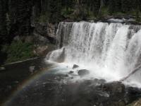
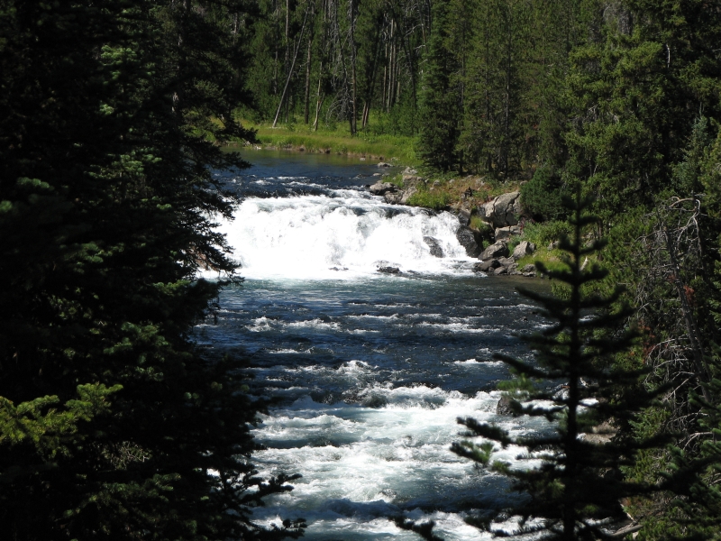
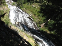
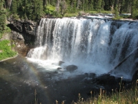
We saw four big waterfalls along the trail. The first, Ouzel, was tall (235) but barely visible across the valley through the trees. Colonnade had two impressive tiers. Iris Falls was my favorite: only 35 high, but with a beautiful rainbow. Allbright Falls wasnt on the map, but is at least 100 tall and is right next to our campsite. The trail climbs gently up the canyon, sometimes wet, sometimes rocky, crossing numerous side streams and occasional talus slopes. There were many different wildflowers and at least six different kinds of berries. We grazed on ripe thimbleberries, tiny blueberries or huckleberries and raspberries, each more tasty than the last.

We passed two groups of hikers heading the other direction one group was fishing in the river, the other group of backpackers had separated, with the slowest hiker walking alone and ahead of the rest. We talked to him for a few minutes and he told us about a good swimmable hot spring up ahead. I didnt think it was a nice thing to make him hike alone in bear country, since he was at least an hour ahead of the group. When we met them, the group was a bit disdainful of their slow friend, which irritated me. We saw little sign of bears on the rocky trail -- no tracks and only one small pile of berry filled scat. We did see deer tracks in the mud, but no deer, though we heard one in our campsite before dawn this morning. I did see another small snake.
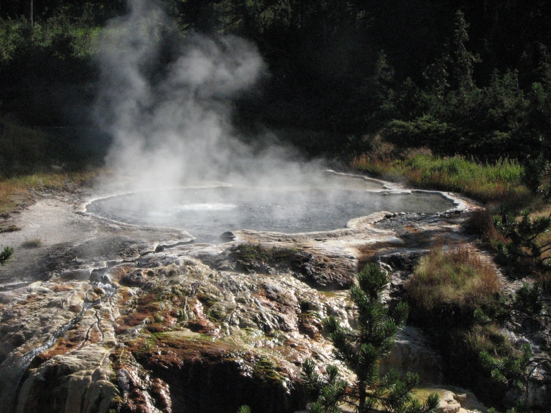
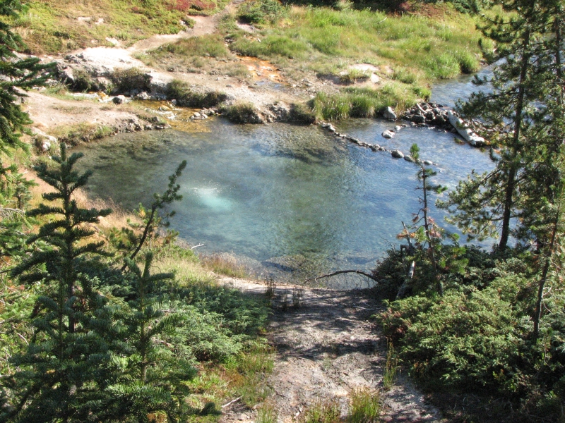
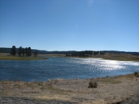
After we set up camp and hung our food, we headed back to the trail and continued walking upstream. We passed a couple of hot springs, orange and steaming. At Three Forks there was another small waterfall. We continued to climb, then turned off on a side trail that led to a thermal area. There were several sulphuric hot springs, a couple of geysers bubbling, boiling and steaming, and, best of all, a large walled off swimming hole. It was much nicer than last nights tiny pool. We soaked for a while, floating in the warm water. A very hot stream led into one side of the pool, but I only spent a couple of minutes on that side. On a cold day, it would feel wonderful. On a warm one like today, the warm and cool areas felt better. We met a couple on horseback on our way in, but otherwise had the whole thermal area to ourselves. After yesterday I was a bit surprised. There are several campsites in the vicinity and the two closest to the thermal area were reserved when we picked up our permit, so I expected lots of company.
Were both tired after doing so many miles, mostly uphill, plus I dont think weve been drinking enough. Theres plenty of water, we just dont take advantage of it.
Monday, August 25: Ashton, Idaho (12 miles)
Our last day in Yellowstone was the hottest yet: 85 degrees when we reached the truck. The river crossings kept us cool for the first eight miles or so, especially the second one which we misjudged a bit: we stepped into a hole so the water came up above my waist. Most of the hike was a repeat of yesterday: 6.5 miles down the Bechler River past the waterfalls, then some new trail through the open meadows, then the last 1.5 on the Bechler Meadows Trail, partly out on the open grasslands and partly in dappled shade in the lodgepole forest. We feasted on ripe berries again, such sweet little gems!
There were lots of people on the trail today: three groups of backpackers, including one of the groups we met yesterday, a group of horsepackers, and another group with llamas, smaller than the one we saw Saturday. A very mobile suspension bridge added a touch of excitement: it swayed and bounced like crazy. We reached the trailhead at 3:00 and started to discuss where to go next. The consensus was not very far. So we only drove as far as the highway and the town of Ashton.
There are a couple of motels and an RV park there. Since it was hot (89) and the RV park had no shade, we opted for the motel. We were both filthy. The horse traffic on the trails pulverizes the soil so we kicked up clouds of dust with each step. We washed it off, somewhat, at the fords, but then added new layers of mud and dust over all. We desperately needed a shower and cold soda; the air conditioning was a nice bonus.
All in all, Im happy with our backpacking trip to the Bechler. The meadows and waterfalls were gorgeous, the hiking generally quite easy, the berries a welcome treat. I was surprised at the number of people out there and disappointed at the lack of wildlife, but otherwise it was an excellent hike.
Tuesday, August 26: Gros Ventre Campground, Teton National Park
Today was a really frustrating day. Last night we stayed at a motel in Ashton with internet service. The computer sent a message that we had a Trojan virus. It also stated that it was unable to quarantine the virus or delete it. Jim spent hours trying to get rid of the Trojan, without success. So this morning we went in search of a computer repair shop. We wandered around the town of St. Anthony, only to learn that the computer guy there was out of town today. His wife sent us to Rexburg, a bigger town, where again we went around in circles trying to locate a computer repair shop. The technicians at the shop offered to do a clean-up and installation of new anti-virus software (since the old software wasnt working all that well). It ended up taking over five hours to complete the clean-up. We went to the grocery, did laundry and went to the library while we waited. Finally we picked up the computer. The technician who had worked on the computer was gone when we got back to the store. The battery was dead, since he hadnt bothered to plug it in, so we never did find out whether the original virus was deleted. We were told that the software had found six viruses plus assorted spyware. Hopefully this will fix some of the other problems weve been having with the computer lately. We discovered later I had lost my jacket left behind at the library this afternoon. That was not happiness.

We did have an interesting encounter at breakfast: we overheard a couple of men at the next table talking about the Continental Divide Trail. We asked them what they had to do with the trail and learned that they are avid mountain bikers whose mission is to keep the CDT open to mountain bikes. We had a long conversation with them. Their view is quite different from ours in some ways much more political than our more opinionated view of the trail but it was interesting to hear what theyve been doing. On our two CDT thruhikes, the only place we ran into mountain bikes was near Monarch Pass in Colorado, so I had no idea that they had a real interest in the trail. We did run into Great Divide bicyclists near South Pass, but they ride a different route, mostly on roads I think. (NB: Im not opposed to mountain bikes on the trail, but I do believe that wilderness areas should remain open to foot/hoof travel only. There has to be some place that people can go to get away from mechanical monsters racing by. I really think that if bikes are allowed in the wilderness areas, it wont be long before motorbikes and ATVs are also permitted, or at least ignored. They are already a problem on parts of the CDT and a huge problem on the PCT.)
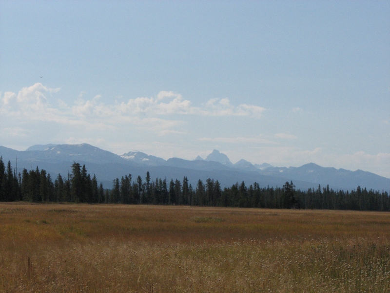
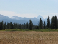
Since we were so far south already, we decided to go around the Tetons and then back up to Yellowstone on the eastern side. I was hoping for good views of the mountains, but it is very hazy and smoky from a fire south of here. Last year was also smoky when we were in this area, so we didnt get good photos of the mountains. I was hoping for better luck this time. Oh well. It has cooled off though, which helps. The drive was a pretty one, with rolling hills and farmland, yellow grass, green crops, winding silvery rivers, and blue mountains in the distance.
We stopped to take a picture and were surprised to see a Washington DC type motorcade enter the highway a short distance away. There were cops, several black SUVs, a limo and an ambulance maybe Cheney was here fishing?
There was a beautiful view of Jackson Hole from Teton Pass. The town itself was a zoo. We stopped at the Visitors Center to find out about nearby RV Parks since we hadnt passed any during the drive from Rexburg. To get an electric site at any of the RV parks in the vicinity would cost between $55-65, so we decided to try the more primitive NPS campground a few miles from town where we stayed last time. They had plenty of space, though half the campground was closed.
We saw a couple of deer in the Elk Refuge a few miles out of town and heard wolves when we were falling asleep. That was nice.
Wednesday, August 27: Fishing Bridge Campground, Yellowstone NP
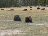
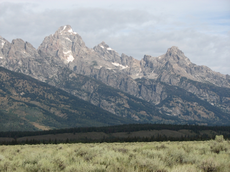
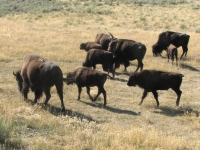
We played tourist today, photographing the beauty of Teton and Yellowstone National Parks. It was cloudy but relatively clear, so the mountains were gorgeous. We saw four sandhill cranes in a meadow in Teton and several bison near the road in Yellowstone.
We got a very expensive campsite at Fishing Village so that we could have electricity for the computer. It needs to be recharged, plus Jim has begun working on a slideshow for the Gathering, so he needs the computer to begin sorting through our thousands of photos. The RV Park is pretty awful: a huge open parking lot with only one bathroom per loop, no tables, no fire rings, a charge of $3.25 for a shower all for $40 per night. If not for the slideshow, wed be at a nicer and cheaper NPS campground, but its still cheaper than a motel with the electricity that Jim needs, so here we stay.
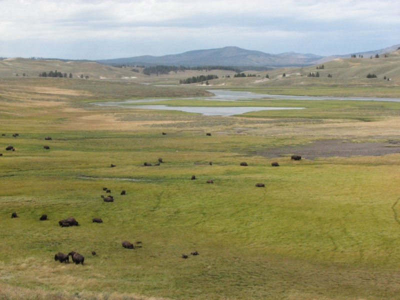
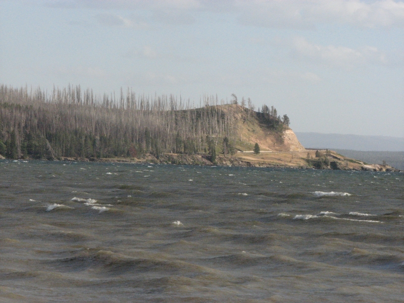
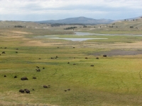
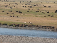
After we checked in, we drove up the Hayden Valley looking for wildlife. There were several large herds of bison, including one group that held up traffic for a while as they crossed the road from one meadow to another. One bull acted as crossing guard for the group, blocking the road so they could cross safely. We had heard about a bison carcass beside the river that was attracting bears and wolves. Sure enough, a gray wolf was feeding on the carcass when we looked with our binoculars. It was too far away to photograph, but we watched him for a while.
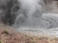

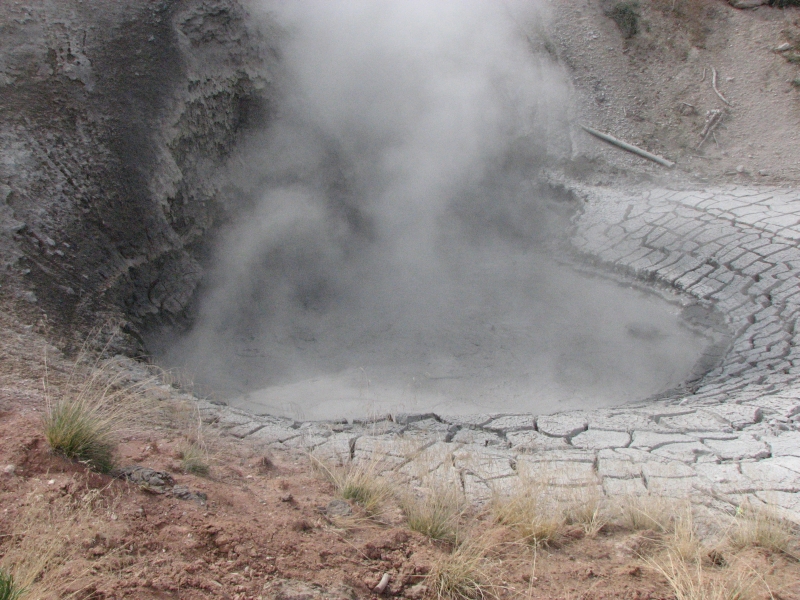
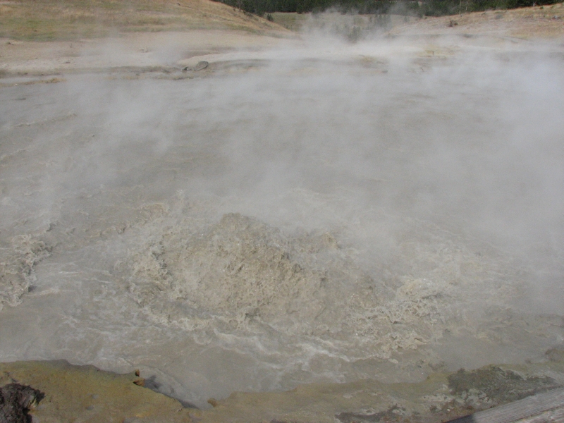
Mud Pots was a new stop for us: bubbling, boiling cauldrons of steaming sulphurous mud. Interesting, especially reading about how it, like other thermals in Yellowstone, changes constantly due to earthquakes and other underground phenomena.
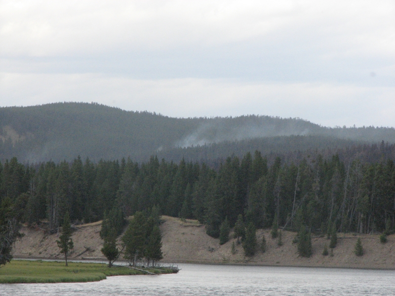
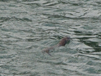
We got an ice cream at the Fishing Bridge general store, then Jim settled in with the computer while I went for a walk. The trail I tried to hike along the Yellowstone River was closed ½ mile up due to a big fire in the vicinity. I could see smoke rising from the hills upriver and there was yellow ribbon across the trail and trees in the treadway to block hikers, so I turned around. Back at the bridge I was fortunate to see four river otters in the water. A family group got too close so they swam off, but I was happy to get a glimpse anyway. I have only seen wild river otters twice before, once on a rafting trip in Idaho and then there was a brief glimpse of one in Florida.
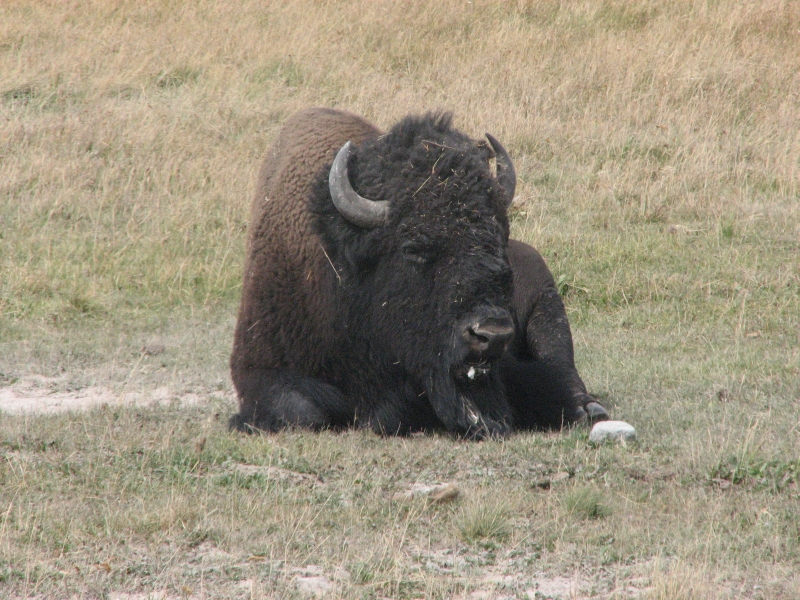
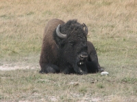
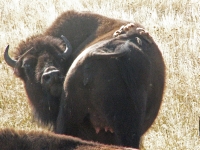
When I got back to the campground, we headed out in search of a picnic area where we could cook dinner since the RV park was not a good place for that (no tables and all the ambiance of a strip mall). We headed east but the picnic areas along the lake were too windy. The water was choppy and muddy too. We did see a heron by Pelican Creek though. We turned around and headed north along the Hayden Valley to a picnic area in the trees. It was occupied by a lone bison. We moved to the far end, away from him, but he followed us. I cooked dinner anyway. The bison grumbled at us, but we ignored him as long as he stayed away. He grazed for a while, scratched his head on some trees, then wandered back to the other side of the picnic area. As we ate we could hear the herd nearby grumbling and growling.
On the way back to the campground, traffic was stopped for ten minutes by a slow moving herd that crossed and recrossed the road in the middle of all the late evening traffic. One bison had gotten tangled with a tree and walked off with a branch wrapped around his horn. Later we watched the herd swim across the Yellowstone River just at dusk and then watched as a male separated a cow from the rest. Its rutting season. Interesting evening.

Thursday, August 28: Yellowstone NP (6 ½ miles)

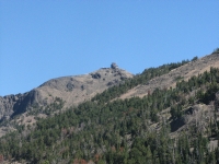
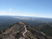
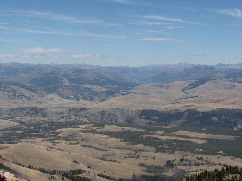
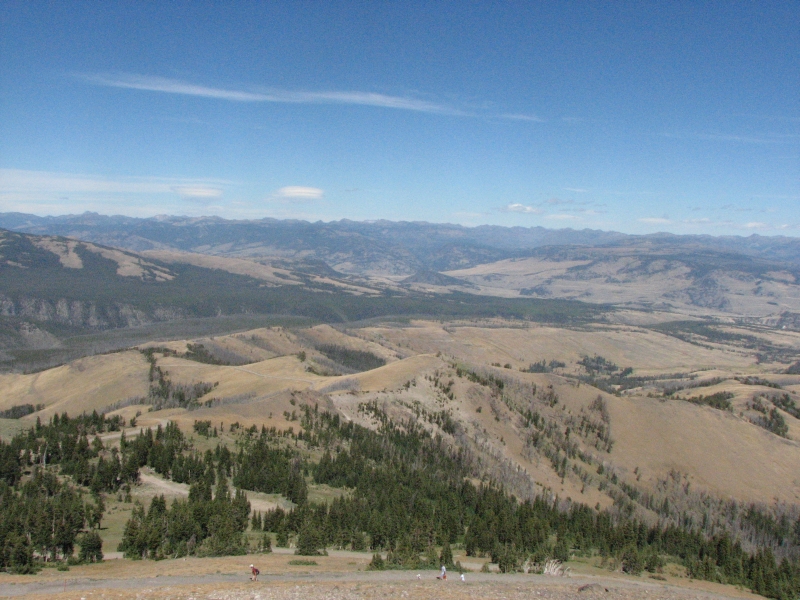
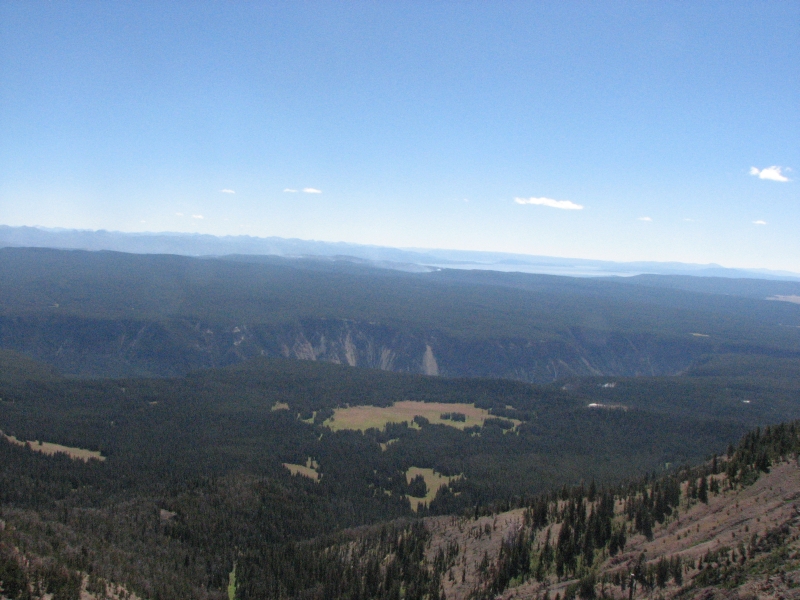
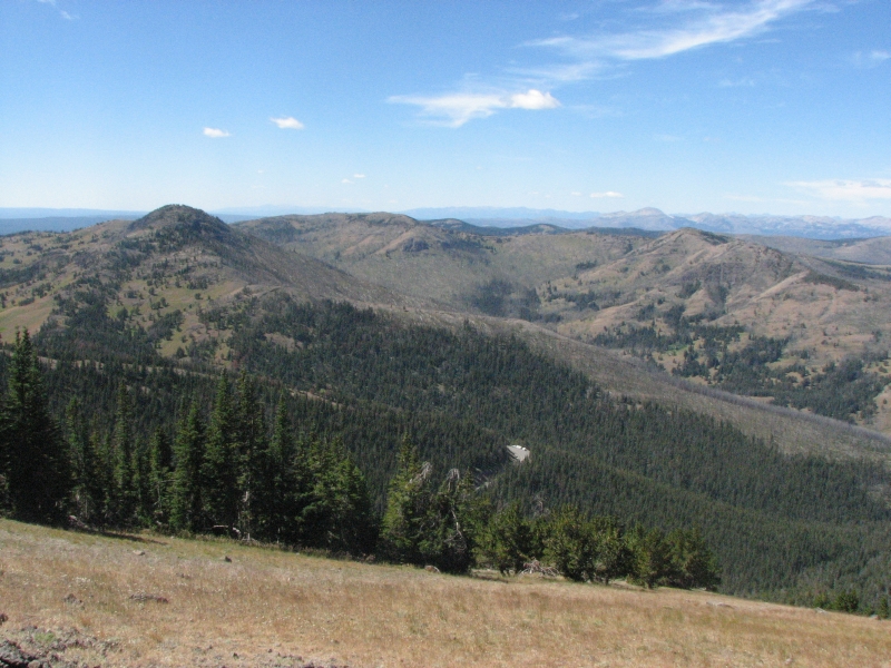
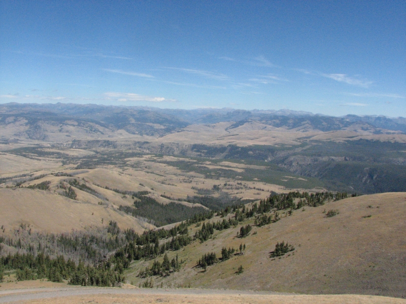
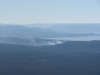
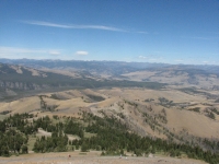
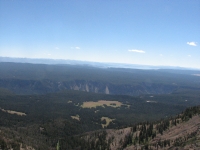
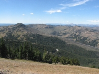
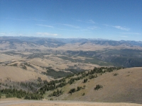
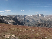
It was a beautiful cool, sunny, windy day. We decided the time was right to climb Mt. Washburn, one of Yellowstones most popular dayhikes. Its a 6 ½ mile round trip with a 1400 climb to a fire tower with 360 degree views. It was gorgeous. We hiked on an old road with frequent views to the south and west. We could see all the way to the Tetons, 75 miles to the south, Electric Peak to the northwest, Specimen Ridge to the east, Yellowstone Lake and the Hayden Valley to the south, and the Grand Canyon of the Yellowstone. There is a big fire in Pelican Valley so we could see several columns of smoke to the southeast, but all in all, the day was remarkably clear.

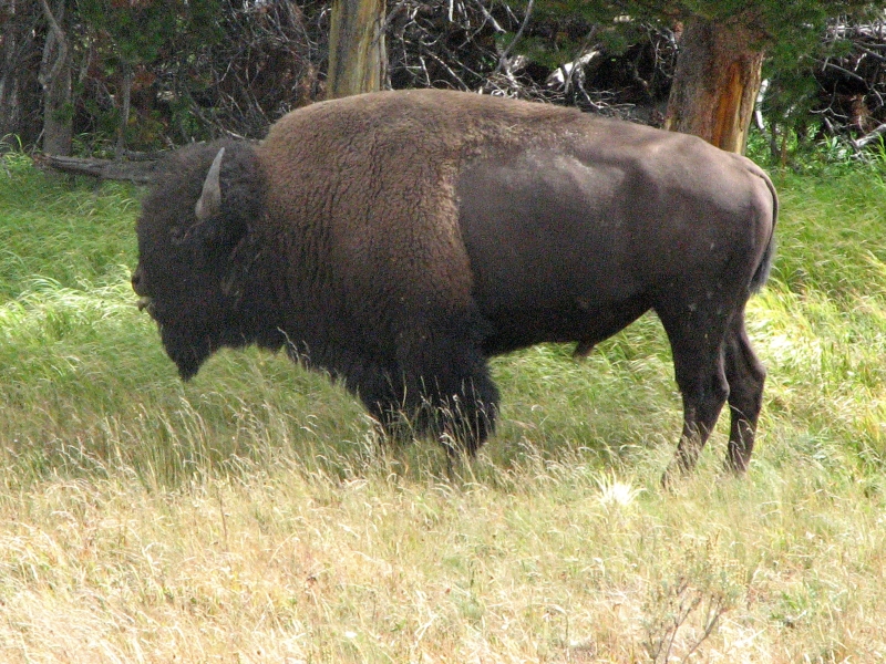
Its a very busy trail. There are three routes to/from the top and all were in use today. We got the last parking spot in the lot, which warned us. Several people were hiking without water. One couple gave away two quarts to unprepared daytrippers. I dont think people realized that the little building way up on top of the peak was their destination. 1400 is a good climb, even on easy trail. We didnt see much wildlife today only the bison along the Hayden Valley. Most of those that crossed the river last night were still on the far side. One big group wandered through our campground this morning. We heard wolves again last night, but didnt see any today.
We decided to stay in one of the cabins at Roosevelt Lodge so we could get a hot shower and enjoy their delicious ribs. We stayed there in 2006 and had good memories of the place. Its a bit expensive for what they offer, but its on a par with most of the National Park Lodges. Weve stayed at NPS lodges in Yellowstone, Glacier, the Grand Canyon and Shenandoah NP. Ive always enjoyed staying at the historic lodges, even if the rooms are small and very basic. They aren't luxurious, but they are dry and clean and comfortable enough for us.
Friday, August 29: Beartooth Highway to Red Lodge
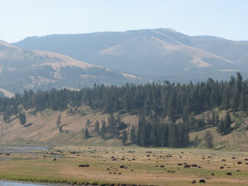
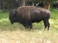
A smoky morning, but sunny. It was really cold last night, but the day soon warmed up. We drove out of the Park along the broad grassy Lamar Valley, passing several herds of bison. A couple of the herds included large groups of antelope, 20-40 in each herd. A lone coyote trotted between two bison, stopping to look at another lone bison that was lying down. I imagined it asking, Are you dead yet? before it trotted up the hill. There were fishermen galore along the rivers.

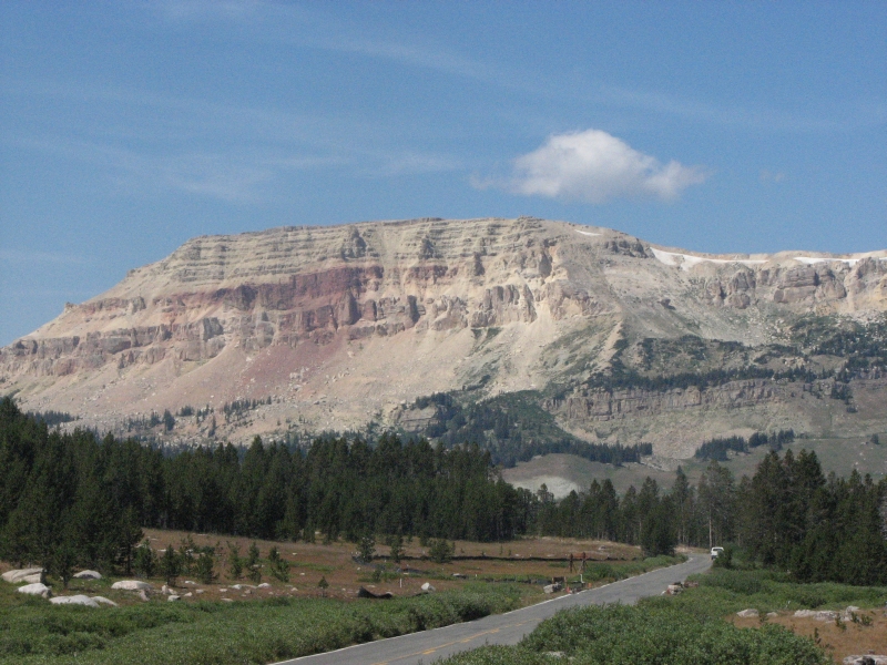
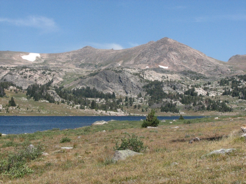
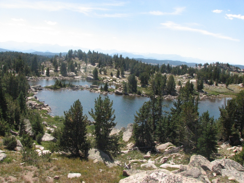
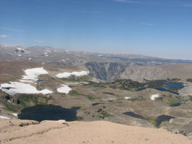
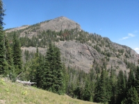
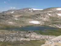
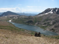
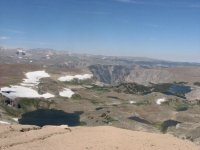
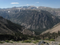
We wanted to drive the Beartooth Highway, which we had followed when we did some backpacking in the Absaroka Beartooth Wilderness six years ago. It is beautiful wild country, with granite domes, dozens of lakes, and alpine meadows. The road twists and turns for 60 miles or so, climbing well above treeline. Despite the heavy smoke from a big fire near Cody, I enjoyed the drive. We picked up a muffin at the Top of the World store and ate it for lunch beside beautiful Island Lake. Since it was a nice day, the alpine lakes and ridges were really spectacular. Theres still snow in patches and lots of wildflowers in the green grassy areas. One pond was still half-frozen, with a big snow bank above it. This is August! The road climbs to almost 11,000 so I suppose the snow shouldnt be that surprising.

When we reached the valley on the far side of the plateau we decided to look for a forest service campground. We had more or less forgotten that this is the start of Labor Day weekend. We stopped at two campgrounds and found that all the sites were reserved for the next three days. Some of the other nearby campgrounds were closed because of a fire in the mountains. We were told that we might find a spot if we backtracked 12 miles or we could try the KOA campground north of the town of Red Lodge. We decided to do that since it was closer. Its more expensive than the forest service campgrounds, but Im not willing to spend hours circling the area looking for an empty spot. It will be the same story tomorrow and Sunday. Holiday weekends are a real pain when youre just passing through an area. The KOA offers breakfast on the weekends, which is a nice touch. Its only $3 for bacon and pancakes and $1.50 for scrambled eggs not bad.
Home | Links| Trail Journals |
The Thruhiking Papers | Bun-bun
Created: 1 Jan 2009
Revised: 30 Sept 2016Copyright 2009-2017 Spirit Eagle