|
 |
 |
 |
 |
|
|
|
|
|
|
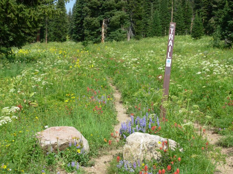
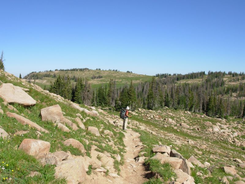
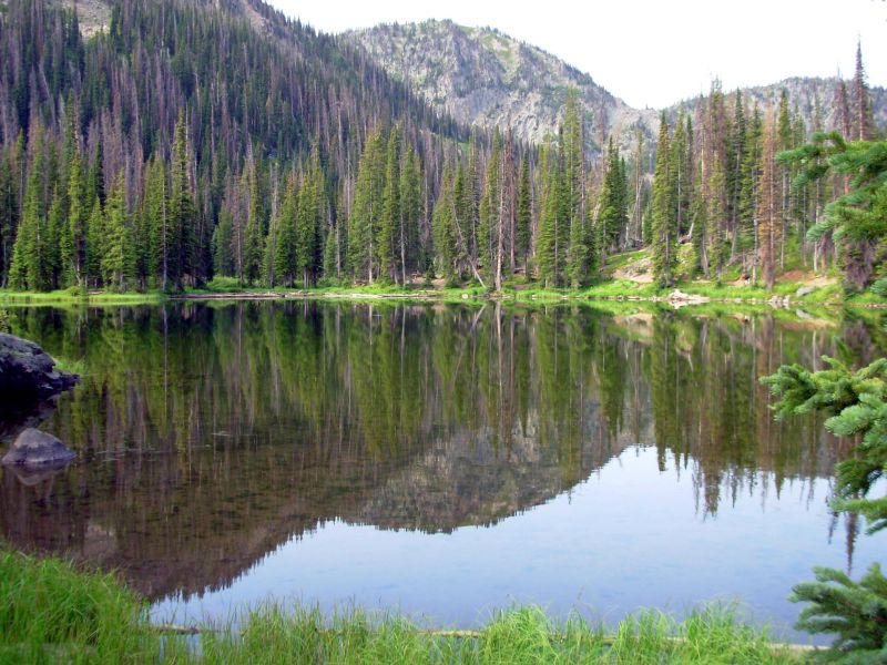
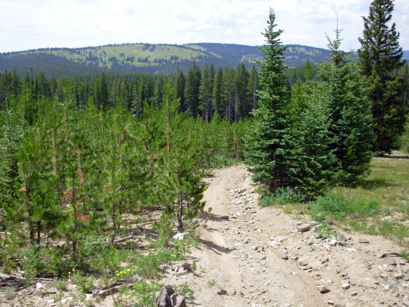
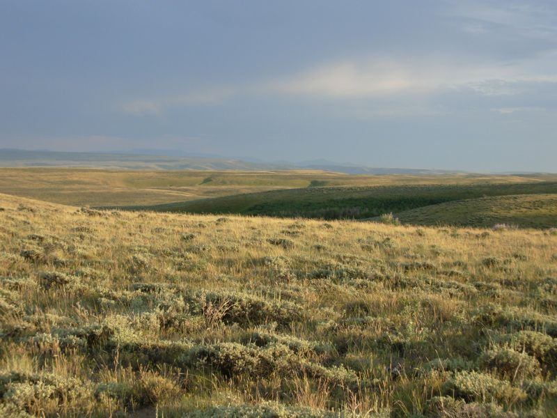
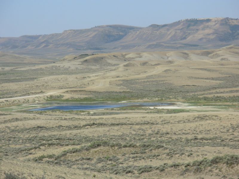
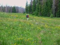
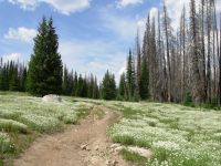
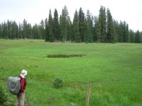
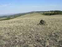
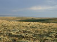
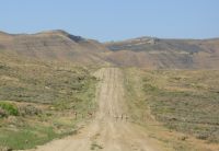
July 21 17 miles to Mt. Zirkel Wilderness Area meadow
Im feeling really good, starting out this new section. We stayed in town an extra day so we could start this 170 mile stretch rested and relaxed. Much as I enjoy the luxuries of town life (hot water, cold beer) I was very ready to hit the trail again. Our main highlights in town were another interview for Marks documentary and a good Italian dinner. Otherwise it was just the usual chores, made easier by the free bus that took us around town.
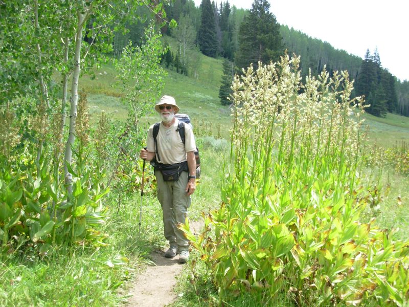
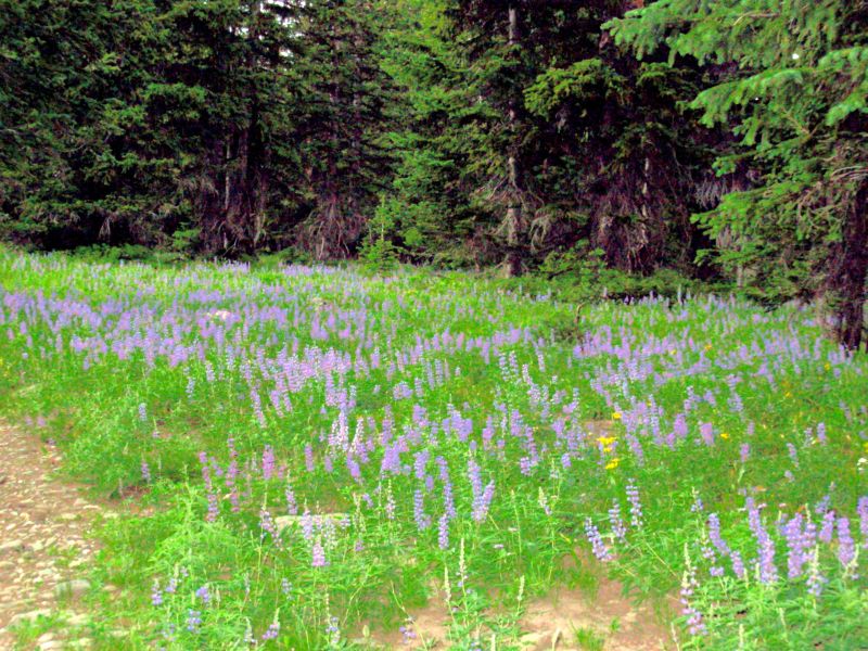
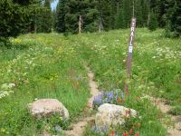
We got a late (10:30) start after breakfast and a visit to the post office. The bus took us out a couple of miles from our motel downtown. We were then picked up by a woman and her young son, heading out for a hike. She recognized us as CDT hikers. Were back in the afternoon thunderstorm pattern: hot clear beautiful mornings, clouds build up from 10:00 on, rain in the afternoon. Well see how today goes. The trail starts out beautifully from Old Rabbit Ears Pass. They have relocated the trail so it now goes through Dumont Lake Campground and around the lake. Thats good for thruhikers since you get access to water and bathrooms. Then we climbed past several meadows. The wildflowers have been incredible gorgeous. I was really happy walking along in the sunshine, surrounded by fields of flowers. We ran into a couple of guys on ATVs heading to the closed CDT. It turned out they had Forest Service permission to drive the trail as they are part of a snowmobile group surveying the trail for a maintenance trip next week. They should have walked, its not very far, and by driving, they encourage other ATVs to follow their example. Still I appreciate the fact that he stopped to explain when I told him the trail was closed to ATVs.
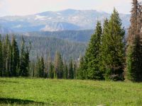
I am excited. This is our last section in Colorado. In a few days, well be in Wyoming. Were half way. We still have a lot of miles to go, but I feel good that we made it this far. I loved Mt. Zirkel Wilderness last time, so Ive been looking forward to our return. This is the last high meadow alpine environment for a while. Colorado has been better than I expected. Colorado has some of the best and worst trail on the CDT. It is still difficult with all the steep up and down. We had a lot of days with 4000+ elevation gains. The trail is sometimes terrific, and sometimes really awful as we followed old jeep roads or ATV trails. Weve seen more wildlife than last time, but also a lot more people and a lot more motorized vehicles. Ive loved the beauty of the flowery meadows, but miss the solitude we knew last time. Its a lot more peaceful in the autumn.

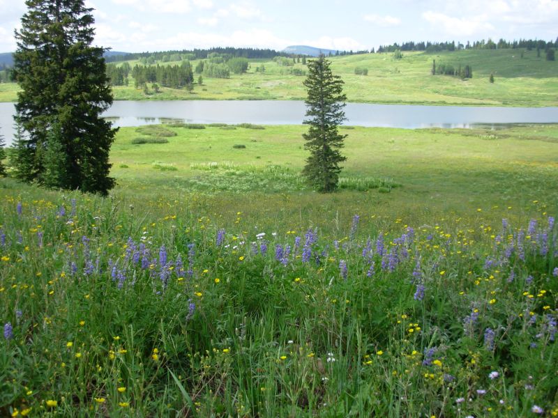
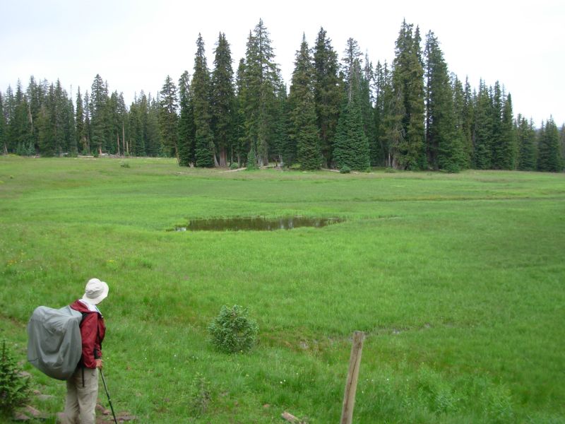
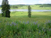
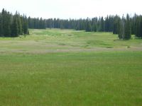
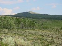
The afternoon hike was a nice one, from lake to pond to meadow. We had views of the mountains ahead (Ethel?), but most of the hike was in light forest or meadow. I only saw one animal, probably a deer. We were mostly on our own, aside from one fisherman and a family out for a short hike to the first lake. The meadows werent as extravagantly colorful as the ones near Dumont Lake, but they were pretty. The rain stayed away, though clouds gathered for a while midday. Our biggest problem was the bugs millions of mosquitoes. But its a small problem on such a beautiful day in such a lovely place. We camped in a grassy meadow, out of sight of the trail, behind a grove of trees.
Our flowers today reminded me of similar meadows in Southern Montana that we saw in July of 1999, also covered with lupine. Heading north or heading south, so much of the Continental Divide Trail has the same characteristics: open ridges, fantastic views of mountain ranges near and far, green grassy flowery meadows I love this country.
Jim: So - two ATVs have permission to use the CDT. And the snowmobiles use it in winter - that means the next step is to open the trail to motorized use. This is new foot trail built specifically for the CDT.
Today was a relatively easy section from Old Rabbit Ears Pass to Buffalo Pass, then into the Mt Zirkel Wilderness. We hiked into the Wilderness and found a campsite in a meadow well off the trail.
Saturday, July 22 17 miles to Gold Creek
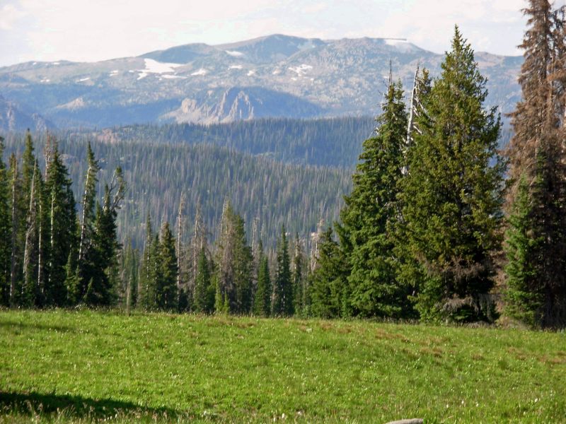
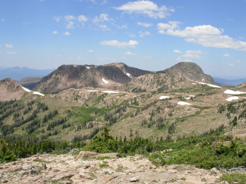
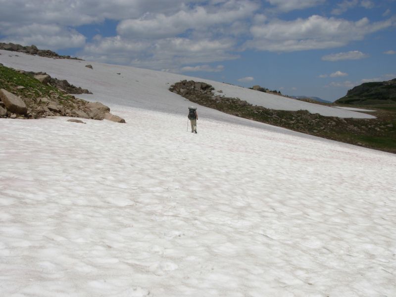
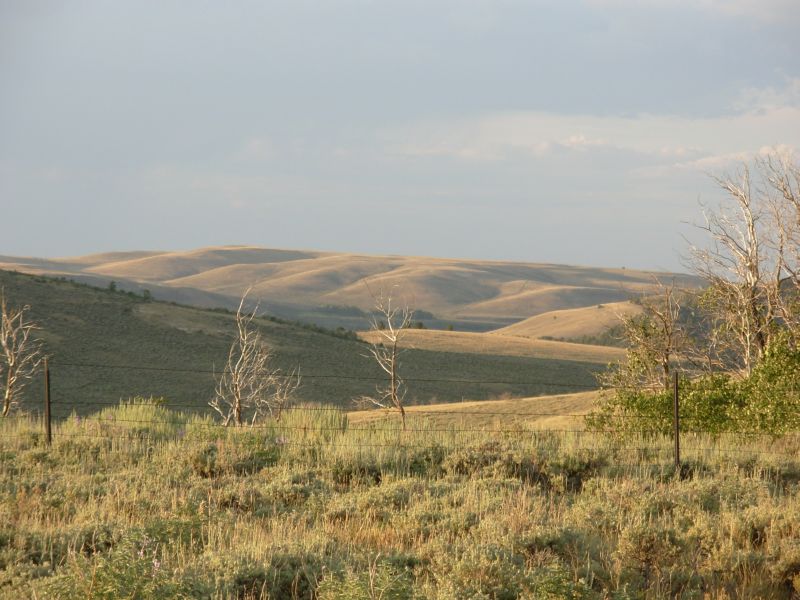
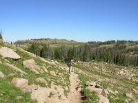
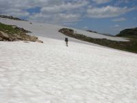
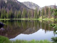
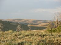
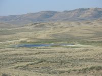
We spent a beautiful morning wandering the high country. Were mostly above treeline with views of several distant and nearby peaks. We passed a couple of lakes, ponds and tarns. One surprising thing is the amount of snow still here. Several drifts were on the trail and there were snow banks scattered all over. One cornice was still 8-10 feet deep. We spotted a red gray fox this morning by Portia Lake. Last night when we got up in the middle of the night, the stars, especially the Milky Way, were incredible. We didnt look around us, just up, but evidently there was a herd of elk in our meadow. As soon as we returned to the tent, we heard stomping, yelping and running. We really upset them. We woke to frost on everything and a dripping tent. Open meadows have drawbacks as campsites. Theres a smoky haze to the west forest fire?
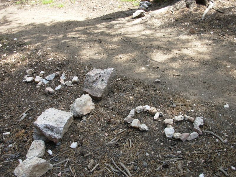
On the way up Lost Ranger Peak we met a young backpacker out for two or three days. Otherwise we had the trail to ourselves. The trail felt like a wilderness trail. Once past Luna Lake there was rarely any treadway, we just wandered the meadows from cairn to cairn. We stopped to repair several cairns that had fallen down as we went.
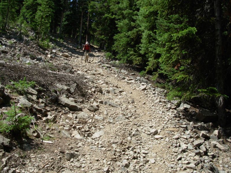
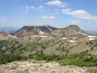
We decided its time to try to get adventurous again. There are several options in the Mt. Zirkel W.A. Most of them spend very little time actually in the Wilderness, a day and a half at most. We would like to spend two or three days here, so we looked for an alternative that would allow us to do that. We picked the most uncertain, starting with a bushwhack along the Divide for several miles. We dont even know if its possible, just that Jim Wolf, in his guidebook, challenged his readers to try it and tell him the results. Im sure its been attempted several times over the years, we just dont know the result. After the peaks section, well drop down to pick up one of several trails heading north to the border. The CDT follows an old jeep road, much used by ATVs and jeeps. I didnt want to do that section again, if I could avoid it. So well follow Trail 1101 to Gold Lake, then head up to Red Dirt Pass to Mt. Zirkel, then follow the divide around to Seven Lakes, and then ?
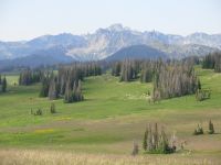
Jim: Today was a lot of cairn to cairn walking - the trick was finding the cairns. This is beautiful country, with fields of flowers, occasional snow fields, lots of climbs and views where you can "see forever." It reminds me of parts of the South San Juans. Last time we were here, the wind on Lost Ranger Peak made difficult to stay on our feet. This time - no wind.
The elk herd last night really surprised me - they came in and settled down around the tent after we'd gone to sleep. They couldn't possibly have missed the fact that we were camped there. But they didn't move while we were outside the tent - only after we were back inside. Then they panicked. Funny.
Sunday, July 23 17 miles
Plans changed. We woke to cloudy skies. Bushwhacking several miles along the divide with no egress didnt seem like a good idea if it was going to rain. Although the clouds cleared up, we took it as a warning. So we went on to plan B: follow the old guidebook route past Gold Lake to the CDT, follow that for a while, then head up Trail Creek and Trail 1152. We would get ten more miles in the Wilderness and avoid the jeep road to the border. The trail north of Seedhouse was actually new to us since it was closed last time we came though due to the Routt Blowdown, a huge wind event. The trail is open now, but lined with burnt trees for the first few miles. We ran into a large recent burn zone yesterday too, north of Lost Ranger Peak. Todays burn was older, with lots of grass and flowers, sometimes head high.
We had visitors again last night: some deer that played leapfrog around the tent, over downed logs and back again. We heard no snorts or barks, just jumping back and forth for about 15 minutes. It was funny.
Sunday is a busy day along these trails. We ran into more than a dozen dayhikers heading to Gold Lake, a church group out on a nine-day backpacking trip, horses and bikes along the CDT and a ranger on patrol. That was just the morning. Im disappointed about the change of plans, but when we asked the ranger about our plan to hike the divide, he said hed never heard of anyone doing it, though it might be possible. The church group leader, who climbed Mt. Zirkel yesterday, said he didnt think you could descend the north side of the peak, youd have to go to Red Dirt Pass and contour around the base. I wish we could have done it. But with Jim in a lot of pain from his knees, a lot of steep bushwhacking probably isnt a good idea right now.

Plan B didnt work out for us either. We started out on Trail Creek Trail and it vanished completely in the meadow no tread, no cairns, no trail. We could have bushwhacked up the stream for the next two miles, but then what? The old faint jeep tracks just arent visible any more. I got worried that if this trail was non-existent, what about the one it is supposed to connect to? Ten miles of bushwhacking just didnt appeal, especially at 5:00 in the afternoon. Jim was tired and hurting, so he was just as happy to go back to the CDT, at least until he realized that we had to climb 500 straight up on jeep track. We only went another mile or so before we found a flat spot in the trees. A motorbike passed us as we set up the tent. All in all, it wasnt a great day.
On the plus side, there were some pretty flower-filled meadows, even in the burnt zone. One area was covered with white pussytoes (a flower). I spotted two deer and an elk in the meadows, plus three sheep that just wandered by on their own. Where is the rest of the flock? There were occasional views of Lost Ranger Peak and the Sawtooths. Still, I was really disappointed that none of my plans for extending our time in the Wilderness worked. We got a few extra miles by going to Gold Lake, but for the rest, we were stuck with burned trail followed by really bad ATV and motorcycle trail. And it didnt even rain, despite this mornings black clouds. That was not happiness.
Jim: This day wasn't what I expected. The first plan blew out when we looked at the weather this morning. So when we got to the trail to Red Dirt Pass, we turned left toward Gold Lake instead of right.
Then we got to the Trail Pass Junction. The junction was marked and there was one cairn leading off into the meadow, but no treadway. And then the trail died. We spent a half hour or more looking for any sign of trail, but it just wasn't there. It disappointed Ginny and irritated me, but I was too tired to put a lot more energy into chasing invisible trail at the time. But both those alternate routes are ones I'd like to go back and try again. It also occurred to me that there might be an alternate route that doesn't require the descent toward Gold Lake.
Monday, July 24 20 ½ miles to Huston Park Wilderness Area
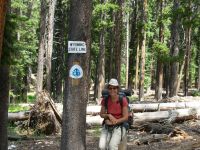
We made it to Wyoming in time for lunch hurray! I am ready for a new state, especially after the last 25 miles. I hate following ATV trail. Although we only saw three this morning, the damage to the treadway, especially on steep hills, is inescapable. Part of the morning hike was nice as we traveled along the Divide in forest with occasional views west to Hahns Peak, but part was on the eroded jeep tracks I hated so much last time. Last year one of the hikers wrote in her on-line journal, At last were in Colorado, where the trail doesnt suck. I laughed, because I remembered how bad the trail is near the border. It hasnt gotten any better in the last six years.
We spotted the three errant sheep this morning. We saw tracks of sheep and coyotes along the road, but no herds or sheepherders. Jim heard a pack of coyotes nearby last night, so we wondered how long those poor lost sheep will last out here. There was also an abandoned van stuck on a stump on the jeep trail with a couple of flat tires, its door hanging open. Theres a story there, no doubt. We wondered if it belonged to someone from the Rainbow Gathering two weeks ago who tried to take the van on the wrong road.

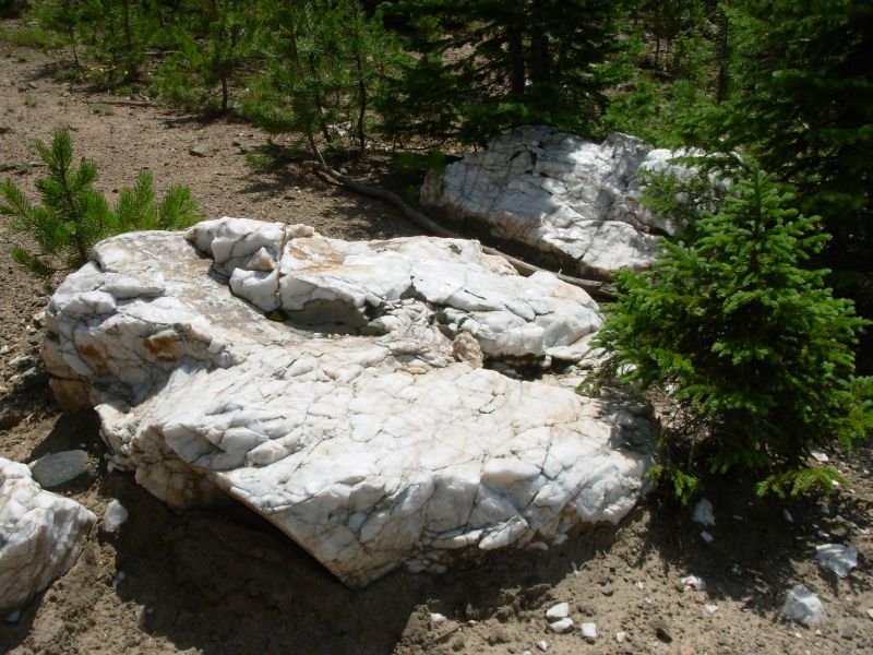
The trail this afternoon followed ATV trail for a while, then took off cross-country, following old cairns and blazes. We reset several cairns as we went.There were some open meadows along the divide, covered with yellow flowers, and a lot of woods walking. White and pink quartz was everywhere. We finally found the rest of the sheep herd, 12 miles from where we saw our strays. No visible shepherd though. This is the third herd weve seen so far, including one Jim saw near Rabbit Ears Pass when he went for water. All afternoon the clouds gathered and thunder rumbled. Fortunately, it waited until we had the tent up in a desperation campsite before it started to rain on us. We were supposed to continue climbing, but stopped half a mile early because of the approaching storm.
Jim: One thing Colorado has in abundance is sheep. It's surprising - at least to me.
The van that was high-centered on the stump was good for a lot of conversation/speculation today. Whoever owned it didn't even lock it - the doors were wide open. Not your usual backcountry sight, but now that I think about it, we've seen a fair number of that kind of thing over the years. There was one in New Mexico, south of Pietown this year.
Tuesday, July 25 22 miles
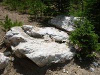
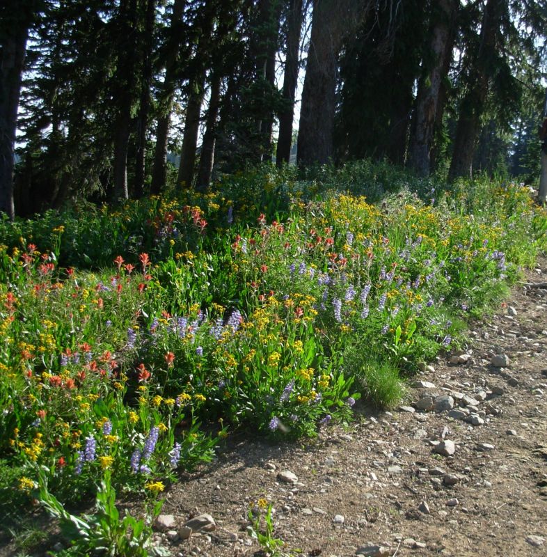
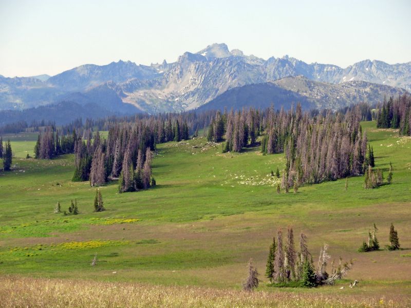
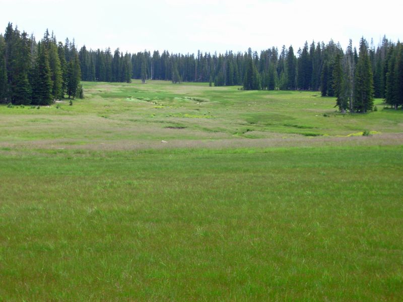
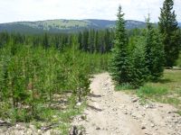
Although it rained off and on for an hour or two last night, we woke to dry ground and a nearly dry tent. We also woke to gray skies. As we climbed up to the Divide, we could see black clouds and rain to the west of us, not a welcome sight when walking at 10,400. The first part of the day we played hide and seek with the cairns on mostly open ridge. The trail twisted and turned unexpectedly, so we had to really pay attention. After a while we reached older, more established trail with visible tread, so walking was a little easier. On the divide, the meadows were very colorful: big pink boulders, white quartz cairns, blue lupine, with an occasional orange paintbrush for contrast. Around 10:00 it started to sprinkle just enough to wet the grass. We dropped down a bit to a series of large wet meadows. Huston Park was the largest, spreading arms in all direction. We had to be careful following cairns in two of the meadows because side trails branched off and it was easy to follow the wrong set of posts. The meadows were very boggy and had fewer flowers than the higher country: mostly purple asters, white bistort and a little yellow blossom. No wildlife aside from a hummingbird that came to check us out. Because were at 9-10,000 the mountains here in the Medicine Bow Forest look just like Colorado--spruce forest and grassy meadows--but it is already noticeably dryer. One benefit: fewer mosquitoes. We havent used DEET for two days. Theyre here, but not swarming. Butterflies of all kinds are still abundant though.
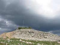
We spent the afternoon dodging thunderstorms as we climbed over Bridger Peak. Just as we neared the top, at 11,000, it started to rain. The lightning was still a few miles away, but we wanted to get down, fast. New trail took us up instead, closer to the white rocky peak. We didnt go up to the transmission building, but 50 yards was too close to the tallest point in the area. After that we followed a jeep road for several miles along or near the divide. There were lots of views, mostly of black clouds. We got rained on a third time when we were still two miles from the creek where we hoped to camp. None of todays rains got us completely soaked, except from sweat inside our rain jackets. They each lasted about 15 minutes. The ground dried almost as fast as it got wet.
Jim spotted a very young deer. A bicyclist and a family in a vehicle totally unsuited for the rough track passed us on the jeep road. Papa rolled down the window and said to us, Youre probably more comfortable walking than we are driving this road. Since it was raining at the time, that sounded really funny, but watching as he slowly maneuvered around the rocks in the road, I understood his point.

We ended up with another desperation campsite. Those are the ones that you wouldnt choose, except that youre so tired you feel like you just cant walk another mile in search of a better place, so you accept a slope or lumps or a tiny little space and hope for the best. Sometimes it works, sometimes you spend all night tossing and turning in search of a comfortable position. Jim tends to just run out of energy all of a sudden, probably because of his blood sugar. I can usually manage a little more distance, rather than settle for a really bad campsite, but sometimes its easier or smarter to settle for a bad site than to keep going in hope of finding a better one. In this case, the first water in 12 miles was in an area of steep sidehill. We found a sorta flat spot. After 22 miles, we really didnt want to go much farther and theres no telling how far this sidehill continues. Its new trail and the description we had was not very detailed.
Jim: This was a long day, and we ended by taking a less-than-ideal spot to camp. But we do have water, and the tent is relatively level and the sleeping bags are warm and dry. And we've been fed. What more can you ask? I know - 8 or 10 hours sleep.
Wednesday, July 26 20 ½ miles
Rain chased us into the tent as we were finishing dinner. We grabbed our Oreos and ran. It didnt last long, but an hour later that shower was followed by a huge humdinger of a thunderstorm that went on, directly overhead, for hours. There was lighting and thunder and torrential rain. We were very happy to be safe in our tent, well off the ridgeline. With my eyes shut, the lightning was blinding. One caught Jim with his eyes open; he saw stars for a while. We woke to sunshine and a soaked world.
At lunch we spread everything out in the sunshine: tent, sleeping bags, and rain jackets, and they were dry in no time. Today we finished hiking through the Medicine Bow Forest. This was a different route from the one we took last time, which was disconcerting because we kept trying to match ourselves and our memories to current reality and they didnt fit.
We hiked a mile or so from cairn to cairn along an open ridge in sage and cactus (hedgehog type, very hard to see because they are so small). Part of the hike was following jeep roads through spruce and aspen forest. Navigation was sometimes an effort, as part of the way was on new trail, part on interim trail, and there were numerous side roads not in the guidebook or on the map. Some of the road numbers didnt match the guidebooks and the occasional CDT marker didnt always help. Several places in the Medicine Bow they placed cairns to indicate turns in places where you werent supposed to turn. We werent sure how far we could trust these. The cairns ended abruptly, with no indication of where to go next. Weve gotten caught that way before, in New Mexico. So later when we saw a piece of new trail crossing the road we were on, we didnt take it. The old route led to water, who knows where the new route goes, and how far it goes before it stops?
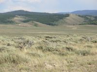
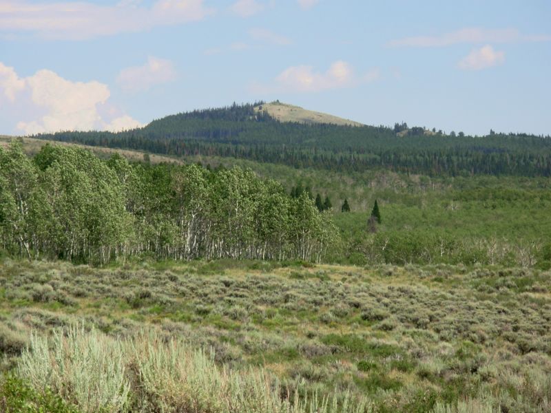
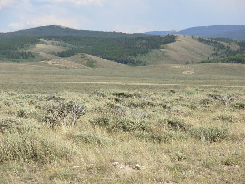
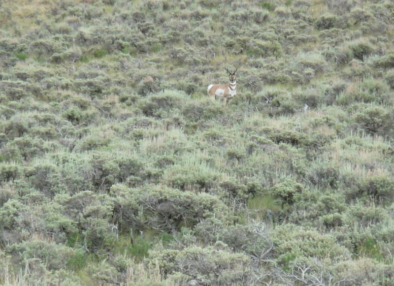
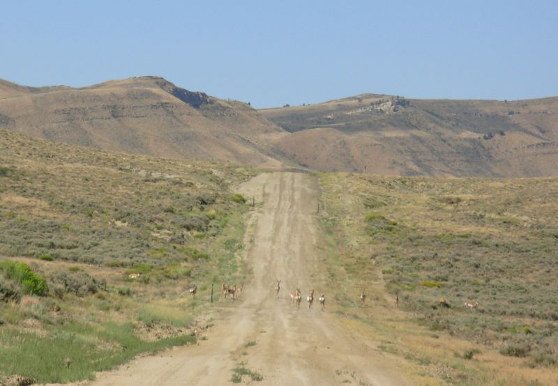
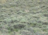
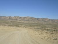
We saw one deer in the woods this morning and a couple of hawks. This afternoon we entered the Great Basin. Its a different world: mile upon mile of rolling hills covered with blue green sage and scant grass. No houses to be seen. Few trees. Just an occasional jeep track and fenceline indicate human presence. Yet the land isnt empty. Just this afternoon, I counted 82 antelope (though some may have been counted twice), six horses, innumerable cows, two snakes, an eagle, a horny toad and three red velvet ants, plus a dead blue lizard. I had fun.
We picked up more water at Savery Creek, washed up, and went a few more miles into the hills. Savery was a lovely green oasis. The trail stayed high, so we had great views of the land around us and back toward the blue mountains we were hiking yesterday. Soft gray clouds to the south and west shaded us late in the afternoon, a most welcome event. A gentle constant wind in our faces kept us relatively cool.
Im really enjoying this: the miles of emptiness, the wildlife, the hawks and prairie dogs, the blooming sage sprinkled with small yellow and purple flowers and lupine, the sound of the antelope huffing at us as he tried to decide whether or not to stand his ground, and the distant blue mountains. The only sound is the wind and the chirrup of an occasional bird or the warning cry of a hawk overhead. I sat watching the clouds drift overhead while waiting for dinner to come to a boil while elk grazed on a green meadow across the valley. Life is good!
Jim: Last night's storm was a monster. We had rain on-and-off most of yesterday, and we got in the tent because it was raining last night. But then it got serious - and the thunder and lightning started. And kept going and going and . . . It turned into an Energizer Bunny storm - several hours of really nasty thunderstorm, first directly over us and then later both north and south of us. One lightning strike was directly over us - and CLOSE - so close that there was no delay time for the thunder - and since I had my eyes open, I wasn't sure I wasn't blind afterwards. That actually hurt. Ginny had her eyes closed and still was blinded by it.
Today we come out of the mountains and into the desert. And my first thought was: Now I'm home. Not that I don't love the mountains, but some of my most vivid memories of our 1999 hike were of the Wyoming desert. Strange, because I don't think I'd want to live here. Camp tonight is a flat spot on the side of the "trail", which is no more than an old, seldom-used dirt track that's dignified by having a BLM road number.
Thursday, July 27 28 miles to Emigrant Creek
Before we left camp this morning we had already seen five antelope. It just got better and better. Before noon we saw at least 57 antelope, three deer, three elk (stags), a badger and a coyote. Every time we went over a hill or around a bend, there were more. The elk were a surprise, but in the coves and draws of the hills the vegetation is thick (even some trees) and thats where the deer and elk were hidden. This afternoon well head up Muddy Creek, with no trees and no shade, so any wildlife will likely be resting from the heat of the day until late afternoon, though we may surprise some near the creek where it is a little shadier. We were happy this morning to find that there was a piped spring along the route. We followed the official trail here, a graded dirt road. No traffic so far. We missed a turn that would have cut off 2 ½ miles of winding road. We were looking for a jeep track and it was a cross-country stretch instead. Or maybe it was the jeep track that left the road half a mile before we were looking for it. Our day was lengthened, unexpectedly, but the extra miles allowed us to see the elk and coyote, so were worth the effort.
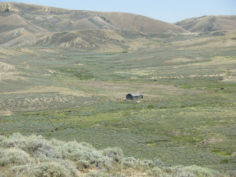
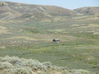
We decided to bypass the water in Muddy Creek as it was, indeed, quite muddy. It is shared by a lot of cows and other critters. One bull challenged us at a bridge crossing the creek. While the herd ran off, he stood there snorting and pawing the ground. He was a huge black bull, but without horns. Finally we walked on by and he chased after his herd, which was heading upstream in the direction we were going. We met them all at the next bridge, a mile or so later. Fortunately we soon went over a cattle guard and lost them. We heard the bull grunting and bellowing for a long way. The next herd showed little interest in us. There were a couple of derelict cabins by the creek. In such extreme country, so dry and lonely, it must have been a hard life.
Today we hiked on the Overland Trail past Bridger Pass. One hundred and fifty years ago the stage coaches ran through these mountains. No obvious traces remain, though the road itself may have been the old stage road, at least in places.
We stopped at a spring before Bridger Pass to fill up our water and cook an early dinner. We got water at a spring above a stock pond. It had a metal pipe feeding the pond, just dripping slowly, but the spring itself was an open fenced pool, covered with algae. It tasted odd, maybe alkali, maybe of pipe, maybe algae. But its the last decent water until Rawlins, 26 miles away. The other water sources are much more uncertain. Because this is roadwalking, albeit on dirt roads, we are making good time, so we decided to try to go to Rawlins tomorrow. We started today with 49 miles left to town. If we can do 25 or more today, well be enjoying a shower tomorrow.
Wildlife count: 3 deer and 40 antelope just this afternoon.
Later: Doing the extra miles was painful--the roadwalk gave me blisters on both little toes--but Im glad we did it. Were set up in a green meadow next to the road. We only saw one car all day, so it feels safe enough. Were tired and sore, but content. If only we werent so dirty. My feet are black, but neither Muddy Creek nor the stock pond where we got our water would have made them much cleaner, and we still had to continue on the dusty road afterwards. Tomorrow Ill get clean. Thoughts of that hot shower will push me the 21 miles to town.
Jim: It was a long day but easy walking. Coulda done without the extra 2 1/2 miles but we survived it. At least there's "some" good water along the route. The piped spring was really good. The upper reaches (first crossing) of Muddy Creek would also have been good - that's where we saw the coyote. He was probably resting in the bushes there until we came along a flushed him. After the first Muddy Creek crossing, though, the water is less than desirable.
There's water at Emigrant Creek but I wouldn't call it "usable." But there is a flat spot on the south side of the road that actually has grass (as well as cow pies and a lot of trash). But it's not the worst campsite we've had.
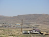
Friday, July 28-22 miles to Rawlins
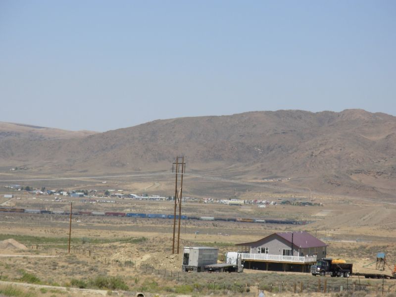
We made it to town by 3:00 p.m. The hike went quickly but was painful. We had six miles on graded dirt road, the rest on paved highway. Traffic wasnt bad, about one car every 5 10 minutes. The land was gray and brown, very dry. We passed a couple of ponds/reservoirs, but nowhere we wanted to get water. The city reservoir on the highway was a beautiful deep blue. I wanted to swim but was forced to refrain thanks to a six foot fence. Since it was around 90 degrees outside, it was a temptation. On the road we chatted with an oil geologist working nearby who was curious about what we were doing out in the middle of nowhere. Later, at the laundromat, we talked with another oil worker who works north of here. He was quite interested in our trek. Wyoming is in the middle of an oil/natural gas boom right now so there are a lot of oil field workers in Rawlins and elsewhere. Ive read that Pinedale is really a boom town these days.
We only saw 22 antelope and one rabbit today. There were too many cars, plus I was distracted by badly blistered feet, so wasnt paying as much attention as usual.
We stopped at a little grocery on the edge of town for a long awaited cold drink, stopped at the post office to pick up our drift boxes, and then found a cheap motel nearby. Its almost as bad as the one we stayed in last time, but more expensive because of the Wyoming gas and oil boom. Were here for the weekend. I need to heal my feet before we begin the long roadwalk out of town. Besides, Rawlins is really spread out. Its at least a mile to the grocery from here. After taking care of errands well need a day to recuperate. The fact that temperatures are in the mid-90s doesnt help make us more eager to head out into the desert, especially since the last couple of water sources were not viable. Five Mile Spring was dry; Little Sage Reservoir was drying up. It had water, but not good water.
I have mixed feelings about the next couple of weeks. Yesterdays big miles across such dry empty land dimmed a lot of my excitement about being in the desert. I worry well be forced to push too hard because of the water situation. We have no current information about the water sources ahead, which doesnt help. The Wind River Range follows the desert stretch, and I have good memories of that area, but I remember that we also had to push the miles there because of the long distance between resupply stops. Im really tired, but because Rawlins pretty much closes down over the weekend, staying here in a cheap motel really doesnt appeal.
Jim: This was one of those "early start" days. At 0600, there were trucks with horse trailers on the road - which was about 20 ft from the tent. Woke me up. The roadwalk was fast, but hard on the feet. We knew Little Sage Reservoir was probably unusable - it's saline - so we didn't even check out the water there. There's a state park a mile off the road that probably has water, but we weren't much interested in a two-mile detour. We thought Five Mile Spring might have water, but when we got there it was bone dry. OTOH, we were only five miles out of town at that point and we still had a quart of water left, so it didn't really matter much.
July 29-30 Rest Days in Rawlins
We ended up staying over the weekend. It was restful and we ate a lot, but Rawlins still isnt one of my favorite trail towns. Nice people though. The motel was really the pits, very run down with no service, just like the one we stayed in last time. OTOH, the folks at Quality Inn, across town, let Jim make copies and send faxes and never even asked whether he was a guest. We werent, wed just stopped in for breakfast. We ate most of our meals at Sanfords Pub & Grub good beer and burgers and its one of the few places open downtown on the weekend. Saturdays breakfast was out of the gas station minimart since there were no restaurants open for breakfast on the weekend near our motel. On Sunday we walked the mile and a half to the grocery and ate breakfast at a motel nearby. We took a cab back to the motel with our load of food. We read a lot, watched a little TV, made a lot of phone calls, and surfed the internet at a computer gaming center--a dark cave of a place, but with a nice very young owner/ manager. There was a huge thunderstorm Sunday night while we were there. Power was knocked out three times and rain fell in a torrential downpour, flooding the streets. I was very happy to be inside. The upside is it cooled things off for a couple of days.
Jim: Rawlins hasn't changed much - it's still a spread out Interstate town without a lot to offer. But it does have most of what we needed - grocery, motels, restaurants, and laundromat. Internet access is a little trickier - the library has it, but closes on weekends. The Quality Inn at the east end of town has it - for guests. And the gaming cave (Gaming Plus?) next to the Thai restaurant can provide it for a reasonable price.
Sanford's is probably the best restaurant in town - it has good food, it's open every day and their beer selection is great (130 labels). And they have daily specials on different beers. Too bad they don't do breakfast
Home | Links| Trail Journals |
The Thruhiking Papers | Bun-bun
Created: Dec 2006
Revised: 30 Sept 2016Copyright © 2006-2017 Spirit Eagle