|
|
|
 |
 |
 |
 |
|
|
|
|
|
|
|
|
Alaska Flight - 2004
Nutzotin Traverse
Thursday, July 15 – Washington, DC to Anchorage
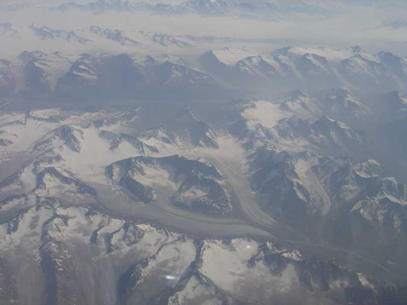
We’re off on a new adventure, happy and excited, feeling free and relaxed. It’s a good start. Our flight from Washington to Minneapolis to Anchorage was long, but went smoothly. The last hour or so we got incredible views of snow capped mountains, icefields and glaciers below. That was beautiful. I was amazed at how big the glaciers were, and how many – 100,000, I’ve heard. Jim got pictures from his side – I was in a middle seat so couldn’t get any, but I enjoyed the view. We arrived at 5:30 local time, picked up a rental car, drove to the hotel (cheap and noisy, but right in the middle of town) went for a short walk around the tourist district, got a burger and a sampler of three different local brews, and finally collapsed around 9:30.
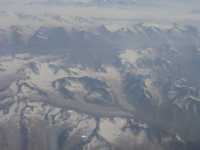
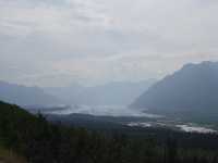
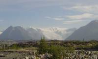
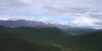
Chugach GlaciersJim: We left Washington, DC and got to Anchorage about 10 hours later (with a layover in Minneapolis). For the last hour of the flight we were watching the coastal mountain ranges, icefields and glaciers of southeastern Alaska and southwestern Canada (the Chugach, Wrangell and St Elias ranges). That 30,000 ft view is jaw-dropping if you have any idea at all of the scale of what you’re looking at.
Friday, July 16 – Anchorage to McCarthy
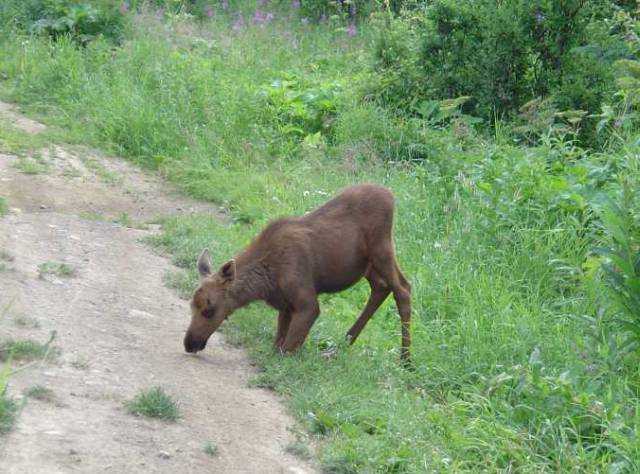
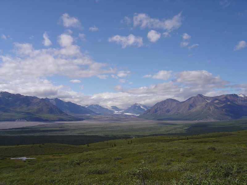
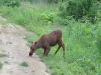
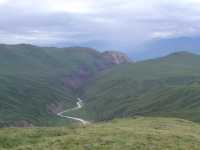
We woke to low clouds and dark skies. We ate breakfast at Country Kitchen, a buffet place, stopped at the grocery to pick up bread, cheese and a styrofoam cooler and at a hardware store to pick up alcohol for the stove – by 9:15 we were on our way. I’m excited. The Chugach Mountains around Anchorage are big, round and tree covered, with very steep sides. They’re very pretty. Anchorage was smaller than I expected. There are few tall buildings, but lots of brewpubs and tourists. It was fun to see the frequent small airplanes and floatplanes. In a state with more landing strips than roads, they are common. By mid-morning the clouds lifted. The mountains were hazy, but pretty. We crossed several rivers, some quite large. As we headed east, following the wide, fast and silty Matanuska River, the mountains got more sheer, more dramatic. We could see a few small glaciers far away. We stopped a few times to take pictures of the mountains, the river, and once, a baby moose that was feeding by the side of the road. We never saw mama.
On the overlook for Matanuska Glacier we followed a short nature trail for better views and some Nature Trail type explanations of glaciers and glacial succession. We enjoyed a very relaxed drive through forests and mountains. Lots of pink fireweed lined the road. That is a pink wildflower that can be anywhere from a few inches tall (dwarf fireweed) to 7 or 8 feet tall. Mostly it’s about two feet or so. In Alaska, it is everywhere. (But the state flower is forget me not, which doesn’t grow in the interior.) We ran into some road construction which slowed us down, but fortunately it was right at a place where I was able to spot a family of white Dall sheep or mountain goats on a rocky outcrop high above us. We didn’t mind waiting a bit.
Then the valley opened up. The mountains were farther away, so mostly we looked out on flat lands full of skinny black spruce and lakes. We stopped for a while at the Wrangell St. Elias visitor’s center where we read the exhibits, watched a pretty film about the park, and borrowed the bear canisters that we will need for our trek. We had ice cream for lunch at the gas station in Copper Center around 4:00. Between the road construction and our take it easy attitude, it took seven hours to drive the first 250 miles, with 100 still to go before we stop this evening. There were hazy views of snow-covered volcanoes: Mt. Drum and Mt. Wrangell from the Visitors' Center.
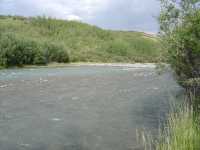
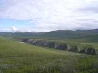
There are some serious fires north of here which have really affected the air all over Alaska. It wasn’t until we turned off onto the Edgerton Highway that we started to get good mountain views again – blue mountains with small snow patches. The Copper River was wide and milky blue from glacial silt and was lined with fishermen trying their luck. Farther along it was gray with silt. Evidently it clears up later in the season, when the glaciers stop melting as rapidly. Past the village of Chitina we could see several fishwheels out on the river. The native Alaskans are allowed to use either dipnets or fishwheels to catch salmon in season. The wheels are like light mill wheels which scoop up the fish and drop them in a trap in the middle.
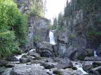
We stopped briefly at a waterfall – Liberty Falls – which was quite pretty. Two guys were trying to dip gold using just their hands in the creek. We decided to have an early dinner at a small diner in Chitina before starting the long gravel road to McCarthy. Sixty miles at 20 mph (it has a reputation for being VERY rough) – well, it’s a good thing sundown is so late here. Eleven miles up the road, at one of only two locations in the 60 miles that claim to be able to repair tires (neither is a gas station – they don’t exist on the McCarthy Road), we ran into Pat Gammon, a ranger at Denali who had managed to get two flat tires – five miles apart – on the rough McCarthy road (it used to be a railroad, and sometimes people pick up old spikes). We gave Pat a ride back to his girlfriend and truck, where he got to explain why the tire couldn’t be fixed and figure out how to get 50 miles out to some place where it could be replaced. I kept my fingers crossed for our tires; the rental car only had a donut, not a real spare.
Jim: We stayed in Anchorage overnight, then drove 300+ miles to McCarthy and the Wrangell-St Elias National Park the next day. We played “flatland tourister” all the way (although we did stop to do a couple short loop hikes). And we stopped at the National Park HQ in Copper Center to pick up a couple bear cans. The Park supplies (loans) them free to those who intend to go into the backcountry. And we certainly did intend to do that.
Wrangell-St Elias National Park is the largest National Park in the US – 14 million acres. It has exactly 2 roads – both of them long, rough, unpaved dead-ends with little or no redeeming social value. The McCarthy Road is one of those two roads - and it’s 59 miles of “bad road”. Those who drive these roads are told to carry at least one and preferably two GOOD spare tires. In spite of that, a lot of people seem to drive out there.Saturday, July 17 – Wrangell St. Elias
We ended up camping last night at a private campground near the end of the McCarthy Road. The road ends at a river, with only a pedestrian bridge available to outsiders. (There is another private bridge downriver that allows local access.) The villages of McCarthy and Kennecott are across the river, about ¾ mile and five miles away. There are shuttles that can pick you up, if you call before you cross the bridge. There are two campgrounds and a couple of B&B’s off the main road. The campground nearest the river was more expensive than the other and very open and rocky. Glacial moraines don’t make for soft campsites. We stopped at a campground about half a mile from the river, which had some trees and a tiny cafe. There are mountains all around, one green tree-covered one and one purple rocky one are visible from our campsite. The long daylight is confusing. In the middle of the night we got up to go to the bathroom. It looked like 6:00 a.m. just at dawn. I went back to bed, slept a couple of hours, woke up – and it was only 5:45. From our campsite, we can see a glacier peeking up above the trees. The road was surprisingly busy last night. I suppose people were drinking in town and then coming out late. I think that in summer Alaskans take advantage of the daylight as much as they can. Otherwise our campsite was a nice peaceful one. There was even a picnic table, which was good since we needed to spread everything out while we packed to make sure nothing essential was forgotten for our backpacking trip.
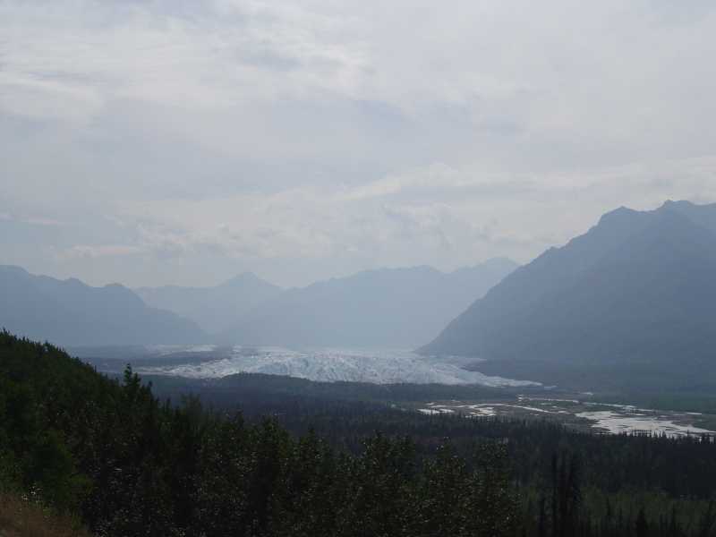
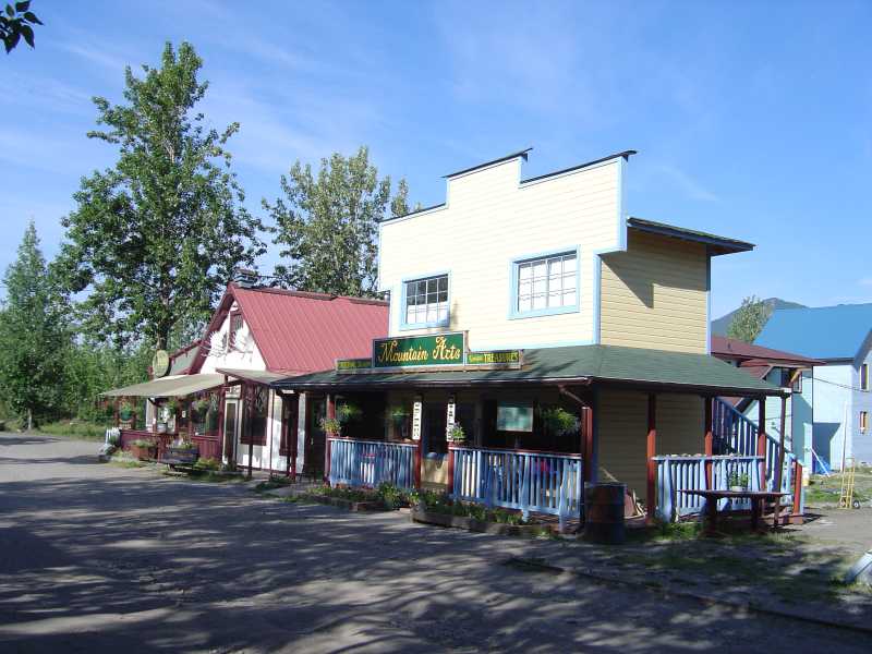
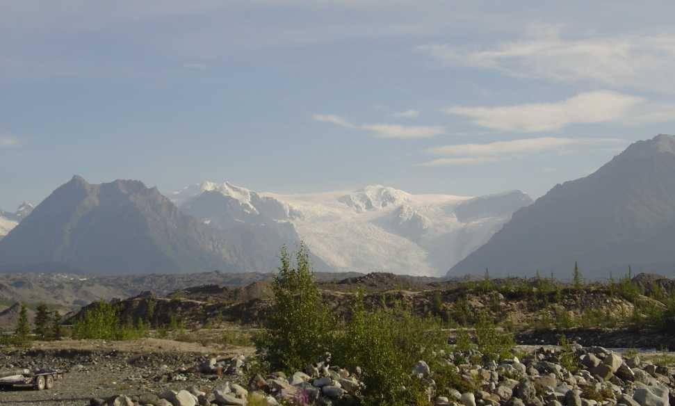
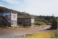
We were up and about early, carefully checking our packs a final time to make sure we hadn’t forgotten anything. We’re not usually this careful, but out here you can’t just hitch to a nearby town if you need something essential. You have to make do or do without. Jim dropped me and the packs off at the pedestrian bridge, then went back to the campground to park the car in the campground long-term lot ($5/day!) There was a beautiful view from the bridge upstream toward the glaciers – Kennecott and Root. They are beautiful. According to locals, this is the first time in a week that it has been possible to even see them through the smoke. We started the long walk to the village of McCarthy (3/4 mile) when a van pulled up and asked if we wanted a ride. We agreed, of course. They turned out to be two sons of the famous/infamous Pilgrim family – Mr. and Mrs. Pilgrim and their 15 children who have been in conflict with the Park Service about access to their inholding. Because there was some local opposition to the Park Service (Wrangell hasn’t been a park for very long, and the restrictions are resented by some) the Pilgrims seem to be well accepted locally, even though they haven’t been there very long either – at least, that was the impression I got. We had a nice chat before they dropped us off in front of Wrangell Mountain Air.
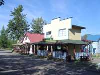
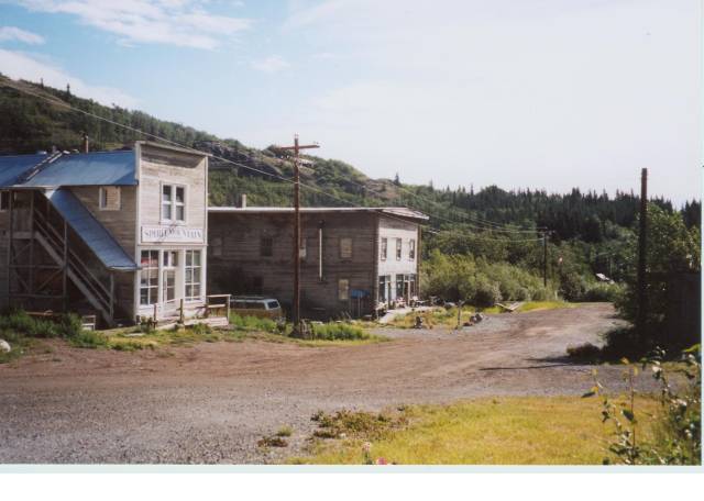
We left our packs on the porch there, then went across the street for a good breakfast at the McCarthy Lodge. We wandered around town for a bit while waiting for our flight. It’s a very small village, but rather pretty and interesting.
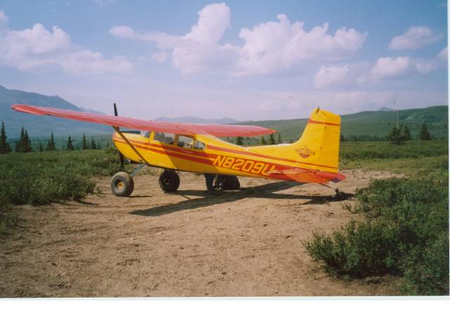
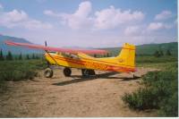
About 11:00 a van took us out to the dirt airstrip. It really had a good view of the glacier. There were several small planes parked around the edge of the airstrip, besides those belonging to the two air charter companies. It seems that a lot of the pilots who fly for the charter companies also own their own planes. We watched our little four-seater land and drop off three men, then fuel up (in the wings) and finally we got to board. I was really excited by this time.
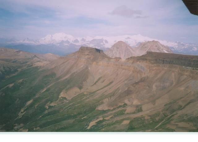
The flight up Chitisone Canyon was gorgeous – about 45 minutes long, high above the canyons. We were actually not that far above the plateaus at 6-7000’. There were glaciers, flat mesas, steep canyons and rocky knobs. One area reminded me of the Grand Canyon. It was spectacularly and harshly beautiful.
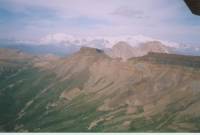
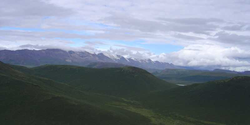
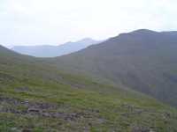
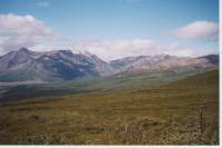
Then we went over the divide and saw the area where we will be hiking. It is quite different: rounded hills and ridges, green, lots of tiny lakes and small creeks. It looked more like Montana than glacial Alaska. It is wide open – good hiking country.
We spent a few minutes after the plane dropped us off taking pictures and getting our gear adjusted. Before we were ready a group of horses came by with a local family out for a week. I was a bit disappointed to see them. We won’t be all alone out here after all. We know of one other group of five girls out in this part of the park, (they were dropped off about 10 days ago), but that’s it. We probably won’t see these people again, but we know they’re out here. We don’t have the entire wilderness to ourselves. Oh well, c’est la vie. If we had taken the Goat Trail, as originally planned, we would have heard airplanes overhead every day dropping off other hikers. This is an improvement. I think this area is big enough to hold 12 people. One of the reasons we decided to hike in the Nutzotin Range is that we read that this is a little visited part of the park. (The other reason is that it seemed like the most hikeable area for people wanting to cover ground. Most of the park is glacial, which means ice, scree and difficult river crossings. I wanted to be challenged, but I also wanted to enjoy our week in the wilderness.)
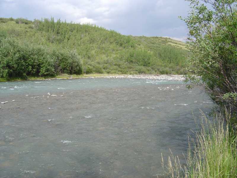
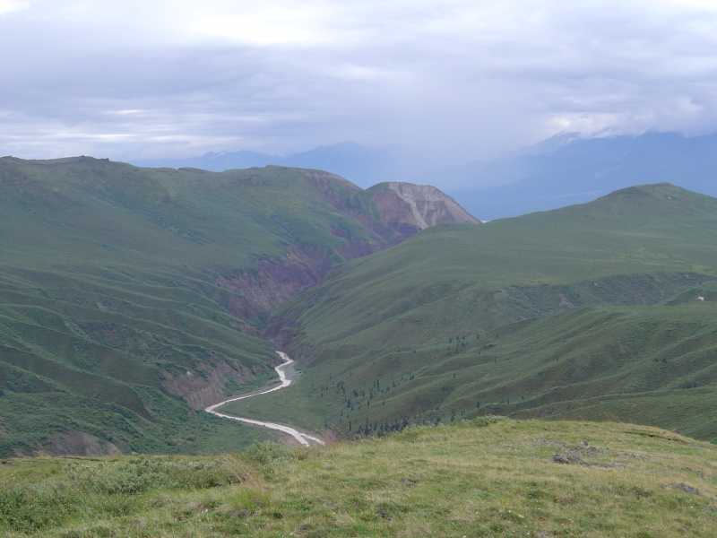
We followed the horses along pack trail from the airstrip at Horsfeld for the first few miles, climbing small hills and winding through waist high willow and alder. There are a lot of wildflowers: mostly fireweed, but also monkshood, lupine and others. The sun is shining but there are thunderclouds all around. There are a few scattered trees--aspen and spruce–but mostly it’s just low brush. The pack trail was easy to follow, especially with fresh tracks to guide us. It was very pretty, despite the haze from the fires. The trail we followed was a higher alternate to an old jeep road that was closer to the creek. The horsemen recommended that we follow it, though it is a bit farther from our main river crossing. The pilot recommended that we not follow the pack trail at all, but instead try to cross Beaver Creek near the airstrip. He had heard that one of the side streams, Klein Creek, was deep and fast. Hikers from two weeks ago said that the water was waist deep. We ignored his good advice and sure enough, I ended up going for a swim. The creek was faster and deeper than it looked from above. There was a sandbar that should have made it easier, but beyond it the water was too fast for me. So we went upstream--still too fast. Then we went upstream some more. About three-quarters of the way across I could feel the rocks under my feet rolling with the water. I couldn’t stay balanced. So I lost it, and took Jim down with me. I got really wet, front and back, up to my armpits. Jim did better. The only damage to my gear was that I lost both water bottles. I also banged up my shin on the rocks pretty badly – no blood, just bruises.
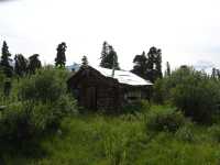
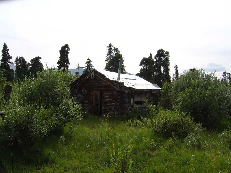
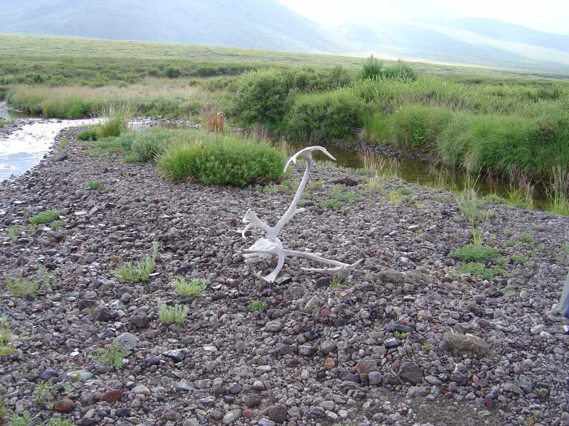
From there it was about a mile or so to the point where we turned off the pack trail and bushwhacked about ¾ mile to the crossing of Beaver Creek. That one, though a bigger stream than Klein Creek, turned out to be easy. It was both wider and shallower, knee deep rather than hip deep. We crossed easily, then bushwhacked through dense willows to a spruce grove with an old derelict cabin. There were lots of antlers and a surprising number of old rusty tools lying about.
From the cabin we bushwhacked through willow and alder to a pretty little pond with a resident beaver swimming around. After looking at the map, we had planned to camp near the pond, but the brush was too thick to allow that. We crossed a section of soft tussocks that wobbled and swayed under foot. It was a little like walking on snow, postholing, except this was soft grass and moss. It felt like we were walking on deep soft pillows that swayed with every step. It was really hard walking at the end of the day when we were tired. You have to be very careful, because if you step on the tussock, it moves and you may fall off, or if you try to step between the lumps, you have to really watch every step and lift your feet high to get over the mounds. You have to take it slow and easy.
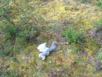
We went further than we had planned, looking for a campsite, eventually stopping about 6:30 when we found a nice little stream with some mossy clearings in the trees. We cooked downstream, 100 yards or so from our campsite. The mosquitoes weren’t too bad. They were biting at Beaver Creek, so we didn’t linger long at the cabin area. From our campsite, we can look up at some interesting peaks and one tiny glacier. We’re tired and sore, but very happy to have found a place where we can stop. We didn’t see much wildlife today, just a few birds and the beaver, but we have seen lots of caribou and moose tracks and scat. There was bear scat in abundance too.
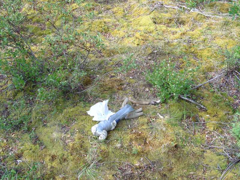
When we went to set up camp after we finished dinner, we discovered that we were missing our tent poles. This is a problem. Tonight we are in a willow grove, so Jim got creative with ropes and we were able to set up the tent, sort of, but I don’t know what we’ll do the rest of the week when we are above treeline. They either fell out of the pack when we fell in the creek or were left on the plane when we unloaded them.
Jim: This morning we walked the half-mile from the Glacier View Campground to the McCarthy Creek bridge. It’s a footbridge – and it’s the only public access to the town of McCarthy and the airstrip that services 14 million acres of backcountry. After a good breakfast, we finally got the packs loaded into a bush plane about 11 am, took off and headed for the Horsfeld airstrip, which is the insertion point for the Nutzotin Traverse (can you say Newt-zoh-tin?) The Nutzotin Traverse is “sorta” what we intended to do. It’s about a 30-mile trailless “route” of mixed Alaskan tundra, taiga and mountain goat country, starting at Horsfeld and ending at Solo Creek. Nearly all of it is above treeline.
The bush plane left us at the Horsfeld airstrip about noon, after which we followed the advice of both the pilot and the horse packing entourage that showed up just after the pilot took off – we changed our route to take a higher elevation and supposedly easier crossing of Klein Creek than the one we’d planned on. Didn’t seem to matter though – we still went for an unplanned, unwanted and unwelcome swim with our packs - and lost 2 of our 4 water bottles in the process. And this was in an area where previous hikers had complained about the lack of “good” water – and we were warned that we should carry as much water as possible. But somehow we never had that problem. The second creek crossing that day went a lot better, the third one was dry and we camped at the fourth creek (about 8 miles from Horsfeld).
This was when we discovered that our tent poles were missing. Ooops!!! Initial speculation was that we’d lost them when we lost it and went swimming at the first creek. But that didn’t fit somehow. We finally decided that they’d fallen out of the pack in the bush plane. Either way – there was no way to get them back. So you deal with it. That first night we were lucky enough to be in trees and could use them to tie the tent up. Good thing we did cause it rained on us that night. But that was the last time we had trees to use like that – and it did rain every night.
Sunday, July 18 – Wrangell St. Elias:
As we were packing up, after a surprisingly restful night in our saggy claustrophobic tent, we heard a plane fly overhead. It circled around and we waved at it. It circled again, lower, and wagged its wings. An arm appeared and dropped something out the window, about 20 feet from us. Sure enough, it was our tent poles, wrapped in a pair of old gloves and a lot of duct tape. Halleluia! We found out later that our pilot discovered the missing poles as soon as he landed, but couldn’t get back to us as he was fully booked all day. He and his wife took his private plane on his day off to try to track us down. Given that it is a 70 mile journey from McCarthy to where he dropped us off, we were really grateful. Especially since it rained last night and we know it is likely to rain on us again sometime in the next four nights.
We spent the morning climbing along our creek. This area is very green with rounded treeless hills. Sometimes we followed game trails, sometimes we just made our way slowly through the willows, alders and tussocks. There are very few trails in Wrangell St. Elias – only the tourist paths near Kennecott are real trails. There are some pack trails in various places (i.e. from a couple of lodges at Horsfeld and Solo Creek to the old mining district of Chisana) but most of the travel is cross-country. From the airstrip at Horsfeld where we were dropped off to the airstrip at Solo Creek where we will be picked up is about 25 miles, as the crow flies. We, of course, aren’t crows. How we chose to travel between the two points was a matter of much discussion. Our final route will be somewhere between 35 and 40 miles, plus zigzags through the brush. Not much distance in six days if we were following trails, but a good hike in this kind of country.
At one point we almost started up a side stream that I thought was the right one (second stream on the left, according to the map) but Jim got out the GPS and sure enough, we were about a mile too early. We have a big climb over a ridge this afternoon. We aren’t moving very fast, but the hope is that up high the footing will be better, with less willow and alder, more dry tundra. It is grey and hazy again, with big black clouds all around. We got sprinkled on a couple of times this morning and the temperature dropped. It rained a few drops last night during a storm with lots of loud thunder and lightning but very little real rain. The area is very dry, for Alaska. Some spots are still very wet underfoot (wet tundra is basically swamp) but the moss is much drier than normal. It crunches.
It rained and hailed lightly off and on for a couple of hours in the afternoon, finishing up, finally just as we found a campsite next to Ophir Creek. I got a bit chilled, especially when the wind picked up, but not hypothermic.
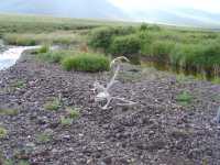
Our day consisted of climbing up along one creek all morning, crossing a wide grassy plateau with beautiful views of ice-capped mountains in the distance and then descending along another unnamed creek to Ophir Creek. Tomorrow we’ll do it again, but steeper. We had some good steady climbing with one short steep pitch. The only wildlife we saw were some ptarmigan playing injured and two caribou (no horns) down by Ophir. There were some other birds and some swallows, but it was very quiet. We saw several moose and caribou antlers buried in the grass. The white shows up well against the green and they are very large.
We’re both a bit tired and sore, but all in all, we’re doing well. The sun is shining again, the tent is up (hurray!) and we can now relax and enjoy the evening.
Jim: Just as we were picking up the packs to start walking, we heard a plane. It was Don, our pilot. He’d found the tent poles late the previous evening. So the next morning he used his own plane, his own gas and his own time, dragged his wife along as a spotter – and air dropped them to us. Trail magic exists – even in the wilds of Alaska. He saved us a whole lot of misery because we had rain every night we were out there.
Monday, July 19 – Wrangell St. Elias:
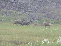
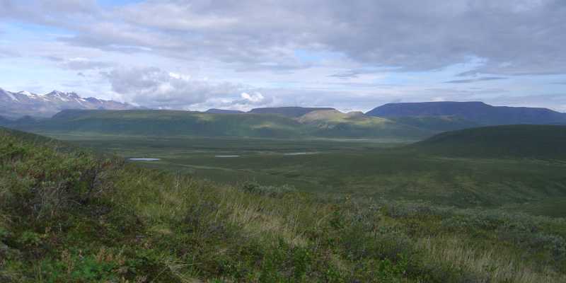
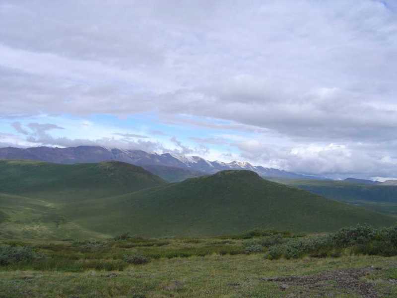
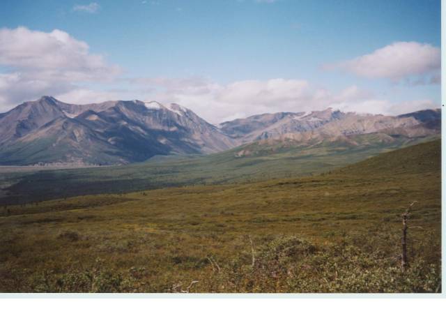
We had several brief rain showers during the night, but woke to cool sunshine. Our route was pretty straight-forward, down Ophir Creek about two miles then up a side drainage to the plateau north of Fogenbera Pass. The only question was which was the right creek, and we got that right. We were able to follow a casual/pack trail most of the way along Ophir Creek. The brush was very dense at the bottom of the side creek with shoulder-high willow bushes. We got soaked from the brush. We followed winding game trails through the willows but as we gained elevation the brush got less dense and less tall. The upper canyon was mostly alpine, with easy walking as we climbed. The last 100’ were over rocks, but solid ones, not loose talus. That was a relief. At the top is a big plateau, about half a mile wide in places and several miles long. There are gentle rises, but mostly it’s flat and open, covered with grass and wildflowers. As we came over the rise to the plateau I spotted a family of caribou a couple of hundred yards away – three adults and one baby. They were curious and approached to about 50 feet, then circled around us to see what we were. We waited until they got bored and moved off, then we sat down to enjoy lunch. It was very cloudy and cold. We expected it to start raining any minute. I wish it weren’t so hazy, we can’t see the glacier-covered ridges we saw yesterday at all. Everything is shades of gray, except the green grass and scattered wildflowers.
We got lucky – the rain held off as we crossed the plateau to Fogenbera Pass. I wanted to go to the pass simply because it was one of the few named places on our map. Why did that pass get named, while all of the others were nameless? The bigger peaks are named, but not all, and most of the streams are also nameless. It’s different. We decided to change our planned route along the ridge after Fogenbera Pass as it would have required a lot of extra climbing up and down and it would be several more miles until we reached water. We were already tired and ready to stop for the day, but didn’t want to camp on the plateau because of the weather. There was water up there and some lovely flat meadows, but we would be really exposed in a bad thunderstorm, and one is building. So instead we descended a watercourse below the pass. It was steep (we dropped 400’ in the first .2) but not as scary as I expected because there was vegetation all the way to slow us down. There are lots of different alpine flowers up there – I had fun looking for them. Some are dwarf versions of wildflowers I know from elsewhere (like the Indian paintbrush) and some are uniquely alpine plants. We descended the U shaped valley for about a mile and then set up camp in an open spot. There are lots of marmots, ground squirrels and picas around here – the holes are everywhere and the whistling is constant. We can see where bears or wolves have been digging at the marmot/ground squirrel holes. No wonder they are anxious. One marmot we saw was much paler than the ones we saw in Colorado and Montana –maybe winter coloring? We’ve seen lots of bear scat but no fresh tracks. We did see a fresh boot print though. That was a surprise.
Tuesday, July 20 Wrangell St. Elias:
We had a peaceful night with only a few sprinkles. We headed downstream, keeping high above the willows, then crossed the ridge to another stream valley and up to another ridge. We spent a lot of time just sitting and scanning the land, looking for wildlife. All we saw were ptarmigan, first a big flock of 16 birds and then another pair. The walking was easier than we expected except for the last drop down to North Fork Creek. Water was a bit of a problem. We started with only two quarts between us (since I lost the other water bottles when I fell) but the next creek was stagnant and North Fork was very silty. The crossing was easy as it was only a foot deep, but you couldn’t tell since you couldn’t see the bottom. We ate lunch on a sand bar after fording the creek. This will be a short day since once we leave the next creek there are several waterless miles of ridgewalking. Besides, we are in no hurry. We are ahead of schedule (I know, what schedule?) and there is no point in getting to the airstrip early. The plane won’t be there. So today will be short, with lots of breaks. We both woke up in a really good mood, feeling rested and relaxed. Despite the smoke haze, it’s pretty and very peaceful.
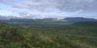
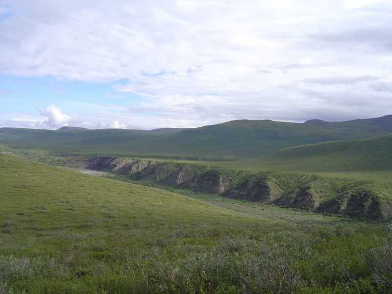
LATER: The mile or so from North Fork to our little side creek ended up with some of the roughest walking all day. We climbed up above the river and ended up wading through knee high alder bushes. Usually we have been able to find game trails to follow, but they were very scarce today. Finally we climbed to the ridge top and were able to follow grassy patches across to the next creek. The water there wasn’t silty, but it was yellow, probably draining from swamps up higher. We drank it anyway. We filled our waterbag with nine quarts and climbed up to a ridge about 100’ above the creek. There are lumpy grassy patches up here between the alder clumps. The views are good, looking across a neighboring ridge to several ridges beyond and the glacier-capped divide beyond that. It is still gray and hazy, so it won’t photograph well, but it is very pretty. We’re on a wide green ridge, which we’ll follow for the next few miles up and down over several high points. The view down North Fork was a nice one with big cliffs and a wide sandy valley. The fireweed on the cliffs made them look red. The valley was quite wide, with high cliffs on both sides and a winding creek at the bottom. Earlier we looked out at several distant ponds in the area known as Solo Flats. We don’t plan to go there. One lesson we learned quickly is that, in Alaska, if possible you hike high. Down low it is either swampy or brushy or both.
Jim: The last couple days consisted of: climb the mountain; look for wildlife; are we where we think we are? (we were); it’s raining again; wow, did you see the size of that caribou?; let’s take this ridge and see where it goes; my feet hurt; holy mackerel, this is beautiful; I’m hungry; I’m sunburned; do we need to filter? (we didn’t); how much film do we have left? (enough); let’s hope the digital memory holds out; let’s camp down there; so where did we put the bear cans last night?; what’s for dinner?; Dang, this pack is heavy!…… etc.
We've climbed over one un-named ridge after another, modifying our route as we went. The following is an appropriate quote from “Mountaineering: Freedom of the Hills” –
The wilderness awaits those who have learned the skills of routefinding and navigation……In medieval times the greatest honor a visitor could receive was the rights of a citizen and the freedom of the city, sometimes even today symbolized by presenting a guest with the “keys to the city.” For the modern alpine traveler, routefinding is the key to wandering at will through valleys and meadows, up cliffs and over glaciers, earning the rights of a citizen in a magical land, a mountaineer with the freedom of the hills.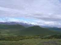
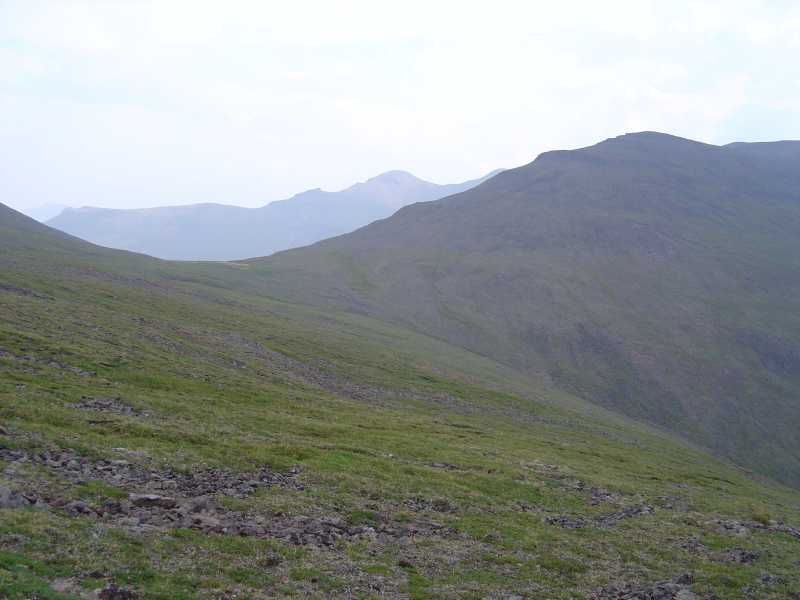
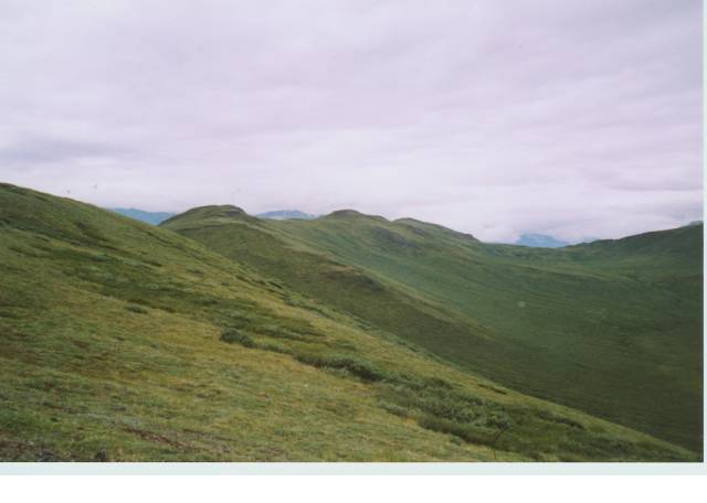
The country is beautiful – green, rolling, un-named ridge after un-named ridge, with stark, jagged mountains in the background interspersed with glaciers, icefields and wild, raging glacier-fed rivers. No roads, no people, not even any aircraft. The wildlife was plentiful – although VERY difficult to spot, the mountains are tough, the hiking is tougher (scrub alder and willow are hard, but tundra is even harder to walk on/through), the stream crossings are difficult, the climbs are long and hard, the views are fantastic, and the wildlife is REALLY wild. It’s REAL wilderness - not the ersatz stuff most people think of as “wilderness.”
Most of the streams, mountains, and passes where we were hiking aren’t even named. One pass stood out on the map because it was the only named feature on that whole ridge – Fogenbera Pass. So obviously we had to go there to see why - even though it was well off our original planned route. We still don’t know --- but we were there. OTOH, the only time we followed our “planned route” was on the 5th day – other than that all the planning we’d done was just so much firestarter – except that there was a fire ban and we couldn’t even get rid of it like that.
Wednesday, July 21 - Wrangell St. Elias:
We had a terrific hike this morning. After a heavy rain in the middle of the night, it was nice to wake to sunshine on our faces. That didn’t last, of course, but it was a good way to start the day. The air was clear and we could see the glacier-capped mountains quite clearly. As we ate breakfast, I spotted a caribou on the next ridge. He was the first of several. Later we saw a mother and baby, then another lone one, then two young ones that danced around a bit, full of curiosity about us.
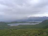
The hike was terrific, following a ridgeline up and down with beautiful views in all directions. The walking was fun in and of itself, the views were a bonus. We could see big Solo Lake, the braided White River, North Fork, many little ponds and snow capped mountains. Rain covered the mountains off and on and we got sprinkled on from time to time. The cold wind blew continually, but we got occasional breaks among the rocks along the ridge. We saw several golden ground squirrels and a marmot. Still no bears, but the caribou spotting is fun.
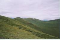
The cold wind and light rains drove us off the ridge finally. It isn’t fun to linger when the wind is trying to knock you down. We did finish our semi-circle before dropping down 500’ to a little valley with four small ponds. We found a sandy spot to set up the tent, staking it down to make it stable. According to the GPS we’re only 2.5 miles from where we camped last night and only 2.5 from the airstrip where we’ll be picked up tomorrow. It’s a leisurely hike, at least the last half is. Our campsite is another beautiful one. The ridge we hiked circles us on two sides. To the west are tall rugged mountains with glaciers high atop some of them. The others are blue, green and purple jagged ridges. The clouds today hugged the mountaintops so you couldn’t actually see the peaks. There were glimpses of glaciers though. I thought this hike wouldn’t be all that spectacular, but today certainly was. And the green rolling ridges and open plateaus have their own beauty. This has been good. We’ve had lots of time to sit and look out, scan the ridges with binoculars, listen to the wind and the birds and marmot whistles, even read in the late evening light. This is not our usual kind of hike, but it is really relaxing.
Jim: This day was a long, easy, open ridge walk with wide open views – at least when the clouds didn’t close down on us. When they did, it was very cold – and very windy. But when it cleared a little, we could see a large part of where we’d been for the last 4-5 days, as well as where we were going, and into the raw jagged ranges all around us.
Thursday, July 22 McCarthy:
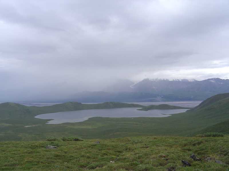
After another rainy night, we woke to sunshine and wispy clouds. We were in no hurry, having no set plan for the day, so we didn’t leave our little basin until 10:00. We climbed back up to the ridge, then down and around through thick brush to Solo Lake, then up to the ridge on the far side of the lake. The views were good, though clouds still hugged the glaciers to the south. There are two really spectacular snow-covered mountains half hidden in the clouds. We spotted some hikers at the lake, though they didn’t see us high above them. After about two hours we turned around and began the two-mile bushwhack to the airstrip. It was some of the roughest travel we have done through here – the willows were 7-8’ tall, the alder was waist high and there were spruce trees to add blowdowns to the equation. Somehow we ended up right on target.
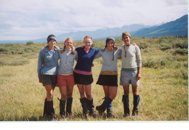
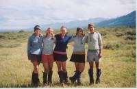
We ran into the group of hikers we had seen earlier. They were five teenage girls from Y camp in Minnesota out for a 34 day wilderness adventure. They are really taking their time though, with extremely heavy packs and lots of rest days. (I asked if they had ever heard of Ray Jardine – they hadn’t.) Their first resupply is tomorrow, after 18 days of hiking. They each carry two bear canisters – that’s five or six pounds of dead weight in itself! They did the same route, more or less, in 18 days that we did in six days. And we wish we had that much time!!
We joined the girls for lunch, gave them a little extra food that we had, then crossed the creek to wait for our plane. We were early so of course the plane was late. It was rather worrisome. The wind was blowing steadily and there were clouds up in the mountains – would we have to spend the night here? As the afternoon drew on, the storm over the pass became obviously worse. Although we were sitting in sunshine under blue skies on the airstrip (getting fried), along the divide the clouds hung low. We were starting to look for a campsite and thinking about dinner when the plane finally arrived at 5:30 or so. It turned out that it wasn’t the weather that delayed Don--he didn’t even know about the thunderstorm--but a previous group had had some problems which took up time. (They arrived late in McCarthy, then had more people or gear than expected so he needed to make three trips to drop them off instead of two, and then they changed their destination when they decided that the eldest was not up to the rugged trip they had planned.) Don had brought the girls’ food drop, saving a trip the next day, so by the time they sorted through the bags and collected garbage and filled their fuel bottles it was 6:00. The horseman we ran into last week showed up too to talk to the pilot. He evidently knows the park extremely well. The girls had asked him if he would be willing to help them cross the White River. Evidently river crossings are easier on horseback than on foot. He said he didn’t have time though, and suggested they ask the charter service to ferry them across the worst of the braided river. The guidebook says that it is possible to hike from Solo Creek to Skolai Pass, but Russell Glacier and the water it emits make a formidable barrier.
The flight over the mountains was beautiful, though we weren’t as excited as on the way out. I think we were tired. Sitting and doing nothing for three hours is exhausting, especially when you spend it worrying about being abandoned in the backcountry. (I remember hearing about folks who were in the backcountry in Alaska after September 11 who couldn’t be flown out because all planes were grounded for a week. What they must have gone through!) The clouds were low so the views weren’t as spectacular as we had last week and I was more concerned with wondering how the Y group was going to get past the glacier and glacial rivers as we flew over the pass that they planned to hike through over the next week than in taking pictures through the scratched glass of the windows. It was not a hospitable area below us. There were a couple of beautiful vertical rainbows to photograph though.
By the time we landed and waited for a bus to take us back to the bridge and drove out, we knew it was too late to drive the three hours of rough road plus another 60 miles of paved road to the nearest motel. A shower would have to wait until tomorrow. We headed back to the campground, which had a few empty spots and a barbeque where we were able to get a couple of big fat burgers with cold sodas – so we’re content. We are really dirty, but at least we have a safe place to spend the night and full stomachs. We got really sunburned and dehydrated from sitting in the sun by the airstrip all afternoon. The cokes tasted awfully good.
Jim: We woke today having seen no human sign except one single boot print up on a ridge since the horse packers just after we’d been dropped at Horsfeld. So - of course – this was our day for “resocialization”. Sorta. We were supposed to be picked up at the Solo Creek airstrip at 3 pm so we were fed, packed and hiking early. Lots of time to cover the 3 miles to the airstrip from our campsite – right? Well – not really. Dontcha know we just couldn’t resist going to see Solo Lake and then doing another ridge walk to get that fantastic view of Solo Lake to the East, the braided White River to the South --- and the un-named ridge we’d walked yesterday stretching off to the North. Beautiful. Unfortunately, it was also too big for the cameras to be able to capture it. It also put us further from the airstrip than when we’d started that morning. So at noon, we still had over 3 miles of bushwhacking through the taiga to get to the airstrip. Talk about a scramble.
Somehow we made it with 45 minutes to spare. And as the airstrip hove into view, so did the girls. Yep – I said “girls”. A group of 5 teenage girls from a YMCA camp in Minnesota who were out there for a 34 day trip in the wilderness. They’d started at Horsfeld and taken 18 days to do the same 30 miles that we’d intended to do in 6 – except that we’d stretched it out to about 50 miles by “exploring” different routes and ridges. And they’d stretched out their “time-on-trail” by carrying 19 days of food for the first leg of their trip. They each had, not one, but TWO bear canisters. And very, VERY large packs. We had lunch with them while we waited for the plane – and then we advised them to go read Ray Jardine.
Of course, after our scramble to be on time for our pickup, the plane got there 3 hours late. All of us sat there having visions of having to walk the 70 miles out of there – and between the seven of us, we couldn’t have scraped together enough food for a single day. But the plane did finally show up – the girls got their resupply, we got back to McCarthy, and we got to thank Don (our pilot) for airdropping our tent poles. And then we got to devour hamburgers and cokes back at the Glacier View Campground.
Home | Links| Trail Journals |
The Thruhiking Papers |Nutzotin | Denali | Kenai
Created: Fri, 03 Sep 2004
Revised: 30 Sept 2016Copyright © 2004-2016 Spirit Eagle