|
 |
 |
 |
|
|
|
|
|
June 8: Bakersfield
Today was a transition day. We left our motel at 10:30 to catch a bus to Lake Isabella, where we ate a quick lunch at MacDonalds, then caught a slow bus through the mountains to Bakersfield. It was a pretty drive, winding though the hills. We got off at the train station, met a couple of men just released from prison (the prison bus dropped off about 20 men dressed in white sweats), then called Enterprise to pick us up. We decided that instead of catching the first plane east, wed spend a week touring and see if Jims knees improve, so we rented a car, found a nice room at Days Inn, and settled in for a restful night.
June 9: Sequoia National Park
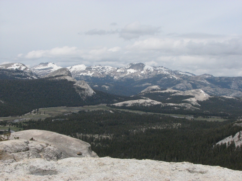
Playing tourist feels odd, after the past month of hiking almost every day. We ate breakfast at the motel, then headed north to Sequoia National Park through the farms of the Central Valley. Lots of orchards, vineyards and cornfields lined the highway. It was so smoggy we couldnt even see mountains until we were less than 20 miles from the Park. Weve hiked through SEKI on the PCT, but never visited the front country, so we decided to take advantage of this break to play tourist. We dont know whether Jim will be able to hike again in a few days, so were staying in the area until we find out. Neither of us wanted to hole up in a motel for a week or two, so renting a car and wandering seemed like a good idea.
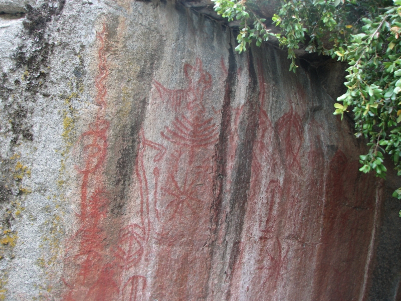
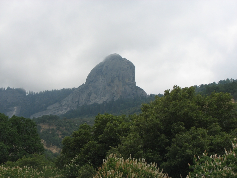
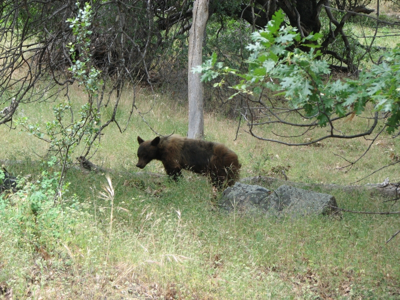
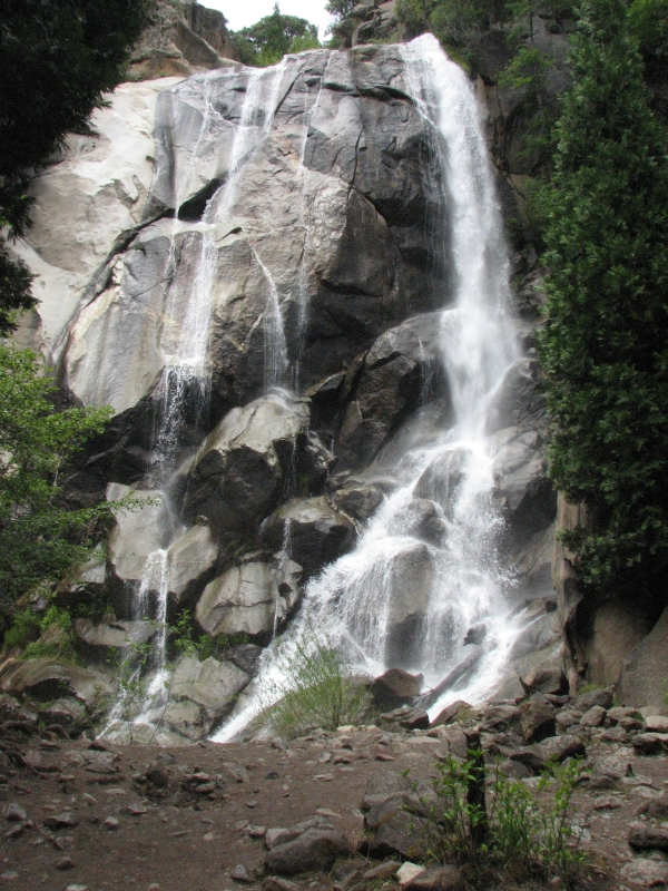
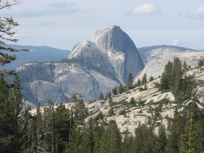
In Sequoia, we stopped at the Foothills Visitors Center, then headed up the scenic road. There are some nice pictographs at a picnic area that we photographed. It is storming in the high country, so views were limited, but Moro Rock was a distinctive landmark. The road twists and turns, switch-backing from 2000 to 6500. We stopped to photograph a bear grazing beside the road. A broken down tour bus stopped traffic for a long while as the tow truck attempted, in vain, to load it up. We ate lunch while we were waiting. The tow truck was too short to accommodate the bus and the road is quite narrow and twisting, so they werent happy about having to pull the bus behind the tow truck. One of the tour bus passengers said they had been waiting three hours. What a disappointment for them! Instead of touring the park, they had to stand beside a road waiting for assistance.
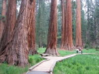
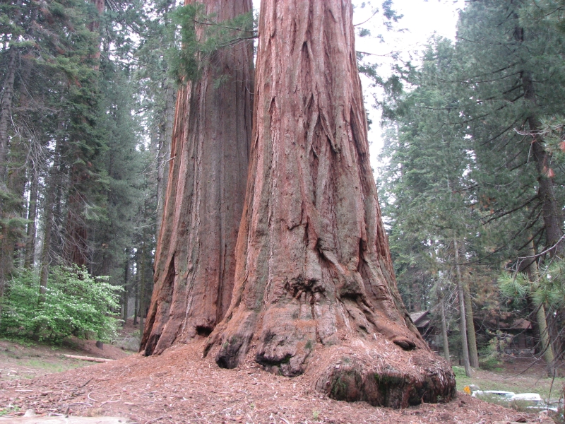
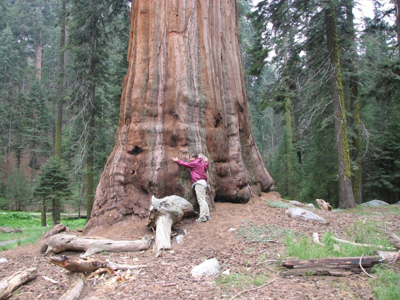
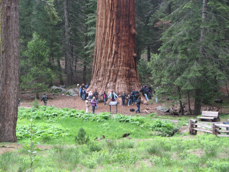
Jim and I did a 1 ½ mile hike through the Giant Forest, circling a meadow. The Sequoias are really huge up to 275 tall and 107 in circumference. They can live 2000-3000 years, though most of the big ones we see are about 1500 years old. They dont taper at the top the way most trees do, so they look really massive. Sequoias continue to grow in girth every year, even after they stop getting taller; some of them are enormous. We drove through the tunnel tree a dead tree lying on its side with an eight foot tall tunnel through it. I had intended to walk around another big meadow, but our road delay made me feel a bit pushed for time. We did go visit the General Sherman, the Parks largest (in volume) living tree. It didnt actually look that much bigger than the others, though it is 104 around the middle. We got a tent site at the large Lodgepole Campground. The tents are crowded together, but so far it seems pretty quiet. We got an expensive burger at the snack bar and a couple of cheap beers at the grocery. It is cold (40s) and clouds cover the ridges beside us. I think Im just as glad not to be in the high country right now. Its supposed to drop to 35 degrees down here; it will be in the 20s up on the PCT. I think there are a few hikers who really weren't prepared for this change in weather. A thruhiker last week set off a furor when she got caught in a snowstorm, panicked, thought she was going to die, and sent off a 911 call on her SPOT device. Her family flew to California and a full search had begun when she emerged on her own a day later. She was apologetic and embarrassed, but she also admitted she was unprepared for the bad weather. Evidently the SPOT reported her location in the wrong area and then didnt notify Search and Rescue when she cancelled the SOS. It was a mess. Another PCT hikers family called out SAR when his SPOT stopped transmitting and the Sheriff ended up tracking him down on the trail, unhurt, via helicopter. Another hiker left the trail because of minor injury, didnt notify the family that they were holed up in a motel, and the family got alarmed because they didnt call when expected. Sometimes technology is more trouble than its worth.
Ive enjoyed our day in Sequoia. There are too many people, but its June, so I dont suppose thats all that surprising. A group of kids screamed and yelled the whole time we were walking the Big Trees Trail. The half mile from the parking lot to General Sherman was a multi-lingual parade. Im hoping tomorrow will be clearer and more peaceful. I did enjoy seeing the bear today though. Each campsite has its own large bear box. A ranger said the Foothills Campground had a problem bear yesterday, but Lodgepole CG hasnt had a problem for a while.
June 10: Kings Canyon
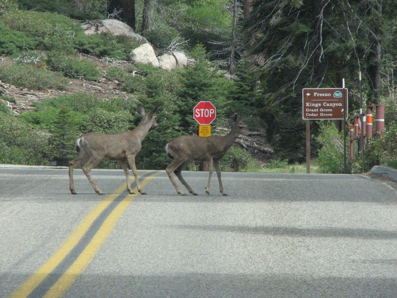
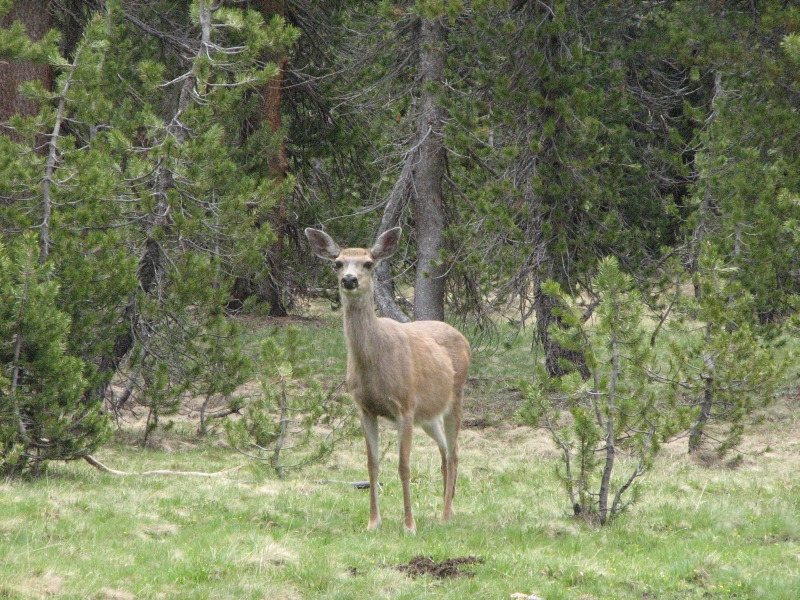
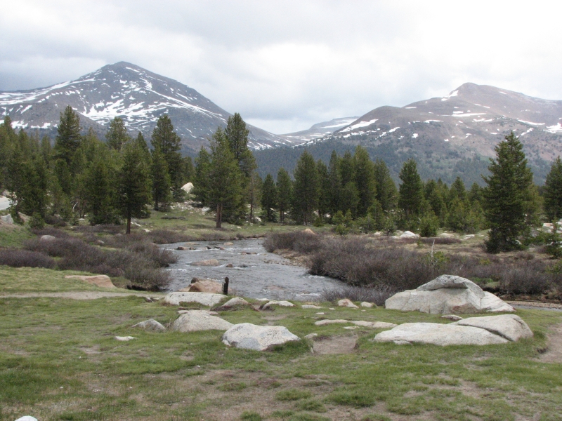
We slept well, despite the crowded campground. The murmur of Spanish voices from the next site put me right to sleep. It was cold this morning, so we slept late, which was nice. The road from Sequoia to Kings Canyon was nearly empty. The clouds and fog prevented much in the way of views, but we enjoyed driving through the dense forest with wildflowers and four deer along the road. General Grant Tree was a half mile walk through sequoia and cedar forest. Its another huge tree: 40 across, 107 around and 270 tall. Supposedly its the third largest tree in the world.
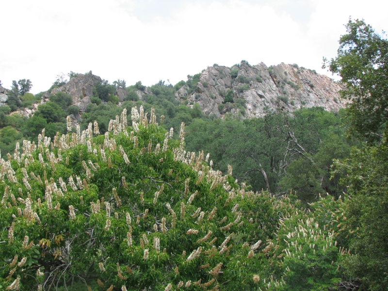
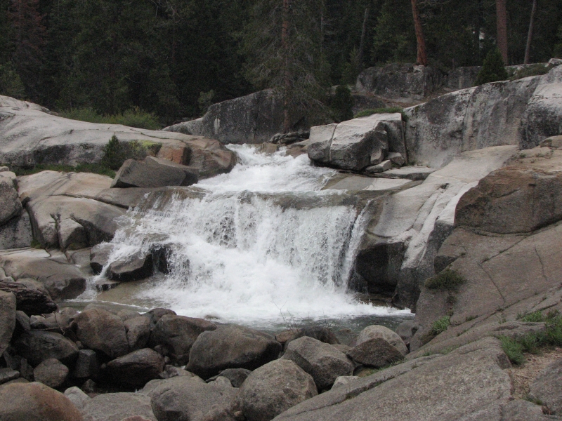
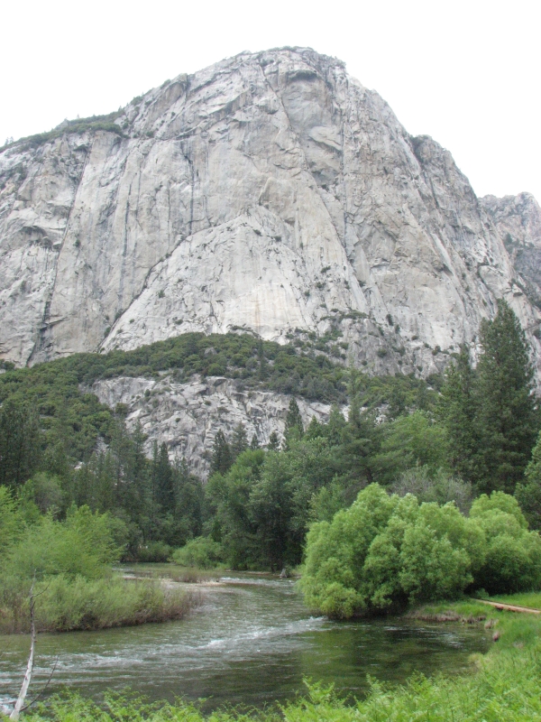
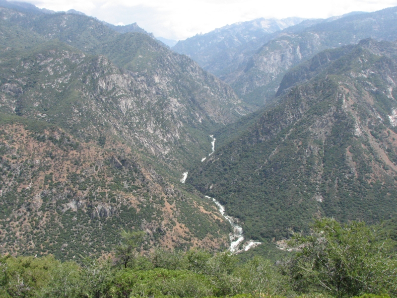
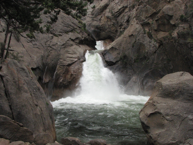
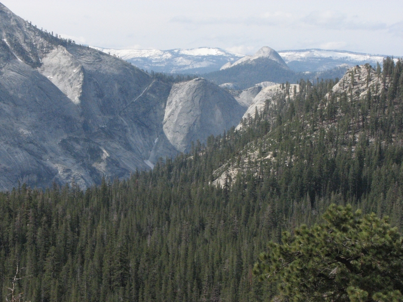
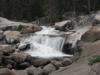
It was much quieter and more peaceful today. Kings Canyon has a long scenic drive with views of the King River Canyon. The river is turbulent green and white water. The canyon walls are sheer gray granite. The trees are pines and cedars for the most part. The road zig zags steeply from 6000+ to 3000 then back up to 4500. Part of it follows the river, with occasional nice waterfalls. We ate lunch near the end of the scenic drive, then I went on a short 1½ mile loop around Zumwalt Meadow. Jim read, resting his still very painful knees. It was a pretty drive and a nice walk, albeit too short. From Kings Canyon, we headed west to Fresno, where we found a motel room, got Jims broken glasses fixed, and enjoyed a quiet evening reading and watching TV. Tomorrow we head to Yosemite.
June 11: Yosemite
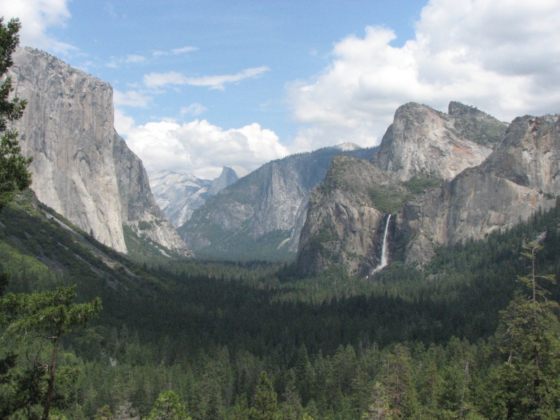
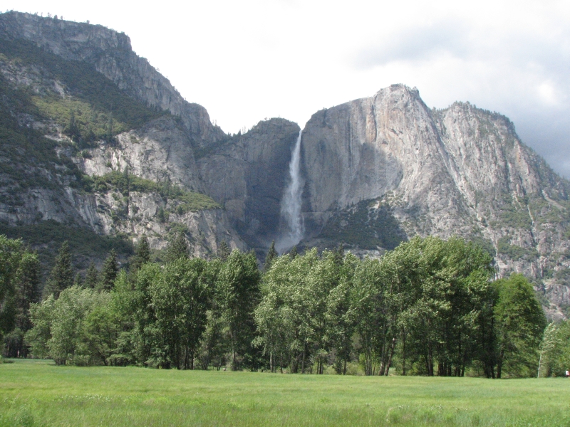
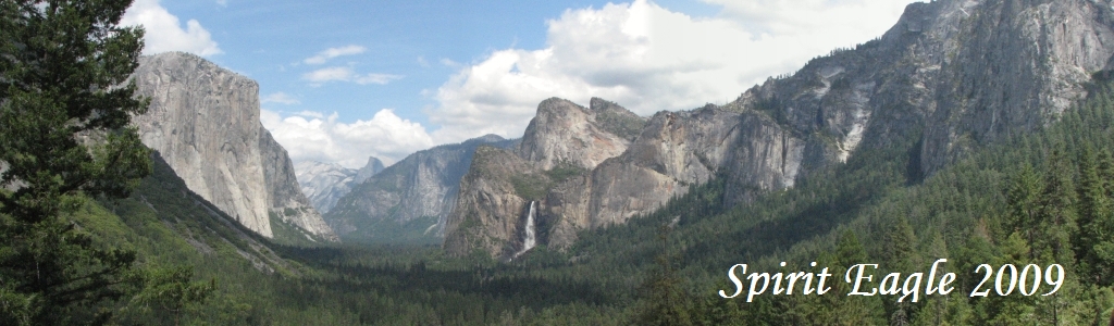
We wanted to visit a used bookstore, so we wandered around Fresno until it opened at 10:00, then didnt manage to leave town until after 11:00. That really limited our time in Yosemite, especially since we needed to stop for gas, groceries and lunch on the way. We drove to Mariposa Grove, but it started to rain so we just kept driving into the Park. I figured we had seen enough big trees; it wasnt that important to see more. The rain didnt last, but clouds and haziness did. We decided against the drive out to Glacier Point since we assumed that views would be limited due to the low clouds. There was a nice view of the valley and Bridal Veil Falls from Tunnel Viewpoint and some good views of the waterfalls and meadows from the road, but we didnt stop again except to take a picture of Yosemite Falls.
Our first priority was to get a campsite and there we were disappointed. The Valley campgrounds were all full, with a long waiting list, and the Tioga Road campgrounds werent yet open for the season. We asked for suggestions and the Ranger recommended driving out of the Park into the national forest to find a spot where we could set up our tent. That sounded really good free camping and no crowds. We got a bit anxious about how long it would take to find a place to camp, so we didnt linger in the valley. I had hoped to hike a bit, but it was very crowded with hordes of people, cars and bikes everywhere. We decided to go look for a campsite, and then I could go for a short walk in solitude. A few miles outside the Park, we turned off on a side road, found a nice place to park with a good flat spot and got settled.
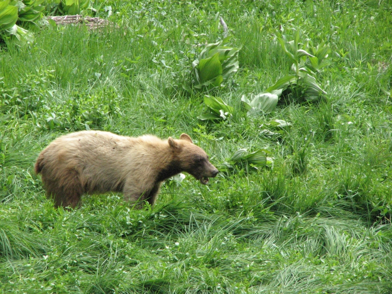
I walked up the road for a bit while Jim read in the car, safe from the hungry mosquitoes. My walk was very quiet and peaceful, with birds singing and sunshine filtering through the cedar and pine needles. Just before we left the park, we pulled over when we saw a crowd, with cameras, looking at a small meadow nearby. Sure enough, there was a blondish black bear hungrily grazing on plants in the meadow. A ranger stood by with a paint gun in case the bear approached the crowd (or maybe if the crowd approached the bear?) while others kept traffic moving as best they could. The bear sighting made up for my disappointment at not being able to spend more time in the valley. Yosemite is beautiful with the huge granite walls, many waterfalls and green meadows and forest, but June isnt a good time to visit way too many people.
June 12: Independence
I started the day happy, pleased at our peaceful campsite and the quiet evening there. Then somehow my mood changed completely and I became really depressed and upset. Driving to the store at Tuolumne Meadows reminded me vividly that we were supposed to be walking, not sitting in a car driving there. I got very unhappy thinking about the ruin of our PCT hike. Im not ready to stop hiking. I dont want to go back east. I dont want to lose the rest of the summer, waiting for Jims knees to heal. But we have no choice. He cant walk. Just standing hurts. I tend to forget about his age, but its a factor. Jim doesnt heal quickly any more. But I hate the end of this hike. I dont want to be stationary, settled, buried in suburbia. I was so happy to be thruhiking again, and losing that is really upsetting.
We got to Tuolumne Meadows and saw two PCT hikersers at the store that we knew slightly, Froggy and Snorkel. They had jumped ahead to pick up a pack that was mailed here, then they planned to hitch back to Lone Pine. They said there were at least 50 hikers at Kennedy Meadows when they were there, waiting for the weather to improve. Not a surprise. I wish we had been among them!
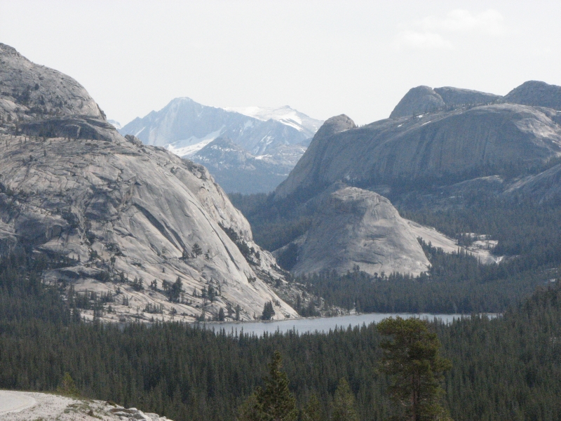
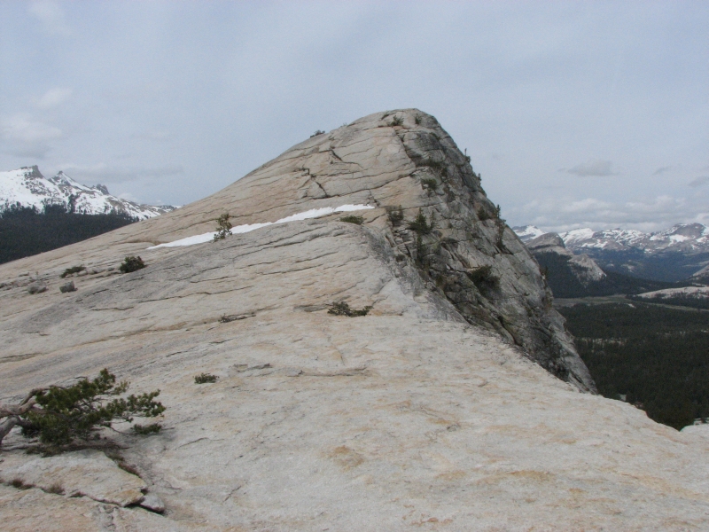
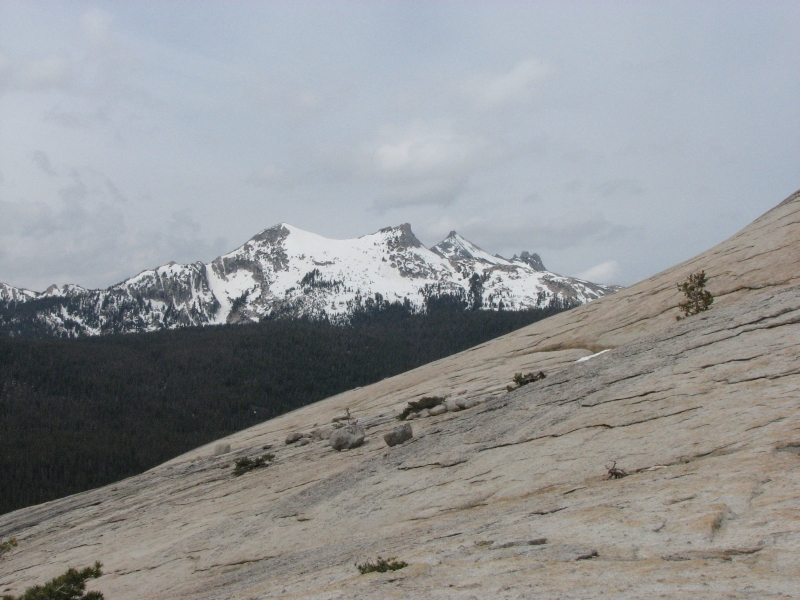
As we drove, we saw a 360 degree halo around the sun. That was fun. I went on a solo hike up and around Lembert Dome. I had the trail to myself on the way up, then ran into lots of people on the way down. It was a fun climb with a sheer rock dome at the top and 360 degree views. I spotted three deer on the trail. We saw two others on the road and several more grazing in the meadows. I needed the reward of a good view and moderately strenuous climb. Yesterdays walk was exercise only, not as satisfying as seeing the peaks and domes from the top of Lembert.
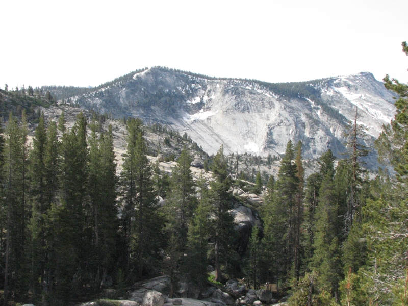
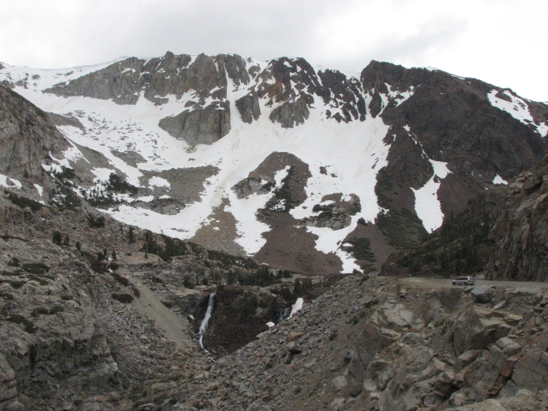
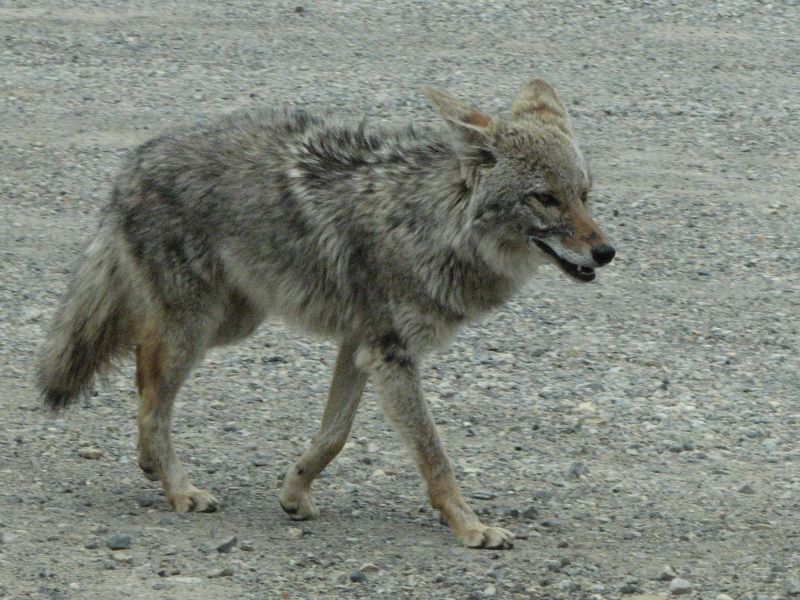
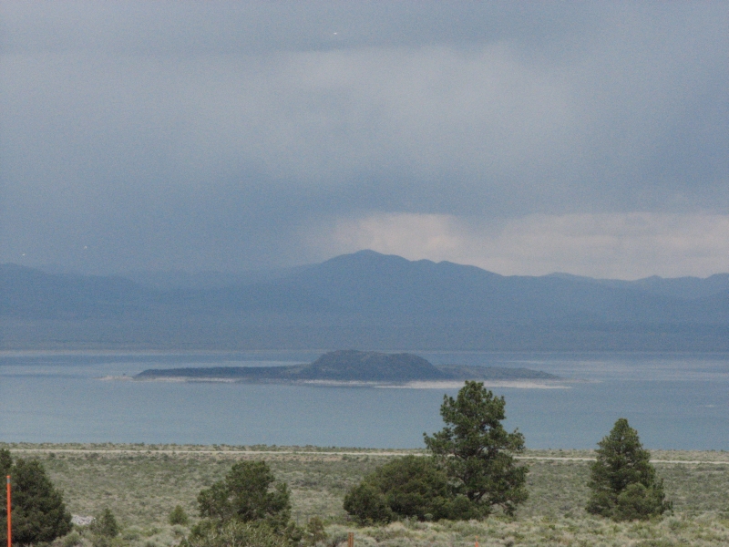
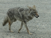
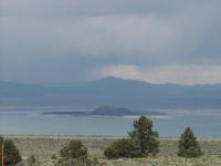
Lunch was at a roadside pullout with nice views of snowy ridges. We started seeing snow by the road at 8000, but just in patches. The meadows were soaked with snowmelt and the river was high. Tioga Pass was dramatically beautiful with craggy cliffs streaked with snow . A coyote ran along the road beside our car. That was a pleasure, since we never manage to get photos of them since they move so quickly. As we drove south, we ran into scattered showers. There was a big thunderstorm to the east over Mono Lake and the snow-capped white mountains. The Sierras were also getting rain or snow. Odd weather for June.
Jim and I ended up driving all the way to Independence, since I wanted to see what that town was like. We had intended to resupply there, and Id never seen it before. There are a couple of motels and restaurants, a post office and a couple of gas station mini-marts thats it. Still, it would have worked fora resupply town, especially since we had a box of food mailed there.
June 13: Death Valley
We gave Rafiki a ride back to the trail and then a ride back to Independence to a hiker named John. It is about 15 miles from the trailhead to town. A woman at the trailhead recognized us from a brief meeting several years ago. That surprised me. She stopped to say hello while we were talking to the hikers. The mountains were buried in clouds. John said hed seen small snow squalls while hiking from Kennedy Meadow to Independence, but hadnt experienced any serious snow. As usual, the rumor mill had exaggerated the situation.
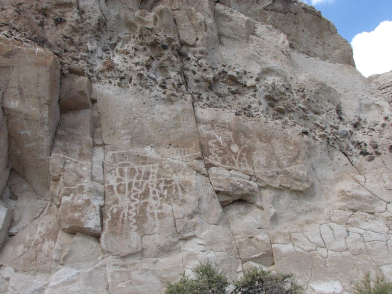
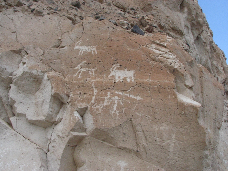
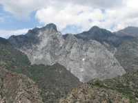
Since we were in the vicinity, we decided to visit Death Valley. I was there 18 years ago, but Jim has never seen it. First we stopped to look for some petroglyphs along the highway that we had read about, but had no luck finding them. The drive into Death Valley is striking as you pass over the Panamint Mountains. There is lots of multicolored volcanic rock red, black and orange. Folding in the rock strata is very obvious. We got several short rain showers, but nothing serious. Later it got really hot. It was 95 in the shade, so I was happy to see clouds moving in from the west. The desert vegetation is sparse, mostly just creosote, though some brittlebush and Princes Plume appeared at higher elevations.
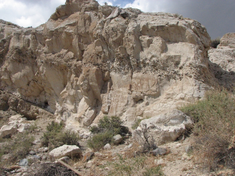
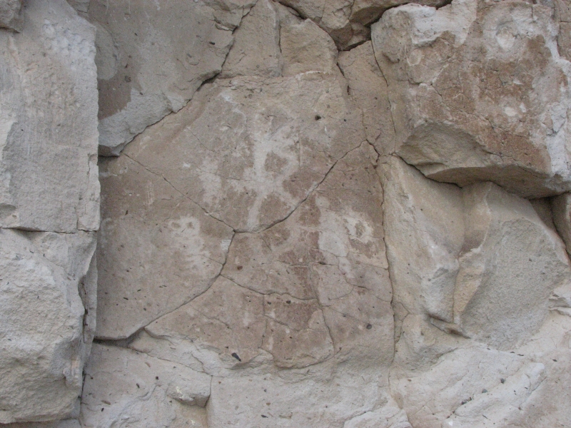
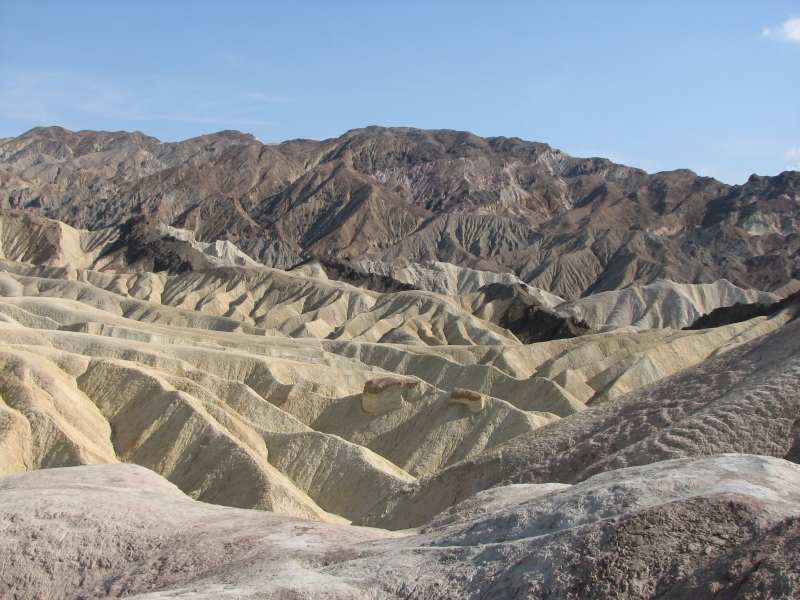
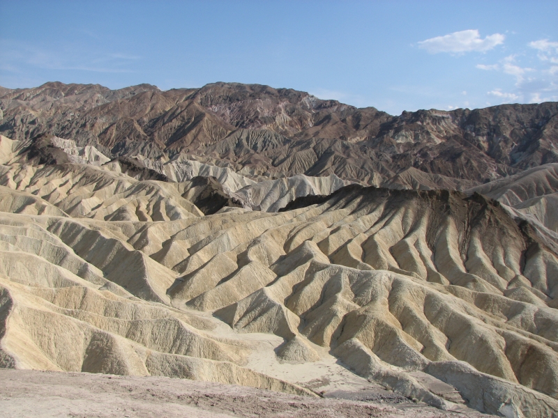
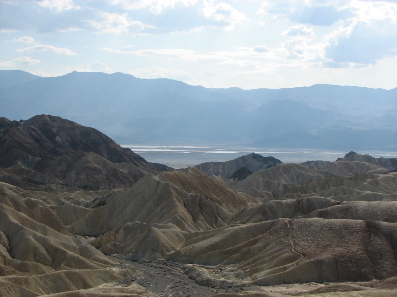
Then a ranger told us about some easily accessible petroglyphs in the park, so we turned back to look for them. We were very happy to find the petroglyph panel we were looking for. Some images were recognizable-- people, bighorns, atlatls but others were more obscure. Then we drove to Zabreski Point, a beautiful overlook near some spectacular badlands. I decided to do a short hike through the badlands and down Golden Canyon. Jim picked me up at the other end. The colors were glorious: red, yellow, chocolate and tan. One area was known as the Red Cathedral, with 200 maroon towers. Gorgeous! There were several mine shafts in the area. I checked one out, but didnt go into the tunnel. There was a shrine to a woman from Germany who died of heat stroke on the trail in 2006. I had the upper section of trail through the badlands to myself, but ran into several people in the lower canyon. It was a nice hike and late afternoon was the ideal time to hike it as the colors were vivid in the setting sun and there was some shade in the deeper canyons. The digital camera ran out of memory, so I got no pictures darn it. When Jim picked me up at the trailhead, we drove the Artists loop through more multi-colored canyons: blue green, peach, pink, chocolate, tan, etc. They werent neatly layered like the badlands, more splotched and scattered layers of colorful rock, but it was beautiful.
It was too hot to cook, so we got pizza at the Furnace Creek Saloon : expensive, but worth it. All in all, it was a good day. The colors of the rocks really are beautiful. Finding the petroglyphs was fun, especially after not locating the earlier panel. There was water in the dry lakes from all the rain lately. Thats unusual in June, I think. We were able to get a campsite in the trees but it was still hot, even after the sun went down.
June 14: Los Angeles
We didnt sleep well last night, thanks to noisy neighbors, a hot night, and Jims knee pain. He was up at 5:00. After breakfast, we continued south. I took advantage of the cool morning to do a short (1 mile round trip) walk to a large natural bridge, but the rest was just a long drive through the desert. We stopped briefly at Badwater, a small saline water source 285 below sea level surrounded by white salt flats. We saw a couple of hawks and a small coyote, but otherwise it was a very dull drive. We were both tired. I dont know how people can live out here. Its partly bare desert, with creosote and salt bush and a few other small shrubs, some sand dunes and dry lakes, all brown and gray and mostly empty. I wouldnt be happy with the lack of green. There are lots of old abandoned houses, so I imagine that it isnt easy to survive out here.
We drove back to Bakersfield, turned in the car and got a shuttle to the airport in Los Angeles where we had a reservation in a motel nearby. Tomorrow we head back to Maryland. After a week of little hiking, Jim is still in too much pain, so were heading to the surgeon to see if he can help. Jim thinks he tore the meniscus again and that is fixable. It just ruins the hiking season for both of us. So its on to Plan C or maybe D. I dont know what well do, but Im sure well come up with something.
Home | Links| Trail Journals |
The Thruhiking Papers | Bun-bun |
Created: October 2009
Revised: 30 Sept 2016Copyright © 2009-2017 Spirit Eagle