
|
 |
 |
 |
 |
Wed., May 13 – about 14 miles to PCT Mile 279.0.
We woke up early, still on east coast time. No one was around, so Jim and I headed to the Teddy Bear Cafe for a good breakfast. We were joined by Pilgrim, Krewzer and Just Jack. It was really fun to talk trail with other hikers, especially people we already knew. After so much solitude the past few years, I wasn’t sure how I’d handle all the people on the PCT, but aside from me talking way too much, it was great. Someone from the hostel drove four of us out to the PCT crossing of Highway 18. After all the conversations and waiting for our driver to eat his breakfast, we didn’t manage to get on the trail until almost 10:00. More hikers appeared while we were waiting for our ride, including another old Ruck acquaintance, Big John. It was good to see him.
Big Bear is a nice little town, with a large lake, snowy mountains above, and lots of little shops and restaurants. The hostel was nice, aside from the cold showers. (Other people didn’t have that problem. We must have arrived after the hot water ran out. I seem to run into shower problems more often than most on the trail – it happened a lot on the AT too.)
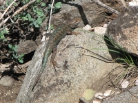
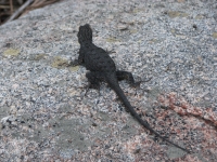
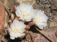
The PCT above Big Bear is also nice, winding through the hills at 7000’+ elevation. There are some areas of pinyon and juniper and others with big shady pines. The sun is warm but the shade is cool and breezy. We’re slow with our heavy packs (six days food!) but it is an enjoyable section of trail, more like northern California than southern. There are lots of wildflowers: phlox, paintbrush, etc. – a dozen or more varieties. The trail was a bit rougher than I remembered. There were several big blowdowns to go over or around and some sections of scree that I didn’t recall. Still it was good walking. Lunch was in the shade of a big pine, listening to the twittering of birds and watching swallows dart about. The birds and a couple of lizards are our only wildlife so far.
Jim is hanging in all right so far. He hurts, but he’s hiking. My nose is bleeding from the dry air. Yech! Thanks to our late start, we didn’t get as far as I’d hoped. There were water sources at 9 miles and at 19 miles. I knew we wouldn’t get as far as Little Bear Camp 19 miles from town, so we loaded up our water bottles at Caribou Creek and continued a few miles up the ridge. The water was heavy, so we really slowed down. Still, we enjoyed the hike through the trees. Late afternoon we started getting good views of Big Bear Lake below us as we hiked far above the valley. We stopped for a while to admire the views and take pictures. Dozens of lizards scurried underfoot. One had an orange belly, another blue and brown scales.
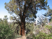
We stopped early, at 5:30 or so, after only 14 miles. Jim was hurting, I was tired, and we had a nice flat pine-covered ridge to camp on. The guidebook doesn’t mention campsites in this area, so it’s hard to know whether there are lots of good sites ahead or if the trail will be all sidehill, with no flat spots. We started out sleeping out without the tent, cowboy camping. It was a bit chilly even in the sunlight, but we thought we would be warm enough. However, as soon as the sun set, it got much cooler and there was a constant breeze that made us even colder, so we decided to put up the tent. It’s warmer and more sheltered inside than outside. Our sleeping bags are very old – and they’ve lost a lot of feathers. At 7800’ it’s just too chilly. A couple of hikers passed by as we were cooking dinner and Krewzer came walking back to our campsite to call home. He and Pilgrim were camped up the trail, but Krewzer walked back 1 ½ miles to deal with a family problem. Evidently there is a good signal here for his cell phone, but none in the next couple of miles. He and Pilgrim both call home every day, or even several times a day. I’m glad we don’t carry a phone.
May 14th: 18 miles to Deep Creek Bridge - Mile 297.2.
Jim and I slept well in our pine flat. We were up at 6:00 and on the trail by 7:00. Early for us, late by normal thruhiker standards. Several hikers passed while we were eating breakfast. We played leapfrog with them all day. It was a nice, though long day – about 18 miles to the bridge over Deep Creek. It was warmer than yesterday, partly because of the descent from 7800’ to 4500’, and partly because the day was spent walking through burnt forest. We followed Holcomb Creek for many miles, mostly high above the water, though we had three wet foot crossings. Lunch was in a shady tributary talking to three hikers: Hemlock, Tom and Paul. There were many wildflowers, yellow wallflowers, fuchsia colored lupine in the burn, and many different ones, including several flowering bushes, in the low country. We saw lots of lizards and one snake – but no other wildlife. The trail was overgrown and narrow in spots, but mostly nice walking as we wound in and out of dry side creeks. There was more water than expected; some of the tributaries had water and we found a piped spring that wasn’t in the guidebook. We drank a lot, but still felt dehydrated. Jim got the bloody nose today.
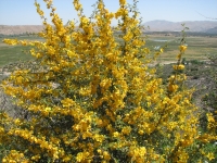
At the end of the day, I jumped into Deep Creek next to the campsite under the bridge with my clothes on since they were as sweaty and salty as I was. A couple of men were cooking dinner when we arrived at the campsite, but they left soon after. I remember the terrain beyond the bridge – it’s a long way to a good campsite. Walking the last few miles was interesting. Nine years ago Deep Creek was freshly burned. Only a few wildflowers dotted the bare hills. Now the brush and oaks are filling in the slopes. A lot of the bushes are in bloom right now. It was really pretty. I know that wildfire is a natural and necessary part of the cycle of life, but I still hate seeing fresh burns. Watching the regeneration was very satisfying.
Friday, May 15th – 16 miles to PCT mile 313.2 near Highway 173
Today was spent following Deep Creek for about 15 miles. The trail contours well above the water, so there were many nice views up and down the canyon. An occasional steep trail leads down to the creek. We were tempted to follow one down, but knew that the hot springs area was not far ahead, so we kept on going until we reached it. We were cold when we woke up, but as soon as the sun filled the canyon it got very hot. Jim and I were both bathed in sweat by 9:00, so the water really looked inviting. Most of the trail is out in the open. The bushes have come back from the 1999 fire, but trees (and shade) are really scarce. There were lots of nice wildflowers. We are lower in elevation than yesterday or the day before, so the flowers have changed. We saw golden Fremontia, orange mariposa, pink prickly pear blossoms, etc. This morning we saw our first horny toad, a pretty one that blended into the rocks. We also saw our first rattlesnake. It slid off the trail and curled up in the bushes, rattling madly. Fortunately, he was far enough back we felt safe passing by. It was a nice walk, though the trail itself is in pretty bad shape. A lot of it has eroded away (too many horses?) so it is narrow and soft, a bit scary at times as it slid underfoot.
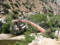
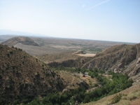
We reached the hot springs at noon, dropped our packs and jumped in. Although a lot of people skinny dip, we kept our clothes on, since they were badly in need of a wash. It was really too hot for the hot pools to be enjoyable, but the cool pools below were deep enough to swim in and felt really nice. There were a lot of people there: a few hikers and a dozen or more locals. Some were dressed, some not - and some should have been. We swam a bit, then ate lunch in the shade of a large sycamore tree. A squirrel stalked the food bags. We wanted to wait a while to let the day cool off before continuing our hot hike. We were told it was 90 today. I believe it. The views of the deep rocky canyon are pretty, but the trail is exposed and the sun got to me. Jim has a sore foot that is slowing us down. His knee is stiff, but not hurting much; it’s the foot that is giving him fits.
Because of the heat, we didn’t cross the huge dam several miles upstream, but just dropped down to the creek below, where I sat for a few minutes, enjoying the coolness of the water before continuing up a use trail through the brush under the dam. Jim soaked his feet, which helped ease the pain. After 15 miles, he was really hurting, so we stopped for the day--we thought-- next to the creek beyond the dam. The heat was getting to him too. However, it’s Friday night, party time at the dam. We talked to one local man for a while, then a group came up, with jeeps, dogs and kids. We decided to leave. Everyone was friendly, but we didn’t want to deal with noisy drunks later in the evening. A mile away we found a water cache under a tree with two gallons left. We cooked dinner and moved on a bit to get away from the road. The hazy hills were pretty in the sunset. There was a good breeze, but it wasn’t cold so we decided to sleep out on a flat sandy spot. I really enjoyed feeling the wind on my face and watching the stars slowly appear.
May 16 – 17 miles to Cleghorn Ridge above Silverwood Lake - PCT Mile 330.6
We still aren’t quite in desert hiking mode. Six o’clock in the morning feels early to me, but it really isn’t early enough to avoid the heat. Last night we were passed at dusk by several hikers enjoying the cool of the evening. At 6:30 this morning Chuck and Larry passed by while we were eating breakfast. They had camped by the stream where we originally intended to camp last night and said they were kept awake by the party crowd. I’m glad we moved on. By 9 a.m. it was hot, though the trail wound in and out of gullies so we were in and out of the shade for the first few hours. Then we reached a big burn and the manzanita no longer offered any shade. We were quite happy to reach the base of Cedar Springs dam and find a big cottonwood tree to shade us as we ate lunch and enjoyed a long cool rest. The hike was a nice one, winding through the hills, looking out on houses and ranches in the valley below. We got some water from a piped spring along the trail, but not enough to satisfy our increasing thirst. I read in the guide that there was water by the highway six miles ahead so we didn’t get much, but it turned out to be a green scummy puddle, not at all appealing.
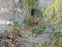
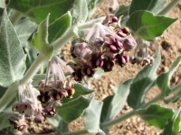
Flowers were abundant, especially Fremontia, but also orange and blue penstemmon and poppies and mariposa, plus many I don’t recognize. We saw a gray and orange striped snake, a horny toad, a rabbit and a small hawk. Yesterday I watched a snake swim across Deep Creek. That was interesting. Chuck and Larry joined us for lunch and we got a chance to talk for a while. By the Book, a hiker who did 1600 miles on the PCT last year, passed us late in the morning. We took a long three hour lunch break in the shade of the huge cottonwood. Four other hikers, including Lake, Blackberry and Jessica passed us while we were resting. Blackberry’s husband flew out from British Columbia to surprise her for their anniversary. He met up with her near our luncheon tree. It was 92 in the shade, over 100 degrees in the sun. We were in no hurry to move on. Around 2:30 we filtered a few quarts of the green algae water, and got a new filter element from Lake when he saw that ours was balky (his filter broke completely and he didn’t want to carry the weight of a useless filter). We passed an empty water cache on the trail a couple of miles later. We weren’t expecting it, so there was no disappointment. We had enough to get to the next water source.
Jim and I headed up the highway to Silverwood Lake, a busy tourist area. The trail goes around the lake, usually 100 or so feet above the water, but occasionally it drops down to the shore. I wanted to go for a swim, but the cove we chose was filthy with trash and bottle caps so we didn’t linger. I just wet my feet and then hiked on. We surprised a couple in the next cove having sex, oblivious of the boats and jet skis passing by in full view. They did notice us – so everybody was embarrassed. It was a busy lake on a hot Saturday. There were lots of people out on the water or fishing or picnicking and swimming. The views of the lake are good from the trail. The land is recovering from fires a few years ago, so there were lots of flowering bushes everywhere. We saw a big hawk with gray wings and a tan body.
We dropped off the PCT on a side trail to a picnic area to fill our water bottles. We chatted with one man and his grandson for a few minutes and he gave us some icy cold water; it was wonderful. The water we had been carrying was hot and tasted awful. At the picnic area we found a table in the shade to rest and cook dinner. It’s not a peaceful place, but there was water and shade, so I was happy. Last time we were here, we passed Silverwood Lake early in the morning, so it was very different from what we experienced on a busy summer afternoon. After dinner we continued up the trail as far as we could before dark. We passed a developed group campground, then found that with the sidehill, there were no good campsites for a long way unless we dropped down into the rocky canyon 100 feet or so below the trail. It looked like pretty steep bushwhacking, so we just kept on hiking. Finally we just threw our sleeping bags down on a wide spot beside the trail and called it a night. Jim’s foot was still an agony. We’re afraid his neuroma has returned, but it may be something else. As long as we were doing short days, he had no problems with his feet, but the miles we’re doing now are putting more pressure on it. We watched the stars rise and lights from the group campground below us for a while before eventually drifting off to sleep. Evidently there was some problem on the highway near the lake, since we could see the flashing lights of emergency vehicles for more than an hour as we tried to sleep.
May 17: 16.7 miles to a wash near Swarthout Canyon Rd. - PCT mile 347.4
Today was a nice hike through the hills from Silverwood Lake to Swarthout Canyon. There were lots of flowers and flowering bushes, a couple of snakes and horny toads. The flowers really make the hike a joy for me. I love the desert in spring. There was a breeze, but it was hot so we still stopped at every patch of shade we could find. There were a couple of water sources we had been told were dry that had a good flow. It made us wonder why we were toting such a heavy load of water. After Cajon Pass, it’s 23 miles to the first natural water source. There may be a water cache put out by trail angels, but given the number of hikers around us right now, we sure can’t count on it.
Jim lost his wedding ring this morning. He had mentioned that it was loose and half an hour later he noticed it was missing. We dropped our packs and went looking for it. Happily, he managed to find it lying in the trail. I was sure it was gone for good. It's safe now - in the pack.
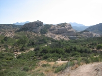
It was another hot, hot day. We woke at dawn, packed and headed up the trail before the sun reached our ridge. When it did, we found a patch of shade and ate breakfast, then moved on to today’s highlight, a MacDonalds at Cajon Pass. The restaurant was air conditioned and the milkshakes tasted great. Jim was having problems with the heat, so he had a really hard time eating, and I ended up eating too much. I was hungry from the hiking, but the heat makes eating difficult. There were at least 16 hikers spread out in the restaurant. I’m surprised they had any other customers eating inside; the smell must have been atrocious. One hiker, who had been staying at a nearby motel for a few days, said there were 30 hikers there yesterday. Evidently we are right in the middle of the main pack of hikers who started the trail at the big kick off party at Lake Morena in late April.
It was fun to meet and talk with some of the hikers. Tamsin is another Canadian, hiking with Brendon, (aka Vegemite) a man from Tasmania. Lake is from Pennsylvania. I think the fact that we are section hikers and new to the trail makes people a bit wary of us. They don’t know whether they’ll ever see us again, so why bother getting to know us? They’re right. We’re doing 16 miles a day; they’re doing 18 to 20. We get passed by hikers every day. However, because of the heat the past few days, everybody has slowed down. Three and four hour lunch breaks are common. Many hike until dark, or even later, and most start before dawn, but it still slows us all down not hiking in the heat of the day.
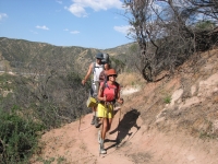
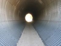
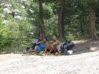
All the hikers stayed at the restaurant for several hours, first eating and drinking in the air conditioned building, then sitting outside in the shade, recovering from the heavy meal. Jim and I stayed about four hours, then finally headed out to hike five miles to a dry wash near Swarthout Canyon Road, where we were surprised to see that there was still a lot of water left in the cache. It was a pretty walk, often up on a narrow ridge with good views of the rocks at Cajon Pass and the valleys all around. We saw several trains on the multiple tracks. A couple of hikers were resting in the cool shade of a freeway overpass, which was a nice breezy tunnel. Smart!
We would have liked to hike farther this evening, to make up for our long mid-day break, but the trail begins a serious climb just past Swarthout Road, and when the PCT is mostly sidehill, there are rarely good campsites. We’ll climb about 5000 feet tomorrow. Besides, this sandy wash is a nice peaceful spot, far enough from the noise of the freeway and trains to be a good place to sleep, as long as there is no rain. Bees and moths are a nuisance, but we’re sleeping out again as we’ve done the past few nights. I’ve really enjoyed cowboy camping. I like watching the stars, feeling the breeze on my face, and then eating breakfast in bed in the morning.
May 18 – 17 miles to Guffy Campground, PCT mile 364.6
We woke up before sunup, but stayed in our bags until it was light enough to see. Jim and I ate breakfast in bed, then were on the trail by 6:00 – a record for this hike. We were surprised to wake up to a cloud-covered sky and thick fog blanketing Cajon Pass. It was a nice way to start the long climb. The trail climbs gently but unrelentingly for 5000’, winding though the hills, switchbacking higher and higher. Around 8:00 the sun burned through the clouds, but the distant haze-covered hills looked more like the Blue Ridge than southern California. It was hot climbing late in the morning and we began to wish we were carrying more water, but after nine miles or so we reached big trees again, so parts of the trail were shaded. There were lots of lizards and horny toads, including two that were mating when we interrupted them.
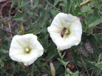
Flowers were fewer, except for a pretty and sweet-smelling blue or white bush that reminded me of lilac. (We were told later it was Buckthorn.) There was a big pile of fairly fresh bear scat on the trail. We heard there was a bear at the campground we are headed to tonight. We considered just getting water and moving on past the campground, but there’s no point in going too far since we’re heading to town tomorrow and we’re not likely to get a ride early in the morning. I wish we were heading to town this afternoon, but our timing is off. It’s too far to go today, unless we want to arrive exhausted. I’m worried about hitching into town tomorrow since the highway is closed a short distance past the trail. It’s been closed for a few years, but is supposed to open again in a few days. Tomorrow there may not be any cars, except for a few locals heading to Mt. Baden Powell. Last time we were here we had a really hard time getting a ride into Wrightwood. There is a side trail into town that avoids the hitch on the highway, but it is steep and rough. Jim is hurting too much to agree to that one, even though it would get us into town today instead of tomorrow. I’m doing well. I have sore feet and a blister on my little toe, but otherwise I’m okay. Jim was feeling dehydrated and it made him light-headed and lethargic. We took a long two hour lunch break and he felt better afterwards.
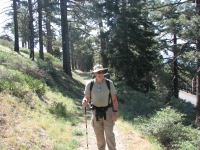
The clouds returned and it got much cooler as we continued to climb. There were pines at the higher elevations, though the desert brush lasted much longer than I expected, up to almost 8000’ in places. We had views of snowy Dawson Peak to our left and late in the day ran into our first snow patch right on the trail. We met Hansel and Gretel, a couple who are hiking the trail with two cars, leapfrogging them so they can hike with much lighter packs. I don’t know whether they do day hikes most of the time, but today at least they only had day packs. We reached Guffy Campground, a forest service car campground right on the trail, at about 5:00 and decided to stop for the night. It was a steep drop down to the spring, but the water was great – and very very cold. The evening was windy, cold and cloudy, so we put up the tent. There are several other hikers here: Tim and Bethany, Larry and Chuck, Fixit, and a couple of others. There’s only one car, but no sign of its owner. Lake stopped to cook dinner, then moved on.
May 19 – 4 miles to Wrightwood – PCT Mile 369.5
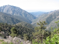
We woke to a beautiful sunrise. Everybody was up and out early. Jim and I walked the trail through a big ski area (Mountain High) and down past another small campground. A truck pulled up and the driver asked if we had seen any bighorns. We said no, though we figured that since the area below the trail was called Sheep Mountain Wilderness Area, there might be some. Tim is a researcher who counts and collars bighorns and keeps an eye on the local herds. He offered us a ride to town and we were happy to accept. We passed the other hikers we camped near last night waiting for a ride or walking the highway to town. One group got a ride in about 20 minutes. We passed Scott and Lake on the edge of town - they had walked the six miles to town.
Our bighorn researcher recommended the Grizzly Café for breakfast. He was right. We walked in with our packs and were given big smiles of welcome and huge tasty breakfasts. Once done with that, we headed to the Pines Motel to get a room and take a lukewarm shower. The owner was doing laundry, so there wasn’t enough hot water, but it still felt wonderful to be clean. An hour or so later, I laughed when one of the hikers ran out of his room dripping wet, barely covered in a towel, shouting “Cold Water! I want a hot shower!” The owner’s wife let him take a hot shower in her apartment. I thought it hilarious. As he said, $50 should entitle you to hot water. I was just happy that the manager offered to do our laundry (for a small fee). I hate sitting around a laundromat. We shopped for groceries, bought ice cream for lunch, then sat outside talking with the other hikers for a couple of hours. It was fun and relaxing.
Home | Links| Trail Journals |
The Thruhiking Papers | Bun-bun |
Created: October 2009
Revised: 30 Sept 2016Copyright © 2009-2017 Spirit Eagle