|
 |
 |
 |
 |
|
|
|
|
|
|
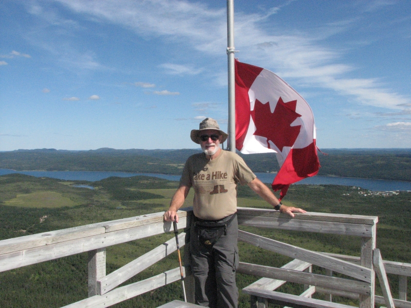
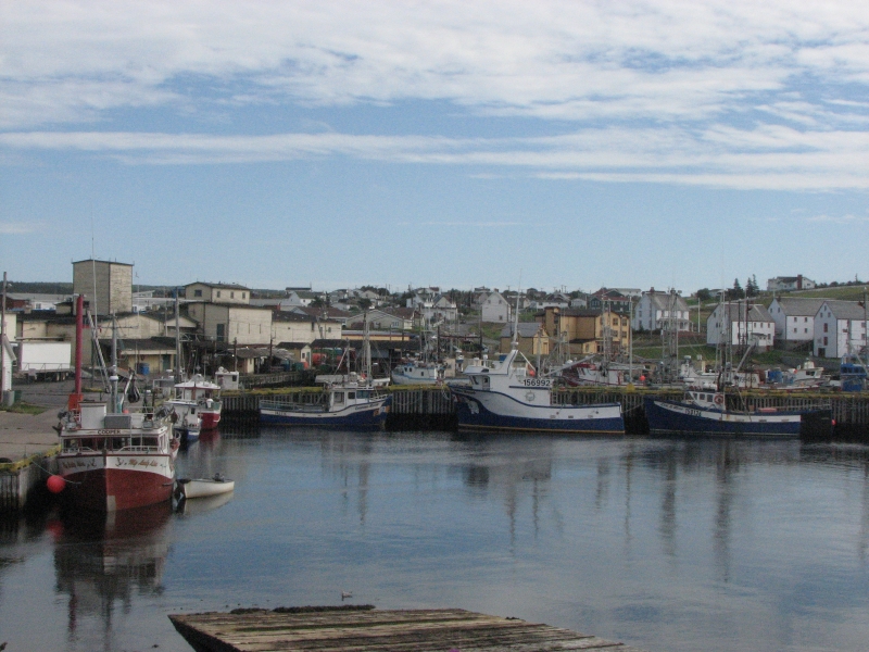
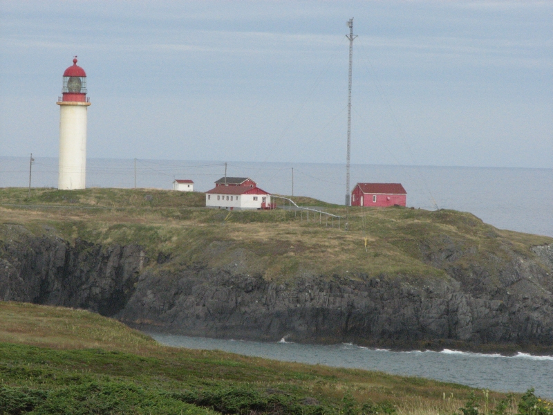
Friday, August 14: J.T. Cheeseman Provincial Park, Newfoundland
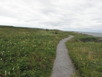
Today was our travel day to Newfoundland, and a long and weary day it was too. After breakfast we wandered a while, looking for a nearby park that was supposed to have a hiking trail. We missed the turn and ended up at another beach park where we sat for a while watching the waves and people swimming in the warm water. Jim decided to keep looking for the other park and soon we found it, more or less by accident. There was a one mile trail around a small lake with swimming beaches. It was a nice short walk through cool shady woods before heading to the ferry.
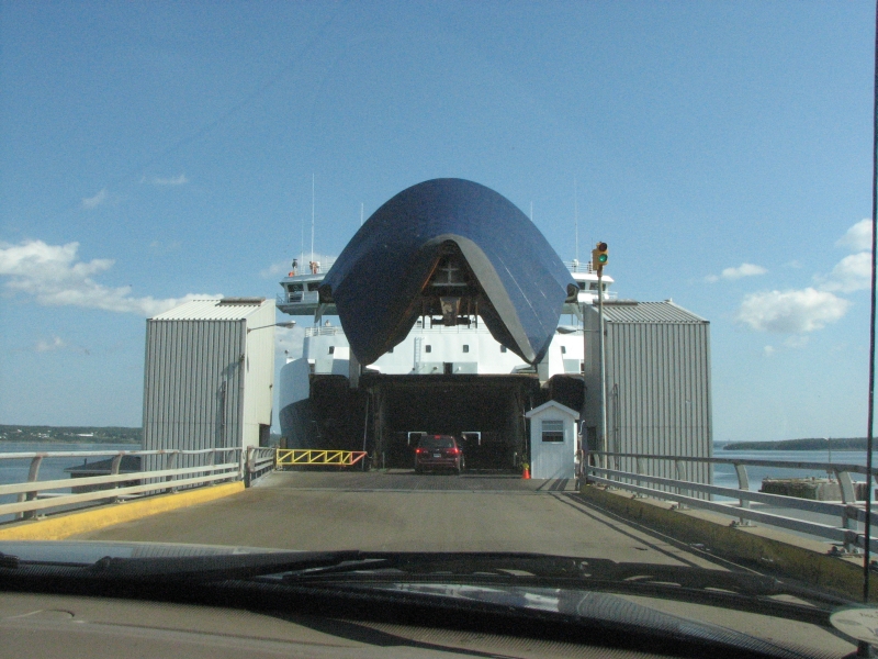
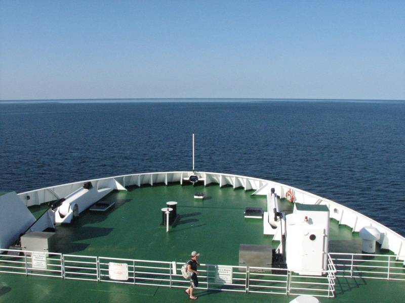
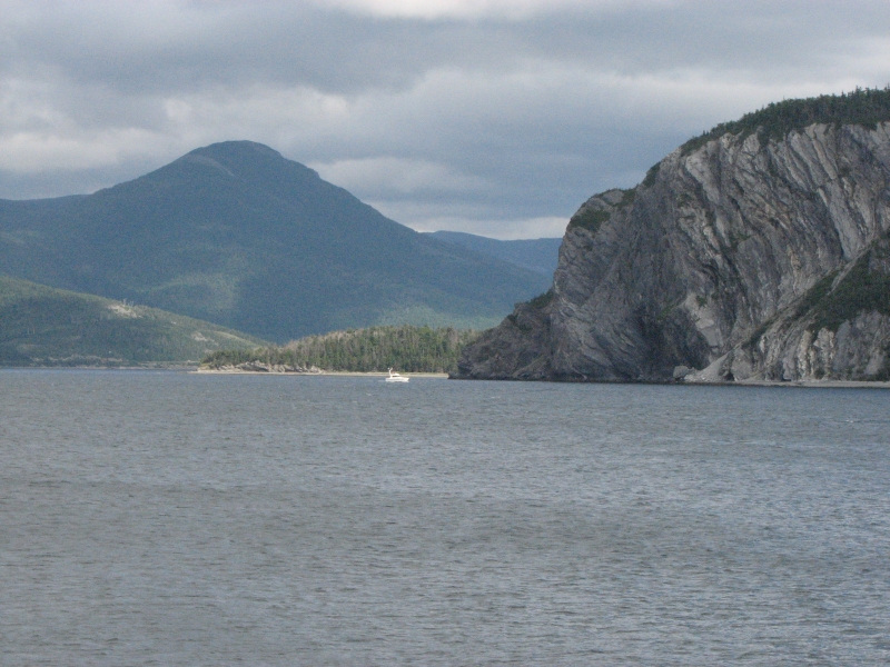
We were told to arrive by 2:00 for the 3:30 boat. Unfortunately, they were running late. It was an hour and a half before we started to load. Jim and I were melting, sitting out in the sun. It was in the mid-80s and humid. Once on board, it was just a matter of being patient as we slowly crossed the water. We ate an expensive and not too tasty supper (the nautical equivalent of airport food), looked at the views when we were near land and while the sun set, and talked with a couple from Indianapolis for most of the seven hours it took to make the crossing. I was told the trip would take 5-6 hours, but supposedly it can last anywhere from 4-8. (And this is the quick ferry. The other ferry to Newfoundland takes 14 hours or so.) The weather was good, so I dont know why we were so slow. I wasnt impatient, just very tired by the time we debarked at midnight. Fortunately, there was a provincial park with camping only a few miles away, so we pulled in, got a campsite and settled down. We were too tired to sleep right away, so Jim and I read for a while, then tossed and turned for a couple more hours before finally falling asleep.
Our plan is to head up the west coast of the Island, passing through Gros Morne National Park and on up the Viking Trail to the northernmost point of the island, then head south through the Park again. If time allows, we will drive east and explore the eastern shore of Newfoundland. Well see how things go. We would have liked to take the ferry across to Labrador, since we are so close, but that would take at least a couple of days, and we dont have the time on this trip. Next time, maybe.
Saturday, August 15: Deer Lake
We were up earlier than I expected after last nights insomnia. Perhaps we were anxious to start exploring? We paid for last nights campsite, got a season pass for the provincial parks in Newfoundland, and were on the road by 9:00.

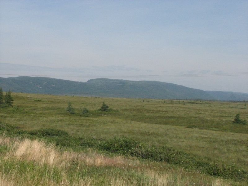
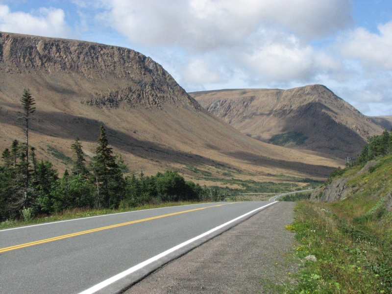
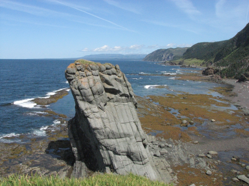
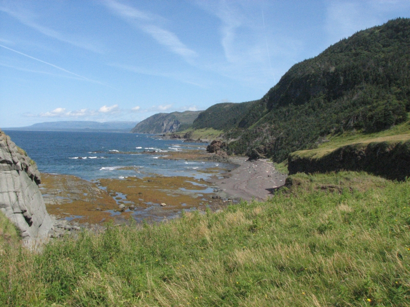
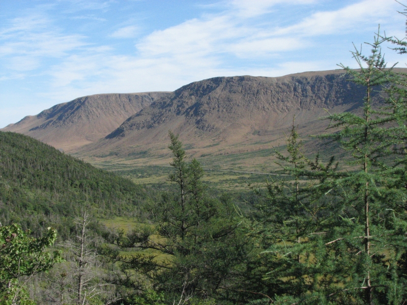
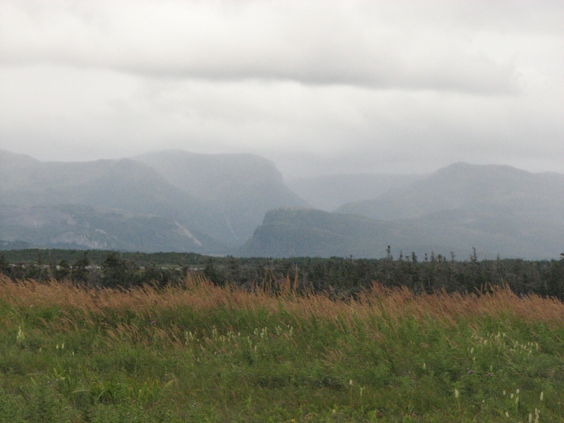
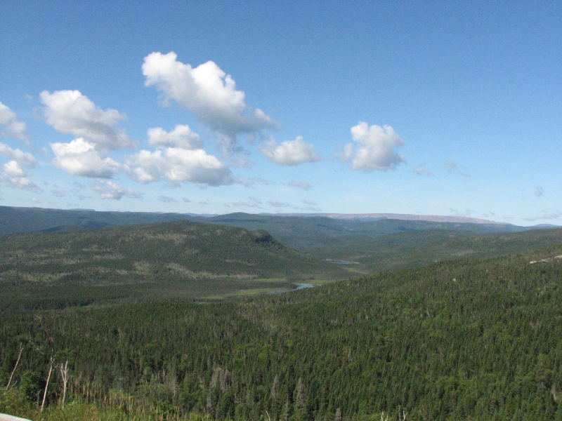
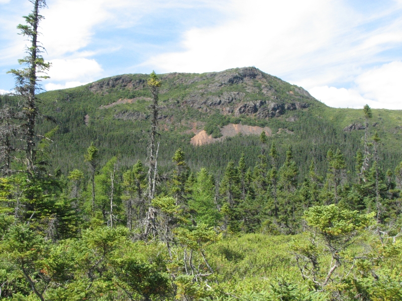
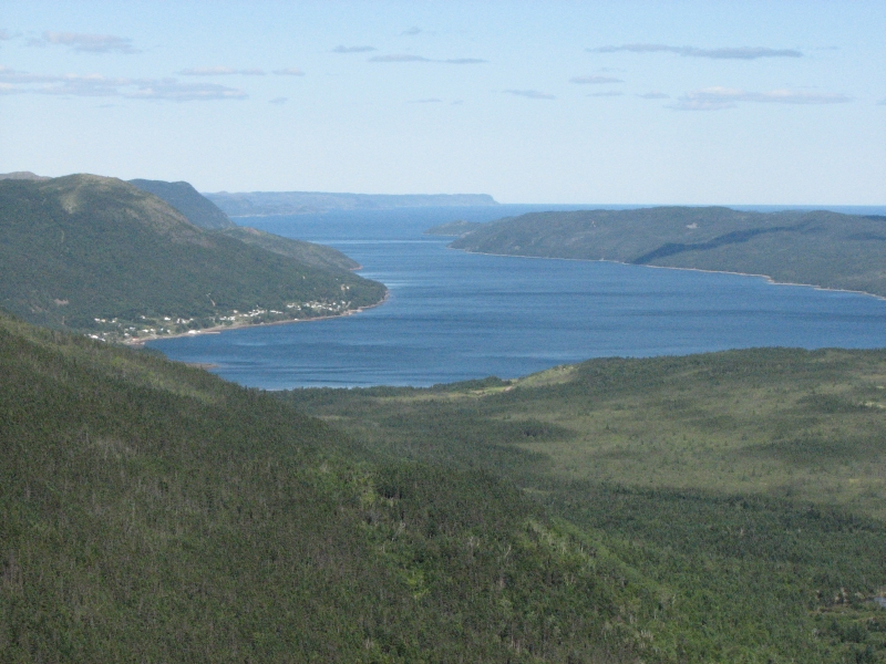
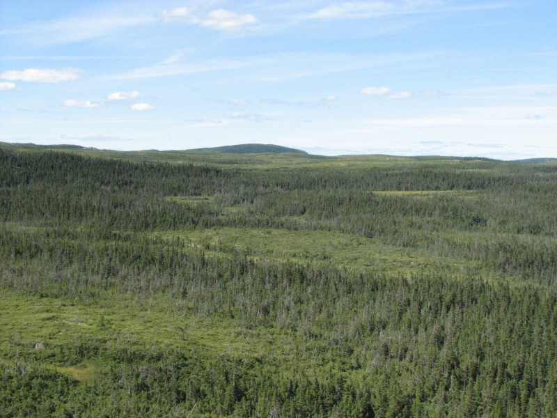
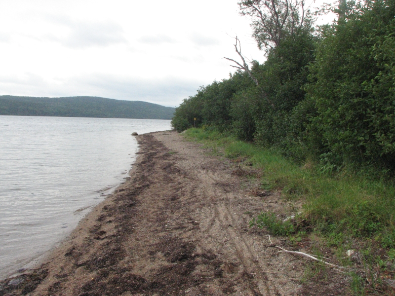
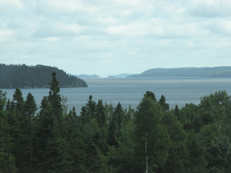
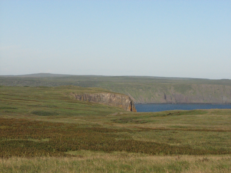
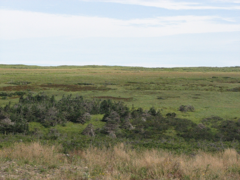
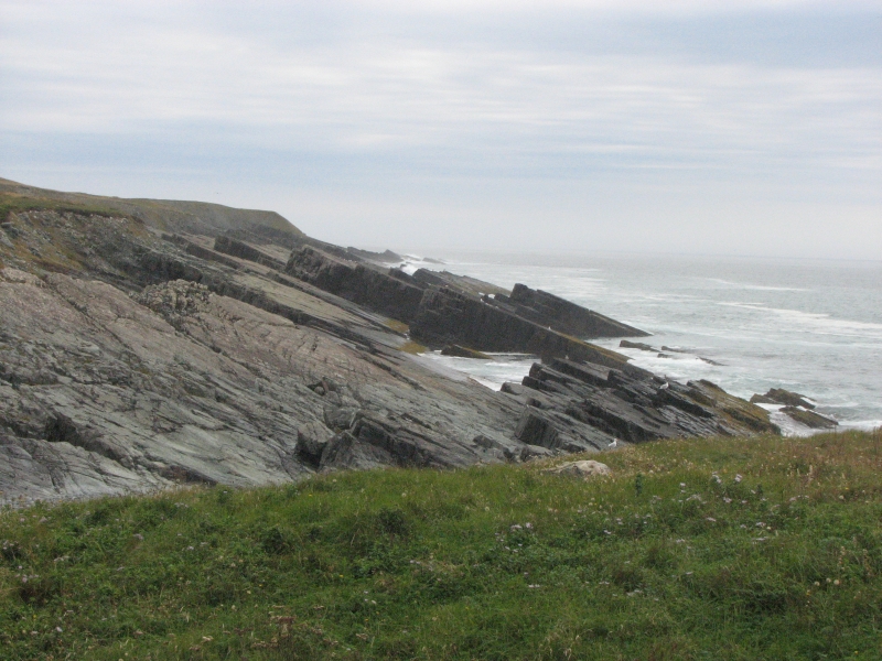
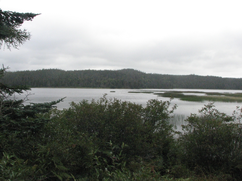
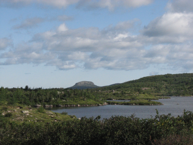
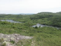
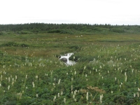
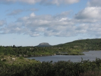
Newfoundland immediately struck us by how different the terrain is from Nova Scotia and New Brunswick. Its much wilder even than Cape Breton. The land reminded me a lot of Alaska, in the shape of the mountains and the mixture of open tundra, shallow ponds and forest. In researching eastern Canada before we left, I knew that one of the highlights of our journey would be Newfoundland, and especially the west coast of the island. It has the kind of wild remote country that we both love. I was happy to see that the reality measured up to my expectations.
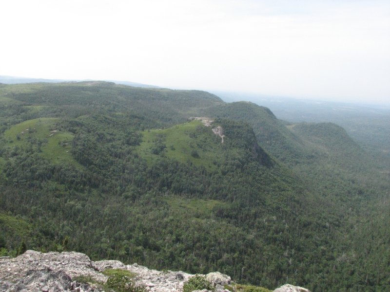
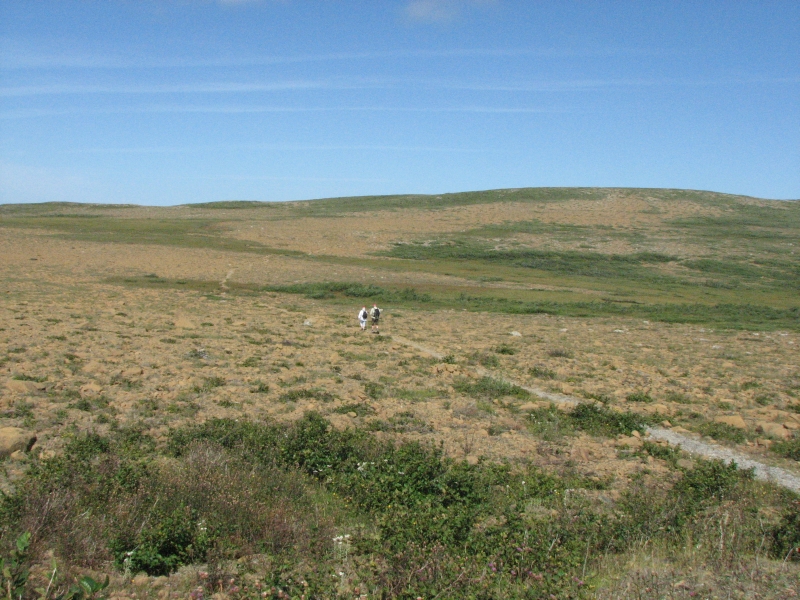
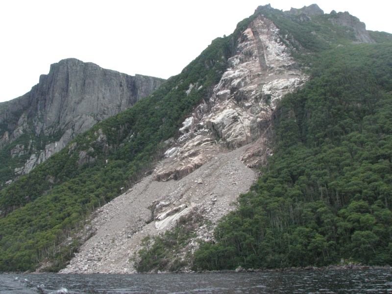
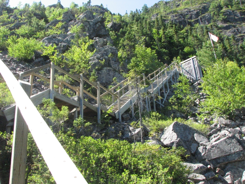
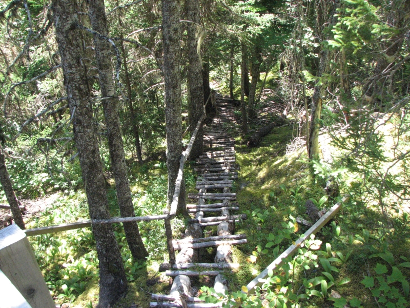
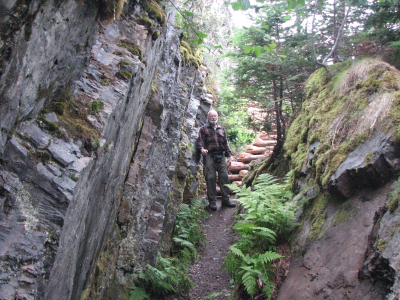
Today was a warm sunny day, but surprisingly hazy. A couple of hours up the road we stopped at Barachois Pond Provincial Park to do a short four mile hike to the top of Erin Mountain. The trail started out easy, with boardwalk and easy climbing on wooden steps. Halfway up, after the first viewpoint, the trail got much much steeper. We climbed 1000 or so feet to the top of the plateau. Once there, we agreed that it was worth the effort.
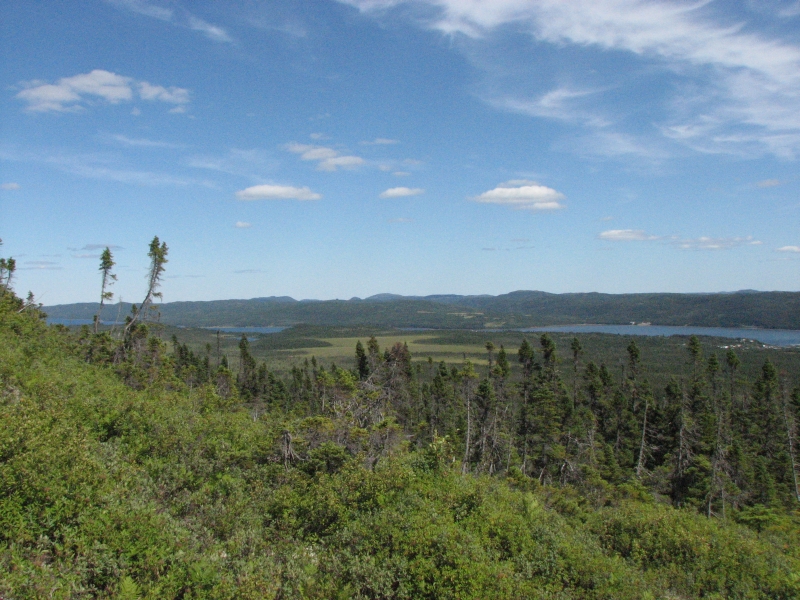
The alpine country with several small ponds reminded me of Kesugi Ridge in Alaska. The views from the top were beautiful, despite the thick haze. I wish wed been there on a clearer day, but I was happy we had done the hike.
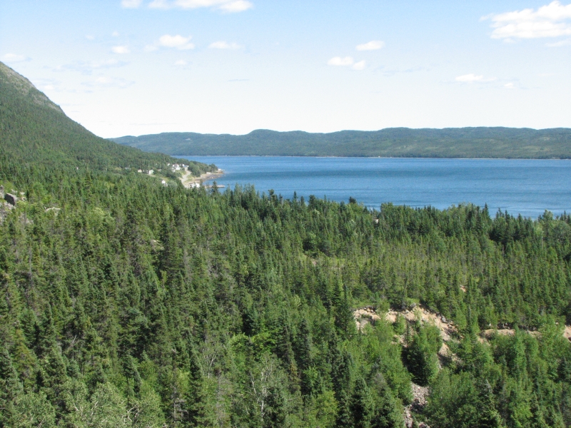
We got back in the car to drive through mountains with views of numerous lakes and ponds. There is a lot of wild country here. The highway was mostly in very good shape, but with few services along the way. It was nice driving through the forest and meadows. We ended up at a private campground at Deer Lake. It had a lot of RVs that stay for several weeks, plus locals who just use the beach for the day (for a dollar).
Sunday, August 16: Trout River, Gros Morne National Park
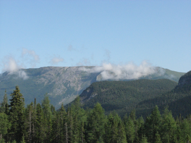
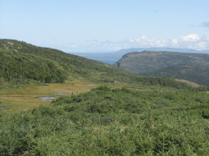
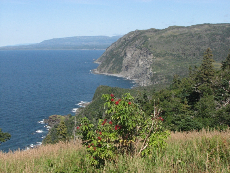
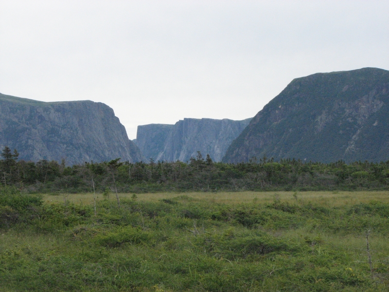
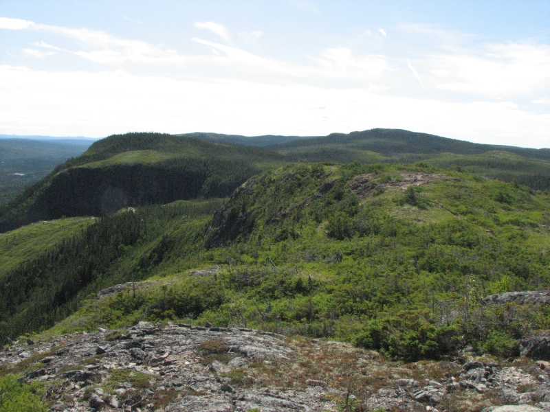
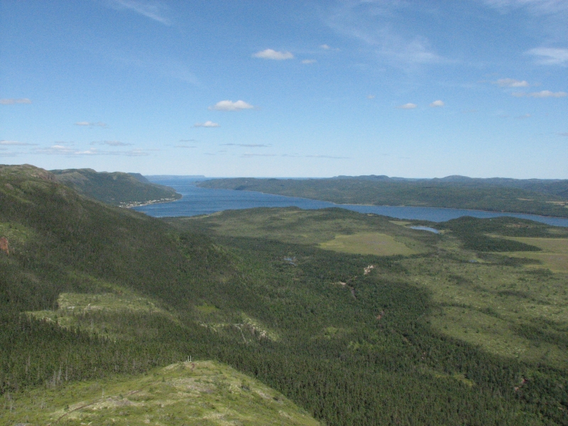
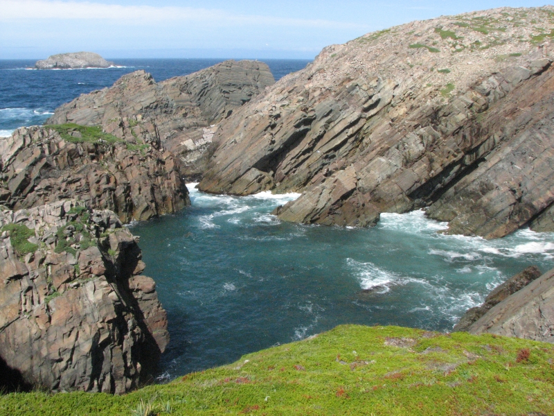
It rained during the night, but we woke to sunshine. By 10:00 most of the clouds had disappeared. We stopped at the Discovery Center in Gros Morne National Park, where we looked at the exhibits and spoke to a warden, then we headed out to the Green Garden Trail. It was an absolutely gorgeous day sunny and clear. The mountains rise steep and barren from the lakes and ocean below.
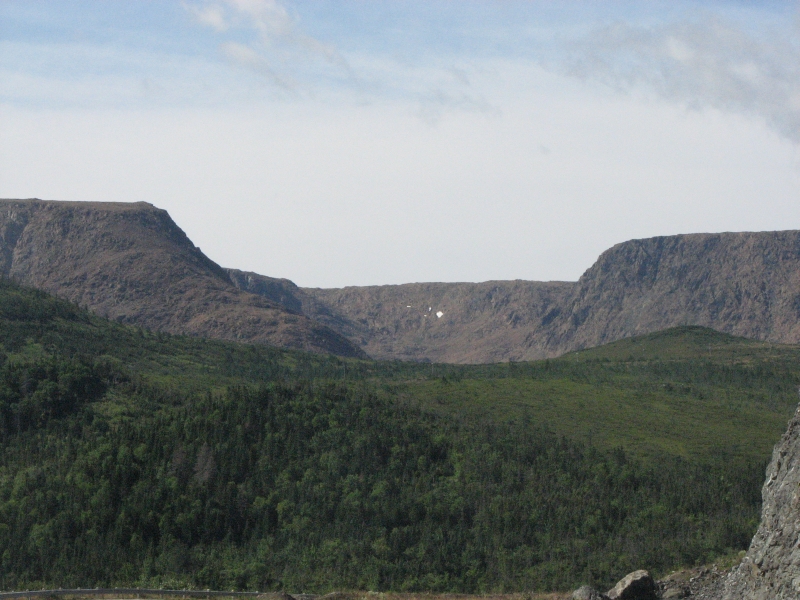
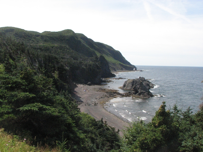
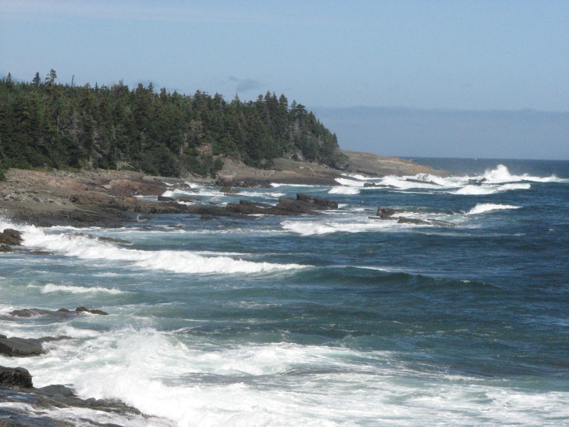
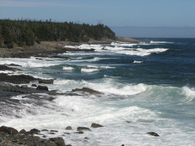
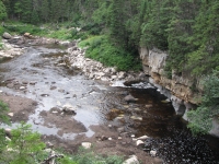
There is a large plateau known as the tablelands on the northern end of the park. Across from it is the Green Garden Trail, which has two trailheads. We entered at Long Pond and I emerged at Warren Creek, nine miles later. We started hiking in open dry tundra, with a little krummholz (dwarf trees) and alpine flowers, but mostly bare red rock. Supposedly the rock is mantle rock, 600 million years old, that is toxic to most plants. We climbed gently for a while, then dropped into a lush green valley with spruce, ferns and grasses. We climbed again to the side of the mountain facing the Bay. There were lush grasses and wildflowers and ripe raspberries in abundance. Views were superb of the ocean, rocky cliffs and sea stacks and gravel beaches. Jim and I ate lunch at a picnic table while admiring the beautiful view, then we walked along the trail above the shore for a while.
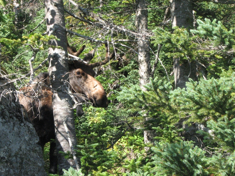
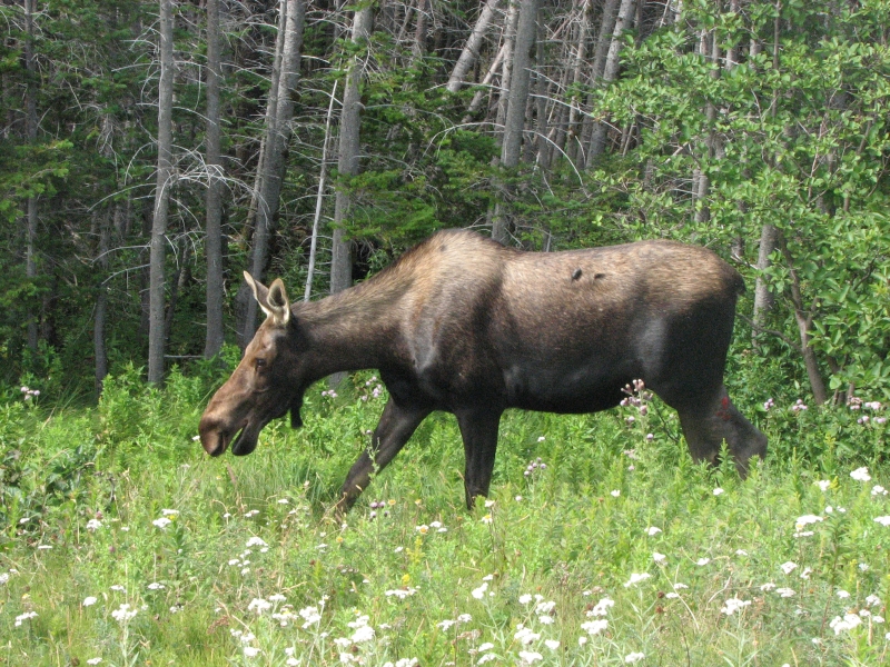
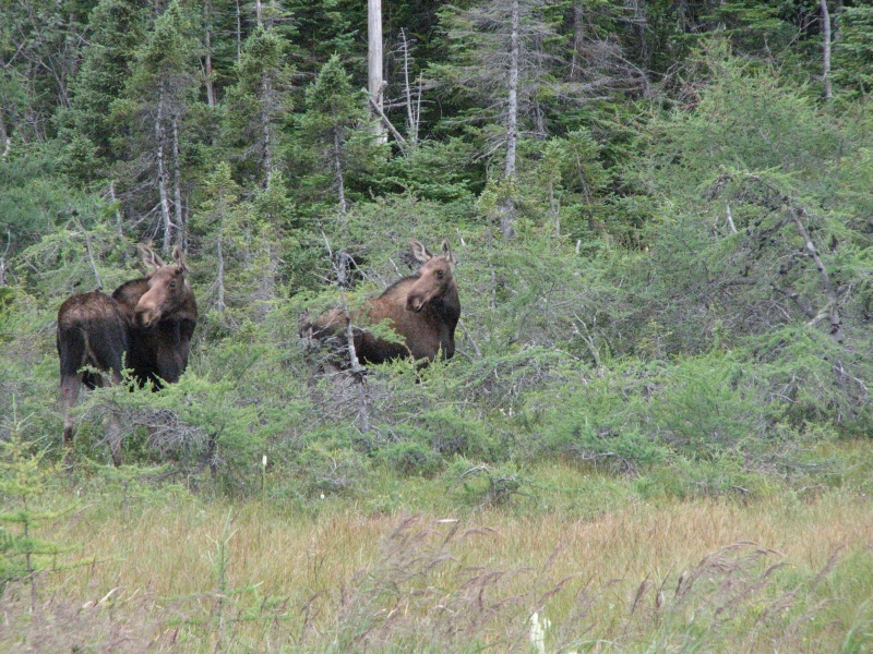
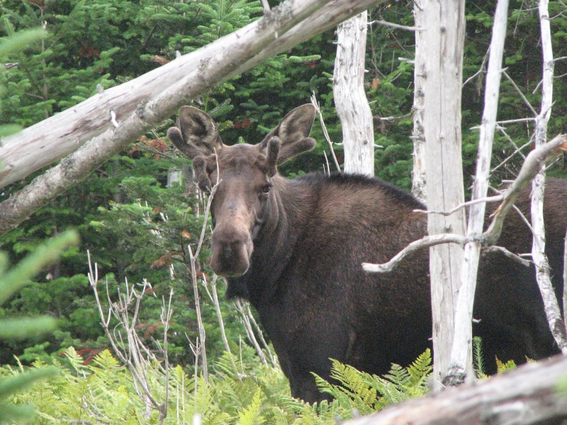
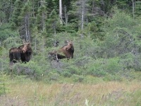
Jim turned around after about three miles, while I continued, munching raspberries and dodging thistles. The trail dropped to the beach and I walked out to some tidal pools to look at the life therein: various algae, bladderpods, snails and sea urchins. Then I climbed up and up and up, then dropped steeply down to Warren Creek, which I crossed knee deep. The trail paralleled the water for a mile or so, rolling up and down through hemlock and birch forest. I spotted a bull moose hiding behind a rock. Soon afterwards I met Jim coming out to meet me, so we turned around and headed back to the moose. He was deeply buried in the bushes, so we didnt get a good photo, but at least Jim got to see him. It was a really nice hike, though quite strenuous with a lot of steep up and down, mostly on wooden stairs. There were a lot of people out enjoying the day. Im not sure how far I hiked. One source said 13 km., another 14.5 and another 17 or 18. It was a good long day, about 5 ½ hours in all. I was slowed by the berries, photography and the steps, so it could have been nine miles or 11, Im really not sure and really dont care.
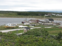
Afterwards we drove to the village of Trout River for a good, albeit expensive, fish dinner. The cod was delicious and we had a view of the water, which was worth a few dollars, I think. We enjoyed watching a fishing boat returning to harbor, swarmed with seagulls looking for a handout. There is a national park campground a few miles away where we settled in just at dark. Its a very nice one, with private wooded sites.
I am so excited to be here. Gros Morne is as beautiful as Id hoped. Getting this glorious weather is more than I had hoped for. Happiness is!
Monday, August 17: Green Point Campground, Gros Morne National Park
We lost our sunshine, but at least it stayed dry until suppertime. Near the Visitors Center we spotted a moose cow by the side of the road, but it was scared off before we got out the camera. We watched a film about the backcountry Long Range Traverse, a hike we would have attempted if not for Jims foot. Its an all cross-country route in the alpine plateau country. Supposedly 35 kilometers takes 4-5 days to hike. That is difficult terrain! Its a lot like Alaska, except the weather is even more difficult, I think. Hiking without a trail in white out conditions sounds like fun!
Jim and I signed up for a boat tour on Western Brook Pond at 4:00, then tried to check into a campground. It was a primitive one where you self-register and they were out of fee envelopes. We drove back to another campground, picked up a few envelopes, then drove back to drop ours in the box. Jim was irritated about the detour and drove off in a hurry, leaving the tailgate open. As we pulled out on the highway, I heard a truck honking behind us. I looked in the mirror and saw that Jims bag, a towel and both water bottles were strewn across the road. Screech! To make up for that aggravation, a few minutes later we saw another moose cow by the side of the road who let us take her picture.
We had a little time before our tour, so we set out to walk the Coastal Trail for 20 minutes or so, then turned around. Thanks to our detour with the campground fee, we didnt have time to do the whole six km. round trip. Theres a rocky beach, some ponds, krummholz, and a nice spruce grove that we had a chance to enjoy before driving out to Western Brook. The sea was gray today, reflecting the gray sky. It was a nice walk, though we didnt do the whole thing.
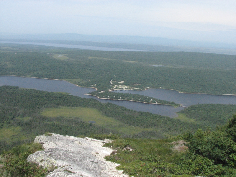
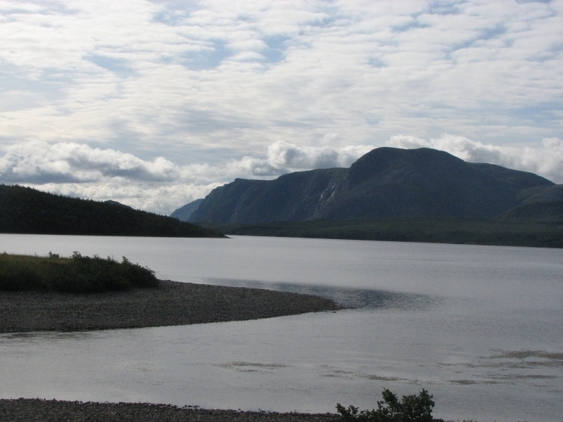
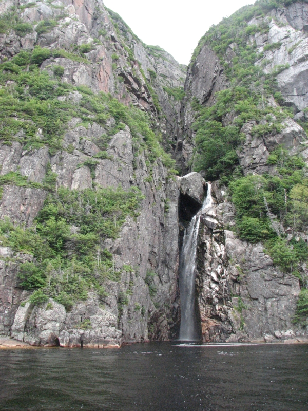
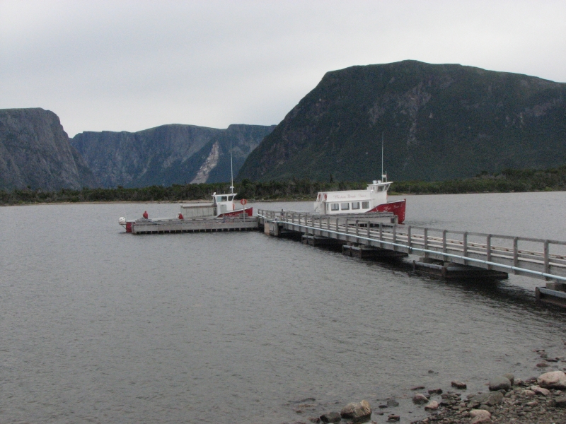
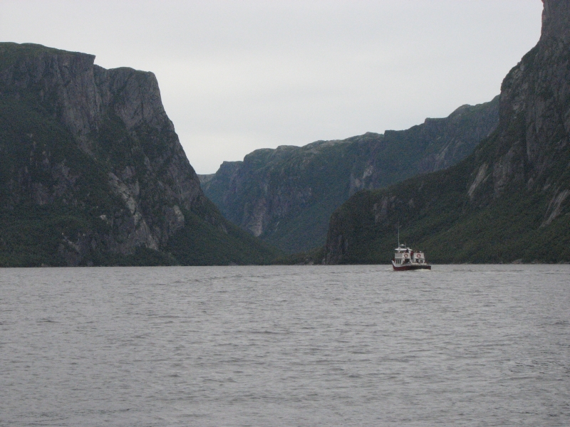
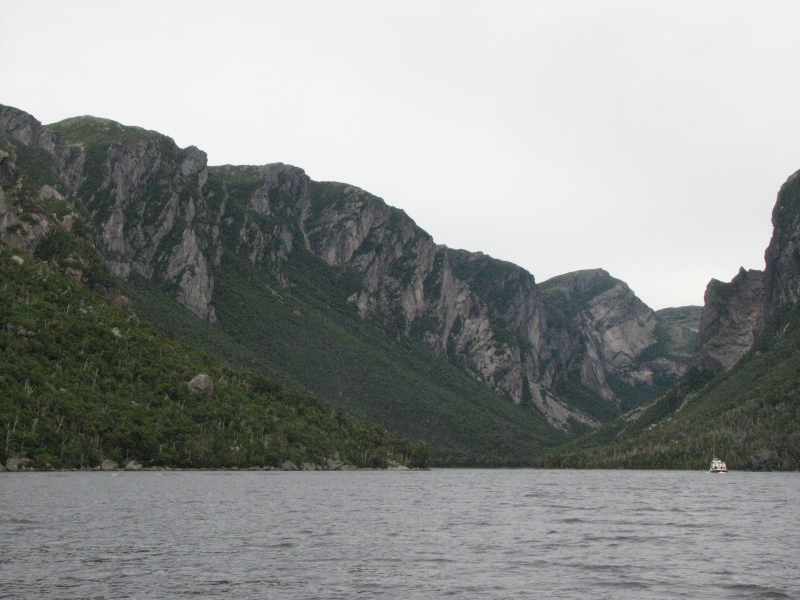
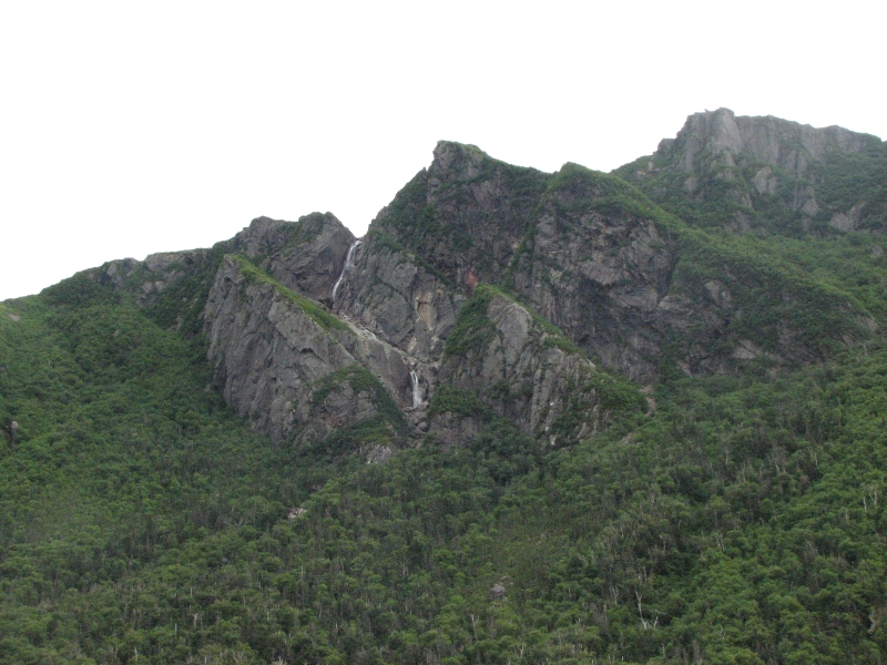
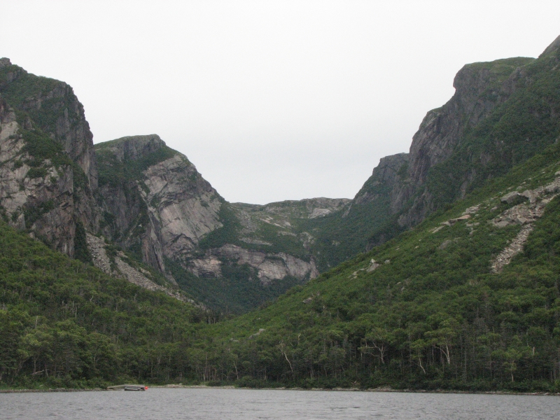
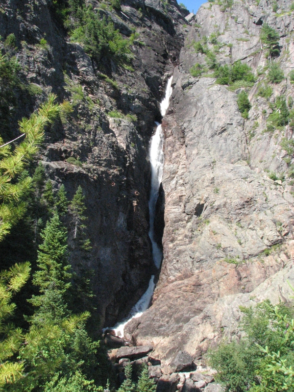
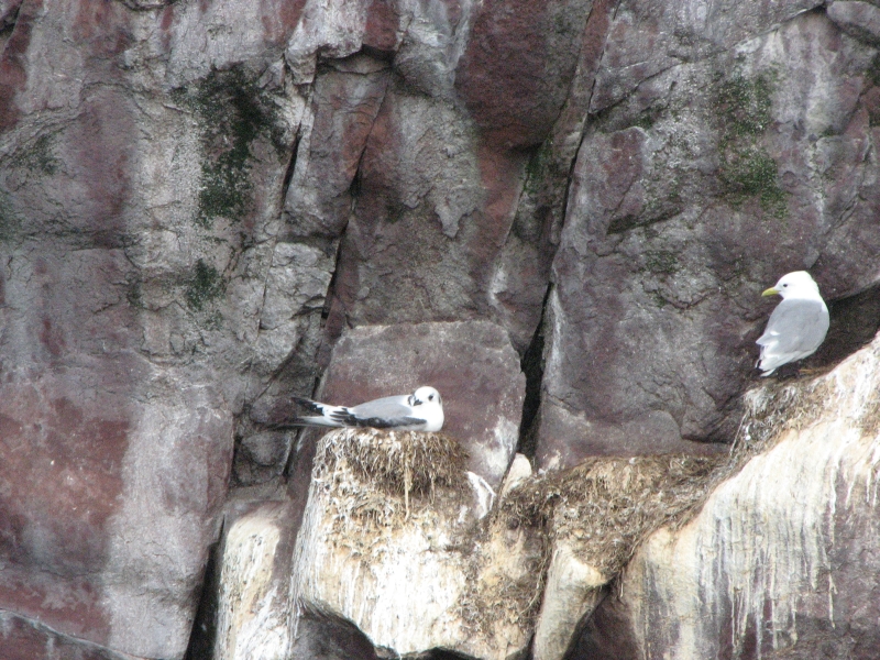
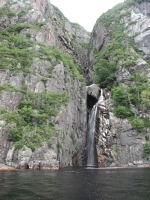
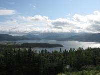
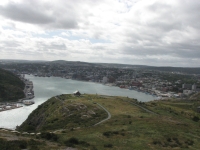
Western Brook Pond is a huge fjord--carved by glaciers--that was cut off from the sea at the end of the last ice age. Theres a 3 km. walk across bogs and wooded ridges to the Pond, where we picked up the tour boat. The trail was easy, with extensive boardwalk across the wetlands. There were enough people to fill two boats, one tour for the English speakers and one for the French. The pond was an amazing place, with 2000 high gray gneiss cliffs and a deep dark lake (525 deep). The fjord is 13 km long, with numerous waterfalls dropping from the plateau above. The tour guide told us that they are very dry right now, so the falls were smaller than usual, but I liked them, especially one wide one that contrasted with the red rock behind the white water. It was a very stark dramatic beauty: huge smooth cliffs, dark green forest, gray skies and black water. The words that came to mind were awesome, majestic, stupendous, and magnificent. The tour gave basic information about the place, but mostly left us to our own impressions. I spotted three black bears (I think) on meadows high above the lake. They were barely visible with binoculars, but I watched them for a while. We finished around 6:00, walked out three km. to the truck, drove back to the campground and barely managed to eat dinner just before dark. It sprinkled a bit, but not for long. Tomorrow the forecast is for rain all day. Were outta here.
Tuesday, August 18: LAnse aux Meadows
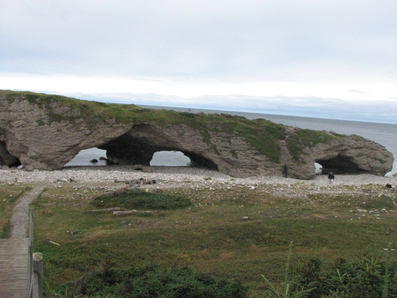
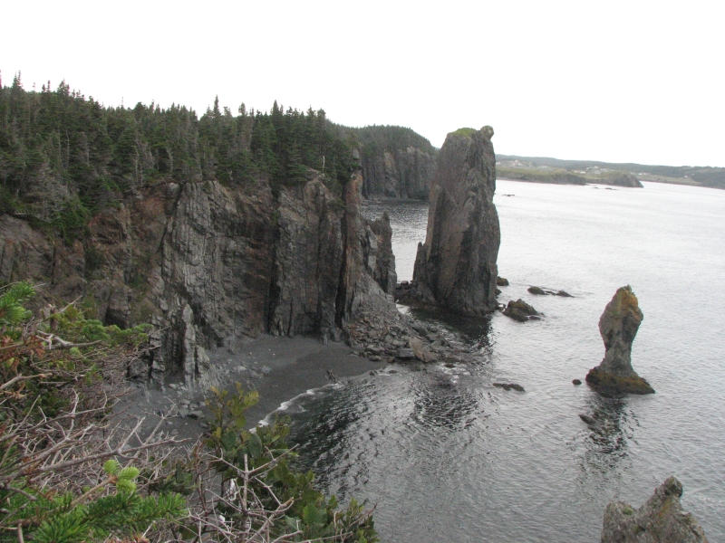
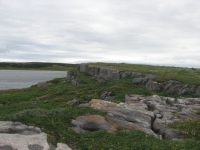
We fell asleep to the gentle pitter patter of rain on the roof. We woke to gray skies, but the rain had stopped, for a while anyway. As we drove north, we could see clouds shrouding the mountains but we only experienced occasional sprinkles. We halted at the site of the SS Ethie, a steamboat that went aground in 1909. Surprisingly no lives were lost in the accident. There were still numerous pieces of metal scattered on the beach and in the water. A few miles up the coast, we stopped briefly at Arches Provincial Park, where waves have worn holes in the limestone to create four large arches. Nice.
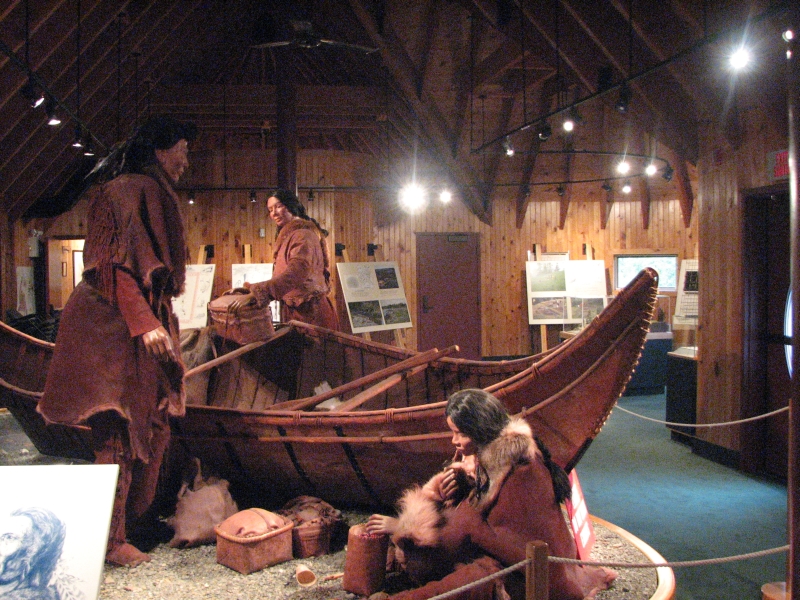
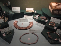
One hundred kilometers later we detoured to a National Historic Park at Port au Choix that commemorates the prehistoric peoples of Newfoundland. Archaeologists say that the area has been inhabited for at least 5000 years. There were four different native groups who inhabited the area to fish and hunt seals and caribou. Vikings visited 1000 years ago, followed five hundred years later by Basque fishermen, then French fishermen who settled seasonally along the coast and finally the English, all drawn by the rich harvests of sea life and berries. There are several archaeological sites you can visit at Port au Choix via hiking trails, but today was very very windyhence coldso we only walked to one that was about 1 kilometer from the parking area. All you can see now are depressions in the ground that once were Dorset houses. It was a pretty area with tuckamore (dwarf forest or krummholz) and many wildflowers next to limestone ledges. We also visited the lighthouse at Pt. Richie and watched a video at the Visitors Center explaining the history of the area. Archaeologists have excavated gravesites and homesites and found many bone and stone tools.
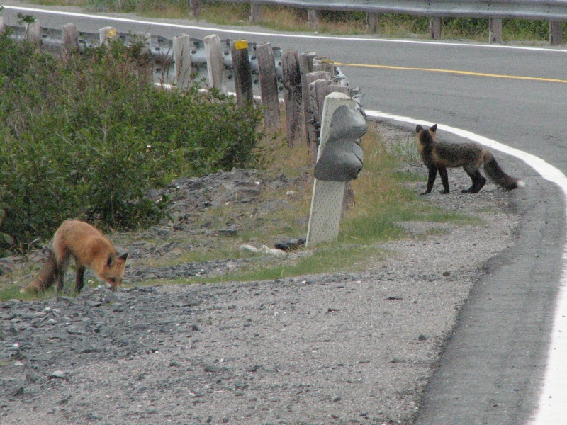
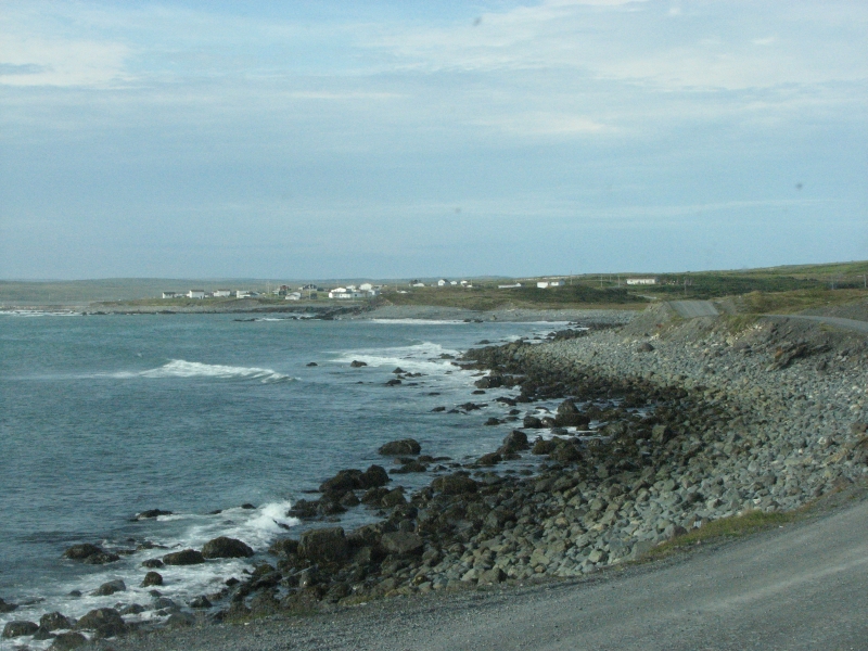
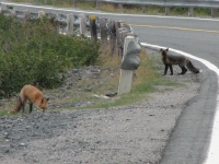
The rest of the day was just driving, sometimes along the shore, passing numerous fishing villages, and sometimes through the forest. Mountains came and went. At one point we could see Labrador across the strait. Along the highway were a few oddities, like piles of cut firewood labeled and piled in neat stacks. There were also hundreds of lobster traps, neatly stacked for the winter, sitting beside the road. Then there were numerous small gardens with neatly fenced 8 x 15 plots. None of them were near any houses, just next to the highway. Odd. It was a good day for wildlife, with four moose and a pair of foxes (one red and one black) next to the road.
We ended up at a small barebones RV Park near the end of the Viking Trail. Tomorrow well visit the erstwhile Viking village at LAnse aux Meadows. Dinner was another good cod dinner at a restaurant called Northern Delight, with a local Newfoundland beer (1892) and partridgeberry pie for dessert. It was too raw outside-- cold and windy and threatening rain--to make cooking on a picnic table appealing.
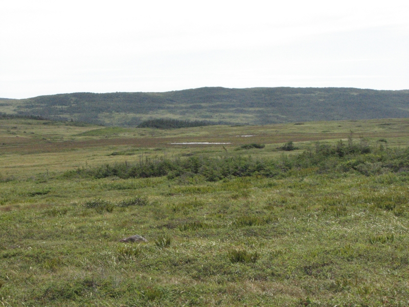
The land up here is hard to describe. Its wild country. People live near the shore, but not inland. The soil is thin and wet and the land is rocky. There are many shallow ponds and peat bogs, some spruce taiga, and a lot of low shrubs. The mountains are round and green, 1000-2000 high. There are grassy pastures and gray rocky areas. Its a hard land, a cold land, but beautiful.
Wednesday, August 19: Hawke Bay, Torrent River
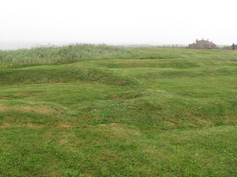
It sprinkled off and on all night and we woke to mist and fog. We decided to drive back to Northern Delight for breakfast instead of cooking in the rain. It was only a few miles from there to LAnse aux Meadows, the only authenticated North American Viking site. Evidently Leif Ericson established a small group there, probably as a way station between Greenland and Vinland. A Norwegian couple spent years searching for the location of the Viking settlements in North America. In 1959 they arrived at the small fishing village of lAnse aux Meadows where they asked whether there were any old ruins nearby. The headman said, Theres an old Indian village where I graze my sheep. Those stone walls turned out to be a Viking village. They excavated several buildings, an iron forge, tools, a bronze cloak pin, etc. No question, it was Viking, but probably not Vinland.
We were given a guided tour of the site (holes in the ground, filled in by the archaeologists after excavation) by a local man who lived there when the excavations were going on from 1960-69 and then again in the 70s. He talked about life in the village before there was a road to connect it to the outside world. I asked him about the woodpiles we had seen. For $22 you can get a wood permit to cut six cords from the forest. The local people cut and move wood in the winter over the snow, let it age a year in piles by the highway, then haul it home. The numbers we saw on the piles represent their permit numbers. He also told me that the gardens are mostly potatoes and are grown on crown land. The soil beside the highway was dug up and turned when they built the road and now people who live near the sea are able to grow vegetables in sunny areas on public land. Im glad I asked.

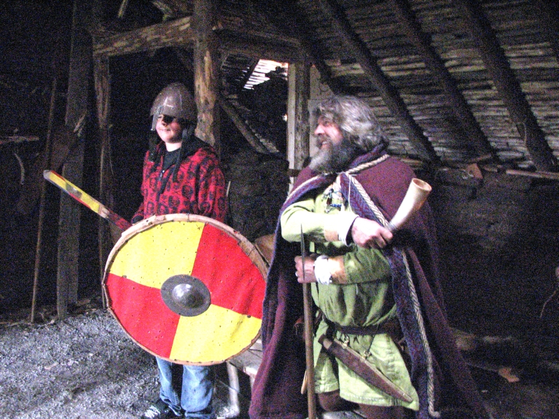
Next to the archaeological site is a modern reconstruction of the Viking village with costumed interpreters who tell stories and demonstrate a few traditional skills, like knitting on a single needle and forging nails. There was a large group of teachers taking a course nearby who were learning the skills when we wandered through. It was a fun site and we stayed a long time, though the day was wet and misty. The museum video showed the Norwegian couple that discovered the site: she was an archaeologist, he was just an adventurer who was fascinated by the Norse sagas. The Viking buildings were constructed of peat, so grass and flowers grew on the roofs. They were in the process of reconstructing the main building, so we could see how it was done. The animators wore wool and leather costumes. They were good.
Heading south again, we stopped at the Dark Tickle Economuseum. The bogs and barrens in Newfoundland have a dozen or so edible berries. Dark Tickle is the name of a company that sell jams and syrups made of several of them. An economuseum is supposed to combine education with commerce - making a museum out of a business. I love the idea of a museum focusing on jams and jellies, since I love berries, but not the prices charged in the shop. We have seen partridgeberry jam in several shops and bakeapple/cloudberry in a couple of places. Crowberry is more rare, though it is very tasty. I havent tried squashberry yet, but Id like to before we leave. Then there are the more common raspberries and blueberries, which weve been able to locate on some of the hiking trails here. I love wild fruits. The economuseum was a disappointment though. Yes, we could watch a woman making syrup in a glassed-in kitchen, but other than that it was just a very expensive small tourist shop.

Jim and I started south on a different route, not along the western shore. I wanted to visit the museum at Roddickton, but it was closed when we arrived there. We did get to see the underground salmon cave, a place where the river vanishes underground and emerges again 100 yards later. We visited one of those in Wyoming a couple of years ago. The fish swim upstream through the cave. We spotted three fish waiting at the mouth of the cave, trying to get up the nerve to continue, I think. Jim and I walked a kilometer or so at the salmon site since it wasnt raining at the time. We thought we might see a bear there: the trash cans were all turned over with trash strewn about, and a sign said, Stay away from the bear cage Danger! We never did see the bear cage. We did see a couple of moose and two more foxes beside the road, one black and one tan. Fun.
Jim and I stopped for the night at Torrent River Nature Center, a small campground in the village of Hawke Bay. Theres a boardwalk trail along the river that I followed for a half mile or so. The story behind the trail was an interesting one, named for a soldier whose plane crashed nearby during WWII. He walked out of the wilderness with an injured companion in mid-winter. Tough man.
The land we crossed today was different from what weve seen previously: dense mixed forests and low hills instead of the mountains, sparsely vegetated bogs and barrens of Gros Morne or LAnse aux Meadows.
We phoned to change our return ferry reservation. Eight days simply isnt enough to see a place as large and as interesting as Newfoundland. We added a week and changed from the ferry at Porte aux Basques to the one departing Argentiers across the island. The ferry ride there is much much longer and more expensive, but it will be worth it to avoid having to drive back 800 km. or more to Porte aux Basques. Ill probably think differently after 14 hours on the boat, but for now it makes sense.
Thursday, August 20: Gros Morne
Today turned out to be a good day, although when we woke to gray skies again, after a night of rain, I wasnt sure what to expect. There were patches of blue out over the water, but inland over the mountains it was definitely wet. The question was, which way was the wind blowing?
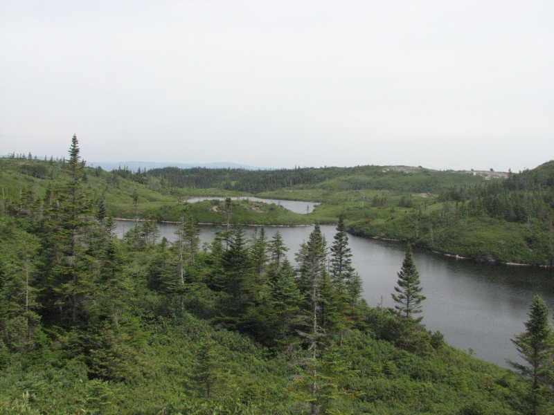
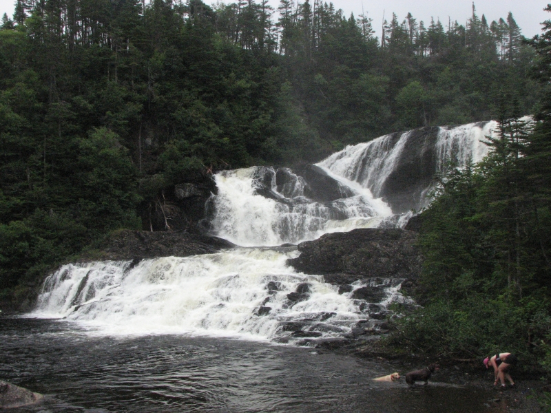
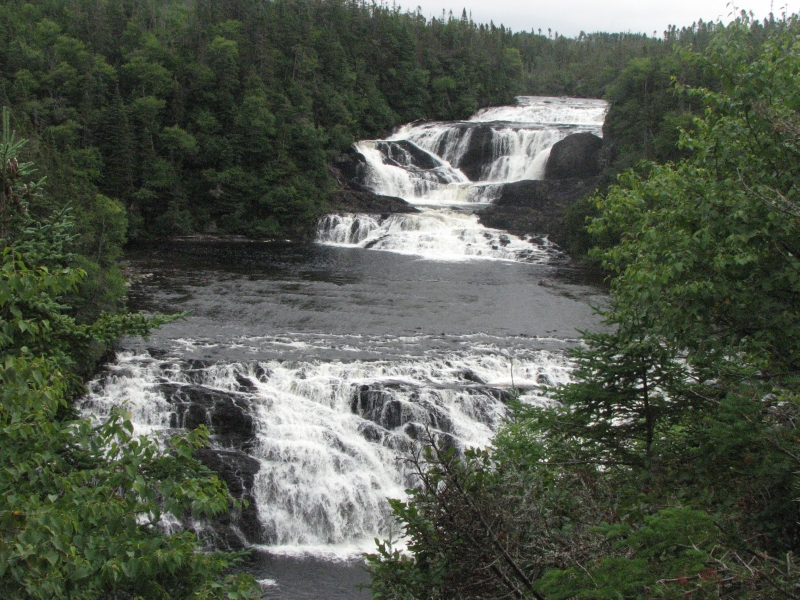
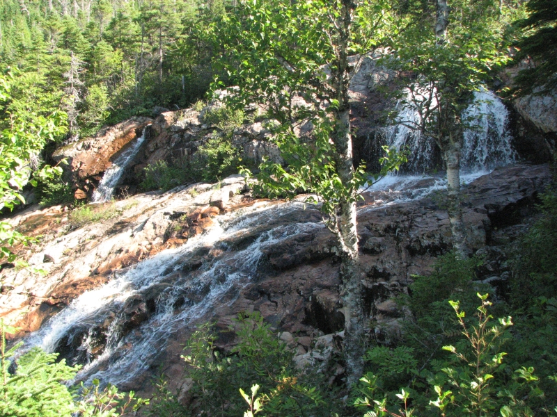
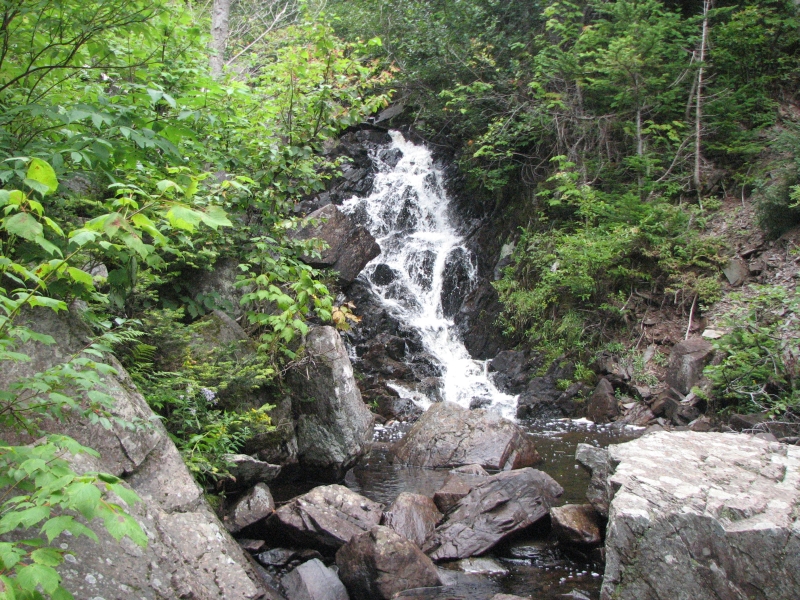
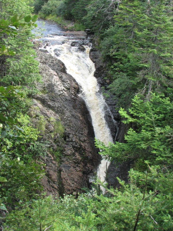
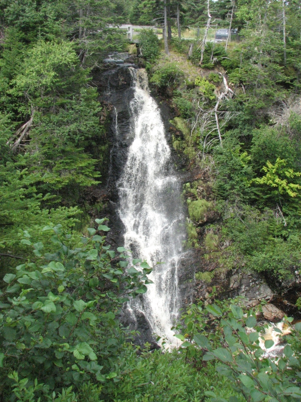
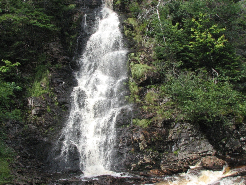
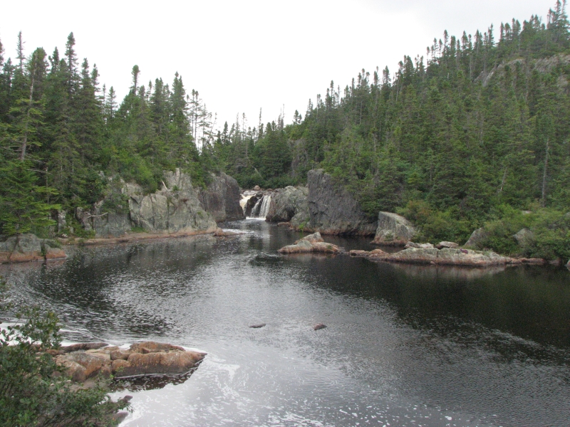
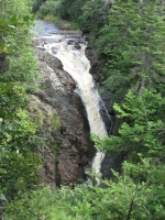
After a long chat with the campground manager, Jim and I headed south to Gros Morne. There was another hike I hoped to do, so I was wishing for clear skies. We reached the park around noon, got a site in the Berry Hill Campground, ate lunch, then set out toward Baker Brook Falls, a six mile roundtrip hike. The hike was an easy one, through bog on boardwalk and past a large blowdown area on good trail. It turned out there were three waterfalls, or maybe one waterfall with three separate tiers that were 50 apart. It was very dramatic and beautiful, one of the best Ive seen in a while. The rain had stopped just before we reached the park; by the end of our hike the sun was shining, off and on.
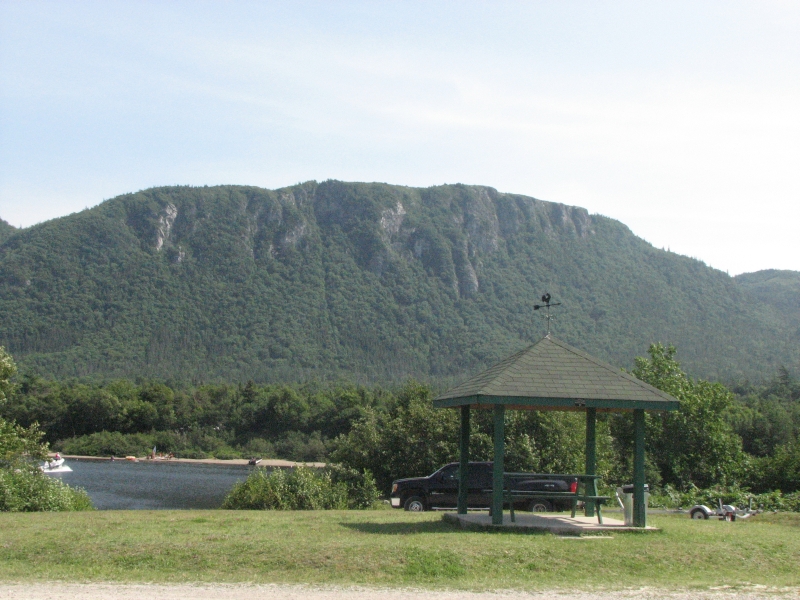
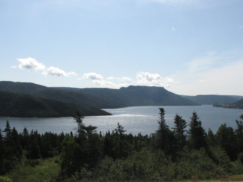
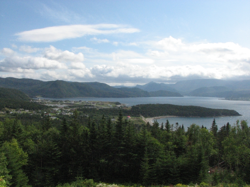
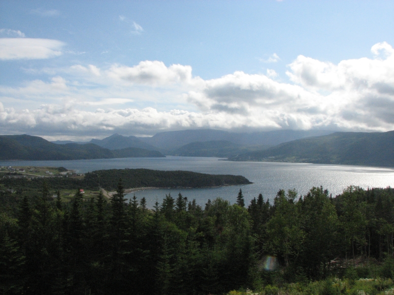
Afterwards, we decided to drive out to Norris Point, where there is a beautiful view of the town and fjord beyond. We walked out to a viewpoint and scared off a bull moose. Jim and I had seen a cow beside the road earlier. We drove back to Rocky Harbor to buy ice and ended up eating pizza at one of the restaurants. Not great, but better than tuna noodles. We also found some jams to round out my collection. Ive bought partridgeberry, cloudberry, crowberry and squashberry jams or jellies none from Dark Tickle. Most are homemade. One was made by the mayor of Norris Point.
I was feeling stuffed after beer, pizza and ice cream, so I did a short hike from the campground around Berry Pond. Its a small hike, only 2 kms. around the loop, but popular with fishermen. I passed two more moose in the trees, one male and one female. They turned their backs and went back to grazing, ignoring my attempt to get a photo. Finally, I headed back to camp and a shower. It was a very good day.
Friday, August 21: South Brook
Today was another waterfall day. We woke to sunshine and blue skies. Jim and I were tempted to remain another day in Gros Morne to hike one of the trails we missed, but since we only have nine more days in Newfoundland, we decided to start heading east. We did stop at Southeast Brook Falls, a 1 km. walk to a waterfall that was impossible to photograph or even see in its entirety. It was a bit disappointing. We left the Park after a couple of stops to admire views.

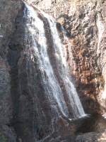
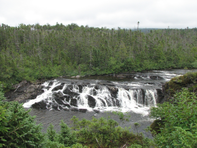
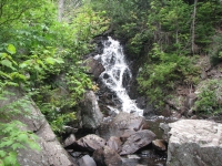
Since it was a beautiful sunny day, we detoured off the Trans-Canada Highway to Rattling Brook, which has an 800 waterfall, partially visible via a short ½ mile hike up wooden steps. We could only see about 100 of the total waterfall, but it was beautiful. Then we continued a few miles to Kings Point which has a five mile hiking trail called the Alexander Murray Trail -- a really nice walk. We hiked through boreal forest, then climbed 1000 to spectacular views: on one side was Green Bay, with beautiful blue water, and on the other side we saw wild tundra. The trail was mostly boardwalk and wooden steps, a vast improvement over the rough ladders that preceded them. A few of the ladders remained, but werent in use any longer. We passed three waterfalls: one was on a side trail with a long drop, so we skipped it, but another was easily visible and absolutely gorgeous. There were lots of ripe blueberries to enjoy as we climbed. The forest was mostly spruce and balsam fir, laurel, blueberries, moss, lichens and ferns and pitcher plants in the bog. Between the stairs, the berries and the views, it took us three hours to hike the whole loop. It was well worth the effort.
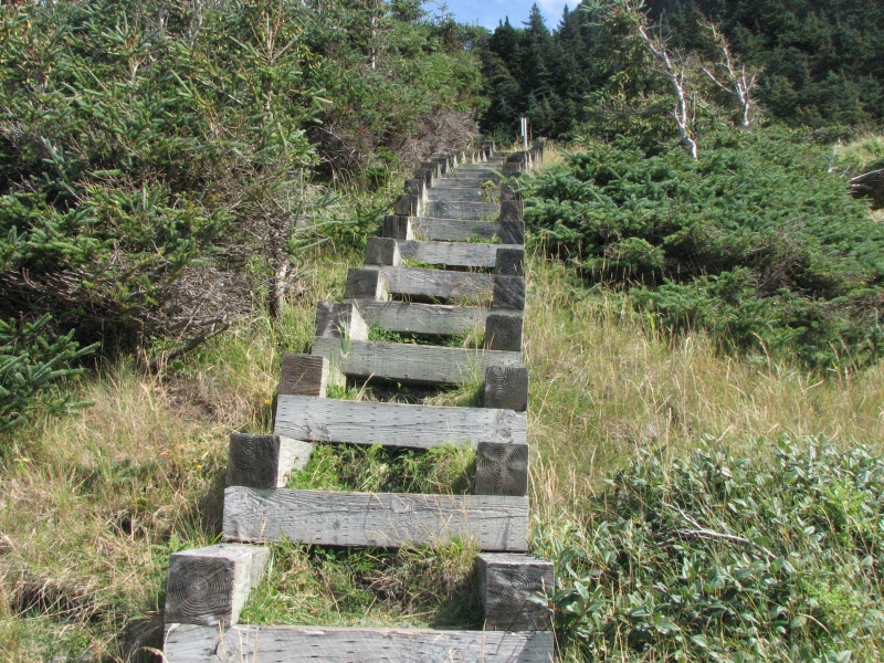
The trail was extremely well signed, with markers at each waypoint that detailed how far it was, in distance and time, to the next waypoint. The trail was also well constructed, though some of the rails were broken and some of the trail was on rooty sod. I have been very impressed with the quality of the hiking trails in Newfoundland. They have put a tremendous amount of time and money into building steps and boardwalks to make them tourist friendly. Wed be out there regardless, but I do appreciate the hard work involved in constructing the trails.
We ended up at Kona Beach Campground near South Brook. Its not a great one. We have a slanted site and its a long walk to the only bathroom, but it was cheap. I got stung by a bee or something, which upset my good mood. Dinner helped revive it.
Saturday, August 22: Gambo
We lost our good weather. Evidently a hurricane (Bill) is approaching the island and will affect weather for the next few days. It rained lightly most of the night, ceased while we ate breakfast, then began to pour in earnest while I washed the dishes. Driving was difficult in the downpour. Jim and I decided it was a good day for museums, so we visited two that were dedicated to the Beothuk, the natives of Newfoundland who were annihilated in the 18th century, partly by warfare, partly by disease, and partly because the French and English presence cut them off from the seashore, source of their main summer food supply. Apparently their numbers were much fewer than the Mikmaq, so they had less ability to absorb the loss of life caused by the European presence. The Mary March Museum in Grand Falls and the Beothuk Interpretive Center in Boyds Cove each told part of the story. No one knows the whole story of how they lived and died, but at least the Beothuk people wont be entirely forgotten.
We ended the day at a primitive campground at David Smallwood Municipal Park. Its the cheapest yet, only $12, but boasts a walk along the river that sounded interesting, especially since the rain stopped around 3:00. The trail was about 1 ½ km each direction along both sides of a salmon stream and included a small waterfall and a fish jump. Were too late for the salmon. The salmon season is just ending, but it was a nice walk on good trail.
Sunday, August 23: Terra Nova National Park

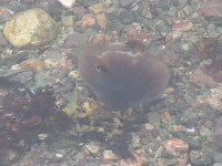
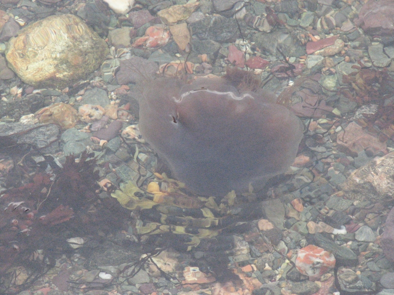
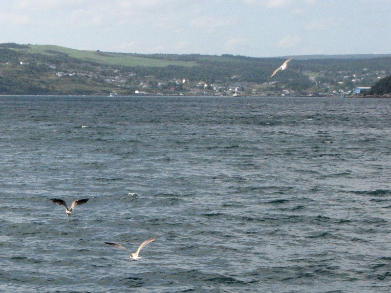
The rain held off, though it was a gray and gloomy day. Hot (85 deg.) and humid though, which was a surprise. We reached Terra Nova National Park early, around 9:30, and decided to go hiking before the rain started again. We picked a short 9 km hike along Newman Sound from the Visitors Center to the campground. The trail hugged the shore just above the water, with a couple of brief forays onto the beach. Swimming would have been nice, except for all the jellyfish. They scared me off. The day was hazy and gray, so the views werent too exciting. Highlight was watching a hawk that stooped down to catch a fish. We saw it again later in the woods.
After lunch at the Visitors Center (ice cream!), we headed to the boat rental office. The outfitter, James Kelly, was very friendly and talked to us for about an hour, recommending several places to visit in Avalon, the south-eastern area of Newfoundland, but he wouldnt rent us a boat. Thanks to the storm, all the boats had been pulled up out of the water. As it turned out, we probably would have been fine, but tropical storms are unpredictable. Jim and I drove to Malady Head Campground and picked a site, then took an overdue (hence very welcome) hot shower. There are two campgrounds in Terra Nova Park, one is huge (300 plus sites) and has hookups, while the other is much smaller (90 or so campsites) and caters to tent campers. Thats where we went. It had a shower and flush toilets, so I was happy. We have our loop entirely to ourselves, so far at least. I guess many would-be campers were scared off by the storm threat.
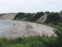
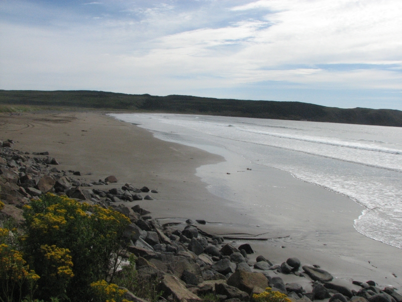
After we got cleaned up, Jim and I headed to a nearby town in search of a grocery. Prices were really high so we just bought a few basics, but at least we now have dinner and bananas. The rest will keep until were away from the tourist areas. Once that was accomplished, we drove out the peninsula to Sandy Cove, which has a lovely white sand beach. If I hadnt just taken a shower, I would have gone for a swim, though the water was colder than I expected. Instead I walked barefoot on the soft sand for a few minutes, then we headed back to the campground to grill burgers and wait for the rain. Someone said it was expected to hit Avalon harder than this part of central Newfoundland. I hope thats right.
Monday, August 24: Bonaventure Peninsula
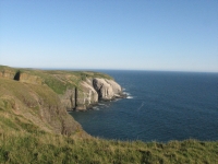
Tropical Storm Bill passed through during the night, raining hard for several hours but doing little damage in our area. Morning brought gray skies, wind and high surf. We ate breakfast in Charlottetown, since our stove isnt very efficient in the wind. I left my jacket behind in the restaurant. Aaargh! We drove around the Bonaventure Peninsula--a beautiful drive, especially on a day where the waves were pounding the cliffs. Sun came and went all day and it stayed cool. The whole route was scenic, with rocky ridges, glacial lakes, spruce and larch forest and big gray cliffs above clear blue-green water.
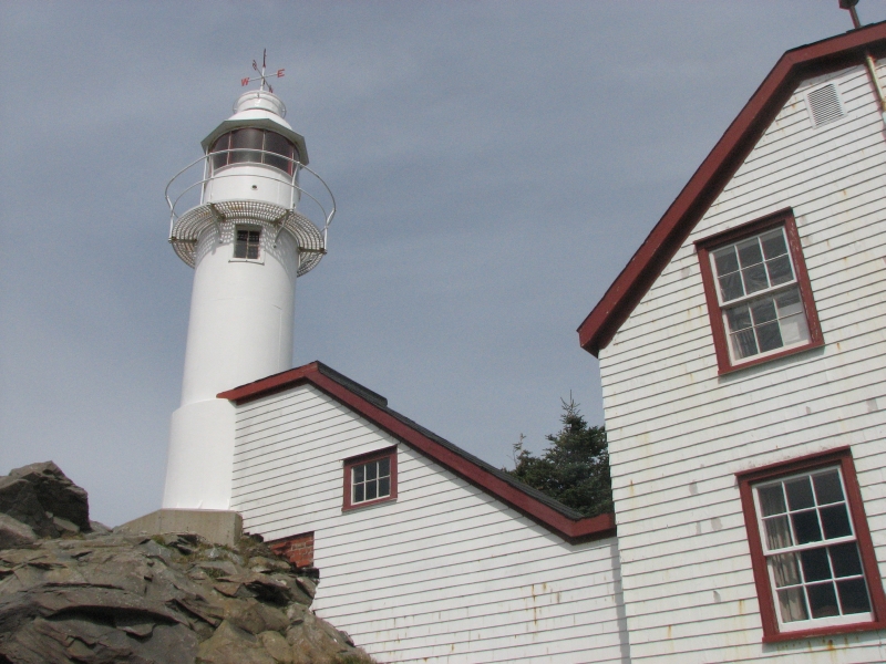
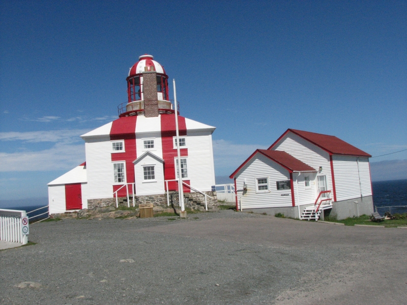
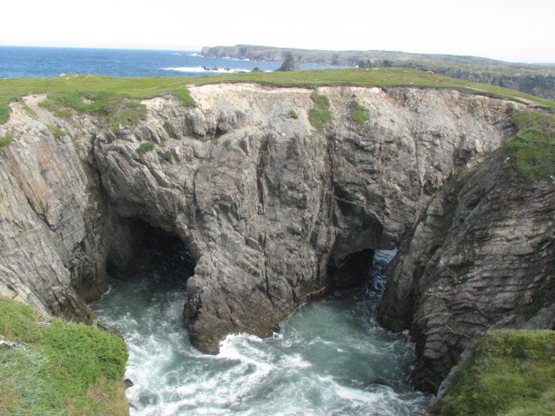
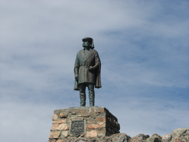
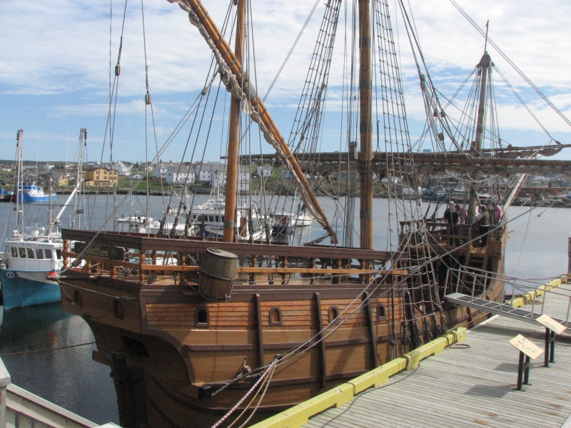
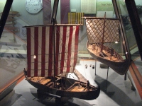
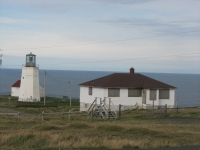
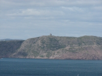
We drove out to Cape Bonavista, supposedly the place where John Cabot landed in 1497. Theres a historic lighthouse that you can tour there. Costumed interpreters explain life in a lighthouse and how the light worked (like a clock, with a weight that dropped, slowly, turning the light. It needed to be rewound every two hours.) It was interesting. Nearby is Dungeon Provincial Park, where a collapsed sea cave now has two natural bridges. It was a pretty site. In the town of Bonavista, we stopped to look at Ye Matthew, a full-sized re-creation of Cabots ship. We also bought groceries for the next few days.
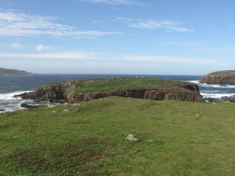
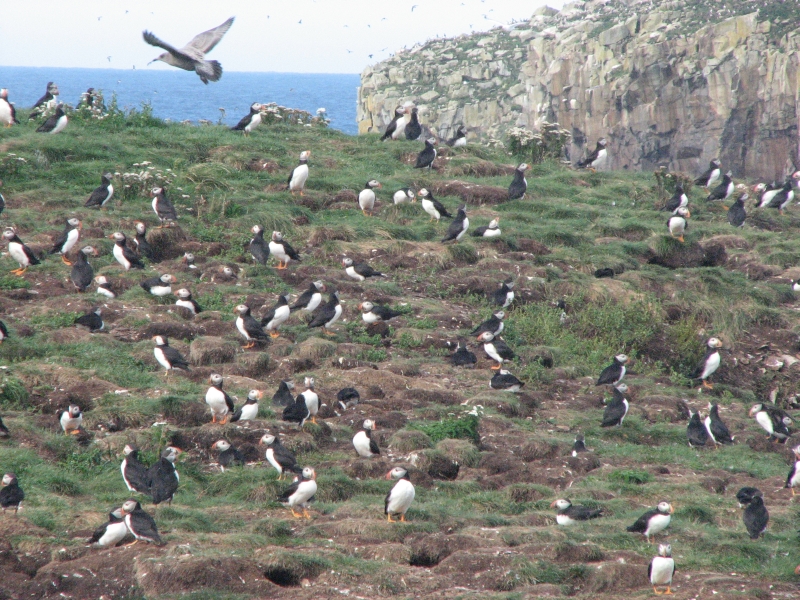
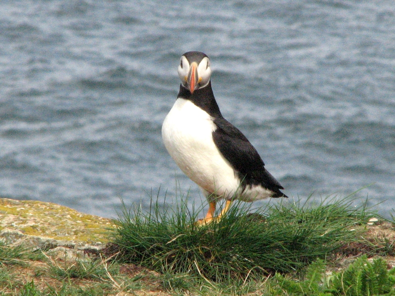
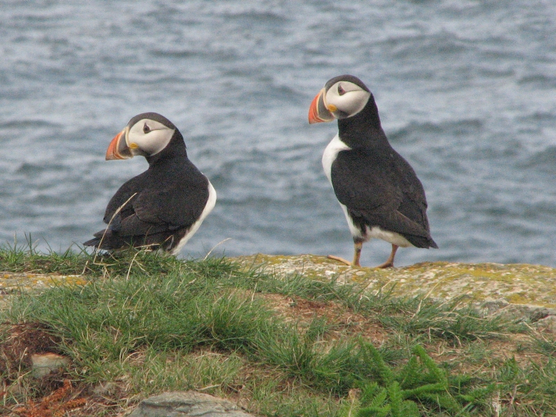
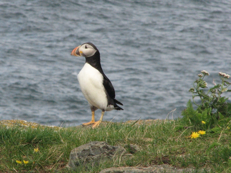
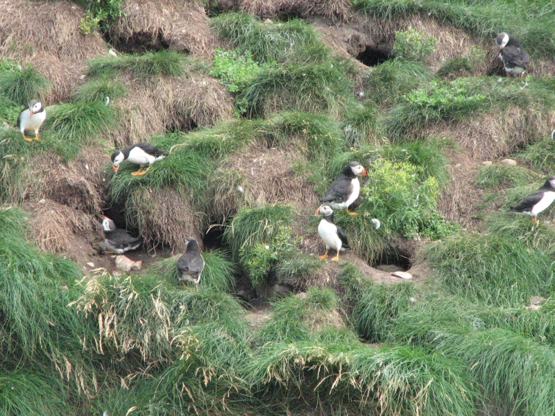
Then we drove a rough road to Elliston, which has a really good puffin rock. You walk out on a grassy point a couple of hundred yards. About 50 yards away is a big sea stack covered with hundreds of Atlantic Puffins. (Actually there are several rocks, but one had been part of the ridge we were on until the sea split the rock apart). Puffins need a certain kind of rock, with enough soil so they can build nests in burrows in the sod. We watched the birds for a while. They reminded me of tiny penguins: waddling on land, awkward in flight, but excellent swimmers. It was a real thrill to see them so close in the wild. When we stood up and turned around, we noticed two that had flown across the water to our ridge and were only 20 away. A photographer who was sitting nearby said that if you stay still long enough, you may become surrounded by 100 or more birds. Elliston is also famous for its numerous cellars, dug into the rocks around town. I dont know what the story is, but we noticed a dozen or more on the way to the puffin rock.
By the time we reached Port Rexton it was already 5:30, so I was surprised that Jim agreed to do the Skerwink Trail, a 5.3 kilometer loop hike with beautiful views of the coast. There were sea stacks, cliffs, ponds, and a lighthouse across the cove. (Theres always a lighthouse!) It was a really good hike. Theyve done some beautiful trail work on the Skerwink Trail: steps, bog bridges covered with mesh, etc. We were lucky to get there after the trail crew had done their work. Actually, they werent quite finished. Tools were left out for tomorrows labor. The hike was a good end to a great day.
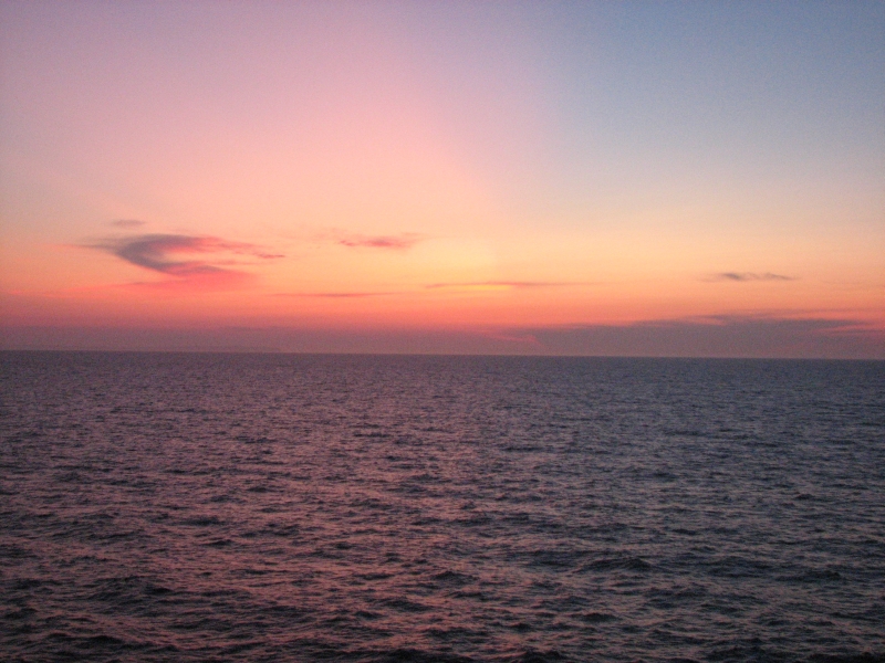
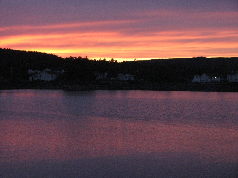
Well, not quite the end, we still had to return to Charlottetown to retrieve my lost jacket and find a place to spend the night. A pink sunset reflected in the water made the journey a pleasure. Dinner was another good cod meal at the restaurant in Charlottetown, then we drove to the Newman Campground in Terra Nova National Park. It was nearly empty. On the way in we spotted a moose and a black bear--probably a cub--diving in to the bushes. This was a great day for wildlife. Besides the puffins, we saw two bald eagles, two moose, the bear and four whale spouts on the bay. Happiness is!
Tuesday, August 25: St. Brides
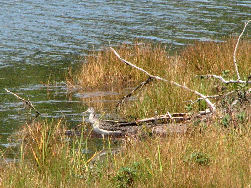
We woke to blue skies and sunshine, a beautiful day. Were heading southeast to an area of Newfoundland called the Avalon Peninsula. The Tran- Canada highway crosses it east west, then there are five arms, each with a scenic driving route: an isthmus leading out to Avalon, the Baccalieu loop, the Killick Coast Scenic Route past St. Johns, the Irish Loop south of St. Johns, and the Cape Shore which goes past Placentia and St. Marys. Before crossing the isthmus, we stopped at Arnolds Cove to hike the Bordeaux Trail, which follows the shore for a couple of miles, then ends abruptly at an oil storage tank on a road leading back to town. We got lost wandering through a residential area, but eventually we found the truck. It was a nice walk, except for the roadwalk, but not as spectacular as advertised, especially after yesterdays much more scenic Skerwink Trail. Still, it was good to be able to enjoy the sunshine. We saw an eagle and a bird known as a Yellow Legs (I think). We spotted three more eagles a little later.
Heading south toward Placentia, we found that the road we chose was in really rough shape. A road crew was repaving part of it, but the other section was worse than anything weve seen so far in Canada. Huge potholes. It turns out there's another highway that most people take, though this one was shorter. The land we traversed was beautiful wild country. Shaped by glaciers, it had big rounded hills, shallow ponds and lakes, open tundra and spruce and larch trees. It reminded me of Alaska or the high alpine areas in the Rockies like the Beartooths or Wind River Range, though these hills were lower. Supposedly Avalon is actually a chunk of Europe that broke off from Portugal and ended up--thanks to the movement of the tectonic plates--crashing into the rest of Newfoundland. Geologically its different from the rest of the island. It also has different wildlife: no bears, but lots of caribou. I hope well see some while were here. We did see something unusual: a squad of planes in formation flying overhead, probably the Canadian version of the Blue Angels.
In Placentia we stopped to do laundry and get gas, beer and soda. I hated to be indoors on such a nice day, but it was necessary since Placentia is the largest town well see for the next few days.
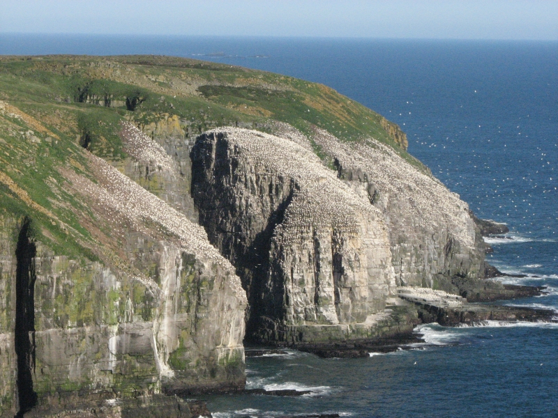
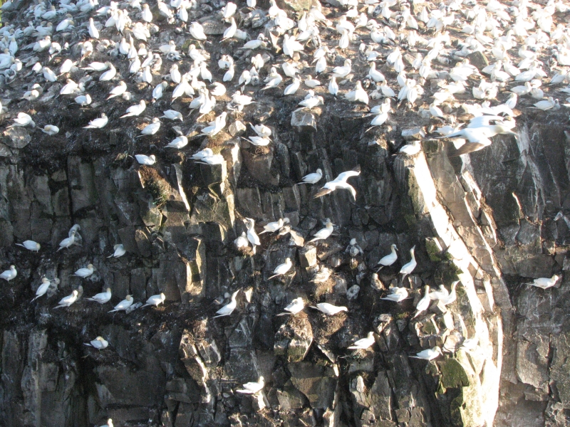
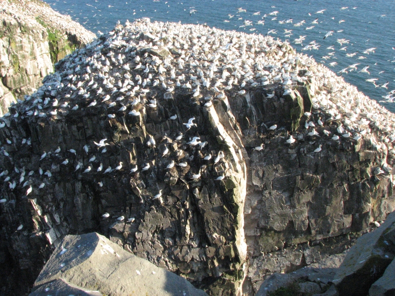
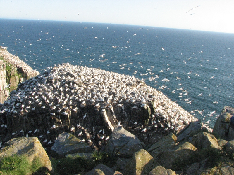
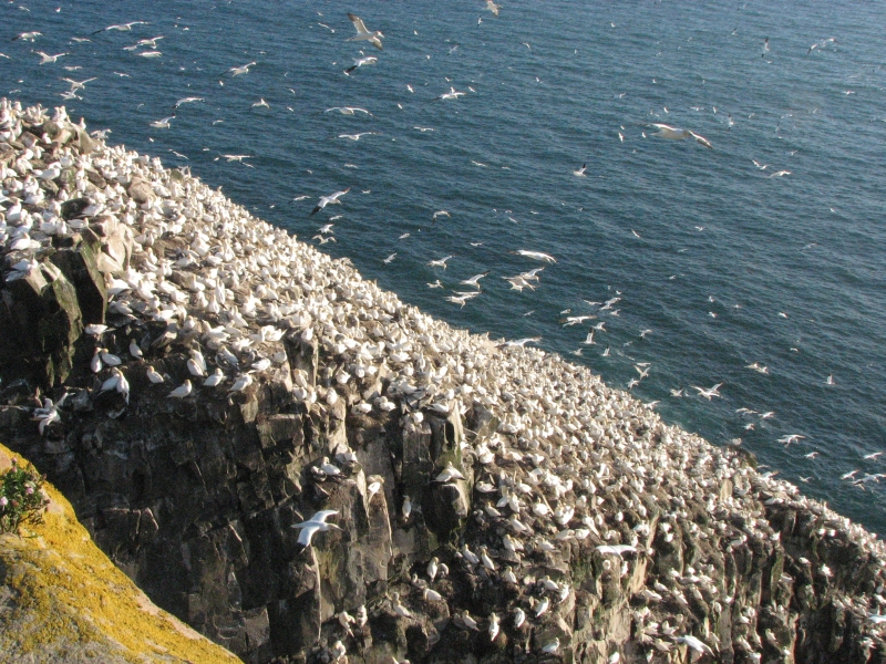
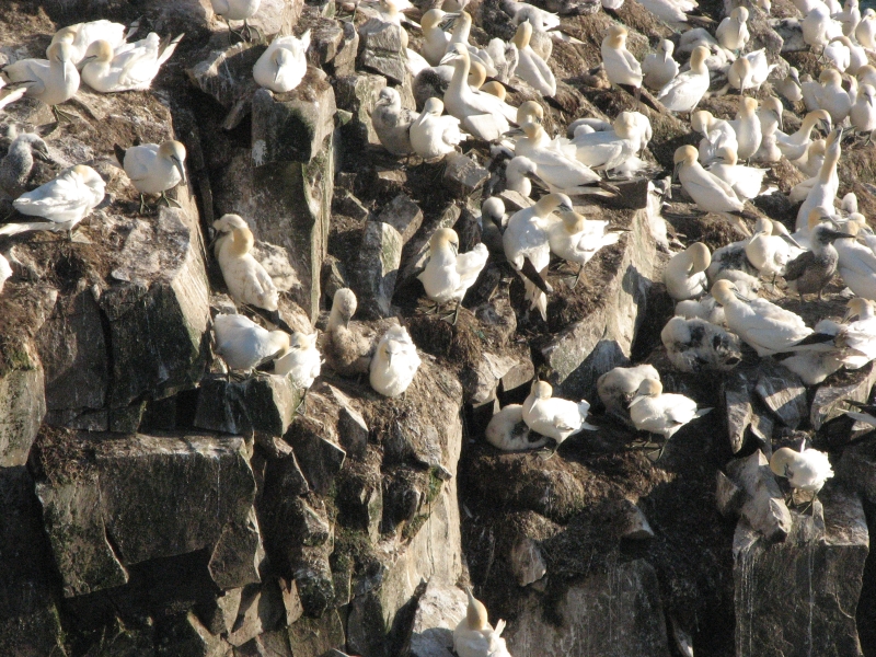
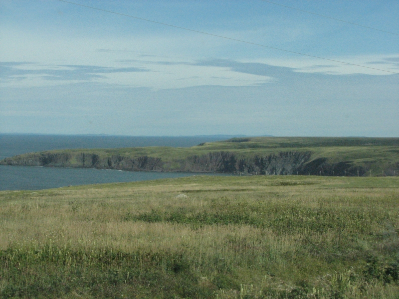
The drive south along the coast was interesting. The road wove up and down from ridge to deep cove up to the next ridge, then down to the ocean again. It was a clear day, so we could see the Burin Peninsula 40 miles or so away across the sea. At St. Bride we got a spot at a small RV Park actually just the parking lot of the restaurant, but it has tables and you can use the restroom in the restaurant. Once checked in, we drove 13 km. to Cape St. Marys, a Bird Reserve famous for its large colony of Northern Gannets. There are other birds that nest there as well, but the gannets are the main attraction since you can walk out a mile or so to a tall cliff within fifty feet of Bird Rock, where thousands of northern gannets roost. It was a lot like our Puffin Rock the other day different birds, but in both cases, we could get very close to huge colonies of nesting birds. We sat and watched the birds come and go. It was windy, so landing on the cliff wasnt easy for them, especially given how very crowded the rocks were. I kept expecting to see crashes and pileups, but mostly they managed to avoid hitting each other. There were numerous young birds still covered with down. It was fascinating to watch them, both on land and in the air. The gannets are pretty birds, with yellow heads, white bodies and black wing tips. The drive out St. Marys was a flat open plateau that again reminded me of the Arctic. We looked for caribou or foxits their sort of countrybut didnt see any.
Wednesday, August 26: La Manche Provincial Park
I got my first taste of moose meat last night. Its something Ive wanted to try, as I heard that it was tasty. The restaurant had moose stew and moose soup. It tasted like beef to me. The stew was light on the meat, but tasted pretty good and the homemade bread and pie were delicious.
Today was nice: partly cloudy, partly sunny. We started by driving back out to Cape St. Marys to visit the Interpretive Center. (It was closed last night when we arrived.) I also wanted to look for some of the other birds that nest there. Unfortunately, we learned that most of the birds have already migrated. The Northern Gannets stay until October, but the others leave in August. We saw some kittiwakes (a small gull) and cormorants, but no murres or razorbills. As we did last night, on our walk to the cliff we spotted a couple of hawks (Sharp Shinned?) hunting by soaring low over the open country.

Afterwards, we detoured (on James Kellys recommendation) to Point Lance, his hometown. We didnt see any wildlife, but the open country, the Barrens, was beautiful. Again, the open tundra reminded me a lot of Alaska. We drove up the west shore of St. Marys Bay, with barrens on one side and open sea on the other. At noon we reached Cataracts Provincial Park. Like Gooseberry Bay Provincial Park yesterday, there was no sign telling tourists where to find it. Because we were looking carefully, we noticed the trails leading back to views of two lovely big waterfalls in a deep narrow chasm. There were wooden steps leading to the base of one waterfall. It was a worthwhile detour.
Then we descended on the east side of St. Marys Bay. I was surprised at all the houses. How do the people living there make a living? Since fishing has been severely restricted, it must be a real problem. We ate lunch at the whale viewpoint at St. Vincents. No whales. Evidently they come for the capelin in June, but now its late August, so the humpbacks are feeding elsewhere. Cape Race Lighthouse was our next destination. It was 19 kilometers out a dirt road. The scenery was splendid, with ocean on one side and rolling Barrens on the other.
We had planned to spend the night at Chance Cove Provincial Park, but it turned out to be just a small parking lot, without a view of the rocky beach below. There are some nice walk-in tent sites, but with rain expected, tenting didnt appeal. Besides, we both wanted a shower, and Chance Cove barely had an outhouse. We reluctantly continued to La Manche Provincial Park, which is semi-primitive (pit toilets) but does have a shower building in the center of the campground. We barely had time to cook before dark, then we drove to the shower building and back out to our campsite. Lazy, but better than wandering in the dark. We asked about visiting the nearby Avalon Nature Preserve tomorrow and were told that the road is very rough and requires high clearance. After our four dirt road detours today, I imagine Jim was relieved not to have a 40 mile (one way) back road drive to look forward to tomorrow, though we were both disappointed at losing the chance to look for caribou. Western Newfoundland was much better for spotting wildlife than the east. As we approach St. Johns, the capitol, thats not likely to change.
Thursday, August 27: Butter Pot Provincial Park
The forecasted rain was something of a no show. It sprinkled a couple of times during the night, and there was a light mist when we got up, but it was only enough to get us a wee bit damp, not wet. We started the day with an easy walk on the Falls Trail, about two miles round trip to a nice little waterfall. It was flat walking with lots of boardwalk beside a pond and marshy area. A nice way to start the day.
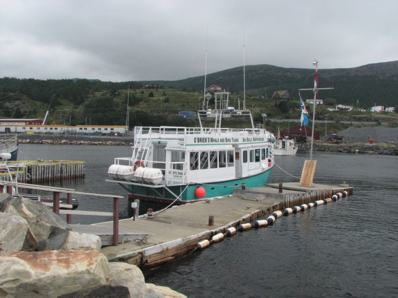
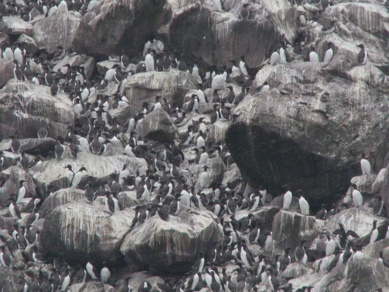
A few miles down the road, we stopped at Bull Bay, the main access to Witless Bay Ecological Area, which consists of five islands that are major bird breeding areas. Because of the storm, it was windy so the water was choppy, but we decided to take a boat tour anyhow. There are three tour boat companies in Bull Bay; we ended up at OBriens, which was a good choice. Since we are late in the season, we were told that most of the whales and many of the birds had already gone south, but it was worth doing anyway.
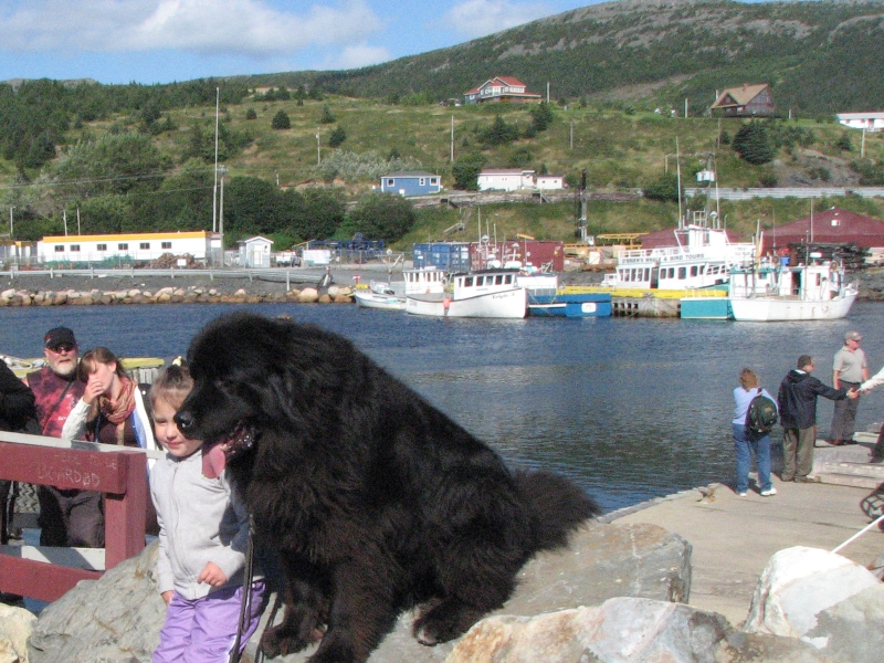
The first large island had a puffin colony that numbered in the hundreds of thousands (700,000?) The puffins were everywhere: in the water, in the air, and on the island in their burrows. Evidently they return to the same burrows each year. The island was covered in holes. Watching them fly, we were told they can flap their wings up to 500 beats per minute. The puffins swim and dive more easily and spend the entire winter out at sea. A nearby island was sanctuary for the common murres. Again, there were thousands of them. They dont burrow, they just lay eggs on rocky ledges. The eggs are shaped so they wont roll off. Again, we saw kittiwakes as well as more common gulls. Jim and I saw an osprey near the harbor, shivering its wings in mid-air to shed water, and I saw the dark head of a seal or otter across the harbor. On the way back to Bull Bay, we saw a Minke whale. We didnt go out very far because of the rough seas. Nobody seemed to be bothered by the waves though. The tour guide sang a couple of Newfoundland songs and in between sightings they played traditional music over the loudspeaker. Jim and I talked to the captain a while, which I enjoyed. I was first on the boat, so we got a good spot on top and up front. The sun came out as we were headed back to shore, though the wind remained strong. Back at the dock, a woman came by with her large Newfoundland dog, the only one weve seen since we arrived. Some of the tourists had their picture taken with the big black dog. He was a pretty one, but I'll bet he sheds a lot.
Afterwards we drove to Butter Pot Provincial Park, where we got a campsite. Jim and I started a hike but turned around when the trail became really rough and rocky. It was too nice a day to ruin with bad trail.
Friday, August 28: Butter Pot Provincial Park
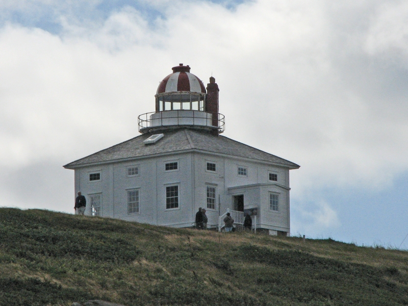
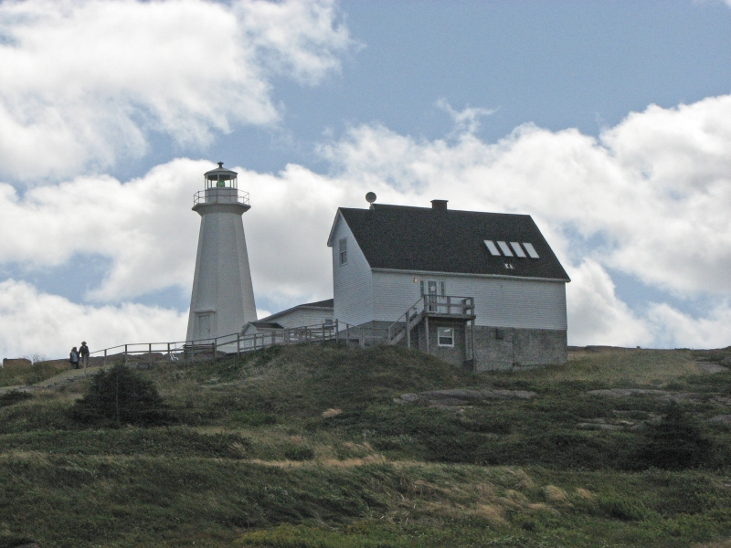
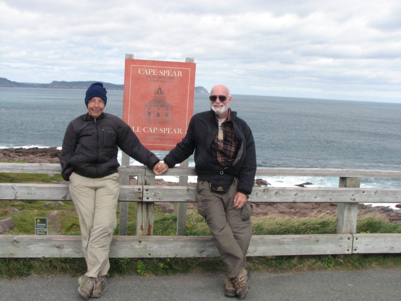
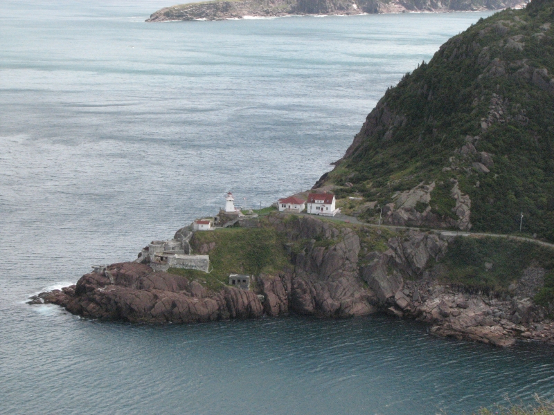
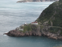
Today was a mixture of fun and frustration, culture and confusion. We drove to St. John, intending to start with a visit to Cape Spear, the easternmost point in North America. There are two lighthouses there: the original 1836 lighthouse which has been restored and furnished in mid-19th century accoutrements, and the modern lighthouse which is still in use, and hence off limits. There is also a WWII battery you can visit. On our way there, we discovered that the route is not marked off Highway 2. We got dumped in the middle of downtown St. John, with an utterly inadequate map. Jim and I wandered in circles, glimpsing a few good tourist sites and an interesting downtown area as we tried to figure out how to get to Cape Spear. We ended up doing a long circle, with another construction detour, and came up on our goal via Petty Harbor, definitely the long way around.
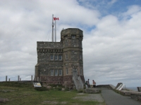
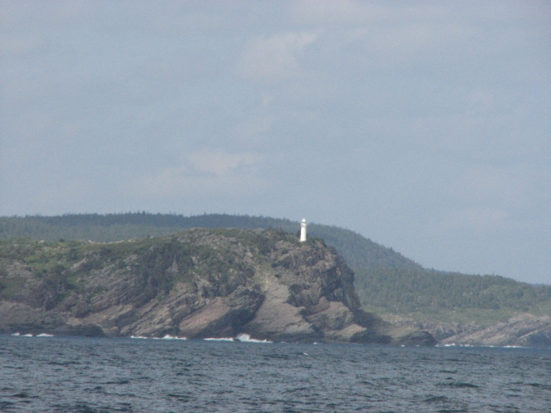
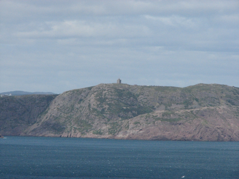
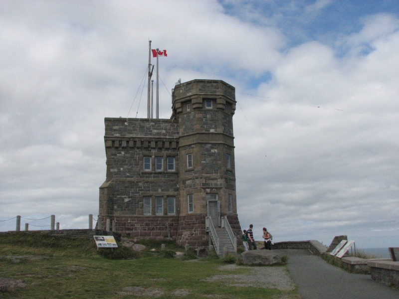
It was really windy all day, with 30-40 mph winds. Walking was difficult. After visiting Cape Spear, we made our way fairly easily to Signal Hill, a historic site above the city. (We had picked up a city map at Cape Spear.) Jim and I stopped at the visitors center to learn the history of Signal Hill, first as a defensive fort during the French and Indian Wars (captured by the French three times and then recaptured by the British), as a signal post for the town, letting them know which ships were approaching, as the site where Marconi successfully received the first wireless transmission from Europe, as a WW II American Army base, etc. There is a good view of the city from Signal Hill. Cabot Tower, built in 1897, is very visible from the town 500 below.

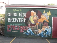
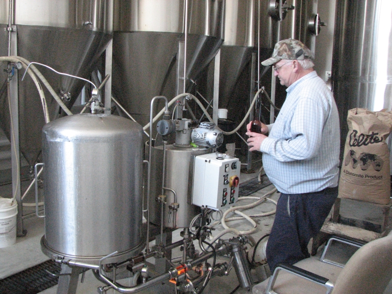
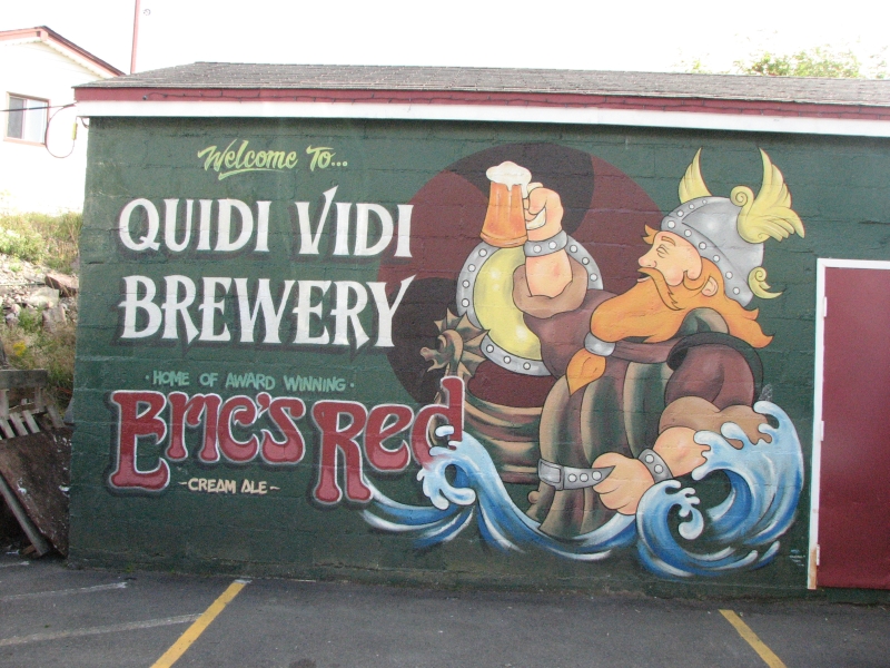
It was mid-afternoon by the time we finished our touring, and we didnt really want to go downtown again to deal with traffic and tourists there, so we decided instead to go to Quidi Vidi, the original village that was settled before St. Johns was established. There is a good brewery there that does tours and beer tastings. Weve been drinking Quidi Vidi beer ever since we arrived on Newfoundland, and liked it, so it sounded like fun to sample different kinds and buy some for the road. The brewery is a small one, only 14 employees, but they make nine different beers. There were eight of us on the tour, from the US, Canada and Australia. The brewing rooms were surprisingly small, but they only do a few batches at a time. It turned out to be more tasting than touring. We sampled six kinds of beer (1872, Eric the Red, Quidi Vidi Light, Seven, Honey Brown and Cranberry Cloud, which is more like a wine cooler than beer.) By the end of it, we were feeling the effects a bit, especially since we had already drunk one beer while waiting for the tour to start. They had a nice waiting area with a view of the harbor. We did buy a couple of cases to take with us, mixing up the ones we liked best. It was a fun way to spend the afternoon.
After we finished at Quidi Vidi, it was time to look for a campground. The roadmap showed one an hour or so to the north. We wandered around the peninsula and finally found it. The campground wasnt described in the tourism guide, and I understand why. It seemed to be all permanent RV people, and either in the process of being constructed or being shut down. We couldnt find an office to register so we drove back to St. Johns, ate dinner at MacDonalds, and followed the Trans-Canada Highway westward. We stopped at another campground at Cochrane Lake. We found an office there, but it was locked tight, so we decided to get back on the freeway and return to Butter Pot Provincial Park. We forgot that its Friday night; all the campsites were booked. Fortunately, they put us in the group campsite, which was being used as an overflow campsite. It was actually better than a regular campsite, since it was large and we had it to ourselves. We took a lukewarm shower and settled in for the night, tired but happy.
Saturday, August 29: A night aboard the Ferry
A beautiful sunny, windy, cool day. What a shame to waste it cooped up in a car. It isnt far from Butter Pot Provincial Park to Argentia, where we were catching the ferry, so we took our time, moseying along. We detoured to visit the museum in Dildo, which had some exhibits on the archaeological excavations nearby. Theyve found Ancient Maritime, Dorset and Beothuk villages in the area. Dildo also had a huge fish hatchery in the late 19th century during a previous period of cod shortage. They should rebuild it. The museum was small, but interesting, a nice way to spend an hour. Dildo was a pretty little fishing village.
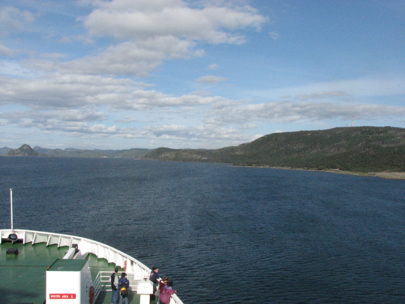
We drove slowly, enjoying the beautiful day and lovely scenery with blue ponds and lakes scattered around. We ate lunch in Placentia: fish cakes made with mashed potatoes and cod, and a delicious bakeapple cheesecake for dessert. Soon afterwards it was time to board the ferry. The ferry took off almost on schedule, only 15 minutes late. Once again, we got to experience the tail of a Tropical Storm Danny this time. I could feel the motion of the ocean a lot more than last time we crossed.
When we were departing, Jim and I stood on deck to watch the land fade away. The wind nearly blew us overboard! We didnt stay out long as it was too difficult to move. Later we looked out the door as the sun set behind the French islands of St. Pierre and Miquelon. Theyre mountainous islands, quite pretty from a distance. Next time we visit Newfoundland, well catch a ferry there, as well as one to Labrador.
Ive really enjoyed our time in Newfoundland. I wish we had another week here. The land is beautiful and the towns and villages are generally well kept and scenic. People are friendly and I love the accent, which is a mixture of English, Irish, Scottish and ???
Jim: This time there were a LOT of highlights, the first being the ferry ride to Newfoundland which was - interesting. Now I remember why I never became a sailor.
From the ferry we wandered north to Gros Morne National Park which was the point of the exercise as far as I was concerned at the time. I'd read about their trails and just salivated over them. And then got there and couldn't hike nearly as much as I wanted. OK - it's beautiful country anyway. So I just have to go back when I can hike again.
Then came L'Anse aux Meadows - a place I didn't really believe in until I got there. It's the thousand year old Viking site that I'd heard dismissed by others who supposedly knew what they were talking about. So it came as a pleasant revelation that it was really all it was advertised to be. I love that kind of thing.
Then it was back through Gros Morne and east to Terra Nova National Park, to St John and the most eastern point of North America, to St Brides, the Puffin and Northern Gannet breeding grounds - and another whale tour, but this time without whales. Oh well, they don't alway come when called.
We ended with another ferry ride, which simply reinforced my antipathy to long ocean voyages. No - I don't get seasick, just bored. But one overriding impression remains - if Newfoundland wasn't in Canada, I could live there. I loved it.
Home | Links| Trail Journals |
The Thruhiking Papers | Bun-bun
Created: 1 Dec 2009
Revised: 30 Sept 2016Copyright © 2009-2017 Spirit Eagle