|
 |
 |
 |
 |
|
|
|
|
|
|
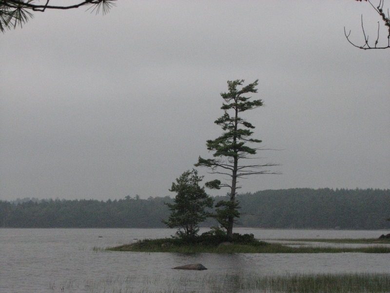
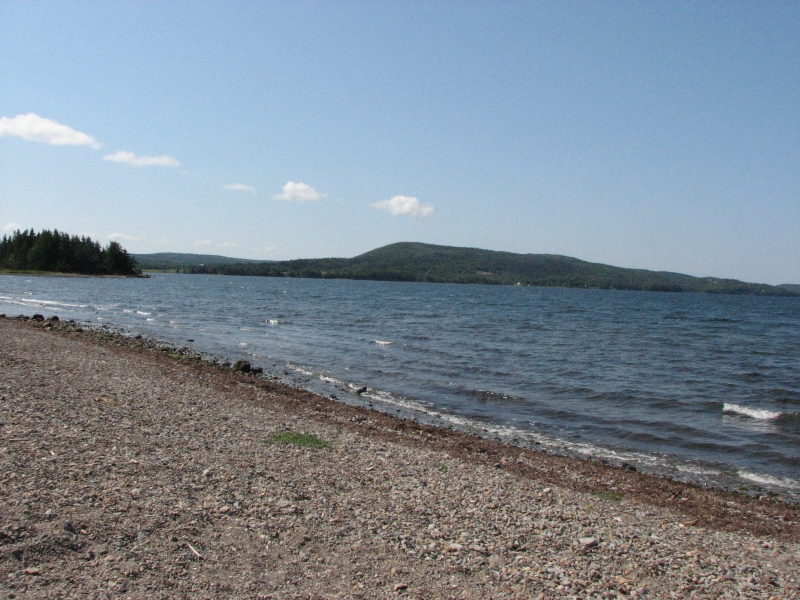
Saturday, August 1: Five Islands Provincial Park, Nova Scotia
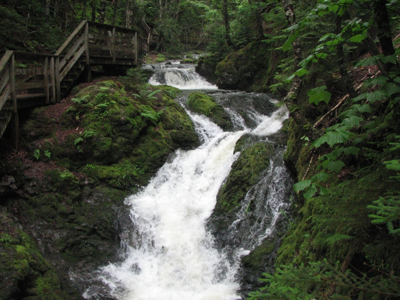
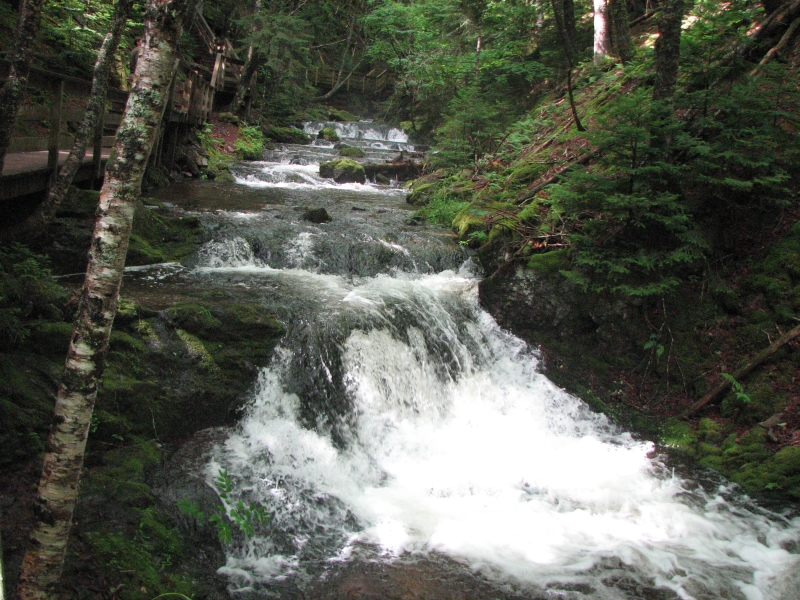
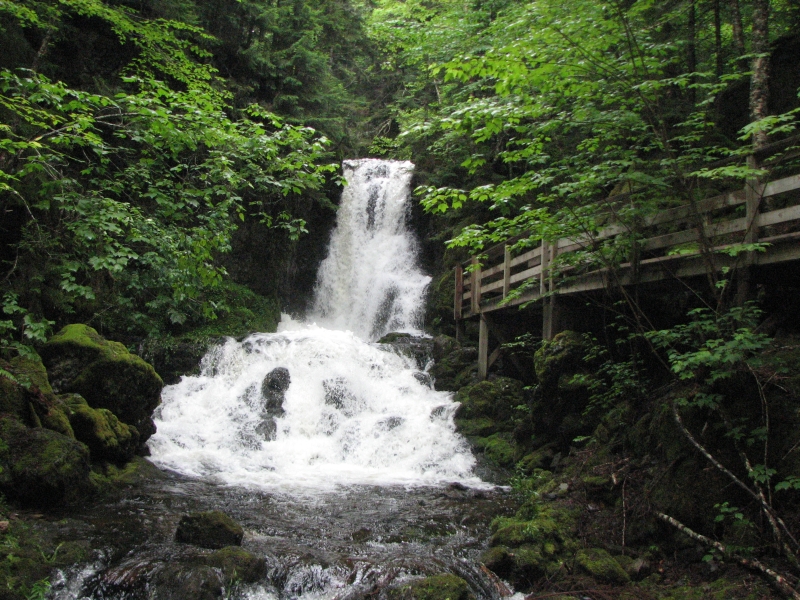
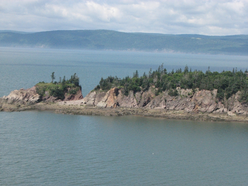
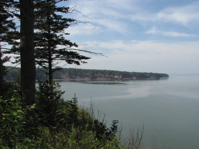
Soon after dinner last night, it began to pour. The rain lasted most of the night, so sleep was scant. Yet when we woke up at 8:30, the sun was out and we ended up enjoying blue skies all day long. We started the day by returning to the Herring Cove Overlook to see what it looked like at high tide: very different. Then we walked along the short Fuller Falls Trail. It was a beautiful powerful waterfall in a cool spruce and fern-filled glen. It was a nice end to our visit to Fundy National Park.
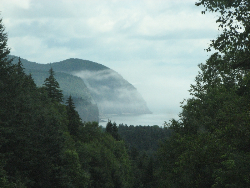
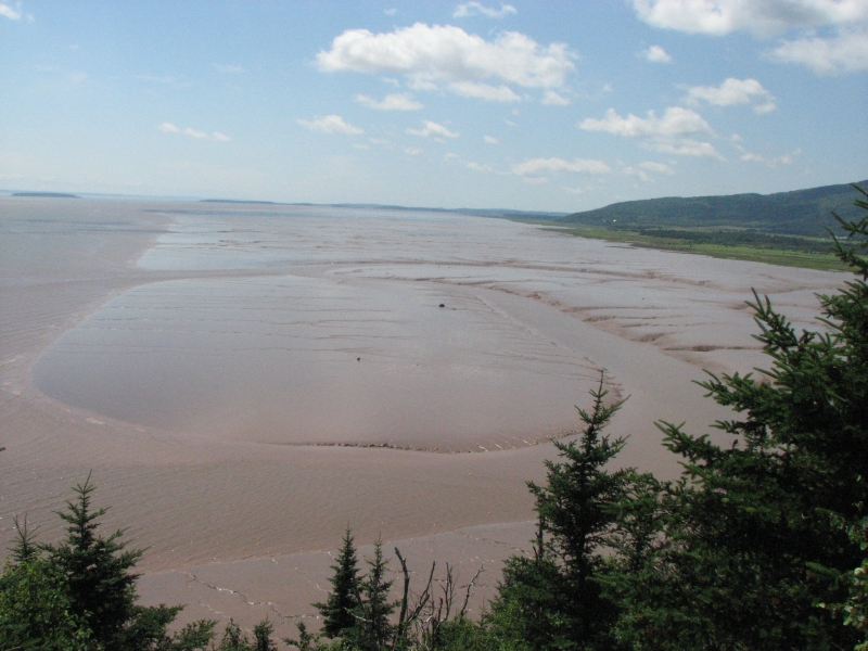
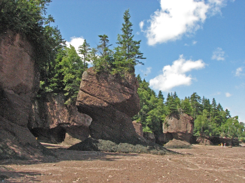
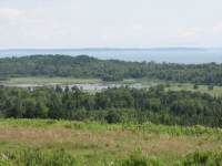
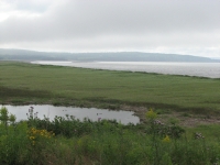
An hour or so east, after a detour to Cap Enrage to see the view and the lighthouse, as well as a stop in Alma for blueberry scones, we paid our admission to visit Hopewell Rocks: a place where the water has carved pillars out of the red conglomerate rock into flower pots, sea caves and natural bridges. We walked along the shore for about a mile. It is an area you can visit near low tide on foot, but at high tide only by boat. It was interesting, though Im not sure it was worth the price ($8.25), since you can see sea stacks and sea caves for free elsewhere. Hopewell Rocks is just more concentrated. I enjoyed the drive along the Bay of Fundy. There was a lot of lush green marsh country, hills and farms.
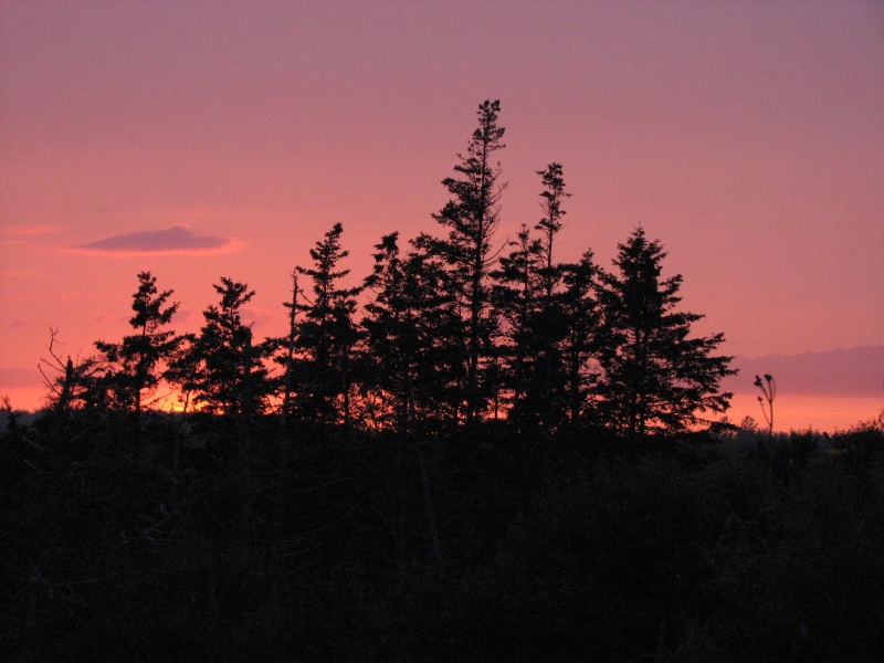
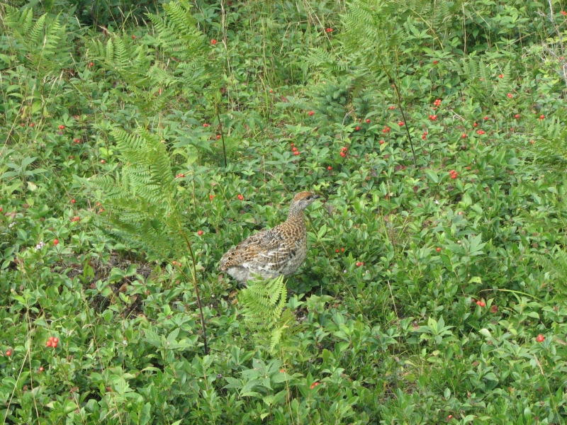
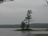
Late in the afternoon we reached Nova Scotia, where we picked up more tourist brochures at the Visitors Center, left the scenic route we had been following, detoured 20 km out of our way on the wrong road, and eventually reached the Provincial Park we were aiming for just at dark. Fortunately, we had stopped for supper a few miles earlier since we werent sure how difficult it would be to find a campsite. This is a holiday weekend in Canada. We got the last site at the park; not a great one, but it will do. There was even a pink sunset off in the distance. We saw a pheasant beside the road, which is unusual. Ive only seen them once before, in Wyoming.
Sunday, August 2: Digby, Nova Scotia

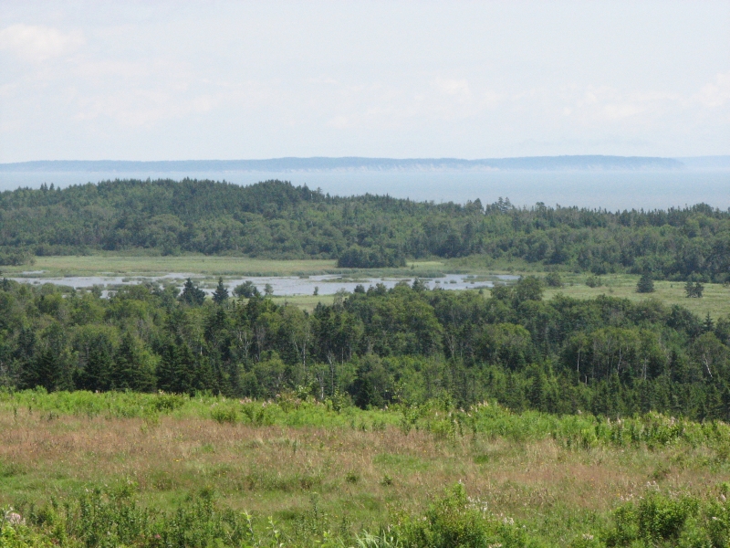
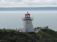
Another warm sunny day; 80 degrees and humid, it feels like Pennsylvania. After last years experience, it feels odd to have such warm weather this far north. It wasnt a very exciting day. We stopped at a lighthouse to look at the view, then drove the Glooscap Scenic Trail along the north coast of Nova Scotia, slowly passing green wooded hills and small farms. The scenic roads here are not major highways, so the driving is quite slow. Im starting to get tired of all the driving. We generally start late and stop often, so we dont cover many miles, but somehow it takes all day. We need to stay put for a few days, I think, and stop and smell a few more roses.
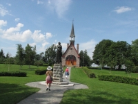
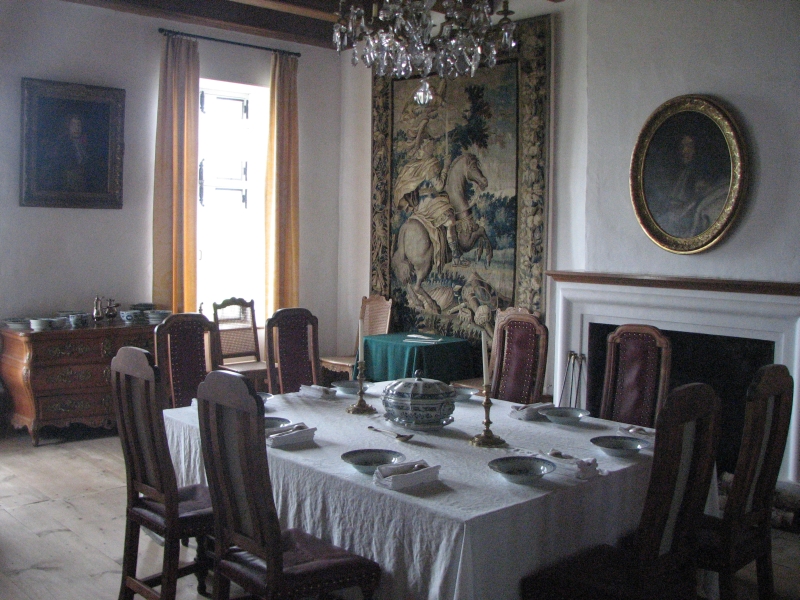
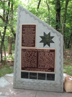
Our main stop today was at the Grand Pre National Historic Site which commemorates the Acadian exile. There was a small museum, a very melodramatic movie in French or English (I practiced my French by listening to the French version), a pretty formal flower garden with statues of the poet Longfellow and Evangeline (his fictional Acadienne), an old well, and a chapel built to honor the Acadian farmers and their families who were caught between the warring British and French and forced to leave their homes. It was an interesting museum, albeit a bit expensive for what it offers.
We ended up at a private campground near Digby. It caters mostly to seasonal visitors who stay all summer, but there were a few muddy sites for transients like us. We almost got stuck in the mud trying to pull in; it will be interesting to see how well we maneuver tomorrow when we try to back out.
Jim and I went for a short walk after supper. Didnt find a route to the bay, but I did find some ripe blackberries. I also enjoyed (have been enjoying all along) the many late summer wildflowers: ragweed, Queen Annes Lace, lupine, etc. There have been several kinds of berries lately on our walks. Ive found only one strawberry, one almost ripe blueberry, but lots of raspberries. The mulberries are almost ripe. Late summer is a good time to explore the northeast.
Monday, August 3: Kejimkujik National Park
It was a rather frustrating day, all in all. Once again, it rained hard all night. Not surprisingly, this morning we got stuck in the soft mud and couldnt get out of the campsite. Eventually our neighbor got tired of the show and went to fetch the campground manager who towed us back to dry ground.
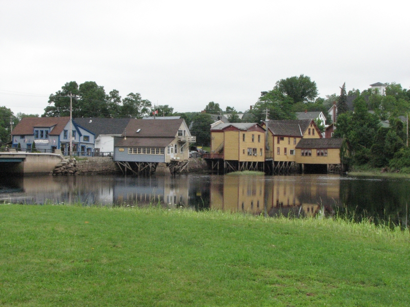
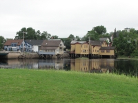
It was misting and sprinkling, so we decided against going whale watching as I had intended and instead headed to the village of Bear River which has a Mikmaq First Nation Heritage Museum. The museum was small, but interesting, with films and displays showing how the Mikmaq used to live. At first we were the only visitors, but after we returned from a walk on the 1.5 km Medicine Trail, a few other tourists showed up. We got back just in time to participate in learning and singing (badly) a greeting song. Afterwards, we stopped at an art gallery in Bear River, looked for the bookstore (closed on Mondays), took pictures of some of the houses on stilts, and then headed to Digby.
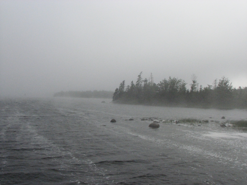
It had stopped raining, so I hoped we could drive out Digby Neck and look for shore birds and whales. Unfortunately, thick fog had moved in and visibility was very limited. Driving was difficult, so we turned around at Gulliver Cove, erstwhile home to a very nasty pirate and his still nastier wife. (She killed him, then forced his crew to sail her back to the West Indies.) I wasnt willing to drive 40 miles in the fog for nothing, so we returned to Digby, ate lunch at a decent pizza buffet, bought groceries, and then headed to Kejimkujik National Park.

Jim and I watched the video at the Visitors Center, talked to a warden for a while, and then headed to the campground where our final and greatest frustration began. Although we sleep in the truck, we are considered tent campers. The tent sites have a flat spot for a tent, but not necessarily a flat parking area. Our site has a definite slant. We tried to change it, but all the available good sites are restricted to RVs. The only empty tent sites were even worse than the one we were given. Although there are a lot of empty RV sites, we aren't allowed to take one. After driving in circles for half an hour looking for a better site, we gave up and accepted our tilted site. At least its near a bathroom.
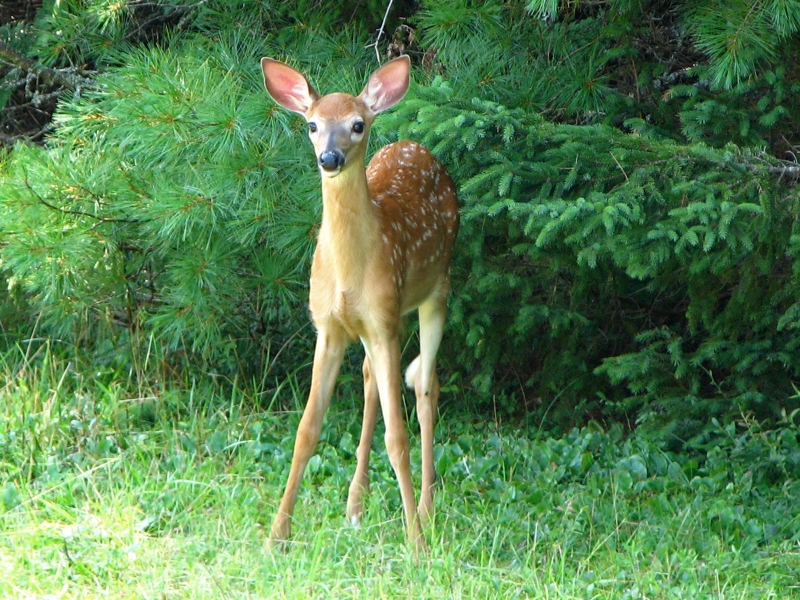
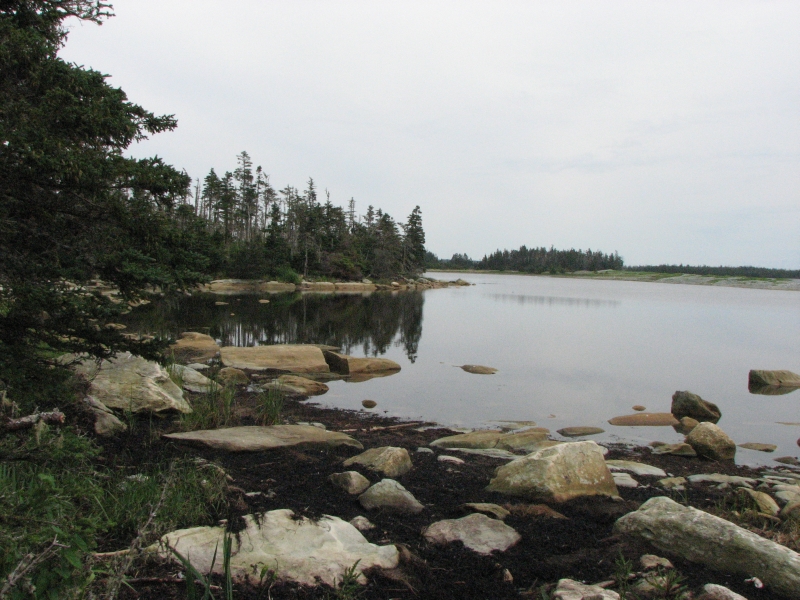
Finally we went for a walk along the lake. It was pretty, with frequent views over the water. I saw a deer in the woods and a tiny frog. I walked about 5 miles today, and Jim walked four, so I felt much happier afterwards. Late in the afternoon we even got some sunshine.
Tuesday, August 4: Kejimkujik National Park
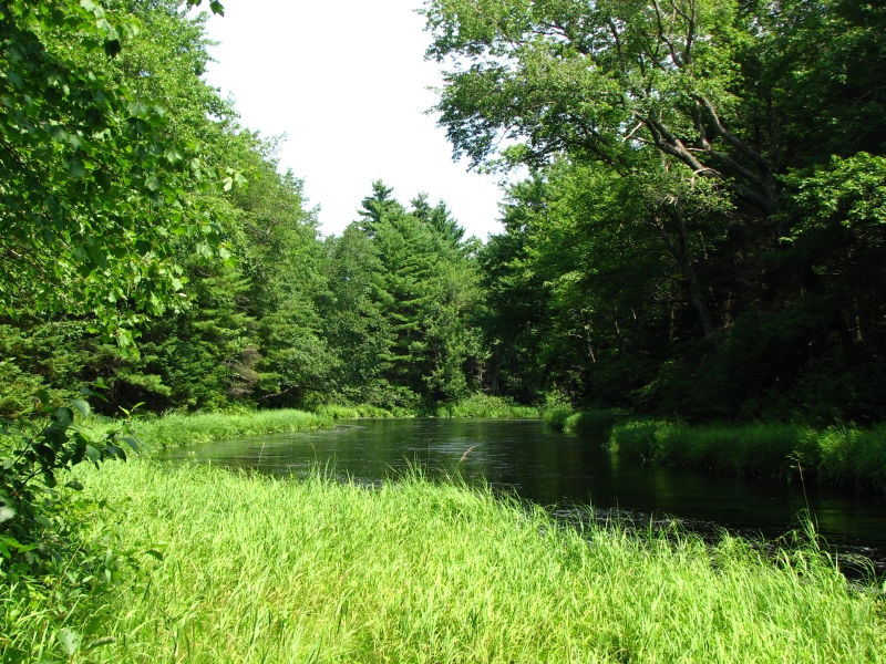
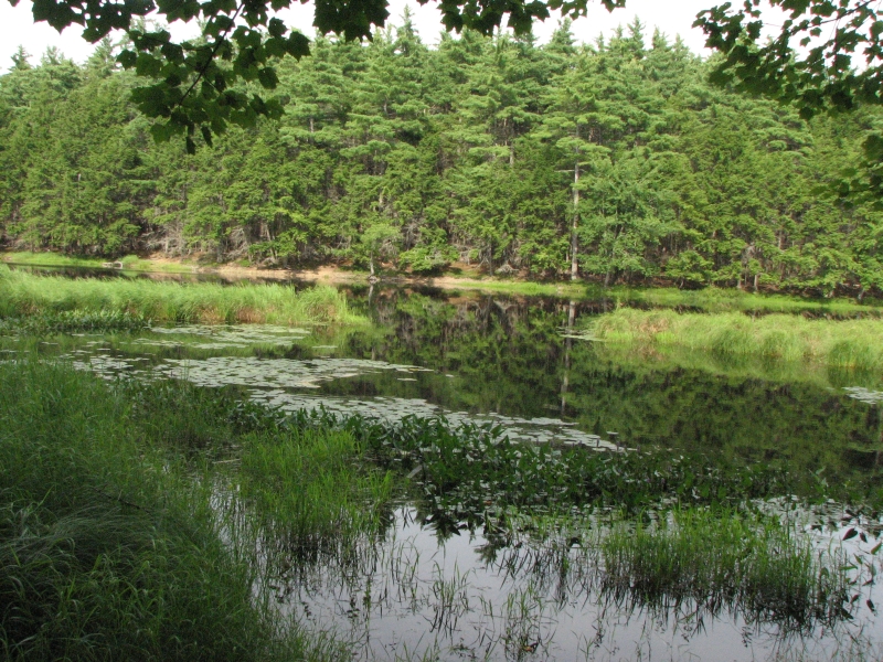
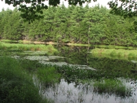
Today was a much better day, all in all. We slept until 9:00, cooked ham and eggs for breakfast, then headed out on a short hike through an old growth hemlock forest, then a shorter loop along the Mersey River. Kejimkujik is mostly known as a great place to go boating, since it has numerous interconnected lakes and rivers, but it also has several nice short hikes.

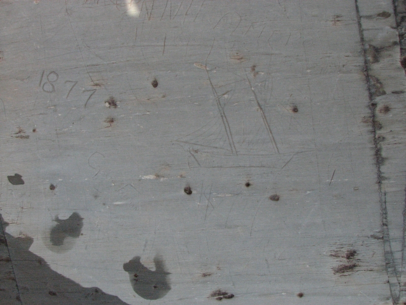
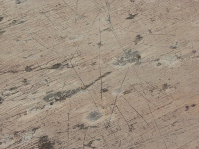
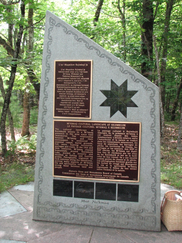
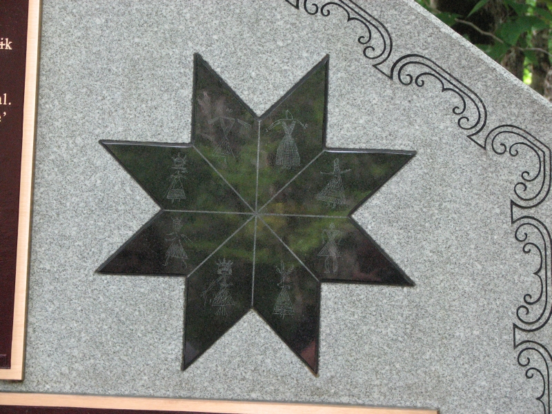
Jim and I had signed up for a Petroglyph Walk which was led by a Mikmaq interpreter. The carvings are on a slate ledge in the river and are hard to see. Water, ice and snow, and numerous visitors walking on the ledges have worn the images down. I was a bit shocked that we were allowed to walk on the images, even barefoot. They arent very old--less than 400 years or so--but the petroglyphs show traditional Mikmaq dress, a pointed hat, boats, hieroglyphics, stars, etc. Ursula, the Park guide, did a good job explaining about the carvings and a little about her peoples history. She was giving another program at 6:00, Mikmaq Storytelling, so we decided to come back to enjoy more of her stories. We had a two hour wait between programs, so Jim and I ate an ice cream cone at the snack bar, then I went for another walk along the Mersey River before meeting Jim so we could go back for another hour of tales of the Mikmaq. It was fun hearing stories about Raven, Glooscap, Porcupine, Rough Faced Girl, etc. Ursula also played traditional songs and instruments. Story time was followed by a much needed shower and a late dinner. Four deer today, including a spotted fawn.
Wednesday, August 5: Kejimkujik
An unexpected day, and a good one. We slept late, packed up, did a short walk to Mill Falls, and then headed south out of the Park. As we waited along the highway for some road construction, I mentioned to Jim how unhappy I was that we had not taken advantage of all the boating activities available at Keji. All summer Ive been trying to get us into a canoe, and always theres some reason not to do it, generally weather, but sometimes money or time. The farther we went, the sadder I was. After about 20 miles, Jim pulled over, asking, Do you want to go back? Yes! I responded. So we did.
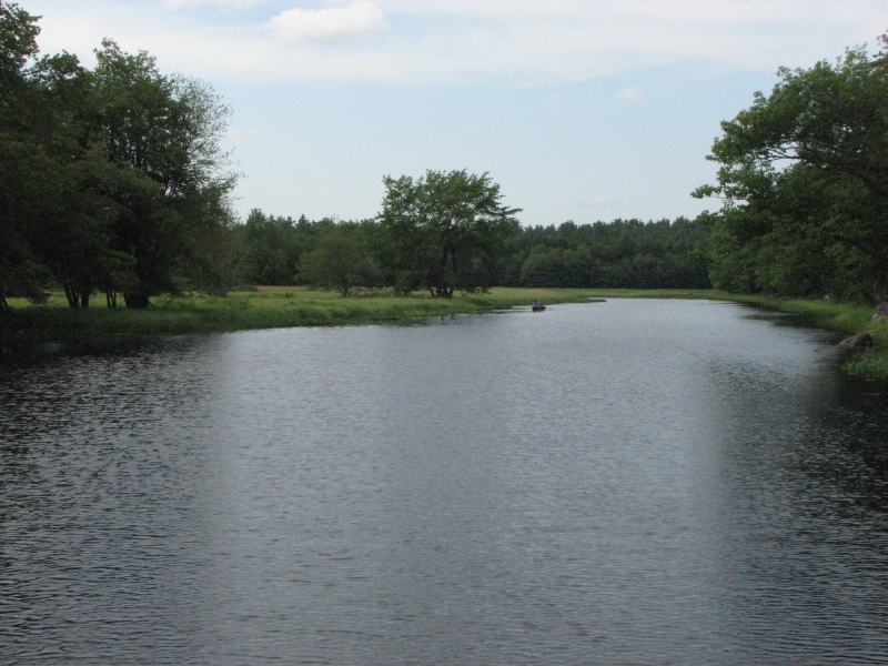
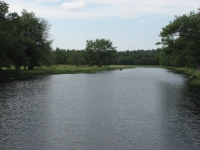
We reached the park around noon, got a campsite at the campground (the same slanted one we had before), then headed to Jakes Landing, where boats and bikes can be rented by the hour. It was gray and threatening and the wind was blowing steadily. We reserved the boat for three hours, but ended up only spending a little more than two on the water. We headed out to the lake, but the wind was against us and the water was really choppy, so we turned around and headed up the Mersey River instead. The lower part of the river is flat water, easy to paddle. After a while the current began to slow us down, so we turned around and floated slowly back. Paddling was harder work than I expected, especially in the wind, but I really enjoyed finally getting a chance to experience canoeing on both a lake and a river.
Jim and I stopped for another ice cream, (no wonder Im gaining weight), checked email on the very slow library computer, and then headed out for another short hike to Peters Point. It was a lovely flat walk through maples and hemlocks to a sandy beach. I jumped in the water, which was just about the same temperatures as the air 70 degrees. The lake was brown with tannin, but felt wonderful. Eventually we headed back out, stopped at the snack bar for a burger and fries, then returned to our campsite to enjoy them. It never did rain, despite the forecast and the fog out on the lake, though tonight will probably be wet.
Thursday, August 6: Porters Lake PP
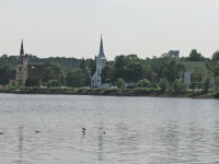
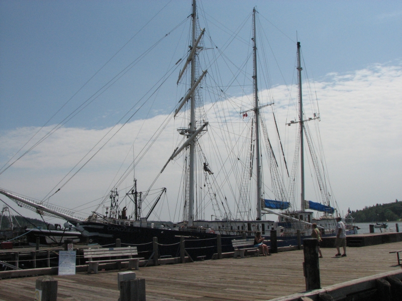
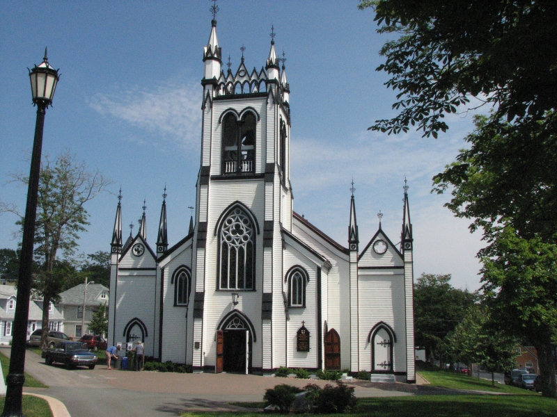
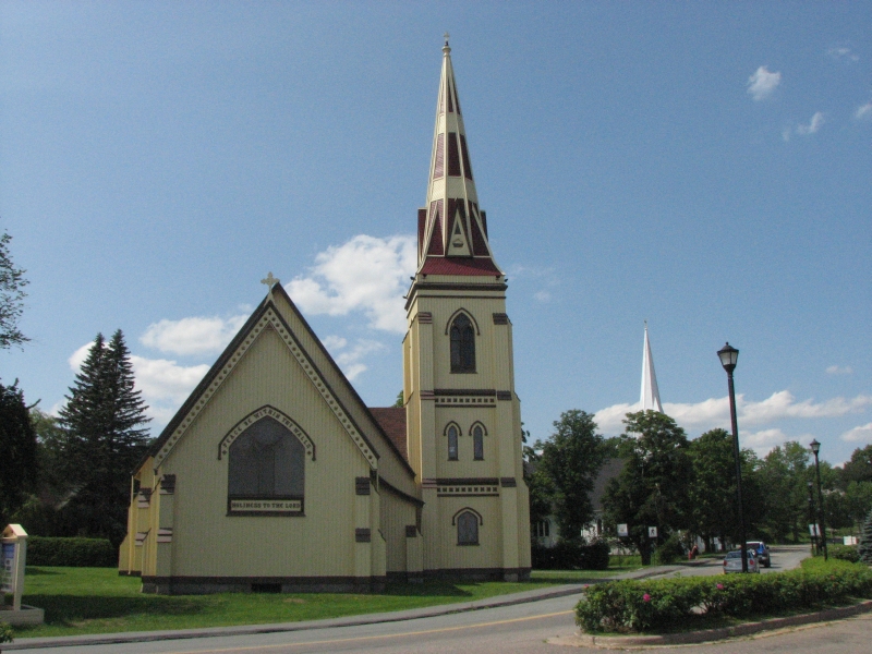
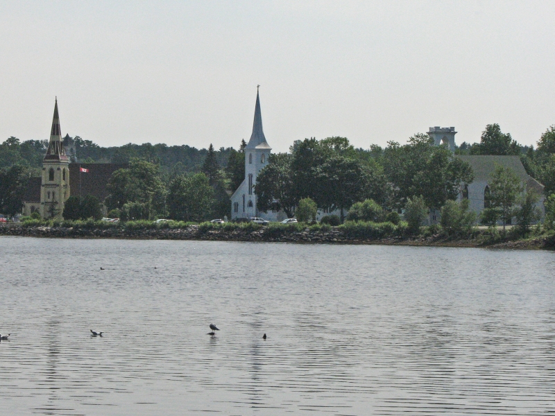
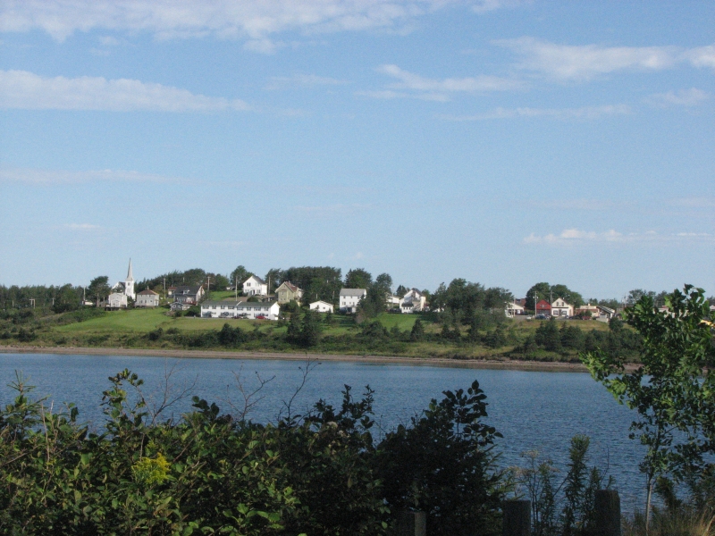
We played tourist today, with visits to the towns of Lunenburg and Mahone Bay. Lunenburg has numerous 18th and 19th century buildings and is a quaint and pretty tourist area. There are three Tall Ships that sometimes harbor there, but only one, the Concordia, was in port today. A folk music festival began today, but only one brief concert was scheduled this afternoon and I wasnt willing to spend $20 for an hour of music from a group I know nothing about. If it had been a full afternoon of music, that would have been different. The campground was full, so we couldnt even stay for the evening concert. We wandered through town looking at the beautifully painted houses, businesses and churches, then moved on to Mahone Bay, a harbor village famous for its three decorative churches, lined up along the bay, then sped through Halifax to look for a campground. Although there are many things to see and do in Halifax, we werent interested in spending much time in a city when there are so many other places wed prefer to visit in Cape Breton and Newfoundland. Id always rather spend time at a National Park than in a city.
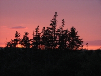
Jim and I ended up at a small provincial park on Porters Lake. It was damaged in a hurricane in 2003 so the car campsites were pretty exposed. We ended up sharing a site with another group. It was cool and foggy so no one was swimming in the lake, though the campground was busy. The park has some lovely walk-in tent sites with beautiful views of the lake for those willing to carry their gear 100 yards or so. We went for a walk around the campground since there wasnt a hiking trail in the park, and discovered the walk-in sites above the lake before heading to the shower. There was a beautiful sunset to end the day.
Friday, August 7: Boylston Provincial Park
The fog cleared overnight, to be replaced by dark clouds. So much for red sky at night! Fortunately, the rain held off except for a couple of very short sprinkles until after dinner.
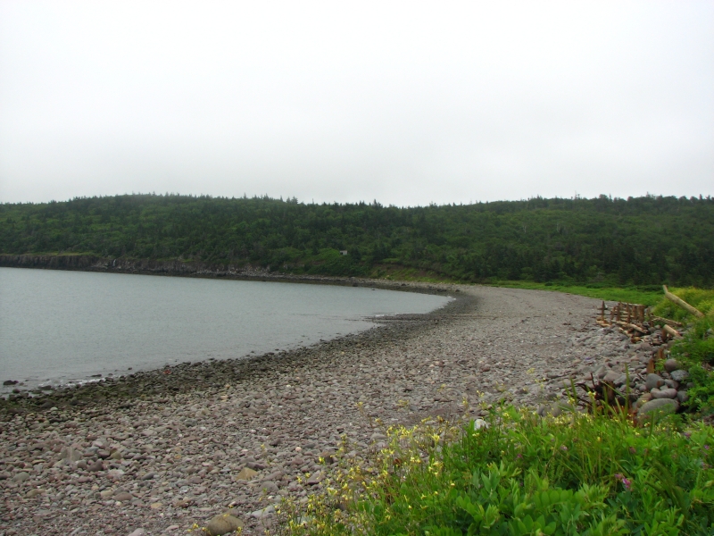
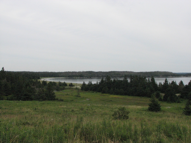
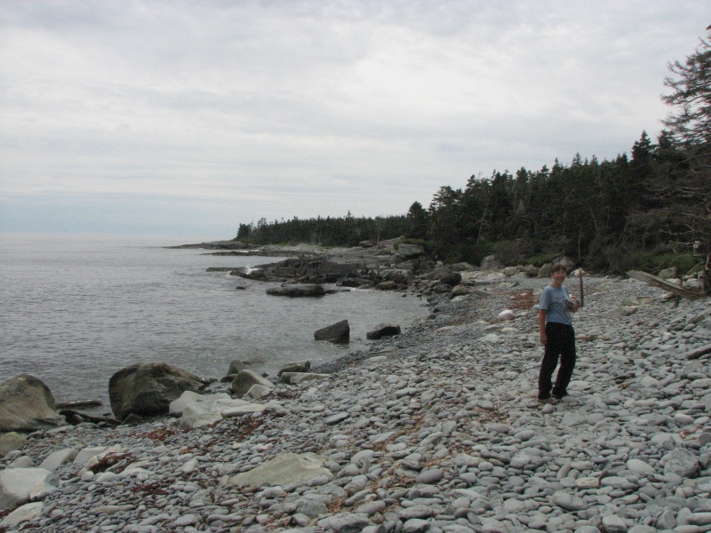
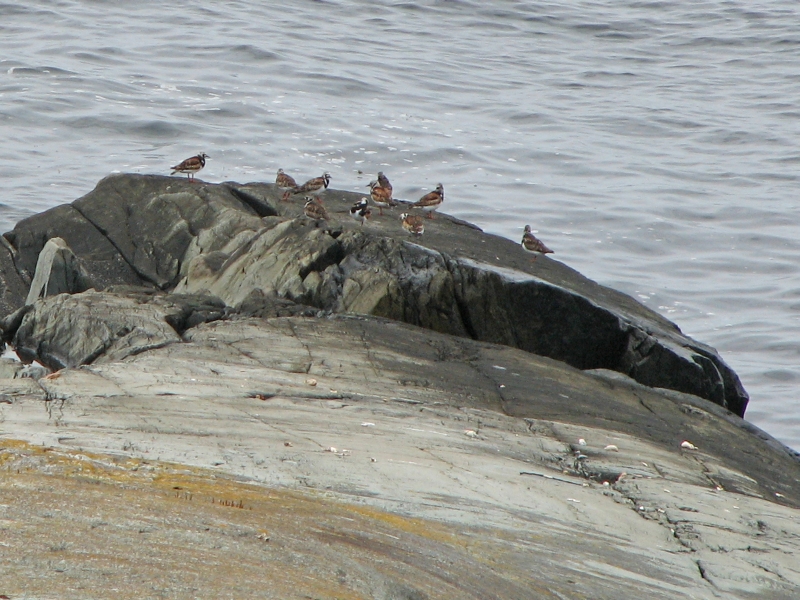
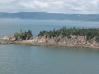
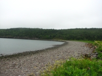
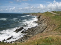
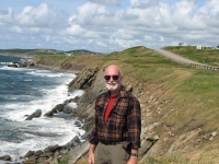
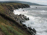
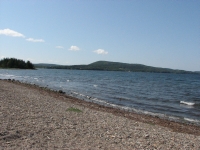
Our main goal for today was a five mile hike at Taylors Head along the coast. We walked through varied vegetation: buggy black spruce forests, rocky coastline, and tundra bogs. It was an interesting hike with some lovely views. The tide was going out while we hiked. There were surprisingly few birds: just gulls, ducks, terns and plovers. I was surprised to see fresh bear scat though. The hike was harder than expected because of the uncertain footing: lots of roots to step around and loose rock (cobble) along the shore. It was odd to hear the scraping of rock on rock as the tide washed over the beach.

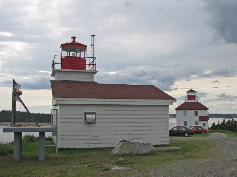
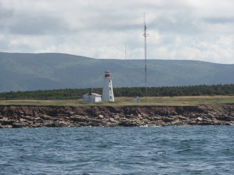
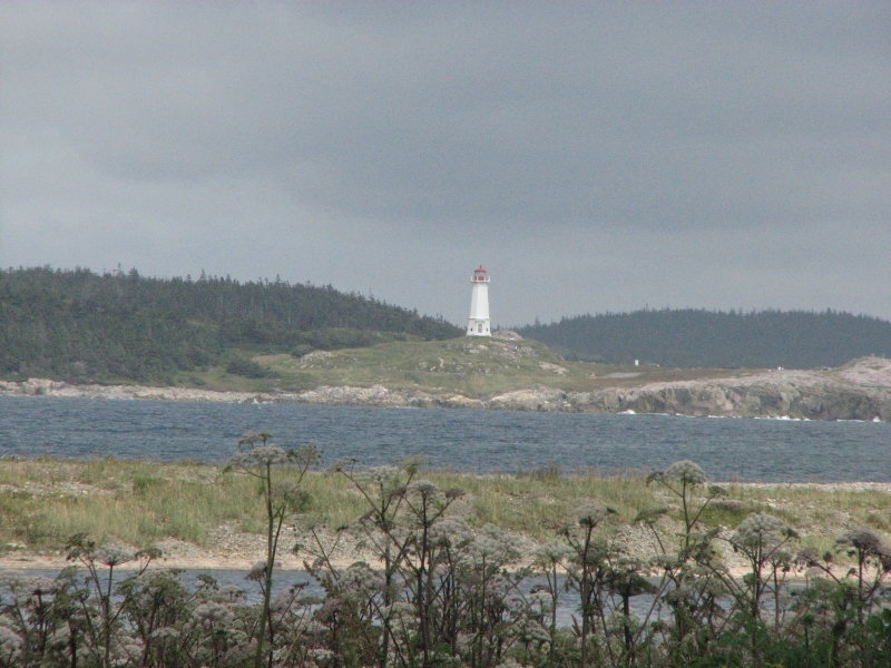
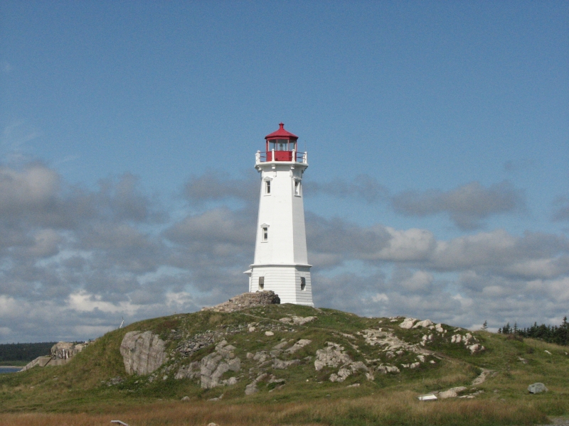
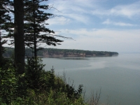
The whole day was scenic as we drove along the southeastern coast of Nova Scotia. Tiny fishing villages, miles of taiga, rocks and waters of all kinds. I liked the tiny tree-covered islands that dot the shoreline. We took an unexpected ferry ride across one wide inlet and had a rough road detour in one back-country area. This part of Nova Scotia is pretty remote and wild. I liked it. We stopped at one lighthouse site, but it wasnt very impressive. I hoped to eat dinner on the road, but there were few businesses that catered to tourists. By the time we reached Guysborough, I was ready to find a campsite at nearby Boylston Provincial Park and stop driving. It was a more primitive park than most (no running water in the bathrooms) but the campground is wooded so the sites felt very private. We got to the campground just before dark, so dinner was eaten in a hurry before night fell and the rain began.
Saturday, August 8: Cape Breton National Park
It rained off and on all night, but we woke to a clear cool Septemberish sort of day. It was cloudy and windy and about 65 degrees, not a summery day at all. We finished our drive along the south coast of Nova Scotia and crossed the causeway to Cape Breton Island. Well spend the next week here. At the Visitors Center we made reservations by telephone for the ferry to Newfoundland. The date we wanted was booked, so I moved it a day, which gives us an extra day in Cape Breton. Well have a leisurely week here. Nice!
Jim and I shopped for groceries and were shocked at the prices ($11/lb. for chicken, $8/lb. for cheese!) then took care of our laundry. I hated wasting a beautiful day inside, but we had been avoiding taking care of chores, so todays errands were definitely overdue.
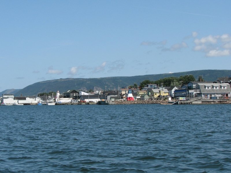
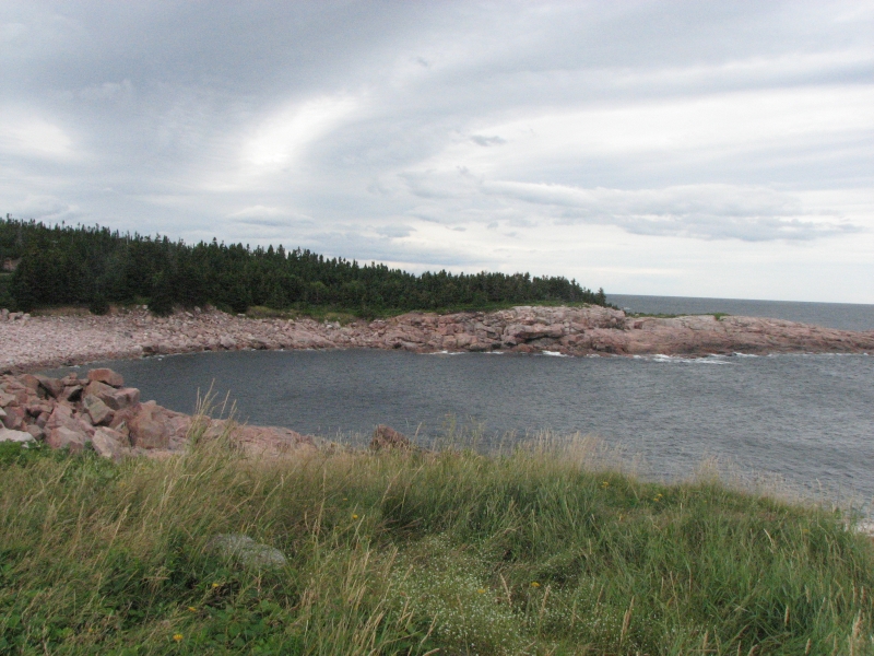
We began our drive along the Gulf of St. Lawrence, heading north on the Ceilidh Trail and the Cabot Trail, a couple of scenic driving routes around the island. We passed through Acadian villages, with Acadian flags (a French tricolor with a star), and through several traditional Scottish areas. Ive never seen street signs in Gaelic before! There is a traditional music center where we stopped briefly. A couple of women were performing Celtic music for the lunch crowd. I had intended to see the museum, but at $12 each, we decided to buy a couple of CDs that we can enjoy over and over instead. Id like to see more live music during our visit here since I love Celtic music, but money is tight, so we may pass on the concerts.
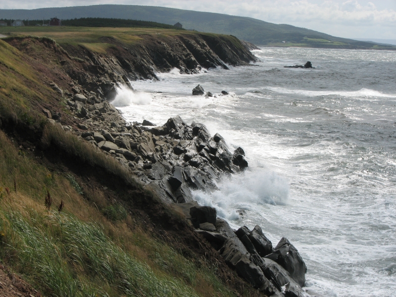
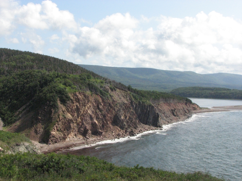
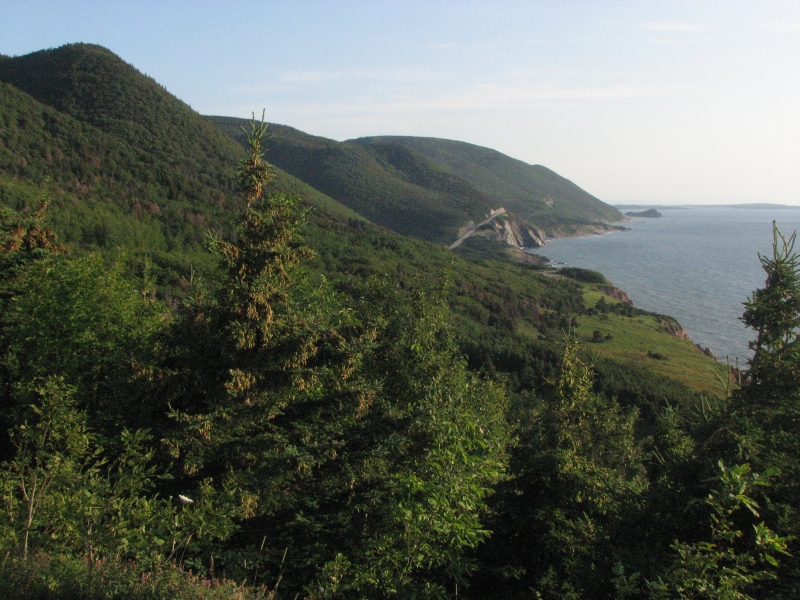
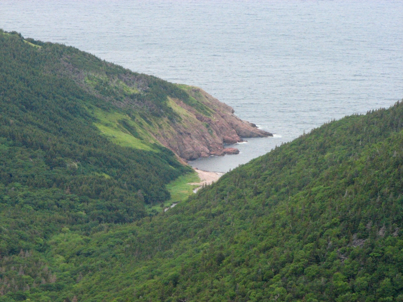
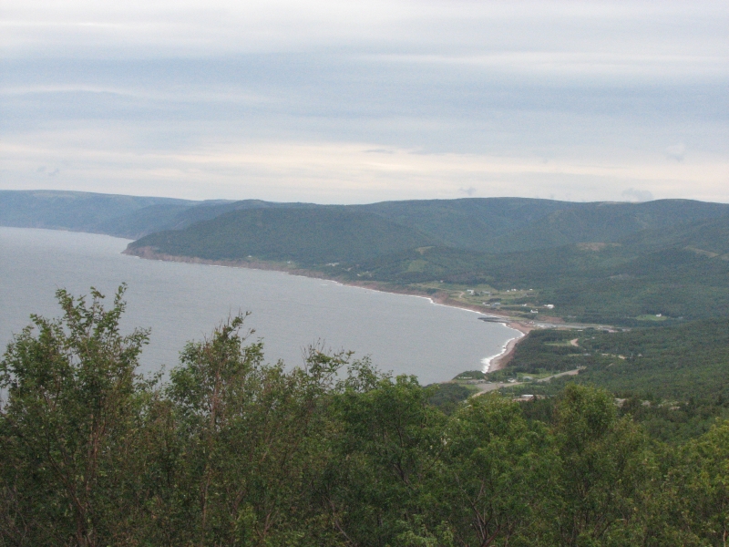
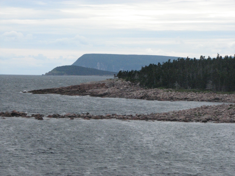
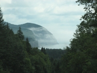
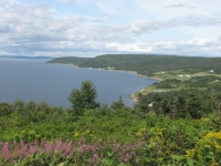
It turned out the distances were less than I expected, so we ended up driving up the coast as far as Cape Breton National Park, where we got a campsite. It was a spectacular drive, with the ocean on one side blue-gray water, white waves and red cliffs and steep green mountains on the other. The mountains reminded me of New Hampshire. They were definitely bigger than any weve seen so far in Eastern Canada. We passed green farms and many clear blue lakes and streams. It was really beautiful. The towns are more touristy than most of the ones weve seen lately, so the houses are neat and brightly painted in pastels or shades of blue and green. The churches are still generally the black and white kind we admired in Nova Scotia. All in all, it was a good day, even though we never did manage to go for a hike. By the time we got our campsite, it was too late to do much besides shower and eat dinner.
Sunday, August 9: Cape Breton National Park
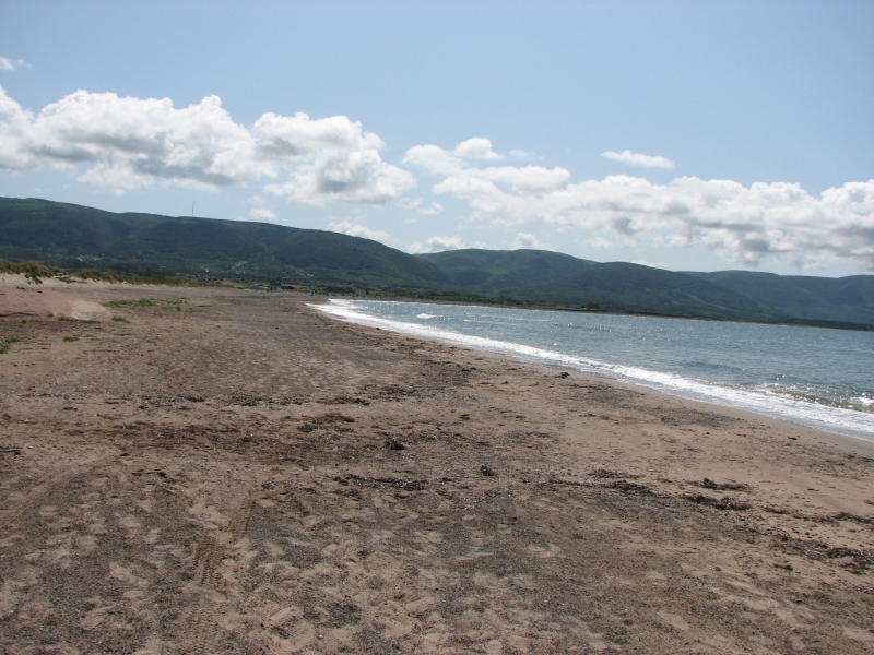
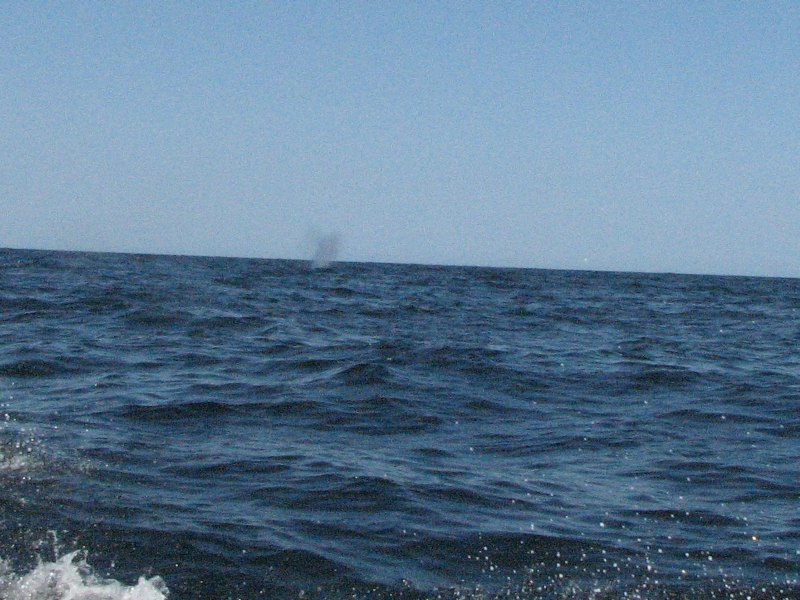
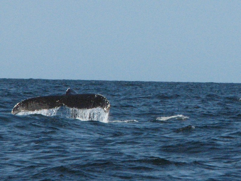
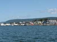
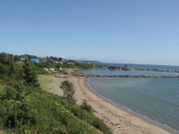
We slept late, and woke to blue skies and sunshine. After breakfast, we returned to the nearby town of Cheticamp where we booked a whale tour, then drove out to the beach to relax until it was time to meet the tour at the harbor. We also stopped at a tourist shop which had some nice hooked rugs (a local industry) but nothing else that was interesting. We ate lunch at Tim Hortons, my favorite donut shop, and then met the boat. The sea was still a bit choppy after yesterdays high winds, but the little tour boat handled the waves well. About ½ hour out we started to see whale spouts. Then we started to see whales. Im not sure how many we saw in all--at least a dozen--but I know we saw three different kinds of whales: minkes with curved dorsal fins, fin whales with a short straight fin, and humpbacks with a fat dorsal, plus they jump up and flip their tails. A pair of humpies entertained us for a while until two other boats came up to watch. The zodiac (a large inflatable boat) approached much too close and scared the whales underwater. We left the zodiac and spent some time with the fin and minke whales, then returned to Cheticamp. The cruise was less than two hours, though it was supposed to last three. I guess the captain figured they were unlikely to top the numerous sightings we had already gotten, so they might as well go home before people got bored or seasick. In a way I was disappointed, because I love being out on the water and I was quite happy to cruise around looking for whales, but by returning early we had time to go for a hike.
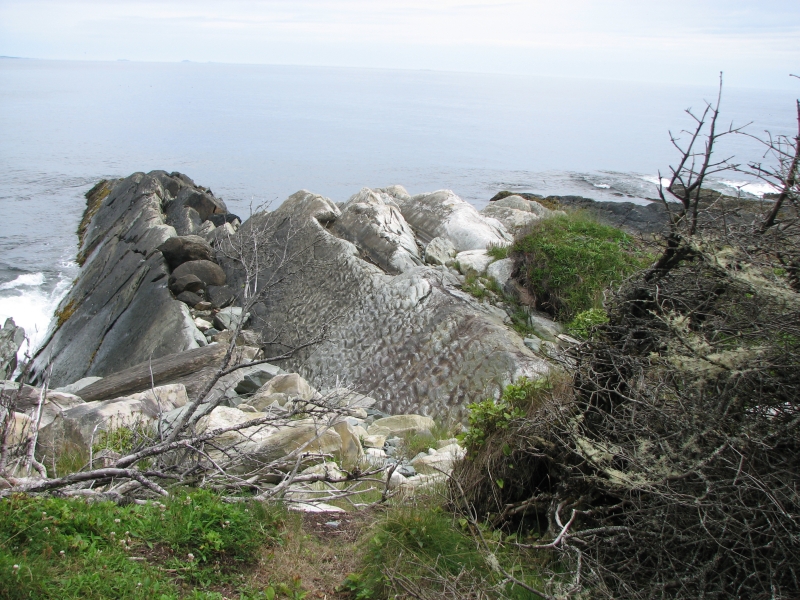
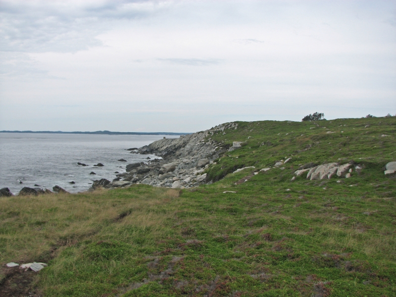
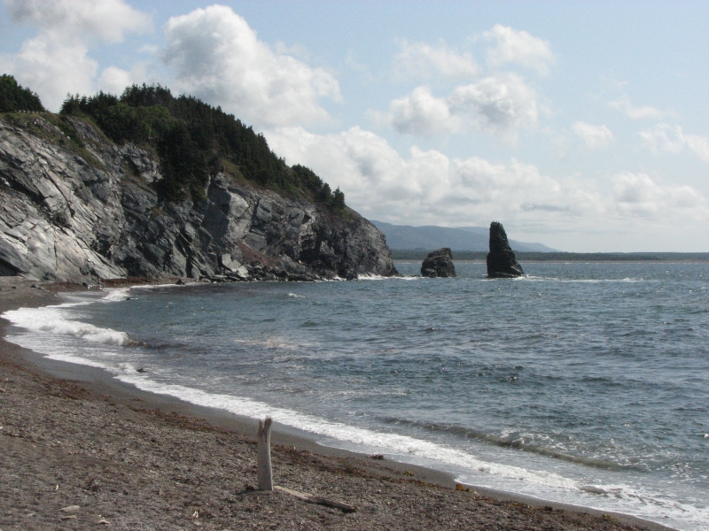
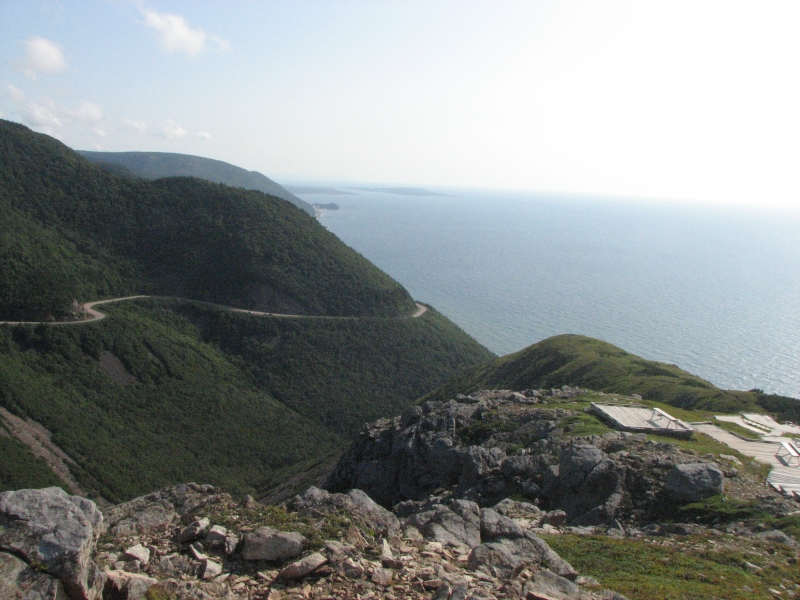
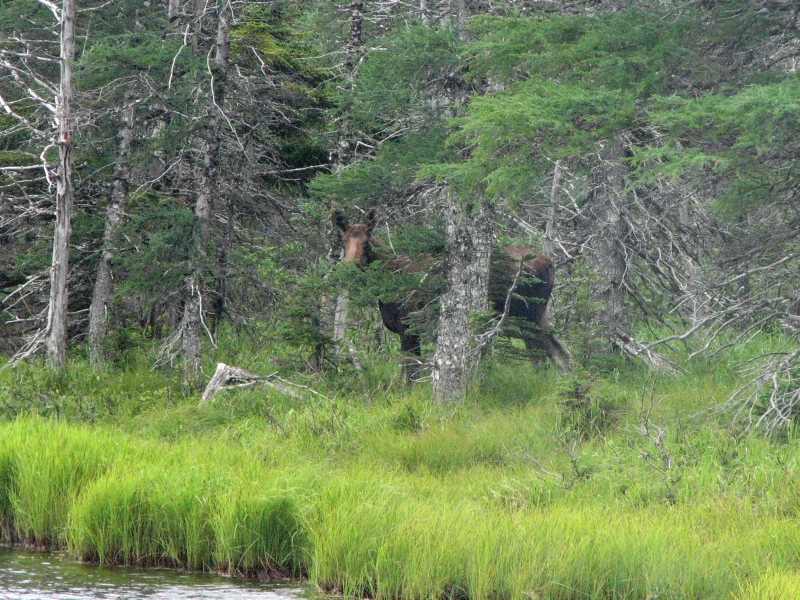
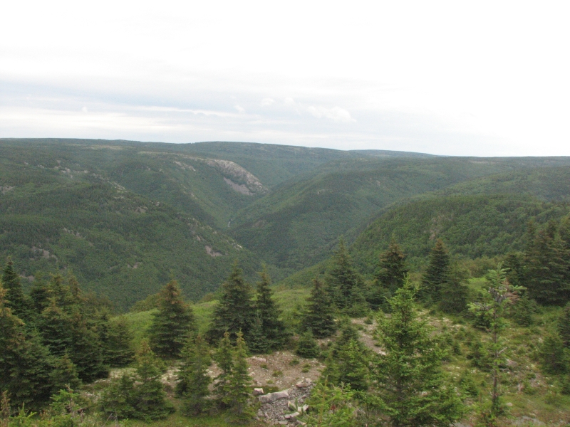
After an ice cream, we drove north into Cape Breton Highlands National Park. There were several scenic overlooks, including a sea stack with cormorants on top and red cliffs that contrasted beautifully with the blue sea and sky and the green spruce trees. A few miles up the highway, we stopped to hike the 5 ½ mile (RT) Skyline Trail, an easy walk that followed a dirt road for a while, then headed out on a long boardwalk through boreal tundra, then looped back through the woods and across open meadows to the trailhead. There were some spectacular views of the ocean 1000 below. We saw one moose hiding in the trees: not worth a photo, but fun to see. We met a couple that saw six moose on the hike, but there were a lot of other people out there, including kids running and yelling, so were lucky we saw one.
We got a campsite at Corney Brook, a very small (20 sites) primitive campground next to the ocean. There was little wind, so Jim grilled hamburgers. I am really happy with today. The weather was perfect, the whale trip a total success, the hike beautiful and easy. Jims foot hurt quite a bit from the longer than usual mileage, but he enjoyed the hike too. It was a really beautiful place.
Monday, August 10: Baddeck
A wet day but a good one. We woke to light rain, which stopped by the time we got up at 8:30. Still, we decided against the five mile hike I had planned up Corney Brook and instead did a one mile hike to another waterfall at MacKenzie Brook and an easy flat two mile hike to Benjies Pond to look for moose. We actually did see a female moose at the lake and another along the highway. Finally we did a short detour to a large beautiful waterfall a mile off the highway. We skipped Maryann Falls because I wanted to eat lunch at a pub a friend had recommended in Ingonish, but it turned out the pub didnt open until 5:00. So instead we ate salmon and scallops at a nearby restaurant. Thats when the rain began in earnest. Our lovely views of steep green valleys, pink and gray cliffs and blue waters were replaced by mist and drizzle. We kept driving south to Baddeck where we wandered through town, stopping at the library where we bought a few more books, though it was too late to use the Internet. Given the nasty weather, we decided to get a motel instead of camping out. We took the last room. A nearby deli provided supper, and then we stretched out in our warm dry room. It felt like luxury to be indoors, watching TV and the view of the lake out the window.
Tuesday, August 11: Battery Provincial Park near St. Peter
The rain stopped while we slept, so we woke to a cloudy, but dry, day. The motel offered a continental breakfast, so after munching on muffins and yogurt, I sat out on the porch of our room, sipping coffee while looking out at the lake. Luxury! The day ended much the same since our campsite had beautiful views over St. Peters Bay. I absorbed the silence and beauty, feeling oh so grateful that my life has brought me to this place, now. I feel so blessed.
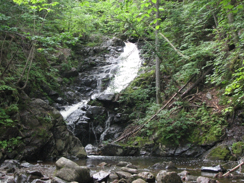
After we left the motel, Jim and I drove to Uiske Ban Falls, a 3 ½ mile loop hike to a beautiful 50 waterfall, then along a cascading river. It was a popular place, but we enjoyed the hike through spruce and fern-filled forest to the two-tiered falls. We then started driving around the Bras dOr Lakes. It was rural country: small villages along the water, several Mikmaq villages and a couple that were more tourist oriented. We stopped at the Mikmaq Cultural Center in Wagmacook, which was a tiny museum next to a restaurant. They showed a good film on the history of the Mikmaq which we enjoyed. The drive was long and scenic, but not terribly exciting. Bras dOr is a big lake with several arms or bays. Road construction made the journey slower.
We ended the day at Battery Provincial Park. It was the site of two old forts that were originally French and then became English. There are trails to both fort ruins, but nothing remains above ground. Nearby there are 18th century house and limn kiln ruins that at least allow you to see partial walls. But we didnt come to Battery Park for the history, just for the campsite. The hikes and spectacular view were a bonus. We ate dinner at a pub in town--slow service but good and plentiful food--then returned to a hot shower and pastel sunset. It was a good day.
Wednesday, August 12: Louisbourg
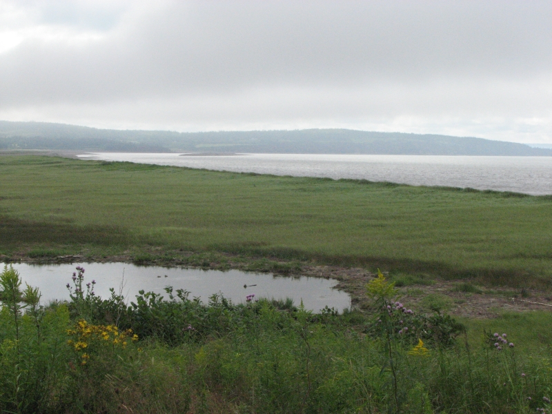
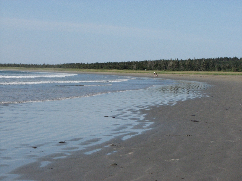
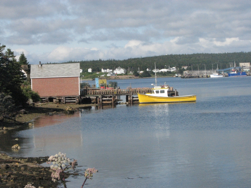
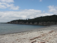
Our good luck continues. We woke to blue skies and sunshine. As we drove along the Atlantic coast, the water was a deep dark blue. We stopped at Pt. Michaud to walk on the long (3 km) sandy beach. The tide was out and there were no shells, but numerous large jellyfish on the sand made the notion of swimming a very unappealing one. During the day, clouds moved in, cooling us off, but the rain stayed away. The drive along the Fleur de Lys Trail went though some very wild country: lots of lakes and ponds, an occasional ocean view and a small village every twenty minutes or so. It isnt a big tourist area evidently. We did see fishing boats in the harbor. Before we left the campground we checked out St. Peters Canal, which is still in use. There were two sailboats and three fishing boats tied up at the canal entrance.
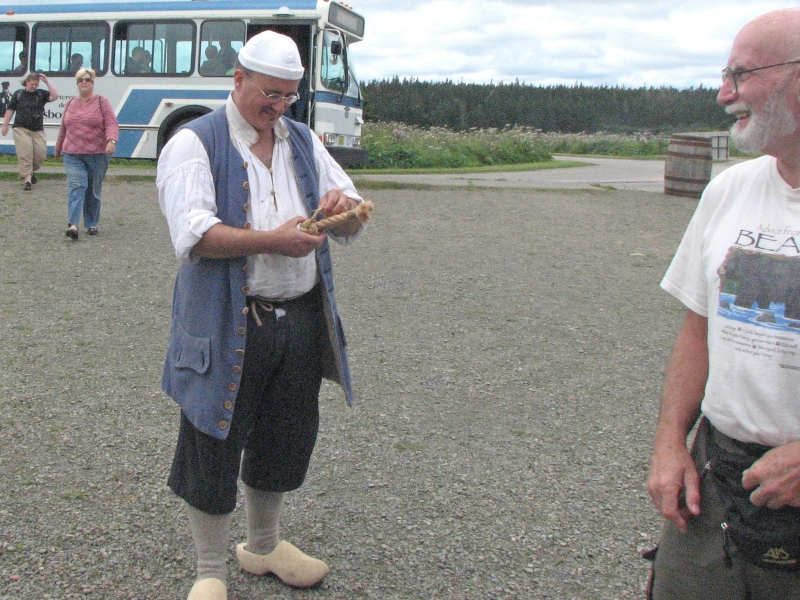
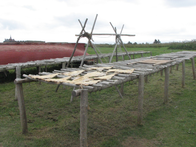
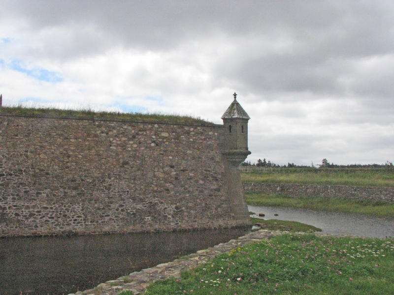
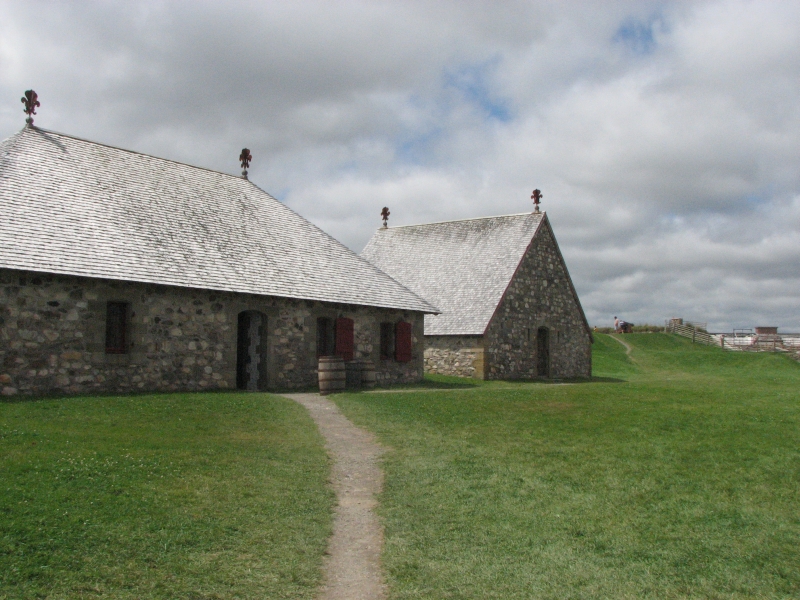
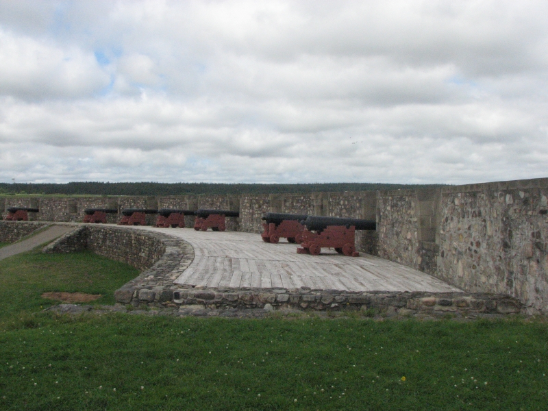
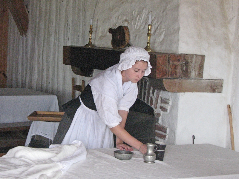
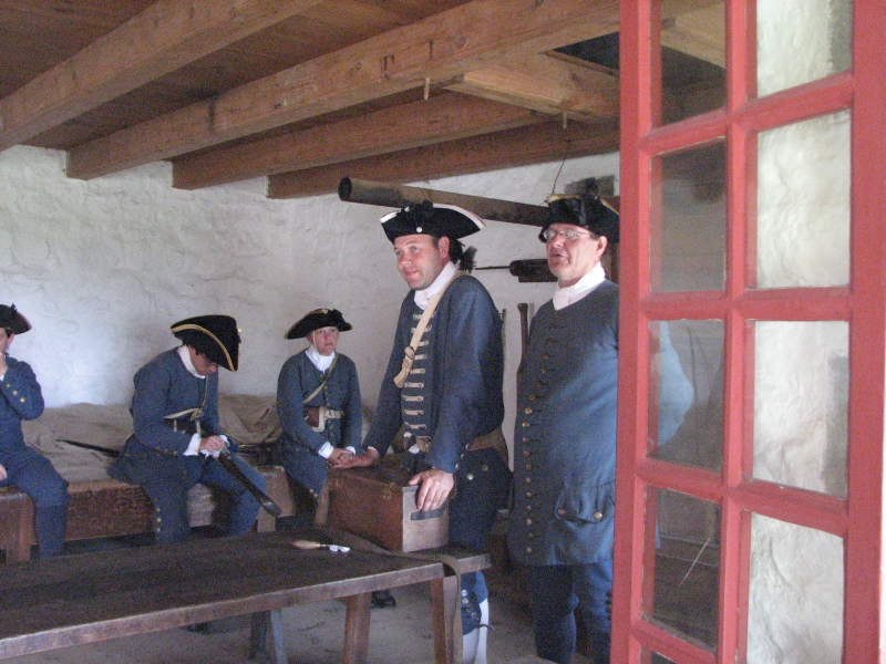
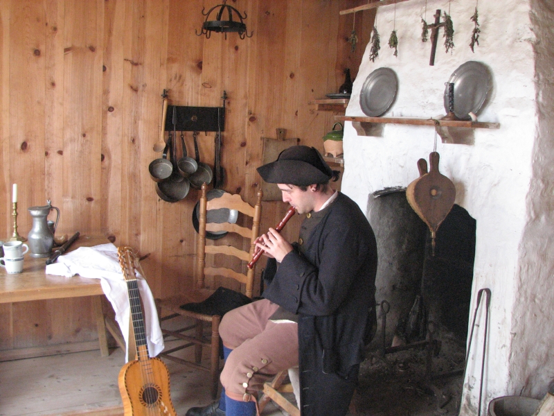
Our goal for today was the 18th century Fortress of Louisbourg. It was once the largest fort in North America and the town was Frances largest/busiest Canadian port. The town exported huge amounts of cod and received everything else they needed to survive from France in exchange. Unlike the English colonies, the French were not allowed to develop local industries to make themselves self-sufficient. Instead of producing their own goods, they had to buy them all from France. The British captured the fort twice, in 1745 and 1758. The second time the fort was destroyed. In the 1960s, as a way of creating jobs when the coal industry was dying, the Canadian government decided to rebuild 1/5 of the old town. They did a good job recreating the historic town. There are costumed interpreters portraying various groups: soldiers, fishermen, servants, officers and their wives, blacksmiths and bakers, etc.
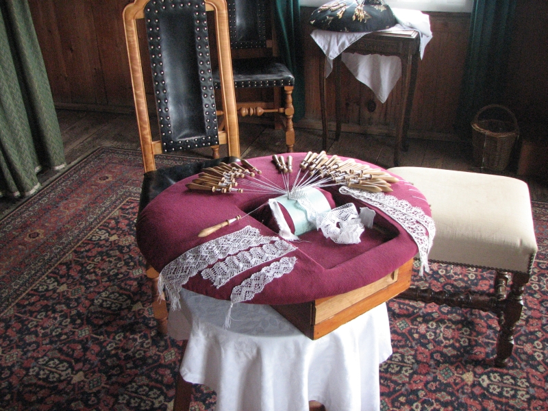
We spent five hours wandering through the town, including a 75 minute guided walking tour that explained the history and described some of the buildings like the Governors home the barracks, the bakery, various storehouses, inns, etc. Archaeologists were digging in the yard of one of the houses. There were also gardens. We didnt have time to see everything, but we enjoyed a glimpse at a historical era we knew little about. Our earlier visits to Ft. Ticonderoga and Crown Point have added to our understanding of the time of the French Indian Wars, as did our visit to Grand Pre (the Acadian expulsion was a result of the wars) and even some of the Mikmaq history weve learned. It is amazing to me how we have ended up focused so much on this one historic period this year. The tour was exhausting, especially since we were hurrying to see as much as possible before closing time. Many of the buildings had interpreters who could explain life in 1744, including bobbin lace making, cooking, gardening, etc. To spend time talking with each one would take at least a day, probably longer. We visited with a few of them, but I wish wed had time for more. We never even made it up to the main museum.
We ended up at a small campground in the middle of Louisbourg not the historical site, but the modern town nearby. Its not very crowded, with only a dozen or so tents and RVs. I think lodging is fairly reasonable in town, plus Sydney, a large city, is not far away. Many people probably just come out for the day, then return to Baddeck or Sydney or some other resort town. The campground has overhead lights that are very very bright. It will be like Alaska: sleeping when the sun is still out.
Thursday, August 13: Big Bras dOr Campground
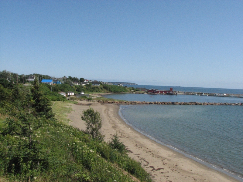
It was another beautiful sunny day. We didnt have any plans. We catch the ferry to Newfoundland tomorrow, but today is free. The rain the other day pushed us forward a half day, so our timing was off a bit. We drove out to the Louisbourg lighthouse, then drove slowly on the Marconi Scenic Drive along the coast to Sydney. We stopped in Port Morien to walk along the beach and the extensive boardwalk they built across the dunes. The water and the colorful fishing villages and lakes and ponds were lovely. In Sydney we searched, in vain, for Diet Mountain Dew at a couple of different stores. They dont seem to sell it anywhere in Nova Scotia.
We stopped early at a small private campground near Big Bras DOr. Its next to a river, but we dont have a view of water from our campsite, just grass and trees, though its not far to the dock where we can look at the river and the mountain across the water. Southern/Eastern Cape Breton is mostly flat, so a thousand foot ridge is pretty notable. They have washing machines at the campground, so I decided to do laundry early so we wont have to bother for the next week or so. Its good to have a lazy day every once in a while.
As we read in the truck, just at dark, a large red fox with a white-tipped tail trotted past our open tailgate. I nudged Jim and we both watched him cross the lawn and vanish into the woods, after glancing back at us. Earlier I saw a bald eagle by the river and this morning we spotted another soaring over the bay. Nice!
Jim: There were actually three highlights in this period. The first was Kejimkujik National Park. It's remote, interesting, has boating, a little hiking (too little), a few petroglyphs (too few), some rain (too much), and ice cream. What more could one want?
The second highlight was Cape Breton - Celtic music, wild coastlines, ocean, hiking, whale watching, more ice cream - even good weather (for the most part). There are a lot of nice campgrounds, beautiful lakes, haunting loons, green mossy forests and interesting trails to explore. Weve been introduced to Acadian and Mikmaq culture, eaten some good seafood, and tried to remember our very rusty French. It has been fun. And it keeps getting better.
The third highlight was Louisbourg. The fortress is a Parcs Canada historical re-enactment site as well as an active archaeological site. Shoulda spent more time there.
A little hiking, a little rain, some more history, a few more petroglyphs, some more ice cream - Life is good!
Home | Links| Trail Journals |
The Thruhiking Papers | Bun-bun
Created: 1 Dec 2009
Revised: 30 Sept 2016Copyright © 2009-2017 Spirit Eagle