|
 |
 |
 |
 |
|
|
|
|
|
|
Sunday, June 15: Skagway
'

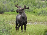

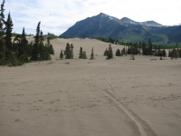
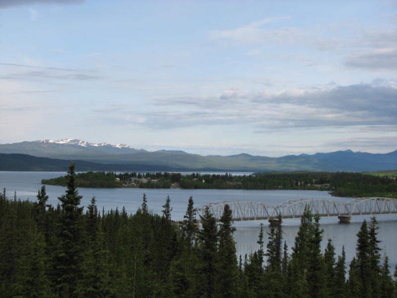
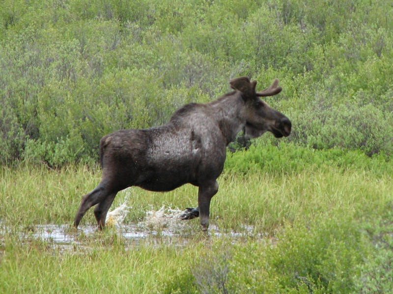
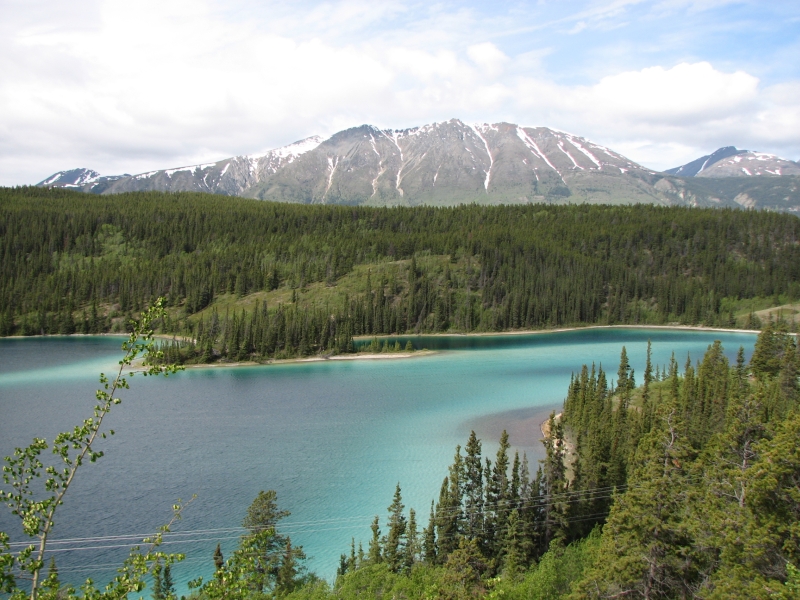
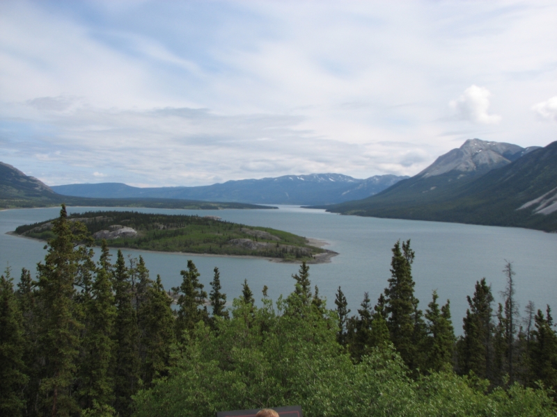
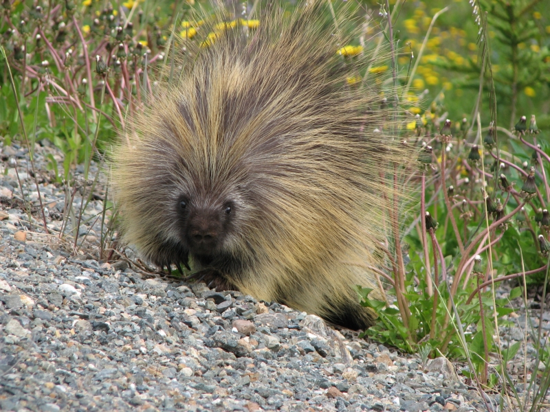
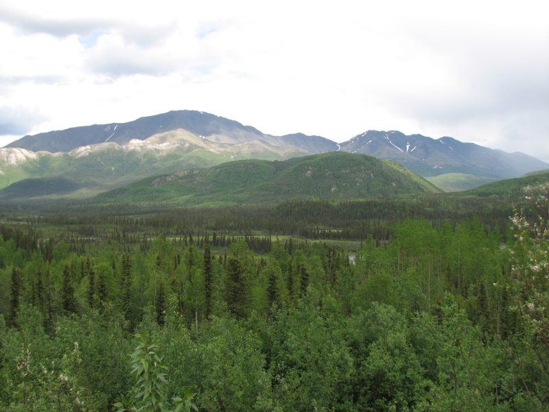
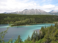
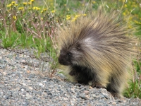
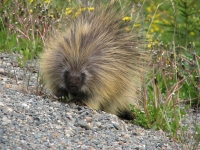
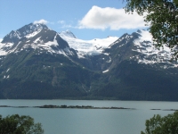
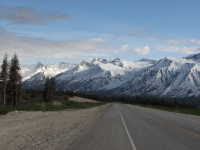
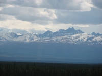
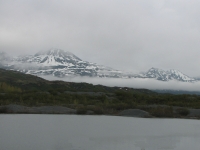
It is an absolutely gorgeous drive to Skagway, past numerous lakes and through snow-streaked mountains. Its amazing to see so much snow, so low in elevation, in mid-June. At Carcross we detoured north a couple of miles to see the Carcross Desert, supposedly the worlds smallest, and Emerald/Rainbow Lake, which was beautiful shades of blue and green. A bull moose hid in a pond but allowed me a quick photo. Later a porcupine ignored me as I took his picture while he ate by the side of the road, but ran when a big truck rumbled past. At the wildlife museum near Carcross, fake animals posed for the tourists: a plastic caribou in the bushes and fake Dall sheep on a cliff high above. It took a minute to realize they werent real. We didnt stay.
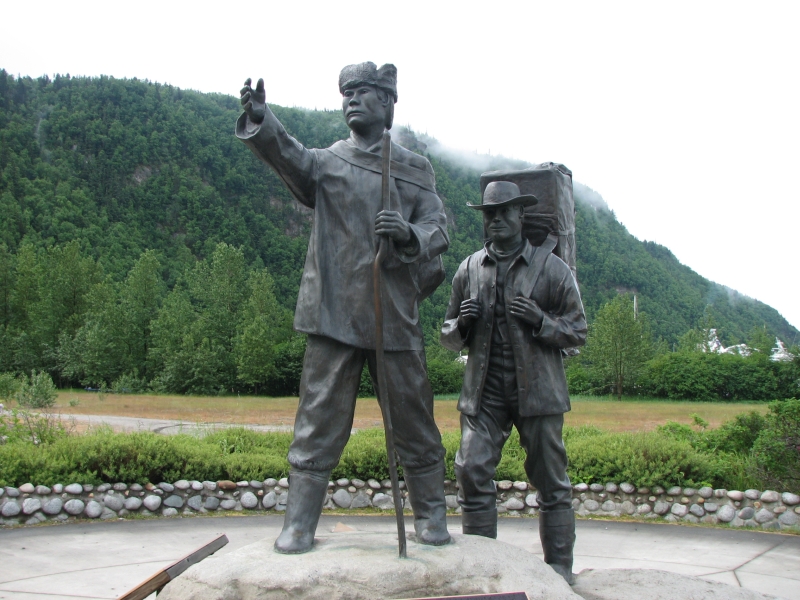
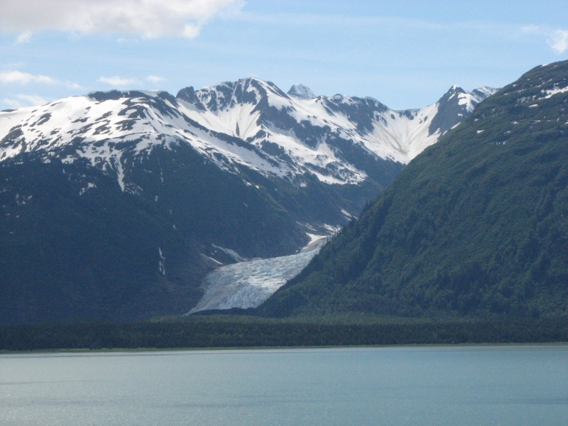
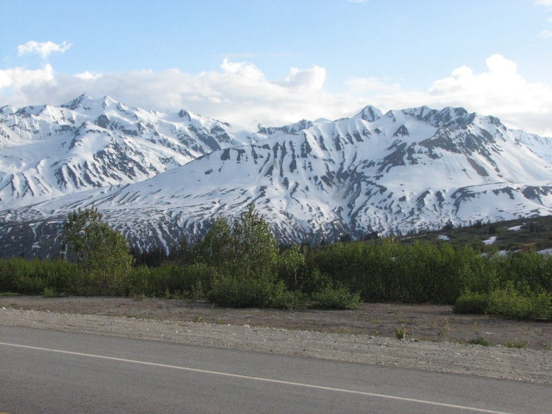
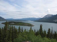
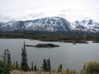
At White Pass there is still ice covering the lake and snow on the hills all around. We stopped frequently to take photos, even knowing that a camera cant begin to do justice to the spectacular beauty of the scene. I tried to imagine what it would be like to be a Stampeder, carrying my ton of supplies across this harsh but beautiful landscape. I remember Robert Services lines in The Spell of the Yukon about how it is the land that draws men back, not the lure of the gold, but to those newly arrived, what a difficult landscape this was, for sure. At one of the view spots I saw some mountain goats high above us on the mountain at least five. We briefly considered backpacking the Chilkoot Trail, but it is cold and snowy enough that I dont really want to spend three days dealing with both.
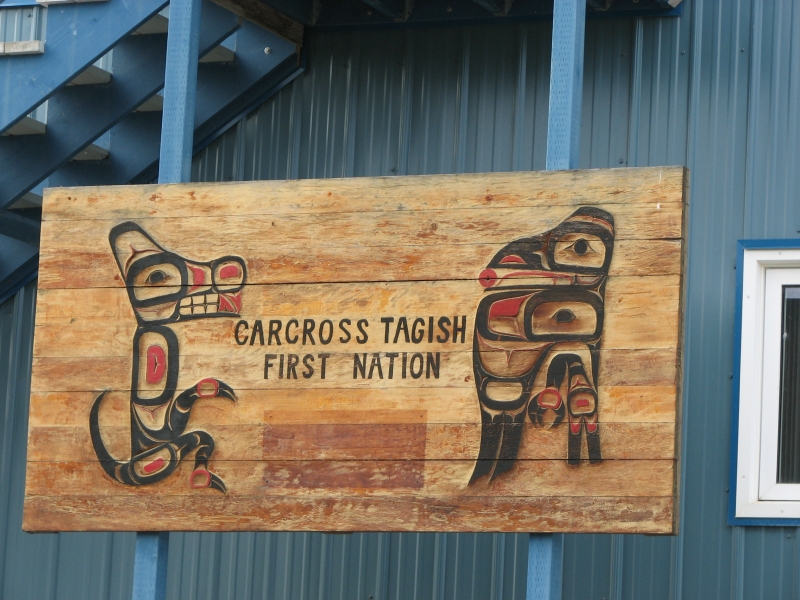
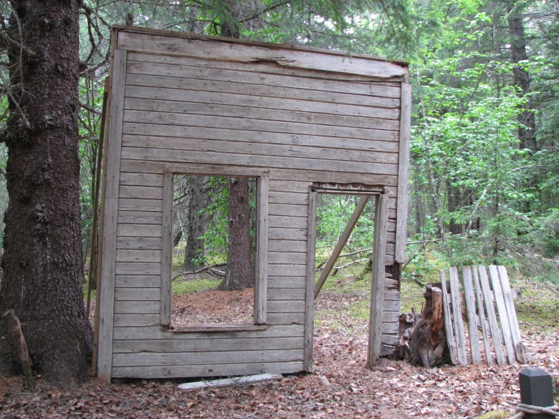
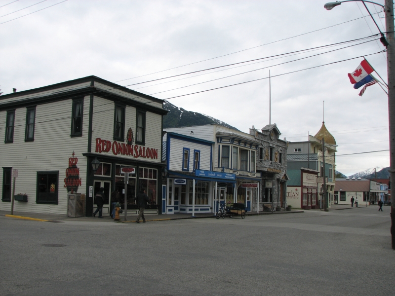
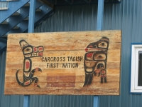
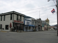
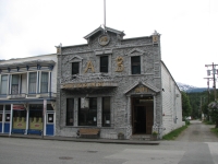
The townsite of Dyea was a disappointment. There is almost nothing left of the old gold rush site: one false building front, some boards on the ground that were once a warehouse and a rowboat, a few holes that may have been cellars or outhouses. Mostly it was just dense mossy green forest. Carcross was a little more interesting: its a real town with a few old buildings as well as modern homes and gift shops. Skagway was much bigger, and has a lot of restored historic buildings, an amazing number of which are now expensive jewelry and fur shops. They definitely cater to the moneyed crowd. Even the outdoor store was mostly Patagonia products, very nice but expensive. We were told that Princess Cruises owns all of the main street and many of the other shops as well. Its a pretty little tourist town, but expensive.
We watched a film on the Klondike Gold Rush at the National Park Visitors Center, wandered a bit up the main drag, then ate dinner at a pizza place. It wasnt bad a little expensive, but thats par for the course up here. We got a site at one of the three campgrounds in town and did laundry and took a shower. Many of the residents at the campground are seasonal workers, working in Skagway for the summer. It made for a noisier crowd than at the usual RV campground.
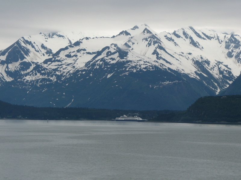
We wanted to make a reservation on the ferry to Haines tomorrow, but the office was closed when we got there. The trip is 15 miles by water, but 350 by road. Its a beautiful drive, but Id like to go by ferry if at all possible.


Monday, June 16: Haines (4 miles)

We were able to get a space on the evening (5:15) ferry to Haines so had all day to wander around Skagway. It rained in the night and was still cloudy and cold when we woke up, so though we wanted to go for a hike, we decided to do a short one. We headed up and around Dewey Lake, a hike of about 3 ½ miles. It was a nice walk in the woods. The trail around the lake was surprisingly rough. I kept thinking we had gotten off on the wrong trail as we clambered over the rocks. The lake was quiet and we only saw two other couples out there.
Jim: The Alaska ferry can be "expensive" but not necessarily as expensive as you might think. A quick calculation says that 350 miles by road with a truck that gets 19 mpg would cost $110 with gas at $6 per gallon. As well as a day to drive the distance. The ferry cost us $111 - and we got a boat ride to boot. Good deal.
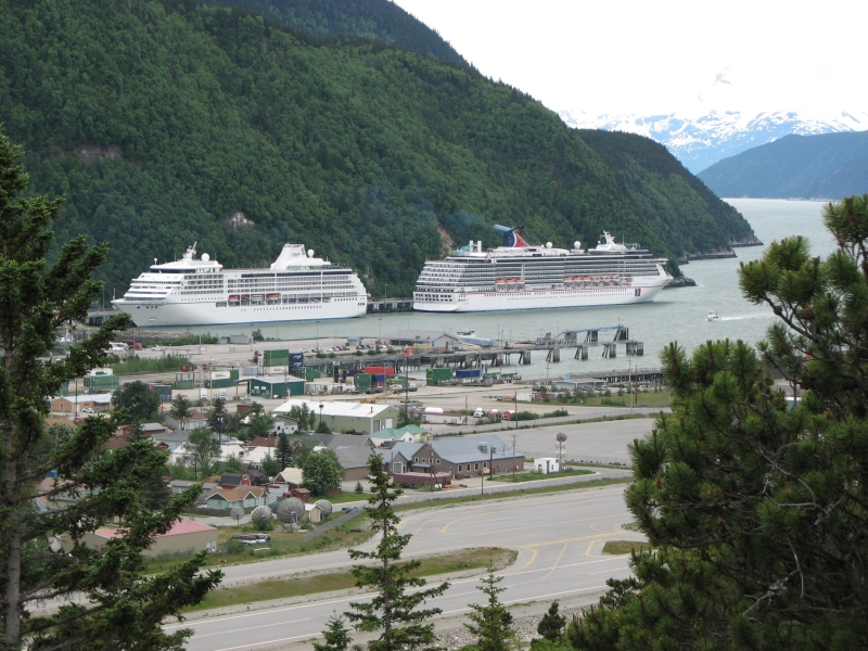
We dropped back into town and wandered through a couple of shops and small museums, then had lunch at one of the overpriced restaurants. The town was hectic today with five cruise ships unloading at the same time. Since Skagway has a very small tourist district, it was crowded, though most cruise passengers spend at least part of the day on the White Pass train or on a helicopter tour. Choppers circled all day, noisily, as did the trains. The main activities here in Skagway seem to be shopping, the tourist train over White Pass, the ferry trip to Haines and Juneau, or hiking the Chilkoot Trail. Since they are still recommending an ice axe and snowshoes after the first five miles, there arent many Chilkoot Trail backpackers in town right now.
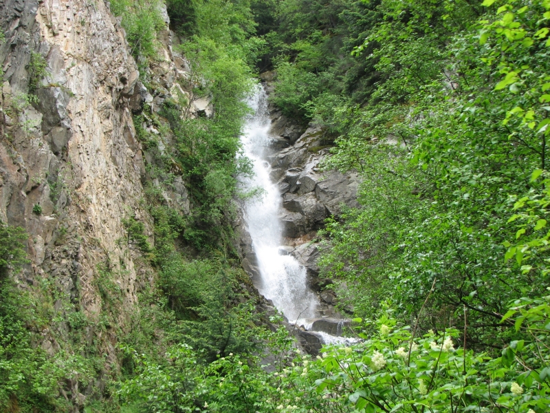
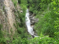
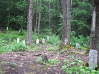
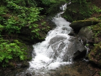
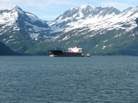
After lunch we drove out to the Gold Rush cemetery and nearby Reid Falls, a very nice waterfall. Neither of us felt like shopping, so we headed out to the ferry pier early to wait for boarding. We watched the boat pull in and disgorge passengers and vehicles. Many were just here for a couple of hours and plan to return on the evening run so unloading was quick. Watching the activity at the harbor was an interesting way of passing the time while waiting.
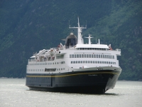
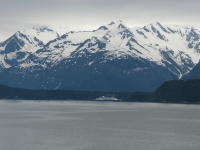
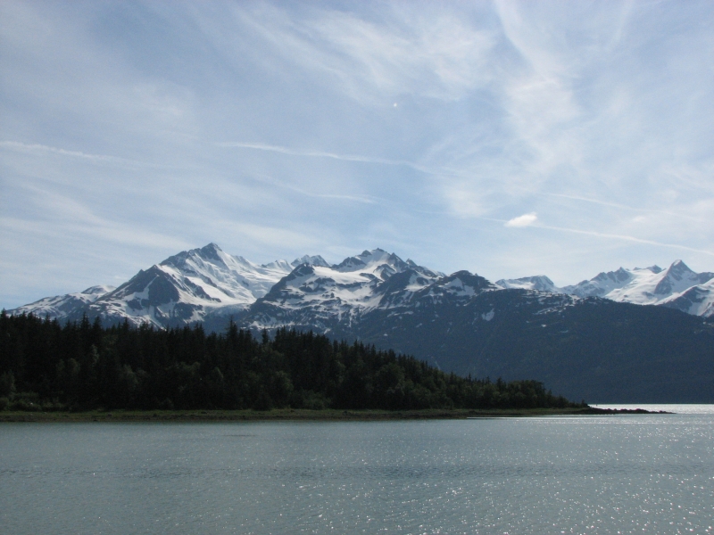
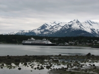
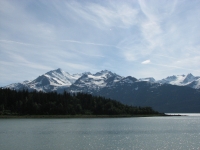
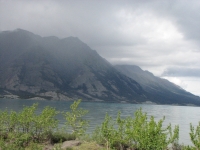
The ferry ride is a pretty one, with steep snowy mountains on both sides of the fjord. There were a couple of beautiful waterfalls tumbling down the side of the ridge. Its only an hour between Skagway and Haines, but we were exhausted when we arrived, so we didnt do any wandering. We just picked up some ice at the grocery, then looked for an RV park. There are three in town, plus a couple of state parks ten miles out of town. The first RV park, next to the harbor, was just a small parking lot with RVs packed in like sardines. The next was more spacious, but backed on a busy highway. We took it. Well put up with traffic noise in favor of clean bathrooms and a free shower. We ate dinner at our picnic table and quickly escaped the mosquitoes by shutting ourselves in the back of the truck. They were really bad.
Tuesday, June 17: Dezadeash Lake (3 miles)
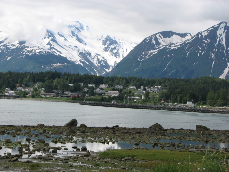
We woke to a dead car battery. Jim had left the keys in the ignition, but neither of us heard the alarm that must have continued until the battery was drained. The campground host gave us a jump so soon we were on our way. We ate breakfast at the bakery then headed to the center of town. Haines isnt as picturesque as Skagway, though nearby Fort Seward is well preserved. The museums and shops were still closed at 9:00, so we decided to drive out to Chilkoot State Park, a few miles out of town.
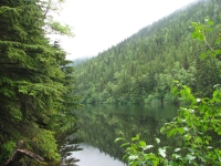
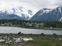
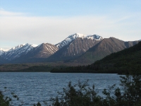
Haines is a pretty area. Theres a point with water all around. Snowy mountains line the shore. On one side of the spit is the Chilkat Inlet with the Chilkat River, on the other side the Lynn Canal and the Lutak Inlet drain the Chilkoot River. Theres a state park on each side, each about ten miles from town. Both were really nice.
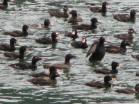
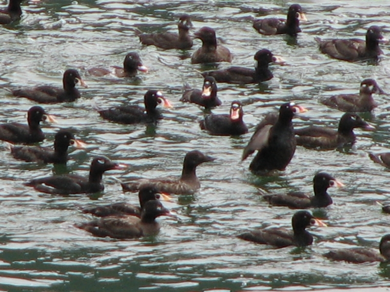
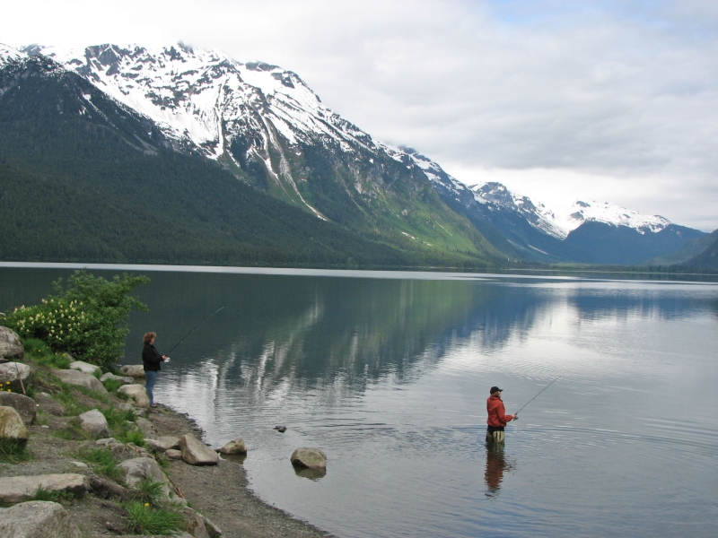
On the way to Chilkoot State Park, we stopped to watch a couple of large flocks of scoters in the water. They dive as a group first the outer row, then the next, then the next until the entire flock is under water. Then one by one they pop up until the whole group is reassembled, drying their wings and moving back into place. Then they all dive again. It seemed to be about a one minute cycle. We watched them for half an hour, trying to get video of the whole process. Out at the park we saw three bald eagles and a bunch of people fishing and canoeing on the river and lake. Theres a fish weir where they count salmon: only three today, 25 this month. Its early in the season.
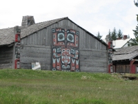
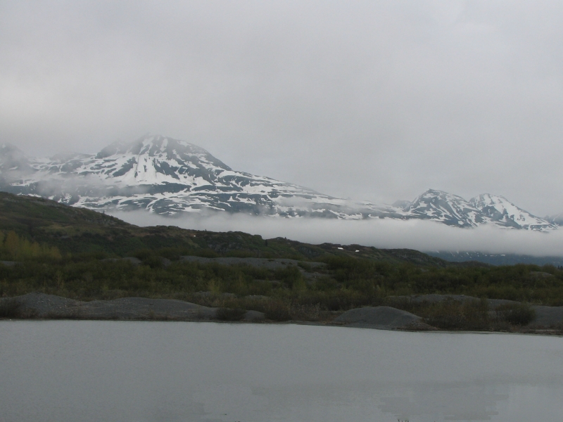
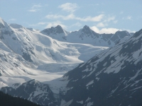
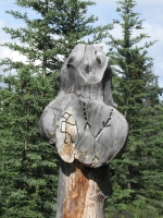
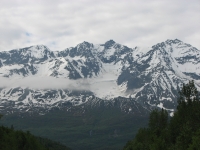
We returned to town to visit the Sheldon Museum a nice one -- and the Alaska Arts Center at Fort Seward where we watched a totem pole being carved. After a quick sandwich we headed out to Chilkat State Park on the other side of Haines. It had a beautiful view of two glaciers: Rainbow, a hanging glacier, and Davidson, which used to extend all the way to the water. Rainbow Glacier had two 600 waterfalls. We also saw two grizzlies, a mama and cub, through the telescope at the viewing platform. They were about three miles away. I watched them slide down the snow and then disappear in the brush.

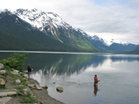
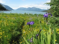
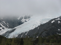
It turned into a beautiful sunny day, so we hiked a portion of the Seduction Point Trail as far as Moose Meadow, then a bit along the shore. Most of the hike was in the woods, but eventually we emerged into a flower-filled meadow with the gorgeous blue-green water of the inlet beyond. Davidson Glacier was three miles across the water. While we were saying hello to a family from Fairbanks, the glacier calved, noisily sending a huge plume of water skyward. The snow and ice-covered mountains rose steep and jagged to an almost clear blue sky. It was gorgeous. The water sparkled in the late afternoon sun. The flowers were a riot of color: white Queen Annes lace, red columbine, blue iris and geranium, yellow buttercups. I was awed by the beauty, filled with joy and wonder.

Since we were both feeling happy and relaxed after our walk in the woods, we decided that we would just as soon keep on driving along the river so we could continue to enjoy the sunshine and beautiful views. Staying in town just didnt appeal. We passed through the Chilkat Bald Eagle Preserve but only saw one eagle soaring high above the mountains. Its the wrong time of year for them, though we saw four earlier as we returned from Chilkat State Park.
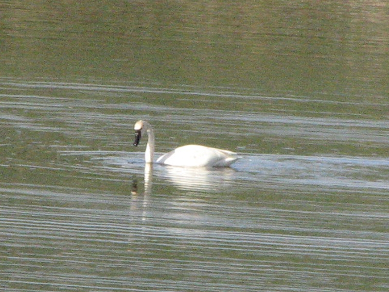
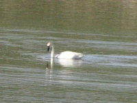
I really enjoyed the drive. We stopped at 33 Mile Roadhouse for a very good hamburger and pie before continuing west. Clouds returned, but the scenery continued to be utterly spectacular. We saw our first trumpeter swan, but couldnt stop. We did stop for three dogs that were being taken for a walk, without leashes, along the highway. They almost got run over. There was almost no traffic, so I guess the owners felt safe letting them run free.

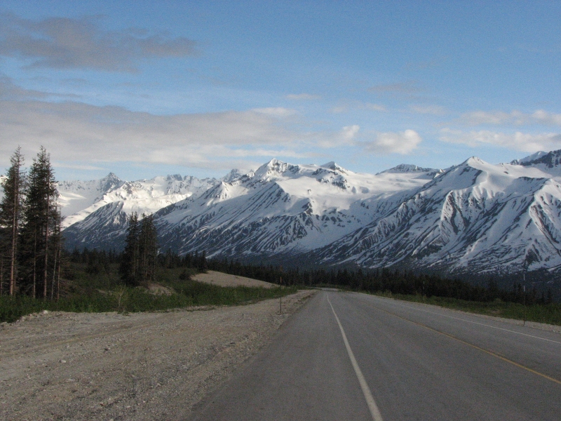
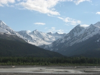
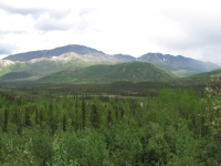
The road rose above treeline (3500) for several miles, so we had long views of brown hills dotted with snow surrounded by big blue and white ridges with lots of snow. Its a wild and beautiful land. I hadnt realized you can drive to places as remote and wild as the areas we love to hike. Late in the evening, we had the whole wilderness to ourselves. We intended to camp at Million Dollar Falls Campground, but it was closed when we arrived at 9:00. We found out later that a grizzly had killed a moose in the campground the previous day, so they closed it down until the carcass was gone. We were tired by then, so we werent happy to keep driving. But since its still daylight until 11:30 or so, it wasnt that big a hardship. In an hour we reached Dezadeash Lake which has a pretty campground with views over the water of snow streaked mountains. It was really windy, but beautiful.
Wednesday, June 18: Beaver Creek RV Park (3 ½ miles)

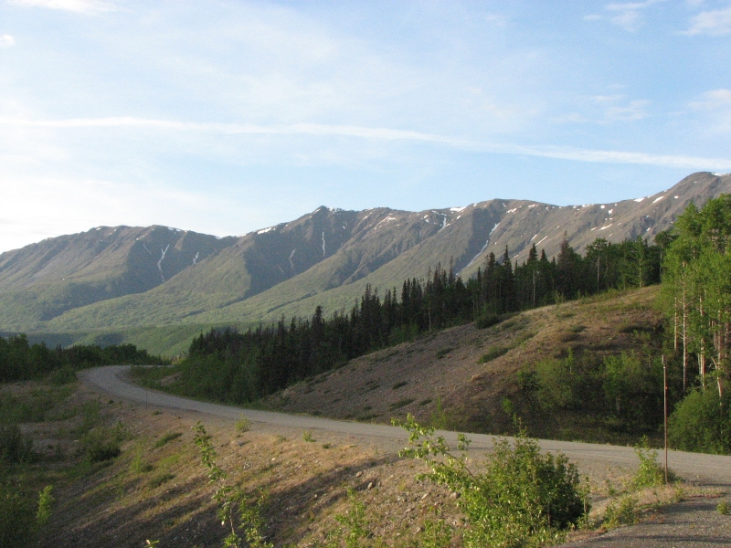
A storm passed through in the night, bringing rain and high winds. Morning was cold, damp and blustery, but the rain stopped, for a while. I was really glad we had done the beautiful drive last night, so we could enjoy the views. At Haines Junction the sun came out so we did a short walk on the Dezadeash River Trail. It was an easy walk, but not especially scenic. There are a couple of views of the mountains, but mostly we walked through aspen groves. By the time we reached Sheep Mountain, an hour after we got back in the car, it was raining again, so I was glad we were able to enjoy an hour in the sun, even if it wasnt an exciting hike. It showered off and on all day so we didnt get yesterdays exciting vistas. The mountains were lower and more rounded, the green ridges not streaked with snow.

We drove along the edge of Kluane National Park and there were occasional views of distant white peaks, but on a gray day they werent as spectacular as the mountains we drove through yesterday. I had hoped to do some hiking in the park, but it wasnt a good day for it, and by the time we reached the visitors center to find out where the trails were, we had already passed the most accessible trails.
Driving was interesting: frost heave turned sections of the road into a roller coaster. Some sections were deliberately left unpaved. We were stopped a couple of times at construction zones. We passed many closed lodges and service stations.
We had planned to camp at White River Crossing I had been told that it was a nice campground but it was also closed. I think it was temporary, but at least for today, orange barrels barred entry. We ended up at Beaver Creek Campground. Its not as nice, but it has a shower and picnic table to cook on, so it will do.
Jim: One of the things we've noticed since we left the US border is the great number of local businesses that are closed. Many, if not all, of them have closed due to the cost of fuel. There are no power lines (no electricity) here and gasoline for generators (which run the gas pumps, refrigeration and lighting) is extremely expensive. And the cost has driven many small businesses to close.
Thursday, June 19: Glenallen, Alaska
It was raining when we woke up, so we decided to eat breakfast at Buckshot Bettys in Beaver Creek. It was good, better than most weve had lately. We then headed north to the border, finally entering Alaska for the third (and final) time. Weve been going back and forth between Alaska and Canada with our side trips to Hyder and Skagway in Alaska, then back to Yukon Territory. We drove through the Teslin Wildlife Refuge for miles and miles. Its an area of low hills, black spruce forests and lots of lakes and ponds. During fall migration, it is a mecca for birdwatchers. We just saw a couple of swans and a few ducks. We did see one bird with a bright orange back. I have no idea what it could be since I only got a glimpse of it as it flew past. The color was distinctive, but I couldnt find any bright orange birds in the bird guide.
We spent an hour in Tok at the grocery and the Visitors Center. The used bookstore we were looking forward to was gone. We had planned to stay in Tok, but since we went farther than expected yesterday, we decided it was too early to stop, so we continued southwest on the Tok Cut-off. We did a short but steep hike at Eagle Trail Recreation Site to a very nice overlook of the Tok Valley. Later as we were escorted through a construction zone we saw a scrawny moose in a pond, seemingly unfazed by all the noise of the machinery. There is a lot of road construction going on. We had to wait half an hour at one spot and ten minutes at another while traffic was escorted past the work zone, one lane at a time.
We have a friend who is currently touring Alaska. We were hoping to see him while were here, but were not sure where he is at the moment, so we needed internet access. Two RV parks advertised WIFI, but neither actually had a working wireless system. We finally parked next to the library in Glenallen and piggybacked on their WIFI to send a brief message to Beau. We ended up at an RV park in town. It was a nice campground with some trees, not just a big parking lot with RVs packed close together. I hate those. I like the primitive forest campgrounds better aesthetically theres usually more privacy, more trees and a more natural feel to them, but it is nice to get clean every couple of days. A dry site at an RV park (no electricity or water) isnt much more expensive than a forest service campground, but they generally have showers. In this case, they charge $5 for a shower, so we skipped it. We can put up with a little sweat for another day or two.
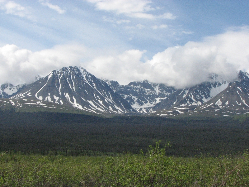
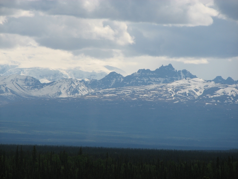
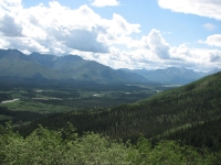
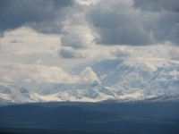
It was a good day. As we headed south from Tok we drove back toward big mountains. We could see some huge snow-covered peaks to the south in Wrangell-St. Elias National Park. It was very dramatic and beautiful, even half covered with clouds. We had clouds most of the day, but only a few brief sprinkles. Now that were in Alaska the roads seem much busier and more crowded. There are lots of RVs some very slow and more houses beside the road. I liked the Yukon better. It felt much more remote.
Friday, June 20: Valdez
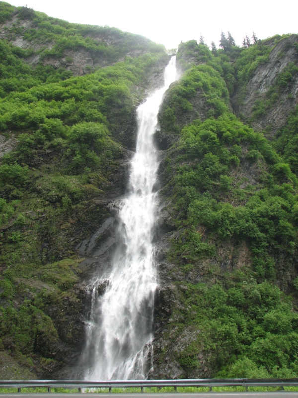
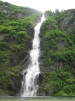
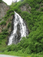
We decided to drive down to Valdez on the coast today. Its a pretty drive through snowy mountains along several rushing rivers. We paralleled the Alyeska Pipeline, which we saw frequently. A coyote crossed the road in front of us. Thompson Pass was covered with clouds, but we could still see snow-streaked ridges all around. Worthington Glacier was visible, though the top was buried in cloud. Farther down the road there were numerous waterfalls tumbling from the snow and ice above. Two were especially scenic: Bridal Veil Falls and Horsetail. We stopped at both and climbed to an overlook above the road for a better view. Despite the cold gray day, we spotted a raft in the Lowe River. Brrr! It was a beautiful drive to a spectacular port.
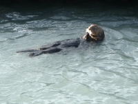
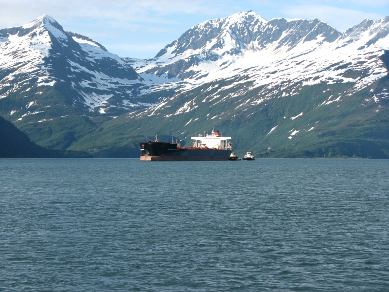
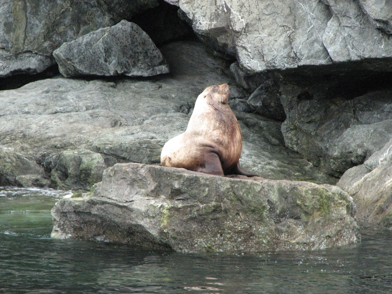
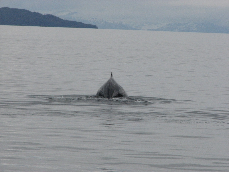
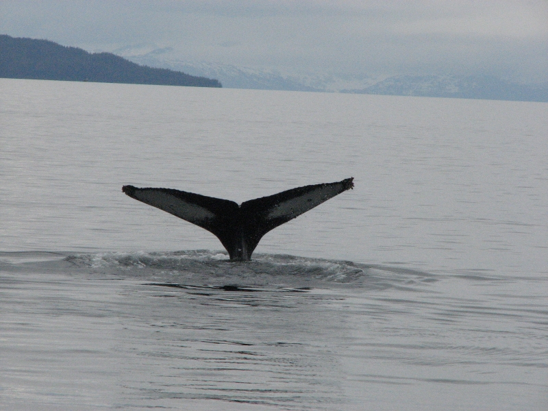
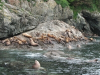
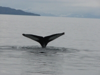
In Valdez, we drove to the waterfront, looked around at the shops and marina for a few minutes, (its small), and then signed up for a cruise this afternoon on the Lulubelle, heading out to Prince William Sound to look for wildlife and the Columbia Glacier. It was a lovely little boat and the tour was a good one, though we didnt see a lot of pelagic wildlife. The trip lasted five or six hours. We stopped to look at the sights and spent a long time watching a large group of sea lions on the shore as well as our lone humpback whale. There were supposedly a couple of others way out, too far to see. We watched our whale dive a dozen times, but he only flipped his tail twice. The only otter we saw was at the dock. Even birds were scarce. Still, I enjoyed the trip.
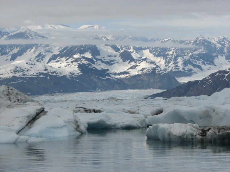
Captain Fred was a character, funny and informative and quite opinionated. He talked about the town, its history, the advent of oil and its effects, the Exxon Valdez spill, wildlife, etc. It was overcast but dry so the views were good of snowy mountains all around. We couldnt get close to the glacier because the ice around the mouth was too thick. There is a wall of ice eight miles out, right where the edge of the glacier used to be. If you find a too narrow passage in, it may close behind you. We couldnt find a good passage today. It seems that Columbia glacier isnt receding because of global warming: evidently a crack developed in the glacier a few years after the big earthquake. Water entered the crack and began warming the ice. Captain Fred spoke of the many glaciers in this part of Alaska, some getting larger, others smaller, some not changing at all.

We ate dinner at a Chinese restaurant then headed a few miles out of town to the nice municipal campground near Valdez Glacier. Its much nicer than the RV parks in town, which seem to be the crammed and ugly parking lot kind. The municipal campground is huge with a nice forest, a waterfall, nesting eagles and silence. The city campgrounds are scenic, since the town is in such a beautiful setting, but they are noisy and crowded.

Home | Links| Trail Journals |
The Thruhiking Papers | Bun-bun
Created: 1 Jan 2009
Revised: 30 Sept 2016Copyright 2009-2017 Spirit Eagle