|
 |
 |
 |
 |
|
|
|
|
|
|
Friday, June 6 Drive to Revelstoke, B.C.
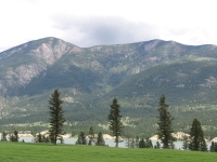
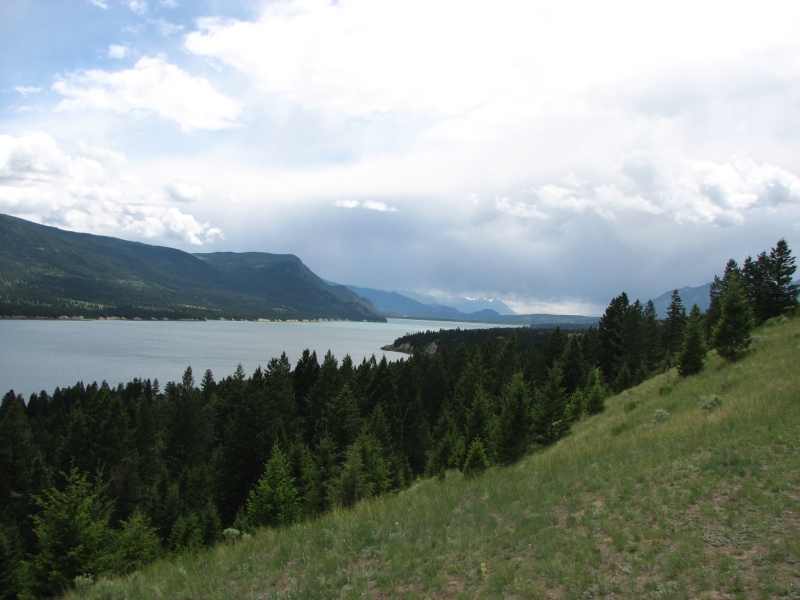
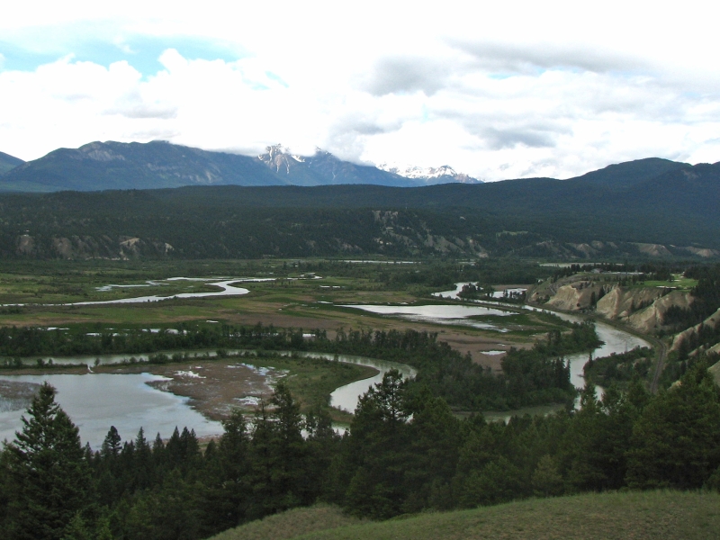
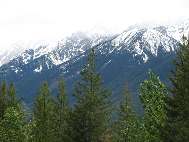
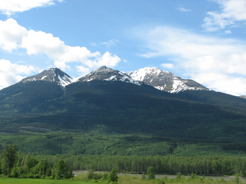
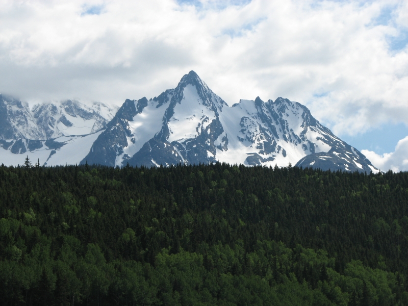
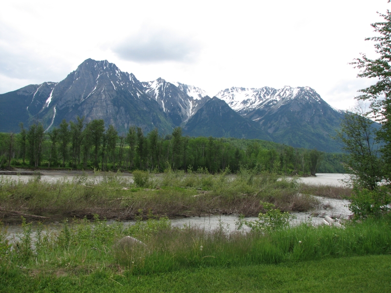
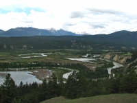
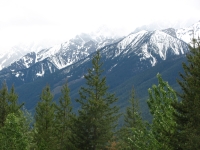
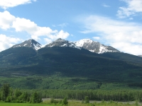
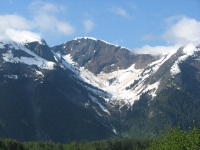
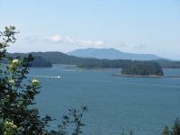
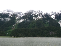
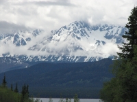
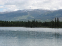
Last night we camped a few miles from the Canadian border at Robinson Lake in the panhandle of Idaho. We fell asleep to the sound of rain on the roof and woke to more of the same. Today we crossed into Canada and officially began our long trek to Alaska. It was another showery day. Although the sun did eventually come out, we had intermittent rain and hail all day. The drive north was pretty, though clouds hid the mountaintops. There were steep mountains on both sides of us, streaked with white snow. The river meandered back and forth across a wide green valley. The trees covering the mountains were densely packed. We saw deer three times, including a group of three that jumped in front of the car unexpectedly. There were also a couple of bald eagles and some hawks. We paralleled the Divide all the way to Golden, looking up at the peaks and icefields of Kootenay and Yoho National Parks. It is a pretty drive and a bit faster than the Icefields Parkway through the Parks, with a lot less tourist traffic, which was a bonus.
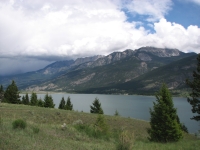
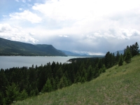
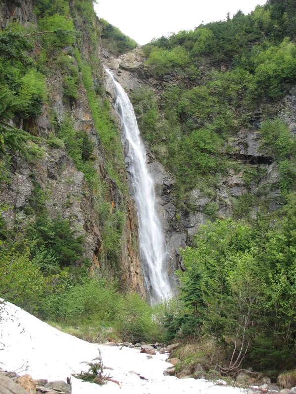
The highway passed through beautiful Glacier National Park (the Canadian one) and past Mt. Revelstoke Provincial Park. The campground at Glacier was still closed, as was the road up Revelstoke. There is still a lot of snow in the mountains, which made for some beautiful waterfalls. I had hoped to hike in Glacier, but aside from the rain, which continued all afternoon, we didnt have a Parks Canada Pass, which we were supposed to have in order to use the facilities, including the hiking trails. We had one from last year, still valid for another two weeks, but we left it at home since we hadnt expected to need it. There wasnt even a Visitors Center along the road to buy a new one, which I thought odd. Why require a pass if you cant buy one?
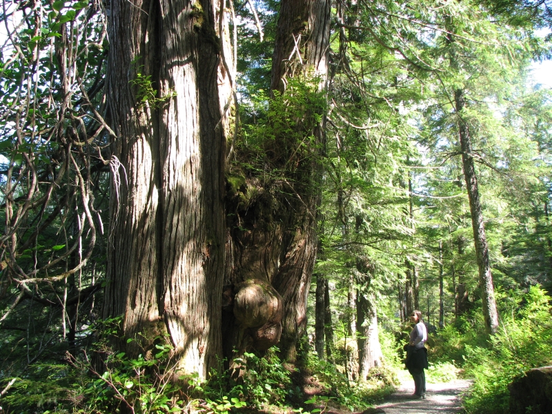
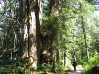
We continued driving farther than we intended. Since the campground in Glacier (where we intended to stay) was closed, we ended up going all the way to the town of Revelstoke. There is a campground beside Williamson Lake, a couple of miles from town. Its more crowded than the one last night, but it has running water and a free shower, so Ill put up with the people. We tried to hike around the lake, but had to turn back because the trail was flooded. I was amazed at the huge stumps in the forest: seven feet tall and about 5 feet across. Those were BIG trees. A few days ago, in Idaho, we passed a small patch of virgin forest wow! Im used to second and third growth forests; virgin forest really is different.
Saturday, June 7: Lac la Hache Provincial Park

We woke up unusually early, for us. It was pouring, just as it was when we fell asleep last night. We tried to go back to sleep, but it was daylight, so we were awake. As we head north, were starting to get much longer days. We can read without headlamps until about 10:00, which is nice.
Rather than cook breakfast in the rain, we decided to head to town for breakfast. Dennys fed us well. We continued our road west, hoping to drive out of the storm. The dark shape of the mountains was often barely visible through the clouds. We drove past several large lakes. I enjoyed the sight of one guy fishing in the rain, sitting in his boat under a large umbrella. Yesterday we spotted a man walking up the highway, towing a canoe on wheels, (or maybe his dog was pulling it). We wondered what his story was. Weve seen a lot of long distance bicyclists, but he was the first canoeist.

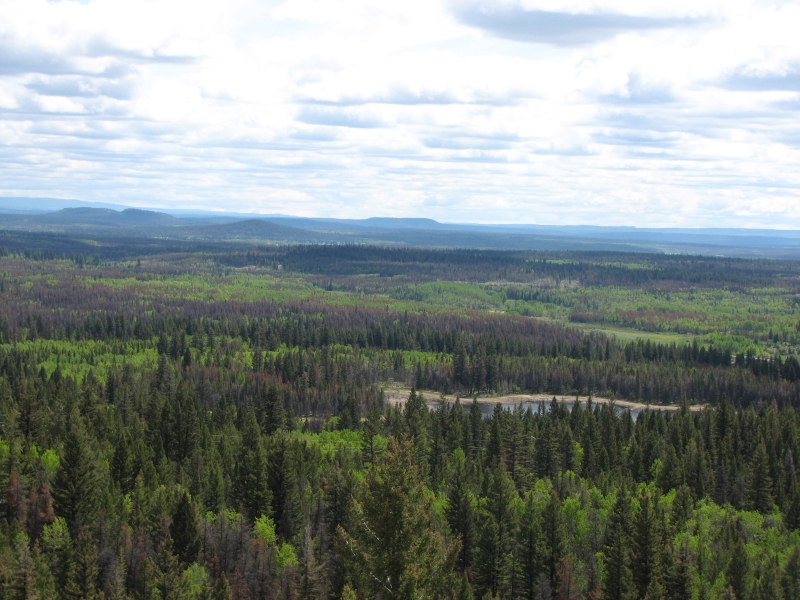
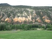
Around 9:30 the rain stopped and we could enjoy views of green hills and tree-covered mountains. Around Kamloops, the terrain changed considerably. Dry sage-covered hills replaced the dense forests. What trees remained were mostly damaged or destroyed by pine or spruce beetles. It looked more like Wyoming than Canada.
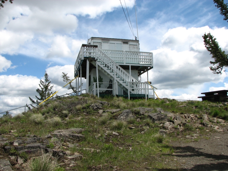
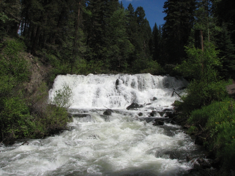
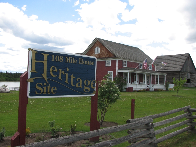
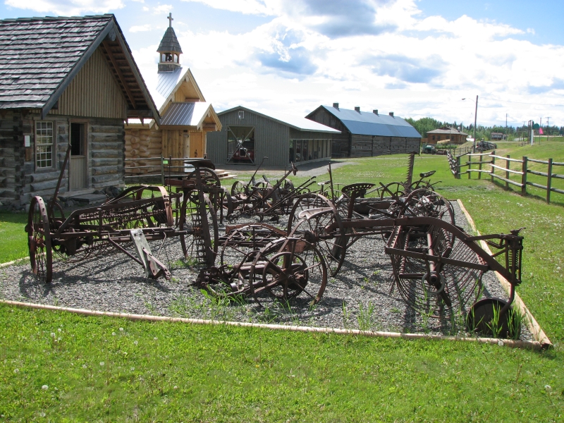
We took advantage of the good weather to make a few stops: first to climb to the fire tower at Begley Summit, then to do the short walk at 100 Mile House to beautiful Bridge Creek Falls, and, finally, at 108 Mile House we wandered around the Heritage Site, which has several reconstructed 19th century buildings: a ranch house, bunk house, store, one room school, barn, blacksmith shop and, of course, the roadhouse that used to be 105 Mile House.


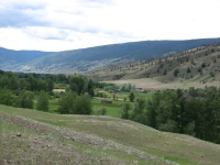
As we drove north we rose in elevation and returned to green grassy meadows and tree-covered hills. No big mountains, just rolling hills with many lakes. Its pretty country. We ended up camped at Lac la Hache Provincial Park, which has a short ½ mile nature trail through the woods. The lake is across the highway, invisible from the campground. Mosquitoes are bad, but its a fairly quiet campground with few people camped here, and those mostly spread out in wooded campsites. We wandered the woods trail, visited the lake, then came back to sit in the sun for a while. Otherwise, all was quiet. The sun stayed out most of the afternoon, which made walking a real pleasure.
Jim: The pine bark beetle in Canada is the same critter that's devastating parts of the Colorado Rockies. Given time, neglect and the right conditions, it can destroy entire forests - as has happened in Colorado. The difference being that the Canadians are apparently harvesting the forests rather than allowing them to become fodder for future massive destructive wildfires.
Sunday, June 8: Burns Lake
It started to rain again as we were eating dinner last night and continued most of the night. We woke to sunshine and scattered clouds not bad. Temperatures were in the 40s and low 50s though, so it felt cold.
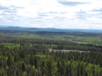
We enjoyed the long drive north to Prince George and then west on the Yellowknife Highway. Once again it was an area of rolling hills covered in green pastures, aspen groves and spruce forest turning red, brown and gray from beetle damage. Its farm country, for the most part--lots of cows, sheep and horsesthough obviously logging is also a big deal in the area. There were lots of small lakes and rivers. We saw several moose crossing signs, but no moose. We did see a couple of deer and hawks in the morning.
Around 10:30 we stopped at Ten Mile Provincial Park where we walked for an hour on cross country ski trails past a couple of ponds. It felt good to stretch our legs and enjoy the sunshine. Jim and I are bad tourists. We intend to take our time, but end up consistently going farther than planned. We zip through towns, usually without stopping except to get gas. There have been a couple of interesting tourist attractions that weve ignored because they were 20 or 30 miles off the main route. However, Ive enjoyed just seeing the country, the green meadows and forests, the lakes, always looking for wildlife; its all good.
Last night the campground host asked, Why go to Alaska? meaning, Why not explore Canada instead? If prices werent so ridiculously high, we would like to spend more time here. Its lovely country. But it is expensive, so were moving on. My answer to him was essentially that its the journey that draws us, not the destination. Its all the beautiful country well see along the way, the wildlife, the hiking. Its spending weeks surrounded by nature, by beauty. Thats why were going to Alaska. Canada is part of the journey, both coming and going, and as essential a part as the weeks well spend in Alaska, but we want to visit Alaska too.
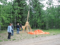
We stopped about 4:00 at a private campground near the town of Burns Lake. It had free showers, which are always welcome. We had the place to ourselves, surprisingly. We went for a short walk and ran into some local folks with a trebuchet that they had built. Its sort of like a catapult, but more forceful. Once upon a time they were used to destroy castle walls. We watched as the group practiced flinging things. It wasnt weighted, so the object only went about 50 feet, but it was fun. I think they were SCA (Society for Creative Anachronism), from the little bit of conversation we overheard.
The bugs werent as bad tonight as last night, but theyre biting. I was so happy to wash the DEET off, Id rather not put more on. Its cold enough they might not be too active, I hope.

Monday, June 9: Terrace, B.C.

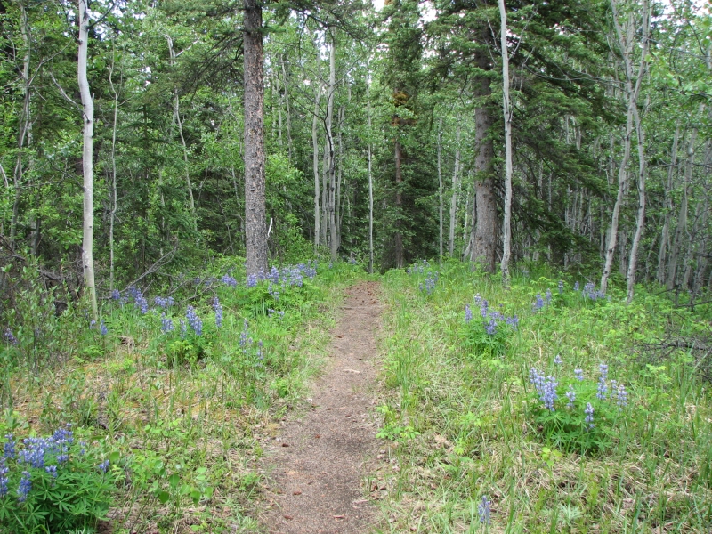
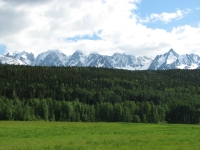
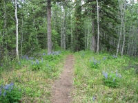
As we drove west, the scenery became more and more dramatic and beautiful. We started the day with hills covered with dying forest. Farther west, after Houston, the trees were more lush and the mountains taller and covered with snow and glaciers. There were several gorgeous areas on both sides of the highway. We did a short 2½ km. hike through the woods at Tyhee Provincial Park near Telkwa. It was pastoral, not dramatic, with lots of wildflowers and green aspen. We saw a red fox with black feet cross the road in front of us.

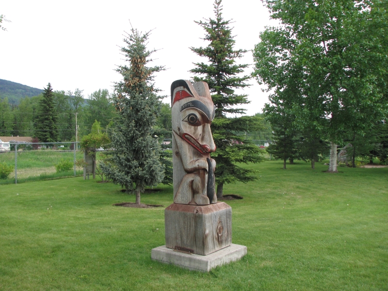
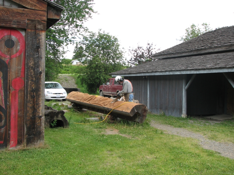
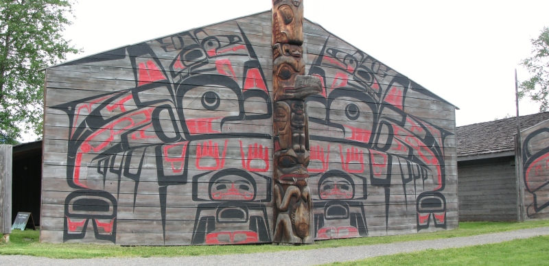
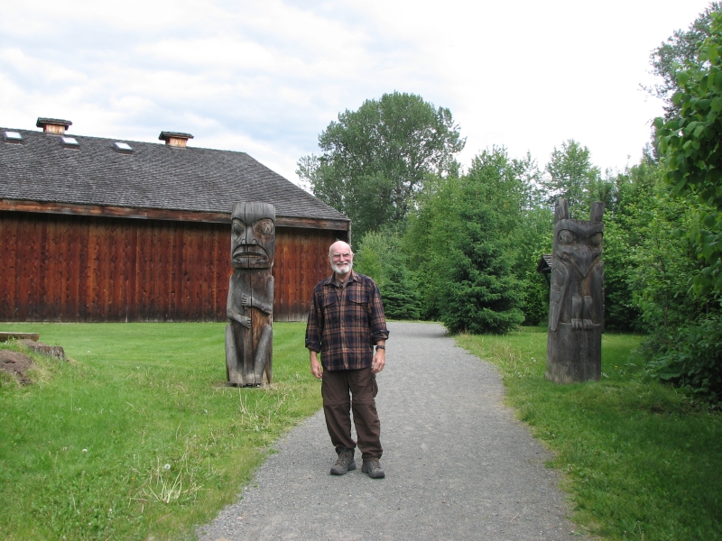
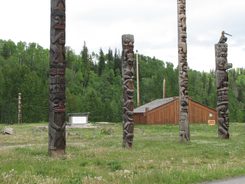
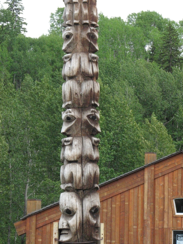
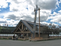
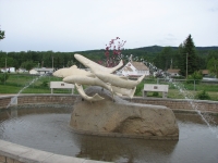
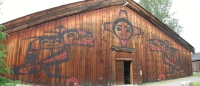
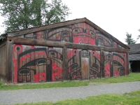
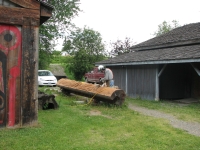
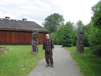
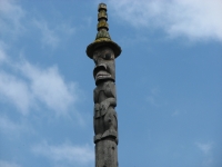
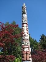
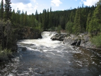
At Houston we stopped to photograph their famous 18 m. long fly rod and fish fountain. Near Smithers we detoured to beautiful Twin Falls. We visited a reconstructed Gitxsan village at Ksan with its museum and totem poles, then stopped at a modern First Nation village, Kitseguecla, to look for more totem poles. As we drove toward Terrace, glacier-covered mountains rose dramatically along the road. It was beautiful. There is a real shortage of good stopping places to photograph the scenery though. It was driving me crazy because there was so much beauty and we had to zip by without stopping. It was cloudy so some of the peaks were hidden, but we saw enough beauty to make me happy.
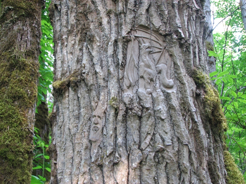
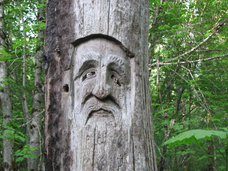
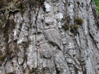
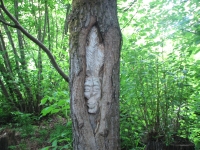
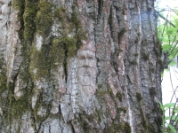
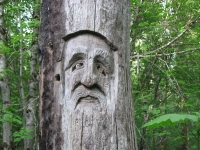
We stopped at Ferry Island Campground near the town of Terrace for the night. It was described in the book as having a hiking trail with some wood carvings. It turned out to be a 2 ½ km. loop around the island through beautiful forest with occasional views of the river. A local artist, Rick Goyette, carved faces and animals in the bark of many cottonwood trees along the trail. Some were large (8-10 inches) but most were quite small, only 2-4 inches. There were all sorts of faces, young and old, white and Indian. There were a few animals: owls, a dragon, a singing pig, an otter, etc. It was a lot of fun wandering through the forest looking for hidden faces. We found about 50, in all. A few carvings may have been done by someone else, since they werent as detailed. It looked like some had been cut off; we could see where the bark was missing. Maybe a thief took them, or maybe the artist wasnt happy with the end result and so removed his own work. In any case, the hike was definitely worth doing.

It is odd, but nice, to be traveling so early in the season. This campground, like many of the ones weve visited, is nearly empty. High gas prices are largely responsible, I imagine. Tourism will be hard hit this year, especially such long and expensive journeys as the drive to Alaska. Gas was $1.37 a liter today. It keeps going up. It was $1.31 yesterday. Thats over $5 a gallon. Ouch. And that was the good price. In some places its been closer to $6. Weve seen hotels advertising $50 rooms theyre desperate. Last year we saw nothing under $90 in Canada and most motels were above $125.
Tuesday, June 10: Prince Rupert
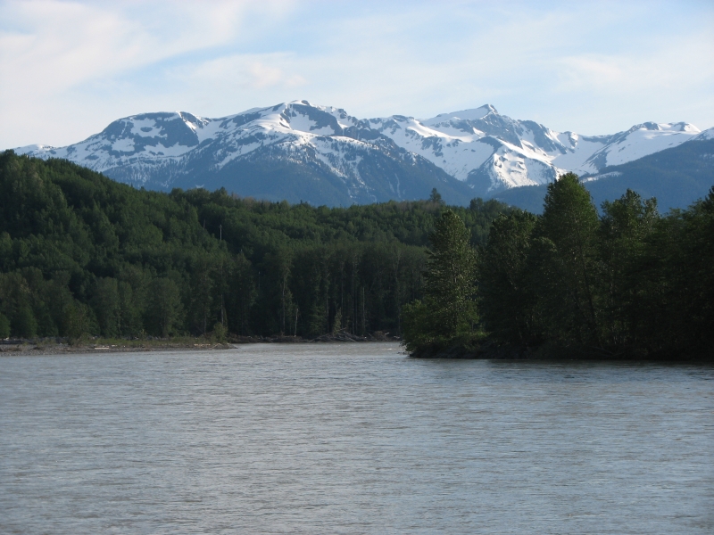
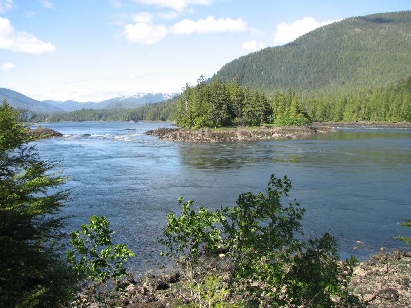
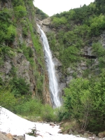
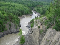
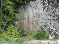
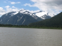
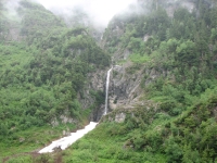
We enjoyed the rest of the drive along the Skeena River to the town of Prince Rupert. Steep mountains covered with snow and ice lined the highway. Beautiful waterfalls tumbled down to the river. We stopped once to check out a pictograph noted in the guidebook. Evidently the local chief had his face painted on the rock to mark the boundaries of his territory. Voyagers had to pay toll when they passed through the area. We tried to visit another rock art site the other day, but the Milepost didnt tell us that the site was 30 miles off the highway. We couldnt find a map to show us exactly where the fish hatchery was and the Visitors Center was closed when we stopped to ask for directions so we never did find it.
Thanks to road construction we didnt reach Prince Rupert until 11:30 or so. We headed to the Visitors Center to ask about a couple of tours I was interested in doing. Evidently tomorrow is cruise ship day, so everything is booked. We eventually decided to sign up for a boat trip out to Khutzeymateen Bear Sanctuary on Thursday. There was a tour available tomorrow that sounded really good, but it cost $100 (each) more than the one we signed up to do. It offered more, with perhaps a better chance to see bears, but still no guarantees. The price difference was enough to make the choice obvious, if unwelcome. We ate lunch, then went to look for a campsite. The campground is a bit expensive ($26) but is located in town, which is convenient. The next nearest campground is about 9 miles out of town.
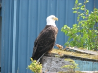
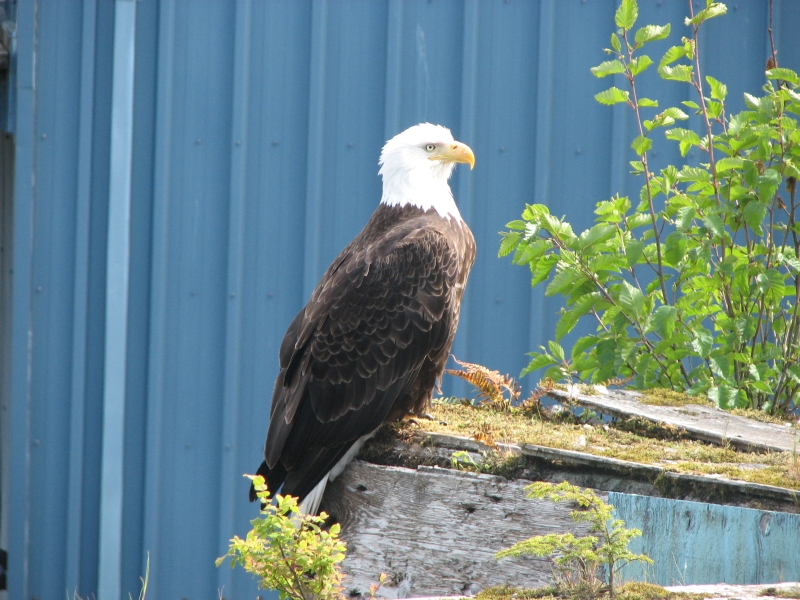
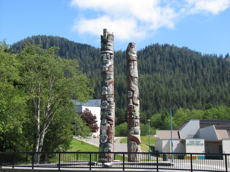
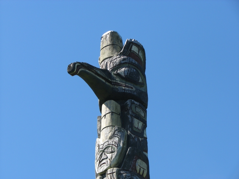
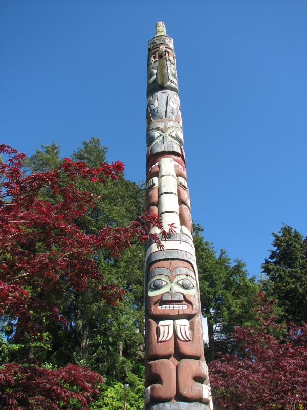
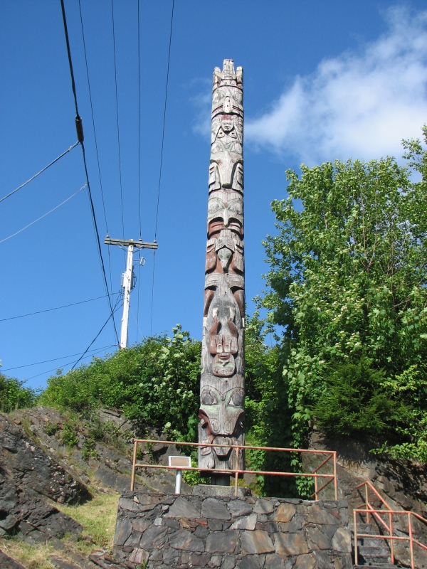
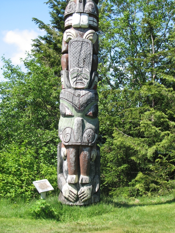
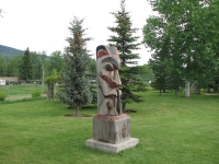
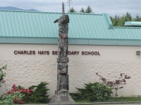
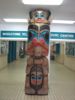
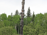
We spent part of the afternoon wandering through town looking for totem poles. There are supposed to be 18 scattered about, reproductions of famous ones. Most have an information sign explaining the origin of the pole, and the story behind it. We found 13 today. We also watched eagles. There are a lot of bald eagles in Prince Rupert. One sat on a wall downtown for hours, while tourists took pictures. Finally we went out to Butze Rapids for a hike through dense rain forest to an overlook of the reversible rapids. There are two in this area. The rain forest is beautiful, with huge cedars and Sitka spruce, lots of ferns and skunk cabbage, with moss covering everything. It was a lovely walk. The views out over the Bay were good. We saw some sort of whale breach three times. No other wildlife though. Its my frustration at the lack of wildlife lately that made me willing to pay for a wildlife cruise. I really want to see some bears!
Wednesday, June 11: Prince Rupert

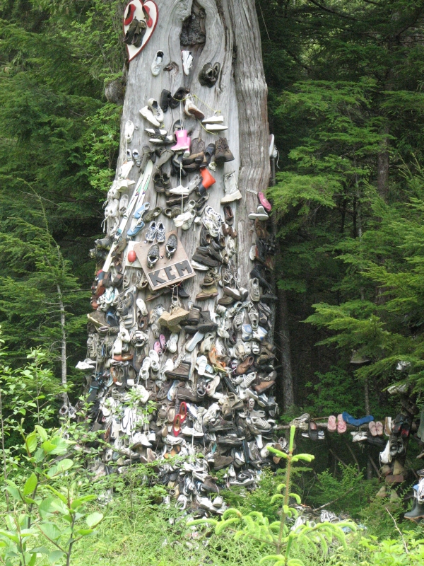
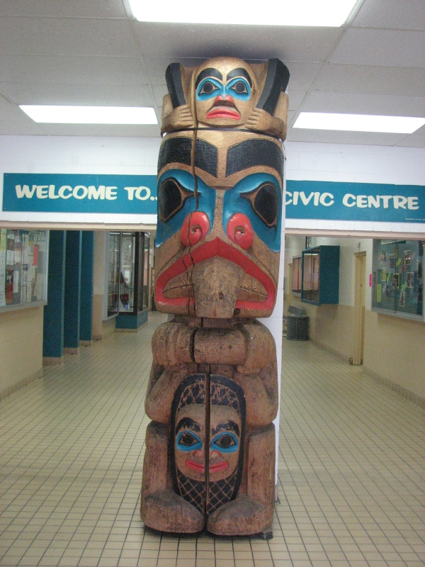
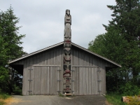
It turned into another beautiful day, after a cool foggy morning. We had breakfast (eggs and sausage) at a Vietnamese restaurant and found a bookstore, but didnt buy anything. We continued to play tourist, visiting the Museum of Northern British Columbia (a good one, though fairly small) and continuing our search for totem poles. We found five more, including the one at Port Edward, one inside the Civic Center, and one at a school that wasnt on the map or in the guide that we picked up at the museum. A woman at the Visitors Center told me about it. We didnt go to the hospital to see the one inside, nor did we find the one at the tire store that doesnt exist any more. (The guidebook was old.) I enjoyed wandering through town and out to Port Edward. We stopped at the Old Shoe Tree (Tree of Lost Soles) and did the very short Oliver Lake Dwarf Forest Trail on the way back. It was barely a trail, old and well used, but not maintained except the boardwalk through the bog. Hardly worth the effort, really, since it was only about 1/3 mile long.

We didnt have anything planned for this afternoon, so I decided to enjoy the sunshine with a long walk through town and out to the campground. There are a couple of long woods walks that I linked with a walk along the harbor. The map I had wasnt entirely accurate, but I managed not to get lost. Prince Rupert isnt a very big town, fortunately. Jims foot was bothering him, so he went back to the campground to read for a while.
It was cruise ship day so town was full of crowds of tourists, quite different from yesterday. We saw groups lined up at the museum, being herded along by their guides, or wandering around town looking for shops or the casino. There were buses headed out to the Cannery at Port Edward and Butze Falls. I was glad not to be part of the tourist horde.

Eagles were everywhere. I saw six circling overhead at one point and four sitting in the same tree somewhere else. The ravens also made their presence known. I heard one making a very odd sound, like a stone plopping in water. I watched it for a while, because I couldnt believe it was the raven making the wierd sound, but it was. Usually they just caw, loudly.
The long days take a bit of getting used to. It didnt get dark until 11:00. Were staying up much later than usual as a result. I feel like I ought to be out and about doing something when its still full daylight at 9:00.
Thursday, June 12: Hyder

It was a very disappointing day. We woke around 5:00 to the sound of rain on the roof. At 7:00 it was still pitter pattering. We went to Tim Hortons for breakfast, then headed to the Visitors Center to wait for our tour. We had been told to be there at 8:45 but got there half an hour early. The building was locked and didnt open until 9:00. We drove off to Safeway to use the bathroom there, then returned to wait in the rain for our tour. A young intern who was supposed to go on the tour let us into the building so we could at least be warm and dry. We waited, but no one else showed up and the tour office remained closed. At 9:30 we gave up. I was mad, so we went over to the Visitors Center to register a complaint. The woman at the counter called Seashore Charters manager, who apologized to Jim and explained that the tour was cancelled because there werent enough people. He claimed he left a message at the campground for us, but he didnt think to leave a message at the Visitors Center office or to tell his intern that the trip was off. I was really unhappy.

One of the main reasons we came to Prince Rupert was that I wanted to get out on the water, either on a tour or the ferry. Our timing was wrong for the ferry to Queen Charlotte and Jim wasnt interested in spending several days on the ferry heading north to Juneau, then turning around and heading back to our truck in Prince Rupert. Taking the truck north on the boat with us is expensive and would mean missing the Cassiar Highway, which is one of the areas I really want to see this year. When we heard about the trip to the bear sanctuary, we both agreed, Yes, this is it. It would combine a trip on the water with wildlife viewing - perfect. Weve seen so little wildlife this year, Ive gotten really frustrated. Only Yellowstone has really satisfied my need to see animals in the wild. This grizzly sanctuary seemed ideal. We cant afford the usual bear viewing tours, (i.e. Brooks Falls), which are fly-ins and very expensive so the boat trip seemed like a good alternative. I was not a happy camper. We probably should have taken the more expensive tour yesterday when it was beautiful and sunny. The manager of Seashore Charters offered us a free trip on another day, but we werent willing to wait around for the weather to improve. Weve seen just about everything this town has to offer except the casino, which really isnt our cup of tea. We would have to spend all day reading in the car, with no guarantee that tomorrows tour will happen, or that therell be room if its a cruise ship day. Evidently the tour operators are not supposed to have non-cruise people on cruise ship tours, they reserve the whole boat. (Though the tour people dont get paid for a full boat if its not full. One of the hazards of doing business with cruise ships.)
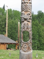

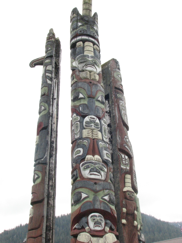
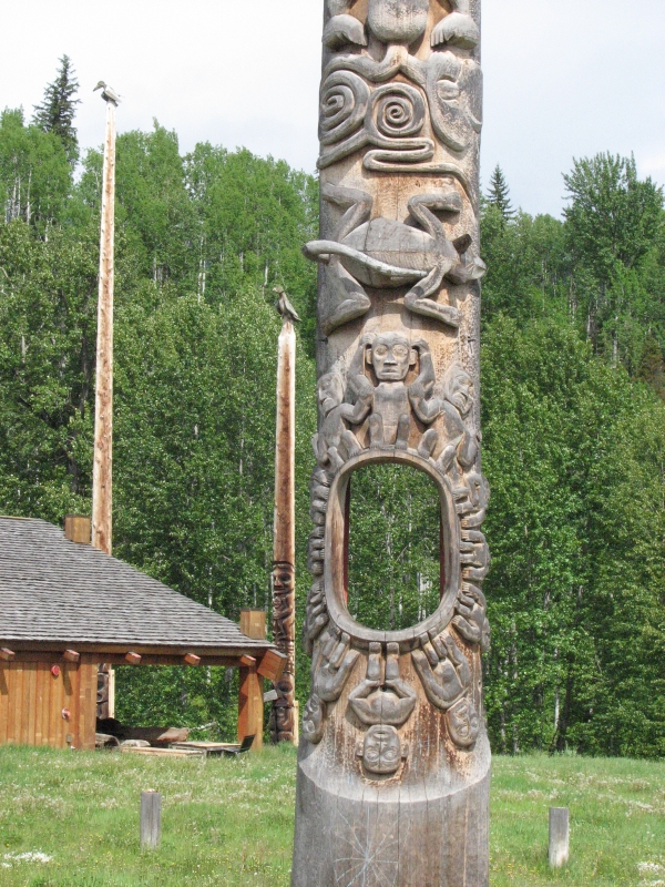
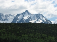
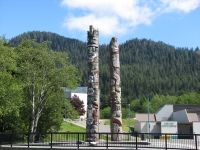
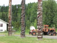
So we got in the truck and headed back east along the Stikeen River. The mountains were covered with clouds. It was still pretty, but hard to photograph. The waterfalls dropping from the snowfields were gorgeous, even shrouded in mist. We ate lunch at the Pizza Hut buffet in Terrace, then continued east to the Cassiar Highway. Two native villages, Kitwanga and Gitanyow, were necessary detours. The first had a dozen or so totem poles, the second two dozen. Some had unique features, like a large hole surrounded by human figures, or arms that reached out, three dimensionally. A local man, passing by, told me the story of one: a woman, kidnapped by the Haida, stole a canoe and cut off the Haida chiefs head and returned to her village. One of the poles has a canoe with three heads: hers, her babys and the chiefs.
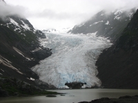
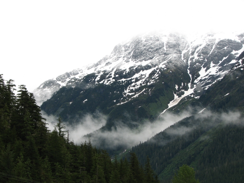
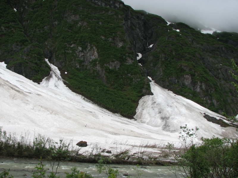
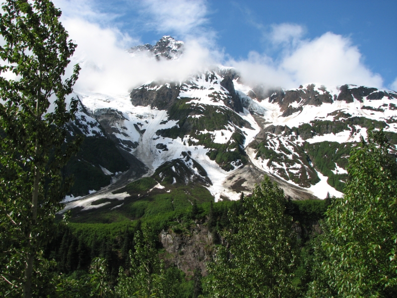
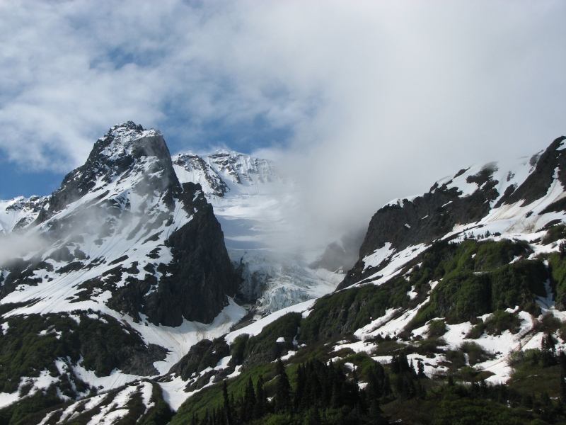
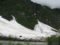
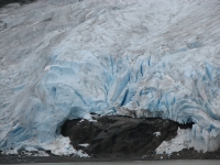
We took the road to Stewart and Hyder and were awed by the beautiful snow-covered ridge to the south, wreathed in clouds. The road follows a very pretty narrow valley out to Stewart. Bear Glacier was gorgeous. It drops to a river right across from the road. You could see the blue of the ice and the crevasses, though the top was buried in cloud. Once again long ribbons of water dropped down the steep sides of the valley. There was snow in deep drifts at road level as well as on the ridges, though our elevation is only about 1000. Typical of our luck, not a bear was to be seen along the road, though the Milepost says frequently, Watch for bears here. We did see another fast fox that crossed the road in front of us.
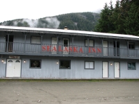

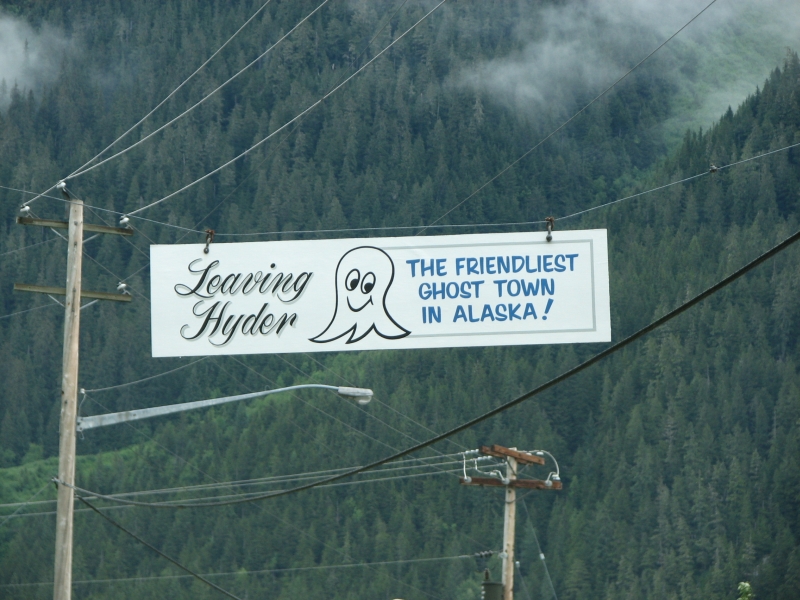
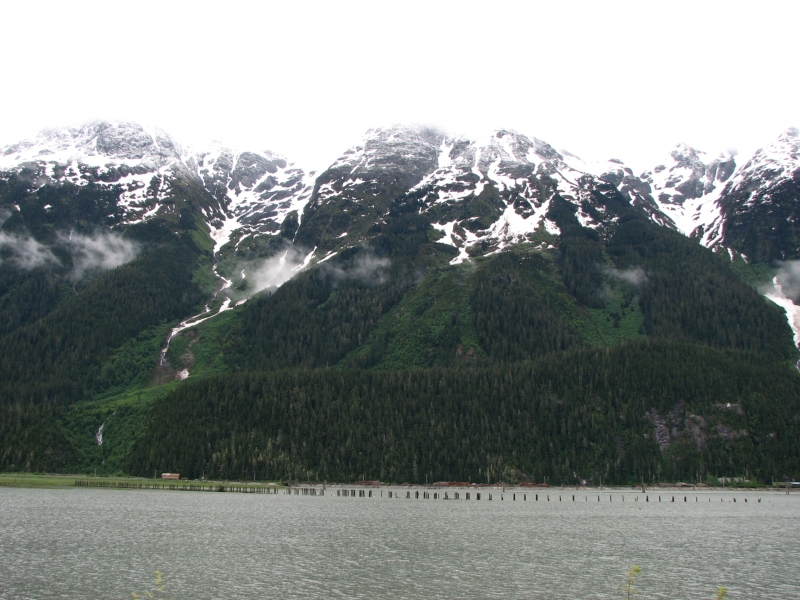
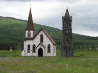
We drove 40 miles out to the town of Stewart, where we had a mediocre dinner, then two miles further to Hyder in Alaska, where we got a motel room at the Sealander Bar. Hyder has a reputation for friendly people (the Friendliest Ghost Town in Alaska according to the sign) but with beer at $6 each, we passed, especially since the bar was really smoky. Stewart was a nice little town of about 600 and is the northernmost ice free port in Canada. They used to ship ore to the coast from there. Hyder is much smaller, with dirt streets and few businesses, but is surrounded by beautiful mountains. Between the two towns is a wide very wet valley. Old pier pilings extend into the marsh. I dont think they ship much any more.
Friday, June 13: Dease River Crossing Campground

We woke to grey skies but no rain. Clouds circled the peaks, which had a dusting of fresh snow. We lay in bed listening to our neighbors, five motorcyclists, discussing their plans. Some were headed north, some south. One complained that he hadnt expected the bone chilling cold. Riding all day in 40 degree rain has got to be miserable.
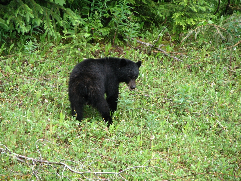
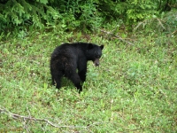
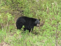
We decided not to continue on the dirt/mud road another 20 miles to Salmon Glacier. It is supposed to be spectacular, but given the clouds and bad road, Jim wasnt enthusiastic. There is a bear viewing area a few miles from town, but the fish dont arrive until mid-July, so the chances of seeing bears there now are slim. We did see a young (two year old?) black bear eating grass beside the highway about 10 miles from town. That was fun. We spotted another black bear about an hour later. That one was a very large (fat), healthy adult. We watched him eat shrubs for a few minutes before he disappeared into the woods.
The drive out on the Stewart Road was as beautiful as the drive in, especially since the sun came out for a few minutes. Even so, the clouds stayed low over the ridges, very scenic, but hard to photograph.
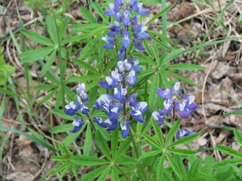
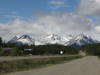
We rejoined the Cassiar Highway, which is as beautiful as its reputation would have it. There are snowy peaks, rocky ridges, densely forested hills, many lakes, rivers and creeks, summer flowers (lots of lupine) and many beautiful views both fore and aft. It is more remote and primitive than the Alcan. Businesses are few and far between, with services 50-80 miles apart. The road is mostly paved, but with gravel stretches and lots of potholes. There was no center line, shoulder or guardrail for many miles. Fortunately, traffic was light. A moose crossed the road in front of us mid-afternoon. It was young and without antlers but had a good beard.
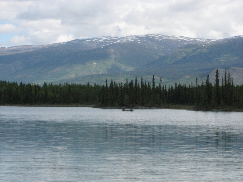
We stopped for the night at a private campground at Dease River Crossing with a nice site overlooking a pretty little lake. It was very peaceful watching the water with the green hills surrounding it. We got a glimpse of a beaver swimming across the lake too far for a picture though. There were only about 10 campsites plus some small cabins with a nice bathhouse. Showers cost $4 each so we didnt bother, especially since we splurged on the motel last night. It rained off and on and the mosquitoes were very active, so we ate dinner in the truck, looking out over the lake.


Saturday, June 14: Dawson Peaks Campground near Teslin
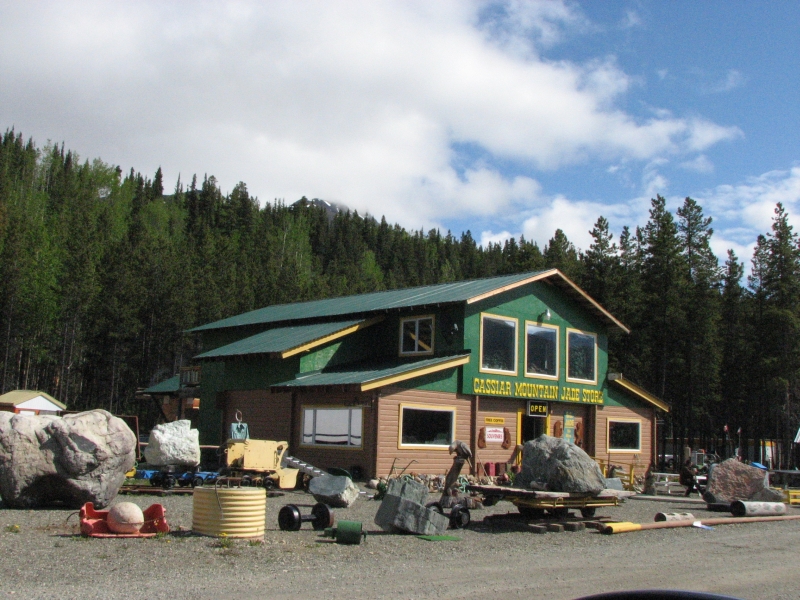
The drive north continued to be beautiful. We stopped at Jade City (population 14) to look at the jade shop there. Evidently 75-90% of the worlds jade comes from British Columbia. The people at the store mine their own jade and sell it raw to overseas carvers who send back the finished product. They showed the whole process: raw stone, rough cut, polished rock, then finished pieces.
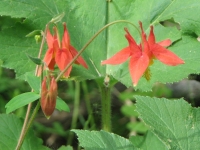
A little farther we stopped for a short hike around beautiful Boya Lake. The water is a beautiful mixture of blue and green. We walked out to a beaver dam and lodge through woods filled with blooming lupine. It felt great to walk again after two days in the car. I keep seeing mountains and ridges Id love to climb, but there are no trails and the base of the ridges is covered with dense young forest. It might be doable, if we could find a place to park the car, but we havent tried. Id love to do a long hike up a mountain, but so far the only hikes weve done have been short flat walks around small lakes. Im hoping for a real hike when we get to Kluane National Park, but there may still be too much snow.
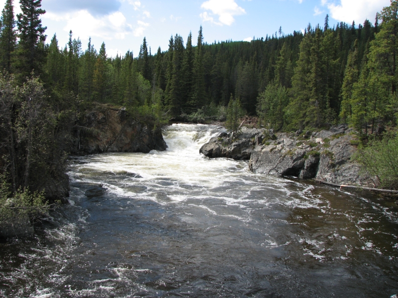
We did another short 2/3 mile walk to Rancheria Falls. It wasnt that impressive, only about 10 feet high, though very powerful. Weve seen so many long unnamed waterfalls that were much more beautiful.
We stopped around 5:00 at a private campground on Teslin Lake. They advertise a good restaurant with award winning rhubarb pie, which sounded interesting. They have a short menu: soup, chili, stew, or todays special in this case, pasta. We enjoyed the chili and bumbleberry pie. The shower was a bit of a disappointment: no pressure and the hot water came and went erratically, so I was either bathed by ice water or a stream of boiling water. The hazards of a propane heater maybe, or perhaps it was just that every time someone flushes a toilet, the shower is affected.
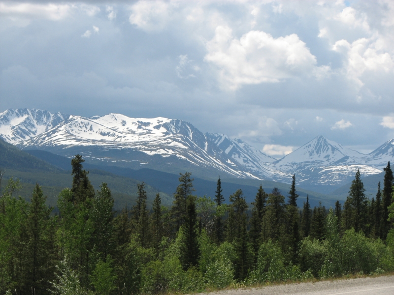
It rained off and on all day but there were also long periods of sunshine. The Cassiar Mountains were beautiful, still streaked with snow. We entered Yukon Territory and joined the Alaska Highway for the first time, after driving 2000 miles in Canada. It was in better shape than the Cassiar, though parts were gravel and dust too. We didnt see any more wildlife. We spoke with people at the campground who saw 12 bears one day and two herds of bison today. Oh well.

The campground is in the trees above the lake, not beside the water like Dease River Crossing, but it is very inexpensive only $12, plus $2 each for the shower. Thats a welcome change. Gas is up to $1.52 a liter over $6/gallon. Were cutting out some of my planned side trips. We just cant afford to explore every highway and byway with gas so dear. Ive become very frustrated at the whole money issue. Everything is expensive: beer at $13/six pack, coke for $2.50 each, a basic breakfast or hamburger for $9.95, a box of Raisin Bran costs $6-8. When you visit the tourist towns, everything interesting costs, a lot. I wanted to visit Pike Island (a rock art site) at Prince Rupert but they wanted $50 each. (And besides, the cruise ship had reserved the whole boat, so they couldnt take us, even if there were empty seats.) The bear trip to Khutzeymateen costs between $140-450, depending on the provider. The train at Skagway costs over $100. The ferry to Juneau another $100. We cant afford to be tourists. We can and do deny ourselves most of the extra excursions, museums, shows, etc. but I feel like were missing an important part of the Alaska experience, especially since Jim cant hike. Were somewhat limited in what we can do. We dont fish. Canoes and kayaks cost money to rent. Shopping has limited appeal, especially with money so tight. (Last time we were here we visited a lot of shops and ended up buying a lot of small presents for the family. Alaska has a lot of unique items. We had a potlatch when we got home, which was a lot of fun. But we were both working then, so money wasnt as much of an issue.) We already read at the campground for several hours a day. That leaves driving. I really enjoy the drives. The country is beautiful and for the most part traffic is light, but I can only sit in a car for so many hours a day. Its a bit frustrating.

Still, I am enjoying our trip, a lot. Despite the frequent rain, weve seen a lot of beautiful country. The scarcity of wildlife has been disappointing yesterdays bears were a real highlight but just looking for wildlife keeps me alert and aware as I search every pond and stream we pass for moose or bears. The water colors are a pleasure, from milky glacier blue to deep emerald and sapphire to dark brown and yellow. I see mountains everywhere Id like to climb. The trees, flowers and waterfalls give me constant pleasure. So I shouldnt complain though sometimes I do.
Home | Links| Trail Journals |
The Thruhiking Papers | Bun-bun
Created: 1 Jan 2009
Revised: 30 Sept 2016Copyright 2009-2017 Spirit Eagle