|
 |
 |
 |
 |
|
|
|
|
|
|
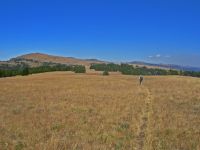
Saturday, August 26 3 miles to Cache Creek
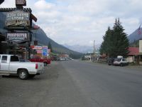
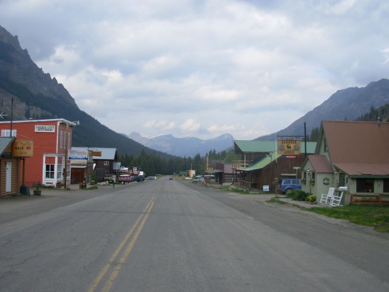
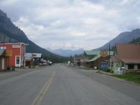
Cooke City is a very small town, with a half-dozen motels, four restaurants, and not much else. There is a small grocery, but this late in the season, there wasnt much choice. Fortunately, we dont need much food right now. Our room was comfortable, but the phone didnt accept our calling card (and the cost to use our credit card was $5/minute, as we discovered too late), TV was limited and it cost $5 to do laundry. Still, we rested, ate a lot, and read. I picked up a book from the Post Office lending library. We got some trail magic from the son-in-law and daughter of the man who drove us to town on Thursday. They're part owners of the Beartooth Café, the best of the restaurants. They treated us to lunch and gave us a ride back to the trail. Nice.
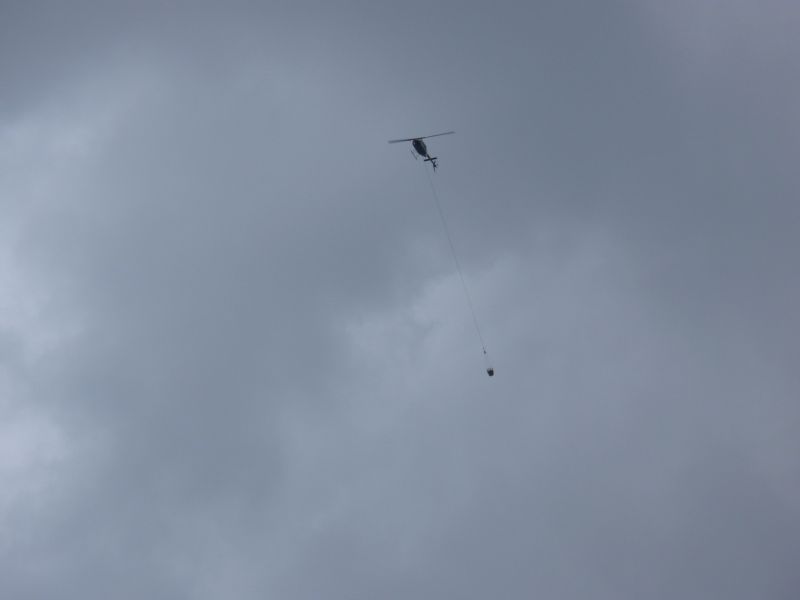
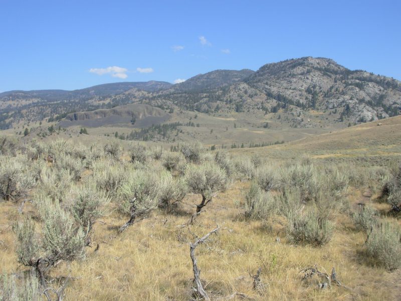
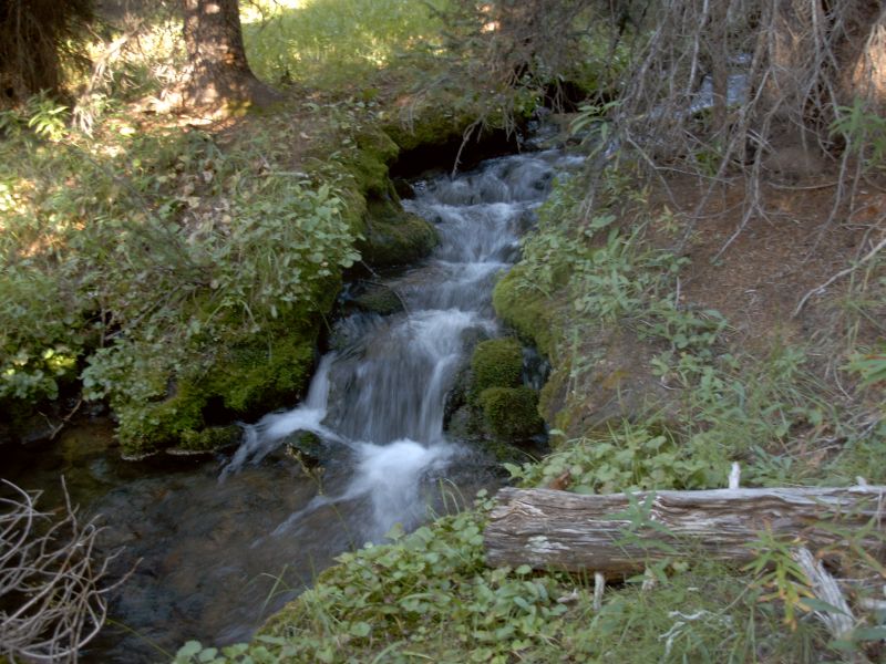
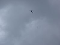
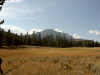
Tomorrow will be a long hard day, 20 miles across Specimen Ridge with a 3000+ climb. Early tomorrow well head for the ridge. It is supposed to have lots of fossils and petrified wood. There is no camping and no water along the way. Since we didnt want to try to hitch from Cooke City to the trail and then hike 20 miles, starting mid-morning, we decided to do a very short day today to set up tomorrows hike. We enjoyed a leisurely morning in town, eating, reading, and eating some more. We began hiking at 1:30, and reached camp at 3:00. We got the campsite closest to the Specimen Ridge Trail, about two miles away, back along the trail we hiked Thursday. It is next to a small creek that smells of sulphur, ¼ mile from the Lamar River. The nearby hills are covered with sage and some pines. Today is gray and cloudy. We had a little rain yesterday, which cleared some of the smoke, but the helicopter is still ferrying loads of water to Calfee Creek. If it rains again, the fire may be put out. It seems to be a fairly large one. There is an even larger fire, the Magpie Fire, elsewhere in the Park. Hence the lone helicopter flying back and forth.
We met a German couple dayhiking and a couple of anglers, but no wildlife. All the bison have cleared off for the moment. The rain cooled things off quite a bit. It feels like autumn. Weve seen a lot of red and yellow in the groundcover and there have been some frosty mornings. This morning I wondered whether we might run into our first snow in the next few days, not just rain. It was cold. It began to rain around 4:00 and continued until 7:30, just in time for me to cook dinner before dark. When we headed for the tent, we spotted a bison 100 yards away. I wondered if it would come into the campsite, but it stayed away.
Jim: This was kind of a "floating" day. We were in no rush to get out of town because we weren't going far - only to Cache Creek to set up tomorrow's hike. If this weren't the Park, we'd go up and camp on Specimen Ridge. But it is the Park so we'll live by their rules.
This was Saturday - the Post Office is closed - and the Postmistress took the package we needed to mail anyway. Another form of Trail Magic.
We figured on hitching out of town, but we went to the Beartooth Cafe for lunch and were talking to the owners and they decided to take us out to the trailhead. They also wouldn't let us pay for lunch. Unexpected generosity = Trail Magic.
At the campsite, the bark was scraped off the trees about 3 or 4 feet off the ground. Couldn't figure it out for a while - thought it might be bad campers or hammock use or .... whatever. Then it dawned on me - it was the buffalo (bison) using the trees as scratching posts.
Sunday, August 27 -- 21 Miles to Tower/Roosevelt

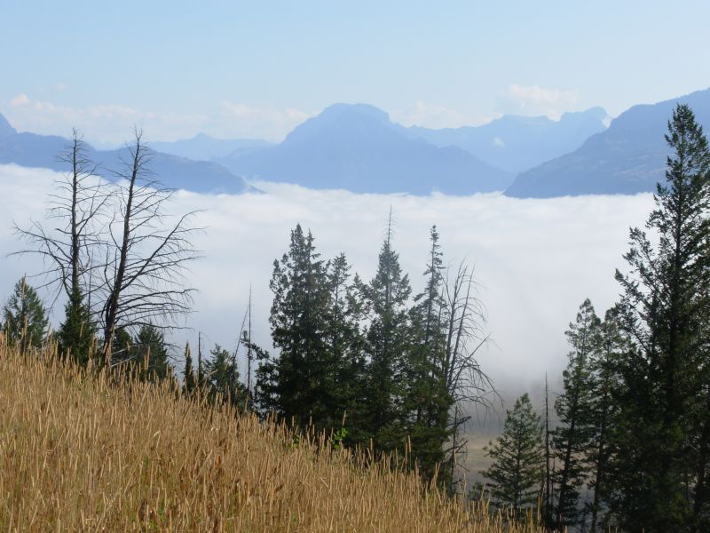
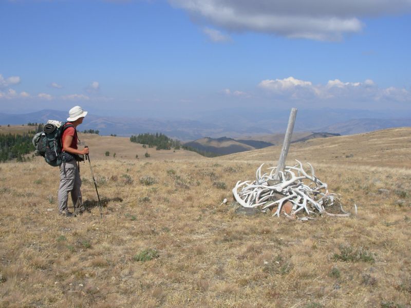
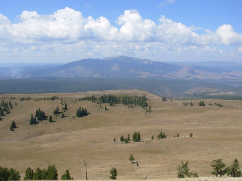
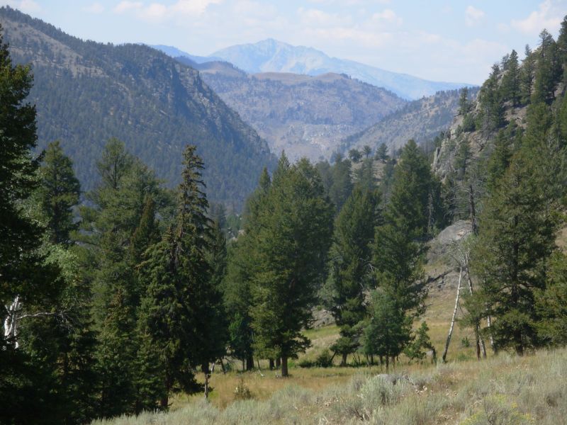
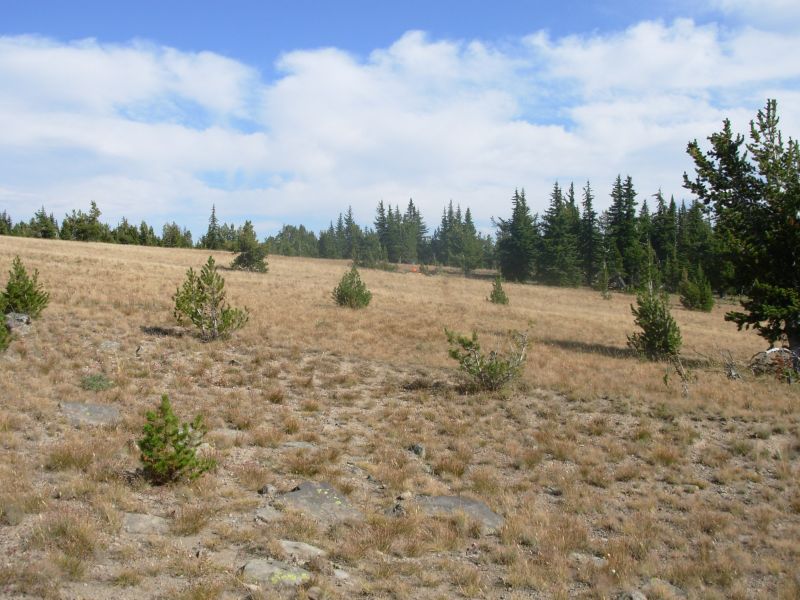
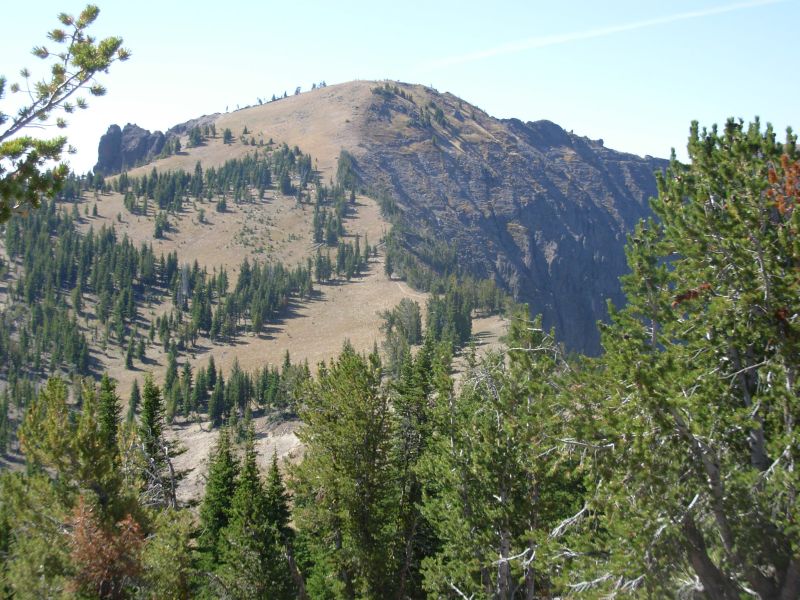
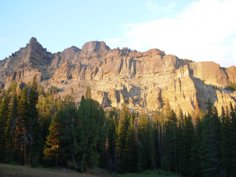
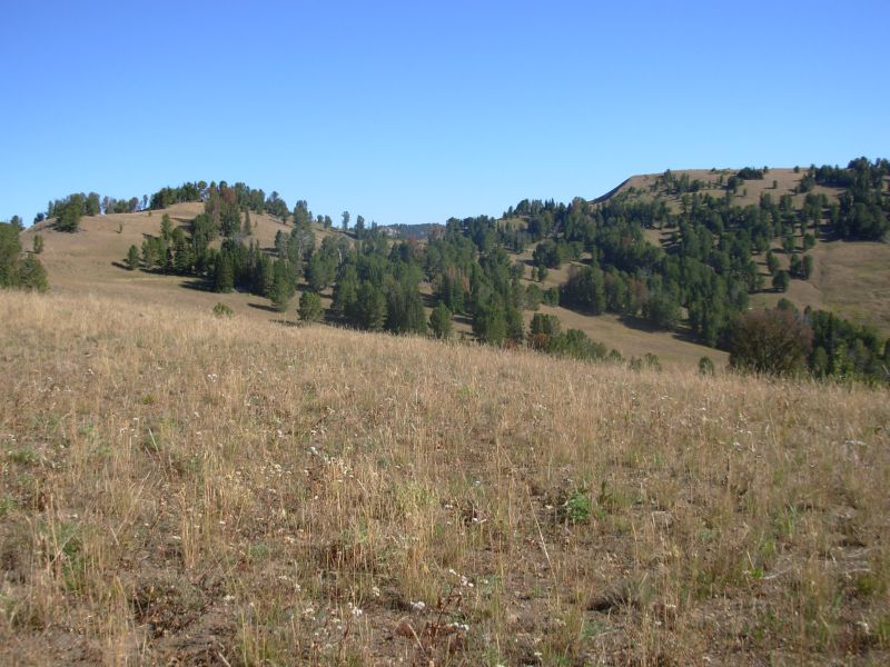
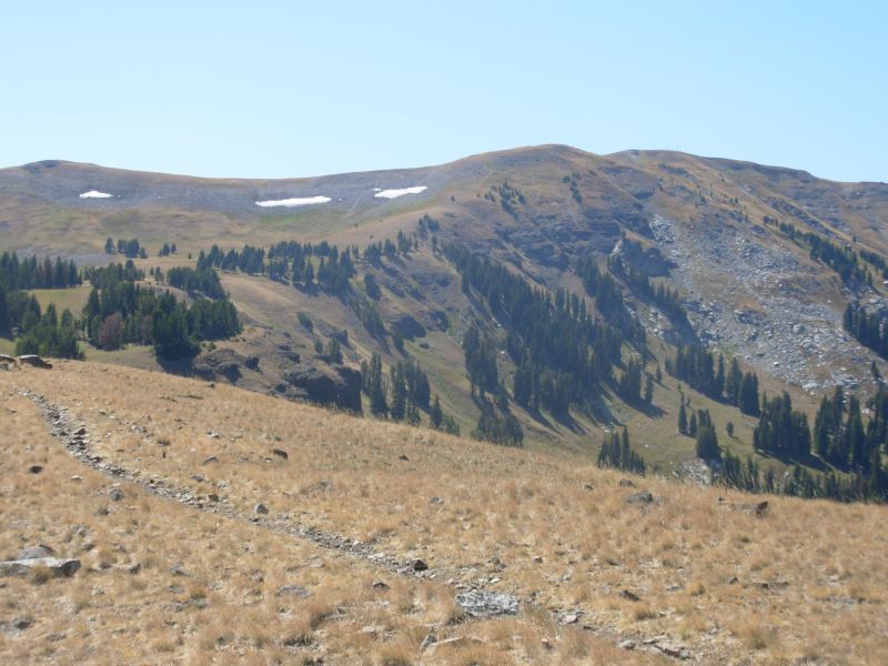
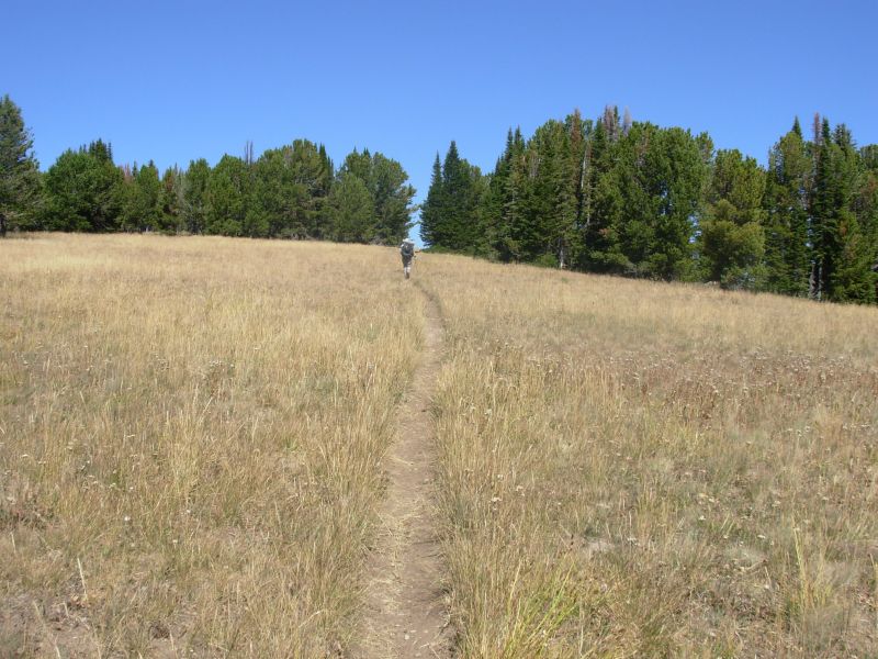
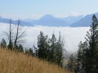
It was very cold when we awoke, so cold that the rope froze to the bear pole and there was a coating of ice on our food bags. We started out wearing jackets and gloves, but the sun soon warmed us up. There was fog in the Lamar Valley, but we soon climbed above it. First we had to ford the knee-deep Lamar River, but since there are thermal areas upstream, the water wasnt that cold. Nor was it fast, just slippery. We spotted one lone bison near the river, then began the long steady climb up to Amethyst Mountain. It wasnt very steep, despite the guidebooks opinion that it was a horrible climb. It was mixed forest and sage/grass meadow, very pretty. The top was typical Rockies alpine meadow, with lots of open grassy knolls. The views were terrific, albeit hazy because of the smoke. Mt Washburn was just to the west. I saw a coyote or wolf running through the grass in one of the meadows; it was too far to gauge size. Two hawks have been following us for miles, shrieking overhead. This is a beautiful hike, well worth the climb.
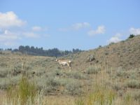
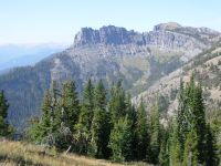
The afternoon hike was mostly in high meadow and sage grasslands. We saw more buffalo and a half dozen antelope. Later we saw two deer standing next to the highway, utterly uncaring that we walked by only ten feet away. Park deer, just like in the Shenandoahs. The last part of the hike was along the rim of the Grand Canyon of the Yellowstone. We couldnt see Tower Falls from our side, but we could look down at the frothing green waters, hoodoos and basalt columns, and a colorful thermal area. It was a really nice hike.
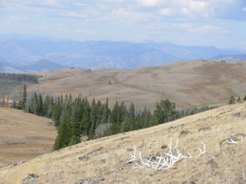
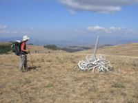
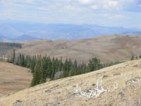
One interesting thing: there were elk antlers everywhere. Ive never seen so many in one place. Trail crews used them to make the cairns more conspicuous and sometimes to mark the trail, but they lay all over the place.
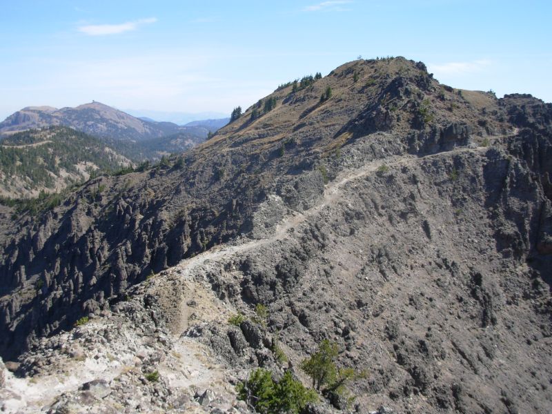
The guidebook warned us that the trail could be obscure. There were a few areas where the tread vanished, but generally the cairns were easy to spot, so we could easily bushwhack from cairn to cairn. The real problem was the multitude of parallel trails. Sometimes the real trail wasnt the most obvious one. We got way off track following such a trail. Fortunately, Jim figured out where the trail should be when ours disappeared. We bushwhacked 1/3 mile and soon picked up the cairns again. Whew! Were both tired and sore, but all in all it wasnt as difficult as I had expected, after reading the guidebook description.

Specimen Ridge was very beautiful, with great views and lots of wildlife. We heard a wolf howl this morning, and the hawks followed us for at least ten miles. That was interesting. One bison bull lay right next to the trail. I moved uphill to avoid him, but he didnt seem to care that we were so close. One ranger was quite surprised we didnt see any bears. She said everyone sees bears on that hike. Oh well.
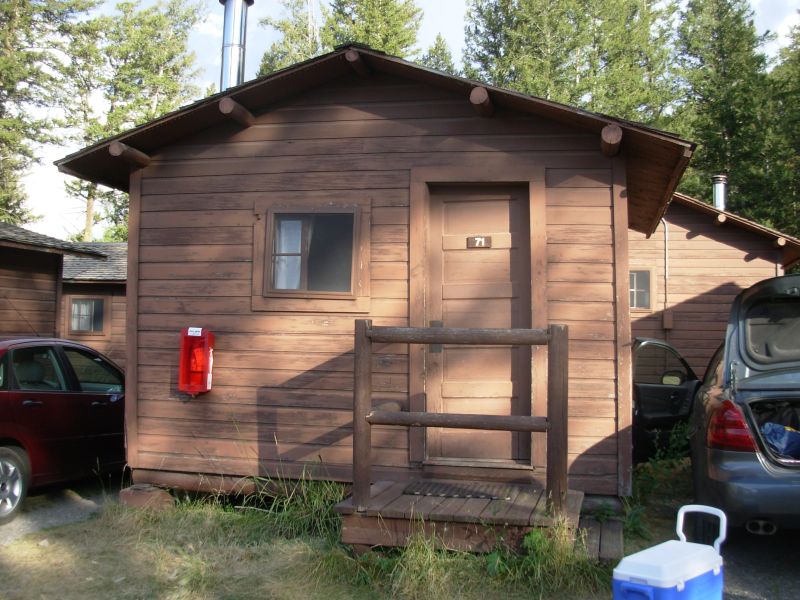
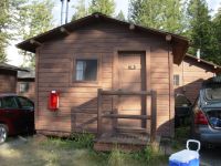
Total mileage is uncertain. The map indicates fewer miles than the ones on the trail signs and those didnt agree. (Two signs put us at 21 miles; one said we hiked 19.) We hiked from 7:30 to 6:00 a good day. We ended our day at Roosevelt Lodge. Any campsites, whether backcountry or developed, would have added a few more miles to an already long day. The lodge has tiny cabins with shared bathhouses. It also has a decent restaurant (good ribs) and a small camp store. We bought lunch for tomorrow, but that was about all. We were told that the store in Mammoth, where we planned a major resupply, doesnt carry many groceries, so we decided to hitch to Gardiner just outside the Park to stock up for the next stretch.

Jim: This was one of those days when almost everything goes right. We were up and on the trail in time to catch some of the wildlife, the one massive climb wasn't nearly as hard as we were told, the views were superb, the trail was easy and we ended the day with a shower, the best ribs I've ever eaten - and ice cream. There was even some water on the west end of the ridge, although we didn't need it. The only nits were the smoke haze and the lack of bears. And those are pretty minor.
Near the parking lot at the west end of the Specimen Ridge, we met several dayhikers. One of them was wearing bear bells AND bear spray. Some people are REALLY paranoid.
Monday, August 28 17 ½ miles to Lava Creek
We slept well in our little cabin, though getting up in the middle of the night to run to the bathhouse was really cold! We ate a good breakfast at the lodge, then went to the ranger station to pick up the paper copy of our backcountry permit. We had made all of our reservations over the phone because there were no permit stations before we reached Tower, but they wanted us to watch the safety video and get a hard copy of our permit at the first possible ranger station. That took a while. We didnt get on the trail until 9:20. I saw a fox and coyote in the first mile. There was probably something dead nearby as there were also a couple of crows perched on a rock at the same place. It looked like a carrion eaters convention. Later we saw a bison and an antelope that posed for us, and a blue heron flew overhead.

The hike north of Roosevelt was pretty, as we went up one canyon and down another in hilly country. We crossed the Yellowstone River on a suspension bridge, but forded Hellroaring Creek. We met some dayhikers there, but mostly had the trail to ourselves. This area is known as the Black Canyon of the Yellowstone because it has so much black volcanic rock. It also has red-winged grasshoppers. The hills are sage and juniper with some conifers dry country. Well be following several different trails today: Yellowstone River Trail, Blacktail Deer Creek Tr., Blacktail Ponds Tr. and Lava Creek. Theres also an option of walking to Gardiner tonight, which would save a hitch tomorrow, but cost us a motel tonight. I doubt well do it.
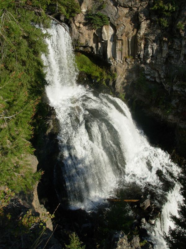
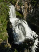
Later: For once we decided to stick with our itinerary. I wanted to see Undine Falls along Lava Creek, which was a spectacular three-tiered waterfall. It was beautiful. We had a good, but long, afternoon hike. It was very hot since we were low in elevation (6500) and in open sage grasslands with no shade for most of the afternoon. Amidst the sage and rabbitbrush were occasional prickly pear cacti. Real desert. We followed the beautiful green Yellowstone River closely for a couple of miles, but mostly we hiked far above the water. We got very dehydrated before we reached Blacktail Deer Creek where we filled up.
The Blacktail Ponds Spur Trail was very obscure. It obviously doesnt get much use. The trail parallels the highway for 2 ½ miles, so we couldnt get lost, but following the tread was sometimes difficult. Sage had grown up in the path so we often had to detour around the bushes. We encountered 14 antelope and one coyote there. The coyote sat on a knob and watched us while we watched it. Jim thought it may have been a wolf, but we couldnt really tell. It was too far off. Aside from a dayhiker, seen far ahead but not met, we had the trail to ourselves.
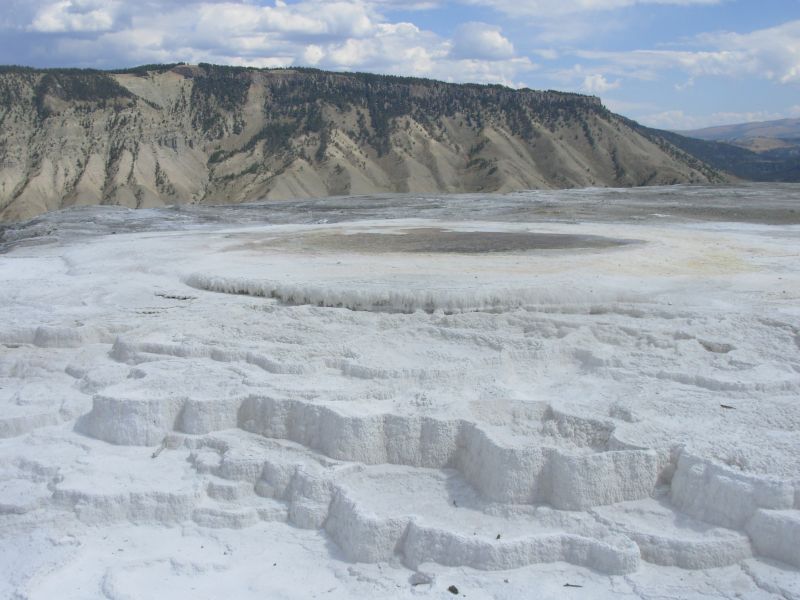
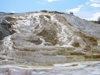
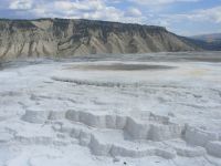
Our campsite was in the pines next to rushing Lava Creek. Although the road is not far away, we cant see or hear it. Above us are rocky cliffs covered with sage and juniper trees. We passed some basalt columns today like those at the Devils Postpile on the John Muir Trail. Descending to our campsite, we could see the white terraces of Mammoth Hot Springs a few miles ahead. I am looking forward to seeing them tomorrow.
Jim: Getting on the trail in the morning took a lot longer than I expected because of the bureaucratic mindset when we picked up the backcountry permit. Tower is NOT a place that deals with a lot of thruhikers so there was a limited understanding of what we were doing. But we managed to not complain too loudly - complaining only increases the footdragging.
I'm pretty sure Ginny's coyote was a wolf - it didn't act like a coyote. On the other hand, this IS a National Park and animals very often don't act like they would in other environments.
Tuesday, August 29 11 miles to Gardner River campsite
We had an easy and quick walk to Mammoth Hot Springs. I was very happy to see the suspension bridge across Lava Creek, since it was a very turbulent river. As we descended, I kept thinking, I hope theres a bridge. It was a typical pedestrian bridge where you cross one at a time and feel the sway. Yesterday we crossed two suspension bridges that were built for pack animals no sway and dirt covered the metal treads. Different.
We spent a confusing half hour wandering past the garbage dump to the campground to the employee housing area, past the school and up to the Visitors Center. Mammoth is almost a real town, not just a tourist area. At the Visitors Center there were dozens of elk resting on the lawns, totally unafraid. Park elk are different. From there, we easily hitched a ride in the back of a pickup the five miles to the town of Gardiner, just outside Yellowstone. We bought five days groceries, something to read, and lunch, then headed back to the Park to play tourist among the hot springs. A Mormon couple who had just spent two years on a mission in India gave us a ride back to Mammoth. You meet some interesting people when you hitchhike.
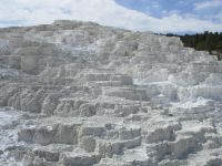
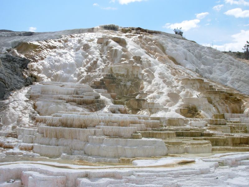
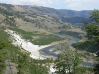
We played tourist, stopping at the Visitors Center, the gift store and the Hot Springs. There are dozens of thermal springs that bubble up from the ground and leave a mineral deposit called travertine. The minerals build up about a foot a year in terraces mostly white but with some orange and yellow. They are quite beautiful. Some were dry but used to bubble up or do so intermittently. The nearby peaks are made of travertine and we walked on it on the trail. The thermal area was very crowded with busloads of mostly Asian tourists. We didnt tour the entire area, that would have taken a couple of hours, but we did wander the lower terraces and part of the upper one on the way to the trail.
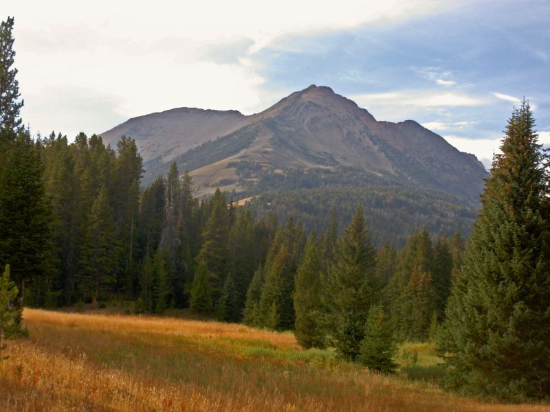
After all the chaos of Mammoth, it was a relief to get back to the quiet of the woods. We only had about eight miles to hike from the Visitors Center to our campsite, which is why we were willing to spend some time there. It was a nice walk. One side of the valley is sage, the other dense conifer forest, in between a stream snakes through lush green grass. We passed between peaks a couple of times. At the end of the day we were rewarded with beautiful views of Electric Peak, which is one that the Yellowstone webcam shows on its website, so I was familiar with it already. Its a beautiful mountain.
Our biggest surprise was reaching our reserved campsite and finding it occupied by a man and his son. We didnt talk to Dad then, he was getting water at the creek, but the son claimed they had a permit with that site on it. I didnt believe him, but there was an empty site 100 yards away that we took, hoping that no one else showed up to claim it. It was fairly late, so we didnt think that would happen. The men were cooking dinner and all their gear was spread out. We decided there was no point in making them move if they accidentally took the wrong site. After dinner they dropped by to visit. They are from Atlanta, but the son had been working in Montana all summer as a river guide. They were nice guys.

Jim: Mammoth, then Gardiner, then Mammoth again - you'd think we were going from town to town. And we are - sorta. But we got our resupply and another "real" meal, used the Post Office, watched the people at the "Mammoth zoo" and played tourist at the hot springs. We also shocked some of the tourists when they asked what we were doing. We told them. They'd never heard of anything like it.
The guys who were in "our" campsite came to visit just before dark. They were VERY interested in the concept and details of thruhiking. The thing with the campsite still doesn't make sense to me but - it's not exactly a big deal.
Wednesday, August 30 18 miles to Crescent Lake

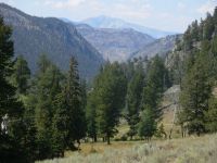
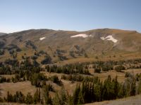
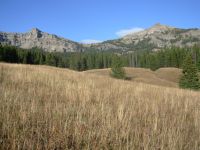
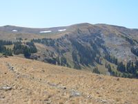
There was a cold wind blowing today. We heard branches and trees falling as we passed through the forest. It doesnt give you a warm fuzzy feeling, wondering whether one of those trees will soon be falling on you. Most of the forest was unburned, except in the valley around Sportsman Lake, but there were still enough dead trees to be disconcerting. We had a 2000 climb and descent this morning. The view from the pass was terrific in both directions. We had been walking up a cirque that reminded me strongly of southern Colorado: rounded hills, golden meadows, a few snow patches. It was beautiful.
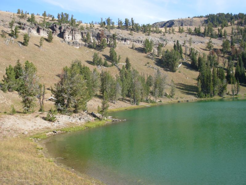
Sportsmans Lake was visible from far above, but not after that. Its in a flat open meadow with a rocky cliff behind. Because so much of the valley is burnt, I wouldnt want to camp there. There was a newish patrol cabin (built post fire), but it was empty. This late in the season, none of the backcountry cabins are likely to be occupied. The climb and descent over the pass were steep and followed by a 500 climb out of the Sportsmans Lake valley. We passed several other lakes this afternoon before ending at the one with our campsite.
We were warned not to drink the water this afternoon because they have treated High Lake and Specimen Creek with chemicals, something to do with fish habitat restoration. We ran into the same thing on Muddy Creek south of Rawlins, though we didnt know about it at the time and we had no desire to drink that water, fortunately. Today we ran into one of the group involved when we passed the lake. We saw a woman with a water bottle in her hand headed toward the lake. We told her, Do you know the lake is poisoned? She replied, Yes, Im one of the people who poisoned it. There were a dozen tents there, so evidently it was a large effort.
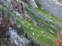
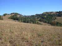
Our afternoon hike was a nice one, meadow to forest to meadow. It reminded me of the meadows near Grand Lake. One hill was a big open bald. We left the Park briefly, then followed the ridge that forms the northern border. At one point we looked down into a valley 300 below with cliffs and a small lake. A dozen antelope were grazing by the lake and ten mountain goats were perched on the cliff. We watched them for a while. I was happy.
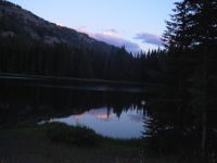
It was a strenuous day: 18 miles and more than 4000 of climbing. The wind was fierce in the open areas. Our campsite by Crescent Lake is windier than I would have expected since it has cliffs on two sides and forest on the other two. Its a small green lake with ducks floating on the water. The cooking area is right next to the lake, the camping up above. It has surprised me how often the official NP campsites have a cooking area within 50 feet of the water. Usually you are supposed to camp 100 or more away to protect the water source. Odd.
We left Wyoming today for the last time. Three states down, one to go the biggest one, of course. Ive really enjoyed Wyoming.
Jim: Somehow the burn zones in and around Yellowstone haven't bothered me like they used to.
Maybe because there's so much evidence of new growth - and maybe an acceptance on my part that it's all part of the cyclical nature of life. That's something I've seen a lot of people pay lip service to, even though by their actions and attitudes it's obvious that they don't really believe it. That's true of a lot of different subjects. Enuff philosophizing....
We're in the northwest corner of Yellowstone. Not a lot of traffic through here - it could just be the time of year, but I don't think so. This is a pretty remote area - and being in the Park, there's no hunting. And it's not easy hiking even though the trails are generally well maintained and marked. Even the rangers who patrol up here do it on horseback rather than on foot.
The campsite tonight is interesting - the trail goes right through it. And then there are multiple trails on the other side, with some confusion as to which trail goes where we want to go because the trails are unmarked. Not the usual Park setup.
Thursday, August 31 16 Miles to Ramshorn Lake
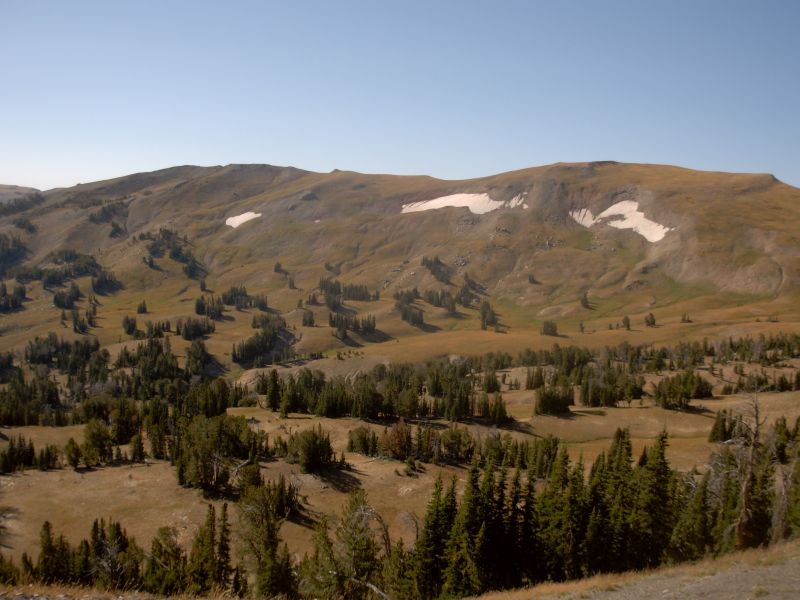
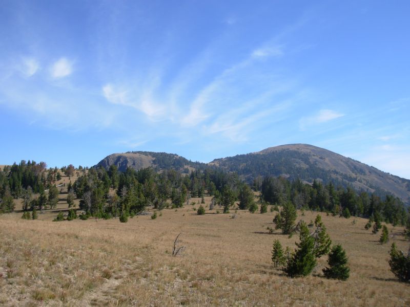
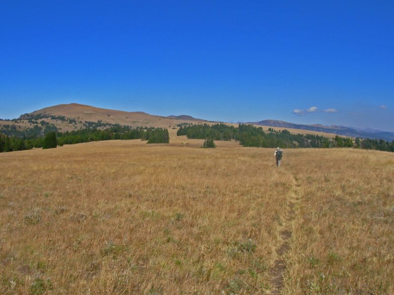
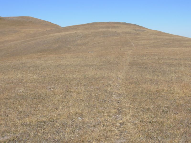
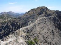
What a beautiful day to hike the Sky Rim Trail! That is a trail that follows the northern border of Yellowstone along ridges above 9000. The views were spectacular: black cliffs, golden hillsides, distant blue ridges . . . even one very green irrigated farm far below the ridges. Up to Bighorn Peak at 9800 the trail was in great shape. There was no trail down the back side, just a 600 drop straight down to a saddle where we picked up pack-trail again. Fortunately, the Park boundary is well marked with red posts, so we couldnt get lost.
Today was clear and cold for August. It was well below freezing last night, since we woke to ice in the water bag. We also woke to the sound of thumps and plops. At first we thought it was our food bags, dropping off the bear pole. Then we realized it came from the other direction. We heard it about a dozen times. Jim figured it was probably a bear rolling over rocks and logs, looking for ants. We didnt hurry to get up, since he wasnt far away. Even so, it was a relief to see our food still hanging high when we did go fix breakfast.
We ran into a lot of people on the trail. We passed one group that looked like a Scout troop late in the morning. Then we met three rangers, hidden atop Bighorn Peak, looking for poachers. Hunting season for bighorn sheep starts tomorrow, so some hunters are out scouting today. They arent allowed to carry weapons into the Park and since the Sky Rim Trail goes right on the edge, they arent allowed on that trail, if they have guns or bows. The cliffs below the edge of the park do have sheep and goats, as we discovered yesterday. The rangers checked our permit carefully and told us which way to go, since there was no sign of trail. Ahead was another group of backpackers and some hunters. We were asked not to tell the hunters we met about the rangers, but they all seemed to know about them anyway.
I was really happy that we were doing this hike today instead of yesterday with all the wind. It is really beautiful. There is smoke to the north (not another fire!) but you can still see quite a distance. We followed the Rim Trail most of the afternoon, then dropped off to the north. Sometimes the trail was good, sometimes very narrow or steep and slippery with loose rock, and sometimes the tread was nonexistent when we crossed meadows. Because of all the steep up and down and treacherous footing, we were slow. Plus we kept meeting people: a bow-hunter on foot, two hunters on horseback, three women on horseback, a couple on horseback, and a hunter on foot with a rifle who greeted Jim with, You look like a guy I met in the Anaconda Pintlers who was hiking the Continental Divide Trail. We talked briefly to all of them, which added up to a lot of time.
Leaving the Park got strange since the maps were wrong, both the Trails Illustrated map and the National Forest map. They both showed Daly Creek Trail coming in after the trail we wanted that headed north out of the Park toward Ramshorn Peak. When we reached the junction for Daly Creek we were puzzled since we hadnt see a trail heading north and the topography was wrong: the ridge heading north was still ahead of us. The trail sign merely said Sky Rim Trail which heads west along the park. We knew there was another trail a mile or two ahead that went northwest, so we decided to keep going, at which point we met the couple on horseback. We asked if they had seen the trail heading north. Sure, its half a mile ahead. Theres a sign at the junction.
Of course, it was really 1½ miles, but sure enough we ended up exactly where we were supposed to be in the first place, at Bighorn Pass, below Ramshorn Peak. It was odd following the trail north, thinking we were on the Sky Rim Trail, but hoping that by going north we would somehow get to the right place. On the CDT you often follow your nose, and usually it works out.
We dropped 1000 from there to an area with lots of green meadows, and then climbed northward on good trail to a lake just below Ramshorn and jagged Fortress Mountain. Ramshorn is a beautiful lake. There are a couple of hunters camped nearby, looking for sheep. This area is open to motorbikes and we met one near the lake. It feels like wilderness, but isnt really.
Jim: A LOT of up and down today - I won't even estimate how much. And a LOT of it was VERY steep. The day started with a 2000 ft climb and then it was up 300', down 400', up 500', down 300', over Bighorn Peak and a dozen other knobs. A lot like the AT, but bigger and meaner with a climb and descent every 3/4 mile or so. I also think the 16 miles is an underestimate, but I don't care enough to recalculate it.
When we stopped for lunch in a saddle on the ridge just north of Bighorn, I saw something glittering in the grass. It was a Buck knife that someone (probably a hunter) had apparently dropped. It was a design I hadn't seen before - and heavy enough that I normally wouldn't carry it on the trail, but I couldn't just leave it there. So here I am, carrying more knife than I've any had use for in a lot of years. I think it'll go home from Ennis.
Friday, September 1 17 miles

Today was another beautiful day of ridgwalking, following the Devils Backbone/Gallatin Crest Trail. We said goodbye to our neighbors this morning, then climbed past the well-named Fortress Mountain. (It had flying buttresses and towers.) The trail was mostly easy to follow as it followed ridges northward, but it was very steep in places. There were no switchbacks and little contouring, we just followed the ridge. The views were spectacular, especially east and west toward Big Sky and the Spanish Peaks. The trail gets little use; all the tracks were wildlife: bears, deer, elk and coyotesno horses or people. With the holiday weekend coming, that may change. Evidently motorcycles use the trail occasionally, but not recently. We spotted one deer in a meadow. It was all very beautiful.
We were planning to follow the trail almost to Hyalite Peak, then head west to the highway and a resupply stop in Big Sky, but water is non-existent up here and we werent moving fast enough to go the 22 or more miles to Crater Lake today. Jim suggested we bail early. There is a trail that will take us down to the highway from Windy Pass. It ends up in the same place as the trail I intended to take, but with 14 or so fewer miles on the ridge. I am very disappointed since I was really looking forward to hiking all of the Gallatin Crest, but I understand the reasoning for cutting this short. The very steep ups and downs are hard on knees and feet, and weve both fallen today descending loose rock. Jim cut his hand again quite badly.
We climbed 9900 Eagles Head Peak this morning and are due for another big climb this afternoon. The climbs arent the problem, the descents are. Thats where the knees scream and we slip and slide on the scree. Descending Eagles Head we bushwhacked carefully around a snow bank through an area that was covered with large chunks of petrified wood. Some were 1-2 feet long. That was fun. We saw a little petrified wood on the Specimen Ridge Trail, but nothing like todays pieces. Those had been picked over and only tiny chunks remained.
When we looked for the trail at Windy Pass, we found a sign, but no actual treadway. We asked some people who were staying at the cabin there, a father and son, about the trail. They had hiked up a different trail with small pack donkeys. I've never seen pack donkeys on the trail. The father said that on a previous trip he followed the trail we wanted for a short way. He said it was faint (an understatement) at the start, but once in the trees, it was easy to follow. So we headed across the meadow below the cabin and found a few cairns. At the ridge, they vanished, but we figured that the logical place for a trail was to the left, in a gap, and sure enough, we found another cairn. The sign at the cabin said it was seven miles on the pack trail to a jeep road, and the map seemed to indicate another three or so to the highway.
We had visited with the two at the cabin for about an hour, so we knew we werent going to the highway tonight, especially after spending half an hour circling the meadows just looking for trail. No matter. The trail was actually quite decent, once we reached the trees. Most of the descent was in forest with an occasional small meadow. There was a lot of up and down over side ridges and around talus. We saw a buck and a coyote along the way.
The trail seemed to end at a jeep road but there was a logging road across the way that might have been a continuation of the trail. We werent sure, so we turned on the jeep road and followed it down the mountain. It is steep country, logged 25 years or so ago, so campsites were in short supply. We ended up on an old logging road, not in use we hope, and hopefully not a major game path. We blocked one end, in case a motorcycle or ATV decides to explore early in the morning. The trees are too young to be any good for hanging food no long branches. We arent entirely sure where we are since the map shows the road heading north and we went west for a mile or so, but well worry about it in the morning. Right now, we're right where we need to be.
Jim: The Sky Rim/Gallatin Crest route has turned out to be really good - and really tough. There's a lot of typical rolling hills, but there's also a lot of steep, rocky climbing. And ALL the maps lie - but that's something we expect.
When we were on the ridge south of Windy Pass, there was a plume of smoke to the north - gotta wonder. The trail we took from Windy Pass was supposed to drop us about 4,000 feet (in 7 miles?), but it wasn't nearly steep enough to do that. So it was no real surprise that the trail dumped us out on a graded roadwalk. The maps lied again.
Saturday, September 2 11 miles to Big Sky
Our three miles of jeep road turned out to be seven, according to the mileage markers. Then we followed the highway for 4 ½ miles. That was a scary walk as it was a very busy road with little or no shoulder.
We could have walked all the way to Big Sky, where there are other trails, but I really didnt want to hike four more miles on the highway, plus two to town. Instead, once we reached the trailhead, we put out our thumbs. It took a while, because there wasnt a good wide spot to pull off there, but eventually a British couple in a Lincoln picked us up and took us to the junction to Big Sky. Some local kids drove us to the grocery store, two miles up the side road. We had a good lunch at a Mexican restaurant, bought four days food, then hitched back to the highway to a motel. Well have to walk the half mile or so to dinner.
Big Sky was unexpected. It is a very wealthy resort town, with lots of golf courses and condos, but not much of a real downtown, at least, not in the Meadows area. Its divided into the upper ski area and the lower meadow area to cater to both the winter and summer tourists. The motels are out by the highway. It isnt particularly hiker friendly as its so spread out. We were lucky to get a motel room, given that its a holiday weekend. The British couple said most of the motels in West Yellowstone were full. This one was expensive, but has a laundry, which we desperately needed. It has been eight days since Cooke City; our clothes reeked. We werent much better, thought it has only been five days since our last shower. It has been too cold to wash up much at night. Ive washed off the dust a couple of times mid-afternoon while the sun was still shining, but a real bath just doesnt appeal when its cold in the evening. It has been below freezing every night, though temperatures have been in the high 60s every afternoon. Great hiking weather, but chilly camping.
Dinner was at a rather upscale restaurant, but since it was the only place within walking distance (1/2 mile or so) we had little choice. Once again we enjoyed a really good bison/elk/pork meatloaf. The lady at the next table asked if it was lo-cal. I laughed, since it was wrapped in bacon. The waiter told her no.
Jim: The roadwalk this morning was a lot longer than we expected, but at least it got us where we wanted to go - the highway. But then we walked the highway to Deer Creek Trailhead (yeah - we're still "connecting the steps") - and that wasn't a lot of fun. Too busy, too noisy, too ...
I got a kick out of the looks we got from a couple of the customers at the Mexican restaurant - like the homeless shelter had moved to Big Sky. But then, I'm perverse that way. And we (or at least "I") really did smell bad. Showers and laundry were a really good idea.
We passed through Big Sky several years ago when we were hiking the Absaroka-Beartooths. But the memories of that passage are a big blank spot except for wondering where in the area Walkin' Jim lived.
Home | Links| Trail Journals |
The Thruhiking Papers | Bun-bun
Created: Dec 2006
Revised: 30 Sept 2016Copyright © 2006-2017 Spirit Eagle