|
|
|
 |
 |
 |
|
|
|
|
|
|
|
Absaroka-Beartooths - 2002
Slough Creek
Tuesday, September 3 – Boulder River –
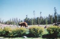
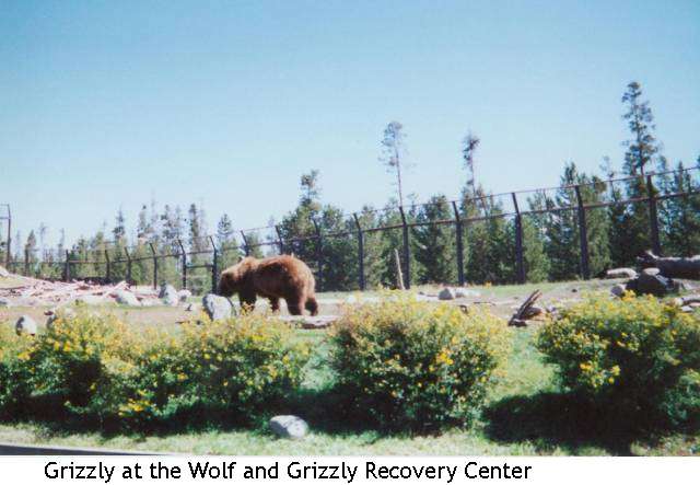
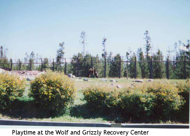
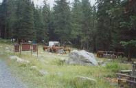
We had a hectic day, just trying to get from West Yellowstone to the trail. We slept very little again, for no reason, just town insomnia. We had a good big breakfast, did laundry, bought groceries, visited a couple of other shops and spent too much money. Our camera broke the other day, so we replaced that at one of the tourist shops. We visited the Grizzly and Wolf Recovery Center. It has a couple of wolf families and several ‘rescued’ grizzlies and aims at educating people about them. I enjoyed watching the bears wrestle (the wolves just slept in the shade), but didn’t feel the place was really worth the price. $8.50 is a lot of money for what is essentially a very small zoo.
We planned to drive through Northern Yellowstone to Mammoth Hot Springs but discovered, 14 miles too late, that the road was closed for construction during the day. Last night it was open because we were there after 5:00. Oh well. So we turned around and drove back to West Yellowstone for lunch. We did spot a large herd of elk by the river, again, probably one of yesterday’s clans. We then drove up the west side of the park through Big Sky to Bozeman to Livingston to the trailhead we wanted on the northern side of the Wilderness. It was a pretty drive, with lots of sage and meadow and mountain. The mountains on this side are steep but covered with trees. Mark said it reminded him of the Adirondacks.
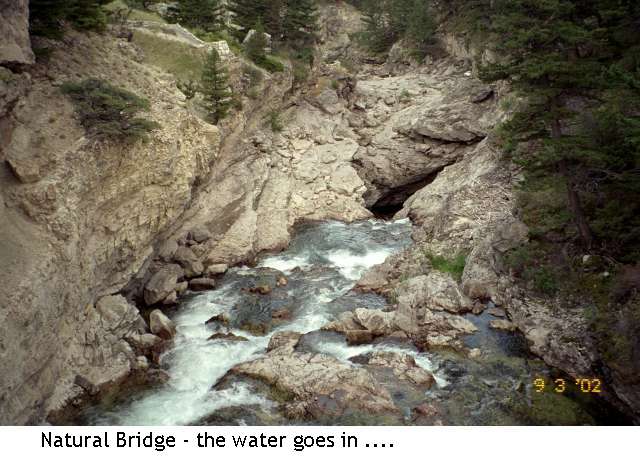
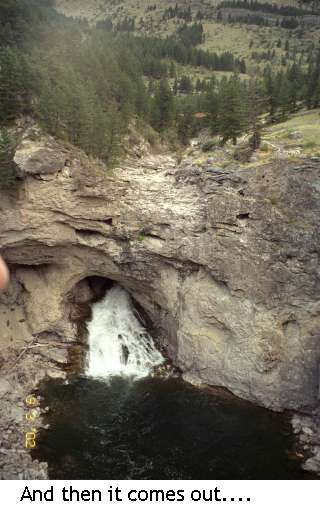
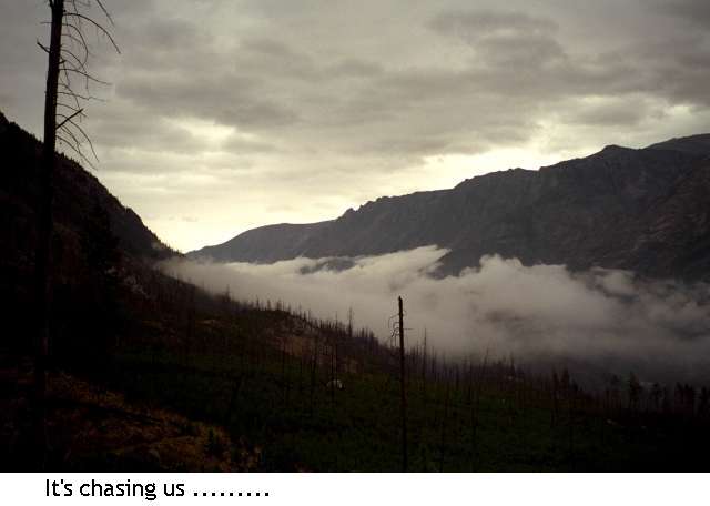
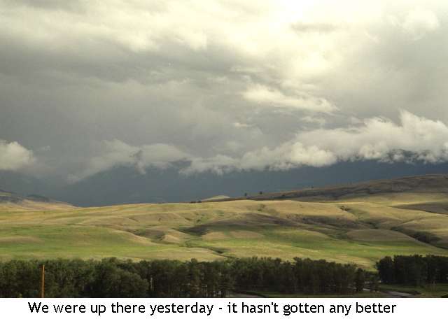
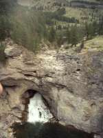
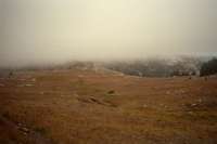
We had a very long drive on dirt roads to get to our little campground near the trailhead. The road got rougher and rougher the farther we went. The clouds were very dramatic, but we only had a few minutes of rain today. It was a pretty drive, but long. We arrived at 7:00 – tired and thirsty but not all that hungry after all the town food. Amazing how exhausting it is to just sit all day. There were a couple of highlights on the drive to the campground: Natural Bridge and Falls is a place where the river dug a hole through the limestone riverbed, vanished into the hole, and comes out downstream as a large waterfall. We hiked around it and were quite impressed. Less impressive was the herd of sheep on the forest road. The shepherd was nearby, and his distinctive round-topped trailer. A big white guard dog chased our car, trying to defend his flock from the big green monster that was our van.
Jim: We left West Yellowstone late today and drove to the Box Canyon trailhead where we camped for the night. The Box Canyon Trailhead is on the northwest side of the Wilderness and is accessed at the end of a 48 mile dirt road. Seems a lot of people don’t mind driving that far – it wasn’t exactly deserted.
Wednesday, September 4 – 16 miles to Slough Creek
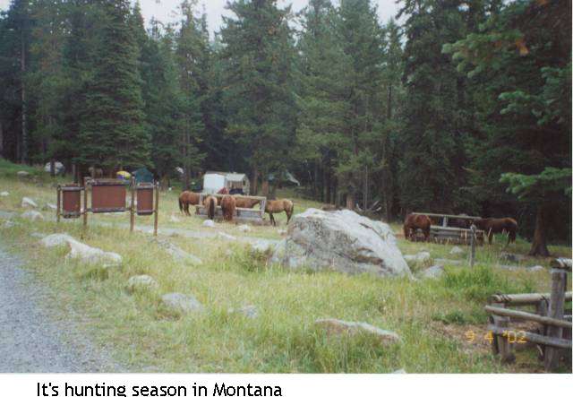
Starting a new adventure is always fun. We slept very well in our quiet campsite. There were only three groups in the 10 or 12 unit area. One was a group of kids with a bus with Florida plates. They must have a story. Driving that bus down the dirt road must have been an adventure in itself. At the trailhead two miles up the road there was another large group – horsemen this time. They were camped there, and sitting around a huge fire when we passed them. The horses were hobbled or tied nearby, and the group looked like it had been there a while.
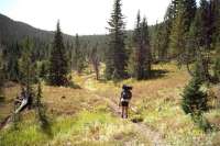
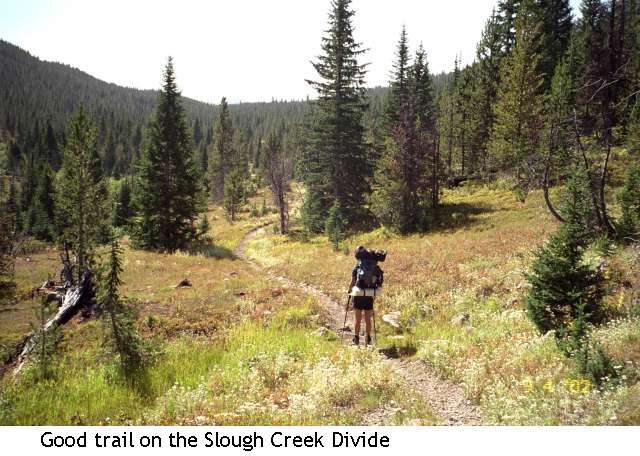
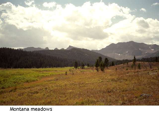
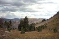
The trail was easy, climbing gently through hemlock forest. We climbed for about ten miles but only gained 2000’. The upper area below Slough Creek Divide was open meadow and quite beautiful with the autumn yellow willow bushes. There are still quite a lot of flowers, despite the red and yellow leaves we’re seeing everywhere. Lots of blue bellflowers, purple asters, blue lupine and orange paintbrush, plus yellow sunflower type flowers and white daisies. Up here we’ve seen several blue gentians. Only one columbine though, and that was a few days ago.
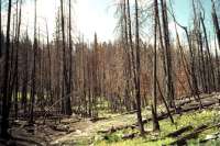
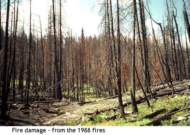
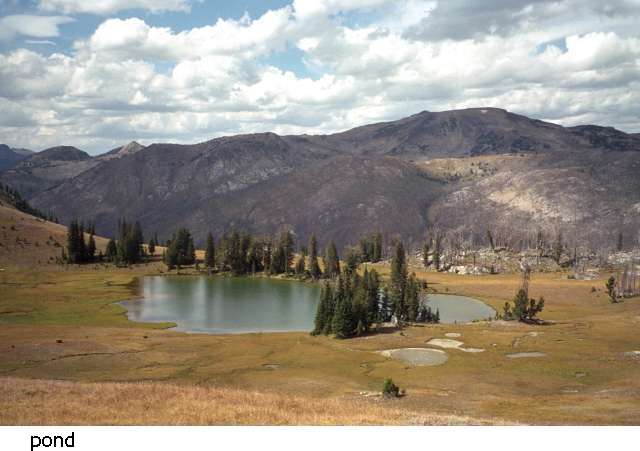
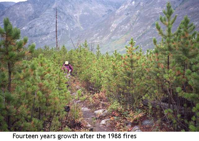
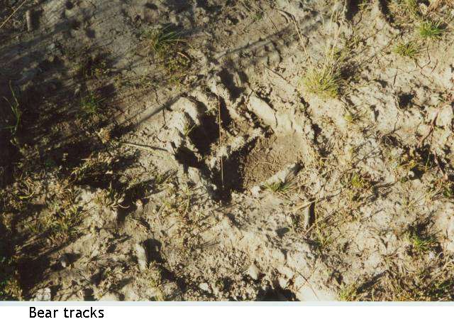
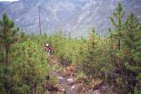
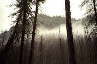
This area is mostly below treeline, lower than the area we hiked in last week. The top of the divide was burned about a year ago. Amid the blackened hulks, daisies thrived. That burn area didn’t last long, and we made very good time gently descending Slough Creek. Our trail was mostly in forest, with several grassy meadows. The big entertainment is checking wet spots for tracks. We saw the tracks of a mama and baby bear, a large cat, a fox, and lots of deer, elk and moose. We saw no other hikers all day. About 3:00 we reached an area that was burned in the 1988 fires. The new saplings are about waist high, but the old dead trees still loom, waiting to fall. We decided to stop for the day and look for an area to camp in that wasn’t burned. We don’t know how far the burn zone extends, and don’t want to camp in the middle of the dead trees. Besides being aesthetically unappealing, it can be dangerous if the wind drops a tree over our tent, plus it is hard to hang food from the bears from burned trees. The branches break too easily.
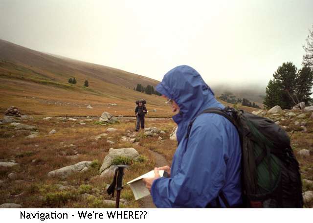
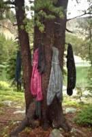
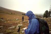
The map shows a side trail here that we couldn’t find in all the deadfall, though we went back and forth several times. It isn’t ‘official’ trail, so they may not maintain it any more. With so many downed trees, maintenance would be a problem. Or they may have just moved the trail. In any case, this stretch may end up being longer than planned as a result. There is another ‘unofficial’ trial we can take tomorrow, but if it is also buried in debris, we will have a long loop around the area. I had wanted to do this area because the guidebook talks about the remoteness and abundant wildlife. “If you like bears . . . ” Being in grizzly country is interesting. We are very aware of noises and look carefully around every corner. Mark doesn’t hike ahead of us any more. We got lucky in our campsite as it has been used before and has a bear pole nearby. When I washed up in the creek, I was a little spooked, being alone there. I was quite happy when Jim came to join me.
Jim: This morning we started up the East Fork of the Boulder River, crossed the Slough Creek Divide and camped on Slough Creek at the edge of one of the 1988 burn areas. This area is reported to abound in wildlife – and I believe it. In one quarter-mile section we saw fox, coyote, elk, moose, cougar and grizzly tracks and/or scat – but no teeth or fur.
Thursday, September 5 – 16 miles to Stillwater River
Last night I got a bit paranoid. Something big visited our campsite after we were in bed. I was quite worried until it wandered away. The ground showed no fresh tracks, and the guys slept through it. Jim said he woke up, but then went back to sleep. We did see a fairly fresh pile of bear scat about a mile away. We’ve seen no wildlife except a hawk, but it is hard to watch both our feet and far away meadows. We’ve had several slips lately. Jim’s knee is very painful, (he twisted it a few days ago) which is depressing him. I offered to turn back, before it gets too late, but he opted to go forward anyway. I know him, he has no reverse gear. If we had been able to find our trail yesterday it would have made this section several miles shorter with at least 1000’ less climbing. But this way we get to see more country, even if it is burned. It was a somewhat slow morning, walking entirely through burned forest. The new growth is abundant – saplings three to ten feet high – but it is still burned – lots of black trunks. It is very hot walking with no shade and there are a lot of blowdowns. After being unable to find our trail last night, it was a relief to find the next two trails exactly where they were supposed to be. The first, the Lake Abundance Trail, was well traveled, with fresh horse tracks, but the second is another unofficial trail up to Wounded Man Creek and seems to get little use. We see fresh elk tracks, but no signs of recent passage by hikers.
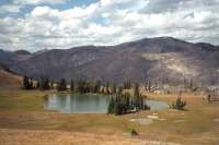
The day turned into a death march. The trail was good for a while, but turned into a goat track –- nice views but narrow trail with loose footing – then became a bushwhack up a meadow in a glacial cirque and steeply up then straight down the other side of a ridge through a lot of blowdowns, then steeply up another wall and down the other side to Lake of the Woods. It was really rough going. We had planned to camp at Lake of the Woods but a storm was approaching and the lake area was all burned out. That meant no protection from the storm, plus the risk of trees falling if the winds got high. We decided to descend Wounded Man Creek until we reached live trees. It was, of course, burned most of the way, and the few stands of trees were along watercourses that were steep and rocky, so we kept going all the way down to the Stillwater River. The area was still burned (the guidebook lied) but we found a few trees in the middle of a wet meadow – made wetter by the rain that fell all afternoon. It stopped just before we arrived, but the grass was knee high and soaked. We managed to find a small area under the trees to set up and eat dinner just before darkness fell. We were all tired and grumpy and Jim decided, “Lets do the shortest way back.” We’ll still have two more days of hiking, but there is a direct way and a roundabout way back – we’ll take the most direct way out of the Lake Plateau. I’m disappointed, as I’d hoped to wander a bit, but Jim’s sore knee is really bothering him, so I can’t ask for more miles.
Jim: This morning dawned fair and hot – appropriate since we were walking through burned out lodgepole forest. After missing the Wounded Man Creek Trail junction (it was buried under blowdowns and not usable – or even visible) we walked the additional 6 or 7 miles to the Lake Abundance cutoff and then “unofficial” trail north to Wounded Man Creek (again) with the last mile or so being a bushwhack because the trail died on top of the ridge and we had to find our way down to the creek 900’ below. Then, of course, we had to climb back over the divide to Lake of the Woods where (surprise) the thunderstorm decided to dump on us. This, again, was in the middle of a burn area with no suitable place to camp, so in the rain we pressed on the additional 4 miles to the Stillwater. We finally found a reasonable campsite by bushwhacking toward the river through the swamp. “Reasonable” is a euphemism – there were two spots barely big enough to put the tents down and another 8’ diameter spot that was dry enough to cook on. But we slept well after a tough 16 mile day.
Friday, September 6 – 11 miles – Jordan Lake
Today was a short day, but worse than yesterday in some ways. It rained all day, from shortly after we got back on the trail until after we stopped. The trail itself was nice, four or five miles gently descending above the Stillwater River, then climbing, first gently, and then steeply, up another Wounded Man Creek to Lake Jordan. Lunch was a handful of gorp huddled under a tree. We finally broke out of the fire zone, but because of the clouds and rain we couldn’t see much. There were occasional meadows, small cascades in the creek, ripe raspberries, blueberries and thimbleberries, but we weren’t enjoying it at all. No grumbling, we know better, but we do much better in the sunshine.
We didn’t get seriously cold until we stopped for the day, but even our short breaks were enough to get us chilled. We arrived at the lake where we planned to spend the night at about 3:00 and found that all the campsites were giant puddles. It shouldn’t have been a surprise as the trail was a running stream all afternoon. We watched a big white cloud come down the river, then follow us up the creek. It was pretty, but a sign of hours of rain to come. We jumped into our sleeping bags as soon as we could, but it took a really long time to warm up. I hurt more than the 11 or so miles should warrant, but too few and too short breaks, plus the tension of hiking blind (my glasses fogged so badly I took them off), plus the cold and the long climb – I ache all over. Dinner will be a cheese sandwich, as it’s too wet to cook. In grizzly country, cooking from your tent is a definite no, no.
Jim: We barely got out of camp before the deluge started and continued all day. After finding the trail junction we started climbing back toward the divide along Wounded Man Creek (another one – there are two of them) in cold heavy rain – again through burned out lodgepole forest. By the time we got to Jordan Lake (about 11 miles) we were all soaked to the skin and nearing hypothermia so it was time to put the tents down, eat and recover. It was also obvious that part of the trip was going to be aborted.
Saturday, September 7 – 15 miles Big Timber
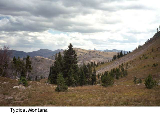
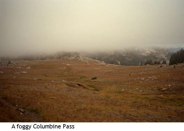
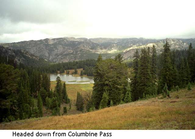
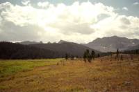
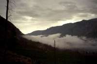
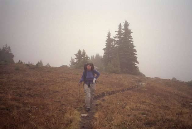
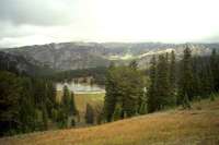
It rained all night, but stopped about the time we were finished packing up this morning. After that it was just grey, foggy and cold. The clouds hugged the ridges, descending to our level from time to time. The climb past Pentad and Flavius Lakes was rather pretty and the area around Columbine Pass was gorgeous. Open golden meadows spread all around--rolling hills--while a few scattered trees and red leaves on the blueberry bushes added color. The clouds hovered on the ridgeline, about 100 feet above us. I like the dramatic granite cliffs that tower above all the lakes. Our campsite by the lake was quite pretty, from what we saw between rainstorms.
We started early, for us, and made really good time down the mountain. We stopped for a lunch break and it immediately began to rain again, so we ate our sandwiches while walking. Not restful, but it satisfied the immediate hunger.
We saw our first people in four days about three miles from the trailhead; two bow hunters and a small group on horseback. I turned my ankle and fell about a mile later. Not a serious injury, but it hurts.
We were all glad to see the car again. We hiked the 15 miles in about 5 ½ hours, a strong pace considering stream crossings, climbs and loose rock. Most of the trail was excellent. They’ve done a lot of work on it, with new sidehill, turnpiking, etc.
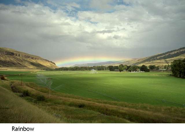
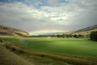
So now we’re out of the mountains. There were black clouds behind us and a rainbow in front of us as we drove to Big Timber, where we stopped for the night. We’re actually out two days early. Jim had been worried about getting stuck 48 miles from the nearest town on a rough dirt road and missing the plane, so we had planned to leave a day early in any case. I’m a bit sorry that our six day hike turned into a four day hike. I had really wanted to wander among some more high country lakes, but given the weather conditions and Jim’s knee, that no longer appealed, especially since everything we were carrying was soaked and there were no views due to the low clouds. Walking all day in the rain is hard because you can’t stop long enough to really rest. The rocks get quite slippery and hypothermia is a risk. Last night and this morning I was very close to real hypothermia. After six hours of getting drenched while walking, then stopping to set up in a hard rain, trying to keep the tent and sleeping bags as dry as possible while setting up, I had a really hard time. My hands wouldn’t coordinate the tent poles and it took about an hour for the shivers to subside once we were safely inside the tent and in our sleeping bags. Then this morning as we were going over the pass, we were wet and the wind was whipping. I dropped my pack to get out a warm hat and jacket and got all emotional. All of us are experienced enough that we can deal with the cold, wet and discomfort without making a big deal of it, we keep our sense of humor, but the last few days have been a hard push between the long miles and constant rain. It was still beautiful and interesting and I was happy to be out there, but descending to hot showers and cold drinks is very appealing too. We stopped at the first motel we saw – it has a laundry, hot water and a restaurant next door. Perfect.
Jim: We’d planned on spending another day on the Lake Plateau, but the shorter way out was a 14-mile run across 9,900’ Columbine Pass and back to the trailhead. So, with everything we owned being at least wet if not soaked (in part due to a partial tent collapse about 04 dark hundred that night) discretion was the better part of valor and we cut out about 6 miles distance and a very wet night and headed back to the car. It rained on the way out.
Sunday, September 8, Red Lodge
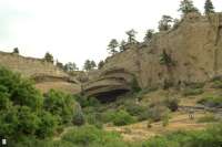
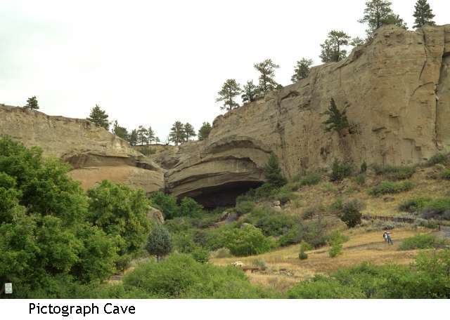
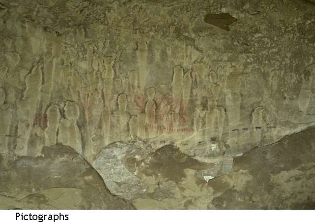
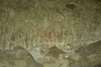
Today was a lazy day, eating, packing, eating, driving a bit, eating. We took a side trip to Pictograph Cave. The cave was interesting, but the pictographs were almost impossible to see, except the more recent ones. Disappointing. It was a pretty area with limestone boulders and cliffs and sage meadows all around . Lots of ranch country. For lack of an alternative plan, we decided to return to Red Lodge, where we will do a short dayhike to finish up our trip. We wandered the shops and read the afternoon away. It was a lazy restful day. None of us were in the mood for a long drive, and around here, everything is a long way away, so we decided to stay relatively close to Billings.
Monday, September 9 – 8 miles – Billings
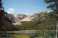
Today was another low key day. We ate a late breakfast in Red Lodge, then drove out to a trail about 10 miles outside of town. We climbed through lush spruce forest past a lovely waterfall to two lakes – one a shallow pond covered with waterlilies, the other a small high mountain lake in a glacial valley, with cliffs above. It was a nice walk in the woods, about eight miles round trip. The day was cool and sunny. We only saw three people on the trail, one on the way up and a couple with a dog on the descent. It was a nice way to finish up our vacation – an easy packless climb to a pretty lunch spot.
It has been a good vacation . I’m still not in very good shape. Every climb was a serious breath stealer, but I had fun. My balance (or lack of same) is still an issue. But I had no serious falls, and I made it over rocky talus and log bridges despite my timidity. The land is beautiful – both the high country and the lower rolling hills and rocky bluffs, the farms and ranches and pretty log homes. I like this country. We’ll be back.
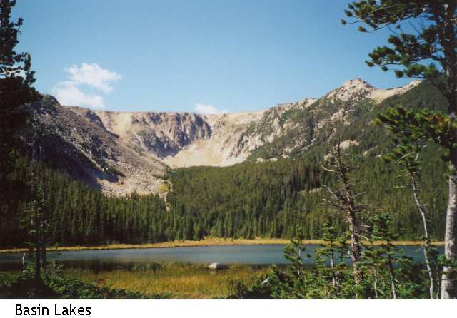
Jim: We were left with a couple days to wander the area, dry out and do some other sight-seeing, including the Basin Lakes National Recreation Trail.
Random notes –
- The only nights we spent below 9,000’ were the nights we were in town.
- Going from near-sea-level to a 9,500’ campsite in less than 36 hours is not recommended practice. It can make you extremely ill.
- This is the first time we used an alcohol stove for an extended trip – I’d modified one of the popular designs to suit myself and it worked extremely well.
- Walking for 2 days through burned out forest, especially in the rain, is a bummer.
- Bushwhacking is no easier in the Absaroka than it was on the CDT.
- Mark (Skeeter) is a great trail companion.
Home | Links
The Thruhiking Papers |
Created: 09 Oct 2004
Revised: 30 Sept 2016Copyright © 2002-2017 Spirit Eagle