|
 |
 |
 |
 |
|
|
|
|
|
|
Friday, June 27: Soldotna

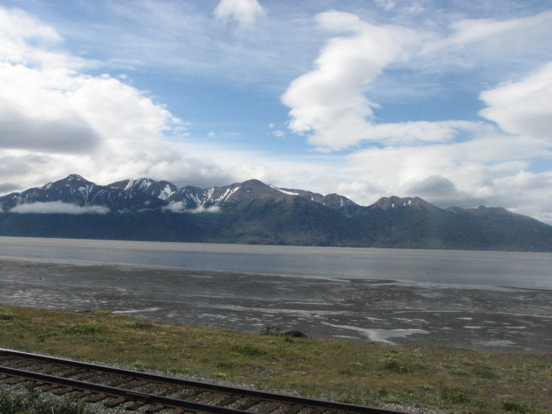
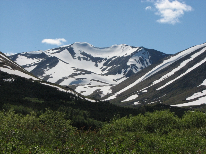
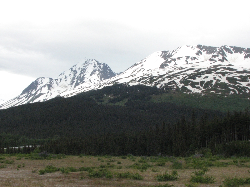
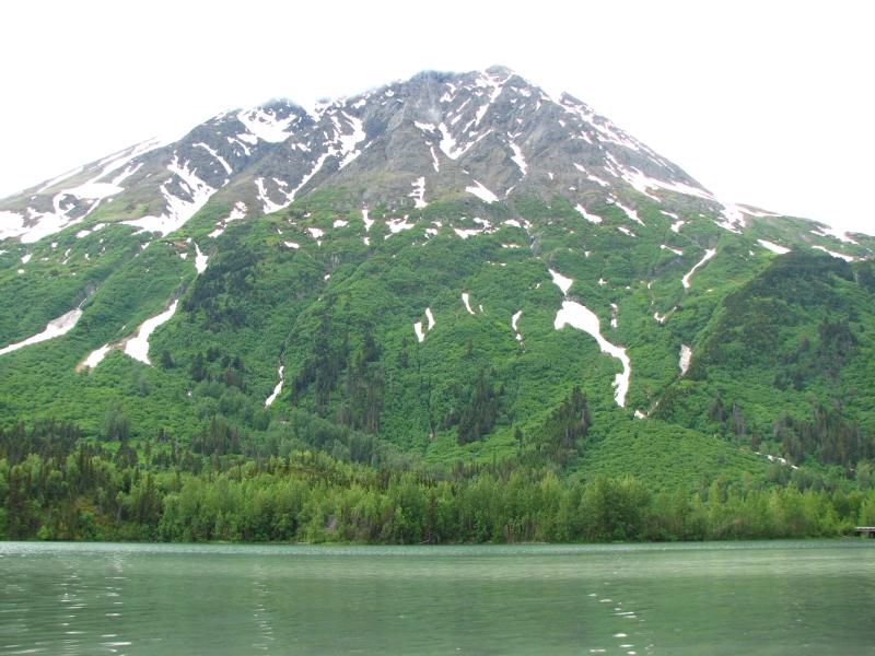
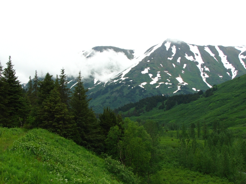
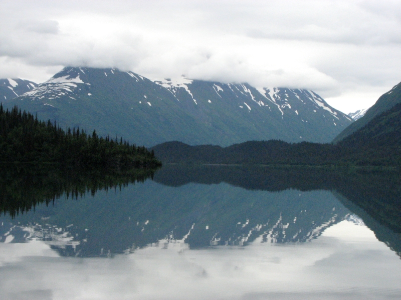
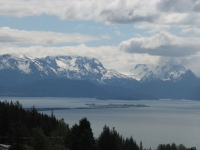
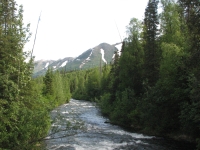
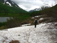
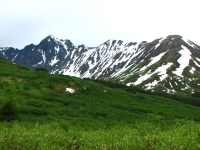
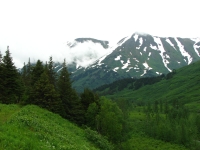
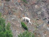
We had planned to go for a hike in the Chugash Mountains today, but by the time we neared the turnoff to the trail, it was pouring rain. We decided to continue driving. There were no views along Turnagain Arm since clouds completely covered the mountains. When we reached the Kenai Peninsula, we were both surprised at the amount of snow still on the slopes. On a nice day it would be beautiful. We did see ten Dall sheep on cliffs high above the highway, right where the Milepost said they would be.
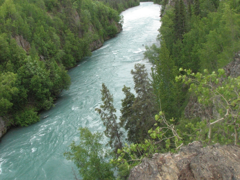
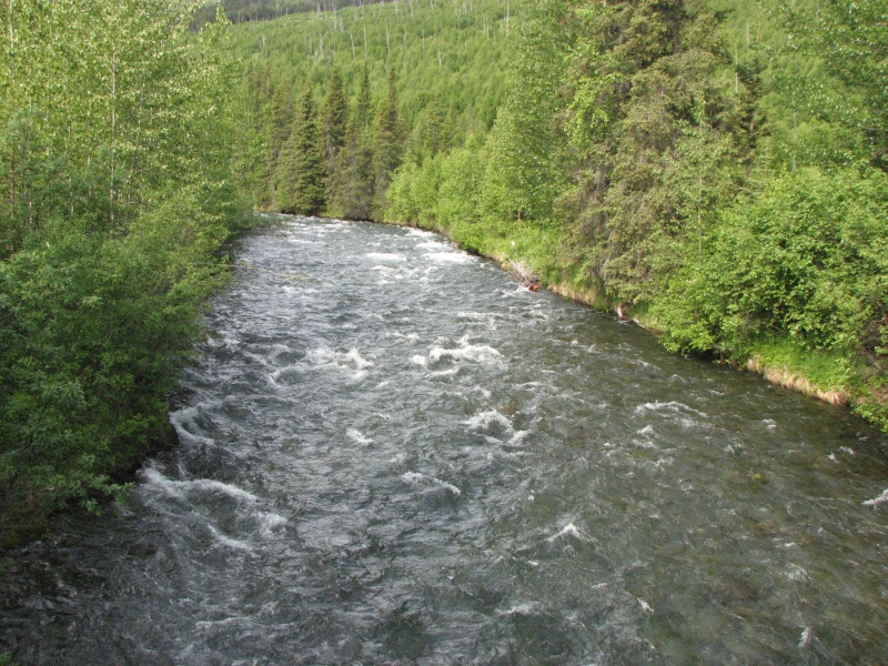
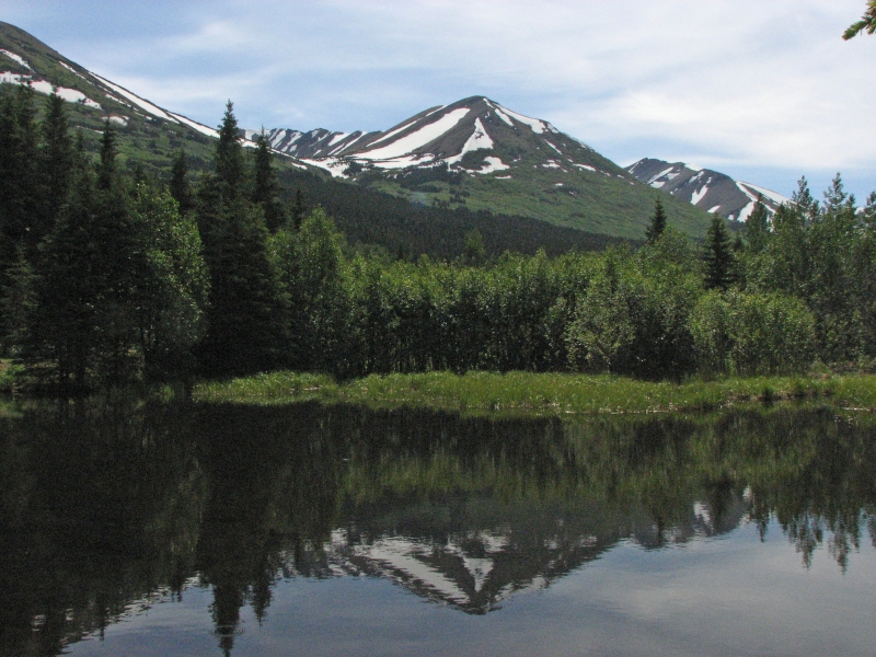
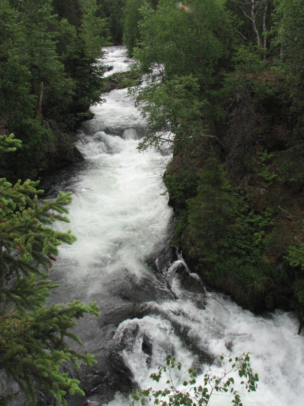
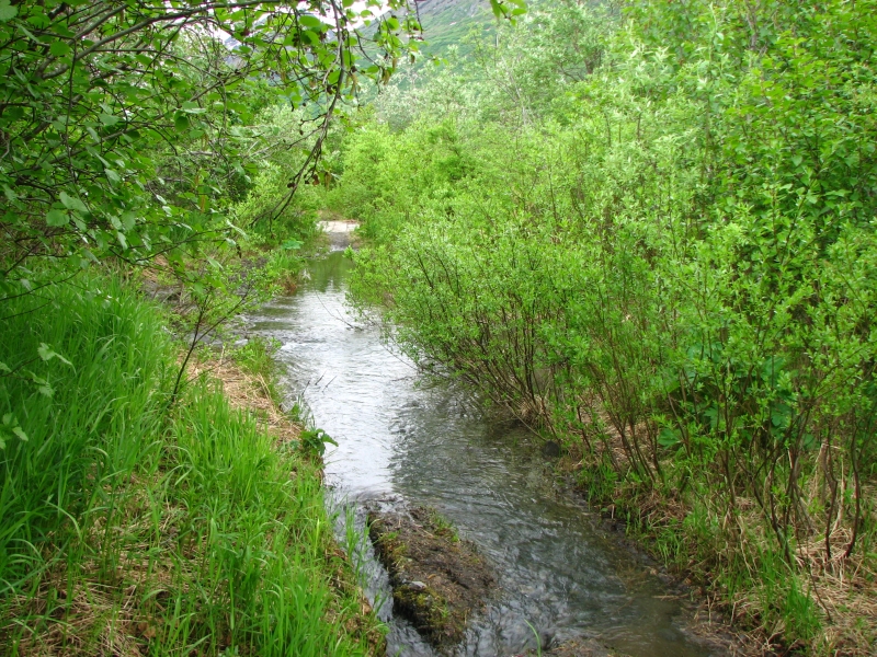
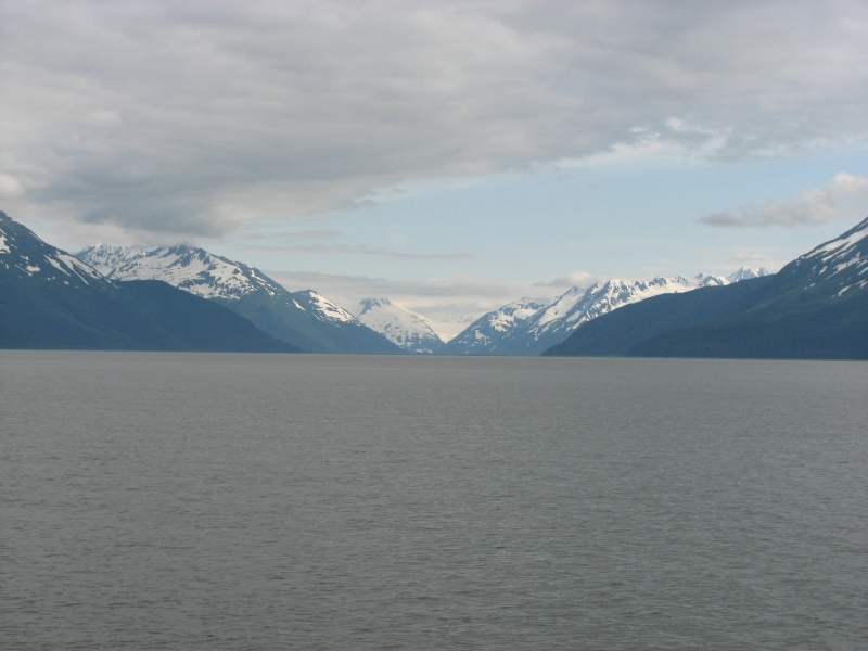
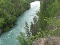
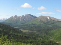
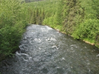
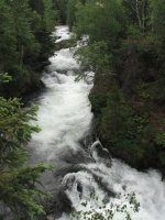
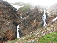
The Seward highway is a beautiful route. First you follow water Turnagain Arm -- with a shallow bay on one side and 4000 cliffs on the other. Then you head into the mountains, with green rounded slopes streaked with snow on both sides. We turned west on the Sterling Highway and began following the beautiful Kenai River. It is a gorgeous shade of blue-green and is very popular with fishermen who stand shoulder to shoulder in the water combat fishing.

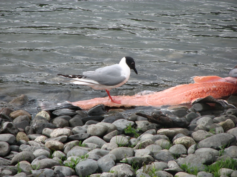
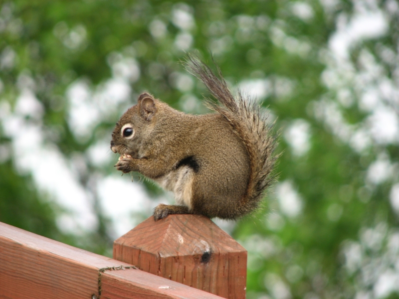
There is a dirt road past Skilak Lake that is supposed to have wildlife, so we decided to see what we could see. It was a surprisingly busy road, so all we saw were hares and ground squirrels. We walked ½ mile to an overlook of the Kenai, but continuous intermittent showers discouraged more ambitious hiking plans. We were stopped for a long time by road construction, and by the time we reached Soldotna it was pouring again. We decided to spring for a motel but changed our minds when we found out the price: $120 for the cheap motel next to the noisy tavern. Instead we split a huge hamburger and then went to the municipal campground, Centennial Park. Many Alaska towns seem to have some sort of city campground. This one is primitive (no running water) but is quiet and wooded, just like the Forest Service campgrounds I like to stay in. The municipal campground in Anchorage had flush toilets and pay showers. Centennial Park in Soldotna has fishing access on the Kenai River. When the rain let up for a while, we went for a walk on a developed trail with stairs down to the water. Several people were fishing and gulls were busy picking at the remains of a big salmon. We watched the birds for a few minutes while they ate and bathed in the river, then we went back to the truck just in time to miss the next cloudburst.

Last time we were in Alaska we had little rain, except at night. We did have one all day rain that I remember (the day we had our car accident), but the rest of our trip was warm and dry. This year has been very different. It has been very cool and cloudy and rain has been frequent. I hate constant grey skies. I want to hike more, but its hard to get excited about walking when the mountains are buried in white and everything is drenched. If Im out already, I dont mind the rain that much, especially if I can change into dry clothes later, but its difficult to leave a warm dry car to go out in a downpour.
Saturday, June 28: Homer
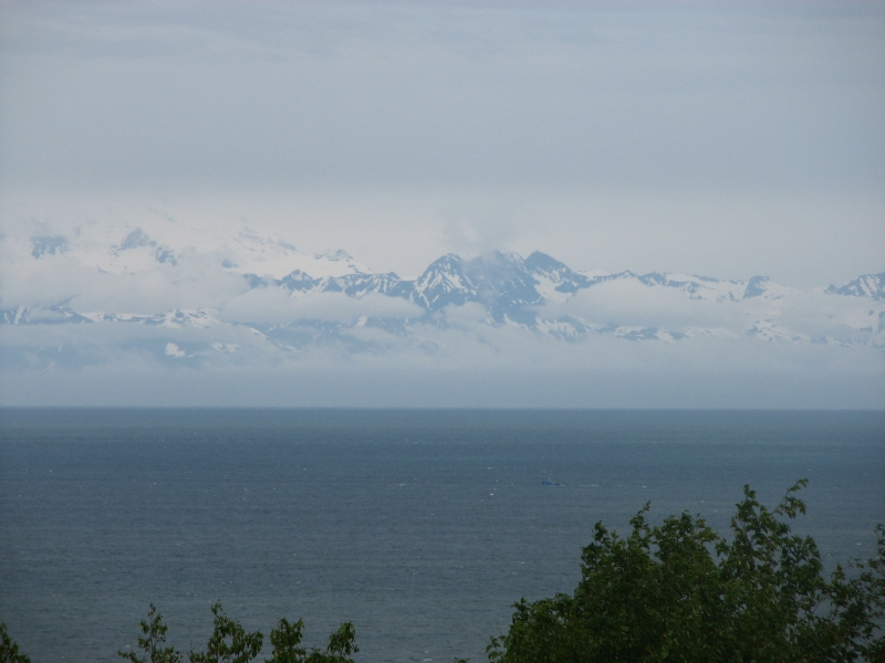
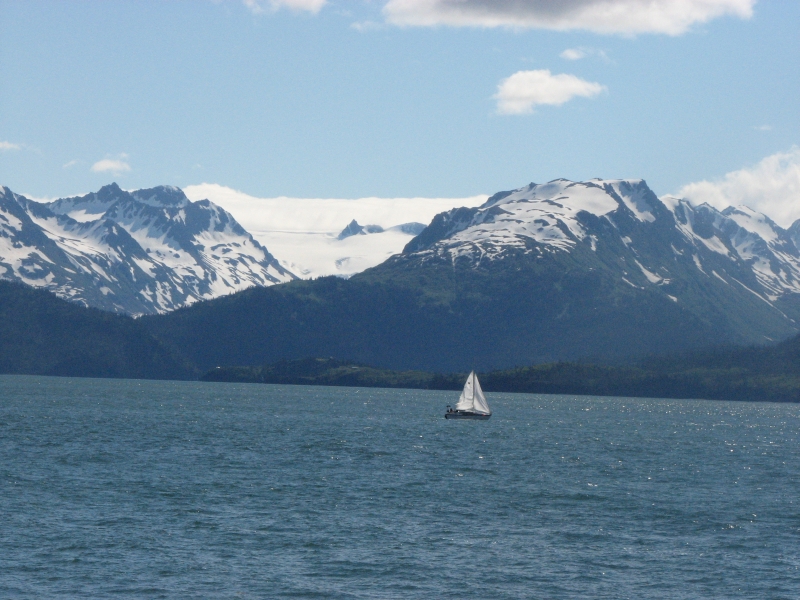
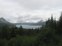
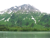
It was another gray day with clouds obscuring the mountains and volcanoes across the Cook Inlet. The water, mountains and sky blend into each other in various shades of bluish gray.
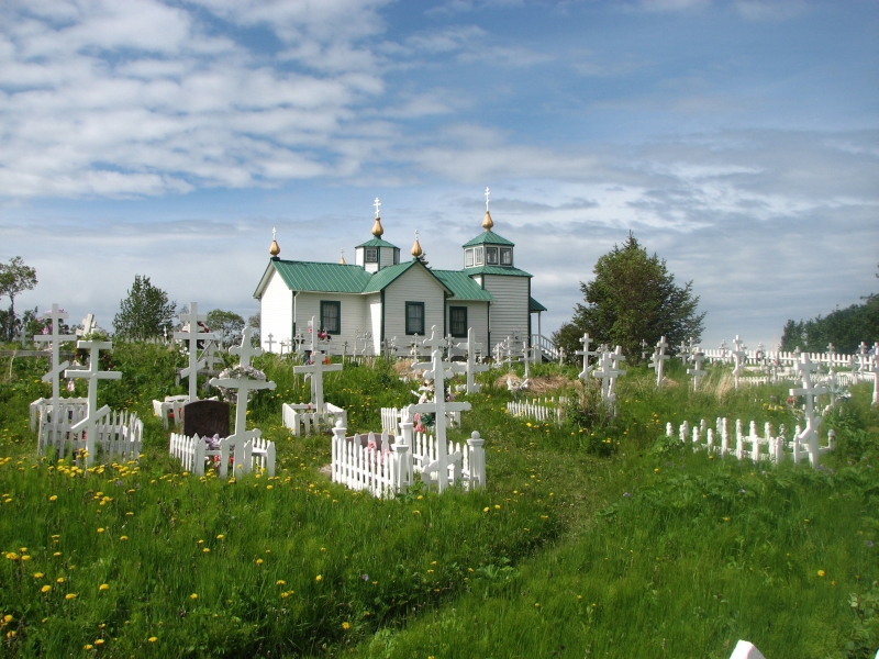
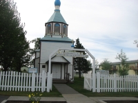
We left the campground late (9:30) and drove to Kenai, an old Russian town nearby. There is a pretty Orthodox Church and a small chapel. They have a Saturday Market selling arts and crafts, so we wandered around looking at jewelry, photographs, paintings, pillows, etc. All we bought was a small loaf of pumpkin bread to benefit an animal sanctuary, but it was fun to look.

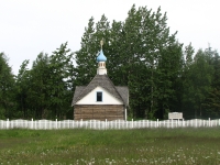
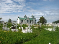
The drive down Kalifornsky Beach Road was a bit of a disappointment because trees hid the beach most of the time. I had hoped for views across the Inlet, even if the mountains were obscured. I remember how scenic the volcanoes can be. The roads were lined with lupine. Last time we were in Alaska, we saw fireweed everywhere. This time its lupine, but were about a month earlier this year. We stopped again at the Russian Church in Ninilchik. Its looking a bit more run down than last time--the weeds were high in the cemetery and the paint is fading--but its still very picturesque.
A couple of miles farther we watched 10 bald eagles circling above Deep Creek. We ate lunch at a viewpoint overlooking Katchemak Bay and watched more eagles hunting for fish. The day was getting dark and rain was imminent, so we stopped at the Alaska Islands and Oceans Visitors Center. They have some nice exhibits and a film on the Wildlife refuges in the Aleutians that made me want to visit the islands are gorgeous. We stayed for a presentation by Taz Tally on Hiking Trails of the Kenai, his new book that is part of the Falcon Press Fifty Hikes series. Taz had slides and stories about several of the hikes in his book. It looked like a good guidebook, especially for someone who likes to be challenged by steep and off trail routes. We had fun learning about some of the trails in the Kenai. Most of the people in the audience were local hikers.
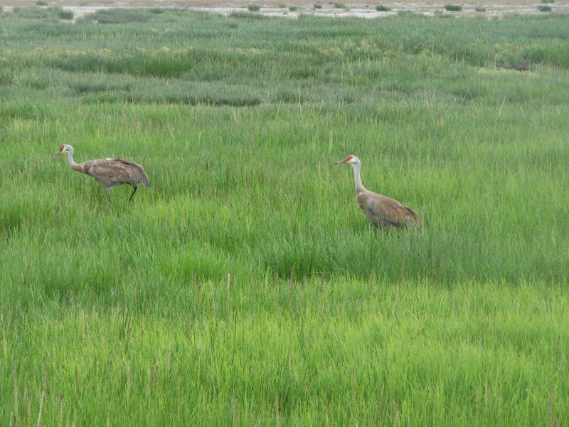
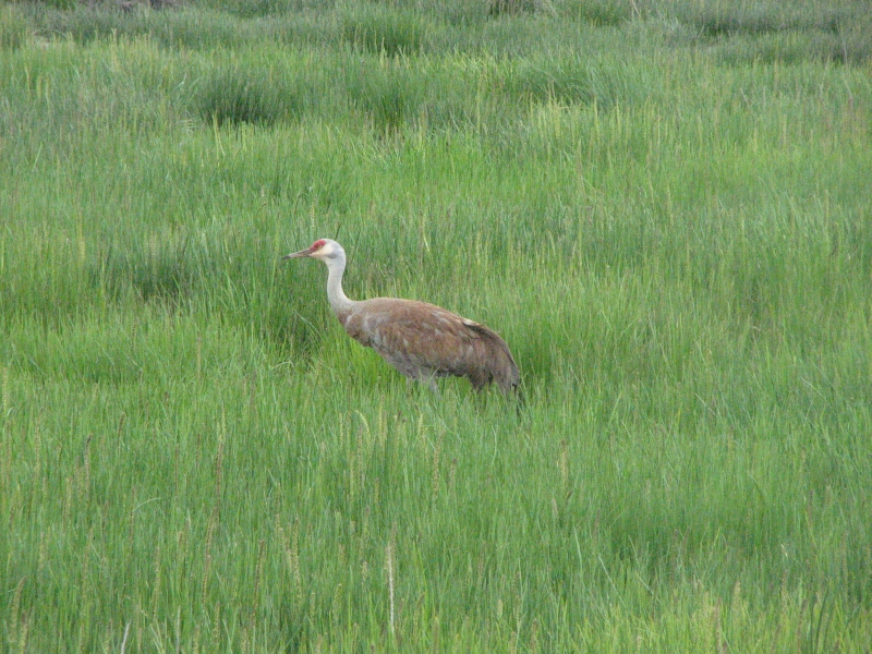
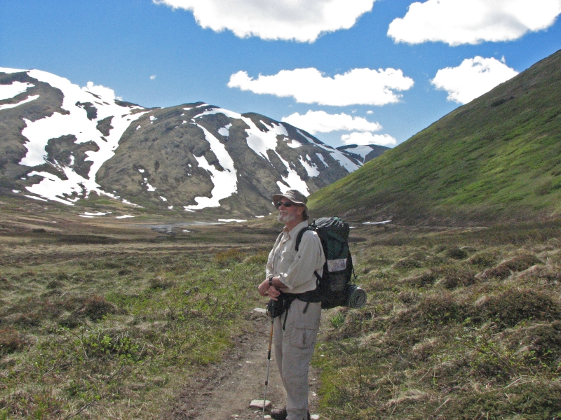
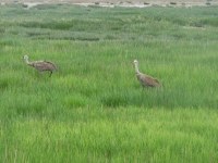
We walked out to the beach afterwards and ran into two sandhill cranes that strutted through the tall grass. They were funny. It started to rain again so we didnt linger. We drove out to the Homer Spit, but didnt stay there long either. We watched a couple of fishermen land fish, then got back in the truck to look for a campground. Since we both need and want a shower, we looked for an RV Park. The first one, out on the Spit, was charging $78/night (for an RV Park!) No wonder they were nearly empty. In town we asked at Oceanview and they said $33, which is still high, but they have free showers as well as electricity and WIFI, so we took a spot, even though it has no charm. Its just your basic parking lot next to the highway, with RVs stacked right next to each other in neat rows. Yech. We wanted to stay in Homer because we are hoping tomorrow will be a nicer day. Our last visit was a real rush and Id like to see more of the area, if possible. Id at least like to see the mountains across the bay. I wish we could go for a hike at Katchemak, but Jims knee has been acting up so we decided against it for now.
Sunday, June 29: Sterling

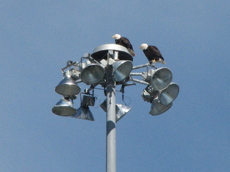
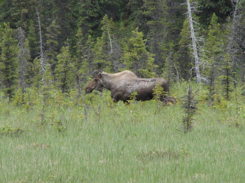
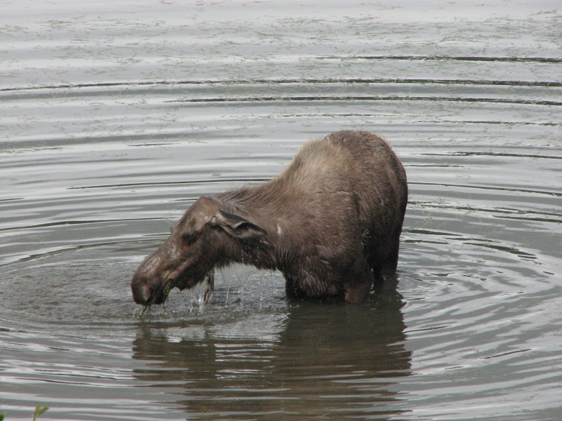
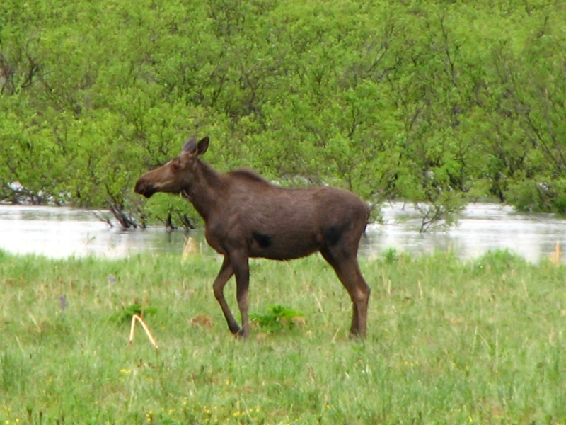
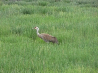
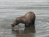
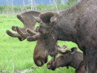
We woke to sunshine, but cumulous clouds still peeked around the edges of the mountains. By noon it was dark gray all over. So much for views of the volcanoes! We did see a moose in a meadow beside the road, another sandhill crane that was walking up the highway, and a dozen or so eagles pairing off near Ninilchik. Watching them fly in unison and then attempt (unsuccessfully) to mate in the air was cool.
We plan to go backpacking tomorrow, so we decided to make today a mostly rest day. We left Homer around 11:00 and drove 90 miles to a small RV park near Sterling with a nice wooded lot. The electricity to our site last night was turned off, so the battery on the laptop was used up without our awareness. Jim wanted a place with electricity so it could get recharged. I just wanted to get past the road construction on a day when the crews werent working, so we found a nice commercial campground just beyond the construction zone. We were able to spend the afternoon relaxing - reading and packing up for the hike.
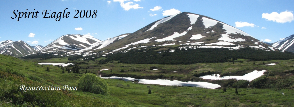
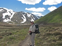
Monday, June 30: Resurrection Pass Trail to Swan Lake (13 Miles)
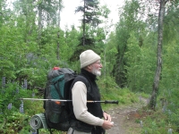

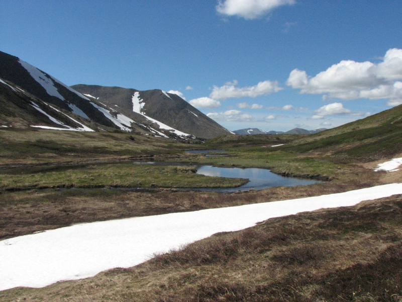
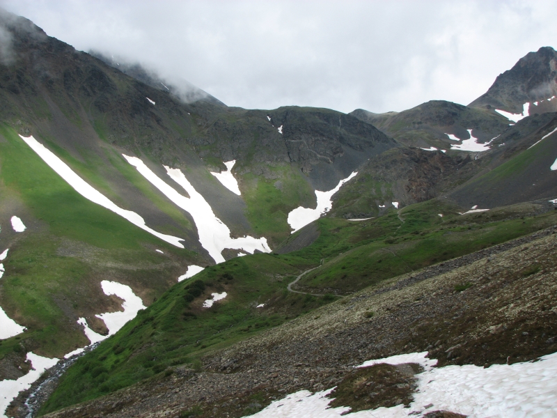
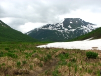
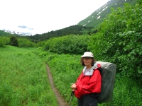
Backpacking at last oh joy! Oh pain! Hurray! The Resurrection Pass Trail is a 39 mile linear trail in the Kenai Peninsula that runs from near Coopers Landing on the Sterling Highway to the town of Hope. Its an old gold rush route and an easy hike. The climb is only supposed to be a total of 2000 in either direction just a very gradual climb and descent with a lot of flat sections.
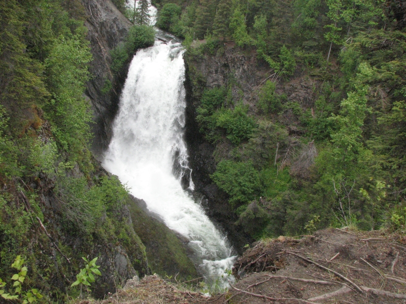
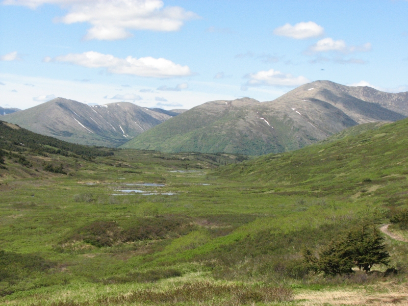
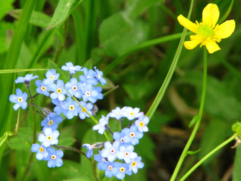
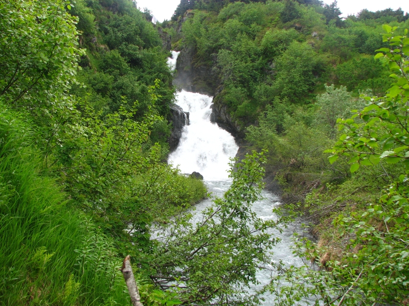
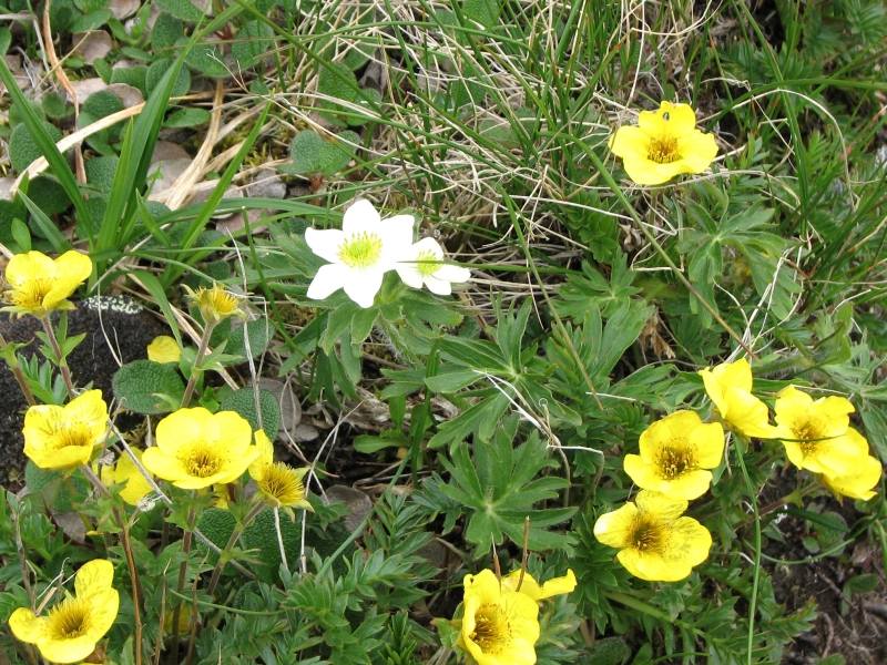
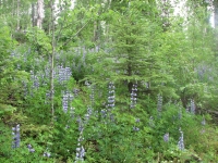
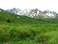
We started out hiking in fields of lupine. There were blue knee-high flowers everywhere. It has been a pretty hike so far, past a couple of lakes, a beautiful big waterfall, along large green meadows and rushing creeks. We hiked in a valley between two big rounded ridges, looking up at the alpine country above. Tomorrow well be above treeline for about seven miles, but today we were hiking in spruce, aspen, and birch forest.

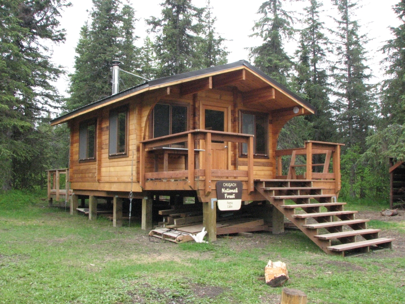
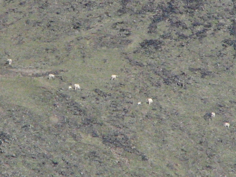
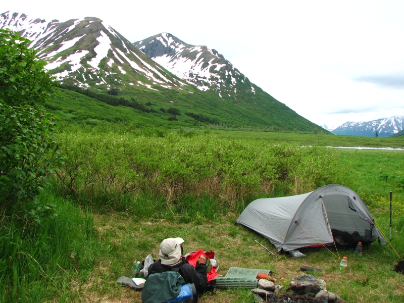
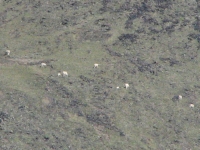
Resurrection Pass is a very popular trail. We saw seven groups backpacking, plus a runner and a trail crew. There are some very nice cabins along the trail, (which must be reserved in advance), as well as campsites every couple of miles that you dont need to reserve. Our campsite is small and lumpy, but we wanted to stop hiking before the trail climbs above treeline and we werent sure what wed find ahead. We dont have a guidebook, just a map, and it doesnt show campsites. We saw a moose at one meadow and about 25 Dall sheep on a ridge above our camp. We heard a wolf howling as we prepared dinner. Mosquitoes were bad when we stopped moving, but werent too much of a problem while we hiked. It was cold and gray again today, but so far dry. The forecast for the next few days is cloudy with a chance of showers, typical Alaska.
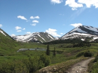
Tuesday, July 1: Resurrection Pass Trail (16 miles)

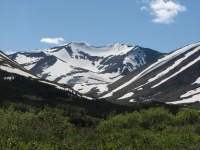
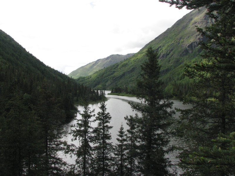
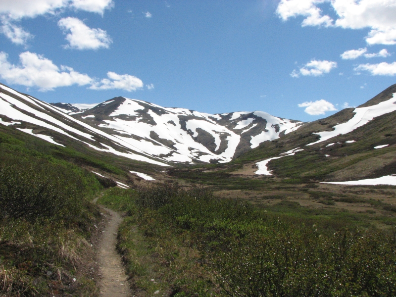
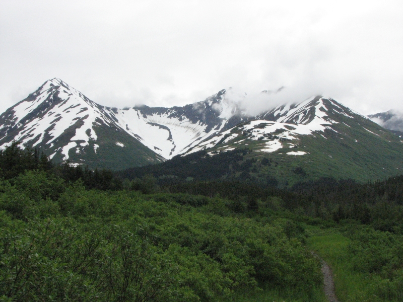
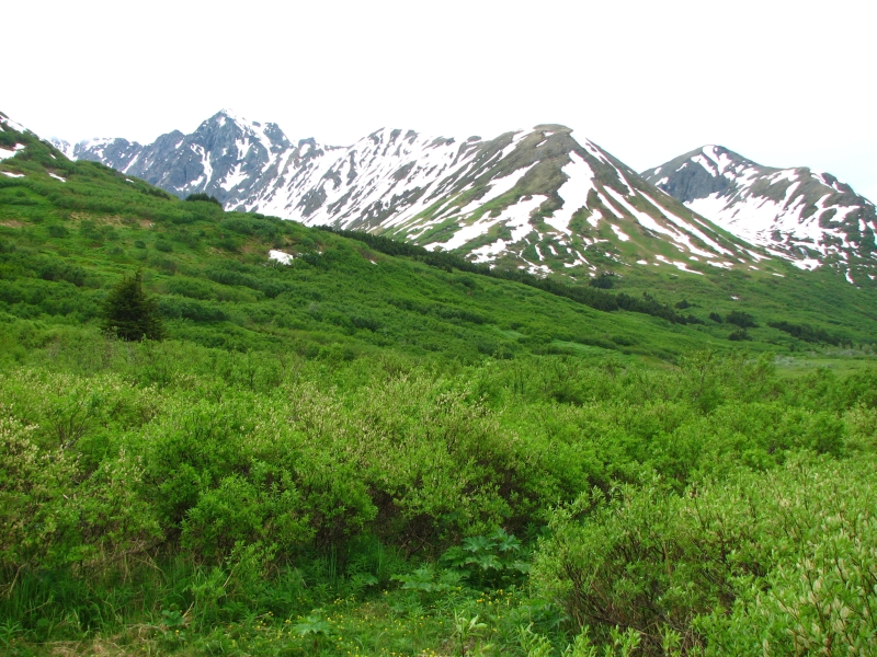
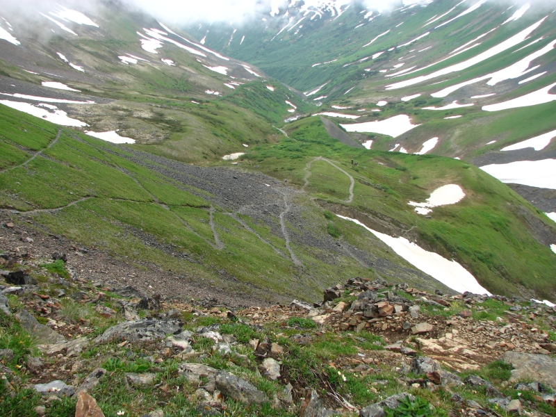
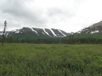
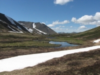
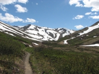
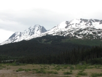
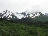
We got really lucky today: the clouds lifted and the sun came out, so instead of wandering above treeline in a cold white cloud, we had sunshine, blue skies and glorious views. It was a beautiful walk with tall ridges on both sides of a narrow valley. Near the pass, the ridges were streaked with snow and we crossed a few small snow patches, yet there were wildflowers galore: lupine, yellow paintbrush, geraniums, wild cranberries, bunchberries, bluebells, etc. We stayed high for about seven miles, then dropped back into the forest, with frequent views of treeless ridges above us. Were following the Resurrection River for the last 20 miles or so.
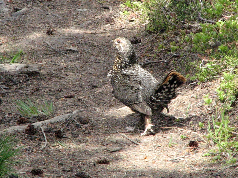
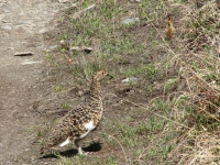
There were fewer people today, probably because we passed Devils Pass Trail, which many use to shorten the hike. We saw only two sets of backpackers: a couple and a woman with a dog, plus three people on bikes. Wildlife was scarce. The Dall sheep from yesterday had moved but were still up on the ridge above Swan Lake. We did see lots of birds, mostly terns and gulls. There was an eagle that I saw twice. He was feeding below the trail and startled me when he flew up next to us. A couple of grouse or ptarmigan families ran off as we approached. Last night we could hear loons on the lake, such an eerie sound.
We cooked dinner in the middle of the trail. We had planned to stop for the night near Fox Creek but didnt find any campsites in the vicinity so we kept going. We werent sure how far it would be to the next campsite and we were both tired and sore, so taking a long break sounded like a good idea. Besides, Im not comfortable with cooking where we sleep in grizzly country. Last night there wasnt room to cook away from the tent and it did make me nervous, though there was no bear sign in the vicinity. We had seen some scat, but it was a long way away from our camp.
We ended up hiking about 16 miles today, more than I had intended. The campsites are scattered, sometimes a mile apart, sometimes two or three. Tonights is more sloped than I like, but we were ready to stop, so well put up with the slant and the lumps. Beggars cant be choosers. The forest has a lot of dense undergrowth, making good campsites hard to find.

Wednesday, July 2: Resurrection Pass Trail to Campground on the Kenai River (14 miles)
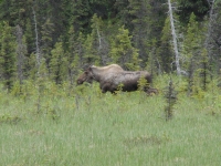
It was another beautiful warm sunny day. Most of our hike was in forest above the river, but there were views of the ridges on both sides of the valley and the river itself. We were visited by a moose while we were eating breakfast. She snorted and ran off before Jim could get the camera. The trail had a lot of easy up and down and up and down. It was less straightforward than the south end. We ran into three groups of backpackers: one heading north like us, the others just starting a southbound hike. The cabins get a lot of use, from what we heard. Most of the backpackers we met were using them.
We reached the trailhead at 1:30 or so, but had to walk four more miles on a gravel road to Hope to get a ride out. Cars passed us but wouldnt stop. We were both worried about the long hitch back to the cars: 15 miles from Hope to the Seward Highway, then down to the Sterling Highway, then all the way to Cooper's Landing.

We lucked out: after only half an hour, a father and son from Long Island picked us up in a tiny rental car and drove us all the way to our truck at the trailhead. They were heading to Soldotna, so it was on their way. That was lucky. I figured it would take at least three rides. Instead we were in a hot shower at an RV park on the Kenai River by 5:00. We spread all of our gear out in the sun to dry and air out before heading to Gwins for dinner.
Im really happy with our backpacking trip. It was a really beautiful hike, especially right now. It was an easy trail, but we did some big miles after not backpacking for so long. It felt really good to hike again. Jims knee gave him fits, but he didnt complain. I think he had fun too.
Thursday, July 3: Coopers Landing
We lost our summer weather; now its back to cold rain and gray skies. Drat! The forecast is for several days of the same. Now what?
Before hearing the forecast, we paid for three more nights at the campground. Its a noisy place and doesnt have WIFI, but we got paranoid about the holiday weekend. We were told a while back to settle in somewhere before the 4th of July and just stay put rather than waste time looking for a campground with vacancies on the busiest weekend of the year. Seward has a big footrace and street fair and its salmon season on the Kenai, so this whole area will be jumping. Of course, the rain may put a damper on things. Our campground was supposed to be full but got some last minute cancellations, probably because of the weather. Its 80 degrees and sunny in Fairbanks, 50 degrees and rainy here.
We talked about going for a hike this morning before the rain came, but decided to give our bodies a break and just go visit the town of Seward. We toured it last time, so our main goal today was just internet and groceries. We enjoyed the drive down, especially the moose next to the road and the beautiful snowy mountains. This is July? In town we watched the artisans setting up booths for the fair in the rain, then walked to the library to check e-mail. They had a big book sale in the basement, which kept us busy for a while. A hot lunch warmed us up after a short walk in the drizzle. Sewards old town area has been cleaned up for the tourists. There are more gift shops and nice restaurants than we saw last time we were here. I mostly remember run down bars, not tourist shops. We had planned to go back and visit the Sea Life Center again, but at $20 each, we decided to skip it this time. I hate to be so cheap, but everything is so expensive, we have to say no sometimes, especially to things we did before. I would have loved to do another Kenai Fjords boat tour it was a great one but thats really expensive.
I worry about Alaska in the near future. In a year or two, no one will be able to afford to come here, except in a cruise ship. Soon Princess will own the whole state and not just the port towns and Denali. We spoke to a woman at the Visitors Center in Tok who has already noticed that more people are camping instead of doing motels and cooking in rather than eating out. Like us, theyre skipping the expensive tours and just enjoying the scenery along the roads. Western Canada will really be hurting without the Alcan tourists and the smaller towns in Alaska that rely on tourists to survive will go bust.
We saw a lot of closed businesses (especially lodges) along the highways and reduced rates for the motels. The cruise ports should be all right for a while, but the rest of the state will feel the effects of high gas prices badly. If we were smarter, we probably wouldnt have come north this year. We knew fuel prices were rising, but didnt expect inflation to be this bad. In February we paid $2.79 a gallon. Today, five months later, it was $4.95. In Canada it was $6. Food costs have been affected by the rising transportation costs. We are eating up our savings much faster than I like. However, life is short. Next year Jim will have his knee surgery. We wont be doing much hiking and well have even less money. Prices will continue to rise and the stock market will continue to fall. Id rather live fully now while we still have some savings and reasonably good health. Who knows what next year will bring? So well eat dessert first, for tomorrow we may all starve.
Friday, July 4: 6 ½ miles on the Russian River/Russian Lakes Trail
Noisy neighbors kept us awake again late last night. Not their fault really, it was just high spirits lubricated by a lot of Bud Light. Unfortunately the campsites are simply too close together. Their fire was 10 feet from our bed. However, everybody slept late, making up for the late night party.
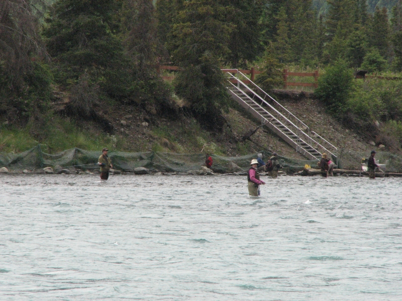
We only had a couple of miles to drive to the trailhead for Russian River Falls and Lower Russian Lake. Its an exceedingly popular trail for dayhikers and fishermen, even though they charge $11 to park at the trailhead. We paid half price, thanks to Jims Golden Eagle Pass. Even so, both parking lots were full and we met a lot of people on the trail.
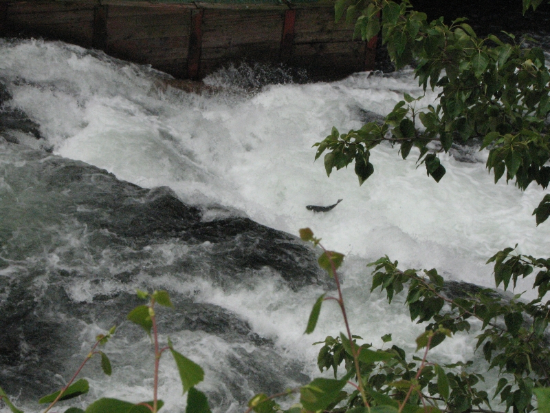
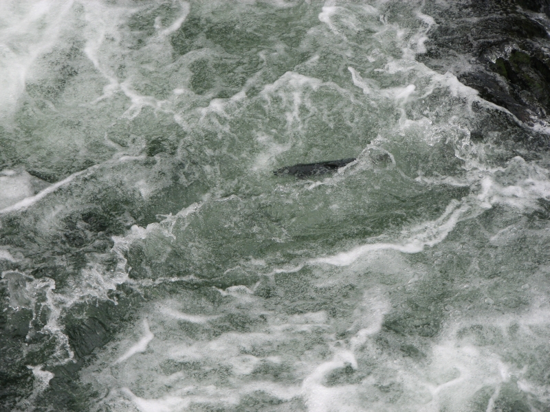
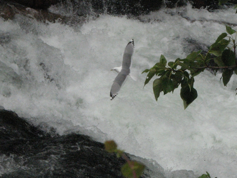
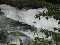
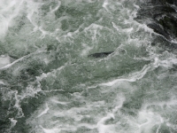
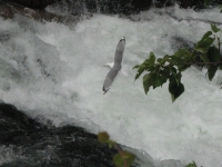
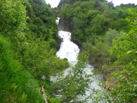
The trail to Russian River Falls is 2½ miles of easy flat trail. Theres a series of cascades where you can watch salmon jumping, attempting to force their way against the strong current up the river. I dont know how any make it to spawn, there was such a strong flow. We could see groups of fish resting in the eddies, then one by one theyd start jumping up the falls. A pack of gulls fed on those that didnt make it or who did but died after spawning. Fishermen tried their luck downstream.
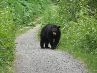

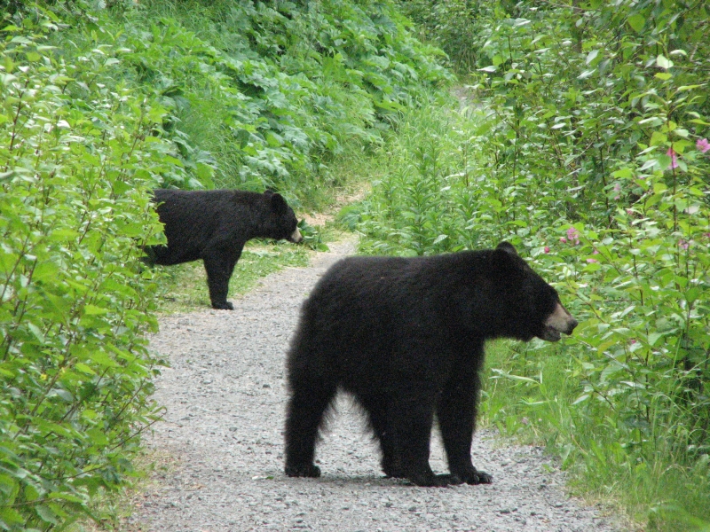
Lower Russian Lake is on a separate trail which fewer people use. Its supposed to be a good two day backpacking trail, though we didnt intend to go that far. We headed toward the lake, but were stopped by two young black bears. One was very curious about us. We yelled, but he walked toward us anyway. The sibling appeared out of the brush and both trotted off down the trail away from us. We followed, slowly, until one popped out of the brush about 20 feet away. Too close. We didnt see mama bear, but she was probably nearby. We decided that the prudent act would be retreat. The cubs were a bit too interested in us and not nearly as afraid as they should have been. I didnt want to share my lunch with them, or have them come much closer. I was sorry not to reach the lake or see the brown bears another hiker saw there earlier today, but our encounter was exciting enough. We glimpsed a porcupine on our way out of the recreation area but it hid before we could get close enough for a picture.
The Kenai really is crowded this weekend. The road is a non-stop line of cars, the campgrounds all say Full, and fishermen line up shoulder to shoulder along the river. We stopped briefly at Kenai Lake where I spotted a few Dall sheep on a mountain north of the highway. It was gray and hazy, but dry. Scenic but not photogenic.
We walked a mile or so after dinner along the highway. The campground is owned by a tour company down the road that does raft and fishing trips, so there is a fair amount of walking back and forth between the two businesses, but the trail didnt last so we turned around.
Jim: Got some good video of the bears, but spent too much time getting it. They were REALLY irritated by the time we left. I'm supposed to be old enough to know better. So much for that theory !
Saturday, July 5: 9 miles on the Primrose Trail

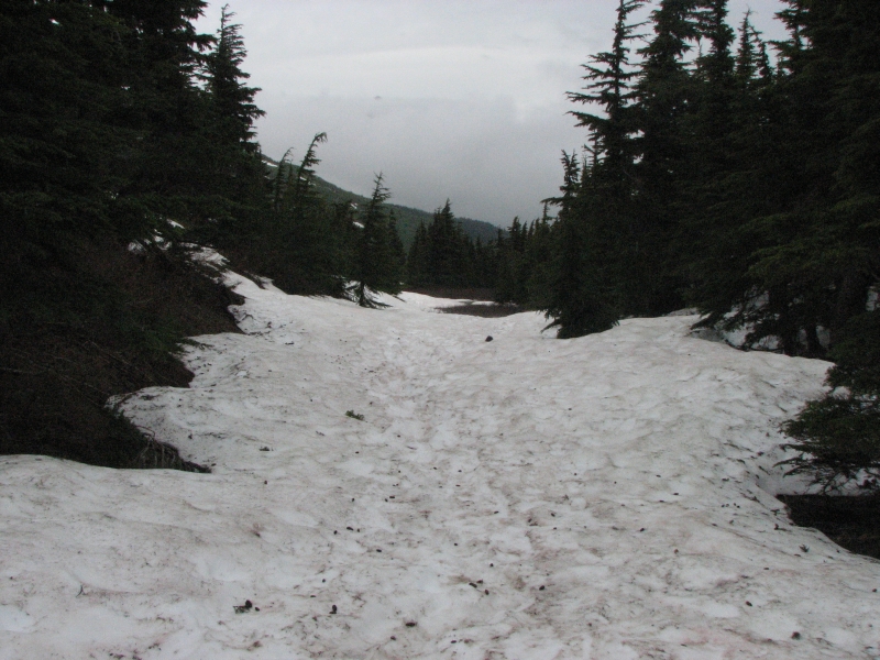
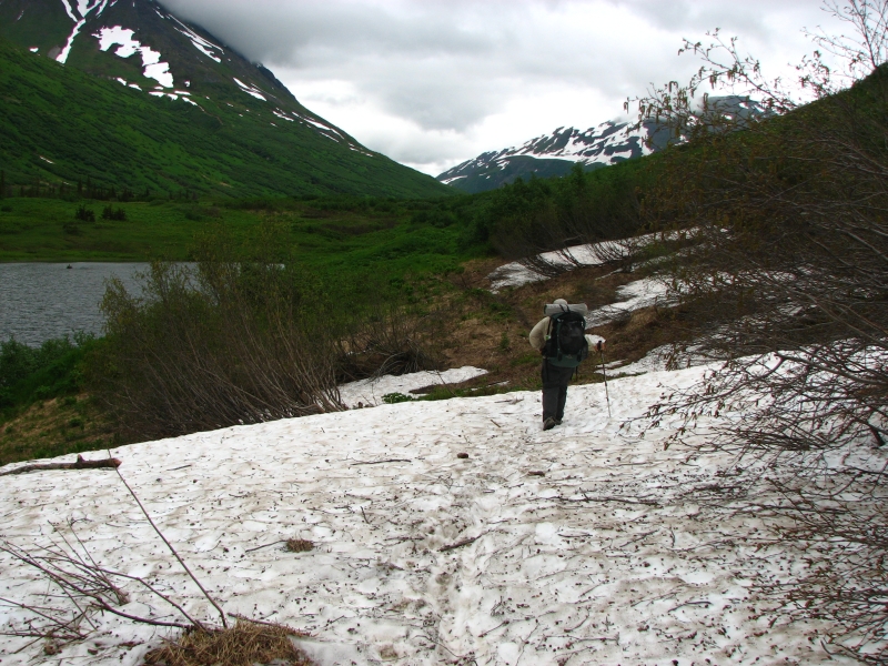
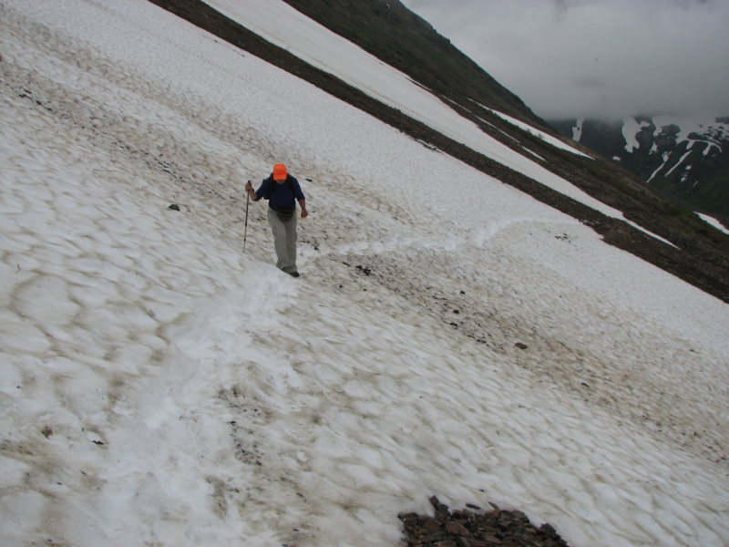
Today didn't work out as intended. We had planned a long hike to Lost Lake. We hiked part of the trail from the south end last time we were in Alaska and thought it beautiful. I wanted to hike the whole 15 miles from Primrose to Lost Lake to the trailhead near Seward. We woke to a light rain, but decided to go for the hike anyway, expecting the rain to either stop or be intermittent. Clouds covered the mountaintops. The trail climbs through pretty spruce forest for the first five miles before emerging into the alpine zone. We never made it that far. At four miles we began running into snow on the trail. It got worse--deeper and more continuous--the higher we went. We met a group of backpackers going the other way who said it got worse before it got better. We kept going, postholing and sliding in the mud and snow. Then we lost the trail completely. We decided to turn around. We were soaked, muddy and tired and still had 2 ½ miles to go to the lake. It had rained most of the way up, though that stopped soon after we turned around.
We met hordes of people on the descent: backpackers, dayhikers, runners and dogs. I hope they had a better day of it than we did. I was really disappointed because I had been looking forward to doing the traverse and hiking in alpine meadows again, but the snow made us slow and the rain and clouds meant no views. The crowds meant no wildlife, though a bear had been seen in the area recently. Turning around was the prudent move, though not very satisfying. But we werent having a lot of fun hiking in the rain and snow, so it was time to stop.
Lunch in the car and a warm shower back at the RV park helped a little. An afternoon at the laundromat made a bad day worse. The sun finally came out, but too late to do us any good.
Jim: I should know better. When we got here a couple days ago the fishermen were lined up shoulder to shoulder. Combat fishing at it's best. And I told myself I'd get the photo "later". Ri-i-i-ght!!
So now it's later - and most of the fishermen are gone. I got the photo, but it's not the same.
Sunday, July 6: 14 miles on the Johnson Pass Trail

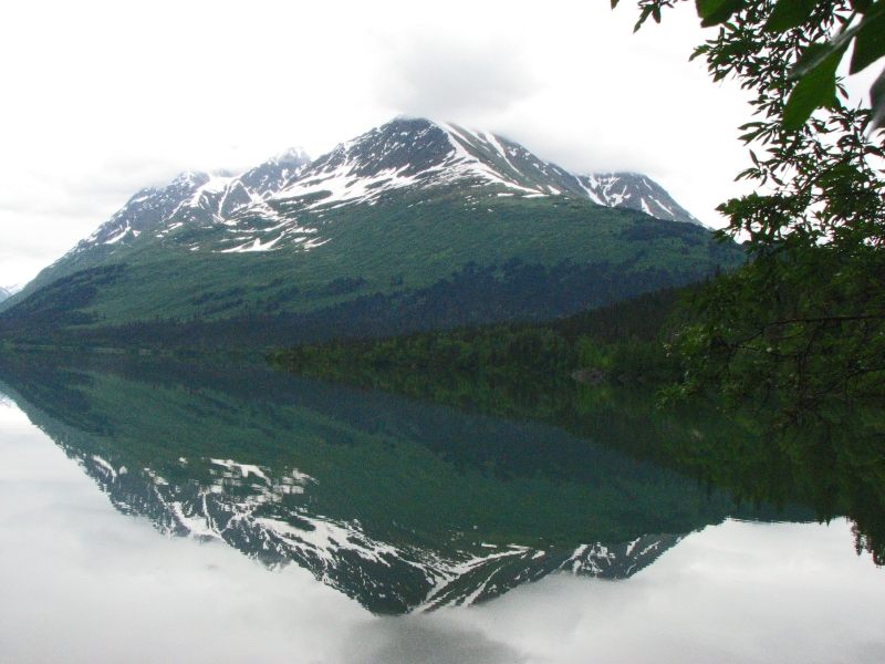
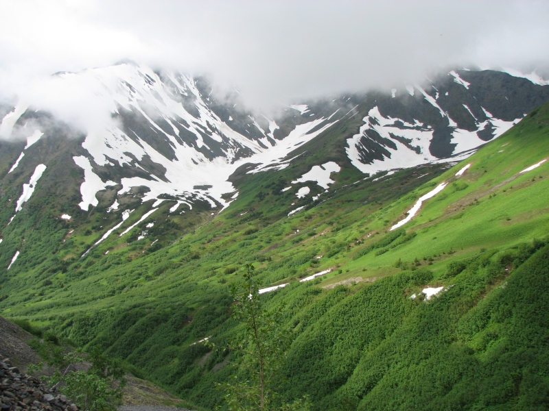
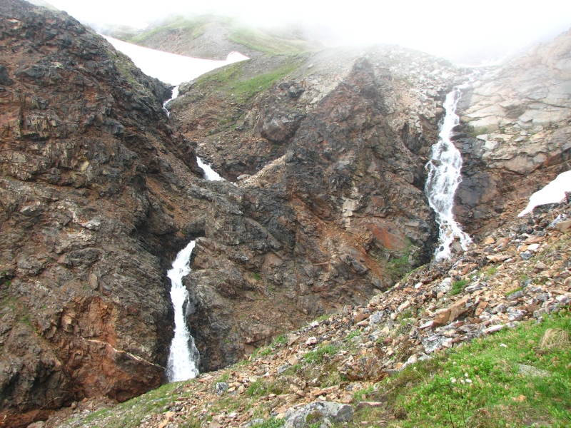
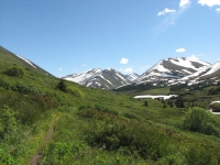
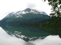
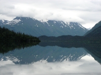
It was sprinkling a bit when we got up, but that soon passed so we decided to risk another backpacking trip. Johnson Pass Trail is another easy 23 mile linear trail that was used by Stampeders and by the early Iditarod racers. It starts out flat, following the shore of large Upper Trail Lake for four miles or so, then climbs through the trees gently for 1000 or so to a long wide pass between two tall ridges lightly streaked with snow. The clouds hovered over the top of the ridges and it sprinkled on us a couple of times but not enough to get us wet. The trail, however, managed to soak our feet several times. At the pass there were still snowfields and lots of snow above the trail that flooded big sections of treadway. Although the first several miles were well maintained, the upper reaches were overgrown and needed some water control. In one place there was a nice bridge, but the stream had changed course and ran over the trail 50 feet beyond the bridge. Even so, it was a very nice hike through hemlocks down low and willows and wildflowers up above. We passed two lakes near the pass, then a huge beautiful waterfall.
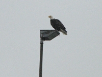
People were less abundant than on the Resurrection Pass Trail. There arent any cabins on this hike, which makes a difference. We met one group of backpackers heading out, then a couple on bicycles. We saw a group camped by Johnson Lake fishing from tiny inflatable boats. A bald eagle stood on the beach, watching. A float plane dropped some people off at Bench Lake without gear. It came back 45 minutes later, but we dont know whether it was picking them up or dropping off their gear. We didnt see any wildlife except the eagle, a loon and a marmot. We saw lots of fresh bear droppings and some moose tracks, but no fur.
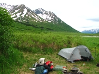
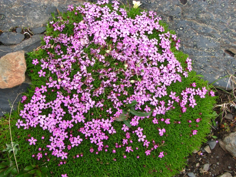
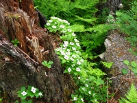
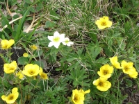
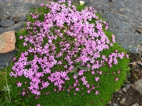
We stopped early at a beautiful campsite at the end of the pass on the edge of the meadow. This trail has several formal campsites, some with bear boxes, some with privies. We chose one with a bear box, since there arent any trees. The ridges are fairly close on both sides, green and white, while the meadow is covered with yellow flowers (cinquefoil?) We saw a lot of flowers: wild roses, geraniums and lupine down below, columbine, forget-me-nots and violets up above. Despite the gray skies, it was a colorful day. Mosquitoes were a problem in the woods but seem to be more scarce out in the open.
Monday, July 7: 12 miles on the Johnson Pass Trail
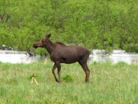
Last night we sat outside reading and admiring the views until the mosquitoes drove us inside. Soon after, it began to rain and rain and rain. It kept up all night and was still pouring when we woke up, so we rolled over for another hour. Finally it lightened up so we got up. We ate breakfast and packed up during the respite, then it sprinkled for another hour so. It didnt really matter; we got soaked from the bushes lining the trail and several stream crossings that were too wide to jump. It was a nice walk anyway with green ridges on both sides, snow above, a couple of nice waterfalls, the milky blue river that we crossed a couple of times on bridges, and flower-filled meadows everywhere. A moose passed our campsite as we ate breakfast. It ran before I got the camera, so I only got a distant shot. I saw a couple of mountain goats or Dall sheep (little white dots) high on a ridge during one of my scans with binoculars. We saw the tracks of a big bear near our campsite, then tracks of a baby bear farther down. No people on the trail today, but that wasnt surprising given the weather.
We reached the trailhead at 2:30 and walked out to the highway to hitch a ride back to our truck. There was lots of traffic but no one would pick us up. After an hour or so, we were shivering, so we started to walk. We got about 1½ miles up the road before a car finally stopped with a couple of European tourists. She was a linguist from Poland, he was a biologist from Spain. They met while doing post-graduate work at Berkeley. They drove us the 30 miles back to our car. As we were putting the packs in the back of our truck, a couple of backpackers came out of the woods, asking if we were heading to Anchorage. We werent, but after our long wait for a ride, driving them to their car felt like the right thing to do. Karma.
Jim: I think I scared them - by snatching a couple mosquitos out of the air while driving them to their truck. Or maybe they're Buddhist and don't approve of killing mosquitos. Whatever... the reaction was "interesting".
We detoured up the Sterling Highway to the Sunset Inn where we got a good hamburger and pie for dinner then headed back to a forest service campground next to Ptarmigan Creek. It was very quiet, with just the quiet rumble of the creek and bird song to break the silence. Im glad the holiday weekend is over.
Tuesday, July 8: Seward

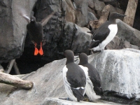
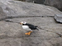
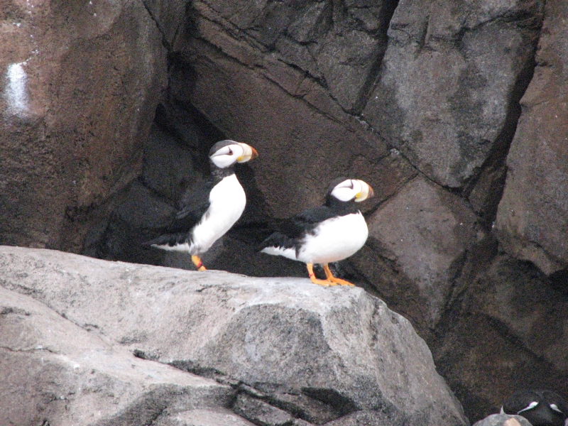
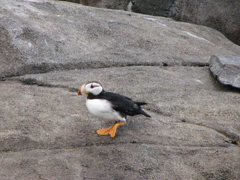
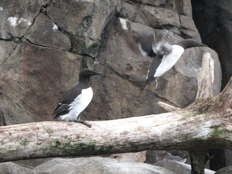
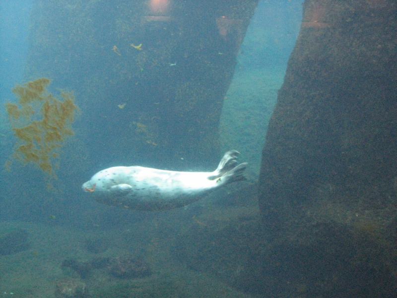
Another rainy night and early morning. The tent we left outside to dry was soaked even worse and the sleeping bags were still wet from the previous night. Rather than cook in the rain, we decided to head to Seward for breakfast at Marinas Café. It was a good idea. We then went to the library to check email and then on to the Sea Life Center. We both agreed that it was worth the money after all. I especially enjoyed watching the birds: puffins, murres, a harlequin duck, a greater Eider, etc. The sea lion put on an acrobatic show for us, turning somersaults in the water. They have above-ground and underwater viewing areas of the seals and sea lion. A kid with a camera kept hogging the window, jumping in front of other people with cameras, ruining their photos. That was irritating. Two other boys begged for money to buy a postcard for our parents. They got it too, but not from us. The live fish and sea life displays were fascinating, with many different kinds of starfish and anemones, beautiful and ugly fish swimming in their tanks. Its a good museum all in all.
Finally we decided to get a motel for the night so we can dry out and enjoy indoor plumbing for a change. The Taroka Inn is a bit pricy for what it offers, but its quiet and has WIFI, cable and hot water. This is a tourist town in prime season, we cant expect good rates right now. This is only our second motel in the past month, so I guess we can splurge a bit. Dinner was an excellent lasagna and mediocre pizza at the Apollo a couple of blocks away. No wonder were gaining weight!
Wednesday, July 9: to Girdwood
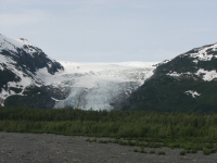
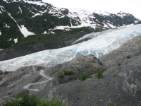
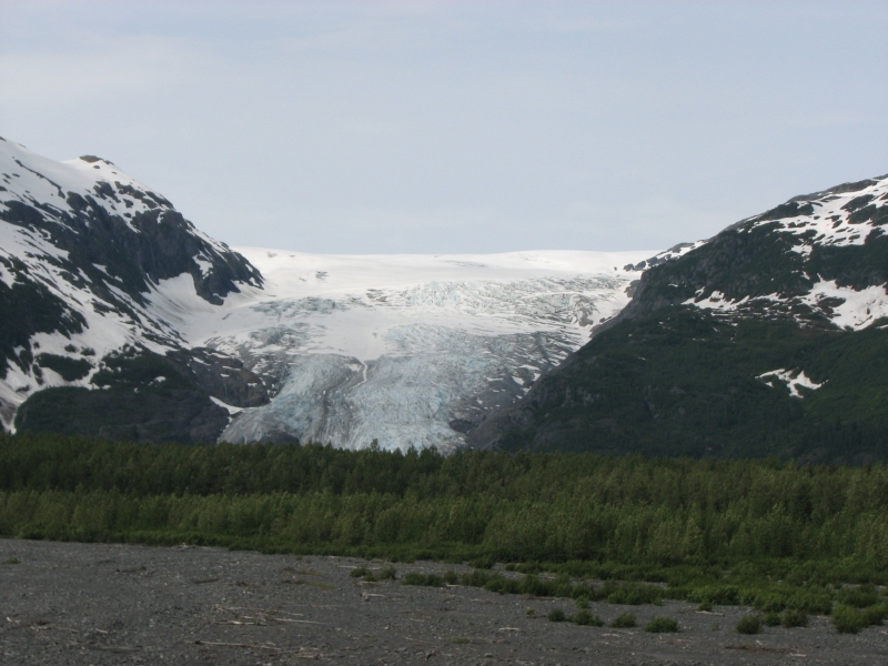
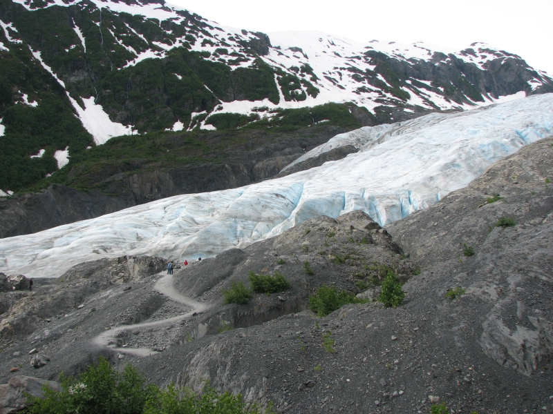
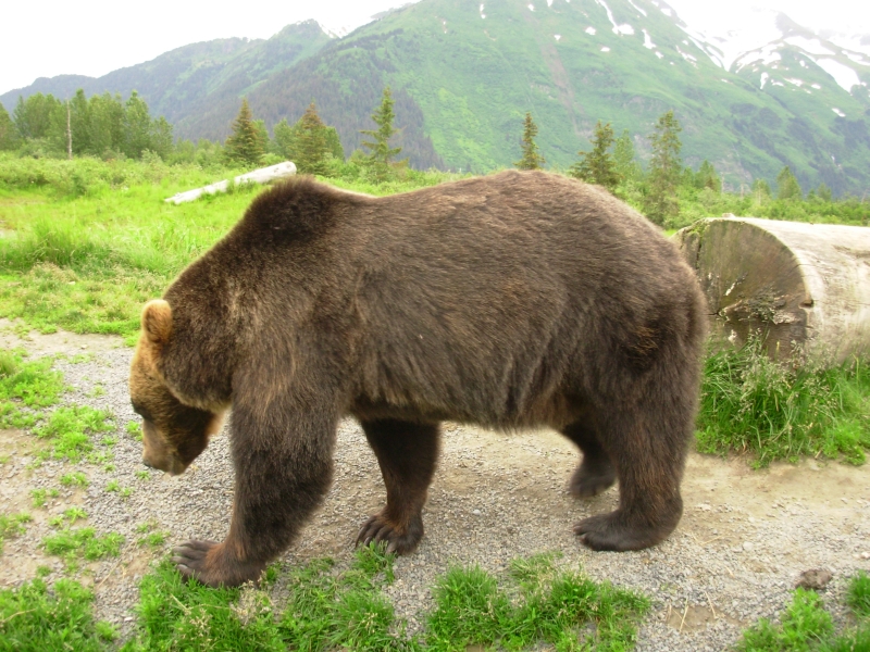
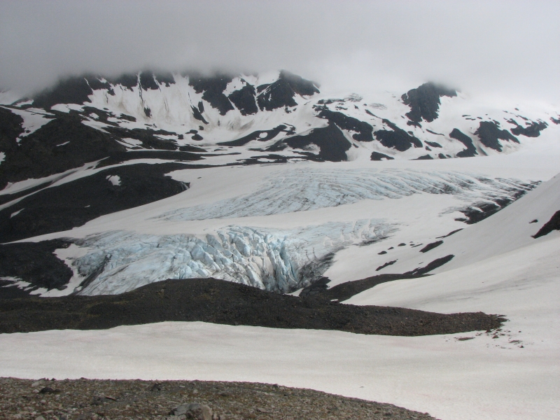
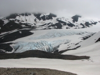
The rain finally stopped and we woke to sunshine and mostly blue skies. It didnt last, but it was a nice way to start the day. We ate breakfast at Marinas, stocked up at Safeway and headed north. We intended to hike the Lost Lake Trail from the south end, but the register was full of warnings about the snow, so we decided against it. It was too late in the day for a 14 mile hike with serious snow issues, so we went to Exit Glacier instead. That is a very popular tourist spot, with easy trails to the edge of the glacier. A longer trail climbs above it, but we stayed on the easy tourist paths. It was fun to get so close to the glacier, though the dirty snow/ice wasnt all that pretty. Worthington Glacier near Valdez was more spectacular, I thought. One high point was seeing a grizzly on the hillside high above the trail. As usual, I wouldnt have seen it without the help of a group of people all looking up the hill with their binoculars.
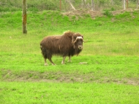
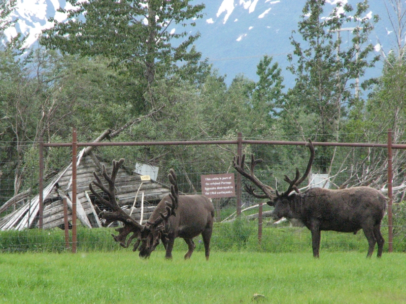
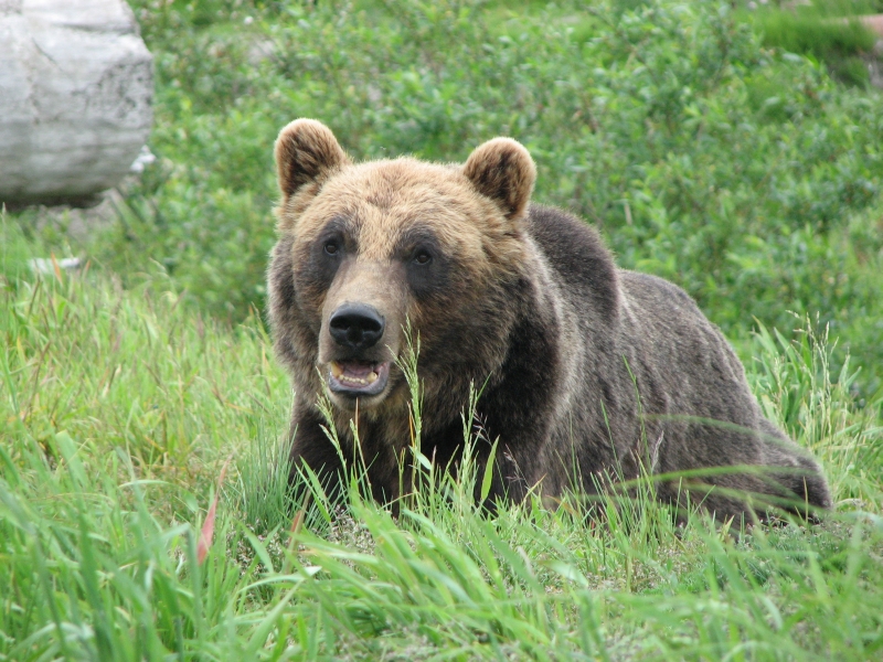
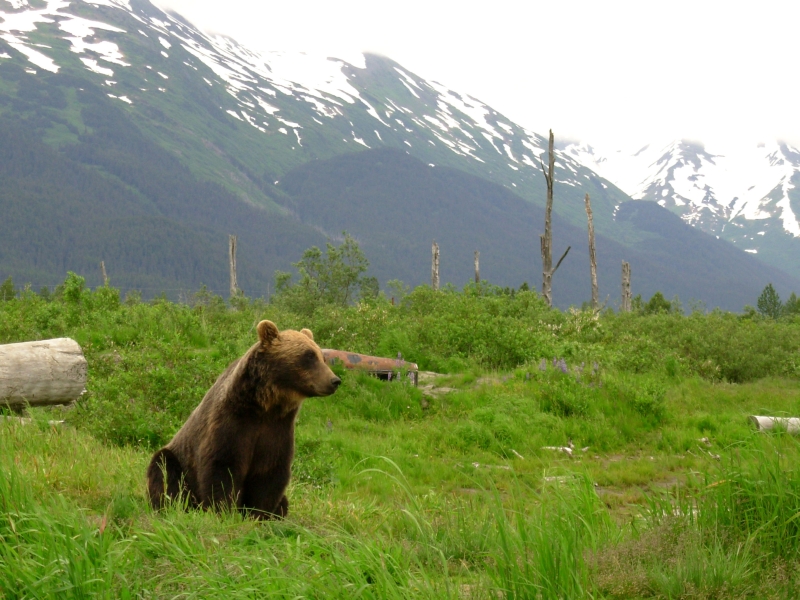
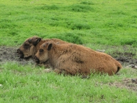
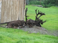
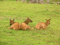
We continued north to the Alaska Wildlife Conservation Center, a zoo of sorts that takes in injured and orphaned animals and is working with other groups to reestablish a wild bison population in Alaska. Its fairly small 140 acres but has moose, caribou, musk oxen, wood bison and plains bison, bears, a red fox, a porcupine, elk, coyotes and Sitka deer. We didnt see the lynx, which is on loan to the Anchorage zoo while they build a new home for them.
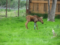
There was a baby moose with a cast on its leg. Evidently, it was hit by a car and someone decided to save it. We saw that the bison breeding is at least somewhat successful, as there were several calves in the small herd.

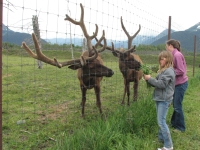
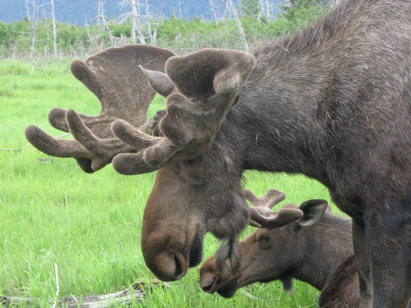
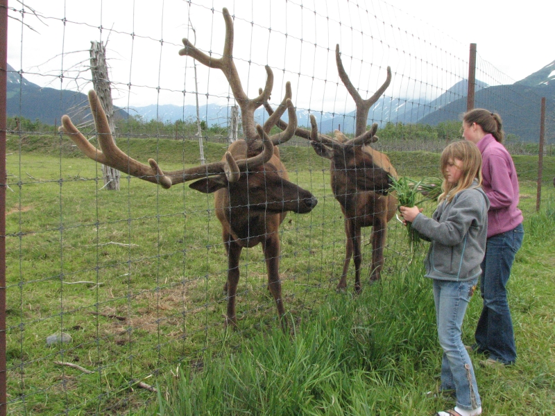
Watching kids feed some of the animals (grass from outside the enclosure) was a bit worrisome. I dont know that moose like to have their antlers touched (though the velvet looks so soft it is irresistible), or caribou either, but we saw that the elk did appreciate the long clumps of grass that were growing outside their enclosure. Only the males got to enjoy it though, since the cows and calves stayed away from the people or maybe from the greedy bulls.
The black bears were nervous, pacing back and forth in their enclosure. Theyre building a more wild setting for them, but for now the two blackies show their unhappiness at being caged.
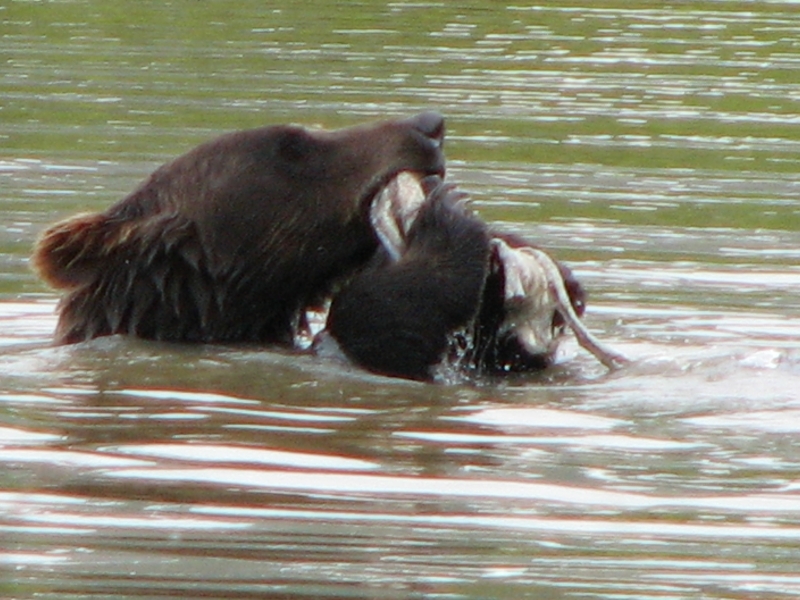
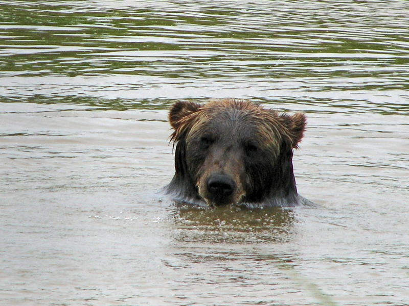
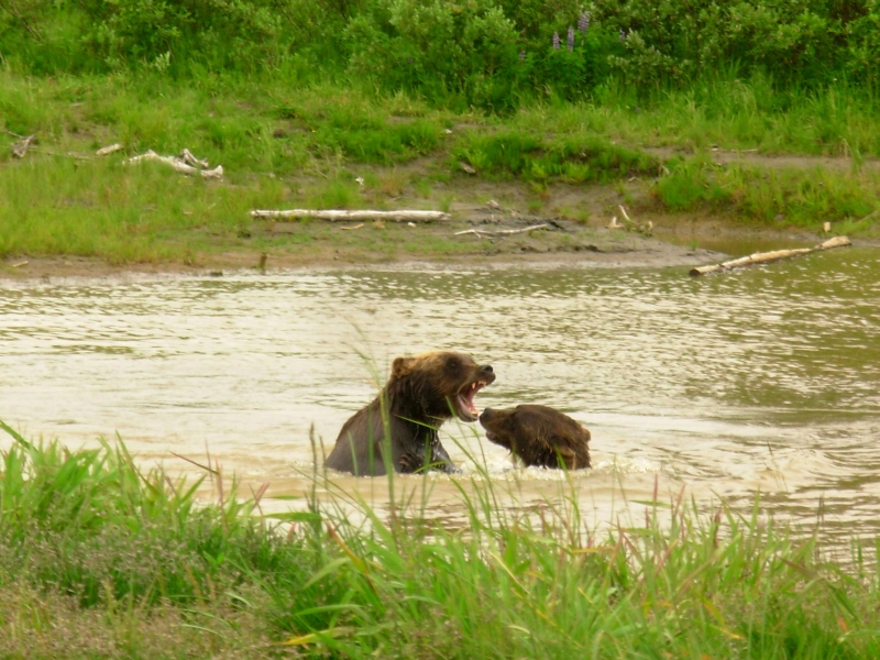
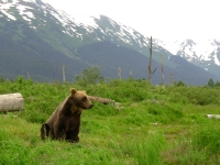
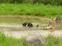
There were three orphaned grizzlies that were taken to the Conservation Center when they were small cubs. They cant be released into the wild now, since they are too habituated to people, but they seemed to enjoy their large natural enclosure with the areas of dense willows where they can hide when they want. The two sibling grizzlies were fun to watch as they played in a pond, wrestling each other and sticks and other toys. They were beautiful. The other unrelated bear entertained us by scratching himself on a big log. We watched them for a long time.
Seeing the animals in mostly natural settings made the experience feel less zoo-like than I expected. Although the animals arent really wild, the setting is natural, (big green meadows with trees and snowy mountains beyond), and the animals are close enough to really enjoy, as you cant when you are in the wilderness. Elk and moose dont generally like to stick around to get their pictures taken. We will probably never get to watch wild bears play the way we did today, not that close. Most of the bears weve seen in the wild were from 200-300 yards away. All you see with the naked eye is a small dot. Even binocs only help a little. In a genuine wilderness encounter, wed be backing off in a hurry, a lot more apprehensive than appreciative. Today was a lot of fun.

We ended up camping near Girdwood at a primitive campground outside the Crow Creek Mine. There are a few sites with fire rings along the dirt entry road and some picnic tables around the large dirt parking lot. Many cars passed us, but few stayed.


Thursday, July 10: 7 mile hike to Crow Pass, Camp at Little Susitna River CG
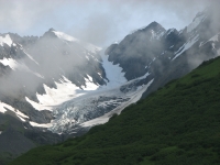

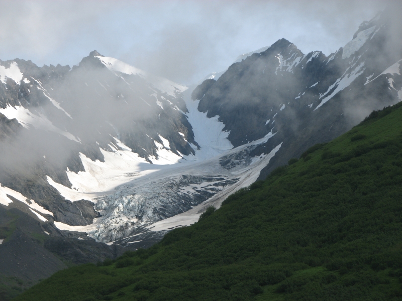
We had a terrific hike to Crow Pass today. We woke late but well rested. The dirt road up to the trailhead was rough with lots of potholes, but passed through lush fern-filled forest. There were patches of blue sky and sunshine as we started the hike. Clouds hugged the mountain tops about 300 above us. They lifted from time to time, giving us views across the valley, but never disappeared entirely. At times we walked through the clouds in almost total whiteout. The trail climbs 2000 in three miles to a pass near beautiful Raven Glacier. It was a steady climb up to the alpine zone, then fairly flat from a forest service cabin to the pass. There was a lot of snow on the trail, which made for slow going at times. There was a high trail that switchbacked gradually, but had lots of snow, and a lower trail from Monarch Mine to the cabin that was much steeper but snow free. We did the high route out and the low route down. There were lots of hikers on the trail today, including a very large group on a Backroads bicycle tour and three groups of backpackers. The trail continues past the pass for 20 or so miles (23 total) to Eagle River. Its a very long way to shuttle cars, but is supposed to be a nice overnight hike.

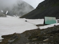
The hike to the pass was beautiful, up a narrow valley, past a defunct mine, past snow-streaked ridges with long waterfalls, through alpine meadows filled with tiny alpine flowers. It was gorgeous. There is a cabin you can rent about half a mile from the pass that was still buried in snow. They had to dig a path down to the outhouse since snow was up to the roof. The clouds lifted for a while so we got terrific views of Raven Glacier and the valley on the other side of the pass. We ate lunch there, then headed down through the clouds to the car. There were too many people for any wildlife to be evident, though a trail register entry from yesterday mentioned people seeing a goat and a bear. We did see a porcupine on the road to Girdwood and a mountain goat on a cliff above the highway. We stopped at a bookstore and ice cream parlor before heading to Anchorage.
Ive really enjoyed spending this time in the Kenai. We still didnt do all the hikes I would have liked to do, or the rafting, kayaking and boat tours wed have done if money werent tight, but we saw a lot more this time than in our rushed visit in 2004. Im not sure we would have stayed so long if not for the holiday weekend, but Im glad we did remain in one place for a while. We drove the same roads several times but the views never got old. The mountains and rivers in the Kenai really are gorgeous. There are too many people, but since were part of the tourist hordes we really shouldnt complain.
Home | Links| Trail Journals |
The Thruhiking Papers | Bun-bun
Created: 1 Jan 2009
Revised: 30 Sept 2016Copyright 2009-2017 Spirit Eagle